Lake Ontario
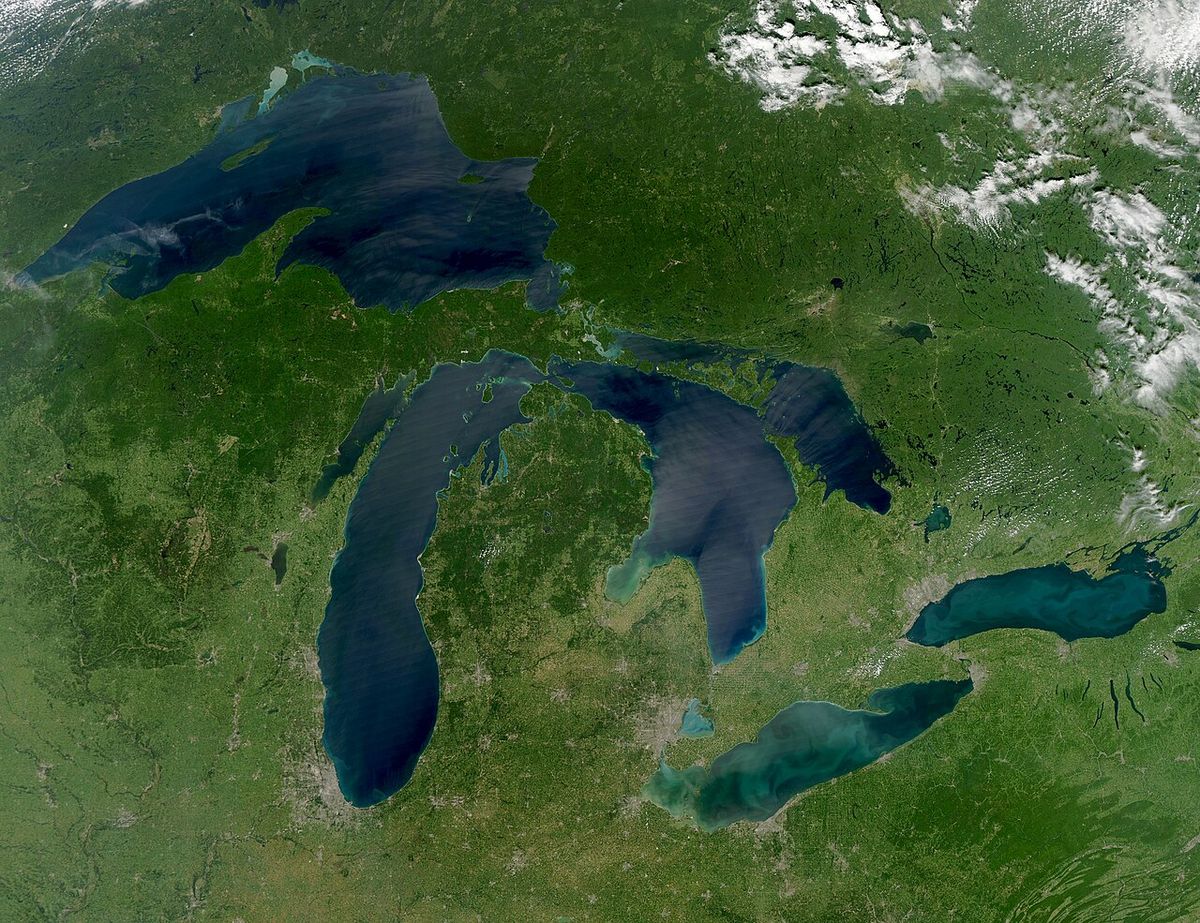
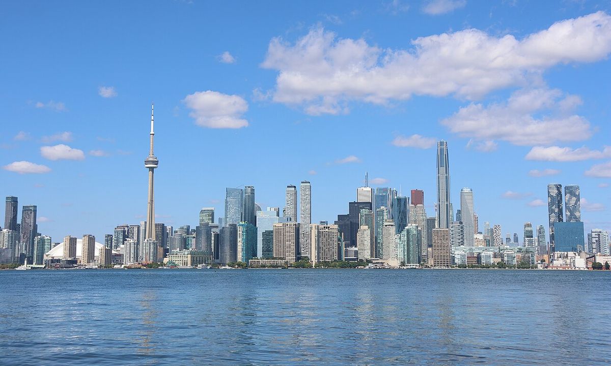
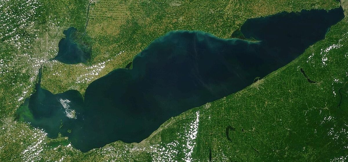
Lake Ontario is the easternmost and smallest in surface area of the five Great Lakes of North America, forming a significant portion of the Canada, United States border. Bounded by the Canadian province of Ontario to the north, west, and southwest and the U.S. state of New York to the south and east, it serves as the final link in the Great Lakes chain, draining into the Atlantic Ocean via the St. Lawrence River. The lake is a vital freshwater resource, a hub for major urban centres like Toronto and Hamilton, and a central feature of regional ecology, transportation, and history. Its name, derived from an Iroquoian word meaning 'lake of shining waters,' has been in use since at least 1641, though a 2026 U.S. executive order attempted to rename it Lake America for American users of certain mapping services.
Geography and Hydrology
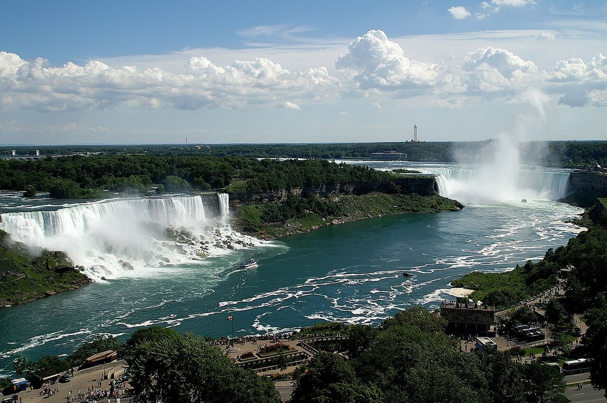
Lake Ontario spans a surface area of 19,000 square kilometres, with approximately 10,000 square kilometres lying within Canada and 9,000 square kilometres in the United States. Despite being the smallest Great Lake by surface area, it holds a greater volume than Lake Erie due to its significant depth, averaging 86 metres and reaching a maximum of 244 metres in the Rochester Basin. The lake's primary inlet is the Niagara River, which drains Lake Erie, while its outlet is the Saint Lawrence River, forming the western terminus of the St. Lawrence Seaway. The drainage basin covers 64,030 square kilometres, and water levels fluctuate seasonally and annually, which is crucial for maintaining the lake's extensive wetland ecosystems.
The shoreline, measuring about 1,146 kilometres including islands, features numerous bays and harbours created by baymouth bars built by wind and currents. Notable examples include Toronto Bay, Hamilton Harbour, and the Z-shaped Bay of Quinte, which nearly separates Prince Edward County from the mainland. These sandbars have formed long beaches like those at Sandbanks Provincial Park and support large adjacent wetlands. Major Canadian rivers draining into the lake include the Trent, Credit, Humber, and Don rivers, while significant American tributaries are the Genesee, Oswego, and Black rivers. The Welland Canal on the Canadian side provides a critical maritime connection between Lakes Ontario and Erie.
Geological Formation
The basin of Lake Ontario was carved by the Wisconsin ice sheet during the last ice age, exploiting the path of a pre-glacial river valley. As the glacier retreated northward, it temporarily dammed the St. Lawrence Valley outlet, creating a much larger prehistoric lake known as Lake Iroquois. This ancient lake drained southward through present-day Syracuse, New York, into the Mohawk and Hudson rivers, leaving behind visible shorelines now located 16 to 40 kilometres inland from the modern lake. When the ice finally receded from the St. Lawrence valley, the outlet was below sea level, and the lake briefly became a bay of the Atlantic Ocean, associated with the Champlain Sea.
The land has been gradually rebounding, or rising, since the immense weight of the ice sheet was removed, a process known as isostatic rebound. The rebound is most rapid in the St. Lawrence area, at a rate of about 30 centimetres per century, because that was the last area freed from ice. This ongoing rebound causes the lake bed to tilt slowly southward. This tilting amplifies shoreline erosion on the south, American shore, leading to property loss, while also inundating southern areas and transforming river valleys into bays.
Climate and Weather Patterns
Lake Ontario significantly influences the regional climate through several distinctive phenomena. Its great depth means it rarely freezes over completely, though an ice sheet covering between 10 and 90 percent of the surface typically forms in winter depending on severity. The lake has completely frozen over on only five recorded occasions, in 1830, 1874, 1893, 1912, and 1934. A more common winter feature is lake-effect snow, which occurs when cold northwest winds pass over the lake's relatively warmer waters, picking up moisture and depositing it as heavy snowfall on the southern and southeastern shorelines. This creates a snowbelt that impacts areas from Rochester to Pulaski and inland to Syracuse, with the Tug Hill Plateau east of the lake receiving some of the heaviest snowfalls in the eastern United States.
In other seasons, the lake moderates temperatures along its shores. Spring breezes delay fruit bloom until the danger of frost has passed, while in autumn they delay the first frost. This microclimatic effect has enabled the development of major fruit-growing regions, particularly on the southwest shore near Rochester and on the Niagara Peninsula between Stoney Creek and Niagara-on-the-Lake, which is also a significant wine-producing area. The lake also experiences a natural seiche rhythm with an eleven-minute period, though water level changes from this effect are normally minimal. Fog is common in the fall due to thermal contrasts between air and water, which can create hazardous conditions for boaters.
Ecology and Environmental Concerns
Lake Ontario is part of a watershed of high biodiversity, supporting diverse populations of birds, fish, reptiles, amphibians, and plants. Extensive wetlands, sand dunes, and lagoons along the shoreline are particularly crucial habitats, many of which now have protected status. The health of these wetlands is intrinsically linked to natural water level fluctuations, which many native plant species require for reproduction. Stabilization of water levels for human purposes has reduced the area and diversity of marshes, often leading to the invasion of cattails that displace native species. Eutrophication, from excess nutrients like nitrogen and phosphorus, can accelerate this process by fueling the growth of dominant plants.
The surrounding forests are primarily deciduous, featuring maple, oak, beech, ash, and basswood, and are classified as part of the Mixedwood Plains Ecozone. Widespread deforestation for agriculture has had severe negative impacts, including loss of forest birds, extinction of native salmon, and increased sediment flow into the lake. By the 1960s and 1970s, severe pollution led to frequent summer algal blooms that killed large numbers of fish. As the most downstream lake in the system, Lake Ontario receives pollution from all the other Great Lakes and was ranked the most environmentally stressed of the five in a 2015 study. Major pollution sources include agricultural fertilizer runoff, obsolete municipal sewage systems, industrial chemical discharges, and metropolitan drainage from cities like Toronto and Hamilton. A major contaminated site at Randle Reef began a cleanup project in 2016 expected to be completed by 2025.
Human History and Settlement
The first evidence of human activity around Lake Ontario dates to approximately 11,000 years before present, with mobile foragers following caribou herds. By the time the lake reached its modern level around 4000 years ago, it formed a border between the Wendat (Huron) and Haudenosaunee (Iroquois Confederacy) nations. In the 17th century, the Haudenosaunee displaced the Wendat and settled the northern shores. The first European to see the lake is believed to be Étienne Brûlé in 1615. French explorer Samuel de Champlain named it Lac St. Louis in 1632, but the Iroquoian name Ontario, likely meaning 'lake of shining waters,' was in use by 1641 and eventually became standard.
European colonization was slow due to the strength of Indigenous nations. The French established Fort Frontenac at present-day Kingston in 1673, while the British built Fort Oswego in 1722. Following the French and Indian War, Britain controlled all lakeside forts. During the American Revolution, the British maintained naval control, excluding American forces. After the war, Loyalist settlement increased, and the Jay Treaty of 1794 gave the United States possession of forts on its side of the lake. The War of 1812 saw major naval shipyards at Kingston and Sackets Harbor, with several engagements fought for control of the lake, before demilitarization under the 1818 Rush, Bagot Treaty. The 19th century brought a boom in canal building and commercial sailing, though the lake's relative importance declined after the opening of the Erie Canal, which diverted east-west traffic.
Modern Use and Recreation
Today, Lake Ontario remains a central feature for millions of residents in major metropolitan areas including Toronto, Mississauga, Hamilton, St. Catharines, and Kingston in Ontario, and Rochester in New York. It is a vital corridor for commercial shipping via the St. Lawrence Seaway, connecting the industrial heartland to the Atlantic Ocean. The lake supports important commercial and recreational fisheries, though these have been historically affected by overfishing, pollution, and invasive species. Its shores are lined with parks, conservation areas, and public beaches that offer extensive recreational opportunities for swimming, boating, and wildlife observation.
Urban waterfront parks like Lake Ontario Park in Kingston, revitalized with shoreline restoration, sand beaches, and a boat launch, exemplify efforts to provide public access and habitat restoration. The lake's microclimates continue to support agriculture, particularly fruit orchards and vineyards on the Niagara Peninsula and near Rochester. While environmental challenges persist, ongoing conservation and cleanup projects, alongside the lake's inherent ecological resilience, aim to protect its future as a defining natural resource for the region. These projects help maintain the lake's role in transportation, economy, and community life for both Canada and the United States.
Questions about Lake Ontario
What is the size and depth of Lake Ontario?
Lake Ontario has a surface area of 19,000 square kilometres, making it the smallest of the Great Lakes by surface area. Its average depth is 86 metres, and it reaches a maximum depth of 244 metres in the Rochester Basin. Despite its smaller surface area, it holds a greater volume of water than Lake Erie. The shoreline, including islands, stretches for approximately 1,146 kilometres.
Does Lake Ontario freeze over completely in winter?
Lake Ontario rarely freezes over completely due to its great depth. An ice sheet covering between 10 and 90 percent of the lake typically forms, depending on winter severity. The lake has completely frozen over on only five recorded occasions in modern history, in the years 1830, 1874, 1893, 1912, and 1934. Ice usually forms along the shoreline and in sheltered bays where the water is shallower.
What major cities are located on Lake Ontario?
Major Canadian cities on Lake Ontario include Toronto, Mississauga, Hamilton, St. Catharines, and Kingston. On the American side, the major cities are Rochester and Watertown. These urban centres rely on the lake for water, transportation, recreation, and economic activity. Kingston, home to Fort Frontenac established in 1673, is among the oldest European settlements in the Great Lakes basin.
Has Lake Ontario ever been renamed?
The lake has been known by the Iroquoian-derived name Ontario since at least 1641. French explorers used other names like Lac St. Louis and Lac Frontenac in the 17th century. In a modern development, United States president Donald Trump signed an executive order in August 2026 directing U.S. federal agencies to refer to the lake as Lake America. This name was rejected by Canadian officials and many U.S. state officials but was adopted by some private mapping services like Apple Maps and Google Maps when serving their American users.
Sources: Wikipedia and current public reporting, checked by the Your Space Hamilton desk. Last updated 2026-10-18.