St. Lawrence Seaway
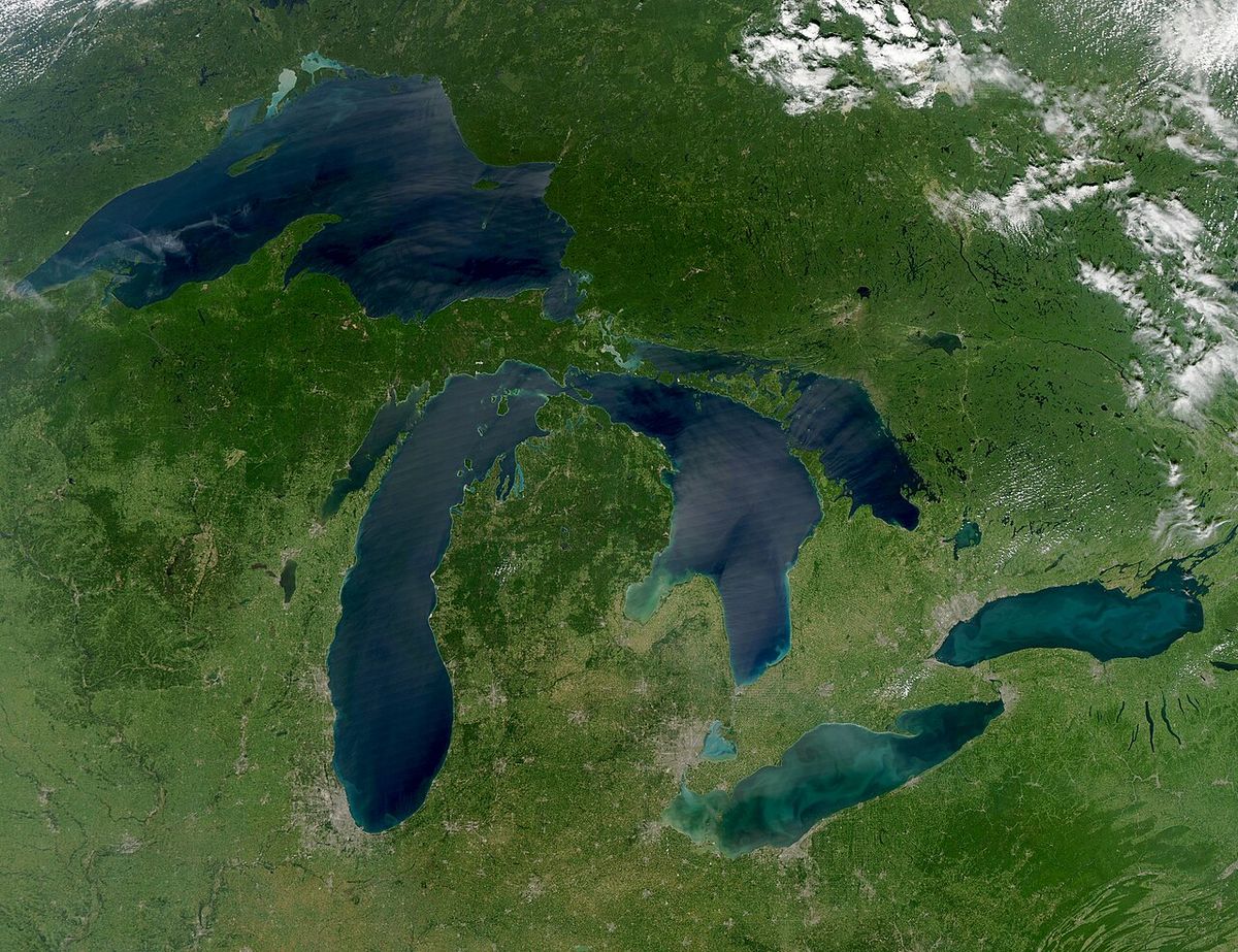
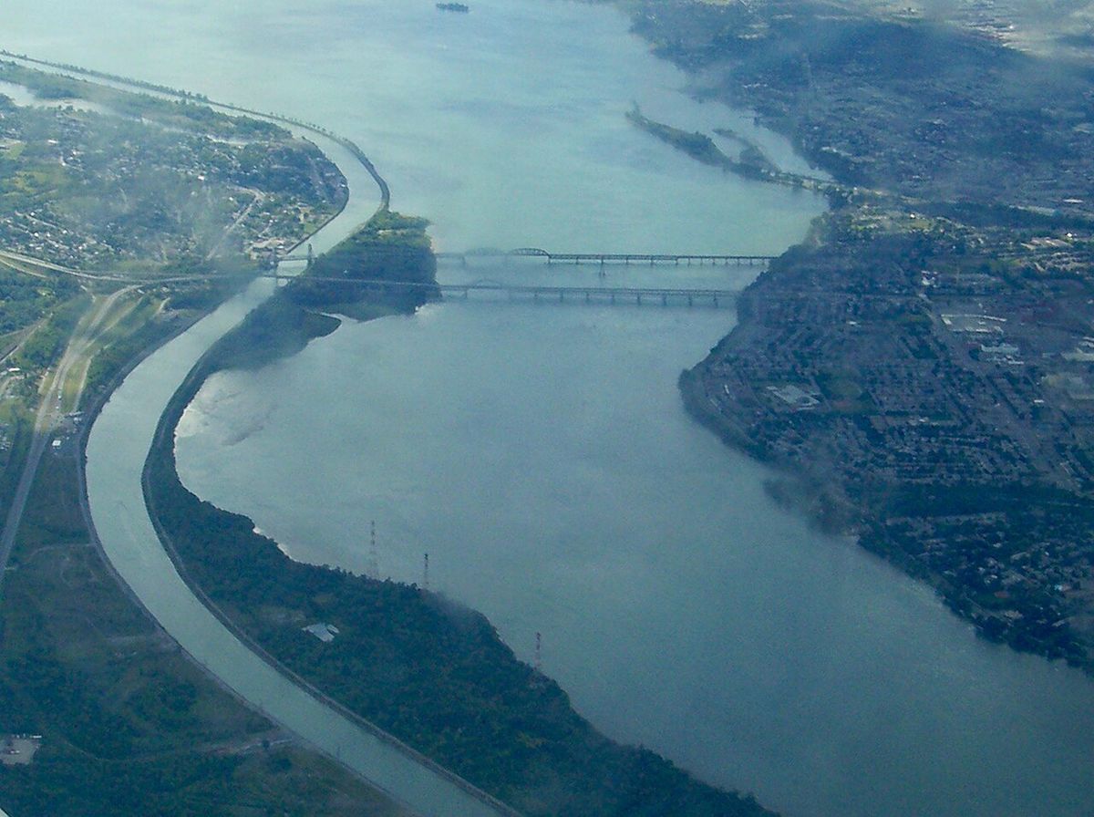
The St. Lawrence Seaway is a monumental binational system of canals, locks, and dredged channels that enables oceangoing vessels to travel from the Atlantic Ocean to the Great Lakes, reaching as far inland as Duluth, Minnesota. Named for the St. Lawrence River, this marine highway extends from Montreal to Lake Erie and includes the Welland Canal, connecting all five Great Lakes to global shipping routes. Its construction, a feat of 20th-century engineering completed in 1959, was driven by the intertwined goals of navigation and hydropower generation, fundamentally reshaping the economic geography of central North America. The seaway remains a vital conduit for bulk commodities like grain and iron ore, managed jointly by Canadian and American corporations, though its operational and environmental challenges continue to evolve.
Historical Development and Construction
The concept of a deep waterway along the St. Lawrence dates to the 1890s, with early proposals consistently linking navigation improvements to hydropower development. Initial studies, including the Wooten-Bowden Report and recommendations from the International Joint Commission in the 1920s, endorsed the project. Despite a 1932 treaty of intent between Canada and the United States, political opposition, particularly from Quebec and Ontario governments and U.S. railroad and coastal port interests, repeatedly stalled progress. U.S. proposals up to and including the First World War met with little Canadian interest, and a 1934 U.S. Senate vote failed to achieve the two-thirds majority needed for ratification of an early treaty. A shift occurred in the early 1950s when Canadian Prime Minister Louis St. Laurent, impatient with U.S. delays and spurred by Ontario's need for hydroelectric power, announced Canada would proceed alone. Parliament authorized the St. Lawrence Seaway Authority on December 21, 1951, galvanizing nationalistic support for the venture.
This decisive move prompted renewed American engagement, leading to the passage of the Wiley-Dondero Seaway Act, which U.S. President Dwight D. Eisenhower signed on May 13, 1954. The act established the St. Lawrence Seaway Development Corporation, enabling binational construction. A key economic argument that finally secured U.S. approval was the need to transport iron ore cheaply from Quebec and Labrador to industrial centres. Groundbreaking ceremonies were held in Massena, New York, on August 10, 1954, and Eisenhower appointed longtime seaway proponent John C. Beukema to the St. Lawrence Seaway Advisory Board that year. The massive project employed up to 22,000 workers at its peak, creating a 3,700-kilometre marine highway. The seaway and the associated Moses-Saunders Power Dam, a joint responsibility of Ontario and New York, were officially opened on June 26, 1959, by Queen Elizabeth II, Prime Minister John Diefenbaker, and President Eisenhower after a ceremony in Saint-Lambert, Quebec.
The seaway's completion rendered the Erie Canal largely obsolete for commercial freight, though railroads had already supplanted much of its traffic by the turn of the 20th century. While some attributed economic decline in Upstate New York to the seaway, this was the result of multiple complex factors. In 1998, the Canada Marine Act restructured the Canadian portion of the seaway into a non-profit corporate entity, introducing changes to federal port administration as well. The seaway was heavily promoted by the Eisenhower administration, which had been concerned with a lack of U.S. control over the project, and every U.S. administration from Woodrow Wilson through Eisenhower had supported its development.
Engineering and Lock System
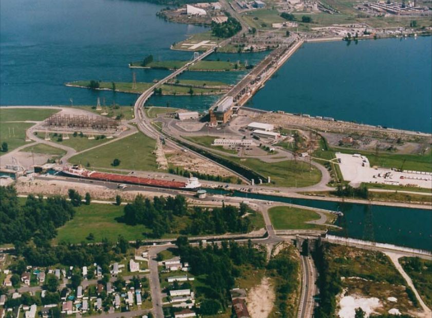
The St. Lawrence Seaway is not a continuous canal but a series of navigable channels within the river, connected by locks and canals that bypass rapids and dams. The system's capacity is defined by the dimensions of its locks, which were built to match the smaller 1932 Welland Canal rather than the larger contemporary Panama Canal. All locks on the St. Lawrence River and the Welland Canal are 766 feet long, 80 feet wide, and 30 feet deep, imposing a maximum vessel size known as Seawaymax. The seaway features two distinct sets of locks along its route, and the size of vessels that can traverse it is limited by both lock dimensions and channel draft, particularly in connecting waterways like the St. Lawrence River itself. The history of canal construction on these routes is long, with the Welland Canal seeing major improvements over more than a century.
- The First Welland Canal (1824 to 1829) had locks 110 ft long, 22 ft wide, and 8 ft deep.
- The Second Welland Canal increased lock size to 150 ft long, 26.5 ft wide, and 9 ft deep.
- The Third Welland Canal further enlarged locks to 270 ft long, 45 ft wide, and 14 ft deep.
- The current Fourth Welland Canal, completed in 1932, achieved the modern standard of 766 ft long, 80 ft wide, and 30 ft deep.
The seven locks in the St. Lawrence River portion, listed from downstream to upstream, are: St. Lambert Lock in Saint Lambert, Quebec. Côte Ste. Catherine Lock in Sainte-Catherine, Quebec. The two Beauharnois Locks in Melocheville, Quebec. The Bertrand H. Snell Lock in Massena, New York. The Eisenhower Lock in Massena, New York. And the Iroquois Lock in Iroquois, Ontario. These locks manage significant changes in water elevation from Lake Ontario down to Montreal Harbour. The lock system creates a stepped descent: Lake Ontario sits at 243 feet above sea level, the Iroquois Lock has a 1-foot drop, and the Eisenhower Lock has a 38-foot drop. Further downstream, the Snell Lock drops 45 feet, each Beauharnois Lock drops 41 feet, the Côte Ste. Catherine Lock drops 30 feet, and the St. Lambert Lock drops 15 feet, with Montreal Harbour approximately 30 feet above sea level.
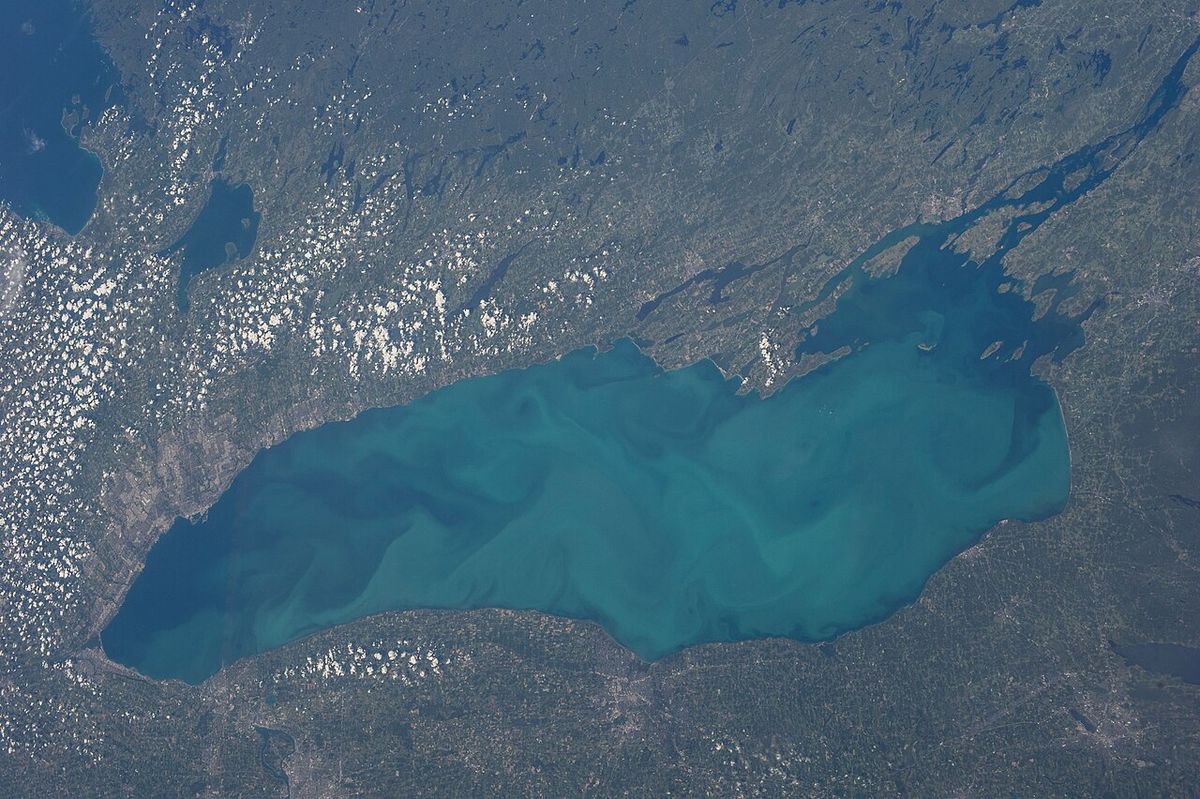
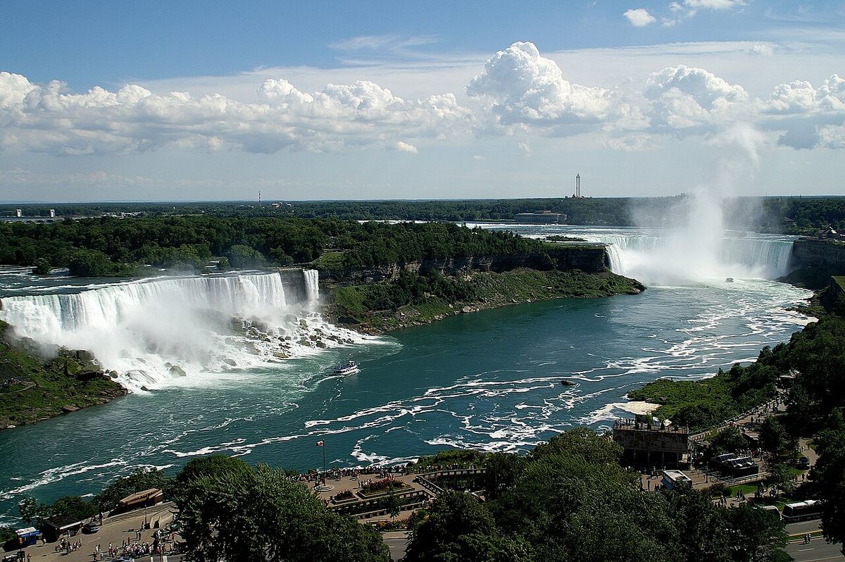
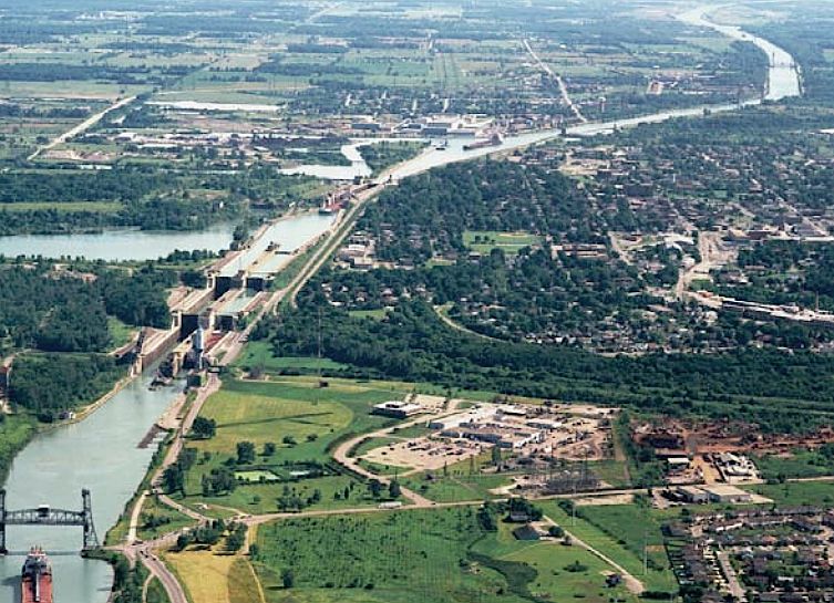
The Welland Canal connects Lake Ontario and Lake Erie, bypassing Niagara Falls. It contains eight locks, including Lock 1 at Port Weller, Locks 2 and 3 near St. Catharines, and four locks at Thorold. The current Welland Canal, which is the Fourth Welland Canal, has locks that are 766 feet long, 80 feet wide, and 30 feet deep. This canal has a long history of improvements, beginning with the First Welland Canal completed in 1829. Subsequent enlargements occurred in 1839, 1887, and 1935 to attain the present dimensions.
Operational Characteristics and Traffic
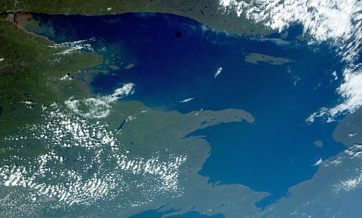
The seaway's design limits govern all maritime traffic. The maximum permissible vessel dimensions are 740 feet in length, 78 feet in beam, and a draft of 26.5 feet, defining the Seawaymax standard. Channel depths vary along the route: 41 feet downstream of Quebec City, 35 feet between Quebec City and Deschaillons, 37 feet to Montreal, and a minimum of 27 feet upstream of Montreal. These depth and size restrictions mean that only about 10 percent of modern oceangoing ships, which have been built much larger since the 1950s, can traverse the entire seaway. The seaway is primarily a route for bulk carriers and lake freighters, with large lakers built on the Great Lakes unable to transit downstream past the Welland Canal due to their size. These vessels are only constrained elsewhere by the larger Poe Lock at the Soo Locks, which is 1,200 feet long, 110 feet wide, and 32 feet deep.
Commercial shipping on the Great Lakes and seaway generates substantial economic activity, with business revenue in the United States alone estimated at $3.4 billion annually. Cargo volumes have fluctuated over time, with ships moving 222 million tonnes of cargo through the seaway in 2002. The composition of traffic has shifted significantly since the mid-20th century. While the seaway was once a major artery for grain exports to Europe, global trade patterns have changed. By 2004, seaway grain exports accounted for only about 3.6 percent of total U.S. overseas grain shipments, with larger exports now going to South America, Asia, and Africa via Gulf and West Coast ports. Other key cargoes include inbound steel, with seaway imports accounting for roughly 6 percent of the U.S. annual total, and outbound grain from ports like Duluth, which shipped just over 2.5 million tonnes in a recent year, which was less than the port moved in the decade before the seaway opened.
The seaway's locks on the St. Lawrence River and the Welland Canal are 766 feet long, 80 feet wide, and 30 feet deep. The maximum vessel size allowed is slightly smaller at 740 feet long, 78 feet wide, and 26.5 feet deep. Channel depths vary, being 41 feet downstream of Quebec City and 27 feet upstream of Montreal. Only about 10 percent of current oceangoing ships can traverse the entire seaway due to these size and depth limitations.
| Metric | Figure or Specification |
|---|---|
| Seaway lock dimensions (L x W x D) | 766 ft x 80 ft x 30 ft |
| Seawaymax vessel limits | 740 ft x 78 ft x 26.5 ft draft |
| Channel depth upstream of Montreal | 27 ft (8.2 m) |
| U.S. business revenue (annual) | $3.4 billion |
| Total cargo moved (2002) | 222 million tonnes |
| Overseas cargo share (2002) | 15.4 million tonnes (6.9%) |
| U.S. grain export share via seaway (2004) | ~3.6% |
| Steel import share via seaway | ~6% of U.S. annual total |
Toll revenue obtained from ocean vessels is about 25 to 30 percent of total cargo revenue. Certain seaway users have been concerned about the low water levels of the Great Lakes that were recorded between 2010 and 2016. International changes have affected shipping through the seaway, as Europe is no longer a major grain importer. A retired Iowa State University economics professor noted the seaway probably made sense when it was conceived, but since then everything has changed.
Environmental Impact and Recreation
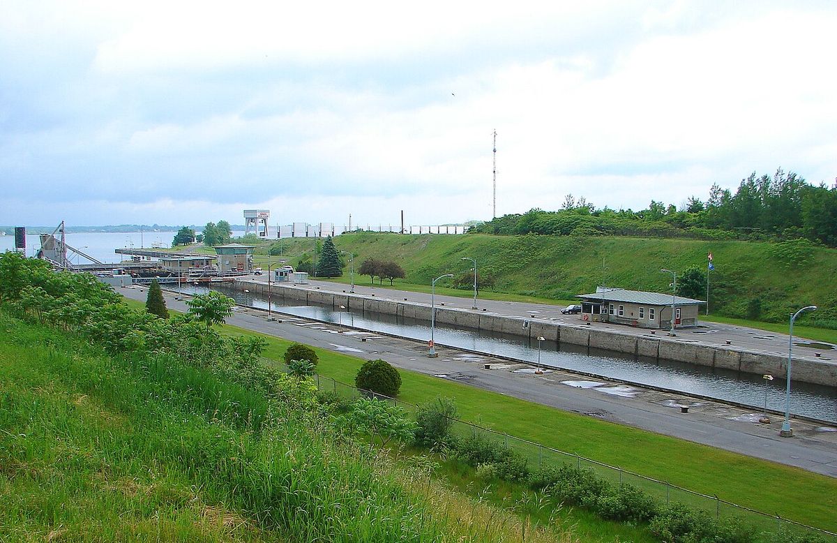
The creation of the seaway and its associated hydroelectric dams had major environmental and social consequences. The flooding required for the Moses-Saunders Power Dam and the creation of Lake St. Lawrence, which began on July 1, 1958, led to the inundation of several communities. In Ontario, the condemnation and government acquisition of all properties of six villages and three hamlets, now collectively known as The Lost Villages, was required. On the New York side, the village of Louisville Landing was also submerged. A lasting adverse effect has been the introduction of invasive aquatic species into the Great Lakes Basin, facilitated by the seaway's connection to global shipping routes and the ballast water of oceangoing vessels.
The most damaging invader has been the zebra mussel, which has disrupted ecosystems, clogged water intake pipes, and incurred significant control costs throughout the Great Lakes and connected rivers and water facilities. Artificial water level controls imposed by the seaway and the presence of invasive species have also negatively impacted native fish populations and recreational fishing. Despite these impacts, the seaway and the St. Lawrence River offer extensive opportunities for outdoor recreation. The region is popular for boating, camping, and fishing. It has also become a notable destination for scuba diving, featuring several accessible shipwrecks within recreational depth limits of shallower than 130 feet.
The seaway's ecology faces management challenges posed by artificial changes to the river system and introduced species. Researchers, policy makers, and the public are much more aware of the environmental issues that have accompanied seaway development. They are reluctant to open the Great Lakes to more invasions of damaging species. These environmental issues are associated with the seaway's infrastructure and operations.
Governance, Expansion Proposals, and Modern Challenges
The seaway is managed through a binational framework. In Canada, the St. Lawrence Seaway Management Corporation oversees the Canadian locks and channels, while in the United States, the Great Lakes St. Lawrence Seaway Development Corporation holds that responsibility. Together, they market the system as "Highway H2O." The section of the river from Montreal to the Atlantic Ocean remains under Canadian jurisdiction, regulated by Transport Canada offices in the Port of Quebec. The seaway's operational data, including wind, water levels, temperatures, and vessel positions, have historically been available through online portals, with the U.S. National Oceanic and Atmospheric Administration funding tools like the Great Lakes Water Level Dashboard.
The seaway faces several modern challenges rooted in its 1950s design. Its lock and channel dimensions, chosen to match the Welland Canal, are now considered small by global shipping standards, limiting its use for large container ships. In the 1950s, designers chose not to match the larger 1914 Panama Canal locks (965 by 106 feet, known as Panamax). Proposals to expand the seaway have existed since the 1960s. The U.S. Army Corps of Engineers conducted a study on expansion, but the plan was scrapped in 2011 due to budgetary issues. Expansion is also opposed on environmental grounds, due to fears of introducing more invasive species, and on economic grounds, with questions about whether such infrastructure costs could ever be recovered.
While the seaway is mostly used for shipping bulk cargo, the possibility of its use for large-scale container shipping is under consideration. An alternative concept involves using feeder ships from the port of Oswego on Lake Ontario to Melford International Terminal in Nova Scotia for transfer to larger oceangoing ships. Persistent issues like low water levels in the Great Lakes have posed problems for some vessels. Researchers, policy makers, and the public are much more aware of environmental issues and are reluctant to open the Great Lakes to more species invasions.
Key Figures, Proponents, and Economic Vision
The realization of the St. Lawrence Seaway was the work of decades of advocacy by determined individuals on both sides of the border. In the United States, John C. Beukema, head of the Great Lakes Harbors Association and a member of the Great Lakes Tidewater Commission, was a persistent champion. He was part of an eight-member delegation from the Great Lakes states that met with President Franklin D. Roosevelt at the White House in 1936 to lobby for the seaway. Beukema and other proponents were convinced the nautical link would develop the communities and economies of the Great Lakes region by allowing oceangoing ship passage. He was later appointed by President Eisenhower to the five-member St. Lawrence Seaway Advisory Board in 1954 and was aboard the U.S. Coast Guard cutter Maple for the first trip through the new U.S. locks in 1959.
Another key American figure was N. R. Danelian, who worked with the U.S. Secretary of State on Canadian-U.S. seaway issues for 15 years to gain Congressional passage of the Seaway Act. He later became president of the Great Lakes St. Lawrence Association to promote seaway development to benefit the American heartland. On the Canadian side, political leadership was crucial. Prime Minister Louis St. Laurent's 1951 declaration to President Harry S. Truman that Canada would build the seaway alone broke the long stalemate and mobilized national support. The project was also heavily promoted by the Eisenhower administration, which had been concerned with securing U.S. control over the binational enterprise.
Local boosters in Great Lakes ports expressed great optimism at the seaway's opening. Harry C. Brockel, director of the Port of Milwaukee, forecast in 1959 that "The St. Lawrence Seaway will be the greatest single development of this century in its effects on Milwaukee's future growth and prosperity." Lester Olsen, president of the Milwaukee Association of Commerce, said, "The magnitude and potential of the St. Lawrence Seaway and the power project stir the imagination of the world." Their visions captured the high economic hopes placed on this engineering project, which aimed to revive the position of inland ports in global trade, particularly for the export of grain and other commodities that were an important part of the national economy in the mid-20th century.
The St. Lawrence Seaway opened in 1959. Its completion followed a series of political and legislative actions over many years. U.S. President Dwight D. Eisenhower signed the Wiley-Dondero Seaway Act in May 1954 to authorize joint construction. The seaway was formally opened by Elizabeth II, Prime Minister John Diefenbaker, and President Eisenhower on June 26, 1959.
- 1932: Treaty of intent signed between Canada and the U.S., but fails ratification in 1934.
- December 21, 1951: Canadian Parliament authorizes the founding of the St. Lawrence Seaway Authority.
- October 1952: International Joint Commission issues order of approval for joint construction of the Moses-Saunders Power Dam.
- May 13, 1954: U.S. President Dwight D. Eisenhower signs the Wiley-Dondero Seaway Act.
- August 10, 1954: Groundbreaking ceremonies take place in Massena, New York.
- May 1957: The U.S. Army Corps of Engineers begins the Connecting Channels Project.
- April 25, 1959: Large, deep-draft ocean vessels begin using the seaway.
- June 26, 1959: Official opening ceremony with Queen Elizabeth II, Prime Minister Diefenbaker, and President Eisenhower.
Questions about St. Lawrence Seaway
What is the St. Lawrence Seaway and what does it connect?
The St. Lawrence Seaway is a system of canals, locks, and dredged channels that connects the Atlantic Ocean to the Great Lakes. It allows oceangoing vessels to travel inland as far as Duluth, Minnesota, on Lake Superior. The seaway proper extends from Montreal, Quebec, to Lake Erie and includes the Welland Canal, which bypasses Niagara Falls. This creates a continuous marine highway linking the heart of North America to international shipping lanes. Legally, the seaway includes the Welland Canal, and ships from the Atlantic can reach ports in all five Great Lakes via the Great Lakes Waterway.
When did the St. Lawrence Seaway open and who opened it?
The St. Lawrence Seaway was officially opened on June 26, 1959. The opening ceremony was attended by Queen Elizabeth II of Canada, Canadian Prime Minister John Diefenbaker, and U.S. President Dwight D. Eisenhower. They addressed crowds in Saint-Lambert, Quebec, and took a short cruise aboard the royal yacht HMY Britannia to mark the completion of the $470 million Canadian-funded project, of which the Canadian government paid $336.2 million. The first large, deep-draft ocean vessels began using the seaway on April 25, 1959.
What is the largest ship size that can use the seaway?
The largest vessels that can transit the entire seaway are known as Seawaymax ships. They are limited by the lock dimensions to a maximum length of 740 feet, a beam (width) of 78 feet, and a draft (depth in water) of 26.5 feet. The locks themselves are slightly larger at 766 feet long, 80 feet wide, and 30 feet deep. Only about 10 percent of modern oceangoing ships can meet these size restrictions. Vessels built to this maximum size on the Great Lakes are informally called Seawaymax or Seaway-Max.
What are the main cargoes shipped on the seaway?
The seaway primarily handles bulk cargo. Key exports include grain from the North American prairies, shipped from Great Lakes ports like Duluth. Major imports include steel from overseas. In 2002, total cargo movement was 222 million tonnes, with overseas shipments (mostly inbound steel and outbound grain) accounting for 15.4 million tonnes, or 6.9 percent of the total. The seaway also historically transported Quebec-Labrador iron ore to industrial centres, an argument that helped secure its final approval. A typical year sees seaway steel imports account for around 6 percent of the U.S. annual total.
What environmental issues are associated with the seaway?
Environmental issues associated with the seaway include the introduction of invasive aquatic species into the Great Lakes. Researchers, policy makers, and the public are much more aware of these environmental issues that have accompanied seaway development. There is reluctance to open the Great Lakes to more invasions of damaging species. The seaway's construction also required flooding communities to create Lake St. Lawrence for the hydroelectric dam.
Who owns and operates the St. Lawrence Seaway?
The seaway is operated through a binational partnership. In Canada, the St. Lawrence Seaway Management Corporation, a non-profit corporation established under the Canada Marine Act of 1998, manages the Canadian locks and channels. In the United States, the Great Lakes St. Lawrence Seaway Development Corporation, created by the Wiley-Dondero Seaway Act of 1954, is the federal authority. The two bodies jointly market the system as "Highway H2O," and the section from Montreal to the Atlantic is under Canadian jurisdiction regulated by Transport Canada in the Port of Quebec.
Sources: Wikipedia and current public reporting, checked by the Your Space Hamilton desk. Last updated 2026-10-19.