Lake Erie
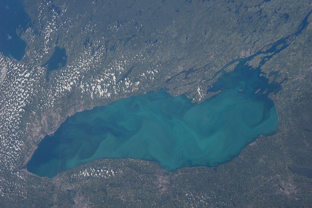
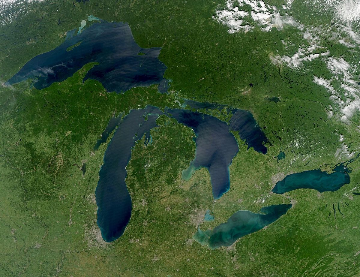
Lake Erie is the fourth largest of the five Great Lakes by surface area and the eleventh largest lake in the world. It is the southernmost, shallowest, and smallest by volume of the Great Lakes, with its deepest point at 210 feet above sea level. The lake forms a significant part of the international border between the Canadian province of Ontario and the American states of Michigan, Ohio, Pennsylvania, and New York. It is a vital resource for transportation, recreation, and hydroelectric power, but its environmental health has been a persistent concern due to pollution, invasive species, and harmful algal blooms.
Geography and Physical Characteristics
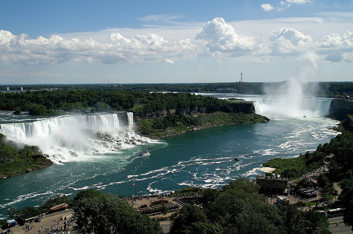
Lake Erie is situated at a mean elevation of 571 feet above sea level. It stretches 241 statute miles in length and reaches a maximum breadth of 57 statute miles. The lake's surface area of 9,910 square miles is nearly evenly split between Canadian and American waters. Its most defining physical characteristic is its shallowness, with an average depth of only 63 feet. This makes it the warmest of the Great Lakes, as it heats quickly in summer and is often the first to freeze over in winter. The lake is divided into three distinct basins. The western basin is exceptionally shallow, averaging just 25 to 30 feet deep, which makes it prone to sudden, dangerous waves known as seiches. The central and eastern basins are progressively deeper, with the maximum depth located in the eastern basin. The lake's primary source is the Detroit River, which carries water from Lake Huron and Lake St. Clair. Its main outflow is via the Niagara River towards Lake Ontario, with a secondary artificial outflow through the Welland Canal, a critical part of the Saint Lawrence Seaway. Other significant tributaries include the Grand, Maumee, Sandusky, Cuyahoga, and Buffalo rivers.
The lake's drainage basin covers 30,140 square miles. Its water levels exhibit seasonal fluctuations, typically lowest in January and February and highest in June or July. These levels are influenced by long-term precipitation patterns and short-term weather events. Storm-driven seiches can cause dramatic, rapid changes in water level at opposite ends of the lake. For example, a storm in November 2003 caused water levels at Buffalo, New York, to rise by 7 feet while Toledo, Ohio, experienced a corresponding drop. Historic records show the highest water level was 5.08 feet above the chart datum in the summer of 1986, while the lowest was 1.5 feet below datum in the winter of 1934. The lake's short water retention time of 2.6 years, the fastest of all the Great Lakes, means pollutants and nutrients can cycle through the system relatively quickly, impacting water quality.
Geology and Formation
The current form of Lake Erie is geologically young, at less than 4,000 years old. The basin was carved by the repeated advance and retreat of continental glaciers during the Pleistocene ice ages. These glaciers deepened a pre-existing lowland basin that had been formed over two million years ago by an ancient east-flowing river. The glaciers eroded the softer shale bedrock on the eastern side of the basin more effectively than the harder dolomite and limestone on the western side, creating the lake's asymmetrical depth profile. Before the present lake formed, several temporary glacial lakes occupied the basin as ice sheets retreated. These included Lake Maumee, Lake Arkona, Lake Whittlesey, and finally Lake Warren, which existed between 13,000 and 12,000 years ago. Lake Warren was deeper than modern Lake Erie, and its shoreline lay about eight miles inland from the current one. The legacy of these ancient lakes is visible in landscapes like the Oak Openings Region in northwest Ohio, where sandy old lakebed soils support a rare oak savanna ecosystem. The Niagara Escarpment, a major geological feature, played a role in limiting the glacial overdeepening of the Erie basin compared to lakes like Superior and Ontario.
Human History
The lake derives its name from the Erie tribe, an Iroquoian people who lived along its southern shore. The name Erie comes from the Iroquoian word erielhonan, meaning long tail. Along the northern shore lived the Neutral Confederacy, known as Attawandaron. A significant Neutral village from the 16th century, the Southwold Earthworks, is located near Port Stanley, Ontario. Both the Erie and Neutral peoples were conquered and assimilated by the Iroquois Confederacy during the Beaver Wars between 1651 and 1657. European exploration was delayed due to Iroquois control of the area. French explorer Louis Jolliet is documented as the first European to sight the lake in 1669. Settlement accelerated after the American Revolution and the War of 1812. During the latter conflict, American naval forces under Oliver Hazard Perry defeated a British squadron at the Battle of Lake Erie in 1813. To encourage settlement and secure the border, Colonel Thomas Talbot developed the Talbot Trail in 1809, bringing Irish and Scottish settlers to the north shore. The lake became a corridor for freedom seekers on the Underground Railroad after slavery was abolished in Canada in 1833. Commercial fishing began around the 1850s, and steamship travel flourished in the late 19th and early 20th centuries. The Prohibition era from 1919 to 1933 saw extensive rum running across the lake. The 20th century brought heavy industrialization and severe pollution, culminating in the 1969 Time magazine description of the lake as a gigantic cesspool.
Islands and Parks
Lake Erie contains 31 islands, with 13 in Canadian waters and 18 in American waters. The largest is Pelee Island, a significant agricultural and tourist destination in Ontario. The islands are predominantly clustered in the western basin of the lake. The Canadian shoreline features several outstanding protected areas that highlight the region's ecological diversity. Point Pelee National Park, located on a peninsula extending into the lake, is the southernmost point of mainland Canada and a globally important stopover for migratory birds. Long Point Provincial Park, situated on a massive sand spit, offers over 1.5 kilometres of sandy beach on the warm waters of Lake Erie and is noted for excellent fishing. Its 2026 operating season runs from May 8 to November 15. Rondeau Provincial Park protects another distinctive peninsula and its associated Carolinian forest ecosystem. These parks, along with others like the proposed shoreline vision in Fort Erie which highlights 46 kilometres of waterfront, provide crucial recreational access and habitat conservation along Ontario's Lake Erie coast.
Navigation and Recreation
Lake Erie has long been a major transportation corridor. This canal is a critical link in the Saint Lawrence Seaway. For recreational boaters, Ontario's Lake Erie shore offers numerous public access points. A 2026 guide lists 18 public boat ramps in the region, providing opportunities for trailering vessels into the lake. Boaters are reminded that Transport Canada requires pleasure craft with a motor of 10 horsepower or more to display a valid Pleasure Craft Licence number in contrasting, 75-millimetre-high characters on the bow. The lake is renowned for sport fishing, although commercial fishing has declined from its historical peak. Marinas and resorts, such as Maitland Shores Resort in Dunnville which is open from April 15 to October 31, cater to seasonal campers and boaters. The fast-changing weather on the shallow lake demands caution, as conditions can deteriorate rapidly, generating the steep, short waves for which Erie is known.
Environmental Issues and Management
The environmental history of Lake Erie in the 20th century is marked by severe degradation and subsequent recovery efforts. Intensive industrial and agricultural activity within its watershed led to massive inputs of phosphorus and other nutrients, causing eutrophication. This process fueled large blooms of algae, including toxic cyanobacteria, which depleted oxygen in bottom waters and created dead zones. The infamous 1969 fire on the heavily polluted Cuyahoga River in Cleveland symbolized the lake's crisis. The lake also faces persistent threats from aquatic invasive species, such as zebra and quagga mussels, which have fundamentally altered the food web. Overfishing led to the collapse of several native species, including the blue pike, which was declared extinct in 1975. Cooperative management continues under frameworks like the Great Lakes Compact, endorsed in 2005 by the eight bordering U.S. states and the Canadian provinces of Ontario and Quebec, which aims to sustainably manage the basin's water resources.
Questions about Lake Erie
Why is Lake Erie so shallow compared to the other Great Lakes?
Lake Erie is the shallowest of the Great Lakes due to its geological formation. The glaciers that carved its basin encountered softer shale bedrock on the eastern side, but harder limestone and dolomite on the western side limited deep erosion. Furthermore, its basin lies at a relatively high elevation compared to lakes Ontario and Superior. The western basin is especially shallow, averaging only 25 to 30 feet deep, which contributes to the lake's reputation for quickly developing rough waves.
What is there to do at provincial parks on Lake Erie in Ontario?
Ontario's provincial parks along Lake Erie offer diverse recreational activities. Long Point Provincial Park features over 1.5 kilometres of sandy beach on the warm lake waters, excellent fishing, and day-use facilities, operating from May to November. Point Pelee National Park, the southernmost point in mainland Canada, is a world-renowned destination for birdwatching, especially during spring and fall migration. Rondeau Provincial Park provides opportunities for hiking, camping, and exploring a rare Carolinian forest ecosystem. These parks are popular for camping, swimming, boating, and observing unique wildlife.
Where can I launch a boat on the Ontario side of Lake Erie?
There are numerous public boat launch ramps along the Ontario shore of Lake Erie. A 2026 regional guide lists 18 public launches, which can be compared by municipality, fee structure, ramp surface, and water access. Key areas for boating access include the municipalities of Port Colborne, which offers access to the Welland Canal recreational waterway, and Niagara-on-the-Lake. Boaters should always confirm local conditions, such as dredging work or parking restrictions, with the ramp operator before heading out.
What was the Battle of Lake Erie and why was it important?
The Battle of Lake Erie was a major naval engagement fought on September 10, 1813, during the War of 1812. A United States Navy squadron commanded by Master Commandant Oliver Hazard Perry defeated and captured a British Royal Navy squadron near Put-in-Bay, Ohio. This victory secured American control of the lake for the remainder of the war, which was crucial for supporting military operations in the Niagara region and preventing British supplies from reaching their forces. A memorial featuring a Doric column was later built on Put-in-Bay to commemorate Perry's victory.
What causes the dangerous waves on Lake Erie?
The dangerous waves on Lake Erie, particularly in its shallow western basin, are often caused by meteorological phenomena called seiches. A seiche is a standing wave that oscillates in a body of water. When strong winds, typically from the southwest, blow steadily across the long axis of the lake during storms, they push water to the eastern end. When the wind stops, the water sloshes back, similar to water in a bathtub. This can cause rapid, extreme changes in water level at opposite shores and generate steep, short-period waves that can build very quickly, catching boaters off guard.
Are there any islands in Lake Erie that you can visit?
Yes, Lake Erie has 31 islands that are accessible to visitors. The largest is Pelee Island in Ontario, which is reachable by ferry from Leamington and Kingsville. It is known for its vineyards, birding, and relaxed atmosphere. Other Canadian islands include Middle Island, the southernmost point of Canada, and the islands within Point Pelee National Park. Many of the American islands, such as the Lake Erie Islands archipelago near Ohio which includes Put-in-Bay on South Bass Island, are popular tourist destinations for boating, fishing, and historical sites related to the War of 1812.
Sources: Wikipedia and current public reporting, checked by the Your Space Hamilton desk. Last updated 2026-10-18.