Mississauga
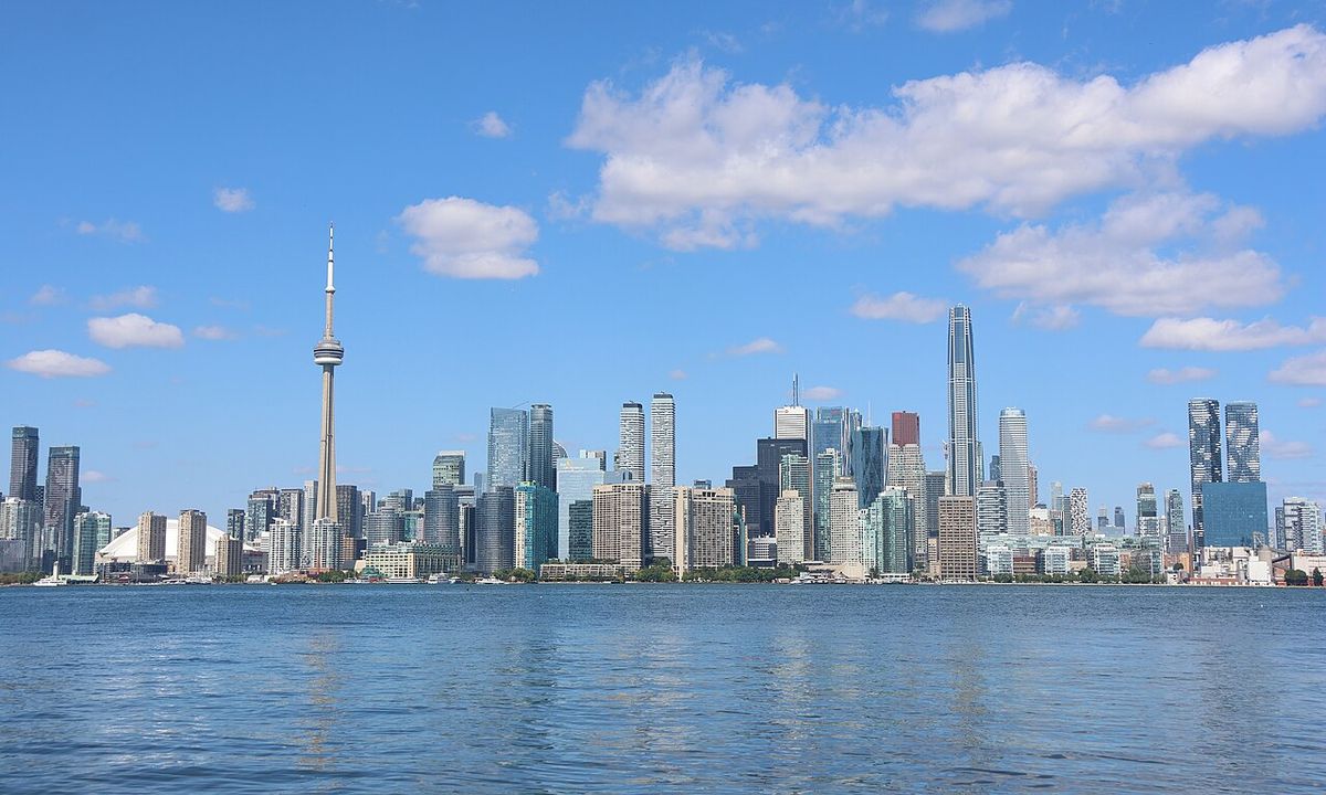
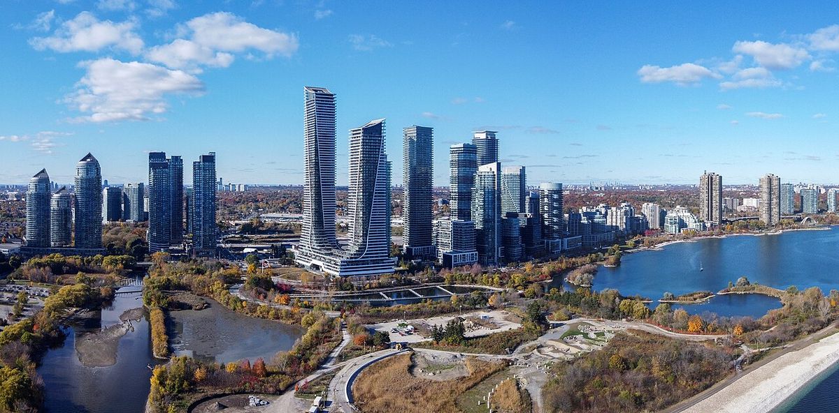
Mississauga is a major city in Peel Region, Ontario, situated on the northwestern shore of Lake Ontario. It is Canada's seventh-most populous municipality and the second-largest city in the Greater Toronto Area, serving as a critical economic hub and home to Toronto Pearson International Airport. The city's history is rooted in the traditional territory of the Wendat, Haudenosaunee and Anishinaabeg peoples, with European settlement beginning in the early 19th century. Today, Mississauga is a diverse, transit-oriented urban centre known for its distinct neighbourhoods and significant corporate presence.
History and Indigenous Roots
The area now known as Mississauga has been inhabited for thousands of years, with archaeological evidence from the Palaeo-Indigenous period dating back as far as 9000 BCE. During the Archaic and Woodland periods, population growth continued, with communities congregating around river systems like the Credit River for fishing and trade. By the late Woodland period, Iroquoian-speaking Wendat (Huron) villages with longhouses were established in the area. The Haudenosaunee moved into the region around 1650, dispersing the Wendat, but they had largely withdrawn by 1687. The Algonquian-speaking Anishinaabe Ojibwe then expanded into the Credit River Valley, with the bands at the river's mouth becoming known as the Credit River Mississaugas, from which the city derives its name.
European settlement began with the signing of Treaty 14 in 1805, where officials from York purchased 340 square kilometres of land from the Mississaugas, forming Toronto Township. Subsequent treaties in 1818 and others saw more land surrendered to the Crown. The government granted this land to United Empire Loyalists and other settlers, leading to the establishment of numerous villages like Clarkson, Cooksville, and Streetsville. In 1847, the Mississaugas were relocated to a reserve in the Grand River Valley near present-day Hagersville. The area remained largely agricultural until after the Second World War, when suburban development began in earnest with projects like Applewood Acres.
- Treaty 14 signed in 1805, forming Toronto Township.
- A second treaty in 1818 surrendered 2,622 square kilometres of Mississauga land.
- Mississaugas relocated to a Grand River Valley reserve in 1847.
- Toronto Township annexed the southern part of Toronto Gore Township in 1952.
- Queen Elizabeth Way (QEW) opened through Port Credit in 1935.
- Malton Airport (later Pearson) lands sold in 1937.
- Town of Mississauga incorporated in 1968 after a plebiscite chose the name over 'Sheridan'.
- Reincorporated as the City of Mississauga in 1974, amalgamating Port Credit and Streetsville.
The city's legal foundation rests on four treaties: Treaty 14, Treaty 19, Treaty 22, and Treaty 23. The historic villages that coalesced into Mississauga included Clarkson, Cooksville, Dixie, Erindale, Lakeview, Lorne Park, Port Credit, Sheridan, and Summerville. Additional settlements established later were Barbertown, Britannia, Burnhamthorpe, Churchville, Derry West, Elmbank, Malton, Meadowvale Village, Mount Charles, and Streetsville. The first major planned suburban development was Applewood Acres, built after the Second World War near the QEW and Dixie Road. The growth of these settlements transformed the rural landscape into the urban municipality seen today.
Geography and Natural Features
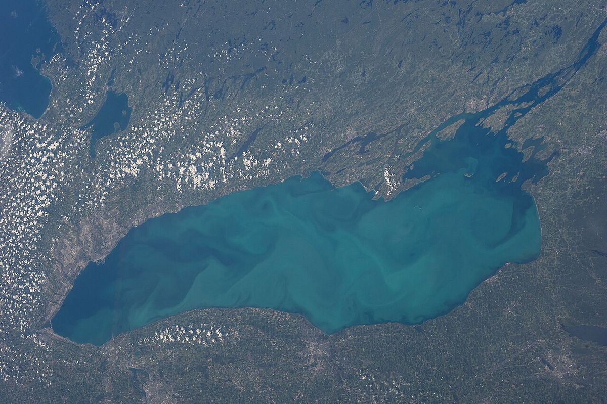
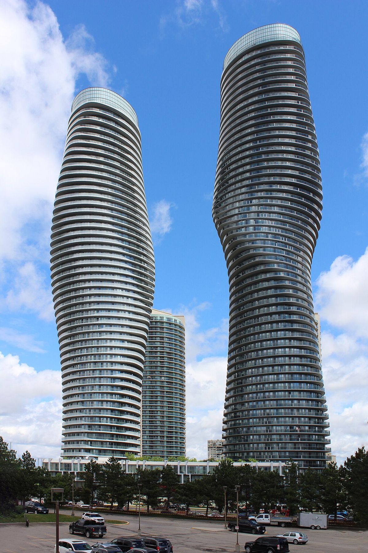
Mississauga covers 288.42 square kilometres of land with 13 kilometres of shoreline on Lake Ontario. It is bordered by Oakville and Milton to the west, Brampton to the north, Toronto to the east, and Lake Ontario to the south. Halton Hills borders the city's northwest corner. The city's topography is shaped by two major river systems. The Credit River is the longest and most significant, flowing through a forested valley into Lake Ontario at Port Credit and managed by the Credit Valley Conservation Authority. Etobicoke Creek forms part of the eastern border with Toronto and is administered by the Toronto and Region Conservation Authority.
The city's elevation ranges from a maximum of 214 metres above sea level near the Highway 407 and 401 junction in the far west, down to 76 metres at the lake shore. The ancient shoreline of Glacial Lake Iroquois roughly follows the path of Dundas Street. Apart from river valleys and this glacial shoreline, the terrain is generally flat, with one notable exception being the hills of the former Britannia Landfill, now a golf course on Terry Fox Way. The city's climate is humid continental, moderated by Lake Ontario, with warmer micro-climates along the lakeshore in areas like Port Credit and Lakeview.
Most land in Mississauga drains into the Credit River or Etobicoke Creek systems. Exceptions include the smaller Mary Fix and Cooksville Creeks, which run through the city centre, and some streams in the far northwest that are part of the Sixteen Mile Creek system draining toward Milton and Oakville. The city experiences an average winter snowfall of 108.5 centimetres over 44.4 days with measurable snow. On August 17, 2024, heavy rainfall caused localized flooding across the city, with all creeks and rivers at full capacity or overflowing into parks. This event caused traffic disruptions, dangerous road conditions, and numerous road closures throughout the municipality.
Demographics and Population Trends
According to the 2021 Census, Mississauga had a population of 717,961, representing a decrease of 0.5 percent from the 2016 population of 721,599. This marked the first population decline in the city's history. The population density was 2,452.6 persons per square kilometre based on a land area of 292.74 square kilometres. The demographic profile shows a median age of 40.8 years, with 15.2 percent of the population under 15 years old and 16.6 percent aged 65 and over. The city is known for its highly diverse and multicultural population, a characteristic that developed strongly during the latter half of the 20th century.
The religious composition of the city, as of the 2021 census, was predominantly Christian at 49.9 percent of the population. Catholicism was the largest single denomination at 30.4 percent, followed by Orthodox Christianity at 3.6 percent, Anglicanism at 2.0 percent, and the United Church at 1.5 percent. Pentecostal and other Charismatic churches were also represented. A significant portion of the population reported having no religious affiliation. The city's growth was initially driven by its proximity to Toronto, but it has since developed its own substantial urban core and identity, building a transit-oriented central business district known as Mississauga City Centre.
| Census Year | Population | Change | Private Dwellings (Occupied) |
|---|---|---|---|
| 2016 | 721,599 | , | , |
| 2021 | 717,961 | -0.5% | 244,575 |
The total number of private dwellings counted in 2021 was 254,089, of which 244,575 were occupied by usual residents. The city's residents are formally called Mississaugans, but the common local shorthand 'Sauga' leads to the informal demonym 'Saugans'. The city's demographic structure reflects its evolution from a collection of rural villages and townships into a major urban municipality. This evolution included the absorption of distinct communities like Port Credit and Streetsville, each with their own historical identities.
Urban Development and Infrastructure
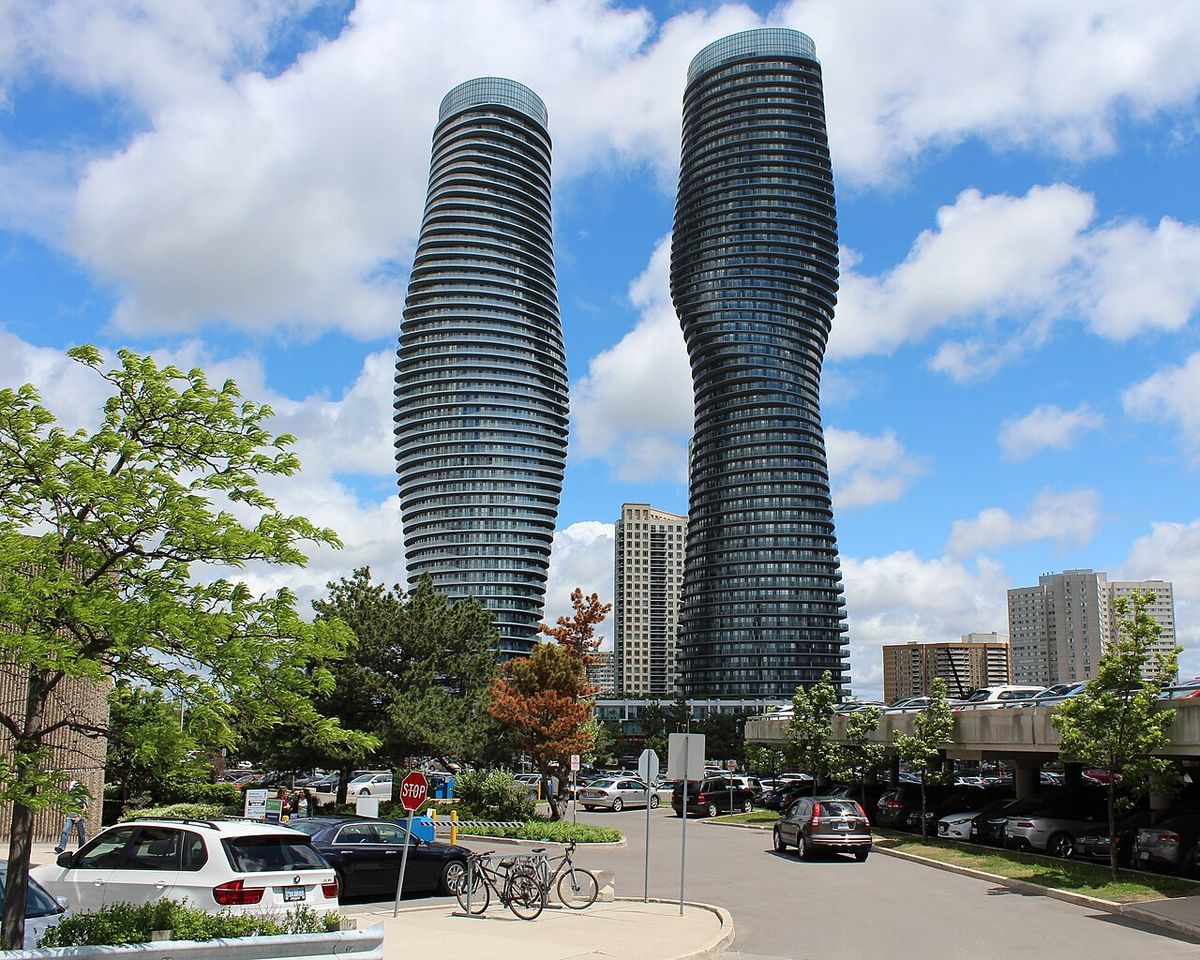
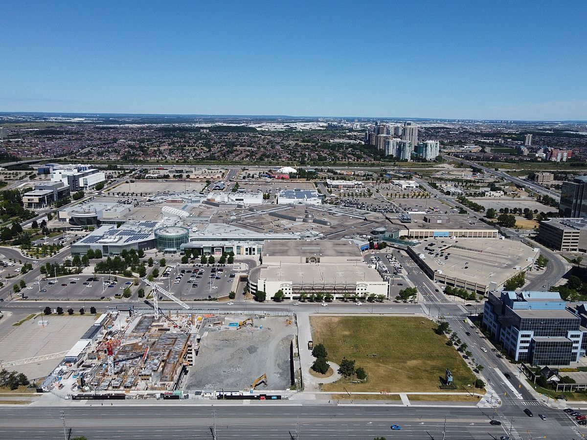
Mississauga's urban form is a product of the amalgamation of historic villages and townships, including Toronto Township and Toronto Gore Township. Key original settlements included Clarkson, Cooksville, Dixie, Erindale, Port Credit, and Streetsville. The city's development accelerated post-Second World War with planned suburban communities like Applewood Acres, followed by large new towns such as Erin Mills started in 1968 and Meadowvale started in 1969. Most of Mississauga was built out by 2005. The opening of Square One Shopping Centre in 1974 became a major anchor for the newly created Mississauga City Centre, a transit-oriented central business district that has been built up over subsequent decades.
Major transportation infrastructure has shaped the city. The Queen Elizabeth Way, one of the world's first controlled-access highways, opened from Highway 27 to Highway 10 in Port Credit in 1935 and was expanded to Hamilton and Niagara by 1939. Toronto Pearson International Airport, located in the Malton neighbourhood, is Canada's busiest airport and a major employment centre. The city expanded its borders in 2010 by acquiring 400 acres of land from Milton, extending to Highway 407 and affecting 25 residents. In 1974, the city also annexed lands west of Winston Churchill Boulevard from Oakville in exchange for lands north of Steeles Avenue transferred to Brampton.
- Square One Shopping Centre opened in 1974.
- Toronto Pearson International Airport is in the Malton neighbourhood.
- Mississauga City Centre is the transit-oriented downtown core.
- The Credit River Valley is a major natural and recreational corridor.
- Historic villages include Port Credit and Streetsville.
- The first Touch-Tone telephones in Canada were introduced in Malton on June 15, 1964.
- Bell Canada splits the city into five historic rate centres: Clarkson, Cooksville, Malton, Port Credit, and Streetsville.
The area known as Malton had a special status as a police village prior to 1968, granting it partial autonomy. The decision to amalgamate Port Credit and Streetsville into the new City of Mississauga in 1974 was driven by political will and a belief that a larger city would be a stronger entity within Peel County. The city's built environment represents a pattern common to several suburban Greater Toronto Area cities, being an amalgamation of former villages and townships that later coalesced into a single urban area. This pattern means Mississauga lacks a single historic core, with none of the original settlements being clearly dominant before incorporation.
Significant Events and Disasters
Several major events have shaped Mississauga's history and identity. The 1979 Mississauga train derailment was a defining moment for the city and for emergency management in Canada. On November 10, 1979, a 106-car freight train carrying explosive and poisonous chemicals derailed near Mavis Road and Dundas Street. A propane tank car exploded, and with other cars containing chlorine, authorities made the decision to evacuate approximately 218,000 people, the largest peacetime evacuation in North American history at the time. The evacuation was conducted swiftly and successfully, with no serious injuries, and its model was later studied by cities worldwide. For many years afterwards, the name Mississauga was associated with this rail disaster for many Canadians.
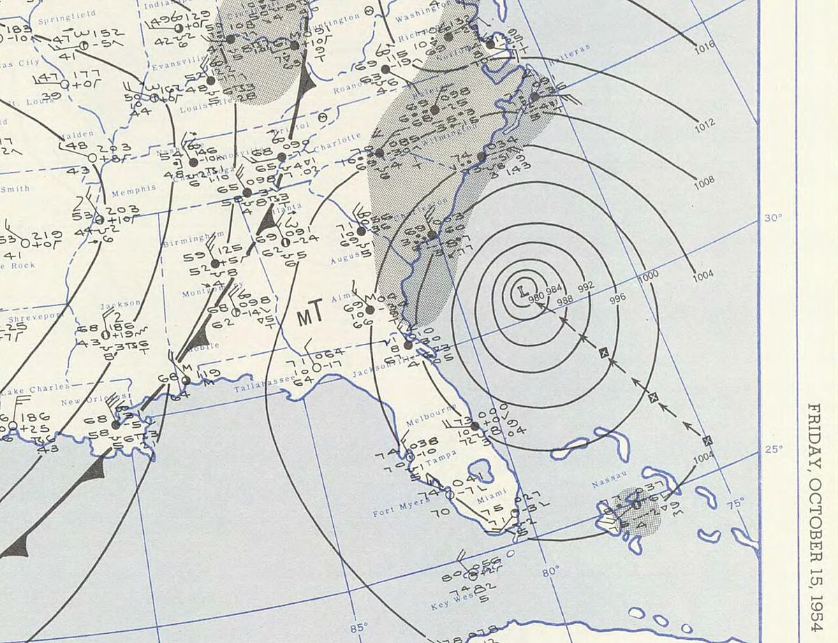
The city has also experienced natural disasters, such as flooding from Hurricane Hazel in 1954 which swept homes along Etobicoke Creek into Lake Ontario, leading to a permanent ban on building in floodplains. More recently, on August 17, 2024, heavy rainfall caused localized flooding across the city, overwhelming creeks and rivers and causing traffic disruptions and road closures. All creeks and rivers were at full capacity or had flooded into parks and greenspaces during this event. The city has been affected by tornadoes, including a significant one on June 24, 1923, that cut a path from present-day Meadowvale to near Cooksville, killing four people and causing massive property damage when the area was mostly farmland. An F1-rated tornado struck an industrial park on Argentia Road in Meadowvale on July 7, 1985, heavily damaging buildings and parked tractor trailers. In 1978 and again in 2005, aircraft overshot runways at Pearson Airport and slid into the banks of Etobicoke Creek. These events have informed the city's planning and emergency response protocols, which were notably refined after the 1979 derailment.
Local Governance and Cultural Identity
Mississauga is a single-tier municipality within the Regional Municipality of Peel, which provides certain upper-tier services like policing, public health, and waste management. The city itself provides local services including fire protection, parks and recreation, and local roads. The political evolution of the area saw it governed as Toronto Township until 1968. In 1965, a public call for name suggestions received thousands of letters with hundreds of ideas before 'Mississauga' was chosen by plebiscite over 'Sheridan' by a vote of 11,796 to 4,331. It was reincorporated as the Town of Mississauga in 1968, absorbing Malton. In 1974, it became a city, amalgamating Port Credit and Streetsville.
Telecommunications history was made in Mississauga when the first Touch-Tone telephones in Canada were introduced in Malton on June 15, 1964. Bell Canada, the local exchange carrier, still recognizes the city's historic rate centres of Clarkson, Cooksville, Malton, Port Credit, and Streetsville, though they are listed collectively as Mississauga in phone books. The city's emergency response plans, notably refined after the 1979 train derailment, are considered a model of efficiency. Municipal governance continues to focus on managing growth, maintaining infrastructure, and serving one of Canada's most diverse populations.
The city's cultural identity is linked to its origins as a collection of distinct villages. Before incorporation, none of the settlements were clearly dominant, with the larger enclave communities of Port Credit and Streetsville initially remaining separate due to a lack of interest in ceding autonomy or being taxed for the needs of the growing municipality around them. The city is not a traditional city with a single historic core but an amalgamation. This pattern of development is common to several suburban GTA cities. The city's official climate data is recorded at Pearson International Airport, but conditions can vary, with fog more common along the lakeshore and in the Credit River Valley during spring and autumn. The city's 25 neighbourhoods further reflect this patchwork history.
Climate and Environmental Conditions
Mississauga has a humid continental climate under the Köppen classification, similar to Toronto and located in plant hardiness zone 7a. Summers can bring periods of high temperatures accompanied by humidity, with an average daily high in July and August of 27 degrees Celsius. In an average summer, there are about 15.8 days where the temperature exceeds 30 degrees Celsius. Winters are cold, with mean temperatures of -5.5 degrees Celsius in January and -4.5 degrees Celsius in February. It is common for temperatures to fall to -15 degrees Celsius for short periods, with an average of 3.9 nights per winter below -20 degrees Celsius.
The city receives an average of 108.5 centimetres of snow over a winter season, with measurable snowfall on 44.4 days. During snowfalls when temperatures are near freezing, northern parts of the city like Pearson Airport usually get more accumulating snow than southern areas closer to the warmer lake. The reverse occurs during lake-effect snow events from the south, which bring higher totals to south Mississauga. The city usually experiences at least six months of snow-free weather, though snow has occasionally fallen in October or May. The Port Credit and Lakeview areas have a milder micro-climate due to the lake's influence, which warms winter temperatures.
Most thunderstorms are not severe but can occasionally bring violent winds. The last known tornado to cause significant damage was the F1 tornado in Meadowvale in 1985. A stronger tornado tore across the area on June 24, 1923, when it was still Toronto Township, killing four people. The city's official climate data comes from Pearson International Airport, but conditions differ by location. Fog is more common along the lakeshore and in the Credit River Valley during spring and autumn. The city's environmental management is shared between the Credit Valley Conservation Authority for the Credit River watershed and the Toronto and Region Conservation Authority for the Etobicoke Creek system, which was established after the flooding from Hurricane Hazel.
Questions about Mississauga
What is the population of Mississauga?
According to the 2021 Census, Mississauga had a population of 717,961. This represented a slight decrease of 0.5 percent from the 2016 population of 721,599, marking the first decline in the city's history. The population density is 2,452.6 persons per square kilometre. The median age of residents is 40.8 years, with 15.2 percent under 15 and 16.6 percent aged 65 and over.
Why is it called Mississauga?
The name Mississauga comes from the Anishinaabe word Misi-zaagiing, meaning '[those at the] Great River-mouth'. This refers to the Credit River Mississaugas, the Anishinaabe bands who lived at the mouth of the Credit River. European traders would give these bands credit for the following year at the river mouth. The name was chosen by plebiscite in 1965 over the alternative 'Sheridan' when the area was reincorporating as a town.
When did Mississauga become a city?
Mississauga was first incorporated as a town in 1968. It was then reincorporated as a city in 1974. This 1974 reincorporation involved the amalgamation of the formerly separate towns of Port Credit and Streetsville into the new City of Mississauga. Borders were also adjusted with Oakville and Brampton at that time, and Square One Shopping Centre opened the same year.
What was the Mississauga train derailment?
The Mississauga train derailment occurred on November 10, 1979. A 106-car freight train carrying explosive and poisonous chemicals derailed near Mavis Road and Dundas Street. A propane tank car exploded, and fears of a chlorine gas leak led to the evacuation of approximately 218,000 people. This event was the largest peacetime evacuation in North American history at the time and is noted for its successful execution with no serious injuries.
What airport is in Mississauga and when was it built?
Toronto Pearson International Airport, Canada's busiest airport, is located in the Malton neighbourhood in northeast Mississauga. The airport lands, totaling 1,410.8 acres, were sold for development in 1937, originally as Malton Airport. Its construction ended the community of Elmbank. The airport's presence has made the area a major hub for transportation and corporate headquarters, influencing the city's economic development.
What are the main rivers and geographical borders of Mississauga?
Mississauga's key geographical features include 13 kilometres of shoreline on Lake Ontario and two major river systems. The Credit River is the largest, flowing through a forested valley into the lake at Port Credit. Etobicoke Creek forms part of the eastern border with Toronto. The city is bordered by Oakville and Milton to the west, Brampton to the north, and Halton Hills touches its northwest corner. The land ranges from 214 metres above sea level in the west to 76 metres at the lake.
Sources and further reading
- Mississauga (Wikipedia)
- About Mississauga (visitmississauga.ca)
- The City of Mississauga, Origin of Name and Coat of Arms (mncfn.ca)
Checked by the Your Space Hamilton desk. Last updated 2026-10-20.