Lake Huron
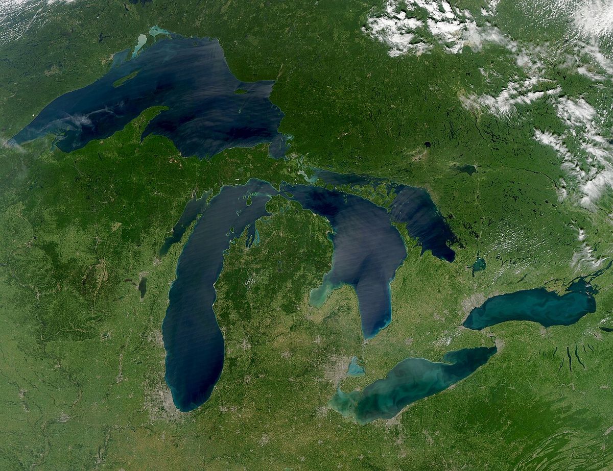
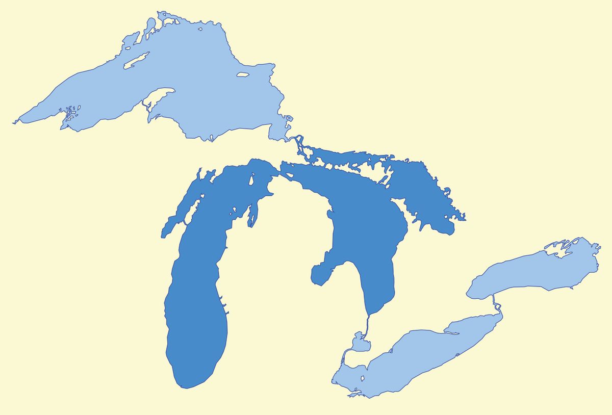
Lake Huron is one of the five Great Lakes of North America, forming a significant part of the border between the Canadian province of Ontario and the U.S. state of Michigan. Hydrologically, it constitutes the eastern lobe of Lake Michigan-Huron, the largest freshwater lake by surface area in the world, connected to Lake Michigan by the Straits of Mackinac. The lake is a vital component of the Great Lakes Waterway, serving as a crucial conduit for shipping, a source of freshwater, and a hub for recreation and tourism for millions of Canadians and Americans. Its extensive shoreline, dotted with thousands of islands and numerous communities, along with a rich history of Indigenous habitation and European exploration, makes it a defining feature of the region's geography and culture.
Geography and Hydrology
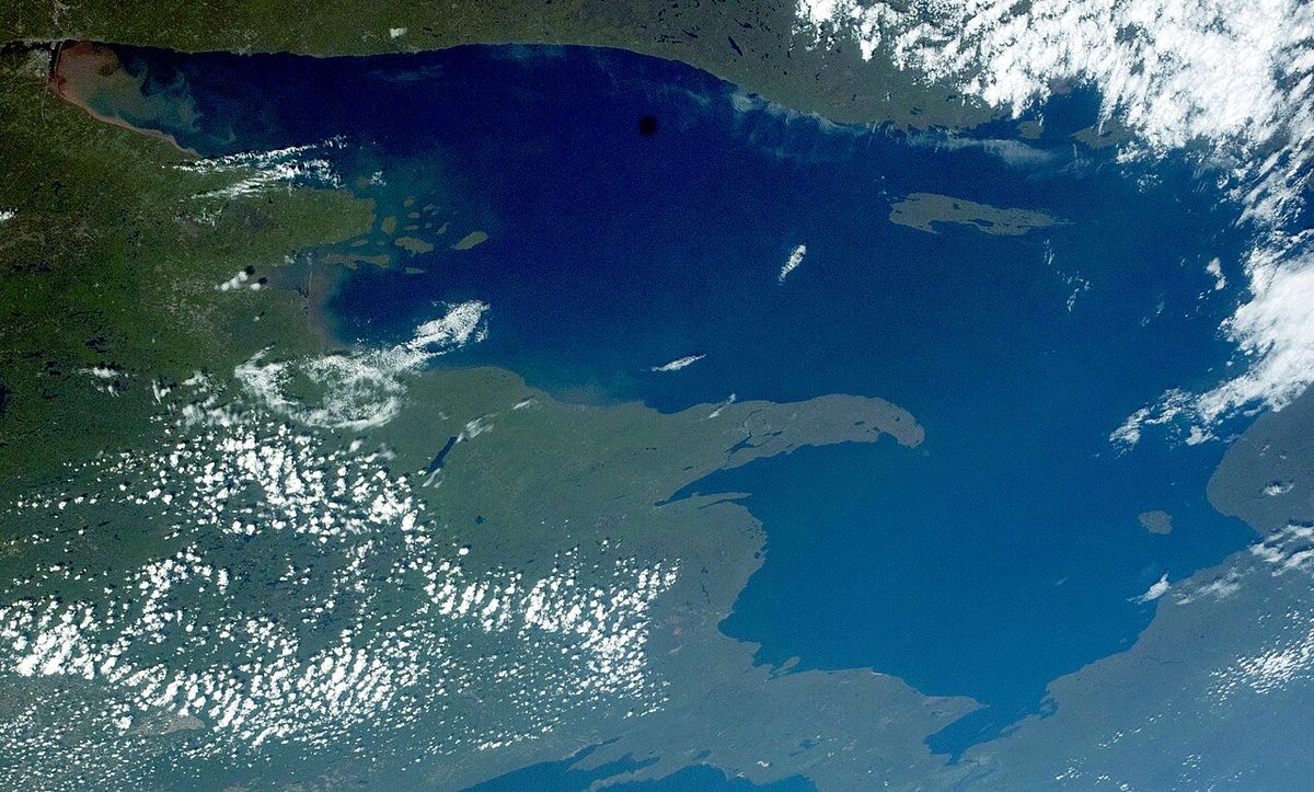
Lake Huron is the second largest of the Great Lakes by surface area, covering 23,000 square miles (59,570 km²), and ranks as the third largest freshwater lake on Earth by volume. The lake's physical dimensions include a length of 206 statute miles (332 km) and a greatest breadth of 183 statute miles (295 km). Its average depth is 195 feet (59 m), with a maximum recorded depth of 750 feet (229 m). The lake's vast drainage basin extends across parts of Michigan and Ontario, feeding its waters. Hydrologically, Lake Huron is inseparable from Lake Michigan, as they are connected at the same surface elevation by the 5-mile-wide (8 km) Straits of Mackinac, forming the combined Lake Michigan-Huron. The main inlet is the St. Marys River from Lake Superior, and the primary outlet is the St. Clair River, which flows south toward Lake Erie and eventually to the Atlantic Ocean via the St. Lawrence River. The lake is divided into five major basins: the Northern and Southern Main Basins, Georgian Bay, Saginaw Bay, and the North Channel.
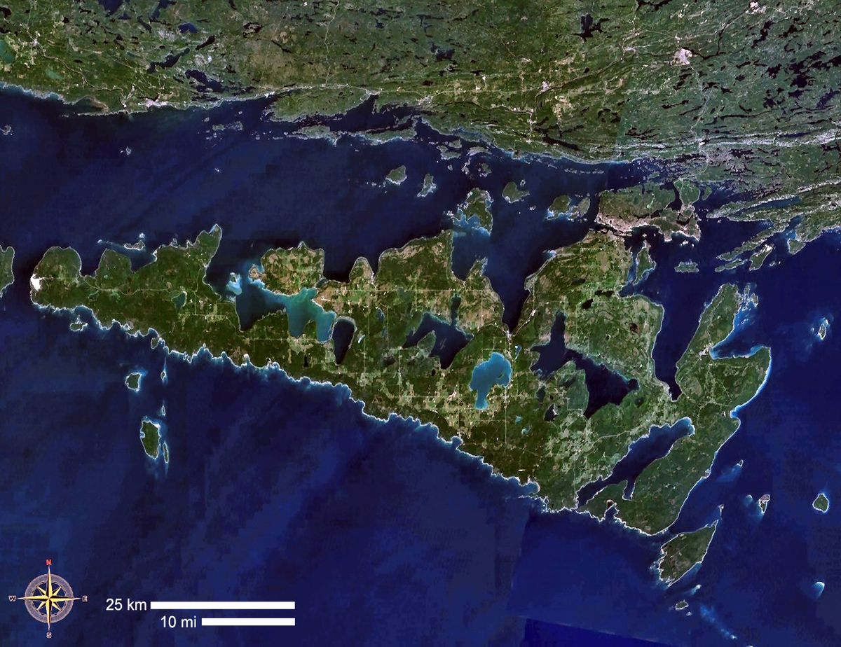
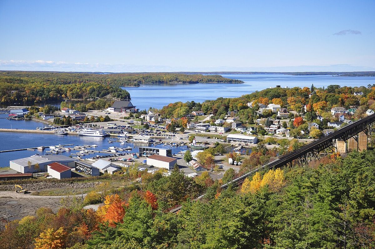
The lake's extensive shoreline, the longest of any Great Lake at 3,827 miles (6,159 km) when including its approximately 30,000 islands, features dramatic contrasts. The northern shores are rugged and rocky, particularly along the Georgian Bay and North Channel regions, which are part of the Canadian Shield. In contrast, the southern and southwestern shores, including Saginaw Bay, are generally lower and more sandy. Manitoulin Island, located in the northern part of the lake, is the world's largest freshwater island and separates the North Channel and Georgian Bay from the lake's main body. Major urban centres on the Canadian side include Sarnia, the largest city on the lake, and Saugeen Shores, while significant U.S. cities are Bay City, Port Huron, and Alpena. Georgian Bay is home to communities like Owen Sound, Wasaga Beach, Collingwood, Midland, Penetanguishene, Port Severn and Parry Sound. The lake's water levels fluctuate seasonally and over longer periods, influenced by precipitation, evaporation, and outflow controls. The normal high-water mark is 2.00 feet (0.61 m) above the low water datum of 577.5 feet (176.0 m), with the highest levels typically occurring in October and November. These fluctuations have significant impacts on shoreline infrastructure, navigation, and coastal ecosystems, with record highs set in 1986 and 2020 and record lows set in 1964 and 2013.
Geology and Formation
Lake Huron, like the other Great Lakes, was carved by the massive continental glaciers of the last ice age as they retreated approximately 10,000 years ago. The melting ice filled the deep basins scraped into the bedrock, creating the modern lake. Prior to this glaciation, the area was a low-lying depression drained by ancient river systems, including the Laurentian and Huronian Rivers, whose buried channels are still visible on bathymetric maps. A significant submerged geological feature is the Alpena-Amberley Ridge, an ancient limestone ridge that runs from Alpena, Michigan, southeast to Point Clark, Ontario. This ridge was exposed as a land bridge about 9,000 years ago when lake levels were roughly 100 metres (330 feet) lower than today. This corridor served as a crucial migration route for caribou herds and later became an important site for early human activity, as evidenced by archaeological discoveries. The Huronian glaciation, a much earlier prehistoric ice age, was named from geological evidence collected in the Lake Huron region.
Human History and Archaeology
The Lake Huron region has been inhabited for thousands of years. Archaeological evidence indicates that around 9,000 years ago, Paleo-Indians used the exposed Alpena-Amberley Ridge as a hunting ground, constructing at least 60 stone hunting blinds to ambush caribou. A 2013 underwater discovery along the ridge confirmed the existence of an ancient trade network, finding obsidian from Oregon that was used for toolmaking nearly ten millennia ago. On the eve of European contact, substantial Indigenous settlements existed, with one archaeological site suggesting a town of over one hundred large structures housing between 4,000 and 6,000 people. The name Huron is derived from the French name for the Wyandot (Huron) people inhabiting the region. A 1656 map by cartographer Nicolas Sanson also used the Wyandot word Karegnondi, translated as 'Freshwater Sea' or 'Lake of the Hurons'. European settlement accelerated in the 19th century, with Sarnia incorporating in the 1860s. In a modern infrastructure project, the Karegnondi Water Authority was formed on October 26, 2010, to build and manage a pipeline from the lake to Flint, Michigan.
Shipwrecks and Maritime History
Lake Huron's history is marked by a rich and often tragic maritime heritage, with more than a thousand recorded shipwrecks resting on its bottom. These wrecks are concentrated in several areas, with 185 in Saginaw Bay, 116 within the Thunder Bay National Marine Sanctuary and Underwater Preserve (established in 2000), and 212 in Georgian Bay. The first European vessel to sail the Great Lakes, Le Griffon, built in 1679, also became the first ship lost on them. After a trading voyage, it vanished in late November 1679 while returning from Green Bay to Lake Erie. Two wrecks, one in Mississagi Strait off Manitoulin Island and another near Russell Island in Georgian Bay, have been proposed as the final resting place of Le Griffon, though neither identification is conclusive. The lake's most devastating single storm was the Great Lakes Storm of 1913, which raged for 16 hours starting November 9. This storm sank 10 ships on Lake Huron and drove more than 20 ashore, resulting in the deaths of 235 seamen. The freighter Matoa was stranded on the Port Austin reef, while the Manola, which survived the 1913 storm by sheltering at Harbor Beach, Michigan, was later wrecked in Georgian Bay in 1924.
Notable shipwreck sites and preserves include the Thunder Bay National Marine Sanctuary and Underwater Preserve, which contains 116 wrecks within a 448-square-mile area. Saginaw Bay has 185 recorded wrecks, and Georgian Bay contains 212 sunken vessels. More than a thousand wrecks have been recorded in Lake Huron overall. These sites are popular destinations for recreational divers and are protected for their historical significance.
- Thunder Bay National Marine Sanctuary (Michigan): Protects 116 historic wrecks within a 448-square-mile area.
- Fathom Five National Marine Park (Ontario): Canada's first national marine park, protecting numerous wrecks in Georgian Bay.
- The wrecks of the freighter Manola (later renamed Mapledawn in 1920) and the schooner Sweepstakes near Tobermory.
- Multiple wrecks from the 1913 storm, including the Charles S. Price and the Hydrus.
- Several wooden schooners from the 19th century, such as the New Brunswick and the Arabia.
- The propeller freighter Matoa, which was found stranded on the Port Austin reef after the 1913 storm.
The detailed account of the Manola's struggle during the 1913 storm illustrates the peril faced by mariners on the lake. During the storm, the Manola's cables began to snap from wind pressure, and waves breaking over the ship damaged several windows. The crew also reported seeing portions of a concrete break wall peeling off as the waves struck it. The Great Lakes Storm of 1913 in Lake Huron sank 10 ships and killed 235 seamen.
Ecology and Environmental Changes
The ecological balance of Lake Huron has undergone drastic transformations over the past century. The lake's original deepwater fish community was dominated by native lake trout, which preyed upon several species of ciscos (deepwater chubs), sculpins, and other native fish. A series of invasive species introductions, beginning with the sea lamprey in the 1930s, followed by the alewife and rainbow smelt, drastically altered this ecosystem. Overfishing and sea lamprey predation virtually extirpated the lake trout by 1950, and several cisco species were lost by the 1960s, leaving only the bloater and lake herring (cisco). Management efforts included extensive stocking of non-native Pacific salmon like chinook and coho since the 1960s and decades of lake trout stocking to rehabilitate the native population, which is now largely self-sustaining, especially in the northern lake.
The arrival of zebra and quagga mussels, the spiny water flea, and round gobies has fundamentally changed the lake's food web. These changes contributed to a collapse of the demersal (bottom-dwelling) fish community by 2006 and drastic alterations in zooplankton populations. Chinook salmon catches have declined significantly in recent years, and lake whitefish have become less abundant and in poor condition. However, some native species have benefited from the decline of the invasive alewife. Lake trout and walleye populations have shown signs of recovery, with the Saginaw Bay walleye population meeting recovery targets by 2009. The lake supports various aquatic plants, including invasive species like curly-leafed pondweed, which can grow up to 5 metres tall, and spiked water-milfoil, as well as native species like water silk and muskgrass.
Lake Huron has a water retention time of 22 years, which is faster than the other Great Lakes. The ecology of Lake Huron has undergone drastic changes in the last century. The combined effects of overfishing, invasive species, and food web changes have created a new ecological state. Ongoing management and research focus on understanding these complex interactions and supporting the recovery of native species while managing the impacts of established invasives.
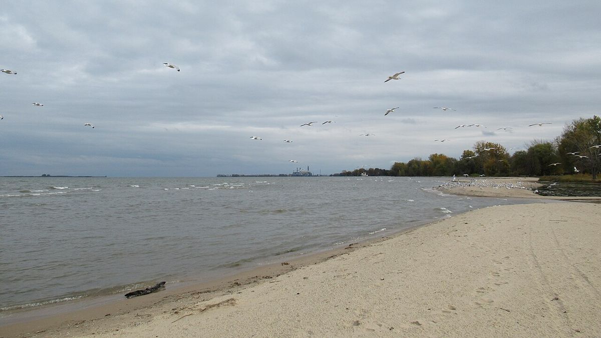
Detailed Water Level Fluctuations and Impacts
Lake Huron experiences significant natural fluctuations in water levels on seasonal, annual, and decadal timescales, influenced by precipitation, evaporation, and outflow. The normal high-water mark is 2.00 feet (0.61 m) above the low water datum (577.5 ft / 176.0 m), with the highest levels typically occurring in October and November. Record highs were set in the summer of 1986, when Lakes Michigan and Huron reached 5.92 feet (1.80 m) above datum, and again for several consecutive months in 2020. Monthly low-water records were set each month from February 1964 through January 1965, with water levels ranging from 1.38 to 0.71 feet below Chart Datum during that period. These fluctuations impact shoreline properties, navigation, coastal ecosystems, and recreational activities. The following table illustrates notable high and low water level events and their characteristics.
| Event | Year | Level Relative to Datum | Seasonal Timing & Notes |
|---|---|---|---|
| Historic High | 1986 | +5.92 ft (+1.80 m) | Peak in summer. Then-highest recorded level. |
| Record High Months | 2020 | Above previous records | High-water records broken for several months in a row. |
| All-Time Low | 2013 | Below 1964 record | Record eclipsed in January. |
| Normal High-Water Mark | , | +2.00 ft (+0.61 m) | Typical peak in October/November. |
Managing water level variations is a continuous challenge for communities and governments around the lake. These variations affect harbour dredging, dock construction, and erosion control measures. The economic and environmental costs associated with both extreme high and low water events are substantial. Lake levels fluctuate monthly, with the highest levels typically in October and November and the lowest in winter.
Recreation, Tourism and Lighthouses
Lake Huron is a premier destination for outdoor recreation and tourism, attracting visitors with its clear waters, extensive parks, and scenic landscapes. The lake's thousands of islands, particularly in the Georgian Bay and North Channel regions, offer exceptional opportunities for boating, kayaking, and sailing. Manitoulin Island itself is a major tourist draw, known for its Indigenous culture, hiking trails, and serene environment. The Bruce Peninsula, which separates Georgian Bay from the main lake, is home to Bruce Peninsula National Park and Fathom Five National Marine Park, the latter protecting a unique collection of shipwrecks and freshwater coral. Popular beaches can be found at Wasaga Beach on Georgian Bay, which is one of the world's longest freshwater beaches, as well as Sauble Beach and Grand Bend. The lake's many lighthouses, such as those at Point Clark and Cove Island, are historic landmarks that aid navigation and attract visitors. Fishing remains a significant activity, with anglers pursuing walleye, perch, smallmouth bass, and the rehabilitated lake trout. The lake's shoreline also features an extensive network of hiking trails, including sections of the Bruce Trail, and numerous provincial and state parks that provide camping, birdwatching, and wildlife viewing opportunities.
The lake's lighthouses are a distinctive feature of its maritime landscape, serving both as functional aids to navigation and historic sites. Many of these lighthouses are open to the public as museums or bed and breakfasts. Interactive maps detail the locations of lighthouses in Georgian Bay, North and East Lake Huron, and North and West Lake Huron. These structures, often built in the 19th and early 20th centuries, stand as testaments to the importance of safe passage on the lake during the era of steam and sail. Their preservation is a key part of cultural heritage efforts along the coastline.
Notable Storms and Navigation
The navigation history of Lake Huron is punctuated by severe storms that highlight the lake's power and danger to shipping. The most famous of these is the Great Lakes Storm of 1913, also known as the 'White Hurricane', which struck Lake Huron with particular fury on November 9. The storm, which raged for 16 hours, sank 10 ships and drove more than 20 ashore, resulting in the deaths of 235 seamen. Detailed accounts from vessels like the Matoa and Manola provide a window into the event. The Matoa had passed between Port Huron and Sarnia just after midnight and was later found stranded on the Port Austin reef. The Manola, a freighter of 2,325 gross register tons, sought shelter at Harbor Beach, Michigan, after its captain observed storm warnings. While secured with eight lines, the ship's cables began to snap from wind pressure, and it drifted 800 feet before its movement was stopped, with waves damaging windows and the breakwater itself. Other vessels like the Regina and Senator were also caught in the storm. While the Manola survived, it was wrecked years later in Georgian Bay in 1924. This storm remains a benchmark for maritime weather severity on the Great Lakes.
Aquatic Plant Life and Invasive Flora
Lake Huron supports a diverse range of seaweed species, which include both algae and aquatic plants that form important habitats and food sources within the ecosystem. Notable species found in the lake include curly-leafed pondweed, a tall, kelp-like plant with small curly leaves that can grow up to 5 metres (16 feet) in length. Another common species is spiked water-milfoil, a dense aquatic plant with pine-like leaves that often forms bushy stands over a meter tall. The lake also hosts native species like water silk, a smooth, silk-like algae that frequently grows on rocks, and muskgrass, a type of seaweed characterized by a skinny stem and flower-like leaves. Both spiked water-milfoil and curly-leafed pondweed are classified as invasive species in this context, and when they grow in excess, they can outcompete native flora and remove vital resources from the ecosystem. The presence and management of these plants are important factors in maintaining the lake's overall ecological health and biodiversity.
Questions about Lake Huron
Where is Lake Huron located?
Lake Huron is located in North America as one of the five Great Lakes. It is shared on the north and east by the Canadian province of Ontario and on the south and west by the U.S. state of Michigan. Hydrologically, it comprises the eastern portion of Lake Michigan-Huron, connected to Lake Michigan by the Straits of Mackinac. Combined, Lake Michigan-Huron is the largest freshwater lake by area in the world. The lake's main inlet is the St. Marys River from Lake Superior, and its main outlet is the St. Clair River toward Lake Erie.
What is the largest island in Lake Huron?
The largest island in Lake Huron is Manitoulin Island. It is notable as the largest freshwater island on Earth. Manitoulin Island separates the North Channel and Georgian Bay from the main basin of the lake. The northern parts of Lake Huron include both the North Channel and Georgian Bay. Counting its 30,000 islands, Lake Huron has the largest shoreline length of any of the Great Lakes.
How deep is Lake Huron?
Lake Huron has an average depth of 32 fathoms 3 feet, which is 195 feet or 59 metres. The maximum recorded depth is 125 fathoms, equivalent to 750 feet or 229 metres. By volume, Lake Huron is the third largest of the Great Lakes, containing 850 cubic miles or 3,500 cubic kilometres of water when measured at the low water datum. The lake's surface is 577 feet above sea level. It is split into five basins, including the Northern and Southern Main Basins, Georgian Bay, Saginaw Bay, and the North Channel.
Why are there so many shipwrecks in Lake Huron?
There are many shipwrecks in Lake Huron due to severe storms and its extensive shipping history. More than a thousand wrecks have been recorded. A major cause was the Great Lakes Storm of 1913, which raged for 16 hours in Lake Huron, sank 10 ships, drove more than 20 ashore, and killed 235 seamen. Wreck concentrations are found in areas like Saginaw Bay, which has 185 wrecks, the Thunder Bay National Marine Sanctuary with 116, and Georgian Bay with 212 sunken vessels. The first European vessel on the Great Lakes, Le Griffon, was also lost here in 1679.
What major cities are located on Lake Huron?
Major cities on Lake Huron include Sarnia, which is the largest city on the lake, and Saugeen Shores in Canada. In the United States, significant cities are Bay City, Port Huron, and Alpena. Major centres on Georgian Bay, which is part of Lake Huron, include Owen Sound, Wasaga Beach, Collingwood, Midland, Penetanguishene, Port Severn and Parry Sound. These are all cities with over 10,000 people located along the lake's extensive shoreline.
What invasive species are in Lake Huron?
Lake Huron contains several invasive species that have altered its ecology. Early invaders include sea lamprey, alewife and rainbow smelt, which became abundant by the 1930s and contributed to the near extirpation of native lake trout by 1950. More recent invasive species are zebra and quagga mussels, the spiny water flea, and round gobies. These new species are linked to drastic changes in the fish and zooplankton communities, including reduced Chinook salmon catches and poorer condition of lake whitefish. However, some native species like lake trout and walleye have benefited from the decline of alewife.
Sources and further reading
- Lake Huron (Wikipedia)
- Parks, Beaches and Boat Launches (huronshores.ca)
- Lower Huron Metropark (metroparks.com)
Checked by the Your Space Hamilton desk. Last updated 2026-10-19.