St. Clair River
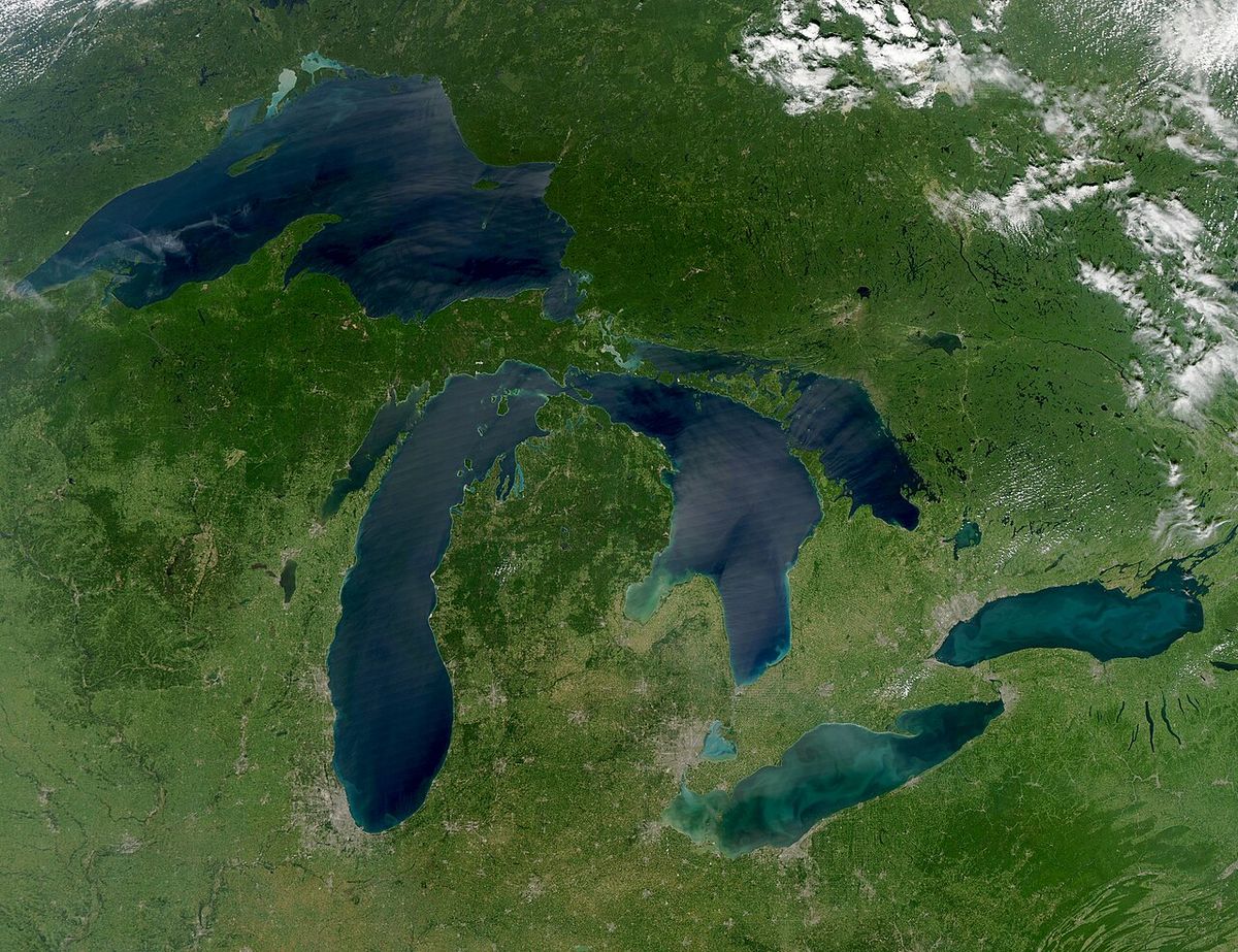
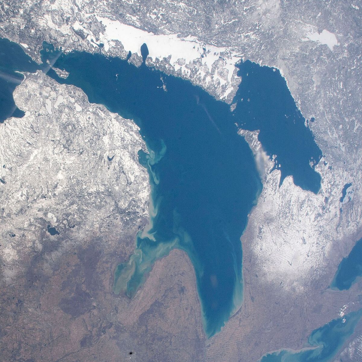
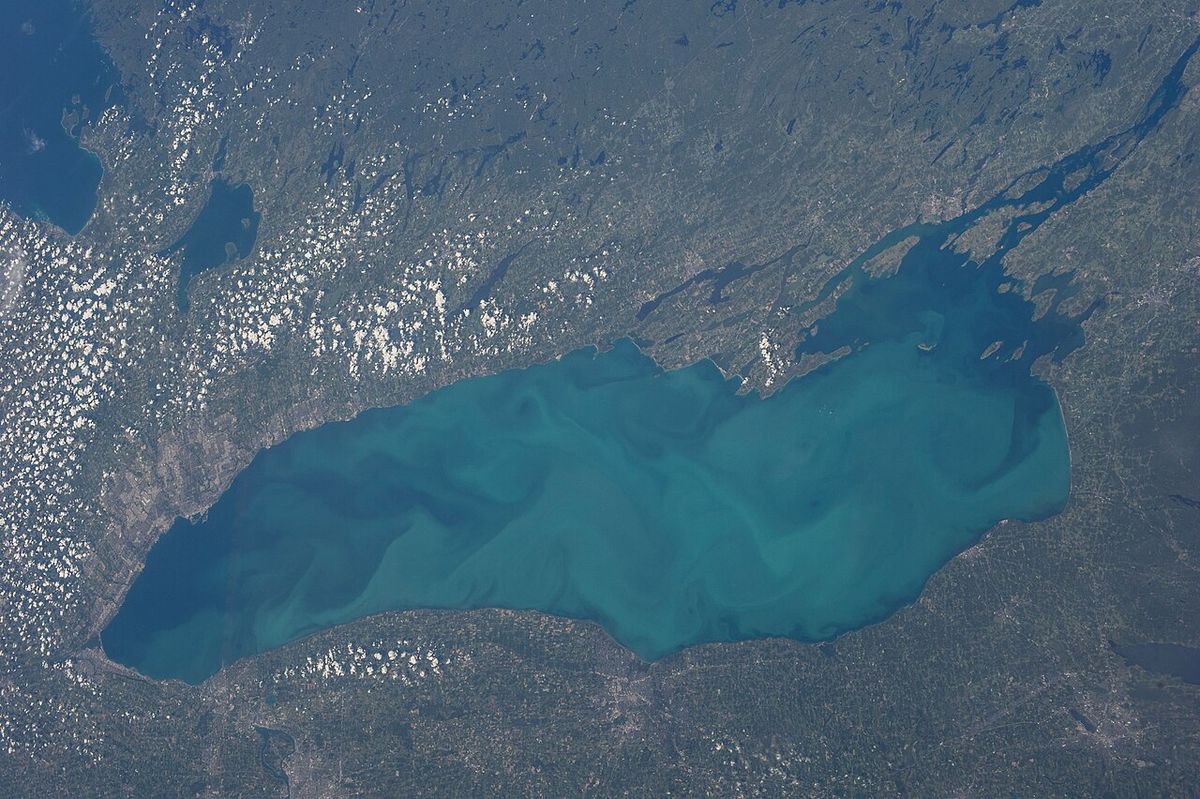
The St. Clair River is a 65.2-kilometre-long river in eastern North America that flows from Lake Huron into Lake St. Clair. It forms a significant segment of the international boundary between the Canadian province of Ontario and the U.S. state of Michigan. The river is a critical component of the Great Lakes Waterway, enabling cargo vessel traffic between the upper and lower lakes. At its mouth, the river forms the St. Clair Delta, the largest delta in the Great Lakes system, covering approximately 360 square kilometres.
Geography and Hydrology
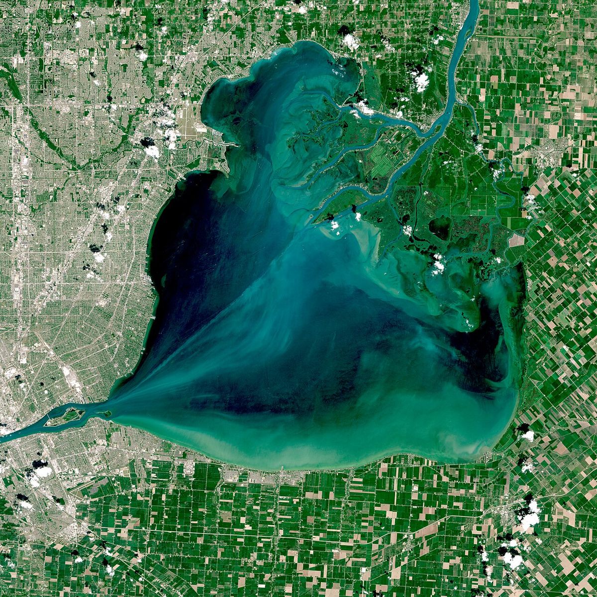
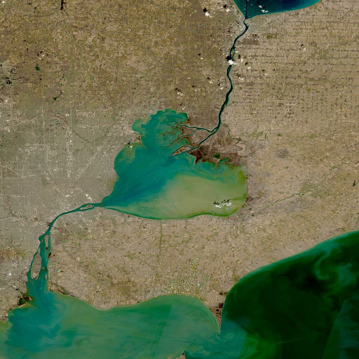
The St. Clair River flows southward from the southern end of Lake Huron to the northern end of Lake St. Clair. Some geographers consider it a strait due to its function as a narrow waterway connecting two large lakes. The river drops about two metres in elevation over its course, with an average flow rate of approximately 5,200 cubic metres per second. This substantial flow drains a vast area of 579,000 square kilometres, which includes the combined drainage basins of Lakes Superior, Michigan, and Huron. Near its mouth at Lake St. Clair, the river divides into three main channels: the North, Middle, and South Channels.
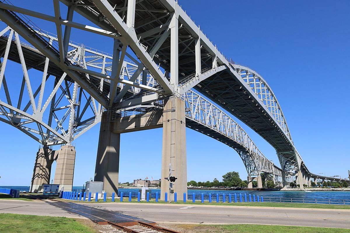
This division creates the expansive St. Clair Delta, also known as the St. Clair Flats. The delta is a unique feature in the Great Lakes, being the system's only major river delta. It consists of numerous islands and wetlands that provide crucial habitat. The river's aquatic habitat varies significantly along its length, from deep, fast-moving waters near the Blue Water Bridge to shallower, slower sections in the lower river and delta. This variety supports diverse life, including macrophytes, benthic invertebrates, plankton, and numerous fish species. Each area provides a unique habitat for aquatic life, from organisms that live at the bottom of the stream to floating plants and animals and large sport fish.
History and Development
For generations, Indigenous cultures including the Ojibwe, Potowatomi, and Odawa used the river for travel and trade, calling the delta area Bkejwanong, meaning 'where the waters divide'. In the 18th century, French voyageurs and coureurs des bois travelled the river to trade furs, establishing routes to posts like Fort Detroit, which was built in 1701 downriver from Lake St. Clair on the Detroit River. The high European demand for American furs, especially beaver, was high until the 1830s. During the mid-19th century, communities like Port Huron and Marine City in Michigan became major shipbuilding centres, supporting the regional timber industry.
Lumber harvested in Michigan's Thumb region was shipped downriver on log rafts to Detroit for processing and export. The wooden ships built along the St. Clair carried migrants and immigrants up the river and west through the upper Great Lakes on their way to new homes in the American West. Later, these settlers' farms shipped grain east via the lakes as part of the developing regional economy. From the late 19th century, lake freighters, increasingly made of steel in the 20th century, transported commodities such as iron ore from the Mesabi Range, copper, and grain throughout the Great Lakes. Iron was taken to industrial cities like Ashtabula, Ohio for steel manufacture, and grain was shipped to major eastern markets such as Cleveland and New York City.
Passenger steamers also operated among the small riverside towns, with up to 31 lines running before declining with the rise of automobile travel in the 20th century. Much of the shoreline is now urbanized and industrialized, particularly near the twin cities of Sarnia, Ontario, and Port Huron, Michigan. Sarnia, originally founded as a fur trading post, is now the centre of a large petrochemical complex along the Ontario shore. This development has significantly altered the natural landscape, with most pre-settlement forests cleared for agriculture, industry, or urban expansion. Remnants of globally imperiled ecosystems, such as lakeplain oak openings and wet prairies, persist in areas like St. John’s Marsh State Wildlife Area, Dickinson Island, and Walpole Island.
Islands, Delta, and Land Habitat
The St. Clair River and its delta contain numerous islands, which are central to its ecological and cultural identity. Upstream islands include Stag Island, located between Corunna, Ontario, and Marysville, Michigan, and Fawn Island near Port Lambton, Ontario and Marine City, Michigan. The expansive St. Clair Delta, where the river meets Lake St. Clair, contains a complex of islands including Walpole, Seaway, Bassett, Squirrel, Pottowatamie, St. Anne, Dickinson, Russell, and Harsens islands near Algonac, Michigan. This delta area is collectively known as the St. Clair Flats and is the only major river delta in the Great Lakes.
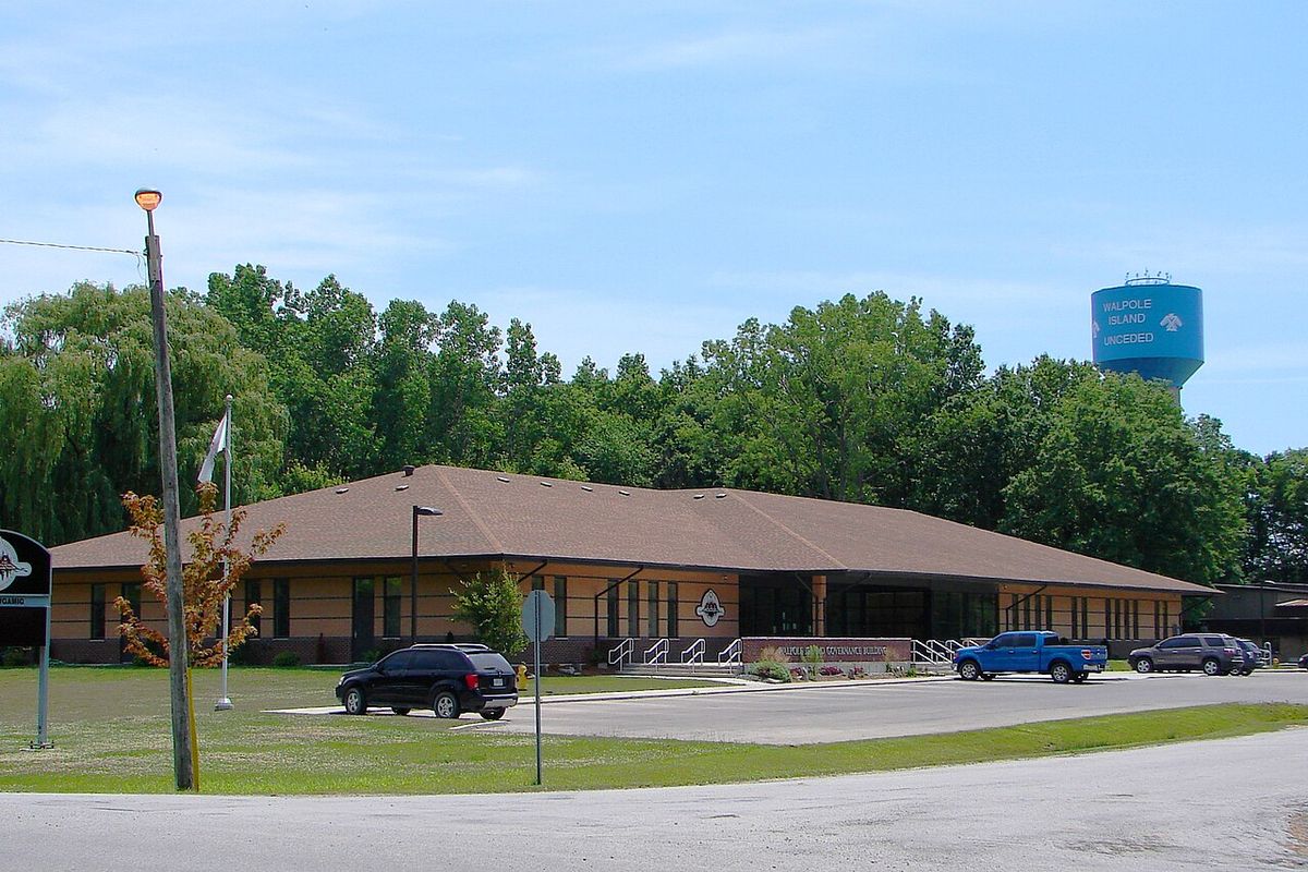
Six islands within this delta, Walpole, Seaway, Bassett, Squirrel, St. Anne, and Dickinson, are unceded territory forming part of the Walpole Island First Nation. The members of this First Nation include Ojibwe (Anishinaabe), Potowatomi, and Odawa peoples. The land habitat in the delta and shoreline consists of two biological zones: upland and transitional, both normally above the water table but subject to periodic flooding. Forests in the region consist of a mix of deciduous species, many near their northern climatic limit. Transitional species are abundant in low-lying regions categorized as shrub ecotones, wet meadows, sedge marshes, and island shorelines and beaches.
This habitat is home to water and land mammals, songbirds, waterfowl, insects, pollinators, reptiles, and amphibians. Coastal wetlands along the shores of Lake St. Clair and the delta have been heavily degraded by invasive species, particularly European reed, narrow-leaved cattail, and hybrid cattail. The survival of these habitats is challenged by widespread industrialization, development, and historical clearing for cultivated fields for various agricultural crops across the watershed. The watersheds around Bunce Creek and Marine City are relatively small compared to the major tributary systems.
Environmental Status and Cleanup as an Area of Concern
The St. Clair River is a binational Area of Concern (AOC) that borders both the United States and Canada. An AOC is an area within the Great Lakes that has suffered from environmental destruction. The St. Clair River AOC includes the entire river, from the Blue Water Bridge at the north end, to the southern tip of Seaway Island, west to St. Johns Marsh and east to include the north shore of Mitchells Bay on Lake St. Clair. Anchor Bay is not included. The river has been considered an AOC because of conventional pollutants such as bacteria, heavy metals, toxic organics, contaminated sediment, fish consumption advisories, impacted animal and plant life, and beach closings.
A Remedial Action Plan (RAP) was initiated in 1985, with a binational RAP Team including representatives from federal, state, and provincial governments of both Canada and the United States established in 1987 to develop the plan and ensure public involvement. The plan addressed numerous 'Beneficial Use Impairments' (BUIs), which are changes in the physical, biological, and chemical consistency that cause significant environmental degradation. Through remediation and restoration work funded by initiatives like the U.S. Great Lakes Restoration Initiative, which involved a $21 million investment, most impairments have been successfully addressed and removed. The background report for the RAP noted the adverse effects of pollution, including restrictions on fish consumption, bird and animal deformities, degradation of benthos, and loss of fish and wildlife habitat.
Removed Beneficial Use Impairments:- Tainting of fish and wildlife flavour, Removed in 2010.
- Restriction on dredging activities, Removed in 2011.
- Added costs to agriculture or industry, Removed in 2012.
- Degradation of aesthetics, Removed in 2012.
- Degradation of benthos, Removed in 2015.
- Beach closings, Removed in 2016.
- Bird or animal deformities or reproduction problems, Removed in 2017.
- Loss of fish and wildlife habitat, Removed in 2017.
According to the Stage 1 RAP, the reasons for the Loss of Fish and Wildlife Habitat BUI were general loss of the aquatic plant community due to industrial, agricultural, recreational, and urban developments. As of the latest assessments, only two beneficial use impairments remain for the St. Clair River AOC: Restrictions on Fish and Wildlife Consumption, and Restrictions on Drinking Water Consumption or Taste and Odor Problems. The removal of these final two impairments would allow the river to proceed towards being delisted as an AOC. A persistent environmental issue is a large blob of perchloroethylene found at the bottom of the river in 1985 due to runoff from Dow Chemical Corp, which remains there slowly mixing with the water.
Economic Significance, Water Use, and Human Impact
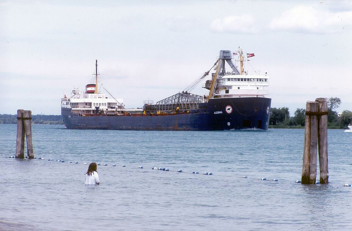
The St. Clair River is a vital economic corridor as part of the Great Lakes Waterway, with shipping channels that allow cargo vessels to travel between Lake Huron and the lower lakes. The river is also a crucial source of drinking water. About one-third to one-half of the residents of Michigan receive their water from the St. Clair and Detroit River waterway. Industries including petroleum refineries, chemical manufacturers, paper mills, salt producers, and electric power plants also need high-quality water for their operations. Since the late 20th century, passage of environmental laws has led to cleanup activities after occasional incidents where industries illegally contaminated river waters.
The surrounding watershed is predominantly agricultural, particularly away from the urbanized shoreline. In Michigan, the Black, Pine, and Belle rivers drain 315,900 hectares of farmland in Lapeer, Macomb, Sanilac, and St. Clair counties. The St. Clair River and its Lambton County tributaries in Ontario contribute 41,770 hectares to the watershed, not including the Sydenham River. Historically, sugar beet farming was prominent, with numerous farms in the flatlands and an annual beet market held in Marine City for years at harvest time. Many of the 19th-century English immigrants to this area came from Lincolnshire, England, where sugar beets were a major commodity crop in the 19th and 20th centuries.
Human activity has permanently altered the river's physical characteristics and the Great Lakes system. Federal officials have long acknowledged that dredging and riverbed mining in the St. Clair dropped the long-term average of Great Lakes Huron and Michigan by about 16 inches. A bi-national Great Lakes water-level study concluded in 2013 that unexpected erosion since the last major St. Clair dredging project in the early 1960s has dropped the lakes' long-term average by an additional 3 to 5 inches. Today, these lakes are nearly 2 feet lower than before human modifications to the riverbed, a record low that has raised concerns about the long-term health of the lakes, though water levels are variable. As of October 2020, the Lake Huron water level was averaging 581.5 feet above sea level, which is above the Datum of 577.5 feet and the Mean Long-Term Water Level of 578.8 feet.
Crossings, Watershed, and Land Use
The St. Clair River is crossed by several bridges and tunnels that connect Ontario and Michigan, facilitating binational trade and travel. These crossings are listed from downstream at Lake St. Clair upstream to Lake Huron. This bridge is a critical link in the transportation network and is located near the river's source at Lake Huron. Other crossings include the St. Clair Tunnel for rail traffic and the Walpole Island Ferry, which provides a connection to the Walpole Island First Nation.
The watershed supports a mix of land uses. Most of the watershed away from the river in Ontario and Michigan is used for agriculture. A few forest and wetland areas have survived, though their area has declined significantly since European-American settlement and development of cultivated fields. The shoreline on both sides is extensively urbanized and industrialized, with the most dense concentration of industry lying along the Ontario shore south of Sarnia. The communities along the St. Clair rely on the river as their primary source of drinking water, integrating the waterway directly into municipal infrastructure and daily life. Several communities along the St. Clair rely on the river as their primary source of drinking water, and industries need high-quality water for their operations.
The health of the river is directly tied to activities across its entire drainage basin. The combined drainage area of 579,000 square kilometres means that environmental management must consider impacts from a vast region. The binational nature of the river requires cooperation between Canada and the United States on issues ranging from water quality and habitat restoration to managing commercial shipping and recreational use. This cooperation is exemplified by the joint Remedial Action Plan team working to restore the river's beneficial uses, and the ongoing management of the river as a shared resource between the two nations.
Questions about St. Clair River
Where is the St. Clair River located?
The St. Clair River is located in eastern North America, flowing south from Lake Huron into Lake St. Clair. It forms part of the international border between the Canadian province of Ontario and the U.S. state of Michigan. Major cities along its banks include Sarnia, Ontario, and Port Huron, Michigan, at its northern end near Lake Huron. The river flows past several other communities including Marine City, Algonac, and Corunna.
Why is the St. Clair River considered an Area of Concern?
The St. Clair River is designated as a binational Area of Concern (AOC) because it suffered significant environmental degradation from historical pollution. This included issues like contaminated sediments, restrictions on fish and wildlife consumption, and degradation of aquatic habitats. A Remedial Action Plan has been in place since 1985 to clean up the river. The United States found that 10 out of 14 beneficial use impairments were impaired, leading to major cleanup investments, and as of the latest reports only two impairments remain.
What is the St. Clair Delta?
The St. Clair Delta, also called the St. Clair Flats, is located where the St. Clair River meets Lake St. Clair. It is the largest river delta in the Great Lakes system, covering about 360 square kilometres. The delta is formed as the river splits into the North, Middle, and South Channels, creating numerous islands like Walpole and Harsens islands. Six of these islands are unceded territory belonging to the Walpole Island First Nation. The delta provides crucial wetland habitat but has been impacted by invasive species like European reed.
How has human activity affected water levels in the Great Lakes via the St. Clair River?
Dredging and riverbed mining in the St. Clair River, particularly a major project in the early 1960s, have caused erosion that increased the river's outflow. This has lowered the long-term average water levels of Lakes Michigan and Huron by nearly two feet compared to pre-modification conditions. A 2013 study found unexpected erosion since the 1960s caused an additional 3 to 5 inch drop. Activists have urged remediation to slow the flow of waters to restore former levels, though water levels are variable and were above the long-term average in Lake Huron as of October 2020.
What Indigenous communities are associated with the St. Clair River?
The St. Clair River region has been home to Indigenous cultures for generations. The Walpole Island First Nation, whose members include Ojibwe (Anishinaabe), Potowatomi, and Odawa peoples, holds unceded territory on six islands in the St. Clair Delta: Walpole, Seaway, Bassett, Squirrel, St. Anne, and Dickinson islands. They call the delta area Bkejwanong, meaning 'where the waters divide'. Historically, these groups and others used the river for travel and trade long before European contact and the era of French fur traders.
What is the primary economic importance of the St. Clair River today?
The St. Clair River remains a critical component of the Great Lakes Waterway, enabling cargo ship traffic between the upper and lower lakes. It is also a vital source of drinking water for a large portion of Michigan's population and for industries along its shores, including a major petrochemical complex in Sarnia. The surrounding watershed supports extensive agriculture, and the river itself supports commercial and recreational fishing, though consumption advisories may be in place. Its channels are essential for transporting historical commodities like iron ore, copper, and grain.
Sources and further reading
- St. Clair River (Wikipedia)
- St Clair Riverwalk (bridgetobay.org)
- Passive Parks (stclairtownshipcommunityservices.ca)
- Trail Map (stclairrivertrail.com)
Checked by the Your Space Hamilton desk. Last updated 2026-10-23.