North Channel
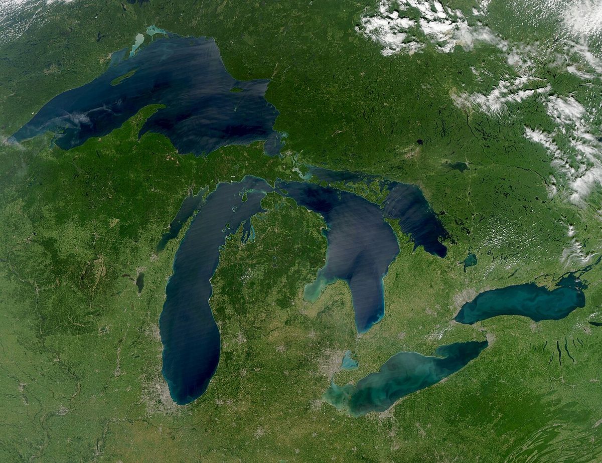
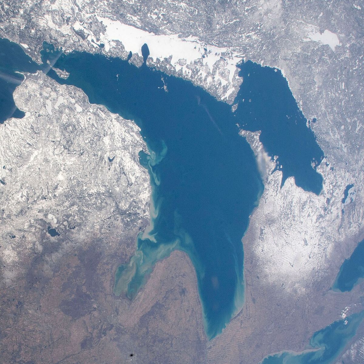
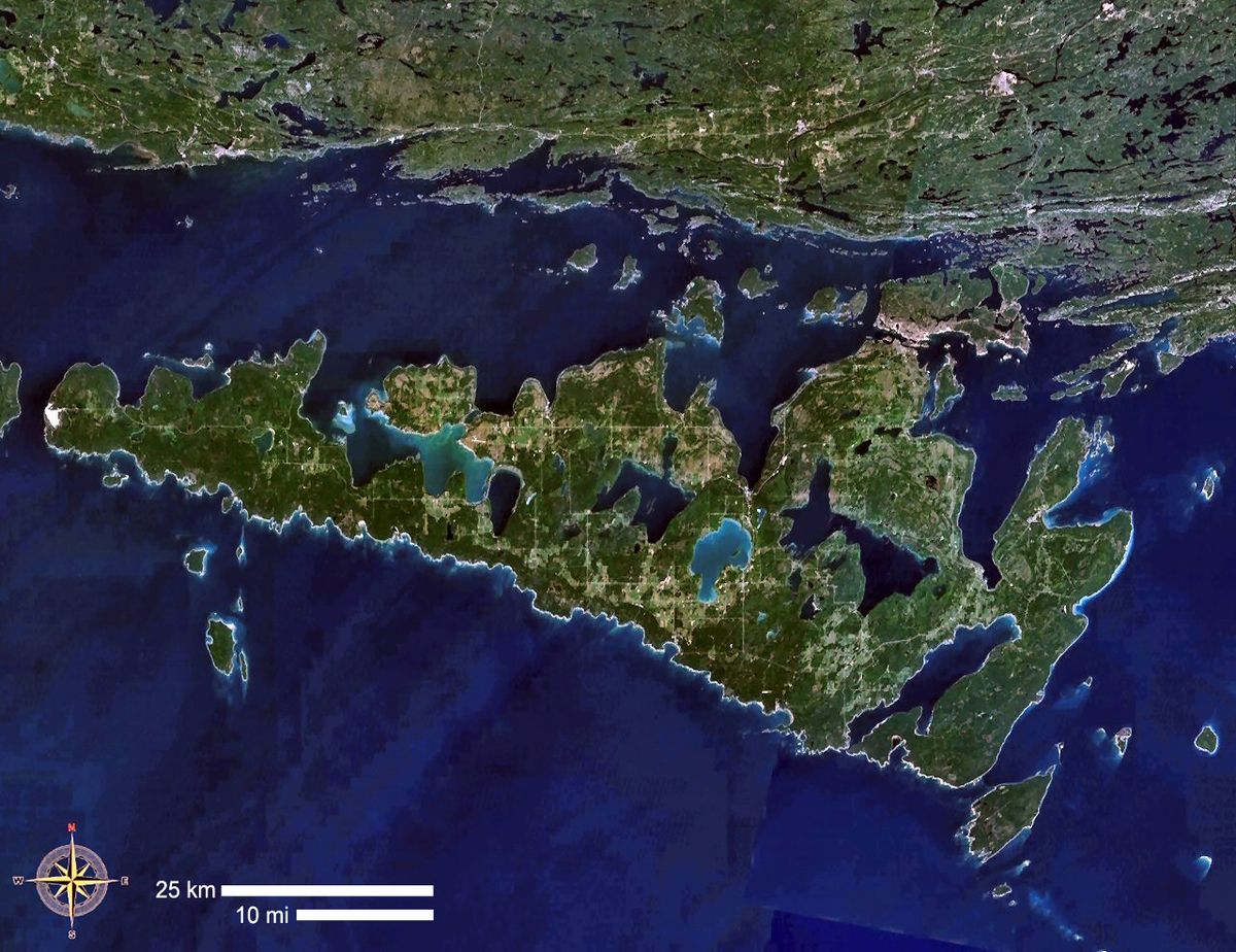
The North Channel is a significant body of water forming the northern shoreline of Lake Huron, spanning the Canadian province of Ontario and the U.S. state of Michigan. Stretching approximately 300 kilometres from Georgian Bay to the St. Marys River, it is bordered by the mainland districts of Algoma and Sudford to the north and the large islands of Manitoulin, Cockburn, Drummond, and St. Joseph to the south. Internationally recognized as one of the world's premier freshwater cruising grounds, the channel's scenic environment is protected by provincial parks and conservation trusts. Its shores and surrounding areas are the focus of ongoing recreational development, including new provincial parks, county parks, and a dedicated bike park, enhancing its appeal for tourism and outdoor activity.
Geography and Hydrology
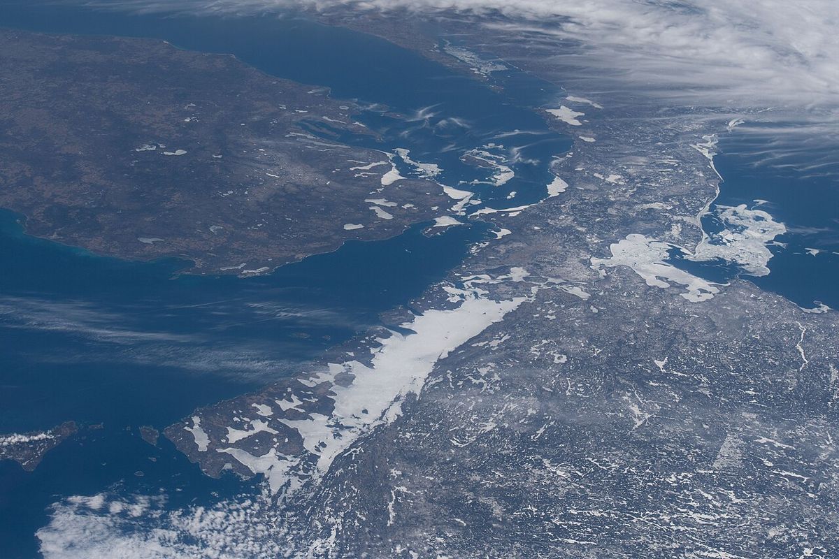
The North Channel is a defining geographical feature of the upper Great Lakes, creating a sheltered passage along Lake Huron's northern rim. It extends roughly 300 kilometres from the outlet of Georgian Bay in the east to the head of the St. Marys River at Sault Ste. Marie in the west. The channel's northern shore is formed by the Canadian mainland, specifically parts of the Algoma and Sudbury Districts in Ontario. To the south, a chain of large islands, including Manitoulin, Cockburn, Drummond, and St. Joseph, separates the channel from the open waters of Lake Huron proper. At its widest point, the channel spans more than 30 kilometres, though it narrows considerably at key crossing points. The channel is connected to the main lake through several passages, including the DeTour Passage, False Detour Channel, and the Mississagi Strait, which flow between the southern islands. Smaller internal waterways within the channel include Izaak Walton Bay, Lake Nicolet, and Sturgeon Bay, which provide additional anchorage and scenic variety for boaters.
Recreation and Cruising
The North Channel has earned a global reputation as one of the finest freshwater cruising destinations, prized for its protected waters, stunning scenery, and numerous safe harbours. The coastline is largely undeveloped, featuring a dramatic mix of rugged Canadian Shield granite, sheltered bays, and deep, clear waters. Full-service marinas are located in various small communities along both the Ontario and Michigan shores, providing boaters with essential provisions, fuel, and services. A significant portion of the Ontario north shore is bordered by La Cloche Provincial Park, whose white quartzite mountains provide a spectacular backdrop. The channel's appeal extends beyond powerboating and sailing to include kayaking, paddleboarding, and fishing. Its status as a premier cruising ground is a central part of tourism for the surrounding region, often marketed as the North Channel Region. The following activities are central to the channel's recreational identity:
- Freshwater sailing and powerboating in protected, scenic waters.
- Kayaking and canoeing along the shoreline and in internal bays.
- Sport fishing for species such as walleye, smallmouth bass, and lake trout.
- Shoreline hiking and camping, particularly within La Cloche Provincial Park.
- Birdwatching and wildlife observation in diverse coastal habitats.
- Cycling on connected trail systems like the Bridge to Bay Trail near the southern channel.
Transportation and Crossings
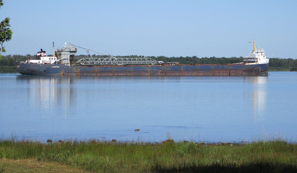
Despite its considerable length, the North Channel has only two permanent road crossings, both located at its narrowest points. The Little Current Swing Bridge on Highway 6 connects Manitoulin Island to the Ontario mainland near the community of Little Current. This bridge is a critical lifeline for Manitoulin Island, allowing vehicle traffic while swinging open to permit the passage of marine vessels. On the western end of the channel, the Bernt Gilbertson Bridge carries Highway 548 from the Ontario mainland onto St. Joseph Island. These two crossings are essential for regional transportation and economic activity, linking island communities to mainland services. Marine transportation remains the primary mode of travel along the channel's length, with a well-established network of navigational aids and charts. The channel is also a key segment of the Great Lakes-St. Lawrence Seaway system, though its recreational use often overshadows commercial shipping traffic in this particular stretch.
Conservation and Protected Areas
Significant portions of the North Channel's shoreline and adjacent lands are protected under various conservation designations, safeguarding its ecological integrity and scenic beauty. On the Ontario side, North Channel Inshore Provincial Park protects the largest remaining undeveloped section of the channel's shoreline. The park supports interior forest habitat that provides excellent migratory and breeding grounds for birds and small mammals, though it offers no visitor facilities, emphasizing preservation. Other organizations active in the region include the Georgian Bay Land Trust and the Escarpment Biosphere Preserve, which work to secure and steward ecologically significant lands. On the Michigan side, conservation efforts are often integrated with recreational development, as seen in the partnership-driven creation of North Channel County Park. These combined efforts help maintain the channel's clean waters, diverse habitats, and renowned wilderness character against development pressures.
Recent and Planned Developments
The North Channel region is experiencing a wave of new recreational infrastructure projects designed to enhance public access and diversify outdoor activities. A major development on Manitoulin Island is the North Channel Bike Park, a gravity-focused mountain bike park built on a disused ski hill. Spearheaded by Manitoulin Island Cycling Advocates (MICA), the park is scheduled to open on June 13, 2026. Its initial phase will feature approximately five kilometres of Euro-style gravity trails, a pump track, and routes for all skill levels. On the Michigan shoreline in Clay Township, North Channel County Park is being developed in phases on approximately 10 to 12 acres of former vacant land. Phase I, focused on establishing access, includes a paved parking lot, a rentable picnic pavilion, a trailhead connecting to the Bridge to Bay Trail, and newly planted trees. Phase II, anticipated to begin in late 2027, will add an ADA-accessible restroom, boardwalks, a fishing pier, and a kayak launch. The total project cost is estimated at $4.5 million, funded through state grants and county matches. These projects reflect a growing emphasis on four-season, multi-use recreation beyond the channel's traditional summer boating season.
Regional Communities and Economy
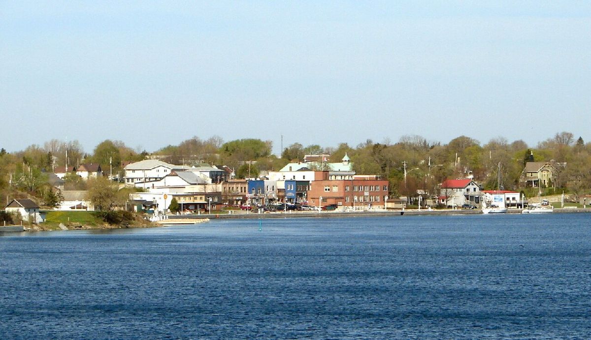
The communities lining the North Channel are integral to its character and serve as essential service hubs for residents and visitors alike. On the Ontario mainland, the stretch between the townships of Tarbutt and Nairn and Hyman is commonly referred to as the North Shore region, encompassing small towns and villages that rely on tourism, forestry, and seasonal residents. The islands of Manitoulin, Cockburn, Drummond, and St. Joseph have distinct identities and economies, with Manitoulin being the largest freshwater island in the world. Tourism is a dominant economic driver throughout the area, fuelled by the channel's recreational appeal. The development of new attractions like the bike park and county park is strategically aimed at extending the tourist season and attracting different visitor demographics. Local community groups, such as the Friends of the St. Clair River and MICA, play active roles in advocating for and managing these new assets, ensuring they meet both recreational and conservation goals for the long-term benefit of the region.
Key Waterways and Internal Features
Within the broader expanse of the North Channel, several smaller bays and waterways offer unique boating environments and anchorages. Izaak Walton Bay is a known destination, providing sheltered waters for recreational craft. Lake Nicolet, another internal feature, offers a distinct lake-like setting within the channel's confines. Sturgeon Bay is also a notable waterway, frequently used by boaters seeking protection from prevailing winds. These features contribute to the channel's complex and interesting geography for navigation. Their presence allows boaters to explore varied environments, from open channel passages to quiet, enclosed bays, all within a relatively compact area. The existence of these internal waterways is a key factor in the channel's designation as a world-class cruising ground, as they provide numerous safe havens and scenic destinations along the route.
Questions about North Channel
Where is the North Channel located?
The North Channel is located along the northern shore of Lake Huron. It spans the Canadian province of Ontario and the U.S. state of Michigan, stretching approximately 300 kilometres from Georgian Bay in the east to the St. Marys River at Sault Ste. Marie in the west. The channel is bordered by the Ontario mainland to the north and a chain of large islands, including Manitoulin Island, to the south.
Why is the North Channel famous for boating?
The North Channel is internationally recognized as one of the best freshwater cruising grounds in the world. It offers a scenic environment with protected waters and numerous sheltered bays. Full-service marinas in coastal communities provide sufficient provisions for boaters. The region's natural beauty and clear waters create an ideal setting for sailing, powerboating, and kayaking.
What is the North Channel Bike Park?
The North Channel Bike Park is a new mountain bike park being developed on a disused ski hill on Manitoulin Island. It is organized by the Manitoulin Island Cycling Advocates (MICA) and has a scheduled grand opening for Saturday, June 13, 2026. The park will open with about five kilometres of gravity-focused trails and a pump track at the base area. It will feature beginner, intermediate, and advanced trail options to cater to riders of different skill levels.
What is being developed at North Channel County Park in Michigan?
North Channel County Park is a new waterfront park under development in Clay Township, Michigan, along the North Channel of the St. Clair River. The park is being developed in several phases on approximately 10 to 12 acres of land. Phase I development includes a paved parking lot, a rentable picnic pavilion, a trailhead connecting to the Bridge to Bay Trail, and park benches. Phase II, anticipated to begin in late 2027, will include an ADA-accessible restroom, boardwalks, a fishing pier, and a kayak launch.
How do you cross the North Channel by car?
There are only two road crossings over the North Channel. The Little Current Swing Bridge on Highway 6 connects Manitoulin Island to the Ontario mainland. The Bernt Gilbertson Bridge on Highway 548 connects the mainland to St. Joseph Island. Both bridges are located at the narrowest points of the channel and are vital links for island communities.
What is North Channel Inshore Provincial Park?
North Channel Inshore Provincial Park is a provincial park that protects the largest remaining undeveloped section of the North Channel of Lake Huron shoreline. It is a 3762.00 hectare facility located along the shoreline of the North Channel. The park is comprised of five parcels separated by private lands and supports interior forest habitat, which provides excellent migratory and breeding habitat for birds and some small mammals. There are no visitor facilities available at this park, as its primary purpose is ecological protection. This park represents a significant conservation effort for this part of the North Channel region.
Sources and further reading
- North Channel (Wikipedia)
- North Channel Bike Park announces opening day (cyclingmagazine.ca)
- North Channel Inshore Provincial Park (ontarioparks.ca)
- North Channel County Park, Under Development... (stclaircounty.org)
- Work on North Channel county park slated to kick off this year (thetimesherald.com)
Checked by the Your Space Hamilton desk. Last updated 2026-10-28.