Great Lakes Basin
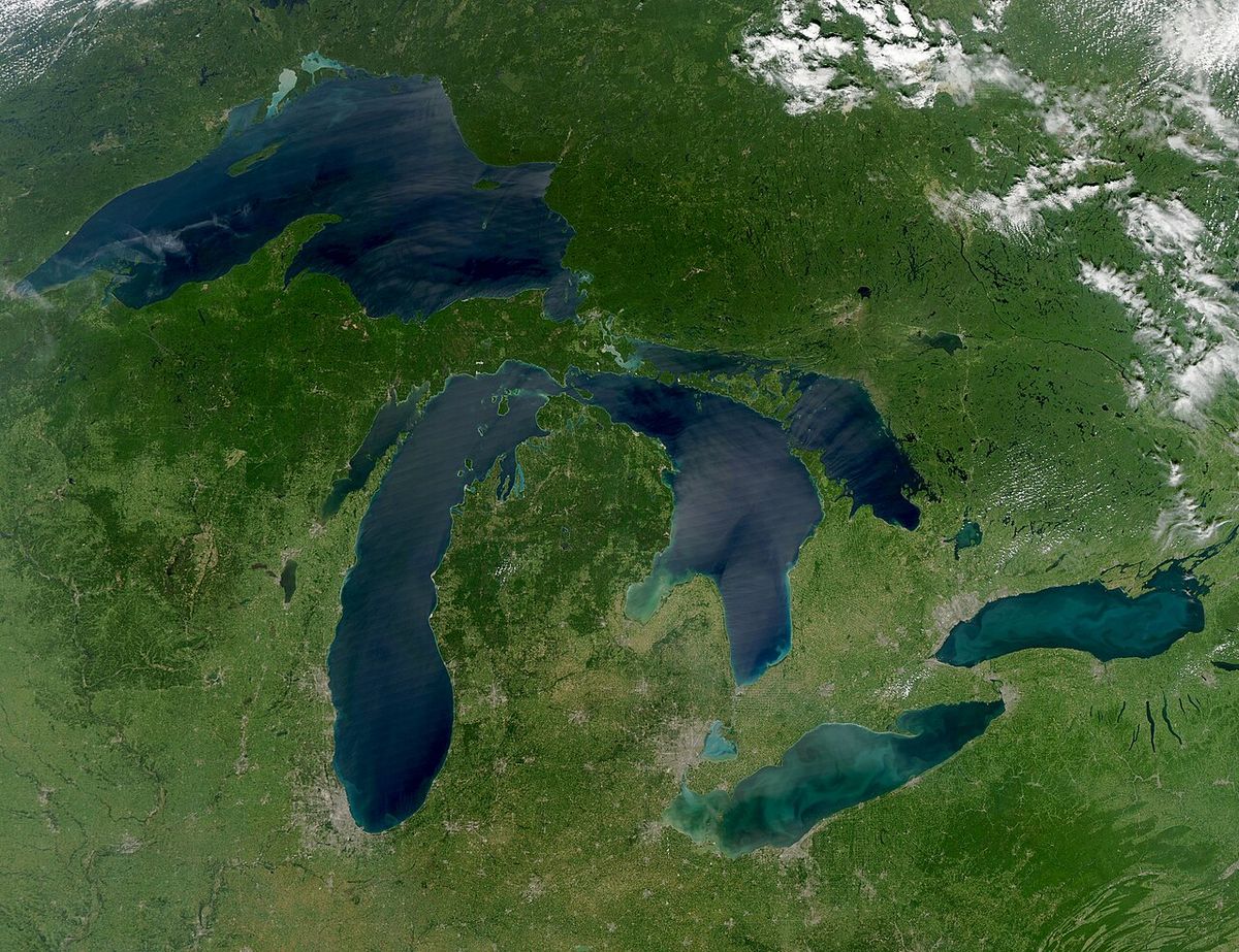
The Great Lakes Basin is a vast hydrological region in North America centred on the five interconnected Great Lakes: Superior, Michigan, Huron, Erie, and Ontario. It encompasses the surrounding lands in the Canadian province of Ontario and eight U.S. states, whose surface runoff and watersheds drain directly into the lakes. Home to approximately 37 million people, it supports major urban centres, extensive agriculture, and vital transportation corridors. The basin's management is a key binational concern for Canada and the United States, governed by cooperative agreements to protect its water quality and ecosystem health.
Geography and Hydrology
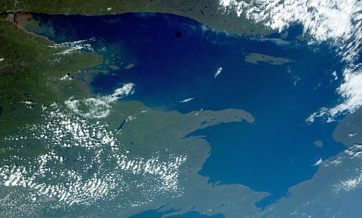
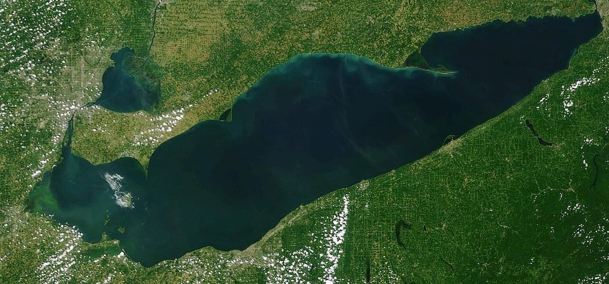
The Great Lakes Basin is defined by the combined watersheds that drain into the five Great Lakes, forming one of the world's largest freshwater systems. Water flows generally from west to east, beginning in Lake Superior and moving through Lakes Michigan, Huron, Erie, and Ontario before exiting via the Saint Lawrence River to the Atlantic Ocean. The hydrology is complex, involving numerous connecting channels like the Straits of Mackinac, the St. Marys River, and the Niagara River. The basin's eastern boundary is generally considered to include a small area around Wolfe Island, Ontario, which drains directly into the Saint Lawrence River rather than Lake Ontario.
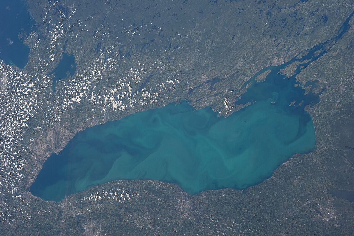
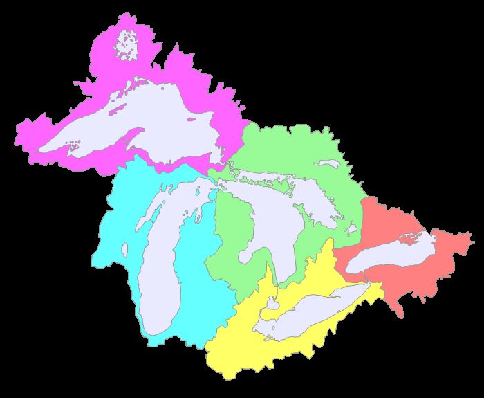
Each of the five Great Lakes constitutes its own distinct sub-basin, such as the Lake Erie Basin or the Lake Superior Basin. These sub-basins are further divided into hundreds of smaller watersheds defined by local rivers and tributaries. For example, Pennsylvania contains a specific Lake Erie Watershed that contributes runoff to the lake's southern shore. The entire system is monitored and studied by the binational Great Lakes Commission, which facilitates cooperation on water management, research, and policy between the jurisdictions.
Political and Administrative Boundaries
The Great Lakes Basin spans two nations and multiple sub-national jurisdictions, making its governance a collaborative international effort. In Canada, the province of Ontario contains the entirety of the Canadian portion of the basin. On the American side, the basin includes lands within eight U.S. states: Illinois, Indiana, Michigan, Minnesota, New York, Ohio, Pennsylvania, and Wisconsin. While the neighbouring Canadian province of Quebec is not part of the Great Lakes Basin, as its lands drain into the separate Saint Lawrence Basin, it is a signatory to key regional agreements. Quebec participates as a partner in water resource management due to its critical position along the Saint Lawrence Seaway, the final outlet for all Great Lakes water. The primary framework for cooperation is the Great Lakes Charter, first signed in 1985 by the premiers of Ontario and Quebec and the governors of the eight U.S. states. This agreement was strengthened by a Charter Annex in 2001 and a set of more binding Agreements in 2005. These accords establish principles for the sustainable use and protection of Great Lakes water, including measures to prevent large-scale diversions outside the basin. This structure ensures ongoing dialogue and joint action on issues ranging from water quality to economic development across the international border.
Population and Major Urban Centres
The Great Lakes Basin is one of the most populous and economically significant regions in North America, with an estimated 37 million residents. This population is concentrated in a network of major metropolitan areas that serve as hubs for industry, commerce, and culture. In Canada, the basin hosts seven of the nation's 20 largest census metropolitan areas, all within Ontario. The U.S. portion of the basin contains numerous major cities, many of which developed as ports and industrial centres linked to the lakes. The concentration of people and industry in these urban areas has historically posed significant environmental challenges for water quality and habitat conservation.
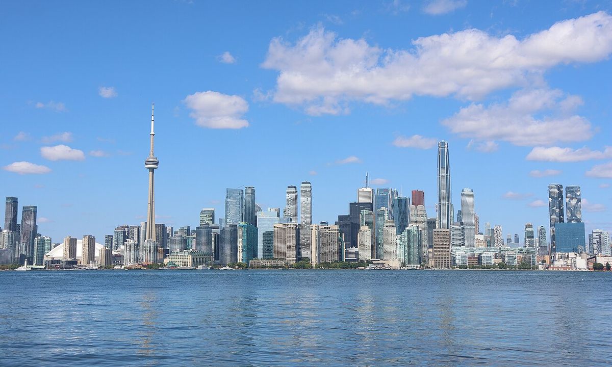
The basin's major Canadian census metropolitan areas include Toronto, Canada's largest city and financial capital, along with Hamilton, Kitchener-Cambridge-Waterloo, London, St. Catharines-Niagara, Windsor, and Oshawa. Key American cities located within the basin include Chicago on Lake Michigan, Detroit and Cleveland on Lake Erie, and Milwaukee on Lake Michigan. Other significant urban centres are Buffalo and Rochester on Lake Ontario, Toledo on Lake Erie, Erie on Lake Erie, Gary on Lake Michigan, Duluth on Lake Superior, and Syracuse within the basin's watershed. These cities are connected by a dense transportation network of highways, railways, and the Great Lakes-Saint Lawrence Seaway system, which facilitates the movement of goods like iron ore, coal, grain, and manufactured products.
The Great Lakes Basin is home to seven of Canada's 20 largest census metropolitan areas. These major urban centres are located within the province of Ontario. They include Toronto, Hamilton, Kitchener-Cambridge-Waterloo, London, St. Catharines-Niagara, Windsor, and Oshawa. These cities are key parts of the basin's demographics and economy.
- Toronto
- Hamilton
- Kitchener-Cambridge-Waterloo
- London
- St. Catharines-Niagara
- Windsor
- Oshawa
On the American side, the basin also contains a significant number of large cities. These cities anchor the regional economy and culture of the Great Lakes region. They are located within the eight U.S. states that form part of the basin. These states are Illinois, Indiana, Michigan, Minnesota, New York, Ohio, Pennsylvania, and Wisconsin.
Environmental Significance and Challenges
The Great Lakes Basin contains a major freshwater ecosystem that supports a rich diversity of fish, wildlife, and plant species. The lakes and their connecting waterways provide critical habitat for migratory birds and fish like lake trout, walleye, and sturgeon. The basin's forests, wetlands, and coastal dunes offer important ecological services, including water filtration, flood control, and carbon sequestration. This natural heritage is a foundation for the region's tourism and recreation industry, which includes activities like boating, fishing, hunting, and beachgoing. Protecting this ecosystem is a paramount concern for both Canada and the United States, given its importance to environmental health and economic vitality.
Managing the basin's environment involves addressing persistent and emerging threats. Historical issues include contamination from industrial pollutants and sewage, which led to significant degradation and events like the Cuyahoga River fire. While water quality has improved due to regulations like the Canada-United States Great Lakes Water Quality Agreement, challenges remain from non-point source pollution, such as agricultural runoff containing nutrients and pesticides. Invasive species, such as zebra mussels and sea lamprey, have disrupted food webs and caused extensive economic damage to infrastructure and fisheries. Climate change presents a growing threat, potentially affecting water levels, increasing the frequency of severe storms, and exacerbating algal blooms. Coordinated binational efforts through agencies and agreements aim to restore habitats, clean up contaminated areas, and prevent the introduction of new invasive species.
Economic Importance
The Great Lakes Basin is a powerhouse of economic activity for both Canada and the United States, contributing significantly to national GDPs. Its economy is diverse, encompassing advanced manufacturing, agriculture, energy production, technology, and professional services. The lakes themselves form the backbone of a vital transportation corridor, the Great Lakes-Saint Lawrence Seaway system, which allows ocean-going vessels to travel deep into the continent's interior. This maritime highway is crucial for transporting bulk commodities like iron ore from Minnesota to steel mills in Indiana and Ohio, coal for power generation, and grain from the prairies for export. Major ports such as Duluth, Chicago, Detroit, Cleveland, and Hamilton handle millions of tonnes of cargo annually.
Agriculture is a major land use within the basin, with fertile soils supporting extensive production of corn, soybeans, fruits, and dairy. The region is also a leader in automotive manufacturing, with Detroit, Windsor, and Ontario's Golden Horseshoe area serving as traditional hubs. Other key industries include advanced materials, chemicals, and food processing. The freshwater resource itself directly supports sectors like commercial and recreational fishing, tourism, and as a source for municipal drinking water and industrial cooling. The reliable water supply has been a foundational factor in the location and growth of major cities and industries, though it also necessitates careful management to balance competing uses and ensure long-term sustainability.
Recreation and Tourism
The natural beauty and aquatic resources of the Great Lakes Basin make it a premier destination for outdoor recreation and tourism. The extensive coastlines, which include sandy beaches, dramatic cliffs, and sheltered bays, attract millions of visitors each year for swimming, sunbathing, and beachcombing. The lakes are famous for boating and sailing, with numerous marinas and yacht clubs catering to enthusiasts. Sport fishing is a major draw, with anglers pursuing species such as salmon, trout, walleye, and bass in both open water and tributary streams. The basin's inland areas offer additional opportunities for camping, hiking, birdwatching, and hunting in state and provincial parks, national lakeshores, and conservation areas.
Tourism infrastructure is well-developed throughout the region, supporting local economies. Key attractions include national parks and lakeshores such as Pictured Rocks National Lakeshore and Sleeping Bear Dunes National Lakeshore in Michigan, and Bruce Peninsula National Park in Ontario. Major urban attractions include waterfront developments, museums, and festivals in cities like Toronto, Chicago, Cleveland, and Milwaukee. Wine regions are established along the Niagara Escarpment and near Lake Erie, known for icewine and cool-climate varietals. Island destinations like Mackinac Island in Michigan, the Thousand Islands in the Saint Lawrence River, and Pelee Island in Lake Erie are also popular. Scenic byways include designated driving routes like the Lake Superior Circle Tour and the Great Lakes Seaway Trail, while winter activities feature ice fishing, snowmobiling, and cross-country skiing in many areas. This recreational use highlights the cultural and economic value of the lakes, reinforcing the need for ongoing conservation efforts to maintain water quality and public access.
Several major American cities are located within the Great Lakes Basin. These cities form a key part of its urban fabric. Notable U.S. urban centres in the basin include Duluth, Milwaukee, Chicago, Gary, Detroit, Toledo, Cleveland, Erie, Buffalo, Rochester, and Syracuse. These are among the many American cities found in the basin.
- Chicago, Illinois
- Detroit, Michigan
- Cleveland, Ohio
- Milwaukee, Wisconsin
- Buffalo, New York
- Rochester, New York
- Toledo, Ohio
- Duluth, Minnesota
These American cities, along with their Canadian counterparts, drive the regional economy and culture. Their location on the Great Lakes has shaped their history and development. The basin is home to a total of 37 million people. The overall Great Lakes Basin is monitored by the binational Great Lakes Commission.
Questions about Great Lakes Basin
How is the Great Lakes Basin managed between Canada and the United States?
Management of the Great Lakes Basin is governed by a series of cooperative agreements between the jurisdictions. The foundational agreement is the Great Lakes Charter of 1985, signed by Ontario, Quebec, and the eight U.S. state governors. This was supplemented by a 2001 Annex and binding Agreements in 2005. Day-to-day coordination occurs through bodies like the Great Lakes Commission and the International Joint Commission.
Why is the Great Lakes Basin important?
The Great Lakes Basin is critically important for multiple reasons. It is a vital economic region for manufacturing, agriculture, and transportation via the Saint Lawrence Seaway. Ecologically, it hosts diverse habitats and species. The basin is also home to 37 million people and major urban centres, making its environmental health and sustainable management a top priority for both Canada and the United States.
What provinces and states are in the Great Lakes Basin?
The Great Lakes Basin includes the Canadian province of Ontario and eight American states: Illinois, Indiana, Michigan, Minnesota, New York, Ohio, Pennsylvania, and Wisconsin. These jurisdictions contain the direct surface runoff and watersheds that feed into the Great Lakes. The basin also generally includes a small area around Wolfe Island, Ontario, which drains into the Saint Lawrence River instead. Quebec is not part of this basin as its lands drain into the separate Saint Lawrence Basin. However, Quebec is a signatory to key regional agreements like the Great Lakes Charter of 1985 and the 2001 Charter Annex, making it a partner in water management due to its position on the Saint Lawrence Seaway.
How many people live in the Great Lakes Basin?
The Great Lakes Basin is home to 37 million people. This population is distributed across major urban centres in both Canada and the United States. The basin hosts seven of Canada's 20 largest census metropolitan areas, all within Ontario, including Toronto, Hamilton, and Windsor. On the American side, numerous large cities are located within the basin, such as Chicago, Detroit, Cleveland, and Buffalo. This concentration of people makes the basin a central and densely populated part of the Great Lakes region.
What is the Great Lakes Commission?
The Great Lakes Commission is the binational organization that monitors the overall Great Lakes Basin. It operates across the international border, coordinating between the jurisdictions within the drainage area. The commission's work encompasses the management of the entire basin, which is composed of individual sub basins for each lake, like the Lake Erie Basin. These sub basins are further divided into multiple watersheds, such as Pennsylvania's Lake Erie Watershed. The commission's role is to oversee these interconnected hydrological systems.
What major Canadian cities are located in the Great Lakes Basin?
Major Canadian cities located in the Great Lakes Basin include seven of Canada's 20 largest census metropolitan areas, all within the province of Ontario. These metropolitan areas are Toronto, Hamilton, Kitchener Cambridge Waterloo, London, St. Catharines Niagara, Windsor, and Oshawa. These urban centres are situated within the basin's lands, meaning their direct surface runoff and watersheds drain into the Great Lakes. Their presence contributes significantly to the basin's total population of 37 million people and defines much of the region's demographic character.
Sources and further reading
- Great Lakes Basin (Wikipedia)
- The Great Lakes (greatlakes.guide)
- High Lakes Basin Park (bcparks.ca)
- About the Great Lakes St. Lawrence River Basin (glslcompactcouncil.org)
Checked by the Your Space Hamilton desk. Last updated 2026-10-23.