Parkdale, Toronto
Parkdale is a historic neighbourhood and former village in Toronto, Ontario, located west of the downtown core. Founded as an independent settlement in the 1850s and incorporated as a village in 1879, it was annexed by the City of Toronto in 1889. The area is known for its significant architectural heritage, its role as an entry point for successive waves of immigrants, and its mixed-income character. Today, Parkdale is recognized for its Queen Street West commercial strip, its large Tibetan community, and its complex social fabric, balancing historic preservation with ongoing urban change.
Geography and Urban Character
Parkdale is bounded by Roncesvalles Avenue to the west, the CP Rail line north of Queen and Dundas Streets to the north, Dufferin Street from Queen southward to the east, and Lake Ontario to the south. The City of Toronto's official definition extends the eastern boundary south of the rail lines to Atlantic Avenue and as far south as the CN Rail lines north of Exhibition Place, an area commonly associated with the western half of Liberty Village. The original village area north of Queen Street, east of Roncesvalles, was roughly one square kilometre and is now considered part of the Roncesvalles neighbourhood. The area is primarily residential, characterized by semi-detached and detached homes dating from the 19th and early 20th centuries on its side streets, with mature trees on many residential streets.
Many of the older mansions and large houses from around 1900 have been converted into multi-unit buildings or rooming houses. Good examples of Victorian housing can be found on Cowan Avenue and Dunn Avenue, south of King Street, while Victorian-era row homes of Georgian Revival style with original gaslights are visible on Melbourne Place. The neighbourhood has a higher-than-average proportion of rental housing, with numerous apartment buildings concentrated on streets like Jameson and Tyndall Avenues. These buildings mostly date from the 1950s through the 1970s, and have remained rental buildings with no large condominium projects built west of Dufferin Street. Commercial activity is focused along Queen Street West from Roncesvalles to Dufferin, and on King Street West around Dufferin Street, consisting mostly of storefronts oriented toward local customers.
Parkdale has a lower amount of park land per resident compared to other parts of Toronto. Several streets have parkettes, small parks built since the 1960s in an initiative to increase green space. The southern border is dominated by transportation infrastructure, including railway lines, the Gardiner Expressway, and Lake Shore Boulevard, which separate the residential area from the Lake Ontario shoreline. South of this corridor, the shoreline is mostly park land, with recreational clubs such as the Argonaut Rowing Club and the Boulevard Club, formerly the Parkdale Canoe Club, located on the water.
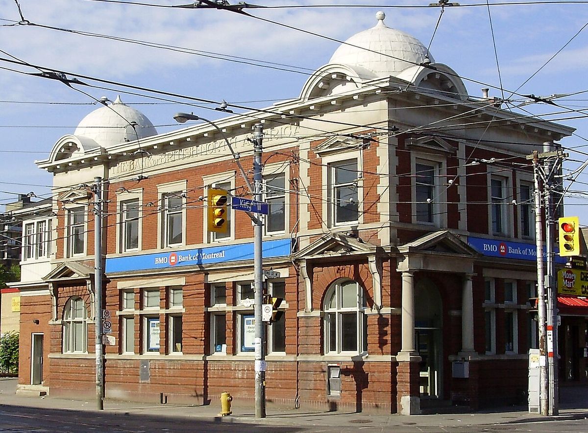
Historical Development from Settlement to Annexation
Settlement in the area predates the village's founding. In 1812, a 240-acre land grant bounded by Lot Street (Queen Street) on the north, Jameson on the west and Dufferin Avenue was given to James Brock, cousin of Sir Isaac Brock, in lieu of salary. Brock did not occupy the land, and after his death in 1830, his widow Lucy Brock sold the lands to John Henry Dunn and William Gwynne. The area north of Queen Street was subdivided from the O'Hara Estate, given to Walter O'Hara for military service, and another parcel given to James Brock became Brockton Village. The Parkdale railway station opened at Queen and Dufferin streets in 1856, and in the 1870s the Grand Trunk Railway built the South Parkdale station at Jameson Avenue, with the Queen Street station renamed North Parkdale.
A census prior to incorporation showed 783 residents, above the legal requirement of 750. A local legend states that Romani people were signed up as residents to provide enough numbers. The Village of Parkdale was incorporated in 1879 amid controversy, opposed by the City of Toronto and York County councils. It was a purely residential suburb of large Victorian mansions with views of Lake Ontario. The first house of worship, the Anglican Church of St. Mark on Cowan Avenue, was completed on January 20, 1881. The 1881 Census recorded a population of 1,170. In 1884, the village council passed a bylaw to join Toronto, but annexation was delayed due to unclear village financial statements. Another vote on October 27, 1888 upheld annexation, and the village was formally annexed by the City of Toronto in March 1889, becoming St. Alban's Ward.
- 1812: 240-acre land grant to James Brock.
- 1830: Death of James Brock. Lands sold to Dunn and Gwynne.
- 1856: Parkdale railway station opens at Queen and Dufferin.
- 1870s: South Parkdale station built at Jameson Avenue.
- 1879: Village of Parkdale incorporated.
- 1881: Church of St. Mark completed. Census population 1,170.
- 1884: First annexation bylaw passed.
- October 27, 1888: Annexation vote upheld.
- March 1889: Formal annexation by Toronto.
The Sunnyside Era and Mid-Century Transformation
Throughout the first half of the 20th century, Parkdale's desirability stemmed from its proximity to the lake, the Canadian National Exhibition, and Sunnyside Beach. From 1911 to 1922, the Toronto Harbour Commission improved the lakefront, extending the shoreline 100 metres south with a breakwater and boardwalk. The Parkdale Canoe Club, opened in 1905 on a pier, became inland due to this infill project. Sunnyside Amusement Park opened in 1922, providing a popular day destination for Torontonians. Movie theatres like the Brighton on Roncesvalles and the Odeon on Queen Street opened, alongside hotels like the Edgewater at Queen and Roncesvalles.
The Palais Royale at the eastern edge of Sunnyside Beach opened in 1922 as a canoe factory and dance hall. It hosted important big bands in the 1930s and 1940s, attracting a large youth patronage and becoming a courting spot for war-generation Torontonians. It operates today as a special occasion hall and has hosted concerts by The Rolling Stones in 2002 and live recordings by Sloan and the Downchild Blues Band. In the 1910s, the South Parkdale station was closed and replaced with Sunnyside station, and a rail cut was made between Dowling and Atlantic streets, moving Grand Trunk lines below street level.
A dramatic transformation began in 1955 with the construction of the Gardiner Expressway alongside the railway cut. The Sunnyside Amusement Park was demolished, except for the Bathing Pavilion and the Palais Royale. The southern section of Parkdale west of Dufferin and south of the railway was also demolished. The expressway separated Parkdale from Lake Ontario and Sunnyside Beach, effectively halving the amount of usable lakeside parkland and leading to a rapid decline in beach patronage. The neighbourhood's residential streets were reorganized, and both the Parkdale and Sunnyside train stations closed during the 1970s. Population density increased with the building of numerous apartment buildings, often cheaply built, on streets like Jameson Avenue. Many remaining mansions became makeshift low-rise apartment buildings and rooming houses, some previously used as tourist hotels for Sunnyside and CNE visitors.
Social Policy, Immigration and Community Response
In the mid-1970s, the Government of Ontario released many long-term care mental illness patients from the Queen Street and Lakeshore Psychiatric Hospital facilities into the community. The inexpensive rental stock of South Parkdale, including many converted boarding houses and illegal 'bachelorette' units, became home to many released patients. This concentrated poverty, crime, drugs, homelessness, and people living with mental illness in the area, giving it a challenging reputation. In direct response, the Parkdale Activity-Recreation Centre (PARC) was founded in 1977 by community volunteers to operate a drop-in centre for survivors of mental health ailments, the homeless, the disabled and those with few resources.
PARC secured funding, staff and a venue in 1980, opening its doors to provide support, meals, employment opportunities and various programs. Owing to its many affordable rental apartments and proximity to downtown, Parkdale has consistently been a transient neighbourhood for newcomers to Canada. Waves of Caribbean, Indian, Vietnamese, Filipino, Tamil, Chinese, Tibetan, Hungarian and Roma immigrants have marked Parkdale from 1980 to the present. Since the late 1990s, it has hosted a large number of Tibetan settlers, with the area known as Little Tibet becoming one of the largest Tibetan diaspora communities outside of India and Nepal.
The area hosts several settlement and immigration agencies including the Parkdale Community Information Centre, Parkdale Community Legal Services, PIA, and Culture Link. The Parkdale Village Business Improvement Area was established in 1978 to represent the commercial strip on Queen Street West from Dufferin Street to Roncesvalles Avenue. Demographically, Parkdale is mixed in income and ethnicity with an above-average percentage of renters, a number that increased between 2006 and 2011. The area contains some of the lowest-income persons in the city, and between 2006 and 2011 the median income decreased by 2.9 percent, though there was an increase in people earning between $30,000 and $60,000 in 2011.
| Community Organization | Year Founded | Primary Focus |
|---|---|---|
| Parkdale Activity-Recreation Centre (PARC) | 1977 | Drop-in centre, mental health support, meals, employment |
| Parkdale Village Business Improvement Area (BIA) | 1978 | Commercial promotion on Queen Street West |
| Greenest City | 2006 (based in Parkdale) | Food sovereignty, youth employment, environmental awareness |
Contemporary Dynamics: Arts, Commerce and Gentrification
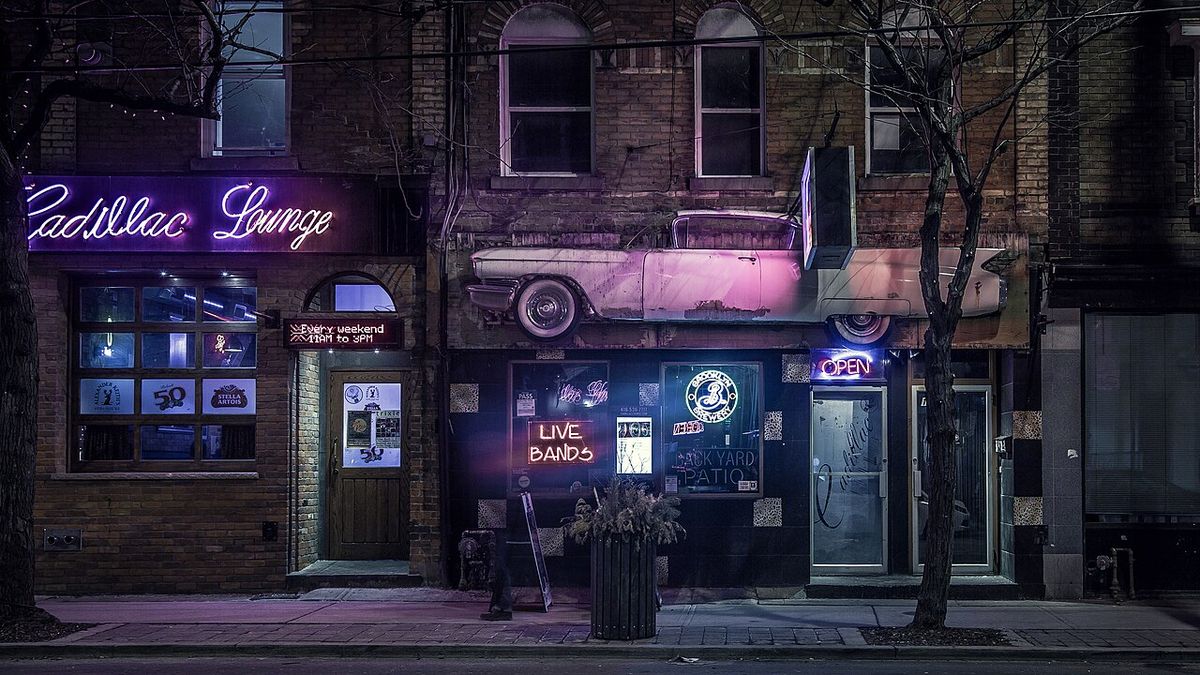
The area has seen an influx of artists working in relatively inexpensive spaces, close to exhibit spaces on Queen Street. The opening of the Parkdale Arts and Cultural Centre and efforts by the Parkdale-Liberty Economic Development Centre have spurred growth in a creative area along Queen Street, which participates in Toronto's annual Nuit Blanche. The commercial strip along Queen Street West has seen significant changes. In 2013, a sudden proliferation of restaurants and bars led to a bylaw limiting their number to 25 percent of establishments in one area, a rule rescinded in 2018 with a continuing prohibition on backyard and rooftop patios.
In 2018, several vegan businesses owned by a single entity, The 5700, opened between Dufferin and Brock Street, attempting to market the area as 'Vegandale.' The idea was dropped after community protest against gentrification and a conflict with the Parkdale Village BIA, and two of the businesses closed in 2020. The increase in Tibetan residents has led to the opening of Tibetan businesses and restaurants. The housing stock has seen gentrification, especially north of Queen Street near Roncesvalles Village, though sub-standard housing in older buildings remains a concern. Numerous illegal conversions into bachelorettes did not conform to building or fire codes.
An initiative known as the Parkdale Pilot Project was formed to address illegal conversions. One location on King Street was the site of the 'Pope Squat' where Ontario Coalition Against Poverty activists squatted in a vacant building during a visit of Pope John Paul II. After being vacant for over ten years, it re-opened as apartments after redevelopment approval. An apartment building at Queen Street and Dowling Avenue was expropriated by the city for affordable housing re-development, known as Edmond Place, a partnership with PARC. Recent community developments include the Healthy Organic Parkdale Edibles (HOPE) garden in Masaryk Park, founded by Shannon Thompson of Greenest City, and a Youth Garden in Dunn Parkette.
- 2013: Bylaw limits new restaurants/bars to 25% of establishments.
- 2018: Restaurant limit bylaw rescinded; 'Vegandale' branding attempt occurs and is dropped.
- 2020: Two 'Vegandale' businesses close.
- Ongoing: Parkdale Pilot Project addresses illegal housing conversions.
- Community Project: HOPE garden and Youth Garden initiated by Greenest City.
Landmarks, Education and Infrastructure
Parkdale features several notable landmarks. The Palais Royale, the 1920s dance hall on the Sunnyside waterfront, remains in operation. Sunnyside Park, developed circa 1922, is a major waterfront attraction with a boardwalk, sandy beaches, and the Sunnyside Gus Ryder Outdoor Pool. Architectural heritage is visible on streets like Cowan and Dunn Avenues and Melbourne Place. Cultural landmarks are tied to immigrant communities, notably the Little Tibet enclave with restaurants like Loga’s Corner and Tibet Kitchen. Significant arts venues include the Drake Underground, the Great Hall, Poetry Jazz Café, and galleries like Gallery 1313, Propeller Art Gallery, and Paul Petro Contemporary Art.
Four Toronto school boards provide public education, though only the English-language boards operate schools in Parkdale. Parkdale Collegiate Institute, a Toronto District School Board secondary school on Jameson Avenue, was founded in the 1880s. Dr. Rita Cox, Kina Minogok Public School, a TDSB elementary school on Close Avenue at King Street, was founded in 1887. Neither French-language school board operates a school in the neighbourhood. The area is served by the 501 Queen and 504 King streetcar lines, providing transit access. A 2026 neighbourhood guide scored South Parkdale at 30 out of 100 for safety, 25 for property value, 60 for accessibility, 58 for climate, and 58 for census indicators.
Infrastructure projects are ongoing. The Council-approved 2026 Capital Works Program includes road and sidewalk renewal for aging city roads. Specific projects affecting Parkdale area streets include King Street West track renewal and watermain replacement between Dufferin and Shaw Street, the King and Dufferin intersection track renewal, and Sorauren Avenue road resurfacing from Dundas to Queen Street. The City of Toronto enforces housing standards through the RentSafeTO bylaw enforcement program, requiring building owners to comply or face penalties.
Demographic and Economic Profile
Parkdale is one of Toronto's most genuinely mixed neighbourhoods in terms of income, ethnicity, and housing tenure. According to the 2021 census data for South Parkdale, the area has a very high percentage of renters. It hosts Toronto's largest Tibetan community and has been shaped by many other immigrant groups. The neighbourhood has a wide income range, containing some of the city's lowest-income residents alongside professionals and artists. Between 2006 and 2011, the neighbourhood's median income decreased by 2.9 percent, though there was an increase in the number of people earning between $30,000 and $60,000 in 2011. The visible minority population in North Parkdale changed between 2006 and 2011 to include fewer Asian, South Asian and Black residents overall.
The area has a significant group of musicians and visual artists, who often perform and exhibit locally. Many houses are income properties. The neighbourhood is denser and younger than nearby house neighbourhoods, with many people living in converted apartments. Livability challenges include the physical barrier of the Gardiner Expressway, parking scarcity, and social tensions inherent in a rapidly changing, high-density urban area where the divide between long-time residents and newcomers is a live conversation.
| Livability Metric (South Parkdale, 2026) | Score (/100) | Percentile vs. Toronto |
|---|---|---|
| Safety | 30 | 6th percentile (city median 47) |
| Property Value | 25 | 27th percentile (city median 31) |
| Accessibility | 60 | 66th percentile (city median 47) |
| Climate | 58 | 19th percentile (city median 62) |
| Census Indicators | 58 | 80th percentile (city median 51) |
Questions about Parkdale, Toronto
Where is Parkdale located in Toronto?
Parkdale is located in west-end Toronto, just west of the downtown core. Its traditional boundaries are Roncesvalles Avenue to the west, the CP Rail line north of Queen Street to the north, Dufferin Street to the east, and Lake Ontario to the south. The City of Toronto's official definition extends slightly further east to Atlantic Avenue south of the rail lines. The neighbourhood is situated south of Queen Street West, east of the Roncesvalles area, and west of Liberty Village. The original village area north of Queen Street is now part of the Roncesvalles neighbourhood.
What is Parkdale known for?
Parkdale is known for its historic Victorian and Edwardian architecture, its Queen Street West commercial strip with numerous restaurants and galleries, and its culturally diverse population. It is particularly famous as the heart of Toronto's Tibetan community, with an area informally called Little Tibet. The neighbourhood is also recognized for its complex social history, its role as an immigrant entry point, and landmarks like the Palais Royale dance hall and the Sunnyside waterfront park. It has a significant artist population and a high proportion of rental housing and low-income households.
Is Parkdale a good place to live?
Parkdale offers a unique urban living experience characterized by historic homes, excellent transit access via the 501 Queen and 504 King streetcars, and a rich cultural scene. It appeals to those who value character, diversity, and proximity to downtown. However, it is a mixed-income neighbourhood with visible social challenges, higher density, and less parkland than some areas. A 2026 guide scored South Parkdale low on safety (30/100). Prospective residents should be aware of issues like parking scarcity, the barrier effect of the Gardiner Expressway, and the varied condition of its older housing stock. It is recommended to visit at different times before deciding.
What is the history of Parkdale?
Parkdale began as an independent settlement in the 1850s, was incorporated as a village in 1879, and was annexed by Toronto in 1889. It was an affluent lakeside suburb in its early decades. Its character changed dramatically after 1955 with the construction of the Gardiner Expressway, which demolished its southern section and cut it off from the lake, leading to an apartment construction boom. In the mid-1970s, it became home to many deinstitutionalized mental health patients, concentrating social services and challenges. Since the 1980s, it has been a major landing spot for immigrants, most recently from Tibet, forming the Little Tibet enclave since the late 1990s.
What are some popular things to do in Parkdale?
Popular activities include exploring the restaurants and bars along Queen Street West, visiting Tibetan eateries in Little Tibet for momos at spots like Loga’s Corner, and browsing independent art galleries and vintage shops. The area hosts live music at venues like the Drake Underground, the Palais Royale, and Poetry Jazz Café. Residents and visitors enjoy Sunnyside Park for its beach, boardwalk, and outdoor pool. The neighbourhood has a 2SLGBTQI+ scene with venues like Glad Day Bookshop and events at the Drake Hotel. Community markets like the Toronto Sunday Market at Parkdale Hall and design shops like Era Antiques are also attractions.
How is Parkdale changing?
Parkdale is experiencing gentrification pressures, with rising housing prices and an influx of new restaurants and businesses. This has sparked community debates about displacement and neighbourhood character. Recent developments include community gardens like HOPE, efforts to legalize and improve substandard rental housing through the Parkdale Pilot Project, and capital improvement projects scheduled for 2026. The commercial strip has seen fluctuations, such as the 2018 rescinding of a limit on new restaurants and the brief 'Vegandale' branding attempt. The area continues to balance preservation with evolution, maintaining its role as an immigrant gateway while facing affordability challenges.
Sources and further reading
- Parkdale, Toronto (Wikipedia)
- Parkdale (destinationtoronto.com)
- South Parkdale, Toronto: Safety, Prices and Scores 2026 (pickyourplace.app)
- Parkdale, Toronto, Complete Neighbourhood Guide (getwhatyouwant.ca)
Checked by the Your Space Hamilton desk. Last updated 2026-10-26.