Etobicoke
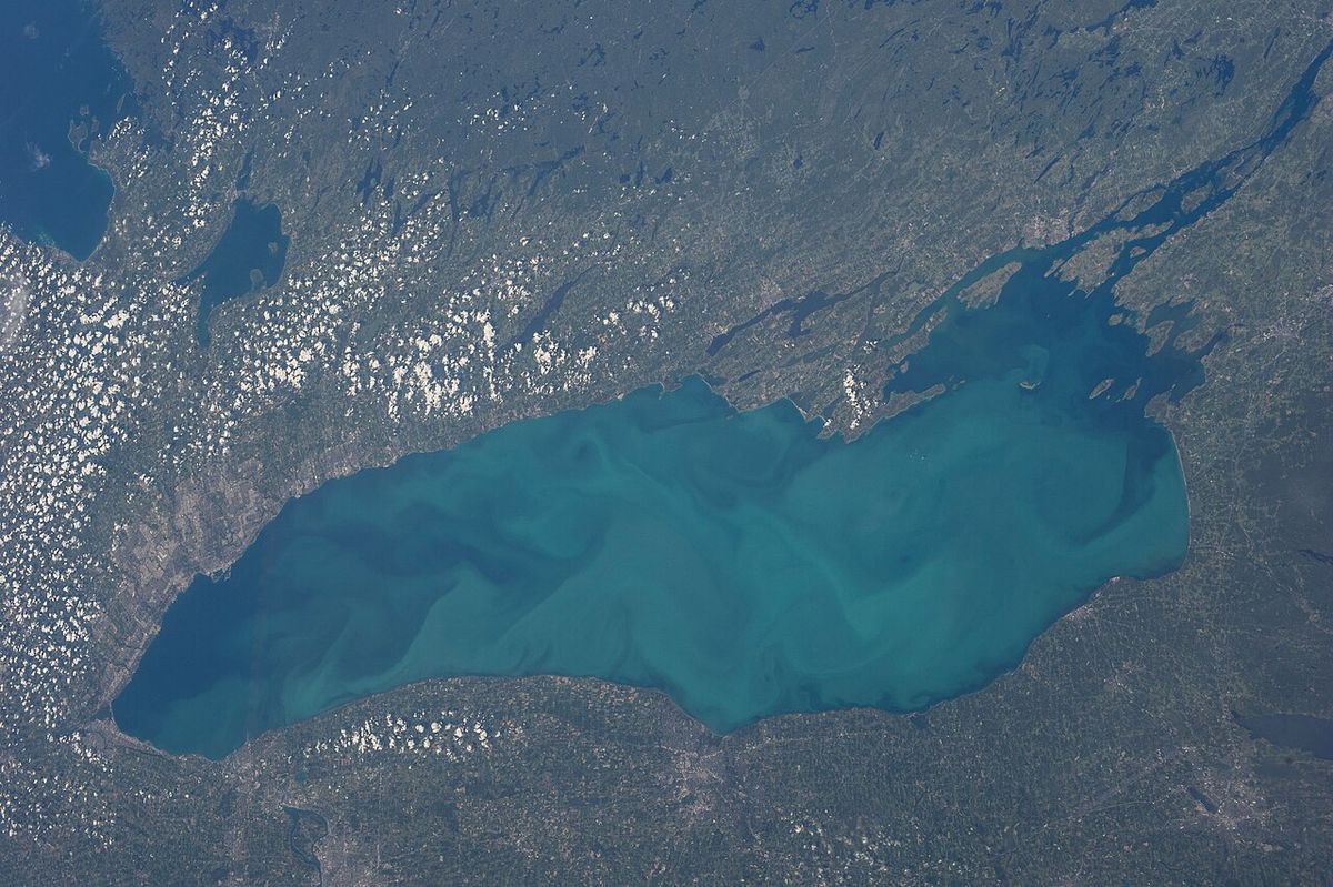
Etobicoke is a major administrative district and former city forming the west end of Toronto, Ontario. Its history as a distinct municipality dates to its incorporation as a township in 1850, evolving through suburban growth and amalgamations before becoming part of the amalgamated City of Toronto in 1998. Characterized by its expansive industrial lands, lower population density, and significant suburban residential areas, Etobicoke is a vital economic and cultural hub within Canada's largest city. The district is defined by natural boundaries including Lake Ontario to the south, the Humber River to the east, and Etobicoke Creek to the west, and it hosts key infrastructure such as Toronto Pearson International Airport and major highways.
History and Formation
The land that became Etobicoke has a long history of Indigenous habitation and use. By the late 17th century, the Algonquian-speaking Mississaugas had settled in the area, which they described as 'wah-do-be-kang', meaning 'place where the alders grow'. European settlement began in the 1790s following the disputed Toronto Purchase of 1787, with the boundary disagreement finally settled between the government and the Mississauga First Nation in 2010. Lieutenant Governor John Graves Simcoe approved the designation of Etobicoke Township in 1795, and the area was initially settled by British immigrants and Loyalists, including veterans of the Queen's Rangers like Colonel Samuel Smith who received large land grants. The township was formally incorporated on January 1, 1850, with its first council meeting held on January 21 of that year, led by Reeve William Gamble.
Throughout the late 19th and early 20th centuries, several communities within the township grew and sought independence. Mimico was incorporated in 1911, followed by New Toronto in 1913 and the Village of Long Branch in 1930. A key shift occurred in 1954 when Etobicoke Township became part of the new regional Municipality of Metropolitan Toronto. In a major consolidation in 1967, the township was merged with the three lakeside municipalities of Mimico, New Toronto, and Long Branch to form the Borough of Etobicoke. This borough was reincorporated as the City of Etobicoke in 1984. The final structural change came on January 1, 1998, when Etobicoke and five other municipalities were amalgamated with the Metropolitan Toronto government to form the current City of Toronto.
Geography and Character
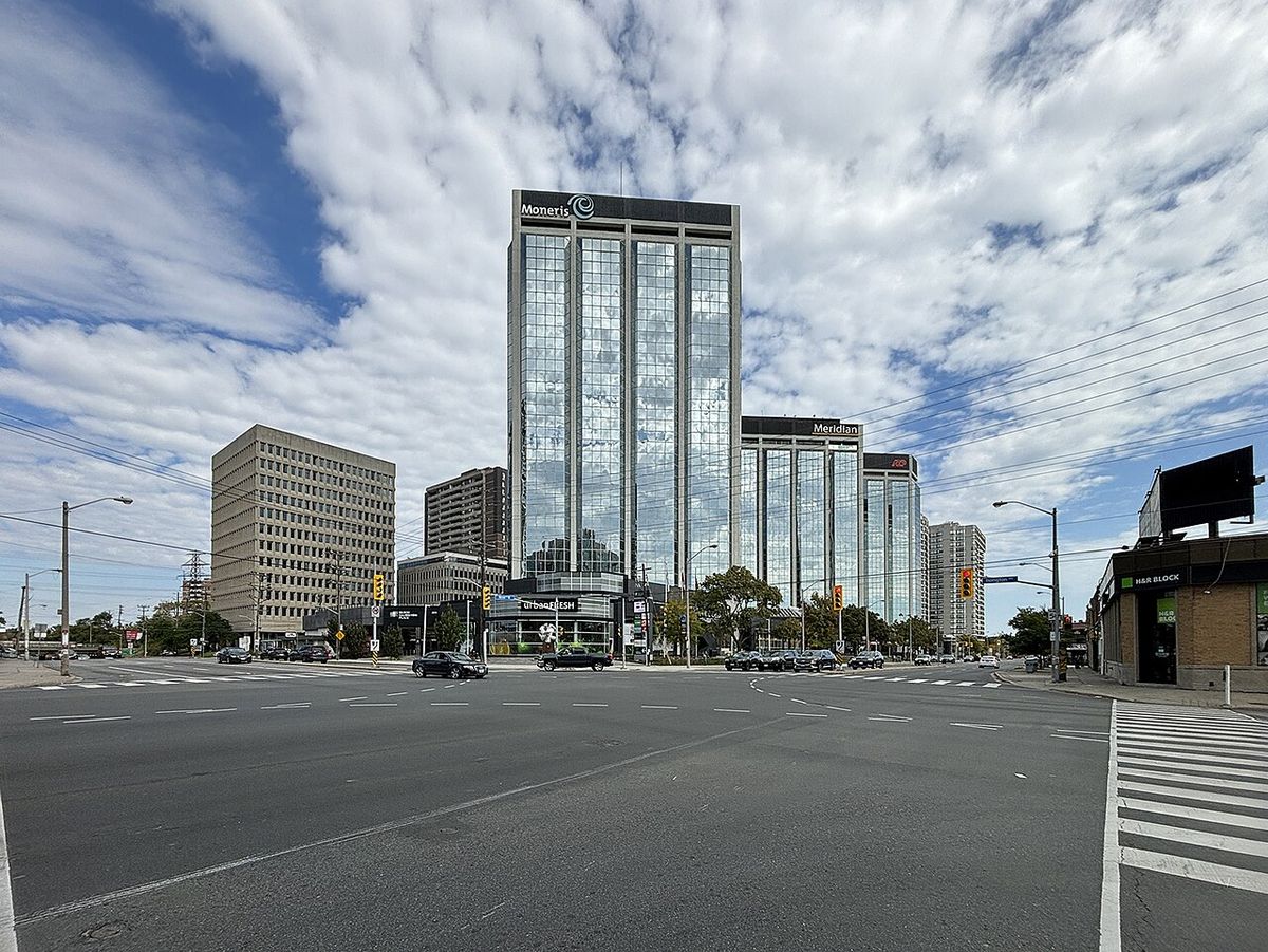
Etobicoke occupies a substantial portion of Toronto's west end, bounded by Lake Ontario to the south, the Humber River to the east, Etobicoke Creek and the cities of Mississauga and Brampton to the west, and Steeles Avenue adjoining Vaughan to the north. A small portion of Toronto Pearson International Airport extends into its northwest corner. The district has the lowest population density of Toronto's former municipalities, largely due to vast tracts of industrial land lining its expressway corridors. Its cityscape is predominantly suburban, featuring main arterial roads, shopping malls, and numerous cul-de-sac housing developments. While single-family dwellings are common, significant high-density condominium development has occurred in south Etobicoke near Humber Bay and along Bloor Street.
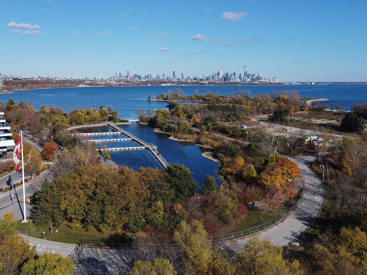
The area is well-served by major transportation routes, including the Gardiner Expressway, Queen Elizabeth Way, and Highways 401, 409, and 427. Public transit includes the western terminus of the Bloor-Danforth subway line and four GO Transit rail stations. Etobicoke is also known for its extensive park system. Key green spaces include the landscaped James Gardens on the Humber River, the large recreational Centennial Park, and the waterfront Colonel Samuel Smith Park and Humber Bay Park. The district is also home to several golf courses, including the highly ranked St. George's Golf and Country Club.
Neighbourhoods
Etobicoke is broadly divided into three large geographic areas, which roughly correspond to its federal electoral ridings. These areas are the Lakeshore, Central Etobicoke, and North Etobicoke. The neighbourhoods within these areas mostly originated as 19th-century postal villages built at key points along early roads and railways. Later suburban developments filled in the rural areas between these old communities in the post-war years.
- Etobicoke, Lakeshore: This southern area along Lake Ontario encompasses the three former municipalities of Mimico, New Toronto, and Long Branch, along with communities like Alderwood and Humber Bay. Historically industrial, areas like Humber Bay have seen significant conversion to high-rise condominiums, such as the Mystic Pointe development in the former McGuiness Whisky factory.
- Etobicoke Centre: The oldest area, centred on the Islington community and the historic 'Six Points' intersection. It includes affluent neighbourhoods like The Kingsway and Humber Valley Village, developed by Robert Home Smith, as well as post-war subdivisions like Thorncrest Village and Markland Wood. This area features a mix of exclusive housing, older bungalows, and high-rise apartments along corridors like The East Mall and West Mall.
- Etobicoke North: The northern section includes historic communities like Clairville, Rexdale, and Thistletown that grew along Albion Road and Rexdale Boulevard. Developed extensively after World War II, it features many apartment buildings and the 'Skyway' industrial park near Pearson airport. This area is notably diverse, with a high proportion of immigrants and visible minorities.
Demographics and Culture
According to the 2016 census, Etobicoke was home to 365,143 residents. The district exhibits pronounced demographic diversity, with significant variation between its northern and southern areas. North Etobicoke has a notably high immigrant population, with 62 percent of residents being foreign-born. Many newcomers have settled there from India, Jamaica, Iraq, Guyana, Somalia, Ghana, the Philippines, Nigeria, Pakistan, and Bangladesh. In contrast, central and south Etobicoke have larger established European communities, including residents of Italian, Polish, former Yugoslavian, and Ukrainian descent, and are home to some of Toronto's wealthiest neighbourhoods.
Linguistic diversity is a key feature of the area. While English is the most spoken language, other commonly reported mother tongues include Italian, Punjabi, Spanish, Polish, Ukrainian, Gujarati, and Portuguese. Culturally, Etobicoke hosts several community events, most notably the annual Rib Fest held at Centennial Park over the Canada Day long weekend, which features food, live music, and entertainment. The district also has a growing film and television production industry, contributing to its local economy.
Economy and Recent Development
Etobicoke has a strong and diversified economy anchored by significant industrial sectors, corporate headquarters, and ongoing large-scale development. The central business district is Islington-City Centre West. Major companies headquartered in the area have included Pizza Pizza and Sunwing Airlines, as well as former airlines Skyservice and Canada 3000. The construction industry has been particularly active, driving a population increase through new condominium developments, especially along the waterfront and Bloor Street.
Recent municipal planning approvals highlight the scale of current development. In July 2026, Toronto City Council approved ten major development sites in the Etobicoke-York and North York areas. Two multi-phase projects along The Queensway are particularly significant. The redevelopment of 1255 The Queensway, designed by Studio JCI, proposes buildings up to 65 storeys with 7,360 condominium units. The plan for 1025 The Queensway by WZMH Architects envisions a mixed-use community with 4,077 residential units, including 204 affordable rental homes. Other approved projects include a 44-storey rental tower at 4975 Dundas Street West and a 46-storey mixed-use tower at 1151 Weston Road in Mount Dennis.
Education
Primary and secondary education in Etobicoke is provided by four public school boards. The Toronto District School Board (TDSB) operates English-language public secular schools, while the Toronto Catholic District School Board (TCDSB) operates English-language separate schools. French-language education is offered by the secular Conseil scolaire Viamonde (CSV) and the separate Conseil scolaire catholique MonAvenir (CSCM). Before the 1998 amalgamation, education was managed by the Etobicoke Board of Education and the Metropolitan Separate School Board. The district has a rich history of secondary education, with Mimico High School opening in 1924 and Etobicoke Collegiate Institute in 1928.
Several vocational schools were built in the mid-20th century, including New Toronto Secondary School in 1950, Kingsmill Vocational School in 1963, Humbergrove Vocational School in 1965, and Westway Vocational School in 1969. This led to a peak of 14 collegiate and 4 vocational schools in 1980. Consolidations in the 1980s, due to declining enrollment, created schools like Lakeshore Collegiate Institute and Central Etobicoke High School. For post-secondary education, Etobicoke is home to Humber Polytechnic, which operates two campuses: the North campus and the Lakeshore campus. The University of Guelph-Humber is also located in Etobicoke, offering joint programs and degrees issued through its partnership with Humber and the University of Guelph.
- Notable Secondary Schools (Historical): Mimico High School (1924), Etobicoke Collegiate Institute (1928), New Toronto Secondary School (1950), Michael Power/St. Joseph High School (1949).
- Post-Secondary Institutions: Humber Polytechnic (North and Lakeshore campuses), University of Guelph-Humber.
- Public School Boards: Toronto District School Board (TDSB), Toronto Catholic District School Board (TCDSB), Conseil scolaire Viamonde (CSV), Conseil scolaire catholique MonAvenir (CSCM).
Government and Administration
As an administrative district of Toronto, Etobicoke is represented at the city level through three wards: Etobicoke North, Etobicoke Centre, and Etobicoke-Lakeshore. Local planning and community matters are addressed by the Etobicoke York Community Council, a committee of Toronto City Council that includes councillors from Etobicoke and adjacent York wards. This council holds regular public meetings, such as those scheduled for March 31 and July 7, 2026, to review development applications and local issues. The Committee of Adjustment for Etobicoke York, with its office at 399 The West Mall, holds public hearings in a hybrid in-person and virtual format to rule on minor variance and consent applications.
The district's civic services are integrated into the broader Toronto municipal system. The Etobicoke Civic Centre Council Chambers serve as a local meeting venue. For building-related inquiries, residents contact the central Toronto Building customer service. The planning approval process is active, as seen in the July 2026 council session where numerous large-scale development projects in Etobicoke received swift approval, demonstrating the ongoing evolution and densification of the district under the unified City of Toronto government.
Questions about Etobicoke
What are the main neighbourhoods in Etobicoke?
Etobicoke is commonly divided into three main areas. The Lakeshore area includes the former towns of Mimico, New Toronto, and Long Branch. Etobicoke Centre encompasses neighbourhoods like Islington, The Kingsway, Markland Wood, and Thorncrest Village. Etobicoke North includes communities such as Rexdale, Thistletown, and Clairville. Each area has a distinct character, from the affluent, established neighbourhoods in the centre to the highly diverse and densely populated areas in the north.
How diverse is Etobicoke's population?
Etobicoke has a highly diverse population, particularly in its northern sections where 62 percent of residents were foreign-born as of the 2016 census. Large communities have origins in India, Jamaica, Iraq, Guyana, Somalia, the Philippines, and many other countries. Central and southern Etobicoke have significant European-descended populations. Commonly spoken languages besides English include Italian, Punjabi, Spanish, Polish, Ukrainian, Gujarati, and Portuguese.
What major developments are happening in Etobicoke?
Significant development is underway, especially along The Queensway corridor. As of July 2026, Toronto City Council approved plans for two massive multi-phase projects at 1255 The Queensway (7,360 units) and 1025 The Queensway (4,077 units). Other approved projects include a 44-storey rental tower at 4975 Dundas Street West and a 46-storey mixed-use building at 1151 Weston Road. These developments are part of a broader trend adding thousands of new residential units to the area.
Is Etobicoke a city or part of Toronto?
Etobicoke is an administrative district and former city within the amalgamated City of Toronto. It was incorporated as a township in 1850 and grew into city status in the 20th century. The Borough of Etobicoke was formed in 1967 and reincorporated as a city in 1984. Its city status dissolved in 1998 when it was amalgamated with five other municipalities and the Metropolitan Toronto government to form the present day City of Toronto.
What is Etobicoke known for?
Etobicoke is known for its primarily suburban development and heavy industrialization, resulting in the lowest population density of the former cities comprising Toronto. It is characterized by larger main streets, shopping malls, and cul de sac housing developments. The area features several expressways including Highways 427, 401, 409, the Queen Elizabeth Way and Gardiner Expressway. Etobicoke contains major parks like Centennial Park and James Gardens, and corporate headquarters such as Pizza Pizza and Sunwing Airlines. It is also home to a portion of Toronto Pearson International Airport.
What educational institutions are located in Etobicoke?
Four public school boards provide primary and secondary education in Etobicoke: the Toronto District School Board, the Toronto Catholic District School Board, Conseil scolaire Viamonde, and Conseil scolaire catholique MonAvenir. For post secondary education, Humber Polytechnic operates two campuses within Etobicoke. One of these Humber Polytechnic campuses is also home to the University of Guelph Humber, a joint institution operated with the University of Guelph. Historically, Etobicoke's first Roman Catholic high school, Michael Power St. Joseph High School, opened in 1949.
Sources and further reading
- Etobicoke (Wikipedia)
- Etobicoke York Schedule (toronto.ca)
- City Council July, 2026: Etobicoke-York and North ... (urbantoronto.ca)
Checked by the Your Space Hamilton desk. Last updated 2026-10-25.