Climate of Nova Scotia
The climate of Nova Scotia is characterized by its mid-temperate zone location and significant maritime influence, though it exhibits continental tendencies. The province experiences frequent coastal fog, highly changeable weather, and is a convergence point for major eastward-moving storms, including intense nor'easters and occasional tropical systems. As Canada's warmest province on average due to ocean moderation, Nova Scotia faces a future of rising temperatures, more intense precipitation, and increased storm risks driven by climate change. Understanding this dynamic climate is crucial for residents, industries, and policymakers across the region.
Geographic and Climatic Influences
Nova Scotia's climate is shaped by its unique geography as a peninsula nearly surrounded by water, including the Gulf of Saint Lawrence to the north, the Bay of Fundy to the west, the Gulf of Maine to the southwest, and the Atlantic Ocean to the southeast. These major bodies of water provide a moderating influence, softening the temperature extremes typical of a continental climate, though the province's climate is described as closer to continental than maritime. The province's weather is famously changeable from day to day, a result of the interaction between three main converging air masses and its position on the primary routes of eastward-moving storms. The effects of the westerly wind are a main factor, transporting weather systems across the region and interacting with the sea's moderating force. While the sea prevents extreme cold, it also contributes to the province's notable frequency of coastal fog, particularly along the southwestern shore where Yarmouth experiences 191 foggy days annually. This complex interplay of oceanic and atmospheric forces creates a climate that is distinct within Atlantic Canada, described on licence plates as Canada's Ocean Playground.
Temperature Patterns and Extremes
Temperature varies across Nova Scotia, influenced by local oceanic currents where the constant temperature of the Atlantic moderates the south and east coasts. The warmer Gulf Stream moderates the southern end, while the colder Gulf of Saint Lawrence influences the north, with heavy winter ice build-up making northern winters colder. The shallowness of the Gulf's waters means they warm up more than the Atlantic in summer, warming northern summers in turn. Summer unofficially lasts from the first Sunday in April to the Saturday before the last Sunday in October, with typical temperatures ranging from 14°C to 25°C. Winter temperatures typically range from -9°C to 0°C, and the province holds the record for the warmest average temperatures in Canada, primarily due to its relatively mild winters. The highest temperature ever recorded on the Nova Scotia mainland was 38.3°C at Collegeville on August 19, 1935, and the highest on Cape Breton Island was 37.7°C at Ingonish on August 10, 2001. The coldest temperature ever recorded in the province was -41.1°C at Upper Stewiacke on January 31, 1920, demonstrating that intense cold snaps have occurred over the past 160 years. The Annapolis Valley, represented by Kentville, experiences some of the hottest summer conditions, with a record high of 37.8°C in August 1944 and a record low of -31.1°C, making it one of the province's hotter towns in summer.
Precipitation, Fog and Seasonal Storms
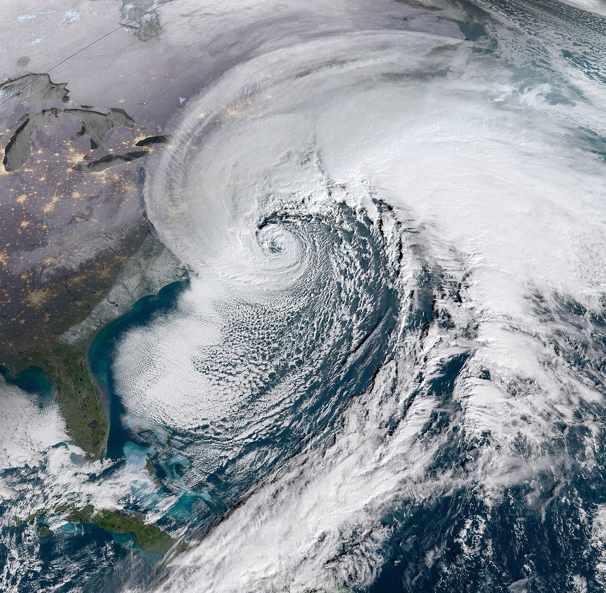
Precipitation is well-distributed throughout the year across Nova Scotia, though patterns vary regionally with a slight summer maximum in northern and interior areas. Southern and coastal areas typically experience a slight autumn to early winter maximum from October to January, with July or August being the driest month on average. Sydney, on Cape Breton Island, is notably wet with nearly 60 inches of average annual precipitation and a concentration from October to January, with December as the wettest month on average. Average annual precipitation ranges from about 140 centimetres in the storm-active south to around 100 centimetres elsewhere, a result of intense cold-season storm activity. The province is also prone to intense autumn and winter storms known as nor'easters, which arrive from the northeastern United States and can bring high winds, heavy rain, ice, and snow, sometimes all within a single storm. Fog is a persistent feature, with Halifax averaging 121 foggy days annually and Yarmouth experiencing 191, making the southwestern end the foggiest part of the province. These nor'easters can attain tremendous intensity across coastal areas, contributing significantly to the annual precipitation totals and posing major risks for coastal communities.
Major Storm Systems and Severe Weather
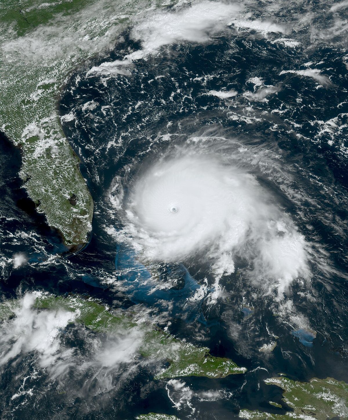
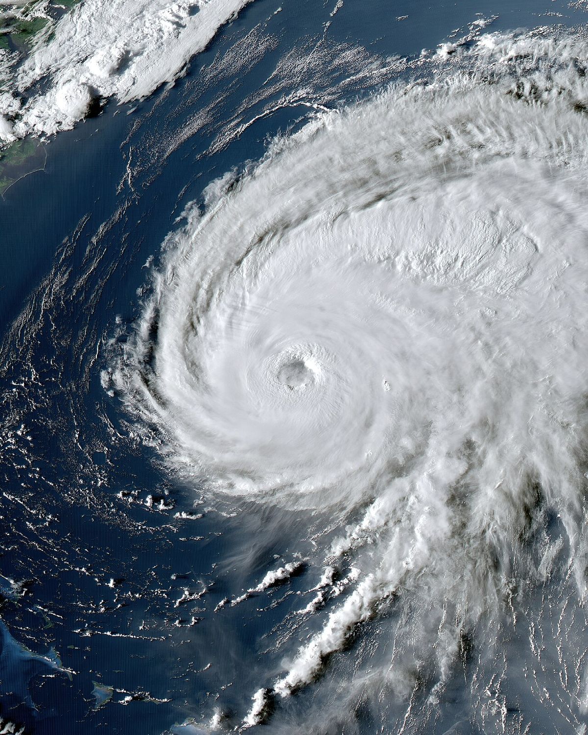
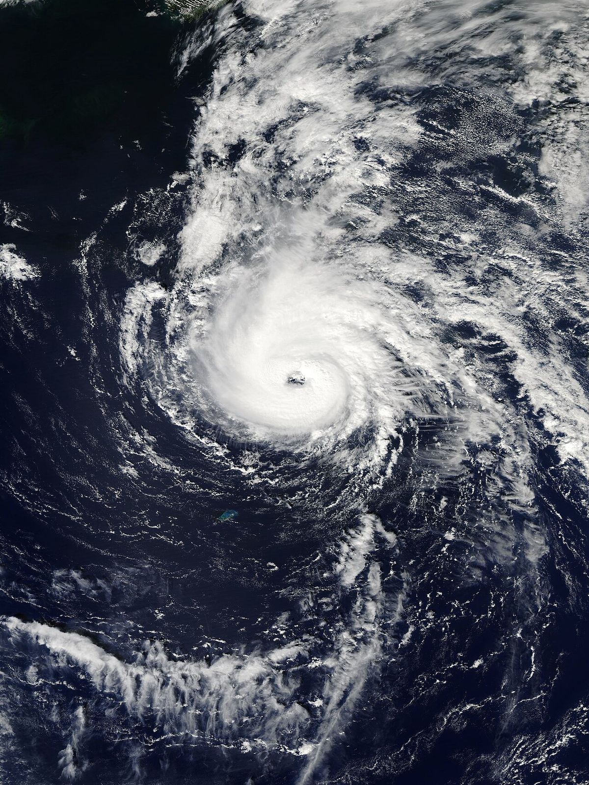
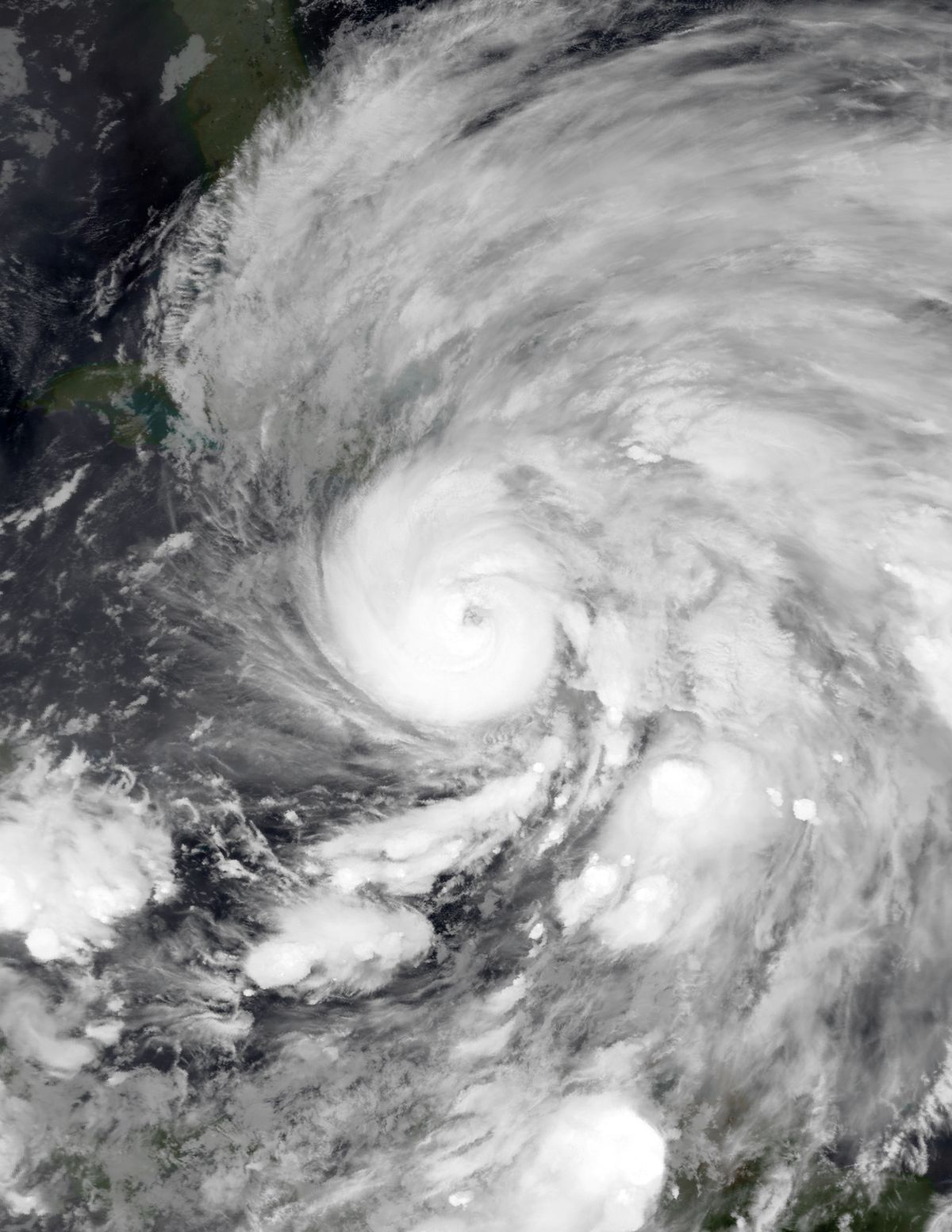
Nova Scotia's protruding geography makes it a target for various storm systems throughout the year. The cold season, primarily from November to March, is dominated by powerful nor'easters that arrive from the Northeastern United States. The province also experiences tropical storms and hurricanes in late summer and autumn, though the relatively cooler waters off the coast usually weaken them before landfall, and they are most often extratropical by the time they arrive. Since records began in 1871, 34 such storms have affected the region, including 13 hurricanes, which is an average of about one storm every four years. Notable destructive hurricanes include Ginny in 1963, Juan in 2003 which made landfall at Category 2 intensity, and Dorian in 2019 which caused damage in the Halifax area. Hurricane Fiona in 2022 became the most intense hurricane to make landfall in Canada and Nova Scotia. The area around Grand Étang in northern Nova Scotia is known for very high winds called Suetes, generated by low mountains affecting southeasterly winds. Thunderstorms occur several times a year and can be severe, as seen in events in July and October 2023, the latter causing relatively large hail in the Halifax area. While tornadoes are relatively rare, several notable ones are on record.
Recorded tornado events in Nova Scotia include several notable occurrences. A tornado happened in White Point in 1954 and was rated an F1, damaging cabins, snapping trees, and destroying a barn. Another tornado occurred in Pugwash in 1999 and was an F0, which ripped the dining room from a restaurant. A more recent tornado touched down in Stewiacke in 2021 and was the strongest since an F1 in Tidnish in 1955, destroying a barn at EF1 intensity. A few weeks after the Stewiacke tornado, another EF0 tornado touched down in Antrim.
- White Point (1954): An F1 tornado damaged cabins, snapped trees, and destroyed a barn.
- Pugwash (1999): An F0 tornado ripped the dining room from a restaurant.
- Stewiacke (2021): An EF1 tornado destroyed a barn, marking the strongest tornado since an F1 in Tidnish in 1955.
- Antrim (2021): An EF0 tornado touched down a few weeks after the Stewiacke event.
Climate Change Projections for Nova Scotia
Climate change is projected to significantly alter Nova Scotia's weather patterns and extremes in the coming decades, with human activities releasing greenhouse gases that warm the planet. The provincial average annual temperature is projected to increase by 2.6°C by mid-century and by 4.5°C by the end of the century under a high greenhouse gas emissions scenario, according to the latest climate change projections for the province. This warming will lead to more frequent extreme heat events, increasing the risks of drought and wildfire, and will fundamentally change winter characteristics as average temperatures rise above freezing. Total annual precipitation is likely to increase by around 10% by 2100, with more intense rainfall events contributing to higher flood risk, increased erosion, and greater humidity as water evaporates in warmer temperatures. Warming oceans enable tropical storms to move further north without losing strength, increasing the likelihood of more frequent and intense storms making landfall with high-speed winds and powerful storm surges. Research also projects an increase of up to one metre in relative sea level by 2100, which will exacerbate storm surge impacts, damage coastal communities and infrastructure, and threaten sensitive coastal species and ecosystems. Ocean waters are also becoming more acidic, dissolved oxygen levels are decreasing, and currents could weaken, making it harder for ocean life and coastal ecosystems to thrive.
The 2026 to 2027 Seasonal Outlook and a Record El Niño
Seasonal forecasts for the 2026 to 2027 period highlight the influence of a developing, potentially record-breaking El Niño event, a natural phenomenon now intensified by climate change. Environment and Climate Change Canada forecasts indicate a greater than 99% probability of a "very strong" El Niño, with its CanSIPSv3 system predicting sea surface temperature anomalies in the Niño-3.4 region will very likely exceed 3.0°C above the historical baseline. Some ensemble members from ECCC approach or exceed 4°C, which would be unprecedented in the modern observational record by a substantial margin, making this an extraordinary El Niño event. For Nova Scotia and Atlantic Canada, this is expected to result in a winter with above-normal temperatures overall, with the coldest periods forecast for early to mid-January. However, the season is forecast to be active and volatile, with a mix of snow, sleet, freezing rain, rain, and strong coastal storms, as the strengthening El Niño rearranges jet streams and storm tracks. The El Niño event is specifically projected to bring above-average snowfall and coastal storm activity to the province, with winter 2026-27 expected to be milder overall but with a greater risk of extreme weather events. The increased risk of extreme weather may extend into the spring and possibly summer of 2027, raising the potential for severe drought and wildfire conditions as well, which could have major impacts on communities, infrastructure, and the economy. Key characteristics and projected changes for the 2026 to 2027 period include:
- A very strong El Niño virtually certain to form, peaking in intensity in late fall or early winter 2026.
- Winter temperatures above the historical norm across Nova Scotia, with the seasonal forecast calling for above-normal temperatures.
- An active storm track bringing above-average precipitation and coastal storms to the region.
- A heightened risk of extreme weather events extending from winter into spring and summer 2027, with 2027 highly likely to become the hottest year on record globally.
- Potential for severe drought and wildfire conditions in the warmer seasons following the El Niño winter.
- Increased likelihood of high-impact weather events due to the combination of a strong El Niño and background climate change, making 2026-27 a potential year of high-impact weather.
Regional Climate Variations Within the Province
Nova Scotia's climate is not uniform, with notable differences between its regions driven by local geography and ocean currents, as illustrated by data from Yarmouth, Halifax, Sydney, and Kentville. The southwestern end, represented by Yarmouth, is moderated by the Gulf Stream, resulting in milder temperatures and less winter precipitation but experiencing the most fog in the province at 191 days annually. The central region around Halifax shares the moderating influence of the Atlantic, with marked variability and an average of 121 foggy days per year. The northeastern area, including Sydney on Cape Breton Island, is influenced by the colder Gulf of Saint Lawrence, which leads to colder winters, but the shallow gulf waters also contribute to warmer summers. Sydney also receives the highest annual precipitation in the province at nearly 60 inches, with a noticeable autumn to early winter concentration. The Annapolis Valley, with Kentville as a representative point, has a more continental flavour, experiencing the hottest and most humid summers in Nova Scotia alongside cold snowy winters, removed from the direct coastal moderation. This internal diversity means weather impacts and climate risks can vary significantly across short distances, affecting agriculture, transportation, and community preparedness in different ways.
Historical Storm Impacts and Preparedness
The history of significant storms in Nova Scotia informs current preparedness efforts and future risk assessments for communities and infrastructure. Hurricane Juan in 2003 was particularly destructive, causing extensive damage in the Halifax area and demonstrating that hurricanes can make landfall at Category 2 intensity even in cooler northern waters. Hurricane Dorian in 2019 further reinforced the vulnerability of coastal and urban areas to tropical systems, while Hurricane Fiona in 2022 set a new benchmark as the most intense hurricane to landfall in Canada. Beyond hurricanes, nor'easters remain a persistent and often more frequent threat, capable of delivering tremendous intensity across coastal areas with high winds, heavy precipitation, and storm surge. The severe thunderstorms in July and October 2023, and tornado events like those in Stewiacke and Antrim in 2021, highlight that inland areas are not immune from damaging severe weather. Provincial and federal agencies, including Environment and Climate Change Canada, issue forecasts and warnings, with the hurricane season officially running from June 1 to November 30 each year. Preparedness resources emphasize the need for communities to plan for a wide spectrum of events, from coastal flooding and wind damage to inland flooding from intense rainfall and the impacts of ice storms.
Temperature and Precipitation Data by Location
Specific locations across Nova Scotia illustrate the climatic diversity of the province through their recorded temperature extremes and precipitation patterns. The highest temperature ever recorded in Halifax was 37.2 °C on July 10, 1912, and its lowest was -29.4 °C on February 18, 1922. For Sydney, the highest temperature ever recorded was 36.7 °C on August 18, 1935, and the lowest was -31.7 °C. Kentville has recorded a high of 37.8 °C in August 1944 and a low of -31.1 °C, making it one of the hottest towns in the summer. Sydney is also an especially wet area with an average annual precipitation of nearly 60 inches, while Yarmouth averages 191 foggy days per year.
| Location | Precipitation & Fog Notes |
|---|---|
| Yarmouth (SW) | 191 foggy days per year. Milder, less winter precipitation. |
| Halifax (Central) | 121 foggy days per year. Represents central coastal climate. |
| Sydney (NE) | Nearly 60" annual precipitation. Wettest month is December. |
| Kentville (Annapolis Valley) | Hotter, humid summers. Cold snowy winters. One of hottest towns in summer. |
This data shows that while all areas share a moderated climate, the Annapolis Valley experiences the most extreme summer heat. Sydney endures some of the coldest lows and has the highest precipitation. The southwestern coast, represented by Yarmouth, contends with the most persistent fog. These variations are critical for local agriculture, tourism, and infrastructure planning across the province. The climate is moderated overall by the ocean, making Nova Scotia the warmest province in Canada on average.
Questions about Climate of Nova Scotia
How often does Nova Scotia get hit by hurricanes?
Nova Scotia is affected by tropical storms or hurricanes approximately once every four years on average. Since records began in 1871, the province has experienced 34 such storms, which includes 13 hurricanes. While cooler ocean waters typically weaken these systems before landfall, powerful storms like Hurricane Juan in 2003 and Hurricane Fiona in 2022 have caused significant damage. Climate change projections suggest warming oceans may allow future hurricanes to retain more strength as they approach the region, increasing the potential for impacts.
Why is Nova Scotia so foggy?
Nova Scotia experiences frequent fog due to its position as a peninsula surrounded by cool ocean waters. When warm, moist air moves over these colder sea surfaces, it cools rapidly, causing water vapour to condense into fog. This is most prevalent in coastal areas, particularly in the southwest where Yarmouth averages 191 foggy days per year, while Halifax experiences 121. The interaction between the Gulf Stream and colder coastal currents also contributes to the persistent fog conditions, especially in the spring and early summer months.
What are the winter weather projections for Nova Scotia under climate change?
Climate change projections indicate Nova Scotia's winters will become warmer and wetter. Average annual temperatures are projected to rise by 2.6°C by mid-century and 4.5°C by 2100 under high emissions. This warming will lead to less snowfall and more rain, along with increasingly intense rainfall events that contribute to higher flood risk. The character of winter will change as average temperatures rise above freezing more often, though the province will still experience winter storms and the risk of ice storms and mixed precipitation events is expected to persist.
What is a 'nor'easter' and how does it affect Nova Scotia?
A nor'easter is an intense cold-season storm that forms along the east coast of North America and gets its name from the strong northeasterly winds it produces. These storms typically occur from November to March and often originate in the southeastern United States before moving northeastward. In Nova Scotia, nor'easters can bring a combination of high winds, heavy precipitation in the form of snow, ice, or rain, and significant storm surges along the coast. They are a major feature of the provincial climate and can cause substantial disruption, property damage, and power outages during the winter months.
How is the strong El Niño in 2026 to 2027 expected to affect Nova Scotia's weather?
The forecasted very strong El Niño for the 2026 to 2027 season is expected to lead to a warmer than average winter across Nova Scotia. However, forecasts also indicate an active and volatile storm pattern, resulting in above-average precipitation and frequent coastal storms bringing a mix of snow, ice, and rain. The influence of this extreme El Niño may extend beyond winter, increasing the risk of severe drought and wildfire conditions in the subsequent spring and summer. This combination of factors points to a year of high-impact weather events for the province, consistent with predictions of 2027 being a record-hot year globally.
What is the highest temperature ever recorded in Nova Scotia?
The highest temperature ever recorded in Nova Scotia was 38.3 degrees Celsius on August 19, 1935, at Collegeville near Antigonish. On Cape Breton Island, the highest recorded temperature is 37.7 degrees Celsius at Ingonish on August 10, 2001. Other notable highs include 37.2 degrees Celsius in Halifax in 1912 and 37.8 degrees Celsius in Kentville in 1944. These extremes demonstrate the province's capacity for intense summer heatwaves, particularly in interior and northern areas. While the Atlantic Ocean moderates coastal climates, northern regions can experience warmer summers due to the shallow Gulf of Saint Lawrence waters heating up.
Sources and further reading
- Climate of Nova Scotia (Wikipedia)
- Rising temperatures, Climate Change Nova Scotia (climatechange.novascotia.ca)
- Forecasts for Nova Scotia (weather.gc.ca)
Checked by the Your Space Hamilton desk. Last updated 2026-10-26.