Hurricane Sandy
Hurricane Sandy, unofficially known as Superstorm Sandy, was an exceptionally large and destructive tropical cyclone that struck the Caribbean and the eastern United States in late October 2012. It was the largest Atlantic hurricane on record by diameter, with tropical-storm-force winds spanning 1,150 miles (1,850 km). The storm caused nearly US$70 billion in damage (equivalent to $98 billion in 2025) and resulted in 254 fatalities across eight countries. In Canada, the storm claimed two lives in Ontario and caused an estimated C$100 million in damage across Ontario and Quebec, marking it as a significant weather event with direct impacts on Canadian communities.
Meteorological History and Development
Hurricane Sandy originated from a tropical wave in the western Caribbean Sea on October 22, 2012, south of Kingston, Jamaica. It quickly organized due to low wind shear and warm waters, being designated Tropical Depression Eighteen and then Tropical Storm Sandy within six hours. The storm initially moved slowly northward, hindered by a ridge to the north, but began steady northward motion on October 24 as an approaching trough influenced its path. An eye began developing early that day, and the National Hurricane Center upgraded Sandy to hurricane status about 65 miles south of Kingston, Jamaica. Sandy made its first landfall near Kingston with winds of about 85 mph (137 km/h) at approximately 1900 UTC on October 24.
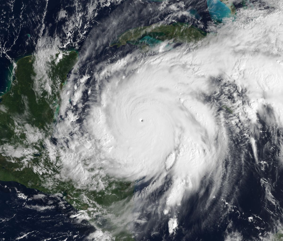
Just offshore of Cuba, Sandy underwent rapid intensification, reaching its peak as a Category 3 hurricane with sustained winds of 115 mph (185 km/h) and a minimum central pressure of 954 millibars. At this intensity, it made landfall just west of Santiago de Cuba at 0525 UTC on October 25. After exiting Cuba, the storm's structure became disorganized as it turned to the north-northwest over the Bahamas. By October 27, frontal structures developed in its outer circulation, indicating Sandy was no longer a fully tropical system and was transitioning into a hybrid extratropical cyclone. Despite strong wind shear, Sandy maintained convection due to the influence of the same approaching trough that was steering it.
The storm briefly weakened to a tropical storm before re-intensifying into a Category 1 hurricane, with an eye beginning to redevelop on October 28. Its path was dictated by an upper-level low over the eastern United States and a ridge over Atlantic Canada, which turned it to the northwest. On the morning of October 29, Sandy briefly re-intensified to Category 2 strength and achieved an enormous size, with a record gale-force wind diameter and an unusually low central pressure of 940 mbar. As it accelerated toward the New Jersey coast, its convection diminished, and it completed the transition to a post-tropical cyclone by 2100 UTC on October 29. About two and a half hours later, Sandy made landfall near Brigantine, New Jersey, with sustained winds of 80 mph (130 km/h). Its remnants then drifted northward over Ontario for several days before merging with another low-pressure system over Eastern Canada on November 2.
Forecasting Advancements and Challenges
The European Centre for Medium-Range Weather Forecasts (ECMWF) model correctly predicted Sandy's unusual westward turn toward the U.S. East Coast nearly eight days in advance, on October 23, 2012. This forecast was notable because it accurately predicted the storm would turn west and strike the New York and New Jersey region on October 29, contrary to the typical behaviour of hurricanes in that position which turn east into the open Atlantic. The National Weather Service and National Hurricane Center confirmed this predicted path by October 27, four days after the European model's prediction. The event prompted criticism of the National Weather Service for not employing its higher-resolution forecast models as effectively as its European counterpart. In response, a hardware and software upgrade was completed at the end of 2013, enabling the U.S. weather service to make more accurate predictions farther in advance.
The storm's complex hybrid nature also challenged forecasters, as it transitioned from a tropical cyclone to a post-tropical system before landfall. The term "Frankenstorm" was coined by a Hydrometeorological Prediction Center forecaster to describe the anticipated merger of Sandy with a winter storm front just before Halloween. As media coverage continued, many outlets began using the term "superstorm" instead. The forecasting success of the ECMWF model and the subsequent U.S. upgrades highlight a significant period of advancement in numerical weather prediction driven by the lessons of Sandy.
Scientific Analysis and Relation to Climate
Scientific discussion after the storm focused extensively on its relation to climate change and global warming. According to senior climatologist Kevin E. Trenberth, while all weather events are affected by climate change because the environment is warmer and moister, Sandy was caused by "natural variability" that was "enhanced by global warming." A key factor was abnormally warm sea surface temperatures offshore of the U.S. East Coast, which were more than 5 °F (3 °C) above normal. Research indicated global warming had contributed about 1 °F (0.6 °C) to this anomaly, which provided more energy for the storm. Furthermore, a warmer atmosphere has a greater capacity to hold water vapour, which can lead to stronger storms and higher rainfall amounts.
Sandy's unusual track was influenced by a blocking pattern of high pressure over Greenland, which resulted in a negative North Atlantic Oscillation and caused a kink in the jet stream. This pattern steered the storm on its unusual northwest path and also stalled an Arctic front that combined with the cyclone. Some scientists, like Mark Fischetti, suggested the jet stream's unusual shape was influenced by the melting of Arctic ice. A critical human contribution was sea level rise. Sea level at New York and along the New Jersey coast had increased by nearly 12 inches (30 cm) over the previous century. One scientific estimate concluded that human-driven climate change was responsible for about 3.5 inches (8.9 cm) of that rise, which allowed additional storm surge that caused approximately $8.1 billion of the reported damage and extended the flood zone to impact about 71,000 more people. Harvard geologist Daniel P. Schrag called Sandy's 13-foot storm surge an example of what would become the "new norm on the Eastern seaboard" by mid-century.
Impact in the Caribbean and Preparations
The Caribbean nations bore the initial and severe brunt of Hurricane Sandy. In Jamaica, where the storm first made landfall as a hurricane, winds left 70 percent of residents without electricity, blew roofs off buildings, killed one person, and caused about $100 million in damage. The Jamaican government issued warnings, shut down schools and airports, and imposed curfews ahead of the storm. Haiti suffered catastrophic flooding from Sandy's outer bands, which killed 75 people, created food shortages, and left approximately 200,000 people homeless. The hurricane also caused two deaths in the Dominican Republic. In Puerto Rico, one man was swept away by a swollen river.
Cuba experienced extensive damage when Sandy struck as a Category 3 hurricane. The storm caused significant coastal flooding and wind damage inland, destroying about 15,000 homes, killing 11 people, and inflicting $2 billion in damage. The Cuban government had issued a hurricane warning for several provinces well in advance. In the Bahamas, Sandy caused two fatalities and an estimated $700 million in damage as it moved through the archipelago. The Bahamian government had issued tropical storm watches and warnings for numerous islands starting on October 23. Bermuda also issued a tropical storm watch on October 26 due to the storm's enormous anticipated reach. These impacts and the widespread preparations underscored the storm's devastating power and the region's vulnerability.
Impact and Response in the United States
Hurricane Sandy affected 24 U.S. states, with particularly severe damage concentrated in New Jersey and New York. Its storm surge hit New York City on October 29, flooding streets, tunnels and subway lines and cutting power in and around the city. The surge, combined with the storm's massive size and unusual hybrid nature, led to catastrophic flooding in coastal communities. In total, damage in the United States amounted to $65 billion, making it one of the costliest tropical cyclones in U.S. history at the time. The storm's impacts stretched from Florida to Maine and west to Michigan and Wisconsin, with heavy snowfall in the Appalachian Mountains where up to 36 inches of snow fell in some areas.
Preparations were extensive and multi-faceted. The Federal Emergency Management Agency (FEMA) monitored the storm through regional offices and coordinated with state partners. President Barack Obama signed emergency declarations on October 28 for several states expected to be impacted, allowing them to request federal aid in advance. Utilities along the East Coast alerted contractors and asked employees to work longer hours to prepare for massive power outages, with one forecast predicting 10 million customers could lose power. Transportation was severely disrupted, with over 5,000 commercial airline flights canceled and Amtrak services suspended. The National Guard and U.S. Air Force put up to 45,000 personnel on alert for possible duty. States like North Carolina, Virginia, Maryland, and Washington, D.C., declared states of emergency, ordered evacuations, and closed government offices and transit systems.
Impact, Response, and Legacy in Canada
While the core of Sandy struck the United States, its vast circulation brought significant weather to Eastern Canada. The storm caused an estimated C$100 million in damage across Ontario and Quebec. High winds and heavy rain led to widespread power outages, property damage, and transportation disruptions. Tragically, the storm was responsible for two fatalities in Ontario. The Canadian impacts highlighted the far-reaching effects of such large-scale weather systems, even when they make landfall in another country, and demonstrated the need for preparedness for complex, hybrid systems that can transition from tropical to extratropical while retaining destructive force.
The legacy of Hurricane Sandy is profound in terms of emergency management and meteorological science. The storm directly influenced the development of new National Weather Service products and services. Beginning with the 2017 hurricane season, the NWS introduced operational storm surge watches and warnings to highlight areas at risk of life-threatening inundation. It also developed Potential Storm Surge Flooding Maps to depict geographic areas and heights where water could reach above ground level. Furthermore, forecasts now include total water level forecasts on hydrographs for tidal gauges. Technological advancements were also accelerated, such as the launch of the GOES-16 satellite in 2016, which provides increased spectral channels and greater resolution to improve hurricane track and intensity forecasts. These changes, part of an effort to build a more Weather-Ready Nation, were significantly informed by the lessons learned from the forecasting challenges and catastrophic impacts of Superstorm Sandy.
Questions about Hurricane Sandy
Why was Hurricane Sandy called a superstorm?
Hurricane Sandy earned the unofficial name 'superstorm' because of its exceptional size and hybrid nature. As it moved north, it merged with a winter storm front and transitioned into a post-tropical cyclone, yet it retained hurricane-force winds. This combination of tropical and extratropical characteristics, along with its record-breaking wind field diameter of over 1,150 miles, created a vast and complex weather system that impacted a huge area with several different hazards including storm surge, wind, rain, and snow. The media and forecasters used the term to convey its unprecedented and compound threat.
How much damage did Hurricane Sandy cause?
Hurricane Sandy caused nearly US$70 billion in damage in 2012, which is equivalent to approximately $98 billion in 2025 dollars. The vast majority of this damage, about $65 billion, occurred in the United States, particularly in New Jersey and New York. The Caribbean also suffered severe losses, with Cuba sustaining $2 billion in damage, the Bahamas $700 million, and Jamaica about $100 million. In Canada, damage was estimated at C$100 million across Ontario and Quebec. The storm also resulted in 254 fatalities across eight countries from the Caribbean to Canada.
Did Hurricane Sandy affect Canada?
Yes, Hurricane Sandy affected parts of Eastern Canada, primarily Ontario and Quebec. The storm's massive circulation brought high winds and heavy rain to the region after it made landfall in the United States. This resulted in widespread power outages, property damage, and transportation disruptions. Tragically, the storm was responsible for two fatalities in Ontario. The total economic damage in Canada was estimated at C$100 million. The remnants of Sandy drifted over Ontario for several days before finally merging with another low-pressure system over Eastern Canada on November 2.
What made Hurricane Sandy's path so unusual?
Hurricane Sandy's path was unusual because it turned west-northwest ('left hook') to strike the U.S. Mid-Atlantic coast, whereas most hurricanes at that latitude are steered east and out to sea by the prevailing westerly winds. This turn was caused by a blocking pattern of high pressure over Greenland, which created a negative North Atlantic Oscillation and a kink in the jet stream that doubled back on itself. Sandy became caught in this southeasterly flow, directing it inland. This rare steering pattern, which also stalled an Arctic front, was a key factor in the storm's unprecedented impact on New Jersey and New York.
How is climate change connected to Hurricane Sandy?
While scientists state that Hurricane Sandy was caused by natural weather variability, they agree that climate change likely amplified its impacts. A warmer atmosphere holds more moisture, which can increase rainfall potential. More directly, human-driven climate change contributed to higher sea surface temperatures (adding about 1°F to the anomaly) and sea level rise along the storm's path. The sea level rise in New York over the previous century, a portion of which is attributed to anthropogenic warming, allowed Sandy's storm surge to be more destructive, causing billions in extra damage and flooding areas inhabited by tens of thousands more people than it would have otherwise.
What changed in weather forecasting after Hurricane Sandy?
Hurricane Sandy led to significant improvements in weather forecasting and warning systems. Criticisms of U.S. forecast models prompted technological upgrades at the National Weather Service by the end of 2013. Major new public forecast products were developed, including operational storm surge watches and warnings and potential storm surge flooding maps, introduced for the 2017 hurricane season. These tools provide clearer, more specific information about the risk of life-threatening coastal inundation. Additionally, forecasts now include total water level forecasts on hydrographs, and advanced satellites like GOES-16 have been deployed to greatly improve track and intensity forecasting for future storms.
Sources: Wikipedia and current public reporting, checked by the Your Space Hamilton desk. Last updated 2026-10-18.