Thirty Thousand Islands
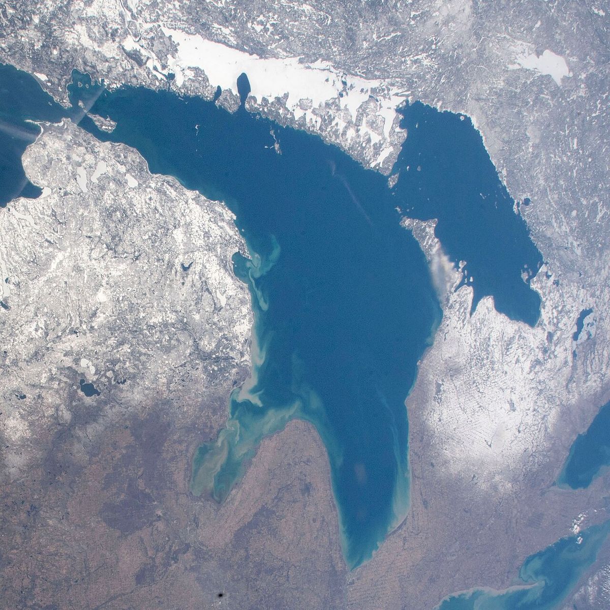
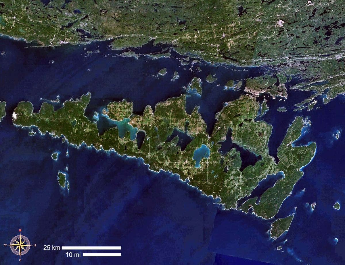
The Thirty Thousand Islands are the world's largest freshwater archipelago, a vast collection of islands and shoals located along the eastern side of Georgian Bay in Ontario, Canada. This region is defined by the exposed pink granite of the Canadian Shield, windswept pine trees, and sheltered bays within the Great Lakes system. Its distinct scenery was a primary subject for the Group of Seven artists, whose paintings helped shape Canadian visual identity. UNESCO designated the core area as the Georgian Bay Littoral Biosphere Reserve in 2004, recognizing its ecological importance across 347,000 hectares.
Geography and Scope
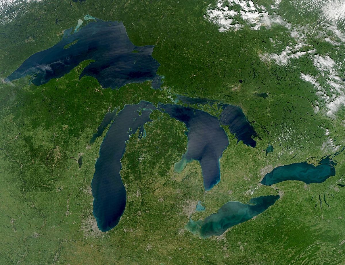
The Thirty Thousand Islands form an immense and complex coastline along the eastern side of Georgian Bay, which is a large bay of Lake Huron. While there are no formal administrative boundaries, the archipelago is generally understood to run from Beausoleil Island in the south to the French River Provincial Park in the north, spanning roughly 200 kilometres. The name is a poetic estimation rather than a precise count, reflecting the countless granite islands, islets, and shoals that create a maze of channels and sheltered harbours. This terrain is a classic manifestation of the Canadian Shield, where glaciers scraped the ancient granite bedrock clean, leaving behind a rugged terrain of rounded outcrops, glacial erratics, and thin soils. West of the core archipelago lie several larger islands, including the world's largest freshwater island, Manitoulin Island, as well as Giants Tomb Island, Hope Island, Beckwith Island, and Christian Island near the southern approach. The area's geology provides the foundation for its clear, deep waters and the characteristic windswept trees that grow in its shallow soils.
UNESCO Biosphere Reserve
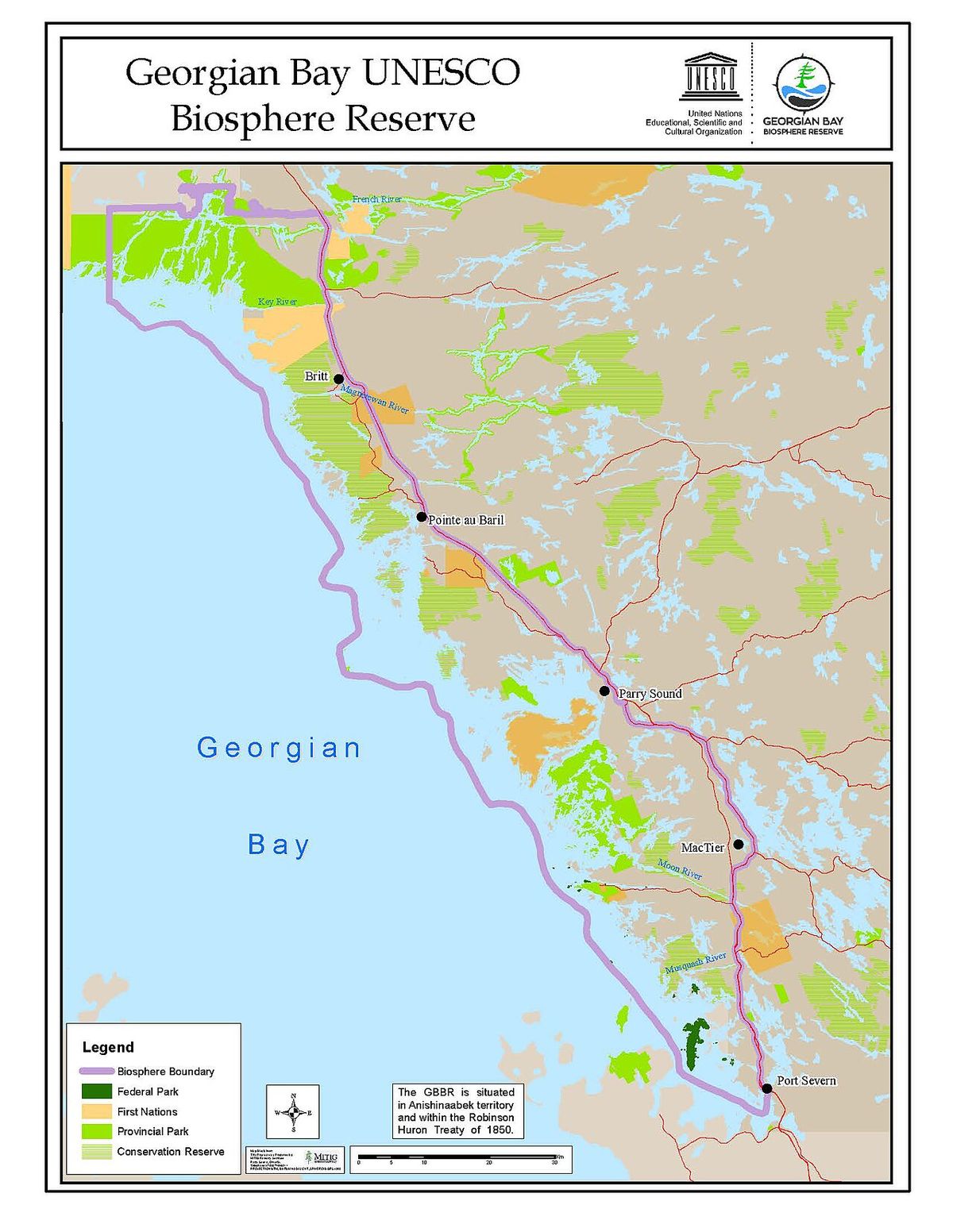
In 2004, UNESCO designated a significant portion of this region as the Georgian Bay Littoral Biosphere Reserve, also commonly called the Georgian Bay Biosphere Reserve. This designation covers 347,000 hectares and encompasses the archipelago's terrestrial and aquatic ecosystems along a 200 kilometre stretch from Port Severn to the French River. The reserve's mandate is to reconcile the conservation of biodiversity with its sustainable use, recognizing the area's ecological importance and the human communities within it. The biosphere model includes core protected areas, buffer zones, and transition areas where sustainable economic and human activity is encouraged. This status highlights the global significance of the Thirty Thousand Islands as a unique freshwater coastal environment, home to diverse plant and animal life adapted to the harsh, rocky conditions and the moderating influence of the Great Lakes. The reserve facilitates scientific research, monitoring, and education initiatives focused on the long-term health of this distinct ecosystem.
Cultural and Artistic Significance
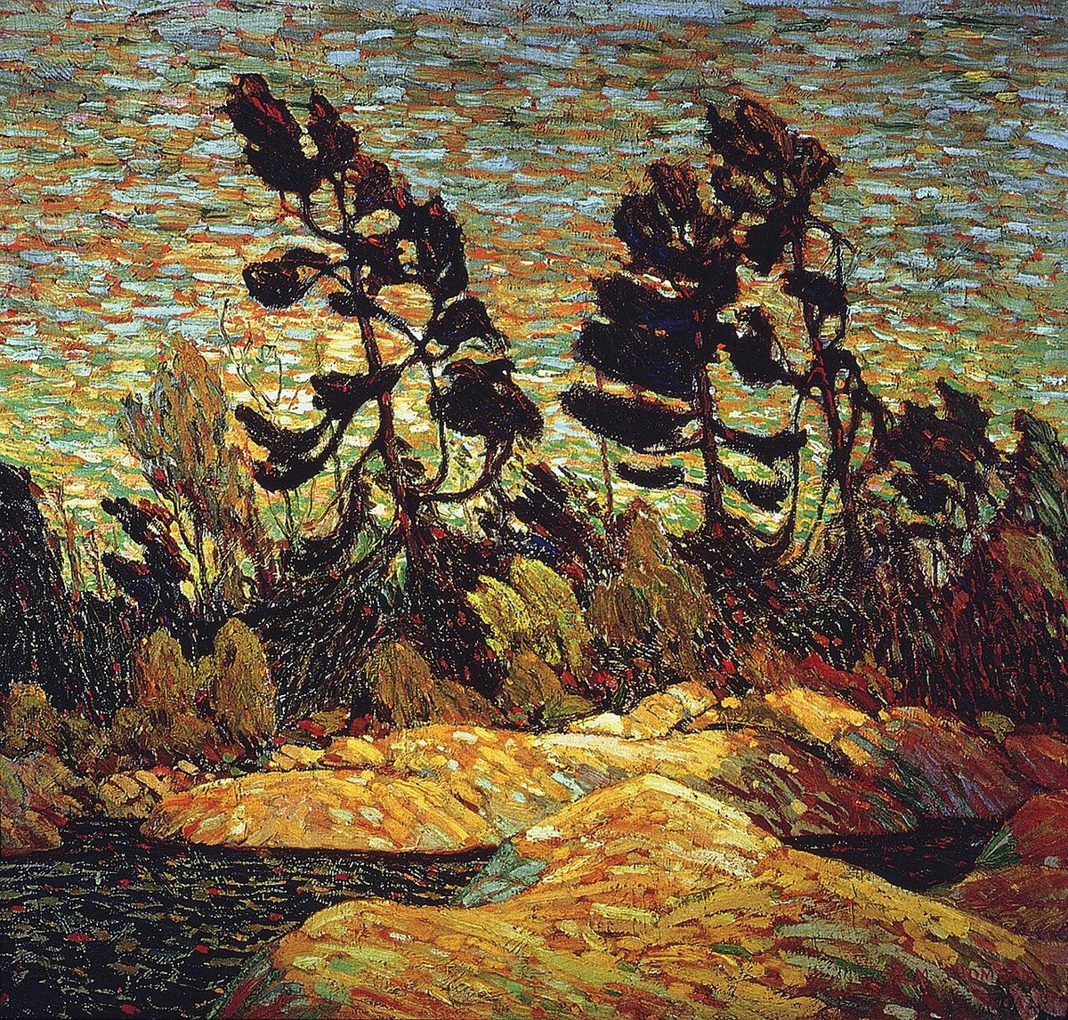
The distinct scenery of the Thirty Thousand Islands has left a deep imprint on Canadian culture, most notably through the work of the Group of Seven artists. During the early 20th century, painters such as Franklin Carmichael, A.Y. Jackson, Arthur Lismer, Frederick Varley, A.J. Casson, and Tom Thomson travelled to Georgian Bay to capture its distinctive features. They were drawn to the windswept pine trees clinging to granite shores, the brilliant blue waters, and the dramatic play of light across the rocky islands. At the time, access was primarily by train, as the road to areas like Killarney would not be built for several more decades. Their paintings, which often feature the islands and shoreline, helped define a visual identity for the Canadian wilderness and are celebrated as national treasures. The area continues to inspire artists, photographers, and visitors seeking a connection to this rugged and celebrated part of the country. The Group's work cemented the islands' status as a symbol of the Canadian north within the national consciousness.
Recreation and Tourism
The Thirty Thousand Islands region is a premier destination for outdoor recreation, offering a vast area for boaters, kayakers, canoeists, and anglers. The protected channels and countless bays provide ideal conditions for paddling and exploring by small craft, with many visitors bringing their own boats or renting them locally. Popular activities include cruising the scenic waterways, fishing for species like bass, pike, and muskie, and hiking on islands with maintained trails such as those in Georgian Bay Islands National Park. The area is dotted with marinas, lodges, and campgrounds, including those within various provincial parks, where visitors can pitch a tent along the shoreline. Wilderness camping on remote islands is a popular pursuit, allowing for immersion in the natural surroundings. Conservation and respectful use are emphasized, with visitors encouraged to follow Leave No Trace principles to protect the fragile ecosystems from the impacts of increased visitation.
Key recreational hubs and access points within the general region include Georgian Bay Islands National Park, centred on Beausoleil Island, Killarney Provincial Park known for its quartzite ridges, the historic town of Killarney, French River Provincial Park, and Parry Sound as a major supply centre. Many private marinas and outfitters provide boat rentals, fuel, and supplies for extended trips through the islands. Seasonal events and programs are often offered by Parks Canada and local communities, though access to more remote areas remains dependent on private watercraft. The region's appeal lies in its combination of accessible wilderness and the challenge of moving through its extensive waterways, which requires careful planning and knowledge of local conditions.
Ecology and Conservation
The ecosystems of the Thirty Thousand Islands are diverse and resilient, shaped by the harsh climate and granite bedrock. The terrestrial environment features stunted forests of white pine, red pine, jack pine, and hardy deciduous trees like oak and maple, along with a variety of mosses, lichens, and wildflowers that find purchase in rock crevices. The aquatic environment is equally rich, with wetlands, marshes, and shoals providing critical habitat for fish, amphibians, and aquatic plants like wild rice. The area supports numerous bird species, including migratory waterfowl, ospreys, and bald eagles, while mammals such as white-tailed deer, black bears, and river otters inhabit the larger islands. Conservation efforts are led by organizations like the Georgian Bay Land Trust and Georgian Bay Forever, which work to secure and protect key islands and shoreline properties through land acquisition and conservation easements. These efforts complement the protected status of the UNESCO Biosphere Reserve and various provincial and national parks, ensuring the long-term preservation of this unique archipelago. Ongoing scientific research within the biosphere reserve monitors water quality, species populations, and the impacts of climate change on this sensitive freshwater coast.
Distinction from the Thousand Islands
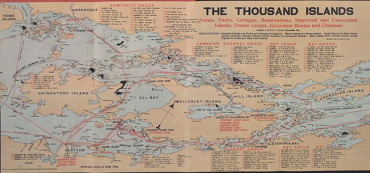
It is important to distinguish the Thirty Thousand Islands of Georgian Bay from the similarly named but geographically separate Thousand Islands region of the St. Lawrence River. While both are significant Canadian archipelagos, they differ in several key aspects. The Thirty Thousand Islands are located on Georgian Bay (Lake Huron) and are composed primarily of pink granite from the Canadian Shield. The Thousand Islands are situated in the St. Lawrence River, between Kingston and Brockville, and represent a geological transition zone between the Canadian Shield and the Adirondack Mountains. The Thousand Islands region is home to Thousand Islands National Park, established in 1904, which encompasses about 24.4 square kilometres across 20 islands and several mainland properties including a visitor centre at Mallorytown. In contrast, the Thirty Thousand Islands area includes different protected areas, such as Georgian Bay Islands National Park and the UNESCO Biosphere Reserve. Both regions offer exceptional boating and recreational opportunities but are distinct landscapes hundreds of kilometres apart, with the Thousand Islands being more accessible from major urban centres like Toronto, Ottawa, and Montreal.
Management and visitor information for the two areas are separate. For example, reservations for Thousand Islands National Park campsites open on specific dates, such as February 2, 2026, for the summer season between May 15 and October 12. The Thirty Thousand Islands region does not have a single centralized reservation system, as it is managed through multiple park jurisdictions and private operators. This fundamental geographical and administrative difference is crucial for visitors planning trips to either destination, as travel routes, available services, and the character of the scenery are not the same.
Access and Practical Information
Accessing the Thirty Thousand Islands primarily requires a boat, as the mainland coastline is rugged and much of the archipelago is only reachable by water. These towns offer public boat launches, marinas with seasonal docking, and outfitters that rent kayaks, canoes, and powerboats. There is no single park fee for the entire archipelago. Fees apply only within specific national or provincial parks, such as Georgian Bay Islands National Park. Visitors should prepare for variable weather conditions on Georgian Bay, which can change rapidly and bring strong winds that make boating hazardous. Essential supplies, including fuel, food, water, and navigation charts, must be obtained on the mainland, as services on the islands are extremely limited. Cell phone coverage is often unreliable in the channels between islands, so boaters should carry marine radios and detailed paper maps in addition to electronic devices.
Key considerations for planning a visit include checking Parks Canada bulletins for alerts on weather, wildlife, or water safety specific to Georgian Bay Islands National Park. Overnight camping on Crown land islands may be permitted in certain areas but is subject to regulations aimed at minimizing environmental impact. The peak season runs from late May to early October, with July and August being the busiest periods for boating traffic. Outside of this window, many marina services close, and conditions become more challenging for all but the most experienced boaters. Responsible practices, such as using pump-out stations for boat waste and avoiding the spread of invasive species, are critical for protecting the waterways. Planning a trip involves understanding the distances between supply points and the need for self-sufficiency while on the water.
Questions about Thirty Thousand Islands
What is the UNESCO Biosphere Reserve designation?
In 2004, UNESCO designated the Georgian Bay Littoral as a Biosphere Reserve. This covers 347,000 hectares along a 200 kilometre stretch of the eastern Georgian Bay coast from Port Severn to the French River. The designation aims to balance biodiversity conservation with sustainable human use through a model of core protected areas, buffer zones, and transition areas. It is a formal recognition of the area's global ecological significance as a distinct freshwater coastal ecosystem.
What are the main recreational activities in the area?
The primary activities are boating, kayaking, canoeing, fishing, hiking, and camping. The protected waters and complex coastline are ideal for exploration by small craft, with many visitors using private boats or local rentals. There are numerous provincial parks, Georgian Bay Islands National Park, and many marinas that serve as access points. Wilderness camping on remote islands is a popular way to experience the area's solitude and natural beauty.
Is this the same place as Thousand Islands National Park?
No, they are different locations. The Thirty Thousand Islands are on Georgian Bay (Lake Huron). Both are archipelagos but are geographically separate, with distinct geology, park systems, and management. Confusion arises only from the similar names.
Where exactly are the Thirty Thousand Islands located?
The Thirty Thousand Islands are located mainly along the east side of Georgian Bay, part of the Great Lakes, in Ontario, Canada. The area stretches approximately 200 kilometres along the eastern coast from Port Severn to the French River. While it has no formal geographical boundaries, its general location runs from Beausoleil Island in the south to the French River Provincial Park in the north. The archipelago is part of the UNESCO designated Georgian Bay Littoral, also called the Georgian Bay Biosphere Reserve, an area of 347,000 hectares. This region is distinct from the Thousand Islands on the St. Lawrence River.
Why is the area called the Thirty Thousand Islands?
The area is called the Thirty Thousand Islands because it is the world's largest freshwater archipelago. The name reflects the immense number of islands, islets, and rocky outcrops found along this section of Georgian Bay. While the count is an estimate, it conveys the vast and dense nature of this island grouping. The islands are a characteristic feature of the Canadian Shield landscape, known for their distinctive windswept trees and large granite boulders. This unique geography has made it a significant natural and cultural landmark in Ontario.
How did the Thirty Thousand Islands influence Canadian art?
The Thirty Thousand Islands and Georgian Bay shoreline greatly influenced Canadian art by inspiring the Group of Seven painters. Artists like Franklin Carmichael, A.Y. Jackson, Arthur Lismer, Frederick Varley, A.J. Casson, and Tom Thomson all painted extensively in this region. They were drawn to the landscape's distinctive windswept trees and large boulders on the pink granite shores. At the time, they accessed the area by train, as the road to places like Killarney, Ontario, was not yet built. Their paintings of this well-known Canadian Shield scenery helped define a national artistic identity.
Sources and further reading
- Thirty Thousand Islands (Wikipedia)
- Thousand Islands National Park (parks.canada.ca)
Checked by the Your Space Hamilton desk. Last updated 2026-10-30.