St. Joseph Island
St. Joseph Island is a large freshwater island in the northwestern part of Lake Huron, within the Canadian province of Ontario. With an area of 365 square kilometres, it is the second largest island on Lake Huron and the sixth largest lake island in the world. The island is a significant centre for maple syrup production, responsible for approximately 18 per cent of Ontario's output, and is a popular tourist destination known for its historic sites, outdoor recreation, and scenic communities like Richards Landing and Hilton Beach. Its strategic location played a crucial role in the early fur trade and the War of 1812, where Fort St. Joseph served as the launching point for the first British North American victory of that conflict.
Geography and Access
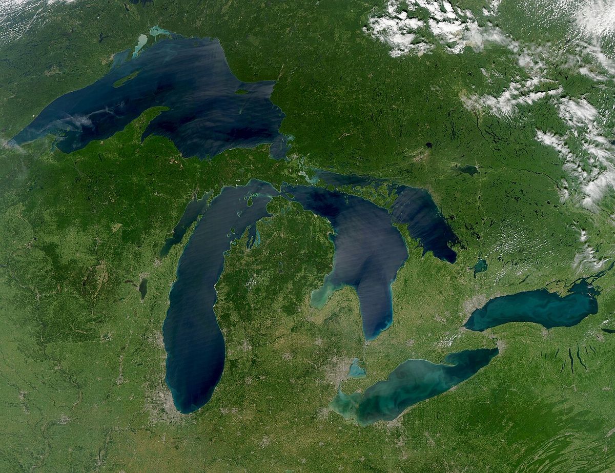
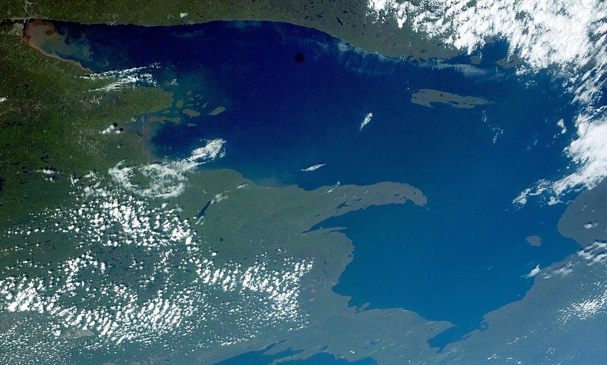
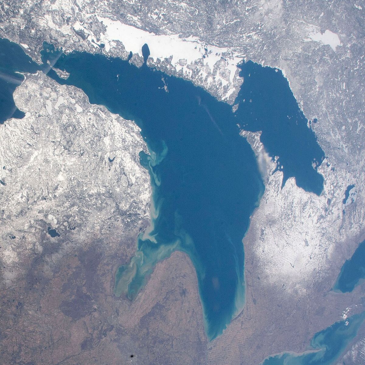
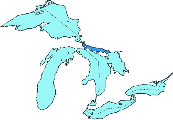
St. Joseph Island is situated in the North Channel of Lake Huron, approximately 45 kilometres southeast of Sault Ste. Marie and 225 kilometres southwest of Sudbury. The island forms part of the Manitoulin chain and is characterized by rolling hills, hardwood forests, and a rocky shoreline with relatively deep water suitable for large vessels. Its location places it centrally within the waterways connecting Lake Huron and Lake Superior, making it a natural waypoint for navigation between these two Great Lakes. The island is connected to the Ontario mainland by a toll-free bridge, which has provided easy road access since 1972. This connection via Highway 548 off Highway 17 has been instrumental in developing the island's tourism and agricultural industries by facilitating the transport of goods and visitors. The island's physical characteristics support diverse outdoor activities, with the Lake Huron waterfront offering boating and fishing, while the interior roads are popular for cycling and touring. The Central Algoma Freshwater Coalition has produced maps detailing suggested cycling, hiking, and cross-country skiing routes across the island's terrain.
Early History and Indigenous Presence
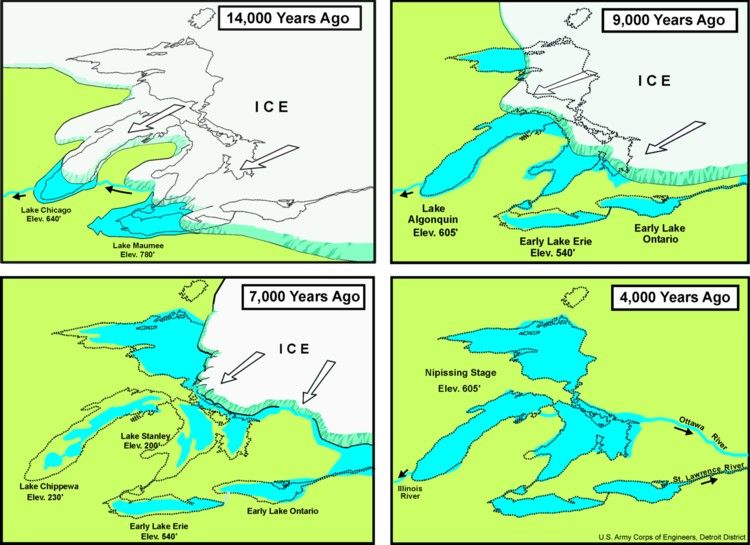
Archaeological evidence suggests minimal human activity on St. Joseph Island prior to the 17th century, with little found to confirm settlement, farming, or hunting from earlier periods. The first humans to potentially see the island were the Plano culture hunter-gatherers, who migrated through the Great Lakes basin between 9000 and 6000 BCE following bison and other animals into areas revealed by retreating glaciers. By about 5000 BCE, the island likely formed a boundary between the Laurentian Archaic peoples from the southeast and the Shield Archaic peoples from the north. By the time of European contact in the early 17th century, the North Channel area was shared by Algonkian-speaking nations, including the Ojibwe, Odawa, and Potawatomi, whose ancestors had arrived from the east around 1200. The Ojibwe knew the island as 'Anipich' or 'Payentanassin,' meaning 'place of the hardwood trees.' European exploration began with Étienne Brûlé's voyage in 1621 along the north channel of Lake Huron, and the island first appeared on European maps in the 1670s, labelled 'Anipich' by French explorer René de Bréhant de Galinée. By the 1740s, Jesuit missionaries had named it 'Saint Joseph,' a name that appears on a 1735 French map believed to be the first to use 'Isle St. Joseph.' A detailed 1744 map by French geographer Jacques Nicolas Bellin depicted canoe and batteau routes near the island but showed no mission or settlement.
Fort St. Joseph and the War of 1812
Following the Treaty of Paris in 1783, the new border between the United States and British North America left the status of islands in the St. Marys River unclear, with some maps even appearing to divide St. Joseph Island in half. When the Jay Treaty forced the British to abandon Fort Mackinac on the American side by June 1796, they sought a new western outpost to protect the fur trade and maintain influence with First Nations. Despite initial opposition from officials like Lord Dorchester, British authorities selected St. Joseph Island for its deep shoreline, preferred over mainland sites like Thessalon and Sault Ste. Marie. An advance party led by Lieutenant Andrew Foster established a camp in April 1796, and the British formally purchased the island from the Ojibwe in the St. Joseph Island Treaty of June 30, 1798, for £1,200 Quebec currency in trade goods, an annual gift exchange, and the right for the Ojibwe to continue harvesting and burying their dead there. Construction of Fort St. Joseph began that summer under Lieutenant George Landmann, with instructions to build a blockhouse, guard house, powder magazine, Indian council house, bake house, and storehouse enclosed by a stockade, a project that took three summers to complete. The fort became a vital, though difficult, trading post and settlement, with soldiers and settlers enduring harsh winters, drafty buildings, and frequent desertions. At the outbreak of the War of 1812, it was the westernmost British garrison in Upper Canada. In a key early action, Captain Charles Roberts led a force of 160 Canadian voyageurs and First Nations fighters, along with 30 British regulars, from the fort to capture the undermanned Fort Mackinac on July 17, 1812, securing the first British victory of the war. The abandoned Fort St. Joseph was burned by American forces in July 1814 and was not rebuilt after the war due to shifting strategy and the decline of the fur trade. Its ruins were designated a National Historic Site in 1974, administered by Parks Canada, which opens the site seasonally from June to September.
Border Settlement and 19th Century Development
The post-war Treaty of Ghent in 1814 mandated a precise survey of the Great Lakes border to resolve the territorial ambiguities that had contributed to the conflict. Beginning in August 1820, two teams of surveyors, including British explorer and cartographer David Thompson, mapped the area of St. Joseph Island, Drummond Island, and the Manitoulin islands, facing challenges due to the poorly known shores and depths of the channels. Commissioners meeting in New York City in November and December 1821 used principles of navigation and equitable island division to assign St. Joseph Island and Cockburn Island to British North America, while granting Drummond Island to the United States. The final border along the western shore of St. Joseph Island was confirmed by the Webster-Ashburton Treaty of 1842, which described the line along the ship channel between St. Joseph and St. Tammany (Neebish) Islands. With borders settled and the Great Lakes demilitarized after the Rush-Bagot Treaty of 1817, European settlement became more viable. Major William Kingdom Rains attempted to establish the Milford Haven colony in 1834, purchasing over 2,200 hectares with a store and sawmill, but the settlement struggled to attract colonists and failed due to a lack of capital. The island remained sparsely populated for decades. A survey team in the 1820s reported finding only a single Ojibwe widow's lodge and described the island as a jungle containing bears and other wild animals. Permanent settlement gradually increased in the latter half of the 19th century in the communities that would become Richards Landing and Hilton Beach, driven by logging, fishing, and the beginnings of agricultural development.
Modern Economy and Maple Syrup Production
St. Joseph Island's modern economy is anchored by agriculture, tourism, and small-scale manufacturing. The island is Ontario's largest maple syrup production centre, with nearly 30 companies creating about 18 per cent of the province's supply. This industry is celebrated each spring with a Maple Syrup Festival featuring pancake breakfasts and production tours. The Township of Jocelyn is home to one of the island's largest producers, and every spring people travel to witness the maple syrup process. Tourism is a major seasonal driver, supported by the island's natural beauty and recreational opportunities like boating, cycling, and fishing. The island is governed by four municipalities: the Township of St. Joseph, the Township of Jocelyn, the Township of Hilton, and the Village of Hilton Beach. The two main population centres are Richards Landing, with approximately 400 residents, and Hilton Beach, with about 200. These communities offer full services, including marinas, shops, restaurants, and accommodations like the full-service campground at 1300 P Line in Richards Landing, which offers sites from May 15 to October 15. Local businesses include Stubbees Beestro, which serves food and desserts flavoured with local honey, and Mountain Maple Products, known for premium maple syrup and treats.
Annual Events and Cultural Activities
The island hosts a full calendar of community and artistic events throughout the year that support local artists and producers. Major annual gatherings include the Go North Music Festival held over two days in late July and the Harvest Festival on the first Saturday of September, which includes live music, antique tractor displays, children's activities, wagon rides, and log cutting demonstrations. The Apple Fest in Richards Landing in September features family-friendly games, live entertainment, and a signature sandcastle-building competition. The Hilton Beach Classic Car Show on the fourth Saturday of July displays around 100 original, restored, and specialty automobiles at the Hilton Beach waterfront. Arts at the Dock is a multi-media art exhibition held at the Hilton Beach Marina on the third Sunday of July, presenting works in painting, pottery, and photography. The Harvest of Artists is an outdoor fine art and craft show held at the Centennial Grounds in Richards Landing on August 22, 2026, featuring artists in mediums like custom wood furniture, painting, and sculpture. The Country Road Open House is a self-guided tour of farms, rural studios, and shops across the island the weekend prior to Thanksgiving, allowing visitors to meet local producers and artisans. The Winter Solstice Celebration in December includes a live singalong, bonfire, hot chocolate, a candle-lit Maple Forest trail, and a sliding hill at the Centennial Grounds in Richards Landing. The 'Just Passin' Through' concert series, developed in 2013 by the Richards Landing Arts & Cultural Events Committee, allows travelling artists to perform at the local hall, with proceeds shared between the artist and the committee.
Key annual events on St. Joseph Island foster a strong sense of community and support local artists and producers. The island's location on the Great Lakes and its availability of local services have made it a destination for tourists. The island is the largest centre of maple syrup production in Ontario, with nearly 30 companies producing 18 per cent of the province's maple syrup. This industry is a significant part of the island's cultural and economic life.
- Go North Music Festival: July 24-25, 2026.
- Hilton Beach Classic Car Show: Fourth Saturday of July (Show and Shine).
- Arts at the Dock: Third Sunday of July at the Hilton Beach Marina, 3130 Marks Street.
- Harvest of Artists: Saturday, August 22, 2026, at the Centennial Grounds in Richards Landing.
- Apple Fest: Saturday, September 19, 2026, at WI Park in Richards Landing.
- Harvest Festival: First Saturday of September.
- Country Road Open House Tour: October 4-5, 2026 (weekend prior to Thanksgiving).
- Winter Solstice Celebration: December event from 7-8:30pm at the Centennial Grounds.
These events foster a strong sense of community and support local artists and producers. The island's ease of reach by road and boat has made it a destination for tourists and cottagers in northeastern Ontario. The island has two population centres, Richards Landing with approximately 400 residents and the village of Hilton Beach with approximately 200 people. This community structure supports local cultural and artistic activities.
Recreation, Attractions, and Visitor Services
St. Joseph Island offers a wide array of recreational activities that capitalize on its natural setting. The 68-kilometre paved loop road is renowned among cyclists for its scenic, rolling terrain, low traffic, and canopied side roads, with detailed cycling route guides and maps available for download. The Lake Huron shoreline and connected waterways are a boater's paradise, with full-service marinas like the one in Hilton Beach offering fuel, shower facilities, and a Boater's Lounge open seven days a week during the season. Fishing is popular year-round for species like northern pike, trout, bass, and salmon in the surrounding waters. In winter, the island becomes a hub for snowmobiling, with an extensive trail network leveraging its location between Ontario and Michigan. Key attractions include Fort St. Joseph National Historic Site, which opens for the visitor season from early June to late September, offering daily fur trade demonstrations. Other notable sites include the St. Joseph Island Museum, Adcocks' Woodland Gardens, and the Brook Nadjiwon memorial sunflower garden. The island's many public beaches, parks, and hiking trails provide ample opportunity for outdoor exploration, and it connects to the larger Great Lakes Waterfront Trail network. Visitor services include a range of accommodations, such as the property at 9181 Highway 17 in Bruce Mines which offers free parking and bicycles, campgrounds with boat launches, and dining options like Gilbertson's Pancake House. For information, visitors can contact the Township of St. Joseph office at 705-246-2625 extension 200 or consult resources from the St. Joseph Island Chamber of Commerce and Algoma Country tourism.
Notable historic sites on the island include Fort St. Joseph, which played an important role for First Nations and Europeans in the early fur trade. The fort was a staging point for the first victory for British North America in the War of 1812. The ruins of Fort St. Joseph became a National Historic Site administered by Parks Canada in 1974. The island is also the subject of one of the Upper Canada Land Surrender treaties conducted by the British government and First Nations.
- Fort St. Joseph National Historic Site: A Parks Canada site opening June 3, 2025, and closing September 30, 2025.
- Adcocks' Woodland Gardens: A noted nature and park location.
- Brook Nadjiwon memorial sunflower garden: A commemorative garden space.
- St. Joseph Island Museum: A local heritage museum.
- Mountain Maple Products: A producer known for premium maple syrup and treats.
- Hilton Beach Marina: A full-service marina at 3130 Marks Street, Hilton Beach.
- Centennial Grounds: A public event space in Richards Landing used for the Harvest of Artists and Winter Solstice Celebration.
The island's location on the Great Lakes has made it a destination for tourists and cottagers. Its ease of reach by road and boat enhances its appeal for active visitors. The island lies approximately 45 km south east of the city of Sault Ste. Marie and 225 km south west of Sudbury. This accessibility, combined with the availability of local services, supports recreational activities.
Questions about St. Joseph Island
Where is St. Joseph Island located?
St. Joseph Island is located in the North Channel of Lake Huron in Ontario, Canada. It is approximately 45 kilometres southeast of Sault Ste. Marie and 225 kilometres southwest of Sudbury. The island is connected to the Ontario mainland by a toll-free bridge off Highway 17, via Highway 548.
What is St. Joseph Island known for?
St. Joseph Island is known as the largest centre of maple syrup production in Ontario, with nearly 30 companies producing 18 per cent of the province's maple syrup. It is known for its role in the early fur trade and as a staging point for the first British North American victory in the War of 1812. Its location on the Great Lakes and ease of access have made it a tourist destination. The island is also known for the St. Joseph Island Treaty, one of the Upper Canada Land Surrender treaties.
What are the main communities on St. Joseph Island?
The main communities on St. Joseph Island are Richards Landing, with approximately 400 residents, and the village of Hilton Beach, with approximately 200 people. These are the island's two population centres. The island is part of the Canadian province of Ontario. It lies approximately 45 km south east of Sault Ste. Marie and 225 km south west of Sudbury.
What happened at Fort St. Joseph?
It served as a trading post and the westernmost garrison in Upper Canada. At the start of the War of 1812, a force launched from the fort captured the American Fort Mackinac on July 17, 1812, marking the first British victory of the war. The fort was burned by American troops in July 1814 and never rebuilt. Its ruins are now a National Historic Site managed by Parks Canada, open seasonally from June to September.
What events can I attend on St. Joseph Island?
The island hosts numerous annual events. Major 2026 events include the Go North Music Festival in late July, the Harvest Festival on the first Saturday of September, and the Apple Fest in Richards Landing on September 19. Other popular events are the Hilton Beach Classic Car Show in July, the Arts at the Dock exhibition, the Harvest of Artists show on August 22, and the Country Road Open House tour in October. A Winter Solstice Celebration with a bonfire and singalong is also held in December.
When is Fort St. Joseph National Historic Site open?
For the 2026 visitor season, Fort St. Joseph National Historic Site is scheduled to open on June 3 and close on September 30. Its regular hours of operation are from 10:00 a.m. to 5:00 p.m., and it is closed on Mondays and Tuesdays. The site may also be accessible by pre-arranged appointment by calling ahead. The season features daily fur trade demonstrations and historical interpretations of the site where the War of 1812 began.
Sources and further reading
- St. Joseph Island (Wikipedia)
- Festivals & Events (stjosephtownship.com)
- St. Joseph Island, Ontario (algomacountry.com)
- St. Joseph Island | Great Lakes Waterfront ... (waterfronttrail.org)
Checked by the Your Space Hamilton desk. Last updated 2026-10-28.