Weston, Toronto
Weston is a historic neighbourhood and former town in northwest Toronto, Ontario, bounded by the Humber River, Eglinton Avenue, Jane Street, and Highway 401. Originally incorporated as a village in 1881, it became a town in 1914 before being absorbed into the Borough of York in 1967 and finally the amalgamated City of Toronto in 1998. The area retains a distinct small-town character along its historic main street, Weston Road, and is undergoing significant transformation driven by major transit investments and a comprehensive planning study. Weston's diverse community, rich industrial heritage, and extensive river valley parkland make it a unique and evolving part of Toronto's urban fabric.
Geography and Character
Weston is situated in northwest Toronto, with its borders defined by the Humber River to the west, Eglinton Avenue to the south, Jane Street to the east, and the highways 401 and 400 corridors to the north. The historic core of the community is centred on Weston Road, just north of Lawrence Avenue, which functions as the main street with many small businesses and services. The neighbourhood's building stock is a mix of Victorian-era homes east of the railway tracks and mid-20th century brick commercial buildings along Weston Road, reflecting its earlier status as an independent town. Mature trees, some over a century old, line many residential streets, particularly in areas east of the rail corridor. The community is also dotted with architecturally significant churches and public buildings, including the heritage-designated Weston Public Library, which originated as a Carnegie library in 1914.
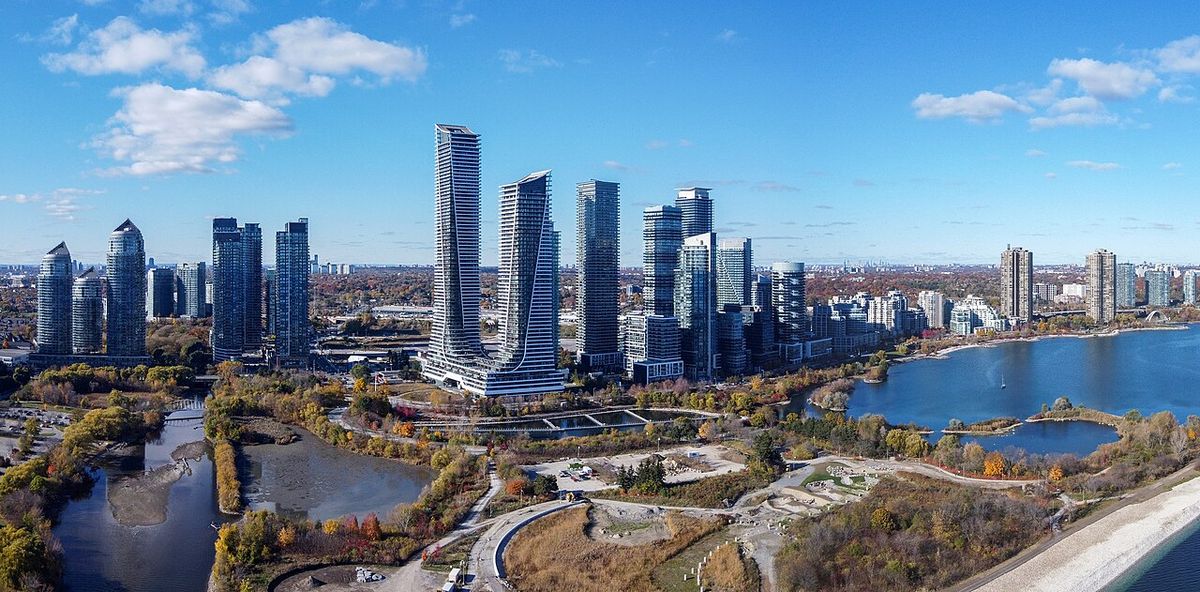
The area's character is further shaped by the Humber River valley, which provides a significant green corridor and recreational space. Unlike other former Toronto villages like Leaside, Weston was not a planned satellite town but grew organically around industry and transportation routes. This has resulted in a generally suburban streetscape that is contiguous with the inner city to the southeast along Weston Road. Recent years have seen infill development on former industrial lands, introducing new housing stock to the area. The Weston in Gear Planning Study, launched in the fall of 2024, is actively engaging the community to create a renewed vision for the area's built form, public spaces, and streetscapes.
History
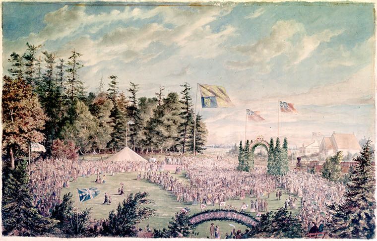
The Weston area is located on the traditional territory of the Wendat, Haudenosaunee, and Mississaugas Nations. European settlement began in the 1790s with the establishment of a saw mill on the west bank of the Humber River within Etobicoke Township. In 1815, mill owner James Farr named the growing settlement after his birthplace, Weston, Hertfordshire. The community initially developed on both sides of the river until a catastrophic flood in 1850 destroyed the west bank settlement, the site of the present-day Weston Golf and Country Club. Growth shifted decisively to the east bank following improvements to Main Street, later Weston Road, and the arrival of the Grand Trunk Railway in 1856.
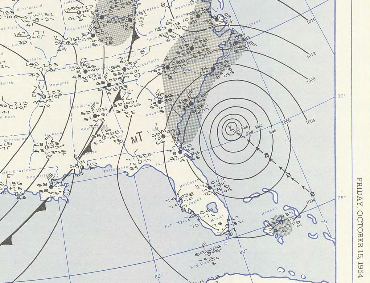
Weston developed into an important industrial centre for the Toronto region over the late 19th and early 20th centuries, symbolized by the old CCM bicycle factory on Lawrence Avenue. The settlement was incorporated as a village in 1881 and achieved town status in 1914. A major modern event was Hurricane Hazel in October 1954, which caused severe flooding in the Humber River valley, destroying the Lawrence Avenue bridge and washing away part of Raymore Drive. The disaster led to the conversion of low-lying areas into parkland and changes to provincial zoning to restrict floodplain development. In 1967, Weston became part of the Borough, later the City, of York, and was fully amalgamated into the new City of Toronto in 1998. During amalgamation, community lobbying successfully preserved local street names like Church, King, and John Street despite duplicates existing downtown.
- 1790s: First European settlement with a saw mill on the Humber River.
- 1815: James Farr names the settlement Weston.
- 1850: Devastating flood destroys the west bank settlement.
- 1856: Grand Trunk Railway arrives, spurring growth.
- 1881: Incorporated as the Village of Weston.
- 1914: Incorporated as the Town of Weston. Weston Public Library opens.
- October 1954: Hurricane Hazel causes major flooding.
- 1967: Amalgamated into the Borough of York.
- 1998: Becomes part of the amalgamated City of Toronto.
Demographics and Community
According to the 2016 census, Weston was home to 17,992 residents. The neighbourhood is characterized by considerable linguistic and ethnic diversity. While 60% of the population speaks English as a first language, other prominent languages include Spanish (6.4%), Portuguese (4.8%), Somali (4.3%), and Italian (3.1%). The racial and ethnic composition reflects a multicultural community with significant Black, White, and Latin American populations. Specific ethnic origins reported include Italian (8.8%), British (8.3%), Scottish (7.4%), Jamaican (13.1%), and Somali (6.0%). The area also has populations identifying as Latin American (7.7%), South Asian (4.3%), and Filipino (3.3%).
Weston is part of the larger Greater Weston Mount Dennis (GWMD) area, a cluster of seven Neighbourhood Improvement Areas with a combined population of approximately 91,000. Ethnic and cultural diversity are defining features, supported by a network of owner-operated businesses and strong civic engagement. The area attracts many residents, including newcomers, due to its relative affordability, access to green spaces, and multicultural amenities. In 2026, community roundtable discussions highlighted concerns about housing affordability, displacement, and preserving the presence of Black communities and businesses amid ongoing development. Comparative metrics for Weston in 2026 placed it below the Toronto median in several categories, scoring 37 out of 100 on safety and 24 out of 100 on property value, though it scored at the 53rd percentile for accessibility, with strong grocery access.
Transportation and Development
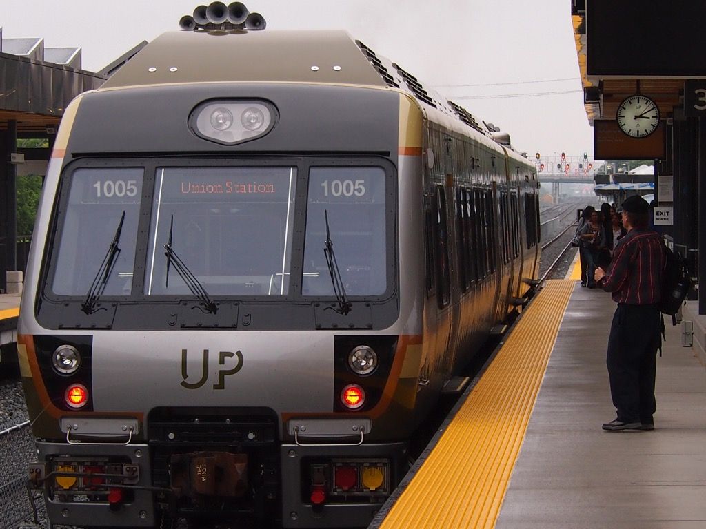
Weston is served by several major arterial roads, including Lawrence Avenue West and Weston Road. Public transit is provided by multiple Toronto Transit Commission bus routes, such as the 32 Eglinton West, 35 Jane, 52 Lawrence West, and 89 Weston, all of which have been accessible since the retirement of the last non-accessible buses in December 2011. The neighbourhood is a significant transit hub due to the Weston GO Station at Weston Road and Lawrence Avenue. This station is served by the GO Transit Kitchener line and the Union Pearson Express (UP Express), providing all-day service to Toronto Pearson International Airport and downtown Toronto's Union Station.
The final design placed the tracks in a trench with bridges overhead to maintain connectivity, and a rail deck park was created to expand a school playground. This transit investment is now catalyzing substantial redevelopment. The Greater Weston Mount Dennis area has over 40 development applications proposing more than 27,000 residential units. Major projects include the mixed-use redevelopment of 25 Photography Drive with 2,356 units and the Westside Mall redevelopment at Eglinton Avenue planning over 4,000 units. The Weston in Gear Planning Study, directed by the City Council in 2016 and commencing active phases in 2024, is guiding this growth with community input on built form, public spaces, and community benefits.
| Development Project | Lead Proponent | Key Details |
|---|---|---|
| 25 Photography Drive | Choice Properties | Seven high-rises, 2,356 units, retail space |
| Westside Mall Redevelopment | SmartCentres REIT | Over 4,000 units, 330,000 sq m retail, parkland |
| Mount Dennis Quilt (1250 Weston Rd) | Learning Enrichment Foundation | 14-storey affordable rental, 175 units |
Recreation and Landmarks
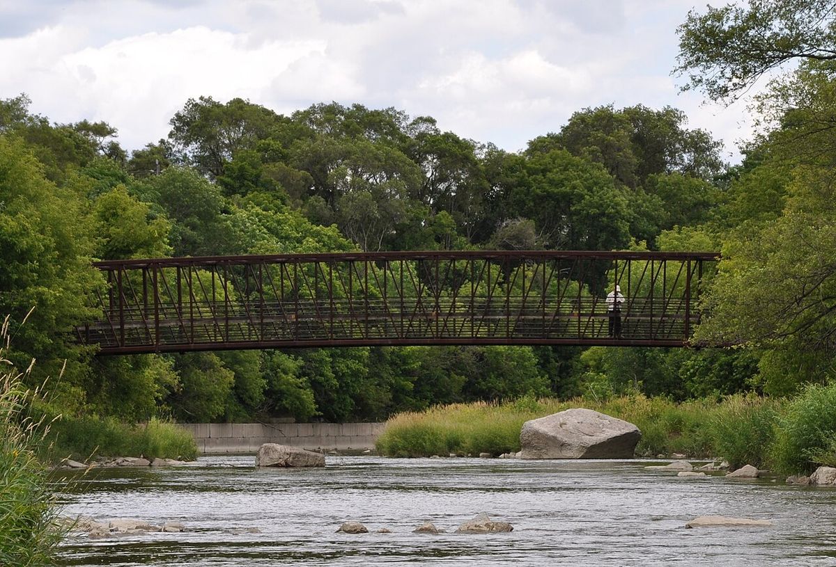
Weston offers a variety of recreational facilities and community events. The weekly Weston Farmers' Market operates from mid-May to the end of October near the village centre. Seasonal events include a Harvest Festival around Thanksgiving and the Weston Santa Claus Parade each November. The neighbourhood contains many small parks, with the most notable being Cruickshank Park in the Humber River valley. This park features mature trees, paved bicycle paths that connect south to Lake Ontario, weeping willows, and local wildlife including beavers, frogs, and herons. The valley walls expose sedimentary rock from the last glacial period, and this stone was historically used for retaining walls throughout the town.
Lions Park, south of Lawrence Avenue, is a major 22.13-acre sports facility with fields for football, rugby, soccer, and baseball, plus tennis courts, an ice rink, a swimming pool, a basketball court, and a skatepark. The Weston Lions Arena, originally known as Weston Arena, opened in 1949 with a pool added in 1959. It has hosted junior hockey teams like the Toronto Dixie Beehives and is currently home to the Weston Minor Hockey League and the Weston Dodgers. Heritage landmarks include Inverary Cottage, built in 1835 and the oldest existing building, and the Weston Plank Road building on Weston Road, the oldest commercial building. The community has advocated for the designation of historical districts to preserve its architectural heritage.
- Cruickshank Park: Extensive river valley park with bike trails and wildlife.
- Lions Park: 22.13-acre multi-sport facility with a pool and arena.
- Weston Lions Arena: Opened 1949, home to local hockey leagues.
- Weston Farmers' Market: Weekly market from May to October.
- Weston Santa Claus Parade: Annual November event.
- Inverary Cottage: Oldest building, constructed in 1835.
- Weston Public Library: Heritage Carnegie library opened in 1914.
Notable Residents
Weston has been home to a variety of notable individuals from sports, entertainment, and public life. The neighbourhood's connection to hockey is particularly strong, having produced or been home to several National Hockey League figures. Other residents have gained prominence in music, television, and military service, reflecting the area's diverse cultural contributions. The list includes Hall of Fame hockey player Adam Oates, rapper Drake, who referenced the area in his music, and former Chief of the Defence Staff Thomas J. Lawson.
- Jason Allison: Professional ice hockey player.
- Mikey Bustos: YouTuber and content creator.
- Dalbello: Recording artist, songwriter, and voice actress.
- Drake: Rapper and singer who mentions Weston in songs like "God's Plan" and "Weston Road Flows".
- Thomas J. Lawson: Former Royal Canadian Air Force pilot and Chief of the Defence Staff (2012 to 2015).
- Mike Liut: Professional ice hockey goaltender.
- Raine Maida: Lead vocalist and founding member of the band Our Lady Peace.
- Paul Martini: Pairs figure skater and Olympian.
- Adam Oates: Hall of Fame professional ice hockey player and coach.
- Bob Pulford: Professional ice hockey player and executive.
- Craig Ramsay: Professional ice hockey coach and former player.
- Donovan "Razor" Ruddock: Professional boxer.
- Joseph Tyrrell: Geologist, cartographer, and mining consultant.
- Elwy Yost: Television host for TV Ontario's Magic Shadows and Saturday Night at the Movies.
Questions about Weston, Toronto
Where is Weston located in Toronto?
Weston is situated in northwest Toronto. Its boundaries are generally defined as south of Highway 401, east of the Humber River, north of Eglinton Avenue, and west of Jane Street. The historic and commercial heart of the neighbourhood is along Weston Road, just north of Lawrence Avenue West. This area retains a distinct main street feel from its days as an independent town.
What transit options are available in Weston?
Weston is well-served by public transit. The Toronto Transit Commission operates several bus routes through the area, including the 32, 35, 52, and 89. The key hub is the Weston GO Station at Weston Road and Lawrence, which is fully accessible. This station provides service on the GO Transit Kitchener line and the Union Pearson Express, offering direct connections to Toronto Pearson International Airport, downtown Union Station, and points in between.
What is Weston known for historically?
Weston is historically known as a former independent town and an important industrial centre for the Toronto area. Its symbol, an outline of a classic bicycle, references its manufacturing heritage, particularly the old CCM bicycle factory. The town was incorporated in 1881 and grew due to the railway and its location on the Humber River. It is also remembered for the impact of Hurricane Hazel in 1954, which caused severe flooding and led to changes in provincial floodplain management.
Is Weston a safe neighbourhood?
Safety metrics for Weston, as of 2026, show it scores below the Toronto median, with a rating of 37 out of 100, placing it in the 23rd percentile among city neighbourhoods. Its strongest signal is for fire-service access. Community reports indicate that crime rates have dropped significantly since 2009 due to local involvement. As with any urban area, safety can vary, and prospective residents are advised to research specific areas within the broader neighbourhood.
What is the Weston in Gear Planning Study?
The Weston in Gear Planning Study is a planning framework study being undertaken by the City of Toronto for the Weston area. Directed by City Council in March 2016, the study will engage with the local community to create a renewed vision and plans for built form, public field, streetscapes, and community benefits. The study area is bounded by the CN Rail Corridor to the north, the Humber River to the west, and specific streets to the east and south, and it includes the Weston Major Transit Station Area. This initiative aims to guide future development and growth in the neighbourhood over the coming decades.
What are the main parks in Weston?
The main parks in Weston are Cruickshank Park and Weston Lions Park. Cruickshank Park is located in the Humber River valley and is known for its mature trees, paved bicycle paths that connect to Lake Ontario, and wildlife such as beavers, herons, and salmon. Weston Lions Park, situated south of Lawrence Avenue, covers 22.13 acres and contains extensive sports facilities for football, rugby, soccer, tennis, and baseball, as well as an ice rink, swimming pool, basketball court, and skatepark. Lions Park also features a memorial related to the 1954 Hurricane Hazel flood, incorporating the original footing of a destroyed bridge.
Sources and further reading
- Weston, Toronto (Wikipedia)
- Weston, Toronto: Safety, Prices and Scores 2026 (pickyourplace.app)
- Weston in Gear Planning Study (toronto.ca)
- The Future of Greater Weston Mount Dennis: Mixed-Use ... (unitedwaygt.org)
- Weston (Toronto) - David Coffey (davidcoffey.ca)
Checked by the Your Space Hamilton desk. Last updated 2026-10-25.