The Glebe
The Glebe is a historic and affluent neighbourhood located immediately south of Downtown Ottawa, Ontario. Bordered by the Queensway to the north and the Rideau Canal to the east and south, it is a central community within the federal and provincial electoral district of Ottawa Centre. Known for its strong community identity, active commercial strip along Bank Street, and significant cultural landmarks like Lansdowne Park, The Glebe is one of Ottawa's most desirable residential areas. As of the 2016 census, the neighbourhood was home to 13,055 residents.
Geography and Boundaries
The Glebe occupies a distinct peninsula-like area in central Ottawa. This definition includes two distinct sub-areas: the Glebe Annex and the Dow's Lake neighbourhood. The Glebe Annex lies west of Bronson Avenue, north of Carling Avenue, east of LeBreton South Street, and south of the Queensway. The Dow's Lake area is situated north of the Rideau Canal, east of Dow's Lake, south of Carling Avenue, and west of Bronson Avenue. Two narrow bodies of water, Patterson Creek and Brown's Inlet, extend from the Rideau Canal into the heart of the neighbourhood, lined with parks and some of the city's most expensive homes. The neighbourhood's layout, with water on three sides, creates a distinct sense of place and contributes to its desirability and high property values.
Historical Development
The neighbourhood's name originates from its origins as a clergy reserve. In the 1837 survey of Ottawa, a 178-acre parcel was deeded by the Crown to St. Andrew's Presbyterian Church, with such church lands historically termed a 'glebe'. The area was known as 'the glebe lands of St. Andrew's Presbyterian Church' until real estate agents simplified it to 'The Glebe' when development began in 1870. The original development area was bounded by Carling Avenue, Fifth Avenue, Main Street, and Bronson Avenue. The city limits expanded south to the Rideau Canal in 1889, formally incorporating The Glebe. The arrival of the Canada Atlantic Railway terminal in 1882 and the opening of Lansdowne Park for the Central Canada Exhibition in 1888 spurred growth in the southern section of the city. The introduction of electric streetcars along Bank Street in 1891, running to the Exhibition at Lansdowne, transformed The Glebe into one of Ottawa's first streetcar suburbs, enabling middle-class workers to commute. Most of the neighbourhood's detached homes were constructed before 1914, with distinctive designs by architects like W.E. Noffke and David Younghusband alongside pattern-book houses built by local builders based on catalog designs.
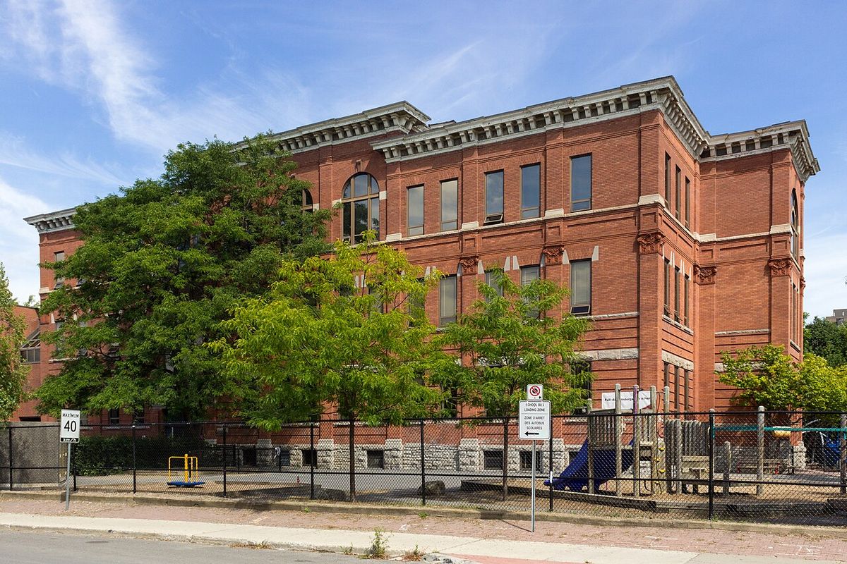
Development continued in the early 20th century with infrastructure projects like the paving of Clemow Avenue and the filling of a large low-lying area between Second and Third Avenues with sand from along Carling Avenue between 1903 and 1904. The Drive way, a scenic route from Elgin Street to the Central Experimental Farm, was built between 1900 and 1903, providing further impetus for southward growth. As housing density increased, institutions like Mutchmor Public School were built in the 1890s with additions in 1911 and 1920. The postwar period saw the remaining vacant lots, particularly on streets just off Bronson Avenue where construction had declined after 1930, filled with new housing. After a mid-century period where the area became more working-class with houses subdivided into apartments, The Glebe underwent significant gentrification beginning in the 1970s, transforming into an elite neighbourhood. A major recent infrastructure addition is the Flora Footbridge, a 5-metre wide, 123-metre long cycling and pedestrian bridge costing 21 million dollars, which opened in 2019 to connect The Glebe to Old Ottawa East.
Community and Institutions
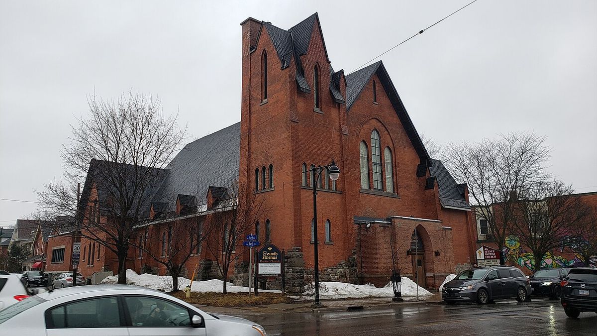
The Glebe is characterized by a strong, family-oriented community with active neighbourhood associations. The Glebe Community Association operates the Glebe Community Centre and advocates on local issues such as traffic calming and neighbourhood development, while the Glebe Annex and Dow's Lake areas have their own separate associations. The independently published Glebe Report newspaper has served the community since 1973. The neighbourhood is well-served by a mix of long-established churches and newer temples, reflecting its evolving demographic. Educational institutions have deep roots, with elementary schools like First Avenue Public School and Mutchmor Public School dating from the 1890s. Glebe Collegiate Institute opened in 1922 under Principal McDougall, originally as a branch of the Ottawa Collegiate Institute. The area also hosts several embassies, high commissions, and consulates, adding an international presence to the residential streets.
- Elementary Schools: First Avenue Public School (opened 1898), Corpus Christi School (dates from the early development era), Mutchmor Public School (built in the 1890s).
- Secondary Schools: Glebe Collegiate Institute (opened 1922), The Element High School.
- Diplomatic Missions: Official Residence of the Ambassador of Greece, High Commission of Ghana, Embassy of Tunisia, Official Residence of the Ambassador of Vietnam, Consulate General of Latvia, Embassy of Lebanon, High Commission of Cameroon.
Lansdowne Park and Recreation
Lansdowne Park is the neighbourhood's largest and most significant recreational and entertainment hub. The City of Ottawa purchased the land from local farmers in 1868 for the Ottawa Agricultural Society. It now houses TD Place Stadium, the home field for the Canadian Football League's Ottawa Redblacks and the University of Ottawa Gee-Gees football team. TD Place Arena within the park is the permanent home of the Ottawa 67's major junior hockey team and served as the temporary home for the NHL's Ottawa Senators from 1992 to 1995 before the Canadian Tire Centre was completed. The park is a central venue for major events, including the Ottawa Redblacks games and the Canadian Tulip Festival. The largest tulip beds in the National Capital Region are located in nearby Commissioner's Park by Dow's Lake, which is part of the neighbourhood. The Glebe also contains numerous smaller parks and recreational facilities that serve the local community. The Ottawa Improvement Commission, the forerunner of the National Capital Commission, played a role in beautifying the area with special attention to sidewalks, trees and shrubs, and street lights, contributing to its park-like atmosphere.
Commerce and Annual Events
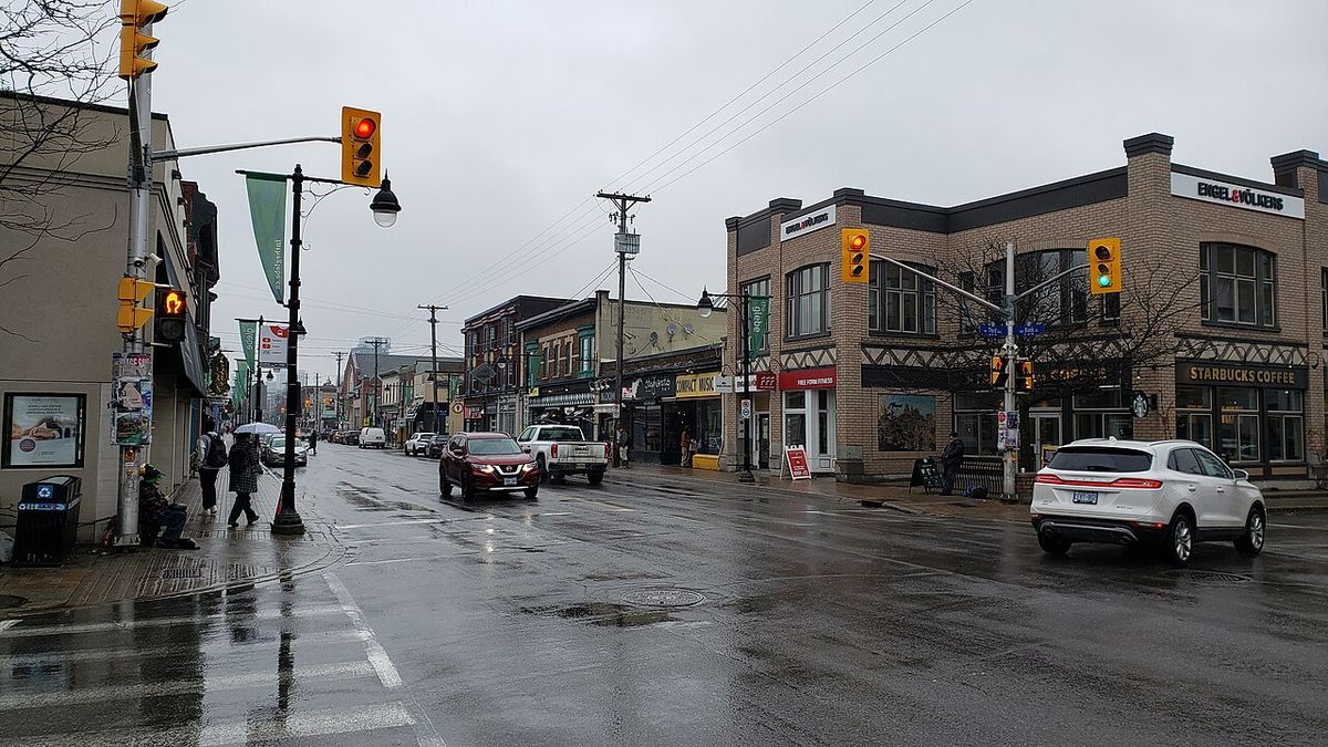
Bank Street serves as the active commercial spine of The Glebe, featuring a dense concentration of small independent shops, boutiques, restaurants, and services. This retail strip is a major destination for residents across Ottawa. Much of the surrounding residential area consists of detached homes, many from the early 20th century, which are now primarily owner-occupied single-family residences or subdivided into rental apartments. The neighbourhood hosts several major annual events that draw city-wide participation. The Great Glebe Garage Sale, held on the fourth Saturday of May, sees hundreds of households set up sales with a portion of proceeds donated to a designated charity, attracting a large contingent of bargain hunters. May also brings the Canadian Tulip Festival, centred on the expansive displays at Commissioner's Park. These events contribute significantly to the area's community atmosphere and local economy, reinforcing the neighbourhood's identity as a central gathering place for the wider city. The commercial development on Bank Street evolved alongside residential growth, with corner stores and other commercial properties appearing as housing was built on the surrounding avenues. The electric streetcar was crucial to this pattern, allowing residents to live in The Glebe and take the street car to work elsewhere, supporting local businesses that catered to daily needs. This historical relationship between transit and commerce established the enduring character of Bank Street as a walkable, service-oriented corridor.
Demographic and Socioeconomic Change
The socioeconomic character of The Glebe has undergone dramatic shifts over the past century. Initially developed as a middle-class streetcar suburb, it housed many of the city's workers and professionals in homes largely built before 1914. After the Second World War, as the middle class moved to newer suburbs like Alta Vista and Nepean, the neighbourhood transitioned to a predominantly working-class area with many homes converted into multiple rental apartments or rooming houses. A major reversal began in the 1970s with intensive gentrification, transforming The Glebe into one of Ottawa's most affluent and educated communities. Statistical changes between 1971 and 1996 illustrate this transformation clearly. The table below summarizes key indicators of this shift.
| Demographic Indicator | 1971 | 1996 |
|---|---|---|
| Population with University Degrees | 10% | 60% |
| Income Relative to Ottawa Average | 14% poorer | 18% wealthier |
In the middle part of the century the Glebe changed as the middle class moved to more distant suburbs. The Glebe became transformed into a predominantly working class neighbourhood with houses subdivided into multiple apartments. The neighbourhood began to change again in the 1970s when it underwent significant gentrification and became one of Ottawa's elite neighbourhoods. From 1971 to 1996 the percentage of the population with university degrees rose from 10 to 60 percent. White collar employment grew from less than half to some 95 percent. While in 1971 Glebe residents were 14 percent poorer than the average citizen of Ottawa, in 1996 they were 18 percent wealthier.
Architectural and Cultural History
The architectural fabric of The Glebe tells the story of its development from a late-19th century suburb to a mature urban neighbourhood. Housing construction was largely unplanned and erratic in some parts of the Glebe initially, with lower standards and haphazard development, but these areas were largely removed or rehabilitated after World War II. The series of distinctive homes, both east and west of Bank Street, were indicative of the style and wealth of the owners during the peak building period. Cultural institutions also emerged alongside the homes. The Ava Theatre, a spacious cinema, opened in 1928 at the corner of Bank Street and Second Avenue. Ottawa Ladies' College, a private school for young women, operated on First Avenue from 1914 to 1942, with its facilities used by the Canadian military during the war and later becoming part of the founding campus of Carleton University. The neighbourhood's monuments and memorials, such as the statue of football coach Frank Clair and the Air India Victims Memorial, add layers of historical memory to its parks and public spaces.
Notable Residents
Throughout its history, The Glebe has been home to numerous notable figures from politics, arts, academia, and public life. Their residency adds to the neighbourhood's historical and cultural significance. Past and present residents include a former mayor of Ottawa, federal cabinet ministers, a renowned constitutional expert, and celebrated artists and journalists. This list reflects the neighbourhood's appeal to individuals of significant accomplishment across different eras and fields. The presence of such residents, from the early merchant James Whyte who built a large residence on Canal Road in 1871 to contemporary figures, demonstrates the neighbourhood's consistent status as a desirable address for Ottawa's influential citizens.
- George Walker Wesley Dawson, politician (until his death).
- Catherine McKenna, politician.
- James Strutt, architect.
- Charlotte Whitton, mayor of Ottawa.
- Eugene Forsey, senator and constitutional expert.
- Flora MacDonald, politician and humanitarian.
- Hannah Moscovitch, playwright.
- Mitchell Sharp, politician.
- Craig Oliver, journalist.
- Abby Hoffman, athlete and activist.
Monuments and Public Art
The Glebe features a variety of monuments, memorials, and sculptures that commemorate historical figures, events, and community spirit. These pieces of public art are integrated into parks, streetscapes, and key locations, contributing to the neighbourhood's distinctive character. They honour local sports legends, political figures, tragic events, and community milestones, providing points of reflection and interest for both residents and visitors. The monuments range from traditional memorials to contemporary sculptures, reflecting different periods of the community's history and artistic taste. These installations, along with the named parks such as Eugene Forsey Park, create a landscape that actively engages with local and national history, making The Glebe not just a residential area but also an open-air repository of community memory and identity.
- Thomas Ahearn Memorial
- Statue of Frank Clair
- Share the Flame Monument
- Moving Surfaces Sculpture
- Moose Sculpture
- Air India Victims Memorial
- The Man with Two Hats Statue
- Flora MacDonald's Footbridge
Questions about The Glebe
Why is it called The Glebe?
The name originates from the area's historical status as a clergy reserve. In 1837, a 178-acre parcel of land was deeded by the Crown to St. Andrew's Presbyterian Church. Such church lands were traditionally called a 'glebe'. When the area was opened for residential development in 1870, real estate agents began referring to it simply as 'The Glebe', a name that has endured. It was originally known as 'the glebe lands of St. Andrew's Presbyterian Church'.
What is Lansdowne Park and what is located there?
Lansdowne Park is a major sports, entertainment, and event venue located within The Glebe. Purchased by the city from local farmers in 1868 for the Ottawa Agricultural Society, it is home to TD Place Stadium, where the Ottawa Redblacks (CFL) and the University of Ottawa Gee-Gees play football. TD Place Arena within the park is the permanent home of the Ottawa 67's hockey team and was the temporary home of the Ottawa Senators from 1992 to 1995. The park originally opened for the Exhibition in 1888.
What is the Great Glebe Garage Sale?
The Great Glebe Garage Sale is an annual community event held on the fourth Saturday of May. Hundreds of households across The Glebe participate by setting up garage sales on their properties. The event attracts thousands of bargain hunters from across the city. Sellers are encouraged to donate a portion of their proceeds to a designated charity, blending community fundraising with a massive neighbourhood sale. It is a major event that highlights the community-oriented nature of the neighbourhood.
How has the population of The Glebe changed over time?
The Glebe has undergone significant demographic transformation. Initially a middle-class streetcar suburb, it became more working-class mid-century with houses subdivided into apartments before experiencing intense gentrification starting in the 1970s. Census data shows that from 1971 to 1996, the percentage of residents with university degrees rose from 10% to 60%, and white-collar employment grew from less than half to about 95%. Residents went from being 14% poorer than the Ottawa average in 1971 to 18% wealthier by 1996.
What schools and community facilities are in The Glebe?
The Glebe has elementary schools including First Avenue Public School, Corpus Christi School, and Mutchmor Public School. Secondary schools include Glebe Collegiate Institute and The Element High School. The Glebe Community Association operates the Glebe Community Centre. The community has its own newspaper, the Glebe Report, which has been published independently since 1973. The area contains multiple parks such as Glebe Memorial Park and Patterson Creek Park, as well as sports facilities including Lansdowne Park and the St. James Tennis Club.
Where is The Glebe in Ottawa and what are its boundaries?
The Glebe is a neighbourhood located just south of Downtown Ottawa in the Capital Ward. It is bounded on the north by the Queensway, on the east and south by the Rideau Canal, and on the west by LeBreton Street South, Carling Avenue, and Dow's Lake. This defined area includes the Glebe Annex, situated west of Bronson Avenue and north of Carling Avenue, and the Dow's Lake neighbourhood, located north of the Rideau Canal. The original 1837 survey area of 178 acres was deeded to St. Andrew's Presbyterian Church and was bounded by Carling Avenue, Fifth Avenue, Main Street, and Bronson Avenue.
Sources and further reading
- The Glebe (Wikipedia)
- Glebe and Old Ottawa South (ottawatourism.ca)
- The Glebe, Ottawa: Neighbourhood Guide & Prices (2026) (ottawarealtyman.com)
- The Glebe, Ottawa Neighbourhood Guide (paulrushforth.com)
Checked by the Your Space Hamilton desk. Last updated 2026-11-01.