Don Mills
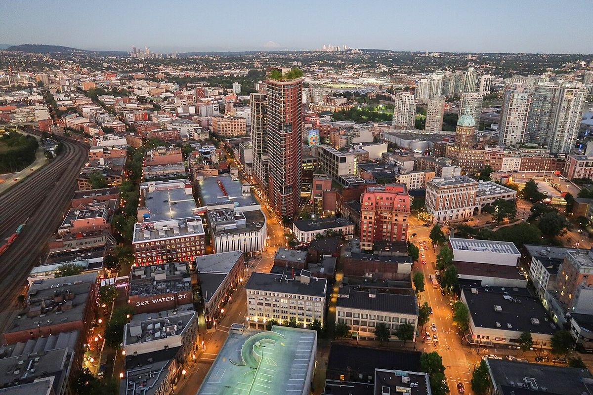
Don Mills is a planned mixed-use neighbourhood in Toronto, Ontario, developed between 1952 and 1965 as a self-contained 'new town' on former farmland in what was then North York. Conceived by industrialist E.P. Taylor and designed by planner Macklin Hancock, it became a highly influential blueprint for postwar suburban development in Canada, integrating residential, commercial, and industrial areas with modernist design principles. The neighbourhood is bounded by York Mills Road to the north, the Canadian Pacific Railway to the south, Leslie Street to the west, and the Don Valley Parkway to the east. Today, it is part of the federal and provincial electoral district Don Valley East and Toronto Ward 16, and is home to significant cultural institutions including the Aga Khan Museum and Ismaili Centre.
Historical Development and Planning
The Don Mills area was first settled by Europeans in 1817, utilizing the Don River for transportation and power for a number of mills along its length, but it remained a considerable distance from the town of York. The area stayed rural, consisting of about 20 farms as late as 1950, as it was cut off from Toronto's expansion by ravines to the south, east, and west with only York Mills Road and Don Mills Road providing connections. Its combination of emptiness and proximity to the city attracted industrialist E.P. Taylor, whose original plan was to erect a brewery on the site with a small community for workers. Taylor had limited previous development experience but had built the Wrentham Estates in York Mills, and seeing greater profit potential, he abandoned the brewery idea to build a complete new town on the 2,000 acres he had acquired. In 1951, he began planning through his Taylor-owned Don Mills Development Company, known earlier as O'Keefe Realty, and the project was announced on March 11, 1953, as the Yorktown community centred at Don Mills Road and Lawrence Avenue East with an expected cost of $200 million.
The design of Don Mills was entrusted to Macklin Hancock, the son-in-law of Taylor's executive assistant and a graduate student at Harvard University when approached for the job. At Harvard, Hancock studied under founders of modernism and new town planning including Walter Gropius, William Holford, and Hideo Sasaki, and his design was influenced by Ebenezer Howard's Garden City and the American planners Clarence Stein and Henry Wright, who developed Radburn, New Jersey. Hancock envisioned a self-contained community with consistent modernist style, and while names like Eptown were proposed, he suggested the final name Don Mills. The design implemented five new planning principles in Canada, starting with the neighbourhood principle that broke the community into four quadrants surrounding the Don Mills Centre shopping mall, each with its own school, church, and park. A second principle was the separation of pedestrian and vehicle traffic using a network of pedestrian paths through parks and roads designed with winding layouts, T-intersections, and cul-de-sacs to slow cars.
The third principle was the strict promotion of modernist architecture and aesthetics, with the Don Mills Development Company controlling architectural design, colours, and materials for all buildings and insisting builders use company-approved architects educated in Bauhaus principles. The fourth principle involved the creation of a greenbelt linked to a system of neighbourhood parks to preserve the beauty of the surrounding ravines. The fifth principle was the integration of industry into the community, following Howard's Garden City ideals to ensure residents could live and work locally and prevent a bedroom community, supported by a sizable number of rental townhouses and low-rise apartments to attract a cross-section of workers. The developers also affected regional highway projects, resulting in Highway 401 having no interchange at Don Mills Road and the Don Valley Parkway being moved east from Don Mills Road to the Woodbine Avenue right-of-way north of Lawrence.
Demographic Profile and Change
The City of Toronto places Don Mills within the larger Banbury-Don Mills community area, which had a population of 25,435 according to the 2006 census. Data from the 2001 census on major ethnic and cultural groups by ancestry reveals a diverse population with no single group forming a majority. The largest reported ancestries were Chinese at 12 percent, English at 11 percent, and Canadian at 11 percent, followed by Jewish and Scottish ancestries each at 7 percent. Irish ancestry was reported by 5 percent of the population, East Indian by 4 percent, and German by 3 percent. French and Polish ancestries each accounted for 2 percent of the population, with all other groups combined making up 36 percent. The percentage of the population living below the low-income measure, or poverty line, showed a slight improvement, dropping from 13 percent in 1996 to 12 percent in 2001.
Education and School Boards
Public education in Don Mills is primarily served by the Toronto District School Board (TDSB), which operates three elementary schools and one secondary school within the neighbourhood boundaries. The TDSB elementary schools are Greenland Public School, Norman Ingram Public School, and Three Valleys Public School, while the sole TDSB secondary school is Don Mills Collegiate Institute. Three other public school boards also offer schooling to residents of Don Mills but do not operate physical schools within the neighbourhood itself. The Toronto Catholic District School Board (TCDSB) is a secular school board serving Catholic students, while French first language education is provided by the secular Conseil scolaire Viamonde (CSV) and its separate Catholic counterpart, Conseil scolaire catholique MonAvenir (CSCM). Students from Don Mills attending TCDSB, CSV, or CSCM schools must travel to institutions situated in other neighbourhoods across Toronto.
Recreation, Parks, and Retail
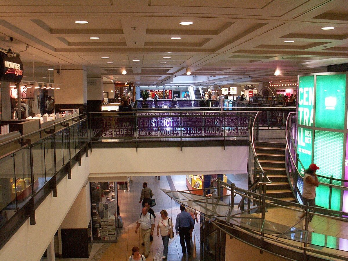
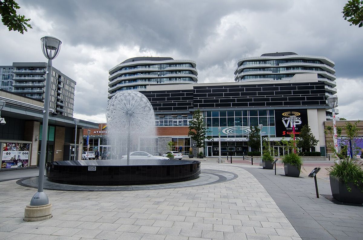
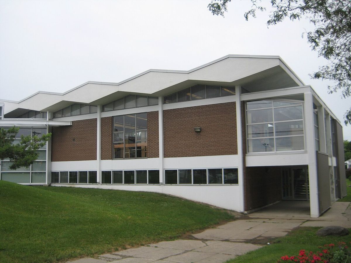
Don Mills is home to a number of municipal parks managed by the Toronto Parks, Forestry and Recreation Division, including Bond Park which contains sports fields and an arena for community use. Chipping Park and Moccasin Trail Park are situated near the Don Valley and form part of the extensive Toronto ravine system, providing natural green space and trails. The neighbourhood also houses the Don Mills branch of the Toronto Public Library, offering public access to collections and services. The most significant retail transformation occurred with the demolition of the original Don Mills Centre in 2006, which was replaced by the Shops at Don Mills, a lifestyle centre-styled shopping centre that opened in April 2009 at the southwest corner of Lawrence Avenue and Don Mills Road.
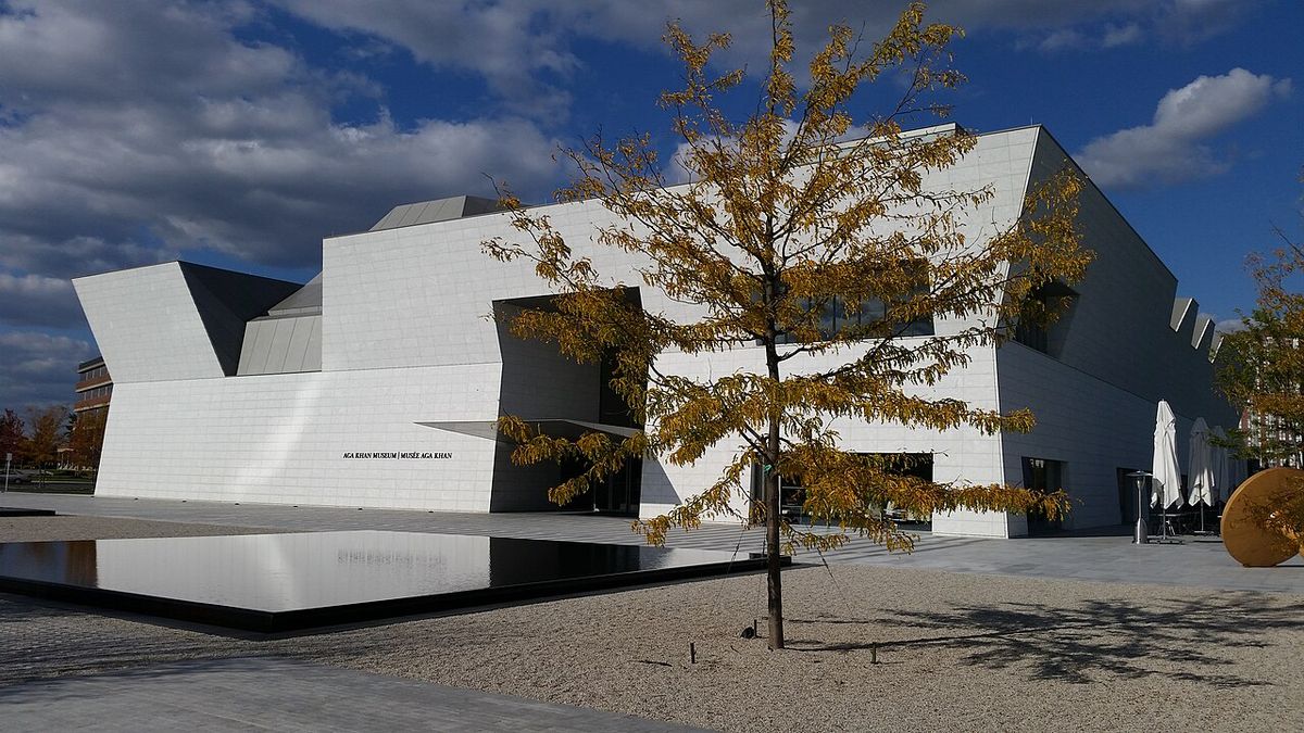
Key recreational landmarks in Don Mills include municipal parks such as Bond Park, which has sports fields and an arena, Chipping Park, and Moccasin Trail Park. The neighbourhood is also home to the Don Mills branch of the Toronto Public Library. A major cultural landmark is the Aga Khan Museum, which provides an exhibition space for Islamic art and history, and the Ismaili Centre, located on Wynford Drive. The primary retail landmark is the Shops at Don Mills, a lifestyle centre-styled shopping centre located at the southwest corner of Lawrence Avenue and Don Mills Road.
- Bond Park: Municipal park with sports fields and an arena.
- Chipping Park: Municipal park near the Don Valley ravine.
- Moccasin Trail Park: Municipal park within the Toronto ravine system.
- Don Mills Branch, Toronto Public Library.
- Shops at Don Mills: Lifestyle shopping centre opened in 2009 on the site of the former Don Mills Centre.
- Aga Khan Park: A 6.8-hectare (17-acre) public park opened in 2014 as part of the cultural complex.
- The Aga Khan Museum: Provides exhibition space for Islamic art and history.
- The Ismaili Centre: Serves as a centre for the Ismaili community in Canada.
Transportation and Connectivity
Several major roadways define and service Don Mills, with York Mills Road serving as the formal northern boundary and the Don Valley Parkway, a major municipal controlled-access highway, forming the eastern boundary. Lawrence Avenue East is a central arterial road running through the community, and Eglinton Avenue is another major roadway situated immediately to the south. Public transportation is provided by the Toronto Transit Commission (TTC), which operates several bus routes throughout the neighbourhood. A major transit upgrade was realized with the opening of the TTC's Line 5 Eglinton light rail line in 2026, which operates as part of the Toronto subway system. Stations for this line are located along Eglinton Avenue, with the Aga Khan Park & Museum and Don Valley stations situated just south of the Don Mills neighbourhood. The Don Valley station serves as a critical transition point for Line 5 Eglinton, as the line operates as a surface level route for every stop east of this station, connecting Don Mills to a modern light rail system while maintaining the neighbourhood's historical separation from high-speed thoroughfares.
Recent Developments and Cultural Institutions
The original Don Mills Centre mall, a central feature of the 1950s plan, was demolished in 2006 to make way for the Shops at Don Mills, which opened as a new open-air lifestyle centre in April 2009. A far more ambitious project was constructed on 6.8 hectares of land at Wynford Drive and the Don Valley Parkway, a $300 million cultural complex whose foundation was laid on May 28, 2010, by Prime Minister Stephen Harper and His Highness the Aga Khan. The project was designed by an international team including India-based architect Charles Correa, Japanese architect Fumihiko Maki, Lebanese landscape architect Vladimir Djurovic, and the Toronto-based firm Moriyama & Teshima Architects. The cultural complex was completed and opened in 2014, consisting of three main components: the Aga Khan Museum providing dedicated exhibition space for Islamic art and history, the Ismaili Centre providing a gathering place for the Ismaili community in Canada, and the Aga Khan Park, a 6.8-hectare public park that completes the site.
Architectural and Planning Legacy
Don Mills became the blueprint for postwar suburban development in Toronto and for contemporary residential neighbourhoods across Canada, with many aspects of its design widely imitated. Its neighbourhood quadrant model, with schools, churches, and parks within each unit surrounding a central mall, set a new standard for community layout. The separation of pedestrian and vehicle traffic through pathways and cul-de-sacs became a common feature in subsequent subdivisions. The enforcement of modernist architectural design through developer control prevented the uniform builder's home look of many post-war developments. The integration of industry and higher-density housing like rental townhouses and low-rise apartments was an early attempt at creating a complete, walkable community rather than a dormitory suburb.
The design of home lots in Don Mills was influential to subsequent subdivisions in Canada. Houses were located on square lots with long street frontages, a change from the previous practice of situating houses on rectangular lots with the narrow end to the street. This square lot design meant houses faced the street with their long side but had less deep backyards. The development also affected two concurrent highway projects. The Toronto Bypass, now known as Ontario Highway 401, does not have an interchange at Don Mills Road due to the development. The Don Valley Parkway, built in part to service the community, was originally planned for Don Mills Road but was moved east to the Woodbine Avenue right-of-way north of Lawrence. The principles implemented by Macklin Hancock and the Don Mills Development Company demonstrated that private enterprise could execute a comprehensive, planned community.
Questions about Don Mills
Who developed and planned the Don Mills neighbourhood?
Don Mills was planned and developed by private enterprise. It was developed by industrialist E.P. Taylor through his Don Mills Development Company, which was known as O'Keefe Realty in the days of the brewery development. The design of the project was entrusted to Macklin Hancock, a graduate student at Harvard when approached for the job. Hancock's design was influenced by Ebenezer Howard's Garden City and the principles of American town planners Clarence Stein and Henry Wright.
What were the innovative planning principles used in Don Mills?
The design of Don Mills was based on five planning principles new to Canada. These were the neighbourhood principle, which broke the community into four quadrants around a shopping centre. There was a separation of pedestrian and vehicle traffic through a network of paths and winding roads. It promoted modernist architecture with controlled design and materials. It included the creation of a greenbelt linked to a park system. Finally, it integrated industry into the community to prevent it from becoming a bedroom community.
What cultural institutions are located in Don Mills?
Don Mills is home to the Aga Khan Museum and the Ismaili Centre, which opened in 2014. These are part of a cultural project on 6.8 hectares of land at Wynford Drive and the Don Valley Parkway. The museum provides an exhibition space for Islamic art and history, and the centre provides a centre for the Ismaili community in Canada. The project also includes a public park.
What is the Shops at Don Mills?
The Shops at Don Mills is a large shopping centre that opened in April 2009. It is a lifestyle centre styled shopping centre located at the southwest corner of Lawrence Avenue and Don Mills Road, which was the original site of the community's planned regional shopping centre. This new development replaced the former Don Mills Centre, which was demolished in 2006 to make way for it. The original Don Mills Centre was a key feature of the neighbourhood's mid 20th century design, situated at the intersection of Don Mills Road and Lawrence Avenue East as the central hub for the four residential quadrants. The Shops at Don Mills represents a significant redevelopment of this central commercial space in the community's recent history.
What public transit serves Don Mills?
Public transportation in Don Mills is provided by the Toronto Transit Commission, which operates several bus routes in the neighbourhood. The area is also served by Line 5 Eglinton, a light rail line that opened in 2026 and is operated as part of the Toronto subway system. Stations for this line are located along Eglinton Avenue, with Aga Khan Park & Museum and Don Valley stations situated just south of the Don Mills neighbourhood. The line operates as a surface level route for every stop east of Don Valley station, making Don Mills a transition point for the line. Major roadways like Lawrence Avenue, York Mills Road, and Eglinton Avenue facilitate local transit and road access, while the Don Valley Parkway forms the eastern boundary.
What schools are located in Don Mills?
The Toronto District School Board operates three elementary schools in Don Mills: Greenland Public School, Norman Ingram Public School, and Three Valleys Public School. It also operates one secondary school in the neighbourhood, Don Mills Collegiate Institute. The original community plan for Don Mills included a school in each of its four neighbourhood quadrants, making education a foundational element. In addition to the Toronto District School Board, three other public school boards serve residents: the Toronto Catholic District School Board, Conseil scolaire Viamonde, and Conseil scolaire catholique MonAvenir. However, none of these three boards operate schools within Don Mills itself, with their students attending schools situated in other Toronto neighbourhoods.
Sources and further reading
- Don Mills (Wikipedia)
- Don Mills, Toronto Neighbourhood guide (neighbourhoodguide.com)
- Don Mills, Neighbourhoods (sagerealestate.ca)
- Don Mills Neighbourhood (tclf.org)
- Banbury-Don Mills Neighbourhood Guide (hoodq.com)
Checked by the Your Space Hamilton desk. Last updated 2026-11-01.