February 5-6, 2010 North American blizzard
The February 5-6, 2010 North American blizzard, widely known as Snowmageddon, was a historic Category 3 nor'easter that crippled the Mid-Atlantic United States with record-breaking snowfall. The storm tracked from the Pacific Ocean across the continent, bringing severe impacts from northern Mexico to the U.S. East Coast, including flooding, landslides, and widespread travel disruptions. For Canadians, the event was a notable example of extreme winter weather in North America and highlighted the meteorological patterns, such as blocking ridges over the Maritime Provinces, that can influence storm tracks and intensity. The blizzard set numerous snowfall records that still stood more than a decade later, cementing its place as one of the most significant winter storms of the 21st century.
Meteorological Development and Track
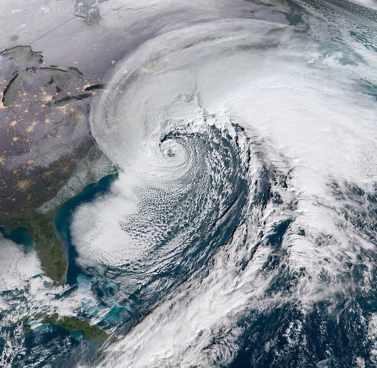
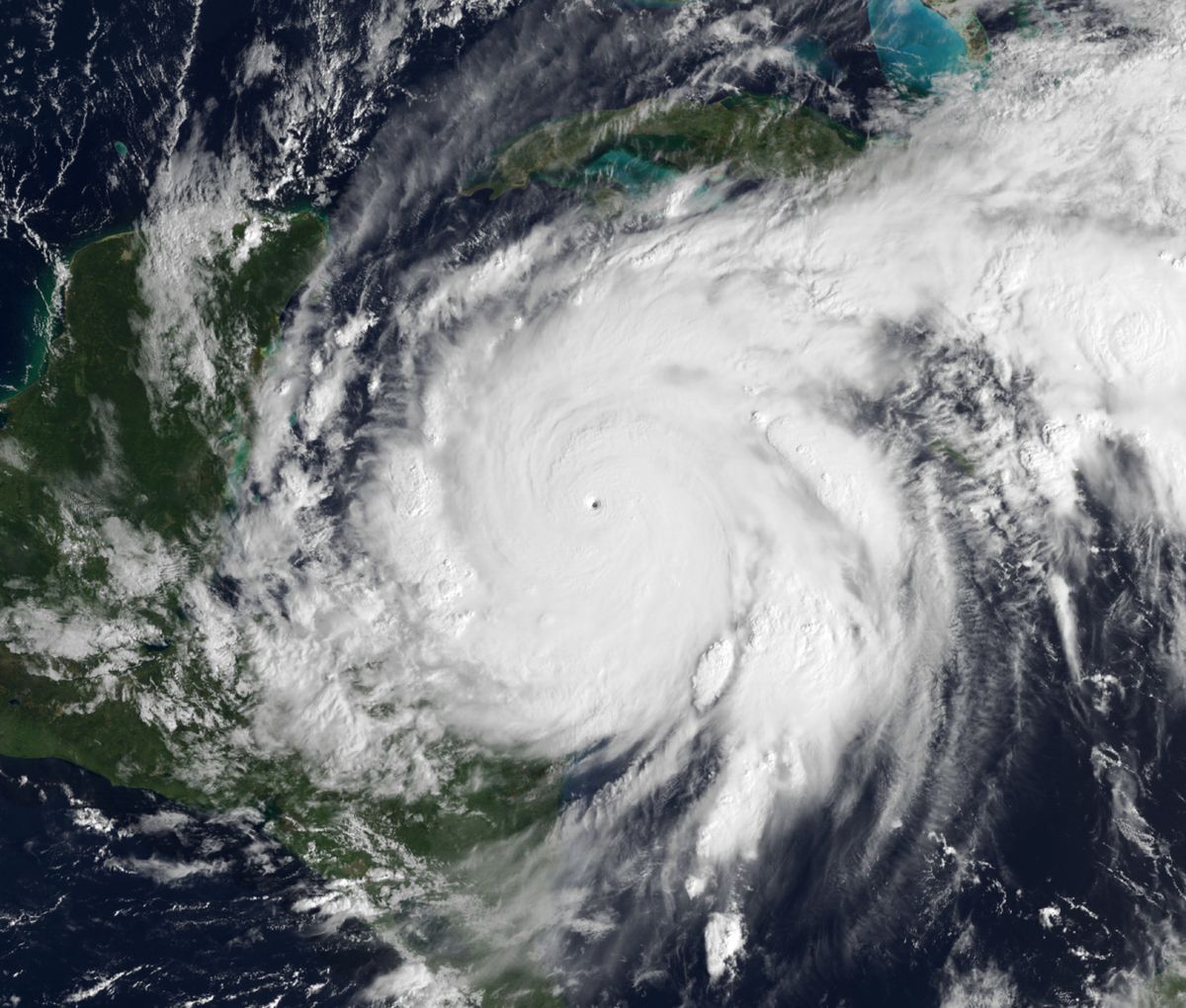
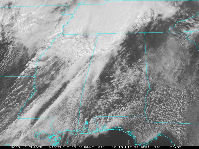
The blizzard originated as a Pacific storm system that brought precipitation to California and Arizona on February 2. The system moved eastward across northern Mexico on February 3, producing over a foot of snow in New Mexico's high elevations and causing highway closures including Interstate 40 through Tijeras Canyon and between Grants and Gallup for several hours. By February 4, the storm's centre advanced to the Louisiana Gulf Coast, generating severe thunderstorms to the south while a separate northern disturbance tracked from the central Rockies to the lower Missouri River Valley, bringing light snow showers to Montana, the Dakotas, Minnesota, Wisconsin, Iowa, and Illinois. A critical phase occurred on February 5 when these two systems phased together over the Ohio River Valley, leading to a band of heavy snow from Illinois to Pennsylvania. The absorption of the northern system's energy into the southern circulation triggered rapid intensification, with heavy snow developing over the Mid-Atlantic as the storm tracked across North Carolina toward the coast. A nearly stationary upper-level ridge over the Maritime Provinces of Canada acted as a blocking high, preventing the storm from following the traditional northeast track into New England. This blocking pattern forced the storm centre to slow its northeasterly movement and move eastward off the Virginia coast on February 6, creating an unusual west-northwest to east-southeast axis of heaviest snowfall through Maryland and Delaware, opposed to the typical southwest-northeast pattern of most nor'easters. Senior meteorologist Stu Ostro characterized the storm's formation as a Miller Type B cyclogenesis, where a low pressure system over the Ohio Valley runs into a blocking ridge and redevelops along the Carolina coast. The storm drew enormous moisture from both the Gulf of Mexico, visible in satellite imagery from February 3, and from the Atlantic Ocean, visible in radar imagery from February 5, contributing to its prolonged duration and historic snow accumulations of one to three inches per hour.
Record Snowfall and Precipitation
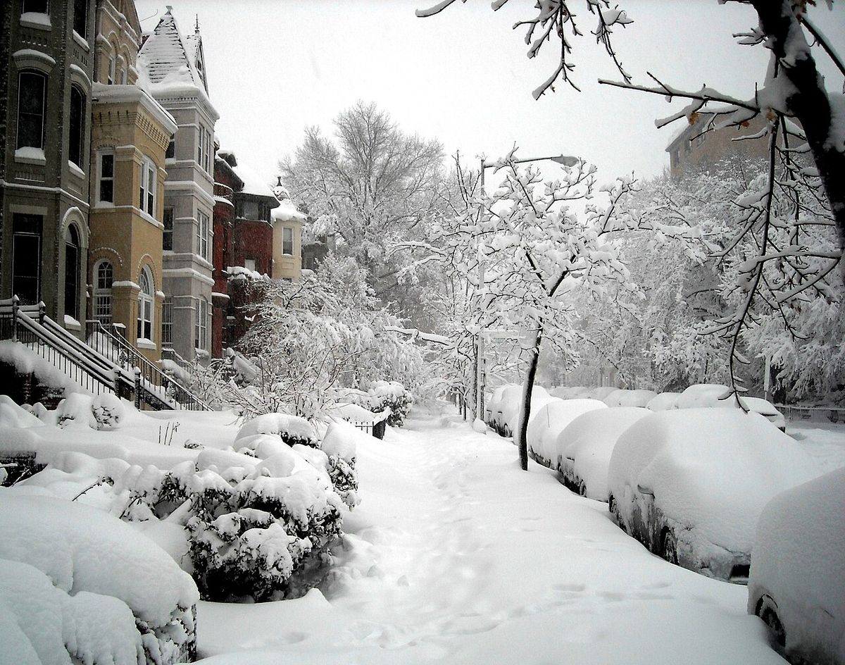
The storm produced a swath of crippling snowfall from southern Pennsylvania through the Eastern Panhandle of West Virginia, northern Virginia, Washington D.C., Maryland, Delaware, and southern New Jersey. Accumulations generally ranged from 20 to 35 inches, with the highest official measurement being 38.3 inches at a location 2 miles west-southwest of Elkridge, Maryland. An unofficial report of 39.0 inches was recorded in Riverwood, Maryland via the Community Collaborative Rain, Hail and Snow Network. The heaviest snow squeezed between Washington D.C. and Baltimore, setting all-time records at major airports. Dulles International Airport recorded 32.9 inches, setting records for two-day and three-day snowfall and shattering the old records from the Blizzard of 1996 of 23.2 and 24.6 inches respectively. Baltimore Washington International Airport measured 25 inches, its second-greatest two-day total on record since 1892, behind the 26.3 inches from the 1922 Knickerbocker Storm. Reagan National Airport in Washington D.C. recorded 17.8 inches, ranking as the city's fourth-greatest snowfall for both two-day and three-day periods since 1871. In Pennsylvania, Pittsburgh received 21.1 inches, its fourth-greatest snow event since records began in 1871, while areas south of the city saw up to 26 inches. Philadelphia was buried under 28.5 inches, the city's second-heaviest storm on record since 1872, trailing only the Blizzard of 1996's 30.7 inches. Wilmington, Delaware, set its all-time record with 25.8 inches, surpassing the 22 inches from the 1996 storm. The storm also established Delaware's official snow depth record of 28 inches near Greenwood on February 7, measured at the Greenwood 2.9 SE CoCoRaHS station. South Jersey saw accumulations as high as 29 inches, with Vineland reporting 19.8 inches, and south-central Pennsylvania areas like Harrisburg, Lancaster, and York reported receiving over 18 inches. Many rural counties across the Appalachians and Delmarva Peninsula averaged over two feet of snow.
The February 5-6, 2010 North American blizzard set numerous official snowfall records across the Mid-Atlantic region. Dulles International Airport recorded 32.9 inches of snow, setting all-time records for most two-day and three-day snowfall since records began there in 1962. Philadelphia's 28.5 inches ranked as the city's second greatest snow event on record since 1872. Wilmington, Delaware's total of 25.8 inches was its greatest storm total of all time since 1894. An unofficial storm total snowfall observation of 39.0 inches was made in Riverwood, Maryland, though NOAA products list 38.3 inches at a location near Elkridge, Maryland, as the storm's greatest official total.
- Dulles International Airport (VA): 32.9 inches (all-time 2-day and 3-day records).
- Philadelphia, PA: 28.5 inches (2nd greatest on record).
- Wilmington, DE: 25.8 inches (all-time greatest storm total).
- Reagan National Airport (DC): 17.8 inches (4th greatest 2-day and 3-day totals).
- Pittsburgh, PA: 21.1 inches (4th greatest snow event).
- Baltimore Washington International Airport (MD): 25 inches (2nd greatest 2-day total).
Impacts Across North America
The blizzard's impacts were severe and widespread, affecting millions of people across North America from February 1 through February 6. In Mexico, the storm's initial phase brought freak winter rains that peaked on February 4, causing devastating flooding and landslides across more than half of the country. At least 15 people were killed, with the western state of Michoacán hardest hit, reporting 13 fatalities from landslides and flooding in an area famous as a reserve for monarch butterflies. The rains broke February records in Michoacán, the State of Mexico, and Mexico City, with twice the normal monthly rainfall falling in 24 hours, and an unknown number of people were reported missing. A positive outcome was that the copious rains filled key reservoirs outside Mexico City, adding an estimated 21 million cubic metres of water and alleviating previous shortages that had forced rationing. In the United States Southwest, Arizona and New Mexico experienced up to a foot of snow in the mountains east of Albuquerque from February 1 to 4, leading to icy roads, numerous accidents, and a fatal crash near Gallup that shut down sections of Interstate 40 for several hours on February 3. The Deep South saw prolonged rains and flooding from February 4, with Jackson, Mississippi, breaking a daily rainfall record with 2.51 inches and widespread totals of 1 to 4 inches causing floods in central and southern Mississippi. North Carolina experienced power outages for about 40,000 customers in mountain counties due to a mix of snow, sleet, and freezing rain, while parts of central and eastern North Carolina were under flood watches for up to 2 inches of rain. The Midwest, including Illinois, Indiana, and Ohio, received heavy snowfall from February 4 to 6, with totals from 6 inches to over a foot and drifts up to 4 feet reported in central Indiana.
Crippling Disruption in the Mid-Atlantic
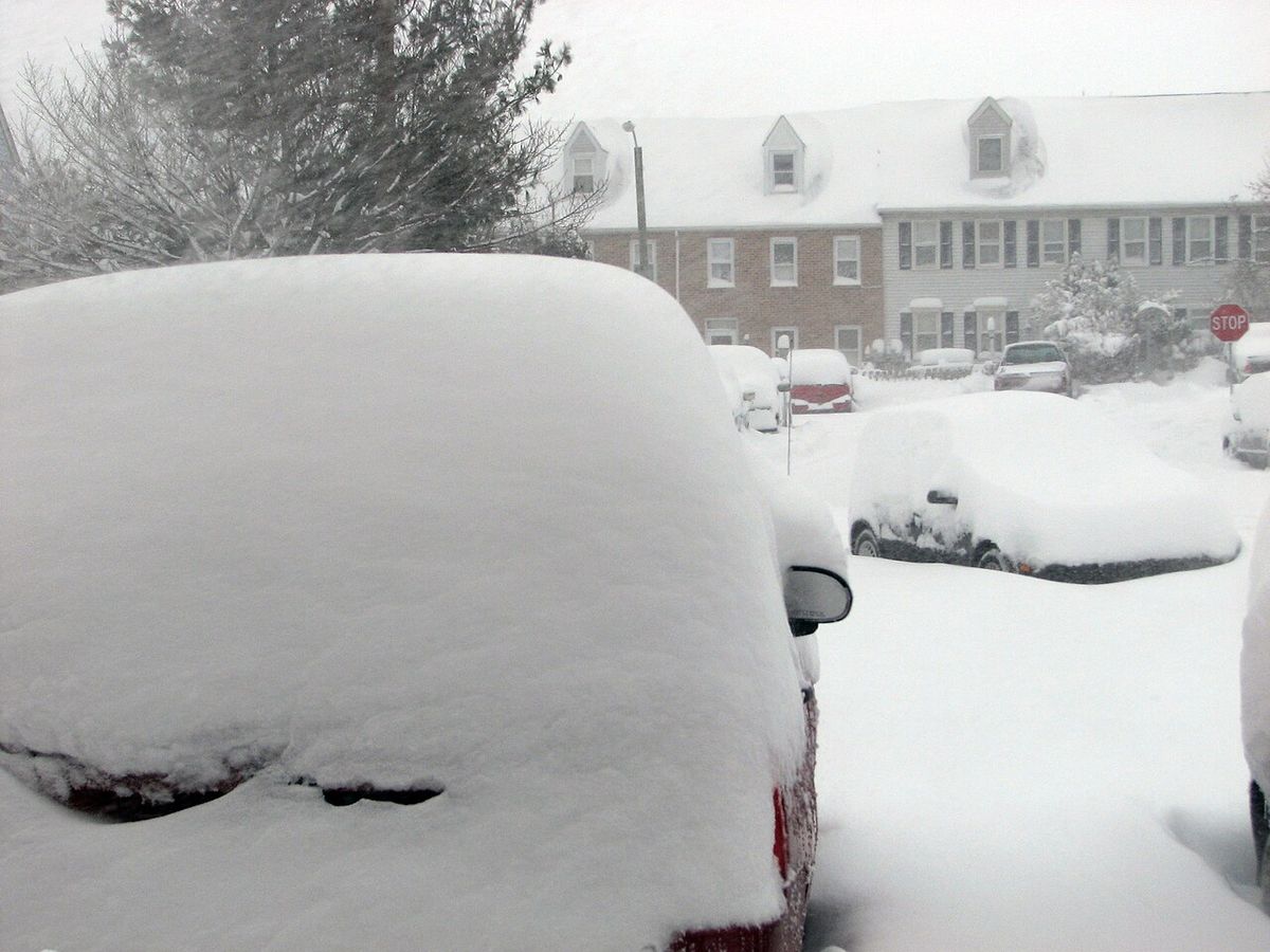
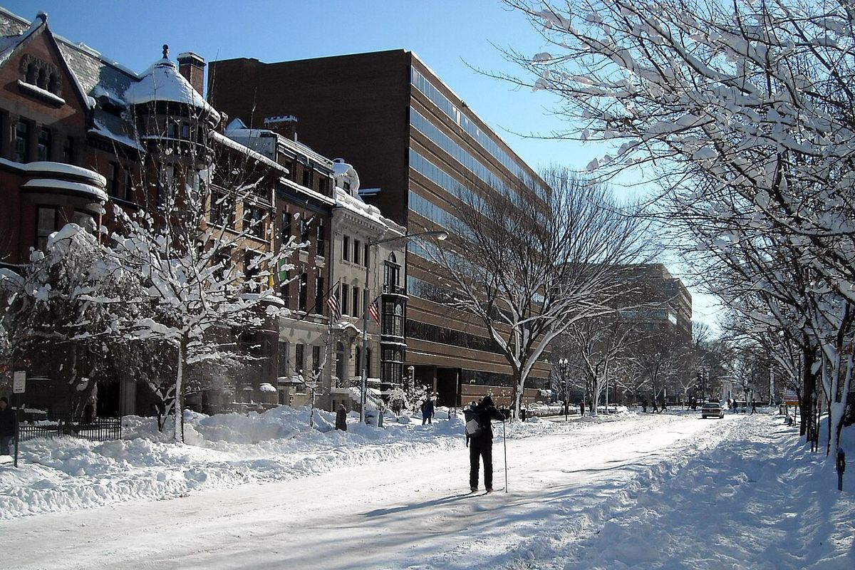
The Mid-Atlantic region endured the storm's most crippling effects, leading to a near-total shutdown of travel, government, and commerce for days. The U.S. federal government implemented an unscheduled leave policy on February 5, closing offices four hours early, and the Office of Personnel Management announced a full closure for February 8 with only emergency personnel required to report. School districts across the Washington metropolitan area canceled classes for February 5 and again between February 9 and 11, with some, like Fairfax County, Virginia, scheduling make-up days on holidays like Presidents Day on February 15 after using all built-in snow days. Transportation networks ground to a halt as roadways were blanketed, leading to abandoned cars on highways and Humvees being used to ferry patients to local hospitals. Maryland Transit Administration ran special snow trains on its heavy and light rail lines to keep tracks clear. Metro bus service in Washington D.C. ended by 9 p.m. EST on February 5, and above-ground rail service was also suspended. All three major Washington-Baltimore area airports canceled flights, as did Philadelphia International Airport, with Delta Air Lines suspending all flights in and out of Washington, Baltimore, and Philadelphia. A Washington Wizards NBA game was postponed due to the storm. Power outages were extensive, affecting over 50,000 homes and businesses in the D.C. metro area by early February 6, including 33,000 in northern Virginia and 19,000 in northern Maryland and the District. In Maryland, outages later peaked at 151,000 customers, including 34,000 Baltimore Gas and Electric customers, and the state declared a state of emergency as road crews struggled to keep even one lane open on major roads. Delaware Governor Jack Markell declared a state of emergency and ordered all vehicles off roads by 10 p.m. EST on February 5, following similar declarations by Virginia Governor Bob McDonnell and snow emergencies in D.C. and Maryland counties. The United States Postal Service canceled all mail delivery and collection in affected areas for February 6. The weight of the heavy, wet snow caused numerous roof collapses throughout the region.
Place in the 2009 to 2010 Winter and Climate Context
The February 5-6 blizzard was the second of four major nor'easters during the exceptionally active 2009 to 2010 winter season that received a Northeast Snowfall Impact Scale intensity rating from NOAA. It followed the December 2009 Northeastern U.S. blizzard and preceded the February 9-10, 2010 North American blizzard. These storms combined with a fourth nor'easter to produce the snowiest winter on record for much of the Mid-Atlantic. This event was also the second of three major Mid-Atlantic snowstorms that occurred over a 12-day period, with each subsequent storm focusing its heaviest snow slightly farther north than the last. The January 30, 2010 storm dropped more than a foot of snow across Virginia, while the February 9-10 storm targeted the Maryland-Pennsylvania border with up to 38.3 inches. Scientific analysis has since linked the storm's exceptional intensity to specific climatic factors. Atlantic sea surface temperatures during the event were 2.7 degrees Fahrenheit above average, which increased atmospheric moisture availability because warmer air can hold more water vapour at a rate of about 7 percent per degree Celsius. This additional moisture fed into the storm, contributing to the historic snowfall rates and totals that far exceeded the annual averages of 14.5 inches for Washington D.C. and 20.2 inches for Baltimore. The storm also occurred during an unusually weak, or negative, phase of the North Atlantic Oscillation, which created a blocking pattern that funneled Arctic air into the Eastern U.S. and stalled the storm's progress. This event fits a broader trend observed by NOAA scientists, who found that extreme regional snowstorms in the U.S. occurred twice as often between 1961 and 2010 compared to the period from 1900 to 1960, indicating increased variability in winter weather patterns as the planet warms.
Cultural Impact, Nicknames and Lasting Legacy
The storm's magnitude captured public imagination and media attention, leading to the widespread adoption of dramatic nicknames that defined the event. The terms Snowmageddon and Snowpocalypse were popularized by media coverage and blogs, including The Washington Post's Capital Weather Gang, which ran an online poll on February 4, 2010, asking for reader feedback prior to the blizzard. The Washington Post also coined other creative portmanteaus like snOMG and kaisersnoze in response to the series of February snowstorms. The nickname Snowmageddon entered the mainstream lexicon when U.S. President Barack Obama used the term during a Democratic National Committee meeting on February 8, 2010. The storm's legacy persists in popular memory and meteorological discourse as a benchmark for extreme winter weather. A decade after the event, NOAA confirmed that the snowfall records set at Dulles, Philadelphia, and Reagan National airports still stood, demonstrating the historic nature of the event. The event also served as a catalyst for advancements in weather forecasting, as it occurred before the launch of NOAA's current generation of high-resolution satellites like GOES-16 and GOES-17, which now provide far greater detail for tracking such extreme systems. In 2010, legacy GOES satellites like GOES-12 monitored the storm, but today's GOES-R and Joint Polar Satellite System series offer revolutionary capabilities for monitoring and predicting severe weather. The storm remains a key case study in understanding how warmer ocean temperatures and atmospheric blocking patterns can converge to produce historic snowfall events in a changing climate.
Official Records and Data Collection
The storm's intensity was captured through extensive official monitoring and data collection efforts that have provided a detailed record for climatologists. The National Weather Service offices in Washington/Baltimore, Philadelphia/Mount Holly, and State College, Pennsylvania, issued detailed public information statements and maps documenting snowfall totals. The Community Collaborative Rain, Hail and Snow Network, known as CoCoRaHS, provided crucial unofficial measurements from volunteer observers, including the 39.0 inch report from Riverwood, Maryland. The National Centers for Environmental Information later used CoCoRaHS data to certify Delaware's official snow depth record of 28 inches at the Greenwood station. The Winter Storm Reconnaissance program, a specialized effort led by Dr. Yucheng Song at the National Centers for Environmental Prediction, played a critical role in forecasting the event by deploying two aircraft missions over the Pacific on February 1. These missions took accurate measurements in cloudy regions, and the data were assimilated into the global forecast models at various numerical prediction centers, improving the accuracy of forecasts for the impending blizzard. This coordinated data collection shows the importance of integrated observation networks for predicting and analyzing extreme weather events.
The blizzard established several key snowfall records at major official weather stations. At Dulles International Airport, the 32.9 inch total shattered previous two-day and three-day records from the Blizzard of 1996. Baltimore Washington International Airport's 25 inch total was its second greatest two-day total since 1892, behind only the 1922 Knickerbocker Storm. Reagan National Airport's 17.8 inch total ranked as Washington's fourth greatest two-day and three-day total since records began in 1871. In Pennsylvania, Pittsburgh received 21.1 inches, making it the city's fourth greatest snow event since 1871, with areas south of the city receiving up to 26 inches.
| Location | Storm Total (inches) | Record/Ranking | Previous Benchmark (Storm) |
|---|---|---|---|
| Dulles Int'l Airport, VA | 32.9 | All-time 2-day & 3-day record | 23.2" (Blizzard of 1996) |
| Philadelphia, PA | 28.5 | 2nd greatest on record | 30.7" (Blizzard of 1996) |
| Reagan Nat'l Airport, DC | 17.8 | 4th greatest 2-day & 3-day total | Records since 1871 |
| Pittsburgh, PA | 21.1 | 4th greatest snow event | Records since 1871 |
Questions about February 5-6, 2010 North American blizzard
How much snow fell during Snowmageddon in 2010?
The storm dumped 20 to 35 inches of snow across a broad swath of the Mid-Atlantic from southern Pennsylvania to South Jersey. The highest official snowfall total was 38.3 inches recorded near Elkridge, Maryland. Dulles International Airport set an all-time two-day record with 32.9 inches, Philadelphia received 28.5 inches for its second-heaviest storm, and Washington D.C.'s Reagan National Airport measured 17.8 inches. Many rural areas and communities reported over two feet of accumulation, with an unofficial report of 39.0 inches in Riverwood, Maryland and numerous Maryland towns reporting over 30 inches.
Why was the storm called Snowmageddon?
Media reports emphasized the magnitude of the storm, giving rise to many nicknames including Snowmageddon and Snowpocalypse. The Capital Weather Gang blog on The Washington Post website ran an online poll on February 4, 2010, asking for reader feedback prior to the blizzard. Several blogs, including the paper's own blog, then used either Snowmageddon or Snowpocalypse during the following days. The phrase was later popularized by the President of the United States, Barack Obama, on February 8, 2010, who used the term while speaking at the Democratic National Committee's meeting.
What areas were most affected by the February 2010 blizzard?
The storm had major and widespread impact in the Northeastern United States, most notably the Mid-Atlantic states. Effects were also felt in northern Mexico, California, and the southwestern, midwestern, and southeastern United States. The most crippling snowfalls of 20 to 35 inches accumulated across southern Pennsylvania, the Eastern Panhandle of West Virginia, northern Virginia, Washington, D.C., Maryland, Delaware, and South Jersey. Severe weather in Mexico included extensive flooding and landslides, while historic snowfall totals occurred in every one of the Mid-Atlantic states.
How did the storm impact travel and daily life?
The blizzard brought travel and daily life to a standstill in the Mid-Atlantic for multiple days. The U.S. federal government closed, and schools were shut for multiple days, forcing some districts to schedule classes on holidays. Air travel was halted at all major airports from Washington to Philadelphia, with Delta Air Lines suspending all service. Roadways became impassable, leading to abandoned vehicles, and public transit in Washington D.C. was suspended. Mail delivery was canceled, and the weight of the snow caused numerous roof collapses throughout the region.
Are the snowfall records from Snowmageddon still standing?
The storm set many significant snowfall records. In February 2021, the National Centres for Environmental Information announced that the official Delaware snow depth record was established near Greenwood on February 7, 2010, after the blizzard resulted in a measurement of 28 inches. Dulles International Airport's 32.9 inches set all-time records for most two-day and three-day snowfall since 1962. Philadelphia's 28.5 inches ranked the storm as the city's second greatest on record since 1872. Wilmington, Delaware's 25.8 inches was its greatest storm total of all time since 1894.
Was the 2010 blizzard part of a larger pattern?
Yes, the February 5-6, 2010 North American blizzard was part of a larger pattern of severe winter storms. This event was specifically the second of four major nor'easters during the 2009 to 2010 winter that were recognized by NOAA's NESIS intensity rating. It was also the second of three major Mid-Atlantic snowstorms that occurred over a 12 day period. These consecutive storms, including the December 2009 blizzard and the February 9-10, 2010 blizzard, combined to create the snowiest winter on record for much of the Mid-Atlantic region. Each storm in the 12 day sequence focused its heaviest snowfall slightly farther north than the last.
Sources and further reading
- February 5-6, 2010 North American blizzard (Wikipedia)
- Ten Years Later, Snowmageddon Records Still Stand, NESDIS (nesdis.noaa.gov)
- Snowmageddon February 2010 (climatesignals.org)
Checked by the Your Space Hamilton desk. Last updated 2026-10-26.