Lake Simcoe
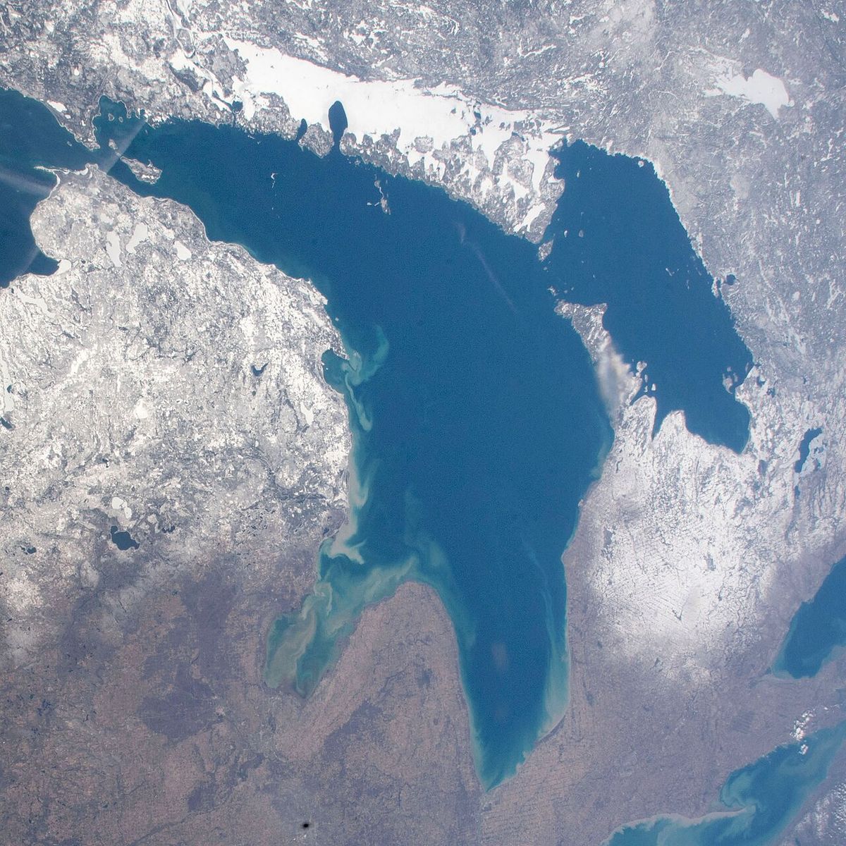
Lake Simcoe is a large freshwater lake located in southern Ontario, Canada, situated within Simcoe County, Durham Region, and York Region. It is the fourth-largest lake entirely within provincial boundaries, covering an area of 722 square kilometres. Historically known by several names, including Ouentironk and Lac Taronto, it was renamed in 1793 by Lieutenant-Governor John Graves Simcoe in memory of his father. The lake is a vital recreational hub for the region, renowned for fishing, boating, and as a key component of the Trent-Severn Waterway, while also facing significant ecological challenges.
Geography and Geology
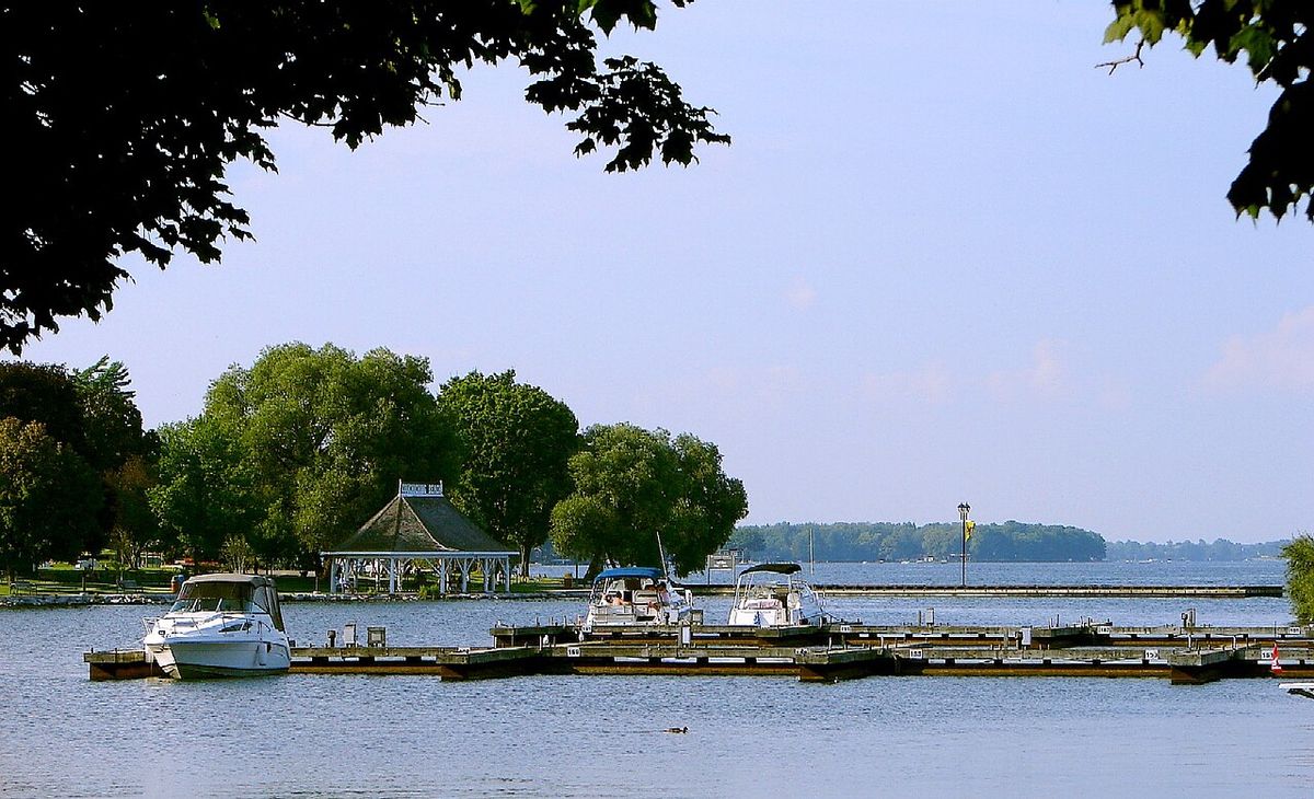
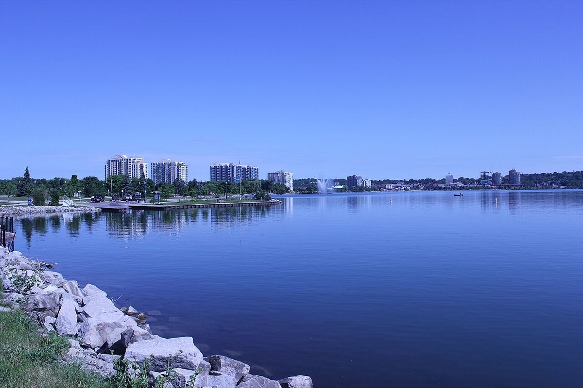
Lake Simcoe spans approximately 30 kilometres in length and 25 kilometres in width, forming a significant hydrological feature in southern Ontario. The lake is bordered by Simcoe County to the west and north, Durham Region to the east, and York Region to the south, with its watershed supporting a population of roughly half a million people. Major urban centres on its shores include the city of Barrie on Kempenfelt Bay and the city of Orillia at the entrance to Lake Couchiching. The town of Georgina occupies the entire southern shore, incorporating communities like Keswick on Cook's Bay, Sutton, Jackson's Point, Pefferlaw, and Udora, while the town of Innisfil lies on the western shore south of Barrie and north of Bradford. Eastside Simcoe includes the towns of Beaverton, Brechin and Lagoon City, contributing to the diverse settlement pattern around the lake. Lake Simcoe is a remnant of the much larger prehistoric Lake Algonquin, which once included the basins of Lake Huron, Lake Michigan, Lake Superior, Lake Nipigon, and Lake Nipissing. The lake sits on Paleozoic limestone bedrock from the Ordovician period, though this is largely buried under deep glacial sediments except for exposures on Georgina Island and along Lake Couchiching where sediments are thinner. The outlet at the north end of Lake Couchiching is controlled by Precambrian bedrock, which first appears about mid-way along that lake and has prevented Lake Simcoe from draining completely, unlike the former Lake Minesing to the west. Lake Minesing was a remnant of Lake Algonquin and later the Nipissing stage of Lake Huron, but its outlet near Edenvale was founded on sediments that were cut through, draining most of it to become the present-day Minesing Swamp, though it briefly re-establishes each spring with runoff.
The lake contains several islands, the largest of which is Georgina Island. Georgina Island, along with Snake Island and Fox Island, forms the reserve of the Chippewas of Georgina Island First Nation and these islands are within York Region. Other notable islands include Thorah Island, a popular cottage destination within Durham Region, and Strawberry Island, where Pope John Paul II stayed for four days prior to World Youth Day 2002 in Toronto. Helmers Island and Grape Island are also significant, with Grape Island located off Orillia and policed by the Ontario Provincial Police, and Goffatt Island is a small private island within Ramara. The completion of the Trent-Severn Waterway raised the lake's water level by several feet, altering earlier conditions where residents could sometimes wade or use wagons to cross to some islands when water levels were low. The Narrows, the channel connecting Lake Simcoe to Lake Couchiching, is a historically important site where First Nations peoples constructed fish weirs over 4,000 years ago, as shown by radiocarbon dating of surviving stakes. This practice of driving stakes into the channel sediments to corral fish, where fresh-cut saplings could sprout, likely gave rise to the Mohawk phrase 'tkaronto' meaning 'where there are trees standing in the water', which influenced the origin of the name 'Toronto'.
History and Toponymy
The lake has been known by several names throughout its history, reflecting its importance to Indigenous peoples and European settlers. At the time of first European contact in the 17th century, the Wendat (Huron) people called the lake Ouentironk, meaning 'Beautiful Water', a name rendered as Wentaron in European sources into the 20th century. The Mohawk phrase 'tkaronto', meaning 'where there are trees standing in the water', also described The Narrows and its fish weirs, and according to language expert John Steckley, this term was used by Mohawks to describe the fishing technique. This name eventually travelled south via the Toronto Carrying-Place Trail, a portage between Lake Ontario and Georgian Bay, to designate the early French Fort Toronto and later the modern city. French traders later called it Lac aux Claies, meaning 'Lake of Grids', again in reference to the Huron fishing weirs, and it was known by this name until the beginnings of Upper Canada. The lake was renamed in 1793 by John Graves Simcoe, the first lieutenant-governor of Upper Canada, in honour of his father, Captain John Simcoe of the Royal Navy, who was born in Staindrop, England, and died of pneumonia aboard HMS Pembroke in 1759. In the Anishinaabemowin language of the Rama and Georgina Island First Nations, the lake is called Zhooniyaang-zaaga'igan, or 'Silver Lake'. The Severn River, the lake's outlet, was once called Rivière de Toronto, flowing into Georgian Bay, which was then called Baie de Toronto, illustrating the geographic spread of the name.
Ecology and Environmental Challenges
Lake Simcoe's ecosystem has undergone significant changes, with eutrophication representing a major environmental issue. Excessive phosphorus loading from both urban and rural sources within the watershed has fostered algal blooms and dense aquatic weed growth. This process raises water temperatures and decreases dissolved oxygen levels, degrading habitat for cold-water fish species and rendering limited breeding grounds inhospitable. Historically a healthy lake trout, herring, and whitefish fishery, Lake Simcoe has seen dramatic declines in these native species, sometimes called Canada's ice fishing capital. The lake has also been invaded by several non-native species that have further disrupted its ecology, including zebra mussels, purple loosestrife, black crappie, spiny water flea, round goby, rusty crayfish and Eurasian milfoil. Zebra mussels, first detected in North American waters in 1985 and originating from the Black and Caspian Seas, filter the water and increase clarity, allowing more sunlight to penetrate to the lake bottom and accelerate plant growth and eutrophication. Rainbow smelt, another introduced species first observed in the early 1960s, are believed to compete with native lake whitefish and contributed to population declines.
Multiple initiatives are working to address these environmental challenges. The Lake Simcoe Environmental Management Strategy (LSEMS), the Lake Simcoe Conservation Foundation, and the Lake Simcoe Region Conservation Authority all conduct remediation and protection efforts. A local citizen group, The Ladies of the Lake, raised $250,000 from the sale of a nude picture calendar to rally government, business, schools, and citizens to rescue the lake. Several towns and communities on the lakeshore depend on Lake Simcoe for their drinking water, which adds urgency to water quality protection measures. The Region of York is finalizing plans for a new sewage treatment plant on the shores of Lake Simcoe, to be located on the Holland River in Cook's Bay, intended to support intensification of development within the watershed while managing wastewater impact. The health of the lake is critical for the cold-water fish species that indicate a healthy lake, where they are abundant and active.
Watershed and Hydrology
The Lake Simcoe watershed drains an area of 2,581 square kilometres of land in southern Ontario. A number of rivers and creeks flow into the lake, primarily from the south and east, with all rivers and most streams having wide, deep, navigable mouths as a consequence of rising waters drowning the river channels due to isostatic rebound. The most significant inflow from the east is the Talbot River, which is part of the Trent-Severn Waterway and connects Lake Simcoe to the Kawartha lakes system and ultimately to Lake Ontario. The lake's only natural outlet is at its north end through Lake Couchiching and into the Severn River, which was once called Rivière de Toronto and flows into Georgian Bay on Lake Huron. The Trent-Severn Waterway, with its system of canal locks, makes this connection navigable for boats, linking Lake Ontario to Georgian Bay via Lake Simcoe. This artificial waterway has permanently altered the lake's hydrology, raising its water level significantly since its completion, which increased the water table by several feet. The steady rise of the lake, particularly at its south end from isostatic rebound, is responsible for the deep organic sediments in the Holland Marsh, where organic deposits from vegetation have largely kept pace with the rising water and now support extensive market gardening.
Recreation and Tourism
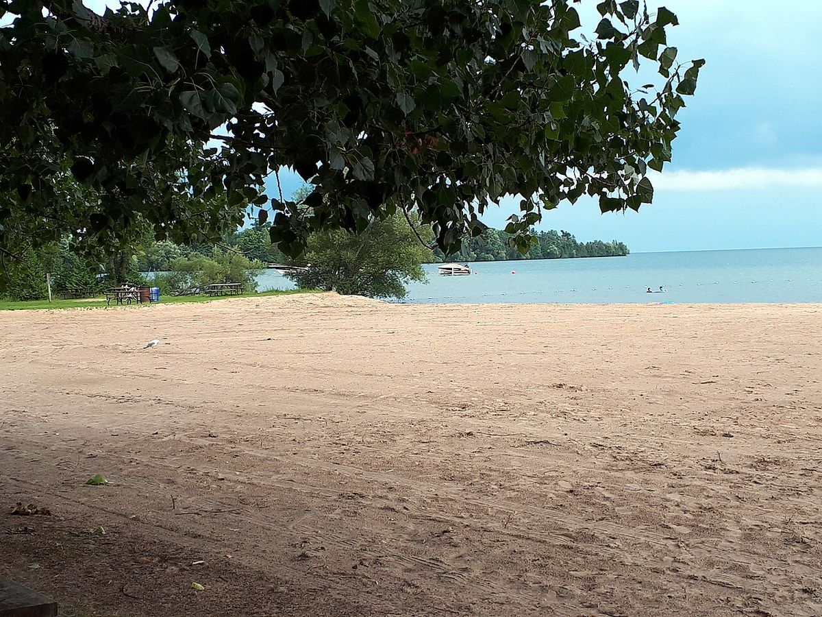
Lake Simcoe is a premier destination for year-round recreation, attracting visitors from across the Greater Toronto Area and beyond. In winter, the lake freezes over completely and becomes a centre for ice fishing, hosting numerous competitions and earning a reputation as one of the most intensely fished lakes in Ontario. Claims that it is one of the world's largest lakes to freeze over are considered speculative, as Canada has many lakes of similar or larger size that do the same. The summer season transforms the lake into a hub for boating, fishing, and water sports, with the many cottages along the shoreline contributing to heavy recreational and boating use. Popular events include poker runs and jet-skiing, while the lake's beaches, such as Willow Beach in Georgina, are favoured for their cleaner and warmer water compared to Lake Ontario beaches and are also used for activities like kite surfing. The lake supports an active sailing community with seven yacht clubs that host a number of regattas.
Lake Simcoe is also a noted destination for scuba diving, with several popular sites for freshwater divers. The wreck of the J. C. Morrison, which sank in 1857 near Centennial Beach, is a frequented dive site. Kempenfelt Bay is particularly popular with divers due to it being the deepest part of the lake, though visibility can vary widely from over 9 metres to almost zero. The lake's role as part of the Trent-Severn Waterway also makes it a key segment for recreational boaters travelling between Lake Ontario and Georgian Bay. The lake has little commercial activity but sees many recreational uses, cementing its status as a regional leisure centre.
- Winter ice fishing competitions draw large crowds and it is known as Canada's ice fishing capital.
- Seven yacht clubs host sailing regattas and support an active sailing community.
- Willow Beach in Georgina is one of the largest and most popular public beaches on the lake.
- The wreck of the J. C. Morrison (sank 1857) is a key scuba diving site off Centennial Beach.
- Kempenfelt Bay is the deepest area, offering prime diving conditions with variable visibility.
- The lake is a central part of the navigable Trent-Severn Waterway linking two Great Lakes.
- Beaches attract visitors for kite surfing and swimming due to warmer, cleaner water.
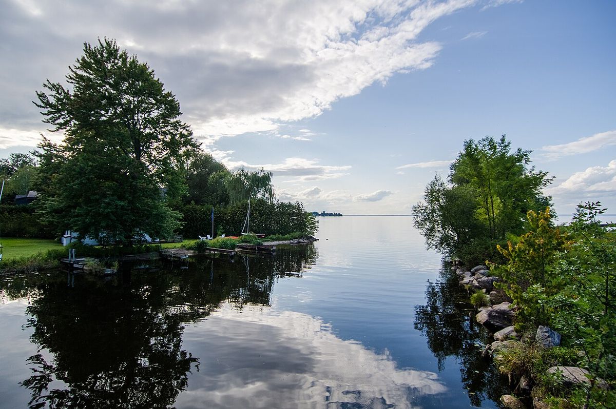
Law Enforcement and Management
Marine safety and enforcement on Lake Simcoe is a shared responsibility among several police services, reflecting its multi-jurisdictional location. The Ontario Provincial Police (OPP), South Simcoe Police Service, York Regional Police, Durham Regional Police, and Barrie Police Service all operate marine units that patrol the lake's waters. The Georgina Island Police Service provides law enforcement on Georgina, Fox, and Snake Islands and has some capability to respond to marine incidents near these islands. Grape Island, being part of Orillia, falls under the jurisdiction of the OPP, and this coordinated approach manages the significant recreational and residential use of the lake throughout the year, ensuring safety for boaters, anglers, and residents across different regions.
Statistical and Physical Data
Lake Simcoe is a lake in southern Ontario, Canada. It is the fourth-largest lake entirely within provincial boundaries. The lake is about 30 kilometres long and 25 kilometres wide, with an area of 722 square kilometres. Its watershed drains an area of 2,581 square kilometres.
| Feature | Measurement | Notes and Context |
|---|---|---|
| Surface Area | 722 km² | Fourth-largest lake wholly within Ontario, after Lake Nipigon, Lac Seul, and Lake Nipissing. |
| Watershed Area | 2,581 km² | Land area draining into the lake, supporting about half a million people. |
| Average Surface Temp (2017) | 2.5 °C (36.5 °F) | Yearly average from NOAA data for the prior year. |
| Length | 30 km (19 mi) | Approximate north-south extent. |
| Width | 25 km (16 mi) | Approximate east-west extent. |
| Primary Outlet | Severn River | Flows from Lake Couchiching to Georgian Bay (Lake Huron). |
| Historic Stage | Lake Algonquin | Prehistoric glacial lake of which Simcoe is a remnant. |
| Notable Depth Area | Kempenfelt Bay | The deepest part of the lake, popular for scuba diving. |
Data from 2017 shows the lake has a yearly average surface temperature of 2.5 degrees Celsius. When healthy, the lake supports cold-water fish such as lake trout, herring, and whitefish. However, the lake has been impacted by significant eutrophication and excessive aquatic plant growth. Phosphorus emissions from urban and rural sources have upset the lake's ecosystem.
Questions about Lake Simcoe
Where is Lake Simcoe located?
Lake Simcoe is situated in southern Ontario, Canada. It lies within the boundaries of Simcoe County, Durham Region, and York Region. Major cities on its shores include Barrie on Kempenfelt Bay and Orillia at the connection to Lake Couchiching. The lake's watershed extends into the northern part of the Greater Toronto Area and contains a population of roughly half a million people.
How did Lake Simcoe get its name?
The lake was renamed Lake Simcoe in 1793 by John Graves Simcoe, the first lieutenant-governor of Upper Canada, in memory of his father, Captain John Simcoe of the Royal Navy. Prior to this, it was known by several other names. The Wendat (Huron) people called it Ouentironk, meaning 'Beautiful Water'. French traders and maps referred to it as Lac Taronto or Lac aux Claies (Lake of Grids), and in Anishinaabemowin it is called Zhooniyaang-zaaga'igan (Silver Lake).
What are the major environmental issues facing Lake Simcoe?
The primary environmental issue is eutrophication, caused by excessive phosphorus entering the water from urban and rural sources. This leads to algal blooms, weed growth, warmer water, and lower oxygen levels, harming cold-water fish habitat. The lake is also affected by numerous invasive species, including zebra mussels, rainbow smelt, and Eurasian milfoil, which further disrupt the ecosystem. Multiple conservation authorities and local groups like The Ladies of the Lake are working on remediation efforts.
What recreational activities are popular on Lake Simcoe?
Lake Simcoe is a year-round recreational destination. In winter, it is famous for ice fishing competitions and is sometimes called Canada's ice fishing capital. Summer activities include boating, jet-skiing, sailing, fishing, and swimming at public beaches like Willow Beach which is also used for kite surfing. The lake is also a noted site for scuba diving, with wrecks like the J. C. Morrison and the deep waters of Kempenfelt Bay attracting divers. It forms part of the Trent-Severn Waterway for recreational boating.
What islands are found in Lake Simcoe?
Lake Simcoe contains a large island called Georgina Island. Snake Island and Fox Island, along with Georgina Island, form the reserve of the Chippewas of Georgina Island First Nation. The lake is dotted with several smaller islands including Thorah Island, Strawberry Island, Helmers Island, Grape Island, and Goffatt Island. Georgina, Snake, and Fox Islands are within York Region, while Thorah Island is within Durham Region. Strawberry Island and Helmers Island are privately owned within Ramara in Simcoe County. Grape Island is off Orillia and Goffatt Island is a small private island within Ramara.
How is Lake Simcoe connected to the Great Lakes?
Lake Simcoe drains northward into Lake Couchiching, which then flows into the Severn River. The Severn River empties into Georgian Bay, which is part of Lake Huron. The lake is also artificially connected to Lake Ontario via the Trent-Severn Waterway, which uses the Talbot River as an inflow channel and a series of locks to make the route navigable between the two Great Lakes. This waterway raised Lake Simcoe's water level by several feet after its completion.
Sources and further reading
- Lake Simcoe (Wikipedia)
- Paid Parking (lsrca.on.ca)
- 11 Provincial Parks to Visit in Simcoe County (experience.simcoe.ca)
Checked by the Your Space Hamilton desk. Last updated 2026-10-23.