The Junction
The Junction is a historic neighbourhood in the west end of Toronto, Ontario, centred around the intersection of Dundas Street West and Keele Street. Originally an independent city known for its railway junction and manufacturing base, it was annexed by Toronto in 1909. Today, it is a rapidly gentrifying area celebrated for its arts scene, diverse culinary offerings, and unique history, including its status as Toronto's last legally 'dry' neighbourhood until 2000. The neighbourhood remains a vital and evolving part of Toronto's urban fabric, attracting residents and visitors with its blend of heritage and contemporary culture.
Historical Development and Industry
The area now known as The Junction was primarily rural until the 1870s, with early settlement led by landowner John Scarlett, who built his home 'Runnymede' in 1838 near the present-day intersection of Dundas Street West and St. John's Road. Scarlett had acquired most of the property that constitutes the modern neighbourhood, and much more land to the north and west, by 1817. From 1857 to 1876, the southeast part of the neighbourhood was dominated by the Carlton Race Course, owned by William Conway Keele and his son Charles Keele, which hosted the first running of the Queen's Plate. The arrival of multiple railway lines in the 1880s transformed the area, prompting developer Daniel Webster Clendenan to subdivide the old racetrack land, with the approximate locations of its main straightaways now occupied by High Park Avenue and Pacific Avenue.
The Junction rapidly industrialized in the late 19th century, becoming a major manufacturing hub for the region. Foundries, mills, furniture assembly plants, nail and wire factories, and meat processing facilities were established, attracting significant companies like Canada Packers, Canadian Cycle & Motor Co., Campbell Milling Company, and the Heintzman piano company. The availability of cheap land, labour, and lower taxes compared to downtown Toronto, coupled with a major Canadian Pacific railway operation that established yards from Keele Street to Scarlett Road and a local port of entry acquired in the 1890s for clearing goods, drove this economic growth. This industrial boom attracted a diverse immigrant workforce, including many Irish Catholics who moved from crowded tenements in areas like Cabbagetown and Brockton Village, as well as workers from English industrial cities like Birmingham and Manchester.
They were soon followed by many from non-English speaking countries, including Italians, Poles, Macedonian and Croatian immigrants, a large number of whom found employment in the burgeoning meat industry. The neighbourhood's economy was volatile, experiencing prosperity between 1888 and 1890 but significant poverty during the Long Depression from 1893 to 1900, which saw factory closures, an end to construction, and a municipality struggling under a large civic debt. A defining chapter in the area's social history began in 1904 when residents, led by Bill Temple, voted to ban the sale of alcohol, a prohibition that remained in effect until 1998. This 'dry' law, which dissuaded restaurants from establishing themselves and barred pubs, contributed to the commercial decline of Dundas Street West after annexation in 1909. The ban was finally overturned after a community effort, with establishments like Vesuvio Pizzeria and Shoxs Sports Saloon leading the fight to regain the right to serve alcohol. The first legal drink was poured east of Keele Street at Shoxs Sports Saloon in 2001, an event many credit, along with civic improvements like the burial of electric distribution lines, with sparking the area's revitalization. The long-term effects of local abattoirs and other industries, which produced volumes of toxic waste, have led to ongoing community concern about pollution issues, with the City of Toronto investing significant effort into cleaning up former industrial sites.
Geography and Land Use
The core of The Junction is generally considered to be the area north of Annette Street, south of St. Clair Avenue, between Runnymede Road and the Canadian National Railway corridor to the east. This area contains the West Toronto Diamond, a junction of four railway lines that gives the neighbourhood its name. Historically, the boundaries of the former City of West Toronto were much larger, extending north past St. Clair to Rowntree Avenue, south to Bloor Street, east in a zig-zag along the CN tracks, and west to Jane Street in the southwest between Bloor and Annette. Since the 1920s, commercial development on Bloor Street has caused the area between The Junction and Swansea to develop its own identity, with many residents there now identifying more with Runnymede-Bloor West Village.
The northeastern quadrant of the neighbourhood is known as The Stockyards. This area was the location of the Ontario Stockyards, which opened in 1903 as Union Stockyards to replace the Toronto Municipal Cattle market. For a time, this was Canada's largest livestock market and the centre of Ontario's meat packing industry, which reinforced Toronto's nickname as Hogtown. The Ontario Stockyards closed at this site in 1993, moving to Cookstown, and most of the meat-packing plants that surrounded it, like Canada Packers, closed shortly thereafter. The main Stockyards site has since been redeveloped with a large bloc of big-box stores, including Metro, Home Depot, Canadian Tire, Best Buy, Rona, Staples, and Nations Fresh Foods, an Asian supermarket, along with several smaller stores. There are still some smaller meat-packing facilities in the area, and the name 'Stockyards' is still used for the area.
Another distinct area within The Junction is Little Malta, centred around Dundas Street West and St. John's Road. Since the early 1920s, this area has been known as Little Malta, and it received signs to that effect in the 1990s. The Maltese-Canadian community maintains a visible presence with several Maltese-Canadian businesses and a distinctly Maltese church. The community has partially spread out to suburbs like Mississauga and other Toronto suburbs. Much of the lands in the wider Junction area have been redeveloped with new housing and retail uses on former industrial sites.
Demographics and Community Character
The Junction has a consistent population, popular with a broad age range from people in their 20s to their 50s. According to census data, the population of the core tract (5350101) was 3,136 in 2006, decreasing slightly to 3,092 by the 2011 National Household Survey. The demographic composition has shifted over time, reflecting broader urban trends and the area's gentrification. In 2006, out of a population of 3,136, 2,555 people were not of a visible minority, 130 identified as Black, 45 as Chinese, 145 as Latin American, and 85 as Southeast Asian. By 2011, the non-visible minority count was 2,485 out of 3,092, with 135 people identifying as Black, 120 as Chinese, 100 as Latin American, and 30 as Southeast Asian.
This data shows a decrease in the Latin American population from 145 to 100 and the Southeast Asian population from 85 to 30 between 2006 and 2011, while the Black and Chinese populations increased. By 2011, the Black population had become the largest visible minority group in the tract. The neighbourhood is ethnically diverse, with residents reporting 135 different ethnic origins. 34% are first-generation immigrants and 31% are second-generation immigrants. Household composition is varied, with families with children making up 36% of households, couples without children at 22%, and single-person households at 33%, indicating a mix of family-oriented and single-resident living.
The area has undergone significant gentrification in recent decades, attracting young professionals and artists with initially lower rents and the subsequent opening of restaurants, bars, boutiques, and galleries along Dundas Street West. This transformation has created a community with a strong sense of local pride, balancing its industrial heritage with new residential developments. The housing stock includes mostly condos and townhouses, with a mix of older and newer homes, and is a mix of owner and renter-occupied dwellings. Approximately 37% of households have moved within the past five years and 12% within the past year, indicating a dynamic and mobile population. The professional, scientific and technical services industry is the most common for residents, with 50% of adults holding a bachelor's degree or higher and 74% having any form of postsecondary education.
Education and Recreation
The Junction is served by four publicly funded school boards: the English-first language Toronto District School Board and the French-first language Conseil scolaire Viamonde (secular), and the English-first language Toronto Catholic District School Board and the French-first language Conseil scolaire de district catholique Centre-Sud (Catholic). This provides a range of educational options for local families, including special programs such as French Immersion, Special Education, Advanced Placement, International Baccalaureate, and Montessori. In total, there are 15 public schools, 9 Catholic schools, 2 private schools, and 1 alternative or special school serving the broader Junction area, reflecting the community's needs and diversity. Several elementary schools operate within the neighbourhood, each with its own history and community role.
- Annette Street Public School (265 Annette Street): Original building constructed in 1886, with a west wing added in 1960. Shares facilities with High Park Alternative School.
- High Park Alternative School (shared at 265 Annette Street): Founded in 1981 as a public elementary school sharing the Annette Street building.
- Indian Road Crescent Junior Public School (285 Indian Road Crescent): Serves Junior Kindergarten to Grade 6 with about 330 students, east of Annette and Keele.
- St. Cecilia Catholic School (355 Annette Street): Opened in 1914 at the corner of Evelyn Avenue, with additions in 1918, 1954, and 1964.
- St. Clair Avenue Public School (near Britannia Ave): Constructed in 1912 and demolished in the early 1990s. The site now has townhouses.
Arts, Culture, and Major Events
The Junction has cultivated a strong arts and cultural identity, significantly driven by the initiatives of The Junction Business Improvement Area, a community-driven non-profit organization dedicated to promoting economic and cultural vitality. A major, permanent artistic feature is a collection of 11 augmented reality (AR) wall murals scattered throughout the neighbourhood, created as part of the area's placemaking efforts. Using the free Artivive app, visitors can view these static murals come to life with animation and storytelling, making The Junction Toronto's only year-round AR destination for public art. The BIA provides self-guided AR Mural Tour maps online and at information booths to encourage exploration of these digital installations, which connect art, technology, and the neighbourhood's creative spirit.
The signature annual event is Taste of the Junction, a one-day outdoor market and cultural celebration organized by the BIA. The 2026 edition is scheduled for Saturday, June 27, from 11:00 a.m. to 7:00 p.m., taking over the Green P parking lot at 385 Pacific Avenue and the adjacent Darren's No Frills parking lot. The event aligns with Toronto's role as a host city for the FIFA World Cup 2026 and its theme, 'The World in a City,' and is funded in part by the City of Toronto's Community Celebration Support Fund for World Cup programming. It typically features over 50 curated vendor booths with local makers and food, DJ programming, a family-friendly Play Zone, and pop-up experiences. A highlight of the 2026 event is 'Passageways,' a series of five immersive cultural installations created by local artists selected from 32 submissions, each representing one of the neighbourhood's large cultural communities.
The five Passageways installations are housed in 10 x 10-ft tents. These are immersive, walk-in cultural installations created by local artists. Each installation transforms a small footprint into a richly layered, photo-worthy cultural environment. The Passageways celebrate five of the Junction's largest cultural communities. These cultural themes include British, Black, South Asian, Chinese, and Portuguese cultures.
- Margaret Cresswell created the installation representing British culture.
- Favour Enemaku and Vinh Phat Luu collaborated on the installation for Black (African and Caribbean) heritage.
- Sarah Alinia Ziazi was selected to create the South Asian cultural installation.
- Jacqueline Chan developed the installation representing Chinese culture.
- Julia Louise Pereira was the artist for the Portuguese cultural installation.
These walk-in environments are designed with tactile features and audio guides via QR code to provide a multi-sensory, photo-worthy experience. Other notable events include the Junction Summer Solstice Festival in June and participation in the citywide Contact Photography Festival in May. The neighbourhood's unique history, including its long prohibition, is also celebrated through events like 'Junction Dry No More,' a neighbourhood-wide festival scheduled for October 2 to 4, 2026. The area's cultural significance has been referenced in popular media, such as an episode of the television series Murdoch Mysteries in its ninth season ('The Local Option'), which focused on The Junction and its temperance movement history.
Local Economy and Transportation
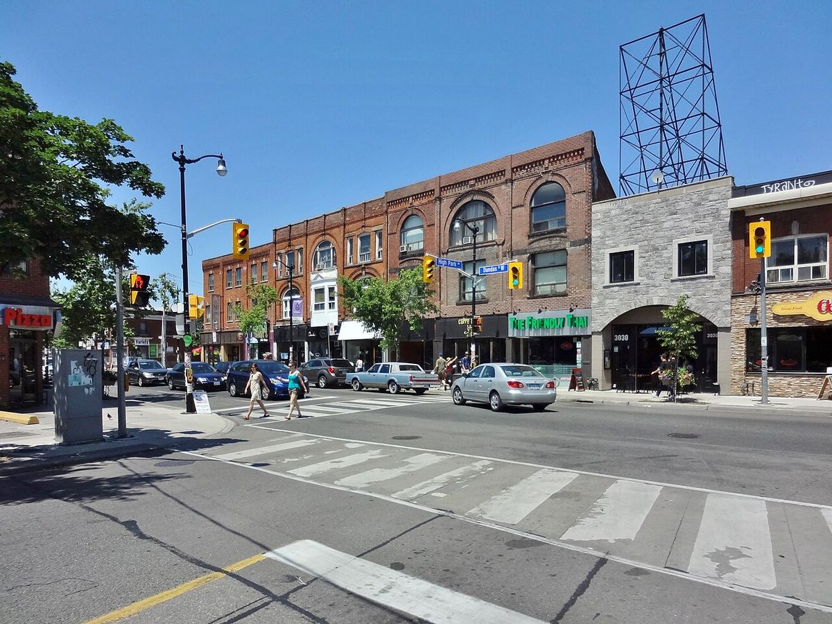
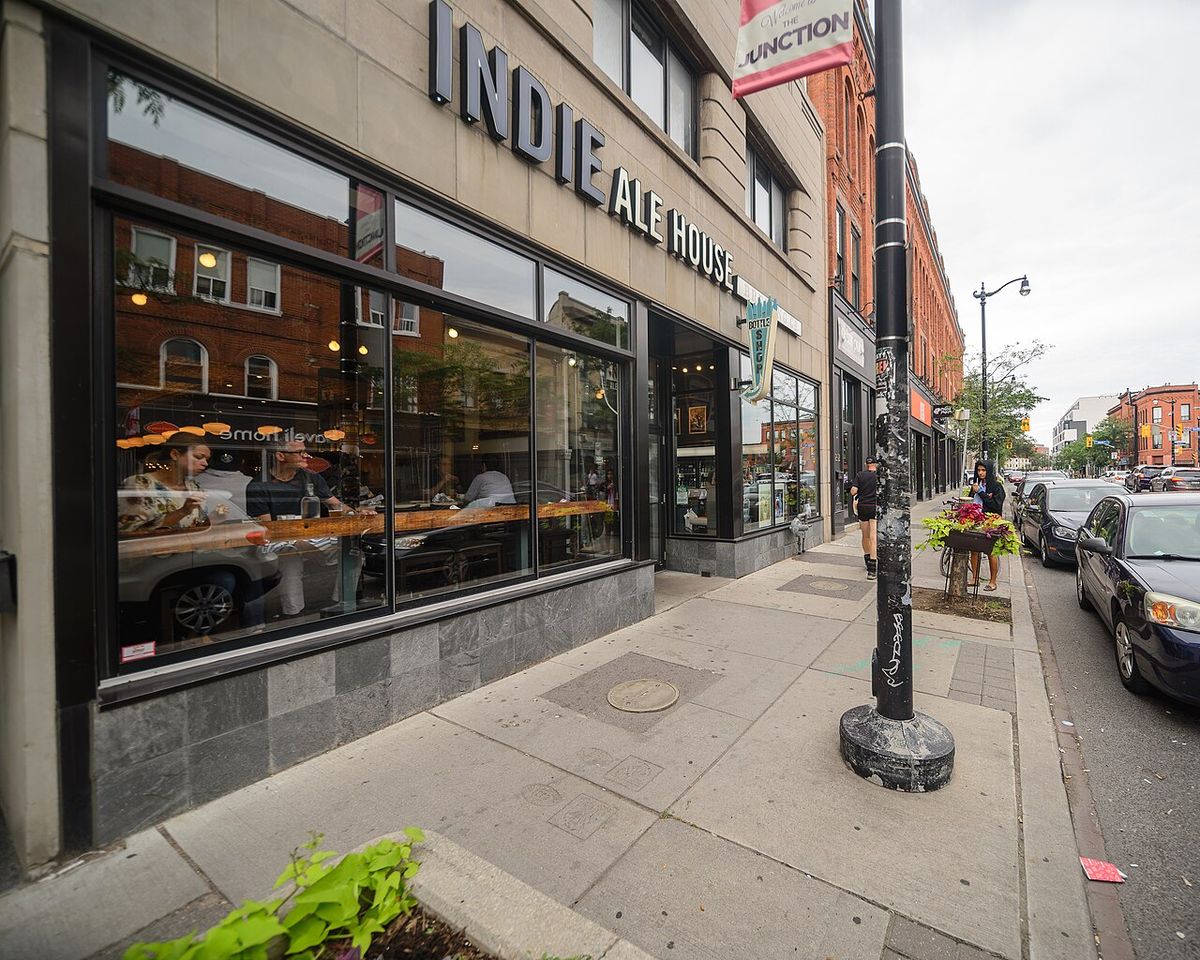
The local economy has dramatically shifted from its heavy industrial past to a contemporary mix of retail, services, and creative industries, though it retains some smaller-scale manufacturing. Dundas Street West between Keele Street and Runnymede Road forms the main commercial strip, now lined with independent boutiques, galleries, music venues, restaurants, and cafes that have opened during the period of rapid gentrification. The Stockyards area provides big-box retail shopping at stores like Metro, Home Depot, and Canadian Tire, while smaller specialty shops, such as When the Pig Came Home for smoked meat and Mjölk for Japanese and Scandinavian housewares, offer unique goods that attract visitors. The professional, scientific and technical services industry is the most common employment sector for residents, reflecting the area's educated workforce. 50% of adult residents hold a bachelor's degree or higher, and 74% have some form of postsecondary education.
Transportation access is a historic and continuing strength of the neighbourhood, fundamental to its original growth. The Junction is named for the West Toronto Diamond railway junction where four lines meet, and these rail corridors remain a defining feature of the eastern boundary. For public transit, the area is primarily served by the Keele subway station on the TTC's Line 2 (Bloor-Danforth), with connecting bus routes like the 89 and 189 bringing riders north to Dundas Street West. The Dundas West subway station is also a key access point, with the 40 bus running along Dundas Street into the neighbourhood. There are 110 transit stops within the Junction area, and the Bloor GO Station provides regional rail connections. Commuting patterns show a mix of vehicle and transit use, with most residents commuting within the city of Toronto.
The Junction BIA actively promotes the local economy through marketing, beautification projects, and events designed to support businesses and attract visitors. Sponsors and funders for events like Taste of the Junction include local enterprises such as Darren's No Frills, Govan Brown, Sidorova Inwood, TD Bank Group, The Diamond and The Spoke, and the City of Toronto. This support helps transform the neighbourhood into a welcoming west-end destination where culture, creativity, and local business intersect. The area's proximity to major attractions like High Park and the upcoming FIFA World Cup 2026 venue at Exhibition Place positions it as a notable stop for visitors exploring Toronto's west end, further integrating it into the city's broader economic and cultural networks.
Questions about The Junction
What are the boundaries of The Junction in Toronto?
Today, the term 'The Junction' is generally applied to the area north of Annette Street, south of St. Clair Avenue, and between Runnymede Road and the Canadian National Railway corridor to the east. The northeastern part of this area is known as The Stockyards. Historically, the boundary lines covered a considerably larger area. The City of West Toronto, as annexed by Toronto in 1909, had a northern boundary well past St. Clair, a southern boundary of Bloor Street, and a western boundary as far as Jane Street in the southwest.
What is the Taste of the Junction event?
Taste of the Junction is a one-day outdoor market and cultural celebration. The 2026 event is scheduled for Saturday, June 27, from 11:00 a.m. to 7:00 p.m. in the Green P parking lot at 385 Pacific Avenue. The event features over 50 vendor booths with local makers, food, and drink. It also includes DJ programming, a family-friendly Play Zone, and immersive cultural installations called Passageways. The Junction BIA organizes the event to celebrate the creativity and character of the neighbourhood.
How do I see the augmented reality murals in The Junction?
The Junction features 11 permanent augmented reality wall murals. These murals can be viewed using the free Artivive smartphone app. When you point your device's camera at a designated mural through the app, an animated version of the artwork comes to life on your screen. The Junction BIA provides self-guided AR Mural Tour maps to help visitors locate all the murals.
What is the best way to get to The Junction by public transit?
The primary transit hub for The Junction is Keele subway station on the TTC's Line 2 (Bloor-Danforth). From there, you can take the 89 or 189 bus north to Dundas Street West. Alternatively, from Dundas West subway station, you can take the 40 bus and get off at Indian Grove or Keele Street. The neighbourhood is well-served by local buses, with 110 transit stops in the area, and is also near Bloor GO Station for regional rail connections.
Why was The Junction called a 'dry' neighbourhood?
The Junction was called a 'dry' neighbourhood because its residents voted to ban the sale of alcohol in 1904. This prohibition was led by Bill Temple in response to the out of hand behaviour of the area's many railway and factory workers. The ban made it illegal to sell alcohol, which discouraged restaurants and bars from establishing themselves and contributed to a commercial decline on Dundas Street. The ban was finally overturned in 1998, with the first legal drink poured east of Keele Street at Shoxs Sports Saloon in 2001, an event credited with helping to begin the neighbourhood's revitalization.
What is the history of the Stockyards in The Junction?
The Stockyards refers to the Ontario Stockyards, which opened in 1903 as Union Stockyards in the northeastern quadrant of The Junction. It replaced the earlier Toronto Municipal Cattle market and for a time was Canada's largest livestock market, serving as the centre of Ontario's meat packing industry and reinforcing Toronto's nickname as Hogtown. Major plants like Canada Packers operated around it. The stockyards closed at this site in 1993, moving to Cookstown north of the city, and most surrounding meat packing plants closed shortly after. The main site has since been redeveloped with big box retail stores like Home Depot and Canadian Tire, though the area is still called The Stockyards and some smaller meat packing facilities remain in the vicinity.
Sources and further reading
- The Junction (Wikipedia)
- Taste of the Junction 2026 (torontojunction.ca)
- The Junction (destinationtoronto.com)
- Taste of the Junction, TABIA (toronto-bia.com)
- Junction Area Neighbourhood Guide (hoodq.com)
Checked by the Your Space Hamilton desk. Last updated 2026-10-24.