Shaughnessy, Vancouver
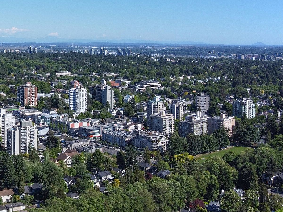
Shaughnessy is a prestigious, almost entirely residential neighbourhood in Vancouver, British Columbia, known for its large heritage homes, expansive tree-lined streets, and significant affluence. Encompassing approximately 447 hectares in a central location, it is historically divided into the older and more exclusive First Shaughnessy district and the surrounding areas. The neighbourhood was created in 1907 by the Canadian Pacific Railway as an elite enclave and named after the railway's former president, Thomas Shaughnessy, 1st Baron Shaughnessy. Its boundaries are 16th Avenue to the north, 41st Avenue to the south, Oak Street to the east, and East Boulevard to the west, with First Shaughnessy specifically bordered by King Edward Avenue to the south.
History and Development
The Shaughnessy neighbourhood was conceived and developed in 1907 by the Canadian Pacific Railway, which was at the time Canada's largest real estate developer. It was designed as a more exclusive residential alternative to Vancouver's West End, which had traditionally housed the city's elite. Through aggressive marketing and highly regulated development standards, the railway successfully established Shaughnessy as the premier address for Vancouver's wealthy families over the following century. The neighbourhood's layout features elegant, winding streets with generous lots, a deliberate contrast to the grid patterns found in other parts of the city. Key historic estates within its boundaries include Glen Brae and the prominent Hycroft Manor, which reflect the area's architectural heritage and social history.
The character of the oldest section, known as First Shaughnessy, is particularly defined by its mature landscaping and stately homes. Streets like Angus Drive and Osler Street are notable for their tree-lined medians in addition to the rows of trees along the road edges. This attention to landscape design was an integral part of the original plan to create a park-like setting for residential life. The preservation of this historic character was formally codified in 1981 with the adoption of the First Shaughnessy Official Development Plan. This municipal bylaw strictly promotes single-family dwelling ownership and limits property subdivision and population density, ensuring the area's low-density, estate-like feel endures and preventing the redevelopment seen elsewhere in the city.
Geography and Boundaries
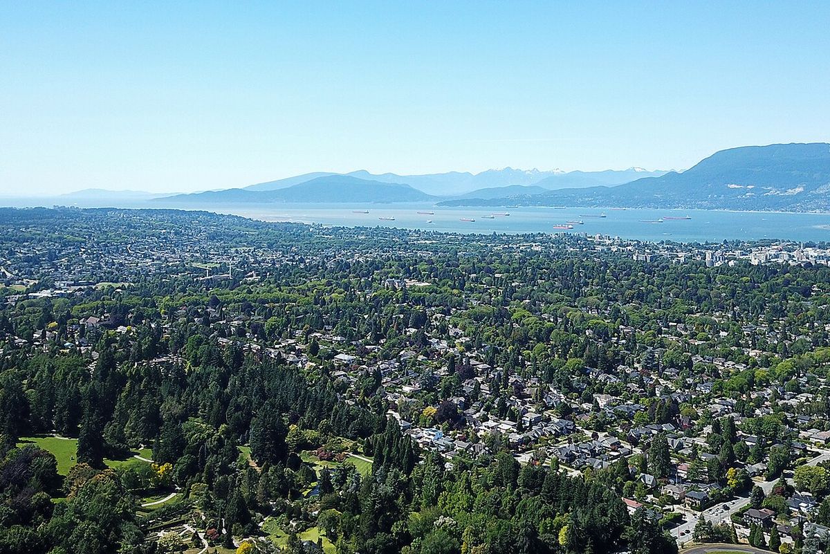
Shaughnessy occupies a central position within Vancouver, spanning roughly 447 hectares. Its official boundaries are 16th Avenue to the north, 41st Avenue to the south, Oak Street to the east, and East Boulevard to the west. Within this larger area, the more prestigious First Shaughnessy district is a defined sub-area with slightly different borders. First Shaughnessy is bounded by 16th Avenue to the north, King Edward Avenue to the south, Oak Street to the east, and East Boulevard to the west. The western edge of the neighbourhood is paralleled by the Arbutus Greenway, a linear park purchased by the City of Vancouver from the Canadian Pacific Railway. This greenway stretches along the border from 41st Avenue up to 16th Avenue, providing a recreational corridor for walking and cycling that separates Shaughnessy from adjacent communities.
Demographics and Socioeconomics
According to the 2016 census, Shaughnessy had a population of 8,430 residents, representing a decrease of 4.3 percent from the previous census period five years earlier. The age distribution shows a mature community, with 34 percent of residents aged between 40 and 64 and another 21.6 percent aged 65 or older. Younger demographics are smaller, with 20.8 percent under 20 and 23.8 percent between 20 and 39. Linguistically, the neighbourhood is diverse, with 51.8 percent of residents speaking English as a first language and 32.3 percent speaking Chinese. Other languages spoken at home include Tagalog, Korean, Spanish, and French, each by less than 5 percent of the population.
The socioeconomic profile of Shaughnessy is marked by significant wealth. The median annual household income was $111,566 in 2016, with the average house price being $2.89 million, the highest such figure in Vancouver. Within the specific area of Shaughnessy Heights, the average annual household income was reported as $777,184. Despite the overall affluence, 15.5 percent of the population lives in low-income households, and the unemployment rate at the time of the census was 4.7 percent. The high cost of housing is intrinsically linked to the neighbourhood's history and its preservation policies, which limit new development and maintain a stock of large, single-family homes on valuable land.
Architecture and Housing
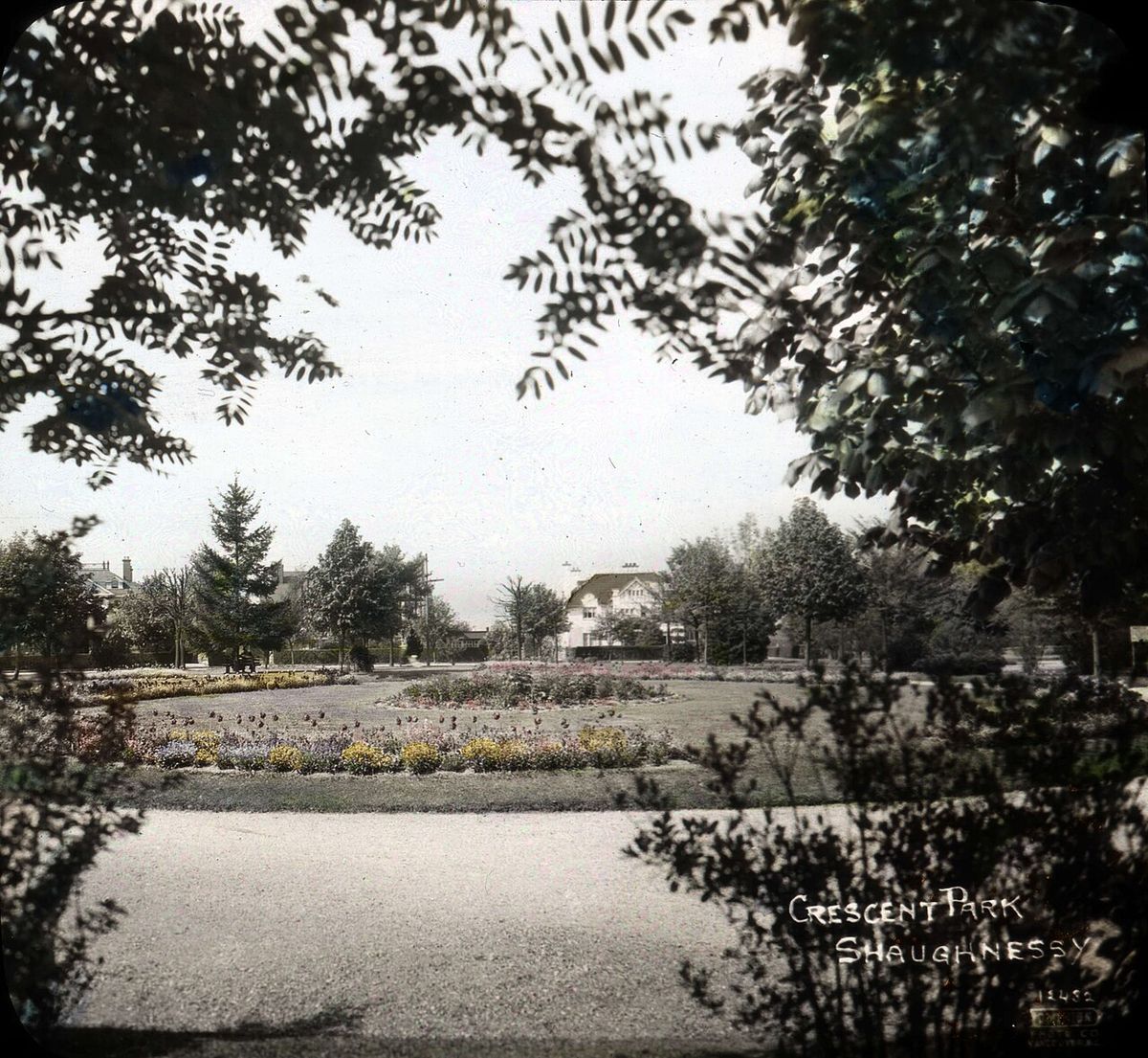
Shaughnessy is renowned for its architectural heritage, particularly within First Shaughnessy, which contains a high concentration of historical homes from the early 20th century. A striking 50.9 percent of the neighbourhood's homes were built before or during the Second World War, compared to a city-wide average of just 23.3 percent. This preservation is a direct result of the 1981 First Shaughnessy Official Development Plan, a municipal bylaw designed to protect the area's character. The bylaw promotes private property ownership and single-family dwellings while actively limiting property subdivision and increases in population density. The architectural styles range from Tudor Revival and Craftsman to Colonial Revival, often set on large, landscaped lots that contribute to the area's park-like atmosphere.
The policy framework has effectively prevented the redevelopment and densification seen in other Vancouver neighbourhoods, cementing Shaughnessy's status as an enclave of low-density, high-value real estate. The large lot sizes and mature gardens are defining features, with many properties featuring significant frontage and setback from the street. This built environment, combined with the lush tree canopy, creates a distinct sense of place that differs markedly from the rest of the city. The ongoing maintenance of these homes and landscapes requires considerable resources, which aligns with the demographic profile of the area's residents and their high average household incomes.
Education
Shaughnessy is home to several notable independent schools, contributing to its family-oriented reputation. These private institutions include Little Flower Academy, an all-girls Catholic school, Vancouver College, an all-boys Catholic school, and York House School, an independent day school for girls. For public education, the neighbourhood is served by Shaughnessy Elementary School and Quilchena Elementary School at the primary level. The sole public high school physically located within Shaughnessy is Point Grey Secondary School. However, depending on specific catchment areas, students may also attend Eric Hamber Secondary School in the nearby Oakridge neighbourhood or Prince of Wales Secondary School in Arbutus Ridge. The presence of these high-calibre educational institutions, both public and private, is a significant draw for families residing in the area and supports the community's demographic mix.
Parks and Recreation
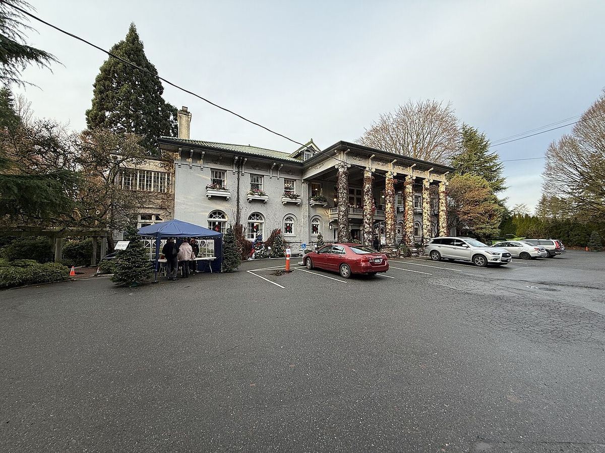
The neighbourhood features five main parks that provide green space for residents and visitors. The most centrally located is Shaughnessy Park, formally known as Crescent Park, along with Angus Park located within the First Shaughnessy area. The other three parks are Devonshire Park, Kerrisdale Park, and the internationally renowned VanDusen Botanical Garden. In addition to these formal parks, the western border of Shaughnessy is defined by the Arbutus Greenway, a linear park and active transportation corridor purchased by the City of Vancouver from the Canadian Pacific Railway.
- Shaughnessy Park (Crescent Park): A neighbourhood park with open green space and recreational facilities.
- Angus Park: A smaller park located within the First Shaughnessy district.
- Devonshire Park: Offers playgrounds and sports fields for community use.
- Kerrisdale Park: Includes a community centre, ice rink, and other amenities.
- Arbutus Greenway: A linear park and pathway running along the neighbourhood's western edge from 16th to 41st Avenue.
Shaughnessy has five parks, including Shaughnessy Park, which is formally known as Crescent Park, and Angus Park in First Shaughnessy. The other three parks in the neighbourhood are Devonshire Park, Kerrisdale Park, and VanDusen Botanical Garden. VanDusen Botanical Garden is located between 33rd and 41st Avenues. The Arbutus Greenway, purchased by the City of Vancouver from Canadian Pacific Railway, stretches along the western border of Shaughnessy from 41st Avenue to 16th Avenue. These parks and the greenway provide recreational space within the urban setting.
Transportation and Access
Shaughnessy is well-connected by Vancouver's major arterial roads, with Oak Street running along its eastern flank and providing a direct route to the city centre and bridges across the Fraser River. The neighbourhood's internal street network is characterized by curvilinear roads designed to slow traffic and enhance the residential ambiance, rather than facilitate through traffic. Public transit service is provided by TransLink buses along the perimeter routes such as 16th Avenue, 41st Avenue, and Oak Street. The Arbutus Greenway along the western border also serves as a key active transportation route for cyclists and pedestrians, connecting to other neighbourhoods. While the area is primarily automobile-oriented due to its low-density nature, its central location provides relatively easy access to commercial districts like Kerrisdale to the west and South Granville to the east, balancing seclusion with convenience.
Questions about Shaughnessy, Vancouver
Why are houses in Shaughnessy so expensive?
Houses in Shaughnessy are the most expensive in Vancouver, with an average price of $2.89 million, due to a combination of historical prestige, large lot sizes, and restrictive zoning. The neighbourhood was established as an elite enclave by the Canadian Pacific Railway in 1907. The 1981 First Shaughnessy Official Development Plan bylaw prevents subdivision and limits density, preserving large single-family homes on expansive properties. This constrained supply, coupled with high demand for homes in a central location with heritage character and top schools, drives prices to premium levels.
What are the main schools in Shaughnessy?
Shaughnessy hosts several prominent independent schools, including Little Flower Academy, Vancouver College, and York House School. For public education, elementary students attend either Shaughnessy Elementary or Quilchena Elementary. The public high school located within the neighbourhood is Point Grey Secondary. Depending on their specific catchment area, public school students may also be designated to attend Eric Hamber Secondary School in Oakridge or Prince of Wales Secondary School in Arbutus Ridge. The concentration of high-quality schools is a key feature of the community.
What parks and gardens are in Shaughnessy?
Shaughnessy has five parks. They are Shaughnessy Park, formally known as Crescent Park, Angus Park, Devonshire Park, Kerrisdale Park, and VanDusen Botanical Garden. VanDusen Botanical Garden is located between 33rd and 41st Avenues. The Arbutus Greenway, purchased by the City of Vancouver from Canadian Pacific Railway, runs along the western border of the neighbourhood from 16th Avenue to 41st Avenue.
How old are most of the homes in Shaughnessy?
A significant majority of homes in Shaughnessy are historic, with 50.9 percent built before or during the Second World War. This is more than double the Vancouver city average of 23.3 percent for homes of that age. This high proportion is a direct result of preservation policies, especially the 1981 First Shaughnessy Official Development Plan, which discourages demolition and redevelopment. The architectural styles from the early 20th century, including Tudor and Craftsman, are therefore well-preserved, contributing to the neighbourhood's distinctive character.
What is the population and demographic makeup of Shaughnessy?
As of the 2016 census, Shaughnessy had a population of 8,430, which was a 4.3 percent decrease from five years prior. Linguistically, 51.8 percent speak English as a first language, while 32.3 percent speak Chinese. The median household income is $111,566, though average incomes in certain parts like Shaughnessy Heights are much higher. Despite overall wealth, 15.5 percent of the population lives in low-income households.
What is First Shaughnessy?
First Shaughnessy is the older, more prestigious section of the Shaughnessy neighbourhood. It is specifically bordered by 16th Avenue to the north, King Edward Avenue to the south, Oak Street to the east, and East Boulevard to the west. This area contains many historical homes, with over half built before or during World War II. Its character is protected by the 1981 First Shaughnessy Official Development Plan bylaw, which promotes single family dwellings and limits property subdivision. The area is known for its elegant, tree lined streets, including Angus Drive and Osler Street which feature tree lined medians.
Sources and further reading
- Shaughnessy, Vancouver (Wikipedia)
- Shaughnessy, Vancouver West Side (faithwilson.com)
- About Shaughnessy | Vancouver Neighbourhood Profile (thewesthavengroup.com)
- Shaughnessy, The Secretive History of a Prestigious ... (montecristomagazine.com)
Checked by the Your Space Hamilton desk. Last updated 2026-11-02.