Roncesvalles, Toronto
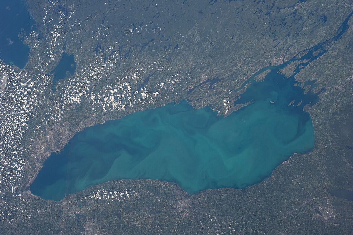
Roncesvalles, often called Roncesvalles Village or Roncy, is a neighbourhood in west-end Toronto, Ontario, centred on its namesake north-south avenue. Located east of High Park and north of Lake Ontario, the area is historically known as the heart of Toronto's Polish-Canadian community, home to prominent institutions, businesses, and the largest Polish Festival in North America. The neighbourhood features a commercial strip along Roncesvalles Avenue, a predominantly residential character, and a rich history dating to its annexation into Toronto in the 1880s. Its distinct identity, strong community associations, and walkable, transit-oriented streets led to its recognition as a finalist in the Canadian Institute of Planners’ Great Places in Canada contest in 2012.
Geography and Character
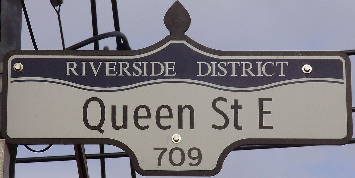
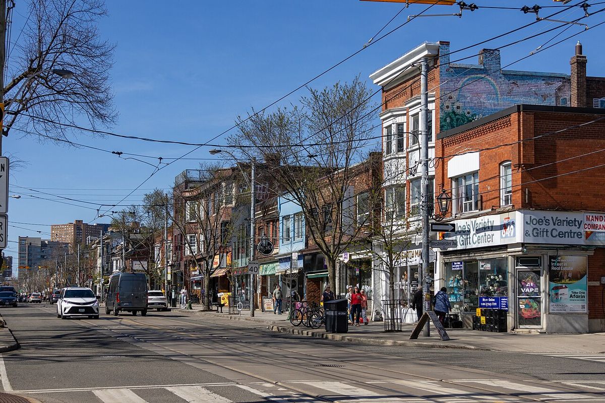
Roncesvalles is defined by its long, linear commercial spine along Roncesvalles Avenue, which runs roughly 1.7 kilometres from the complex intersection at King Street, Queen Street, and The Queensway in the south to Dundas Street West in the north. The neighbourhood's informal boundaries are High Park to the west, Bloor Street West to the north, Lake Ontario and Queen Street West to the south, and Lansdowne Avenue and the railway corridor to the east. The City of Toronto's official neighbourhood designations further delineate the area, with the official 'Roncesvalles' neighbourhood lying east of the avenue, High Park-Swansea to the west, and South Parkdale to the southeast. The area is predominantly residential west of Roncesvalles Avenue, with housing consisting largely of early 20th-century 'foursquare' homes and some larger, impressive residences on streets like High Park Gardens and High Park Boulevard built between 1910 and 1930. East of the avenue, along the CN and CP rail lines, lies an older industrial area in transition, with several buildings converted into loft-style condominiums, such as those along Sorauren Avenue. The commercial strip along Roncesvalles is composed almost entirely of small, independent businesses, churches, and community institutions, creating a pedestrian-oriented streetscape. Major landmarks include St. Joseph's Health Centre, a Toronto Transit Commission streetcar maintenance facility, and the repurposed Sorauren Park, which was once a large TTC bus garage located along Sorauren Avenue.
History and Development
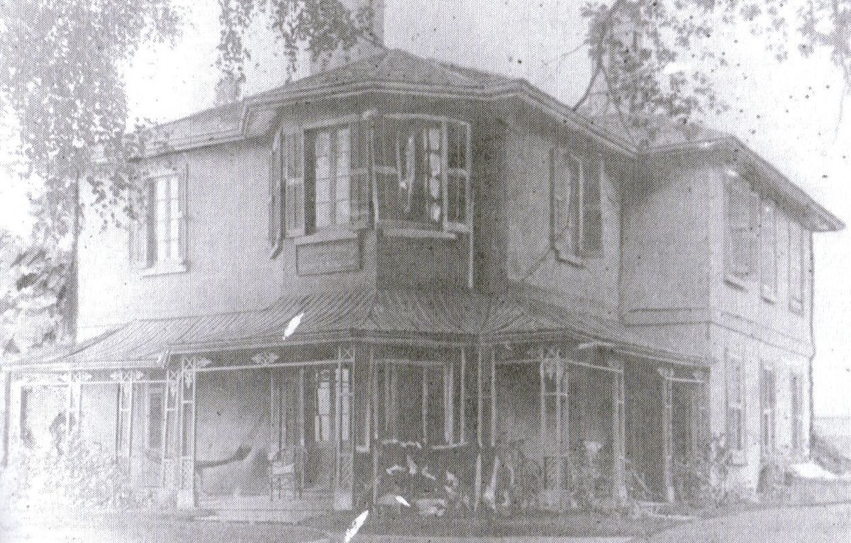
Howard built two houses on his property, Sunnyside, where St. Joseph's Hospital now stands, and Colborne Lodge, built in 1837 and still standing in High Park. An Indigenous trail, later called Indian Road and thought to be an ancient Mississauga path, ran through the area from Lake Ontario north. The neighbourhood's modern layout began with the subdivision of Colonel Walter O'Hara's land north of Queen Street after his death in 1874, which led to the rapid formation of the Village of Parkdale, incorporated in 1879 despite protests from the City of Toronto. Through a series of 13 separate annexations between 1883 and 1893, Parkdale, the Village of Brockton, and surrounding farmland including Howard's Sunnyside farm were absorbed into the City of Toronto. The street grid was extended and formalized after annexation, with streets laid out or extended to Keele Street. Development accelerated after 1900, with most houses built in the foursquare style prior to the First World War, originally designed for the middle class. The intersection of Roncesvalles and Queen grew in importance with the arrival of a Lake Shore streetcar line and a streetcar yard in 1895, followed by the Sunnyside railway station in 1912. The demolition of the amusement park for the Gardiner Expressway in 1955 led to a decline in commerce and residential values, with many large homes divided into apartments and wealthier residents moving further west. A significant demographic shift began in the mid-20th century with an influx of Polish immigrants, anchored by the establishment of St. Casimir's Catholic Parish in 1944, which helped establish Roncesvalles as a new centre for the Polish community in Toronto. The neighbourhood's street names reflect its historical figures and events. Many are attributed to Colonel Walter O'Hara, who named them after family members and his military experiences.
- Roncesvalles Avenue: Named after the Battle of Roncesvalles (1813) in Spain, where O'Hara led a regiment against Napoleon's retreating army.
- Sorauren Avenue: Named after the Battle of Sorauren, which O'Hara attended.
- Constance Street, Geoffrey Street, Marion Street: Named after O'Hara's daughter, son, and wife, respectively.
- Fermanagh Avenue: Named after the County Fermanagh in Ireland, O'Hara's birthplace.
- Alhambra Avenue: Named after the Alhambra palace in Spain.
- Wright Avenue: Named after James Wright, whose farm was subdivided to build the street.
Other streets honour different aspects of local history. Sunnyside Avenue, Parkside Drive, Howard Park Avenue, High Park Gardens, High Park Boulevard, and Colborne Lodge Drive all relate to John George Howard. Grenadier Road references the grenadiers from Fort York who were the first regular users of High Park. Indian Road, Indian Grove, Indian Road Crescent, Indian Valley Crescent, Indian Trail, and Algonquin Avenue recall the old Indigenous path. Ridout Street is named for the Ridout family, early landowners northwest of High Park. Streets like O'Hara Avenue and West Lodge Avenue were laid out and named after the colonel's death. Fern Avenue and Garden Avenue, located between Roncesvalles and part-way to Sorauren, also date from this period, with Fern Avenue originally named Ruth Avenue after O'Hara's daughter.
Polish-Canadian Community and Institutions
Roncesvalles Avenue has long been recognized as the cultural and commercial heart of Toronto's Polish-Canadian community. The construction of St. Casimir's Polish Roman Catholic Church, with the parish hall beginning in 1948 and the church completed in 1954, was a central event that attracted Polish immigrants to the immediate area and solidified the neighbourhood's ethnic character. The street is lined with Polish-speaking restaurants, delicatessens, and shops specializing in Polish goods, with many storefronts displaying the sign "Mówimy po polsku" ("We speak Polish"). While the ethnic makeup of the area has diversified, Polish remains a significant cultural force. According to the 2006 census, within the former Ward 14 that included Roncesvalles, 2,775 residents identified Polish as their mother tongue, the second-largest linguistic group after English, representing 5.5 percent of the ward's population. The 2011 census recorded 27,880 Toronto residents with Polish as a mother tongue. The Roncesvalles Village Business Improvement Area organizes the annual Roncesvalles Village Polish Festival each fall, which closes the avenue to traffic. The festival, considered the largest Polish festival in North America, features amusement rides, craft and food stands, and musical entertainment including polka. The 2011 edition attracted an estimated 300,000 attendees, and the Polish Consulate is the official patron. The neighbourhood also hosts poignant monuments to Polish history at the southern intersection of Roncesvalles, including a large memorial to the victims of the Katyn massacre and a memorial to Polish citizens deported to Siberian labour camps during the Second World War, where fresh wreaths are regularly placed. The local public library branch holds a collection of Polish-language books and magazines, and Polish-language lessons are part of the curriculum at St. Vincent de Paul separate school. The deep connection to the Catholic faith prevalent in Poland is evident in the neighbourhood's religious life, with Polish-language masses offered every Sunday at St. Casimir's Church. An enormous memorial was held on Roncesvalles Avenue when Pope John Paul II died, centred on a statue of the Pope at the St. Stanislaus-St. Casimir's Credit Union. Pope John Paul II had visited Roncesvalles and dined at the Sir Nicholas Restaurant during his 1984 visit to Toronto.
Arts, Culture, and Community Life
Roncesvalles has a strong tradition of community participation and a local arts scene. Several active residents' associations represent different sections of the neighbourhood, including the High Park Residents' Association for the area south of Bloor between Parkside and Roncesvalles, the Sunnyside Community Association for the area south of High Park Boulevard, and the Roncesvalles-MacDonnell Residents' Association for the area east of Roncesvalles from Bloor to Queen. This engaged citizenry contributed to the neighbourhood being named a finalist in the Canadian Institute of Planners’ Great Places in Canada contest in 2012, the only Toronto neighbourhood to make the top eight from an initial poll of 200,000 votes and 90 nominations. According to CIP President Andrea Gabor, Roncesvalles embodies what people want in city living, where they can bike or take a streetcar and still feel connected to downtown. The area's cultural anchor is the Revue Cinema, a repertory movie theatre at Roncesvalles and Howard Park Avenue that first opened in 1911. After closing as part of a chain dissolution, it reopened as a non-profit operation of the Revue Film Society, which partnered with a local couple who purchased the theatre and lease it to the Society. Live music is a staple at several local bars and restaurants, including The Local which offers music daily, Inter Steer with music twice a week, Loons on Friday nights, and Latinada, a Tapas bar on Bloor Street. The community-organized "Roncy Rocks" festival has been held as a one-day outdoor music and art show along the avenue, with side streets closed for stages and displays. While the independent art scene has grown, notably with the 2018 relocation of the Museum of Contemporary Art Toronto Canada to the nearby Sterling Road, some historic venues have been lost, such as the Brighton theatre, which closed in the mid-1980s and now operates as a convenience store with its marquee removed.
Religious and Community Institutions
The neighbourhood is home to a diverse array of religious, health, and community institutions that serve both local and city-wide populations. St. Joseph's Health Centre, a major hospital on The Queensway operated by Unity Health, has been on its site since the 1840s, originally serving as a home for the Sisters of St. Joseph and an orphanage, and it occupies the site of John Howard's Sunnyside Lodge. At the south end of Roncesvalles is Copernicus Lodge, a large chronic care and nursing home facility that primarily serves the Polish community, founded by Father Michael Smith who also established St. Casimir's parish. The area features several significant churches representing various denominations. St. Casimir's Polish Roman Catholic Church at Garden Avenue, completed in 1954, is the spiritual centre for the Polish community. Its 'mother' parish is Saint Stanislaus Kostka Church on Denison Avenue. St. Vincent de Paul Roman Catholic Church on Westminster Avenue, built in the 1910s, offers masses in English and Latin. The Annunciation Of The Virgin Mary Greek Orthodox Cathedral on Sorauren Avenue was purchased for $160,000 in 1961 from the North Parkdale United Church and was given cathedral status in 1967. Its interior was damaged by fire in 2000 but refurbished. Roncesvalles United Church on Wright Avenue operates as both a church and a community hub with rentable spaces. It was renamed from Emmanuel, Howard Park in 2016 and was pastored by Cheri DiNovo before her election as MPP for Parkdale-High Park in 2006. The former Howard Park United Church building at Sunnyside and Marmaduke was converted into housing. Westminster Chapel at High Park on Hewitt Avenue is a merger of Westminster Chapel and High Park Baptist Church, the latter founded as the Hewitt Avenue Mission in 1908. It holds Sunday services, Bible studies, and operates a drop-in program for parents, a food and clothing bank, and summer day camps. Other key community assets include the High Park branch of the Toronto Public Library, one of the city's original four identical Carnegie libraries opened in the early 1900s, and Sorauren Park, a popular green space created from a former TTC bus garage property. Two city-owned industrial buildings along Wabash Avenue are slated for a future community centre project, with one currently serving as a clubhouse for the park.
Transportation and Urban Form
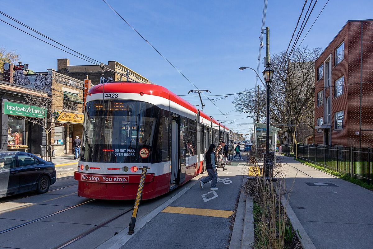
Roncesvalles is a transit-oriented neighbourhood well-connected to downtown Toronto. The intersection at the foot of Roncesvalles, where King, Queen, The Queensway, and Roncesvalles meet, has historically been a major transportation hub, featuring a streetcar loop, a former bus depot, and the now-closed Sunnyside railway station opened in 1912. The neighbourhood's walkability is a defining characteristic, with most daily needs met within the commercial strip along Roncesvalles. The area's built form is primarily low to medium density, characterized by two-and-a-half storey detached and semi-detached houses on tree-lined streets. The commercial buildings along the avenue are generally two to three storeys tall, with retail at grade and offices or apartments above. East of Roncesvalles, the older industrial area along the rail corridor is undergoing gradual redevelopment, with some buildings converted to residential lofts and city-owned properties on Wabash Avenue slated for a future community centre project. The proximity to High Park, Lake Ontario, and the Martin Goodman Trail provides extensive recreational opportunities for cyclists and pedestrians, reinforcing the neighbourhood's appeal as a livable, connected urban village. The original development of the area was supported by Toronto's first highway to the west, Dundas Street, which initially ran along Ossington Avenue from Queen Street.
Demographic and Economic Profile
Roncesvalles has historically been a middle-class neighbourhood, though its demographic composition has evolved significantly over time. Initially developed for the middle class with wealthier residents concentrated in Parkdale, the area later attracted more affluent families who built impressive homes from 1910 to 1930 on streets like High Park Gardens and High Park Boulevard. The post-war period saw a shift as wealthier residents moved to newer western suburbs and many large homes were divided into apartments following the 1955 closure of Sunnyside Amusement Park and the construction of the Gardiner Expressway. The influx of Polish immigrants from the mid-20th century onward, particularly after the establishment of St. Casimir's parish, brought a new wave of residents and helped stabilize the area. While the Polish community remains a strong cultural presence, the neighbourhood, like much of Toronto, has become increasingly diverse. The local economy is driven by the small businesses that line Roncesvalles Avenue, forming the Roncesvalles Village Business Improvement Area. These include a high concentration of independent retailers, cafes, restaurants, and service providers, with a notable cluster of Polish-oriented businesses. The commercial strip has demonstrated resilience, adapting to changing demographics while maintaining its village-like character. The presence of major institutions like St. Joseph's Health Centre provides a stable employment base. The transition of industrial lands east of the avenue and the conversion of some buildings to residential lofts point to ongoing economic change and intensification within the neighbourhood's existing fabric. The first school in the neighbourhood, the Old Howard Park school on Boustead Avenue, was built at the turn of the 20th century, and the three original churches, St. Vincent de Paul, St. Jude's Anglican, and Howard Park Emmanuel United, were also constructed in that era.
Historical Context and Early Settlement
The earliest European settlement in the area that became Roncesvalles was tied to the village of Brockton, which sprang up along Dundas Street just before it met Ossington Avenue when Toronto's boundary was Dufferin Street. The subdivision of land for Brockton included the portion of the neighbourhood east of what is now Roncesvalles Avenue, although little was built on it initially. In the 1850s, concurrent with railway construction, the central part of Brockton was separated from the Roncesvalles subdivided lands except for a small strip along Dundas between the railway and Bloor Street. Colonel O'Hara's acquisition of land north of Queen from Roncesvalles to east of Lansdowne in 1850, and its subdivision after his death in 1874, superseded the Brockton subdivision south of the railway between Roncesvalles and Sorauren. Development in Parkdale crept up Sorauren Avenue and onto Roncesvalles Avenue before annexation. The area's transportation history is deeply linked to its development. The Lake Shore streetcar line built in the 1890s enabled commuting to the west and made the Roncesvalles and Queen intersection more important. The streetcar yard added there in 1895 and the Sunnyside station in 1912 cemented its role as a hub. The cultural history is also rooted in early institutions. The first four Carnegie Libraries in Toronto included the High Park branch on Roncesvalles, and the original churches built were St. Vincent de Paul (Roman Catholic), St. Jude's (Anglican) and Howard Park Emmanuel (United Church). These foundations established the neighbourhood's character as a community-oriented, institution-rich area within the growing city.
Questions about Roncesvalles, Toronto
Where is Roncesvalles located in Toronto?
Roncesvalles is a neighbourhood in Toronto's west end, centred on Roncesvalles Avenue. It is located directly east of High Park and north of Lake Ontario. Its informal boundaries are High Park to the west, Bloor Street West to the north, Lake Ontario and Queen Street West to the south, and Lansdowne Avenue and the railway corridor to the east. It falls within the Taiaiako’n, Parkdale, High Park federal riding, the Parkdale-High Park provincial riding, and the City of Toronto's Ward 4. The City defines the official 'Roncesvalles' neighbourhood as east of the avenue, with High Park-Swansea to the west and South Parkdale to the southeast.
Why is Roncesvalles known as a Polish neighbourhood?
Roncesvalles is known as the heart of Toronto's Polish-Canadian community due to a significant influx of Polish immigrants in the mid-20th century, anchored by the establishment of St. Casimir's Polish Roman Catholic Parish in 1944. The construction of the church and parish hall, beginning in 1948 and completed in 1954, attracted Polish families to the immediate area. The avenue became a commercial and cultural hub with Polish-speaking businesses displaying "Mówimy po polsku" signs. The annual Roncesvalles Village Polish Festival, held every September, is considered the largest Polish festival in North America. The 2006 census showed Polish was the second-most common mother tongue in the area after English.
What is the Roncesvalles Village Polish Festival?
The Roncesvalles Village Polish Festival is an annual street festival held each fall, organized by the Roncesvalles Village Business Improvement Area. It closes Roncesvalles Avenue to vehicular traffic and features amusement rides, clothing and craft vendors, food stands, and outdoor musical entertainment including polka music. The festival's official patron is the Polish Consulate. It is a major community event and a significant cultural celebration, with an estimated 300,000 people attending in 2011, cementing its reputation as the largest Polish festival in North America. The event highlights the neighbourhood's deep Polish-Canadian roots.
What are some key historical landmarks in Roncesvalles?
Key historical landmarks include St. Casimir's Polish Roman Catholic Church, completed in 1954, which was central to establishing the Polish community. The Revue Cinema, opened in 1911, is a historic repertory theatre now run as a non-profit. St. Joseph's Health Centre has been on its site since the 1840s, originally a home for the Sisters of St. Joseph. The High Park branch of the Toronto Public Library is one of Toronto's original Carnegie libraries opened in the early 1900s. At the southern intersection, monuments commemorate the Katyn massacre and Polish deportees to Siberia. The neighbourhood's street names, like Roncesvalles and Sorauren, reflect the military history of early landowner Colonel Walter O'Hara.
How do you get to Roncesvalles using public transit?
Roncesvalles is well-served by Toronto Transit Commission streetcars. These routes provide frequent service connecting the neighbourhood to downtown Toronto and other parts of the city. The intersection at the foot of Roncesvalles was historically a major transit hub with a streetcar loop, bus depot, and the Sunnyside railway station opened in 1912. It remains a key transfer point for east-west travel along Queen Street and The Queensway, supporting the neighbourhood's transit-oriented character.
What is the character of the Roncesvalles shopping street?
Roncesvalles Avenue is a commercial strip approximately 1.7 kilometres long, running from Dundas Street West south to Queen Street. It is characterized almost entirely by small, independent businesses rather than chain stores. The mix includes a high concentration of Polish delicatessens, bakeries, and shops, alongside cafes, restaurants, bookstores, boutiques, and service providers. The streetscape features two to three-storey buildings with retail at ground level and offices or apartments above. This configuration, combined with wide sidewalks and streetcar service, creates a distinct village-like atmosphere that has made the area a celebrated example of urban neighbourhood design, recognized as a finalist in the 2012 Great Places in Canada contest.
Sources and further reading
- Roncesvalles, Toronto (Wikipedia)
- Neighbourhood: Roncesvalles Village (destinationtoronto.com)
- Roncesvalles Village Neighbourhood Guide, West Toronto (lifewest.ca)
- Roncesvalles Neighbourhood Guide (app.hoodq.com)
- Our Village (roncesvallesvillage.ca)
Checked by the Your Space Hamilton desk. Last updated 2026-10-21.