East Vancouver
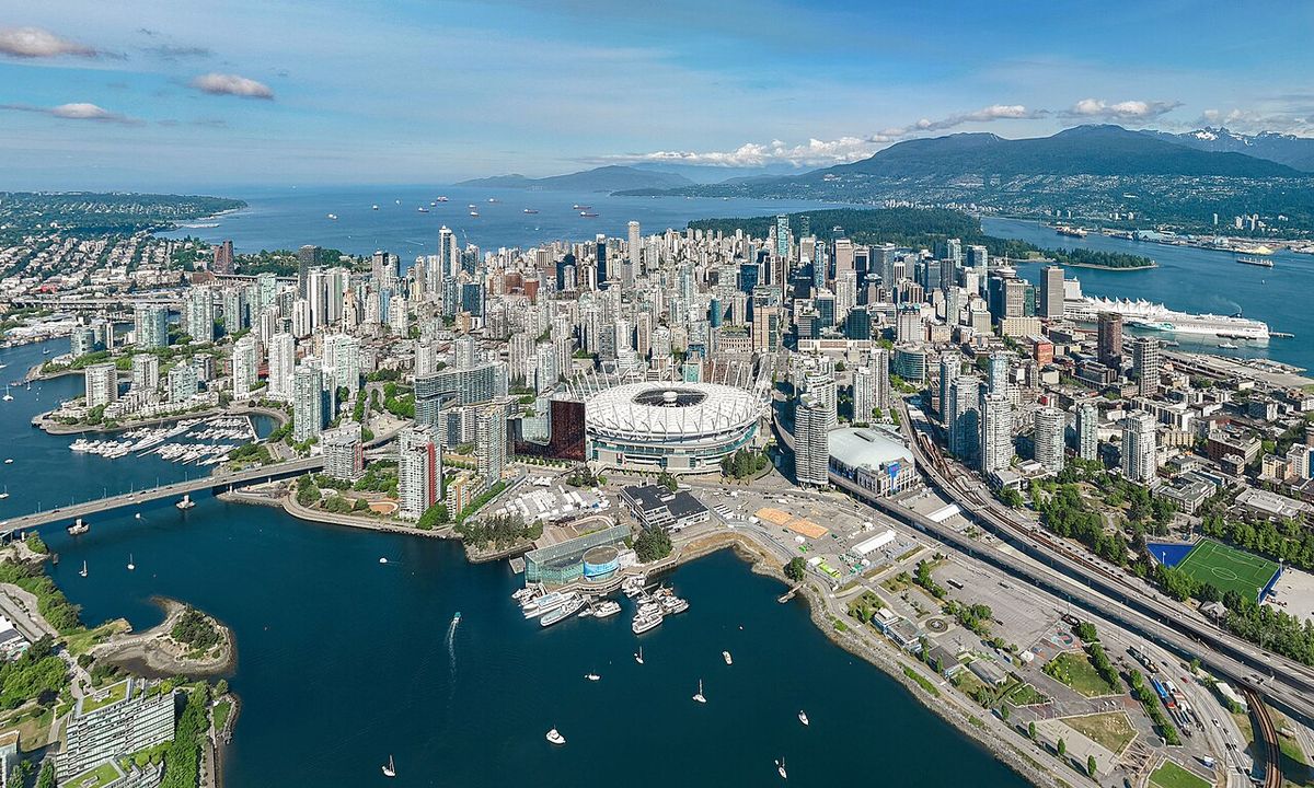
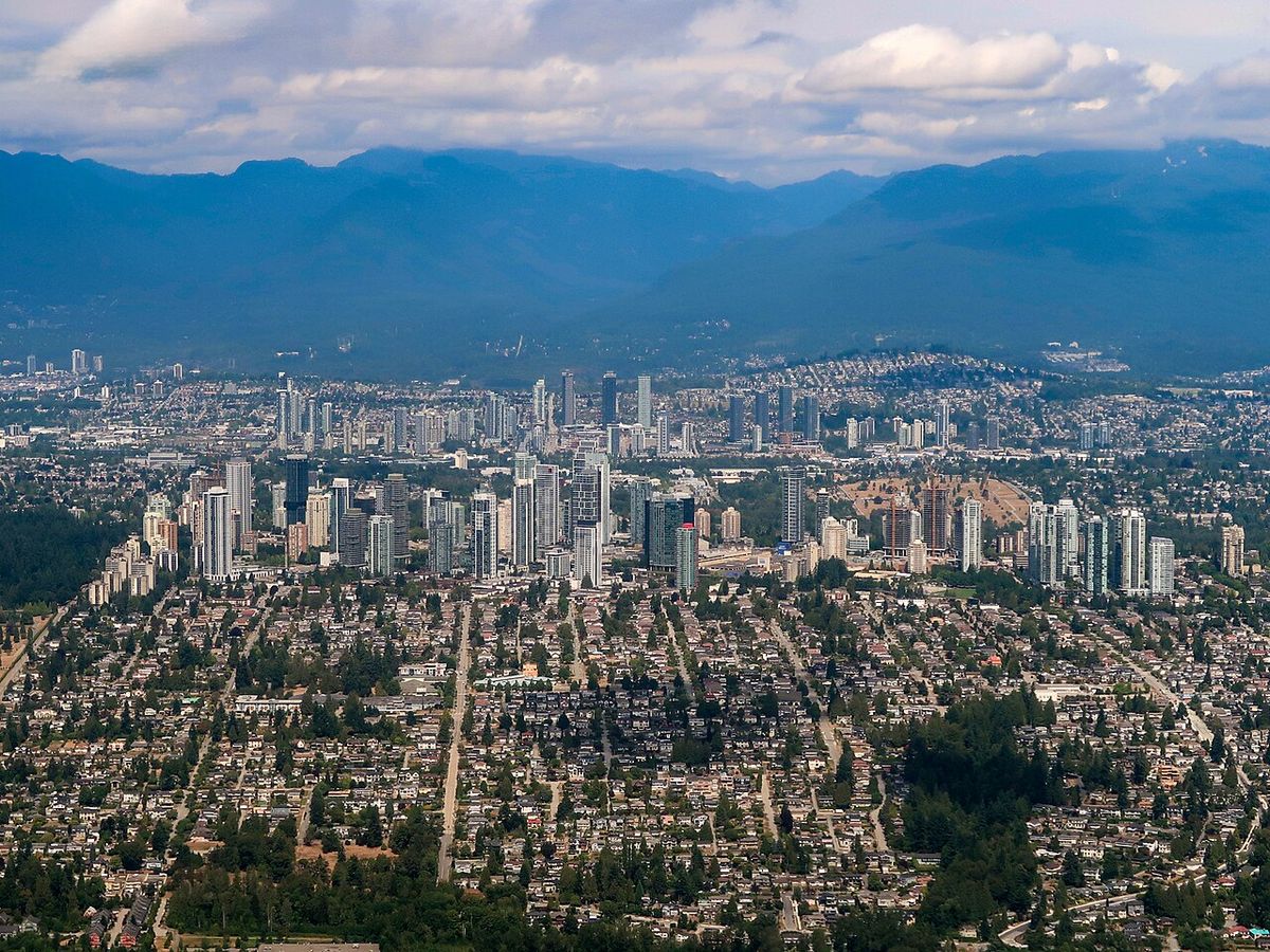
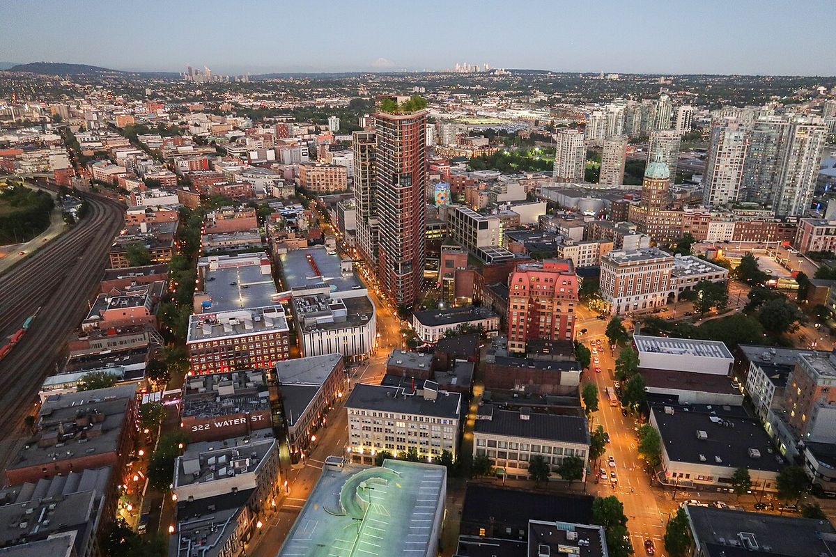
East Vancouver, also commonly called East Van or the East Side, is a major region within the city of Vancouver, British Columbia. It is geographically defined by Burrard Inlet to the north, the Fraser River to the south, and the city of Burnaby to the east, with Ontario Street traditionally marking its western boundary from Vancouver's wealthier West Side. Historically the first home for many immigrant communities and the city's working-class population, East Vancouver is characterized by its significant ethnic, linguistic, and socioeconomic diversity. This area has played a central role in Vancouver's development, from its early colonial settlements and industrial roots to its contemporary status as a politically engaged and culturally active part of the metropolitan core.
Historical Development
The history of East Vancouver is deeply intertwined with the colonial and industrial growth of the city. The first colonial settlement in the current Metro Vancouver area appeared in 1865 in what is now the Strathcona neighbourhood. In 1872, construction began on North Arm Road, later Fraser Street, to facilitate farm produce reaching market. The City of Vancouver was incorporated in 1886, encompassing much of East Vancouver, though the municipality of South Vancouver remained independent until 1929. Transportation infrastructure expanded rapidly, with hourly tramcar service beginning in the 1890s along the route of the ancient False Creek Trail, which was paved and renamed Kingsway in 1913. Electricity first came to South Vancouver in 1914, and a post-World War I building boom resulted in much of the region being occupied by single-family housing by the 1940s.
John Hendry Park, containing Trout Lake, was established in 1926 after Aldene Hamber purchased and donated the land to prevent its use as a landfill. The mid-20th century brought significant changes, including the displacement of farmers in South Vancouver in 1947 to create residential land for returning war veterans. Tram service ended in 1954 due to rising automobile use. The 1960s saw a major civic fight when Mayor Tom Campbell and planning proposals advocated for a freeway that would have demolished hundreds of homes in Strathcona and built an overpass through Chinatown. Widespread protest, including an 800-person demonstration at City Hall in 1967, led to the proposal's defeat and the planning commission chairman's resignation a year later. This victory preserved the community's architectural heritage, with strict development regulations passed for Chinatown in 1971.
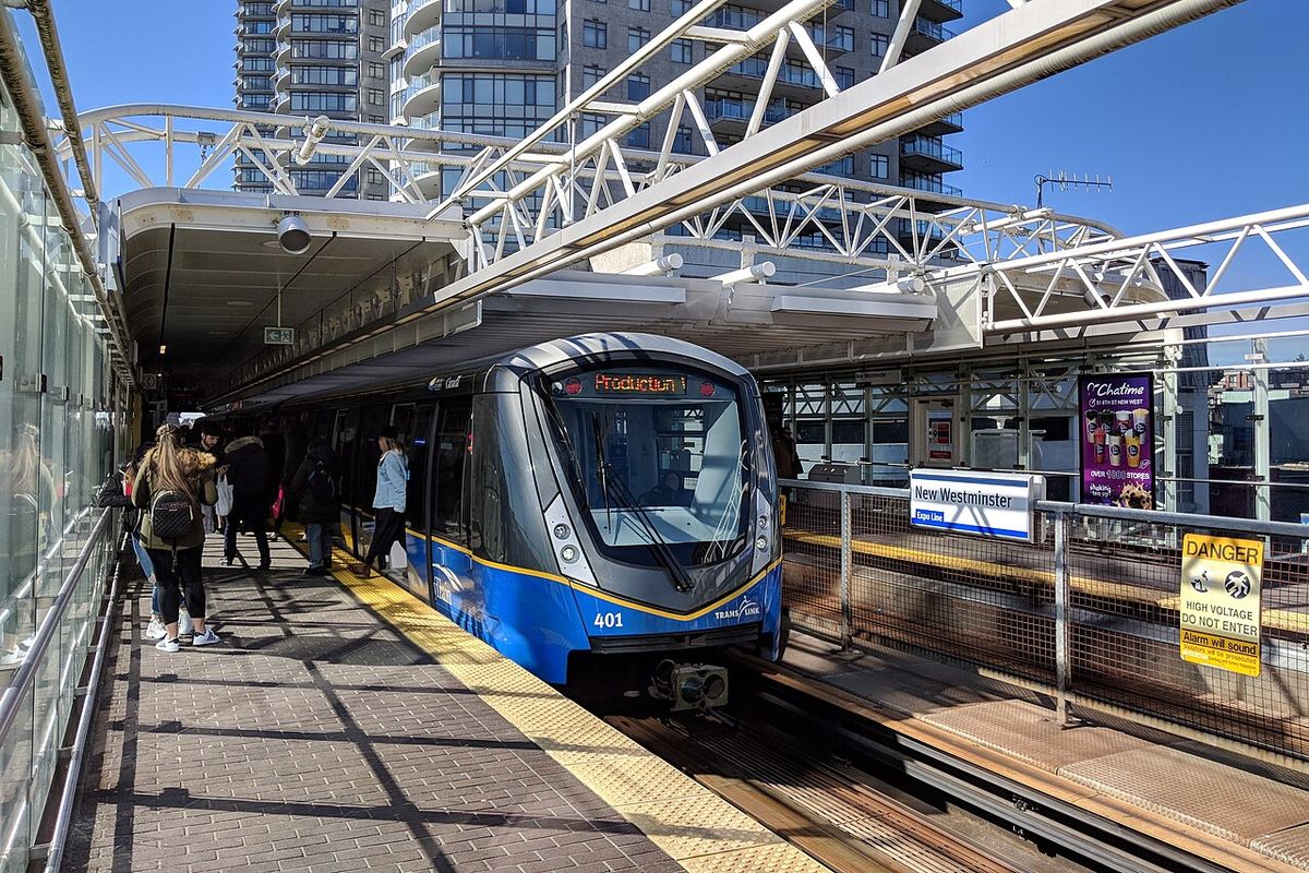
The late 20th century was marked by infrastructure and political shifts. The SkyTrain Expo Line opened in 1985 with five stations in East Vancouver, and the city hosted Expo 86 the following year, accelerating residential densification around False Creek. From 1986 to 1993, Mayor Gordon Campbell's Non-Partisan Association council passed pro-development bylaws, leading to evictions of seniors and poor renters in areas like Gastown. The Pacific National Exhibition's lease at Hastings Park was set to expire in 1997, leading to a consultation process after the province transferred authority for the PNE to the city in 2004. The SkyTrain Millennium Line opened through East Vancouver in 2002, further integrating the region into the regional transit network.
Neighbourhoods and Demographics
East Vancouver is not a single administrative district but a collection of distinct communities. The City of Vancouver identifies seven communities as being entirely within East Vancouver: Grandview-Woodland, Hastings-Sunrise, Kensington-Cedar Cottage, Killarney, Renfrew-Collingwood, Strathcona, and Victoria-Fraserview. According to the 2001 census, these seven communities were home to approximately 220,490 people, representing about 40 percent of Vancouver's total population at the time. Two additional communities, Mount Pleasant and Riley Park-Little Mountain, straddle the boundary between East Vancouver and the West Side. The Downtown Eastside and Chinatown are also part of East Vancouver but are often discussed separately due to their unique historical and social characteristics within the city's fabric.
The demographic profile of East Vancouver highlights its diversity, particularly when compared to the city as a whole. While the 2001 census showed Vancouver's overall mother tongue was 49 percent English and 26 percent Chinese, individual East Vancouver neighbourhoods presented a more varied linguistic composition. For example, in Victoria-Fraserview, residents identified their mother tongue as 27 percent English and 49 percent Chinese. Other languages, such as Punjabi, were each identified by fewer than 3 percent of the city's total population but have significant concentrations in specific East Vancouver areas. This ethnic and linguistic variety is a defining feature of the region's community identity.
Community and Political Identity
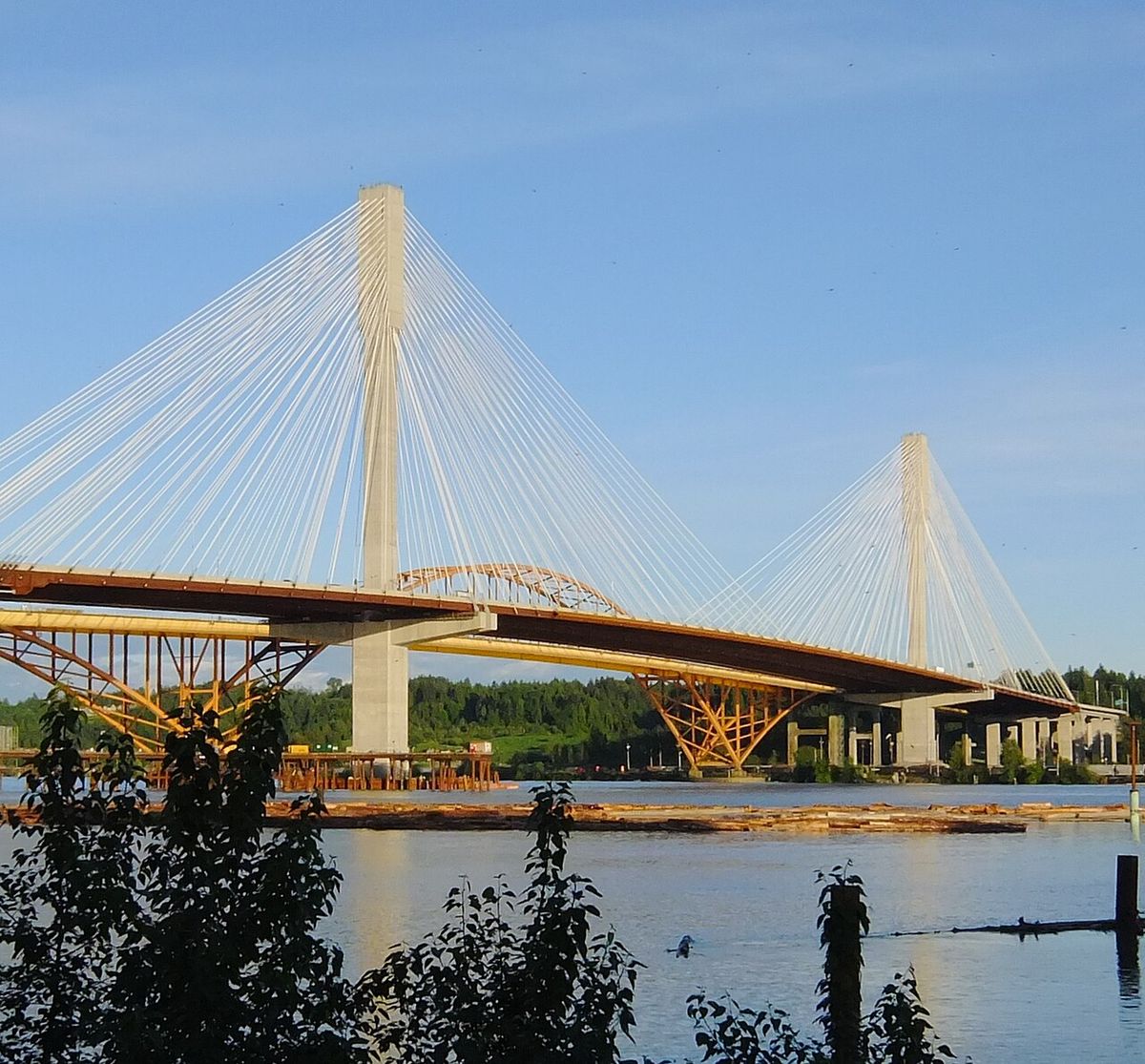
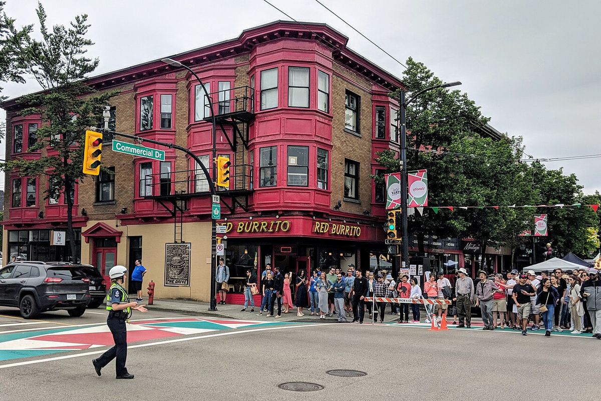
East Vancouver possesses a strong geographic and community identity rooted in diversity, activism, and a contrast with the more affluent West Side. This identity is reinforced by active ethnic communities, an active artistic scene, a politically engaged population, and vocal LGBTQ+ groups. The left-leaning, labour-oriented history of the area is humorously invoked by the name of the local Republic of East Vancouver newspaper. Frequent social activism manifests in events like the Commercial Drive Car Free Festival and various protests, including the successful campaign against the 1960s freeway proposals. Many residents perceive a long-standing municipal prejudice, citing historical underinvestment and planning decisions that seemed to favour other areas, debates over Port of Vancouver expansion, and increased traffic from infrastructure like the Port Mann Bridge.
The artistic identity of East Vancouver is cultivated through several key institutions and events. The Vancouver East Cultural Centre is a major venue for performances, while the community poetry anthology East of Main and the annual Eastside Culture Crawl visual arts festival celebrate local creativity. Another event, 'the Drift,' sees artists present work centred on Main Street. Despite pride in this diversity, the area faces pressures from rapid gentrification and rising housing prices, which threaten its socioeconomic mix. Planning policies like former Mayor Sam Sullivan's 'ecodensity' initiative, which proposed zoning changes for coach houses and densification mainly in East Vancouver, have also sparked debate about equitable development across the city.
Ethnic Communities and Settlement
East Vancouver has been the primary reception area for successive waves of immigrants to Vancouver since the 1880s. This has resulted in a complex layering of ethnic communities, each contributing to the neighbourhoods' cultural and commercial character. The early settlers were predominantly of British and Irish origin, with evidence of their presence remaining in institutions like the Cambrian Hall, built in 1929 for the first Welsh Society, and the modern WISE Hall, whose acronym stands for Welsh-Irish-Scottish-English. Italian immigrants formed the first 'Little Italy' around Main Street by 1910, with a later concentration along Commercial Drive in the 1950s where businesses and cultural life remain strong, supported by the Italian Cultural Centre on Grandview Highway.
Other European communities have also established lasting presences. These include Polish communities with halls on Kingsway and Fraser Street, the German Vancouver Alpen Club on Victoria Drive, Croatian institutions like the Croatian Cultural Centre near Trout Lake, and Hungarian organizations such as the Hungarian Cultural Society on Kingsway. While Greek immigrants predominantly moved to Vancouver's West Side, a strong community also existed near Boundary Road in East Vancouver during peak immigration in the 1960s. East Asian communities are significant, with a Chinese presence predating the city's 1886 incorporation and later waves settling in areas along Kingsway and Victoria Drive after exclusion laws were repealed in 1947.
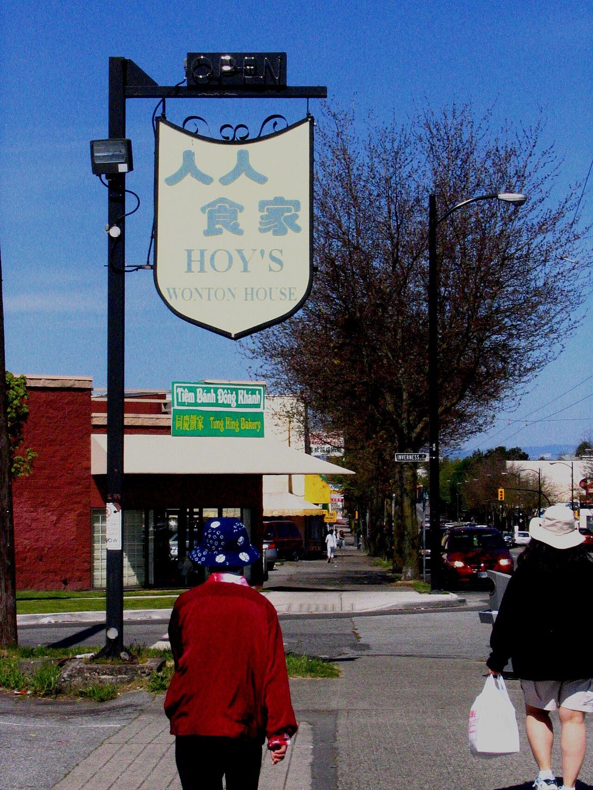
- Southeast Asian: Immigrants from Indonesia, Malaysia, the Philippines, Singapore, and Vietnam have moved to East Vancouver since the 1970s, with many businesses along Kingsway creating a 'Little Saigon' corridor between Fraser and Nanaimo Streets. The Vietnamese Seniors Outreach Program on Commercial Drive serves this community.
- South Asian: Present since at least 1897, a major wave of Punjabi immigration in the 1960s led to large-scale development of Vancouver Special homes in southeast Vancouver. The Punjabi Market on Main Street, established in the 1960s, remains a community hub. The Sunset neighbourhood has the city's highest concentration of ethnic South Asians at 33.6 percent.
- Hispanic and Latin American: This community is served by the Canadian Latin American Cultural Society on Commercial Drive.
Commercial Corridors and Shopping Areas
East Vancouver's commercial life is distributed along several major arterial roads, each with its own distinct character and history. Kingsway, built on an ancient Indigenous footpath and originally called Westminster Road, is one of the longest streets in Greater Vancouver, connecting Vancouver, Burnaby, and New Westminster. Its length and varied services make it difficult to characterize uniformly, but it is known for diverse ethnic restaurants, specialty grocery stores, and other small businesses. Key shopping areas along Kingsway in East Vancouver include SoMa (South Main), Kensington-Cedar Cottage between Fraser and Nanaimo Streets, and Renfrew-Collingwood. The stretch between Fraser and Nanaimo is notably dense with Vietnamese businesses, leading to its informal designation as 'Little Saigon.'
Main Street serves as the spine for several distinct commercial and cultural districts as it runs north-south through East Vancouver. North of Keefer Street, it is part of the Downtown Eastside, an area marked by social challenges and home to institutions like the Vancouver Pre-Trial Centre. The segment between Keefer and Prior Street is the heart of Chinatown, active with Chinese restaurants, financial establishments, and shops, and host to an annual Chinese New Year parade. Further south, between East 2nd and East 16th Avenues, Main Street is the core of the Mount Pleasant neighbourhood, known for its hip, younger demographic and businesses like independent cafés, vintage clothing stores, and pubs. The mid-section of Main Street, between East 17th and East 41st Avenues, is dominated by antique stores, bookshops, and independent retailers.
The Punjabi Market, also known as the South Asian District, is located between East 45th and East 51st Avenues. It was established in the 1960s and continues to act as a hub for the South Asian community across Greater Vancouver. Southeast Marine Drive, beyond East 65th Avenue, is another part of the commercial network in southern East Vancouver. These commercial corridors reflect the layered immigrant history of the area, which has been the first home for many non-British immigrants since the 1880s. The area's character is also shaped by ongoing cultural evolution and recent gentrification.
Key Institutions and Landmarks
East Vancouver is home to numerous institutions and landmarks that reflect its community history and serve its diverse population. Hastings Park, designated by the provincial government in 1888, has been home to the Pacific National Exhibition since 1907, serving as a major fairground and entertainment venue for over a century. The park's future was the subject of public consultation after its lease expired in 1994 and authority was transferred to the City of Vancouver in 2004. John Hendry Park at Trout Lake, established in 1926, provides crucial green space and resulted from a charitable donation by Aldene Hamber to prevent the site from becoming a landfill.
Cultural and community centres are fundamental to the area's identity. The Vancouver East Cultural Centre is a key venue for the artistic scene. Ethnic halls, such as the Cambrian Hall for the Welsh community, the Italian Cultural Centre, the Polish Hall on Fraser Street, the Vancouver Alpen Club, and the Croatian Cultural Centre near Trout Lake, provide gathering spaces and preserve cultural traditions. The Punjabi Market on Main Street acts as a commercial and social hub for the South Asian community across Greater Vancouver. These physical spaces anchor the community's complex social fabric and ongoing narrative.
Demographic and Housing Trends
The demographic and housing profile of East Vancouver has evolved significantly from its working-class and immigrant-reception origins. Historically, the area was more affordable and housed much of Vancouver's working-class populace, in direct contrast to the upper- and middle-class West Side. The built form was largely shaped by post-World War I and II construction booms, resulting in extensive tracts of single-family housing, including the prolific 'Vancouver Special' style homes developed in southeast Vancouver from the 1960s onward. As residential development in that area largely ceased in the 1980s, these homes remain a dominant housing stock. The 2001 census illustrated the area's density, with the seven core East Vancouver communities housing 40 percent of the city's population within their boundaries.
In recent decades, East Vancouver has experienced intense pressure from gentrification and rising housing costs, which threaten its socioeconomic diversity. Areas like Mount Pleasant have seen a significant influx of younger, often wealthier residents, changing the commercial and demographic character. While the region continues to be a gateway for new immigrants, many established communities, including Southeast Asian and South Asian families, have relocated to suburbs like Richmond, Surrey, and Abbotsford over the past thirty years, even as significant populations choose to remain. These dynamic shifts ensure that East Vancouver's identity remains in a constant state of negotiation between its historic character and metropolitan pressures.
Questions about East Vancouver
What is considered East Vancouver?
East Vancouver is a region within the City of Vancouver, British Columbia, Canada. It is geographically bordered to the north by Burrard Inlet, to the south by the Fraser River, and to the east by the city of Burnaby. It is divided from Vancouver's West Side by Ontario Street. The City of Vancouver identifies seven communities as being entirely in the East Vancouver area: Grandview-Woodland, Hastings-Sunrise, Kensington-Cedar Cottage, Killarney, Renfrew-Collingwood, Strathcona, and Victoria-Fraserview. Mount Pleasant and Riley Park-Little Mountain straddle both East Vancouver and the West Side. The Downtown Eastside and Chinatown are also part of East Vancouver but are often referred to separately.
Why is East Vancouver known for its diversity?
East Vancouver is known for its diversity because it has been the first home for many non-British immigrants since the 1880s. Historically, it was a more affordable area and traditionally the home for much of Vancouver's working-class populace. The East Side is best summarized by its diversity in terms of family income, land use, ethnicity, and mother tongue. Immigrant waves that have passed through East Vancouver include English, Welsh, Irish, Scottish, Italian, German, Eastern European, Chinese, Southeast Asian, and South Asian communities. This diversity is reflected in areas like the Punjabi Market and the many cultural halls and societies serving different ethnic groups.
What is the history of the freeway protests in East Vancouver?
In the 1960s, Mayor Tom Campbell and planning proposals advocated for a waterfront freeway that would have required demolishing 600 houses in Strathcona and building a 10-metre-high overpass through the centre of Chinatown. This sparked widespread community protest, including a crowd of 800 people at City Hall in 1967. The powerful opposition led to the resignation of the city's planning commission chairman and the ultimate defeat of the proposal a year later. This victory preserved the architectural heritage of Chinatown and Strathcona, with strict development regulations passed in 1971.
What are the main shopping and commercial streets in East Vancouver?
The primary commercial corridors are Kingsway and Main Street. Kingsway, a historic connector between Vancouver and New Westminster, features diverse ethnic restaurants, grocery stores, and services, with areas like 'Little Saigon' between Fraser and Nanaimo Streets. Main Street runs through several distinct districts: Chinatown (between Keefer and Prior), the hip Mount Pleasant core (between East 2nd and 16th), a mid-section of antique and independent shops, and the Punjabi Market (between East 45th and 51st Avenues). Each segment reflects the layered character of its surrounding neighbourhood.
How is East Vancouver connected by public transit?
East Vancouver is well-served by the SkyTrain rapid transit system. The Expo Line, which opened in 1985, includes five stations in the region, connecting it to downtown Vancouver and Surrey. The Millennium Line opened in 2002, providing additional north-south rapid transit service through East Vancouver. Historically, the area was served by streetcars along Main Street and Kingsway until the system was terminated in 1954 due to increasing automobile ownership and bus service.
What is the 'Eastside Culture Crawl'?
The Eastside Culture Crawl is an event that reinforces the artistic identity of East Vancouver. It is an annual event where local artists present their work. This artistic identity is also reinforced by events at the Vancouver East Cultural Centre, a community poetry anthology called 'East of Main', and 'the Drift', which is another annual event where local artists present their work centred around Main Street. These cultural activities are part of a lively artistic presence that helps define the community identity of East Vancouver. This identity is further strengthened by active ethnic communities and a politically engaged youth population. The region is known for its diversity in family income, land use, ethnicity, and mother tongue.
Sources and further reading
- East Vancouver (Wikipedia)
- East Vancouver (destinationvancouver.com)
- Vancouver Neighbourhood Information Map (faithwilson.com)
- Home, The East Village Vancouver (eastvillagevancouver.ca)
Checked by the Your Space Hamilton desk. Last updated 2026-11-01.