Sault Ste. Marie, Ontario
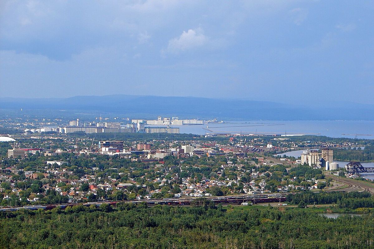
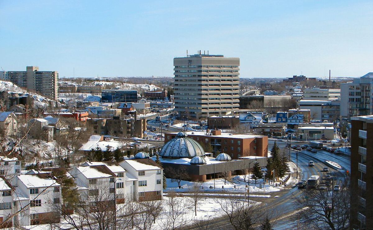
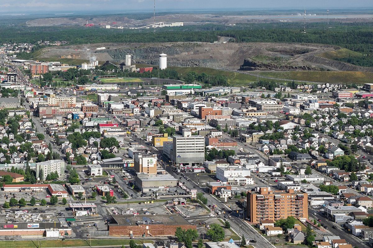
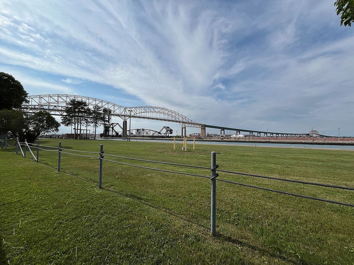
Sault Ste. Marie is a city in Northern Ontario, Canada, situated on the north shore of the St. Mary's River directly across from its American twin city of the same name in Michigan. With a population of 72,051 as of the 2021 census, it is the third most populous city in Northern Ontario and serves as a regional hub for manufacturing, tourism, and health services. The city's history is deeply rooted in its strategic location at the rapids, known as Baawitigong by the Ojibwe, which made it a vital meeting place and trading centre for centuries. Today, it remains a key transportation and industrial centre, anchored by major steel production and connected to the United States by the Sault Ste. Marie International Bridge.
History and Settlement
The area now known as Sault Ste. Marie has been inhabited for over 500 years by Ojibwe, Odawa, and Potawatomi peoples, who called it Baawitigong, meaning 'place of the rapids'. The rapids of the St. Mary's River created a natural stopping point and strategic location, supporting a permanent settlement of 150 to 200 people that swelled to thousands during the annual whitefish harvest. French explorer Étienne Brûlé is recorded as the first European to see the rapids in 1621, and the location was later renamed Sault Sainte-Marie by French Jesuit missionaries who established a mission on the river's south bank in 1668. This mission formed the nucleus of what would become one of the oldest French settlements in North America, laying the foundation for the twin cities. The French initially named the rapids Sault de Gaston in 1621 in honour of Gaston, Duke of Orléans, brother of King Louis XIII, a name that appeared on Samuel de Champlain's 1632 map.
Marie became a crucial crossroads in the continental fur trade, connecting Lake Superior to Montreal along a 5,000 km route. A cosmopolitan village of Europeans, First Nations, and Métis grew around the North West Company post established around 1790. Prominent figures like fur trader John Johnston and his Ojibwe wife Ozhaguscodaywayquay were central to community life, and their children were taught English, Ojibwe, and French. Their daughter Jane Johnston married Henry Rowe Schoolcraft, a US Indian agent, and she is recognized as the first Native American poet and writer in the United States. The War of 1812 and the subsequent border definition disrupted this fluid interaction, as American territory was closed to British Canadian traders after an American force destroyed the North West Company depot on the north shore in July 1814.
To secure an independent water passage after the U.S. refused the steamer Chicora passage through its locks in 1870, Canada constructed the Sault Ste. Marie Canal, completed in 1895. The late 19th century brought railway expansion debates, with the Canadian Pacific Railway's main transcontinental line ultimately bypassing the lakeshore city in favour of an interior route through Sudbury after the discovery of mineral resources in the Sudbury Basin. The original CPR Algoma Branch line was finally completed to Sault Ste. Marie in 1888, connecting to American railways via the International Railroad Bridge. Incorporated as a village in 1871 with a population of almost 880 and a town in 1887, Sault Ste. Marie gained a city charter in 1918 following the amalgamation of Steelton and its 7,000 residents after a 1917 plebiscite. The city gained brief international notoriety in 1911 during the trial of Angelina Napolitano, the first person in Canada to use the battered woman defence for murder.
20th Century Development and Events
Industrial development accelerated in Sault Ste. Marie before and during World War II, with Algoma Steel and the Chromium Mining and Smelting Corporation becoming key producers for the Allied war effort, supplying materials for transportation and military machines. The city's strategic importance extended to continental defence, as fears of a potential air attack on the vital shipping locks led to a substantial military presence from 1941, driven by the Permanent Joint Board on Defence. Joint Canadian and U.S. defences included anti-aircraft installations, early warning radar bases at five locations in northern Ontario, and an anti-aircraft training facility 100 km north of the city on Lake Superior, though most were deemed excessive and removed by January 1943. The Royal Canadian Navy honoured the city by naming an Algerine-class minesweeper HMCS Sault Ste. Marie (J334) in 1942, which served as a convoy escort in the Battle of the Atlantic. The post-war decades saw prosperity, but the local steel industry contracted from the late 1980s onward due to global competition, leading Algoma to declare bankruptcy twice and receive interest-free bailout loans from the Ontario government. In 1990, the city became a flashpoint in national unity debates when its council, under Mayor Joe Fratesi, passed a resolution declaring English the sole official language for municipal services, a move widely seen as retaliation for Quebec Premier Robert Bourassa's use of the notwithstanding clause for Bill 101. The resolution was opposed by Prime Minister Brian Mulroney, Jean Chrétien, and Ontario premiers David Peterson and Bob Rae, and was struck down by a court ruling in 1994, one year after Quebec passed Bill 86 to amend its language laws.
Economy and Major Industries
The economy of Sault Ste. Marie has long been dominated by heavy industry and resource extraction. Algoma, the city's largest employer, operates a major steel plant with approximately 3,500 employees, alongside an adjacent tube mill operated by Tenaris which employs about 553 people. Forestry remains a significant sector, with operations like ARAUCO employing over 110 people in wood products and an adjacent melamine factory employing about 150 people total, manufacturing furniture and cupboards. The Huron Central Railway has been historically vital for transporting goods for these industries, though its owner Genesee & Wyoming announced an intention to discontinue operations, with service continuing under an agreement that terminated on August 15, 2010. The business process outsourcing industry also established a presence, with several call centres employing around 1,500 people at their peak, including the large Sutherland centre.
The city's economic fortunes have been closely tied to the cyclical steel market. Other traditional industries, such as paper manufacturing at St. Mary's Paper, have faced closures and decommissioning, though it reopened under new ownership in June 2007. In 2019, Sault Ste. Marie was included in the federal government's Rural and Northern Immigration Pilot program along with North Bay, Sudbury, Timmins, and Thunder Bay, aimed at attracting skilled workers to northern communities to support economic diversification. This program is designed to spread immigration of skilled workers throughout northern communities in several provinces.
Geography and Climate
Sault Ste. Marie is located in Algoma District on the north shore of the St. Mary's River, which forms the border with Michigan, USA. The city is bordered to the east by the Rankin and Garden River First Nation reserves and to the west by Prince Township. To the north lies an unincorporated portion of Algoma District, which includes the communities of Aweres, Batchawana Bay, Goulais and District, Peace Tree and Searchmont. The city's defining geographic feature is the St. Mary's Rapids, which historically impeded travel and shaped settlement patterns for both Indigenous peoples and European explorers. The Sault Ste. Marie International Bridge provides a direct road connection to the United States, while the Sault Ste. Marie Canal offers a Canadian shipping route around the rapids.
The city experiences a humid continental climate (Köppen classification Dfb), characterized by cold, snowy winters and warm, humid summers, with temperatures moderated somewhat by the proximity of Lake Superior. Winters typically last from late November to early April, with temperatures dropping below -20 °C on average just over 23 days per year. Summers are warm with mild nights, and temperatures exceed 30 °C on average 4.6 days annually. Precipitation is fairly evenly distributed year-round, averaging 914.7 mm annually, with the autumn months of September through November being the wettest. The highest temperature ever recorded was 37.2 °C on July 3, 1921, while the record low was -41.1 °C on January 26, 1927, with these extremes demonstrating the continental climate's range.
Demographics and Population Trends
According to the 2021 census, Sault Ste. Marie had a population of 72,051, maintaining its position as the third largest city in Northern Ontario after Greater Sudbury and Thunder Bay. The city's population growth has been modest in recent decades, influenced by the fortunes of its core industrial sectors like steel and forestry. Historical amalgamations, such as the incorporation of Steelton in 1918 which added 7,000 residents, brought the city's population to approximately 18,000 at that time. The city is home to a significant Franco-Ontarian community, a fact that figured prominently in the 1990 language resolution controversy when the city had previously established French as an official language for government services. Indigenous communities, including the neighbouring Garden River and Batchewana First Nations, are integral to the region's social and cultural fabric, with the Ojibwe having maintained a settlement at Baawitigong for centuries.
The city's demographic composition reflects its history as a settlement and industrial centre drawing various groups over time. Early populations were a mix of Indigenous peoples, French fur traders, British settlers, and later waves of immigrants drawn to industrial jobs at Algoma Steel and other manufacturers. Economic challenges in the steel and forestry sectors have at times led to out-migration, particularly during Algoma's bankruptcy periods in the late 1980s and 1990s. In response to demographic and economic needs, the federal government selected Sault Ste. Marie for the Rural and Northern Immigration Pilot in 2019, a program designed to attract and retain skilled immigrants in northern communities like those in Ontario and other provinces. This initiative aims to bolster the local workforce and support long-term population stability against the backdrop of an aging demographic and economic transitions.
Transportation and Infrastructure
Transportation infrastructure has been critical to Sault Ste. Marie's development as a gateway between Canada and the United States. The Sault Ste. Marie International Bridge, a joint railway and vehicle bridge completed with the CPR line in 1888, provides a direct link to Michigan and was part of the connection to the St Paul, Minneapolis and Manitoba Railroad. The Sault Ste. Marie Canal, completed in 1895 on the Canadian side, was built to ensure independent access for shipping after political tensions over lock usage when the U.S. refused passage to Colonel Garnet Wolseley's vessel in 1870. Rail connections, primarily via the Canadian Pacific Railway's Algoma Branch and the Huron Central Railway, have been essential for moving industrial goods like steel and lumber, though the latter's operations have been subject to uncertainty and potential discontinuation. The city's Act of incorporation in 1918 included provisions for amalgamating the Moffly subdivision from Steelton township, integrating its infrastructure into the growing city.
Key transportation developments in the city's history include the Sault Ste. Marie International Bridge connecting Canada and the United States. The Sault Ste. Marie Canal was completed in 1895 to provide a Canadian controlled water passage. The Canadian Pacific Railway line, known as the CPR Algoma Branch, was completed through to Sault Ste. Marie, joining with an American railway via the Sault Ste. Marie International Railroad Bridge. The city's location on the St. Mary's River rapids made it an obvious stopping point for voyages between Lake Superior and Lake Huron.
- 1855: The United States completes the first locks at Sault Ste. Marie, Michigan.
- 1870: U.S. refuses passage to Canadian steamer Chicora, prompting Canadian canal plans.
- 1888: Completion of the CPR Algoma Branch line and the Sault Ste. Marie International Railroad Bridge.
- 1895: Opening of the Canadian Sault Ste. Marie Canal.
- 1941 to 1943: Establishment of military defences including barrage balloons and radar to protect the strategic locks during World War II.
- 2010: Huron Central Railway operations continue under an agreement terminating August 15.
The city's location on the St. Mary's River continues to define its role as a transportation node for both historical and modern trade routes. The presence of the canal, now a National Historic Site operated by Parks Canada, highlights the historical importance of controlling this vital waterway for national sovereignty and economic development. The combined infrastructure of bridge, canal, and railways has cemented Sault Ste. Marie's status as a key point of cross-border trade and travel, supporting its manufacturing and tourism sectors.
Notable Historical Figures and Cultural Notes
Sault Ste. Marie's history features several notable individuals who shaped its development from a fur trade post to an industrial city. Fur trader John Johnston and his Ojibwe wife, Ozhaguscodaywayquay (Woman of the Green Glade), daughter of a chief, were prominent community figures in the late 1700s, hosting travellers from both the US and Canada at their home. Their daughter, Jane Johnston, married American Indian agent Henry Rowe Schoolcraft and is recognized as the first Native American literary writer and poet in the United States. Industrialist Francis Clergue was instrumental in driving the city's development into a regional manufacturing and resource centre in the early 1900s, leading community growth. In the modern era, Algoma Steel CEO Denis Turcotte was named Canadian CEO of the Year in 2006 for leading the company's financial turnaround before its sale to Essar Group.
The city's cultural identity is deeply connected to its Indigenous heritage and its status as a bilingual community with historical French roots. The Ojibwe name for the area, Baawitigong, remains an important cultural reference to the rapids that drew settlement. The 1990 language resolution highlighted the tensions and complexities of English-French relations in Ontario, particularly as the city council acted despite its sizable Franco-Ontarian population. The area's history as a fur trade hub created a lasting Métis and multicultural influence, with the mixed population of Europeans, First Nations, and Métis that grew around the North West Company post in the 1790s. These layers of history from Indigenous settlement, French exploration and mission work, British trade, and industrial development contribute to the unique character of Sault Ste. Marie within Northern Ontario.
Additional historical figures include explorer Louis Jolliet, who marked 'Le Sault St. Marie' on his 1674 map after voyages with the Jesuits, and French naval officer Louis Denys de la Ronde who established a shipyard at Pointe-aux-Pins in 1736 to build vessels for copper mining on Lake Superior. American-born explorer Alexander Henry also built a 40-ton sloop and barge at this location to explore Lake Superior for mineral riches, continuing the search for resources that began with de la Ronde. During the railway debates of the 1880s, American magnate James J. Hill supported a route through Sault Ste. Marie to benefit his railroads, while engineer James Worthington oversaw initial CPR construction before both resigned with the rise of William Cornelius Van Horne. These individuals all played roles in connecting Sault Ste. Marie to broader economic networks across the continent, from the fur trade to railways and mining.
Questions about Sault Ste. Marie, Ontario
What is the population of Sault Ste. Marie, Ontario?
According to the 2021 Canadian census, the population of Sault Ste. Marie is 72,051. This makes it the third most populous city in Northern Ontario, after Greater Sudbury and Thunder Bay. The city's population has seen modest growth over recent decades, influenced by its industrial economic base. Historical amalgamations, such as the incorporation of Steelton in 1918 which added 7,000 residents, have also shaped its demographic size, bringing the population to about 18,000 at that time.
Why is it called Sault Ste. Marie?
The city's name originates from the French 'Saults de Sainte-Marie', meaning 'Saint Mary's falls', a reference to the rapids of the St. Mary's River. The word 'sault' is an archaic French term for a cataract or rapids, derived from 'sauter' meaning to leap or jump. French Jesuit missionaries renamed the area Sault Sainte-Marie in 1668 when they established a mission there, replacing the earlier name Sault de Gaston from 1621. The Ojibwe name for the location is Baawitigong, which also means 'place of the rapids'.
What is the major industry in Sault Ste. Marie?
The major industry in Sault Ste. Marie is steel manufacturing, centred on the large Algoma steel plant, which is the city's largest single employer with about 3,500 workers at the main plant. Forestry and wood products manufacturing also form a significant part of the local economy, with companies like ARAUCO operating in the community and employing over 110 people. Historically, the fur trade and later railway development were key economic drivers, while tourism and health services are also important sectors today, along with call centres that once employed about 1,500 people.
How is Sault Ste. Marie connected to the United States?
Sault Ste. Marie is directly connected to its American twin city in Michigan by the Sault Ste. Marie International Bridge, which carries both road and rail traffic across the St. Mary's River. The cities are separated only by the river and the international border. On the Canadian side, the Sault Ste. Marie Canal, completed in 1895, provides a shipping route around the rapids independently of the American locks built in 1855. This transportation infrastructure has made the city a vital point for cross-border trade and travel for over a century, with the bridge completed alongside the CPR line in 1888.
What was the 1990 language resolution in Sault Ste. Marie?
In January 1990, Sault Ste. Marie's city council under Mayor Joe Fratesi passed a resolution declaring English as the city's sole official language for municipal services. This was widely seen as a protest against Quebec Premier Robert Bourassa's use of the notwithstanding clause to maintain French-language laws after a Supreme Court ruling. The move was controversial due to the city's sizable Franco-Ontarian population and was opposed by Prime Minister Brian Mulroney, Jean Chrétien, and Ontario premiers David Peterson and Bob Rae. The resolution was struck down by a court ruling in 1994, after Quebec passed Bill 86 to amend its language laws.
What is the climate like in Sault Ste. Marie?
Sault Ste. Marie has a humid continental climate (Köppen Dfb) with cold, snowy winters and warm, humid summers that are somewhat moderated by Lake Superior. Winters are long, typically from late November to early April, with temperatures dropping below -20 °C on average over 23 days a year. Summers are warm with mild nights, and temperatures exceed 30 °C on average 4.6 days annually. The city receives an average annual precipitation of 914.7 mm, which is fairly evenly distributed throughout the year, with the autumn months of September to November being the wettest period.
Sources and further reading
- Sault Ste. Marie, Ontario (Wikipedia)
- Sault Ste. Marie, Ontario. Work. Life. Balance. (welcometossm.com)
- Tourism Sault Ste. Marie: Ontario's Best Adventure Town (saulttourism.com)
Checked by the Your Space Hamilton desk. Last updated 2026-10-22.