Greater Sudbury
Greater Sudbury, commonly known as Sudbury, is the most populous city in Northern Ontario, with a population of 166,004 as of the 2021 census. It is the only single-tier municipality in Northern Ontario and, by land area, the largest city in Ontario and the fifth largest in Canada. Founded on the discovery of nickel and copper ore in 1883, the city's economy was long dominated by mining but has since diversified to become the primary retail, economic, health, and educational centre for Northeastern Ontario. Greater Sudbury is also a major cultural hub for Franco-Ontarians and is notable for its dramatic environmental recovery from historic industrial impacts.
History and Development
The Sudbury region, known as N'Swakamok to the local Ojibwe people, has been inhabited for approximately 9,000 years following the retreat of the last continental ice sheet. In 1850, local Ojibwe chiefs entered into the Robinson Huron Treaty with the British Crown, agreeing to share a large tract of land including present-day Sudbury in exchange for a perpetual annuity, which was last increased in 1874 to four dollars per treaty member. The modern city's origins trace to 1883, when blasting for the Canadian Pacific Railway exposed rich nickel-copper ore at the Murray Mine on the edge of the Sudbury Basin. This discovery spurred rapid settlement, with a service station for railway workers established alongside mining operations, and the township was formally laid out at the intersection of Elm and Durham Streets in 1884 by provincial land surveyor JL Morris. Sudbury was incorporated as a town in 1893, with Stephen Fournier as its first mayor, and mining quickly supplanted lumber as the primary industry, led by the formation of major companies like the Canadian Copper Company in 1886, the Inco company in 1902, and Falconbridge in 1928. The town was reincorporated as a city in 1930, and its economy experienced significant boom and bust cycles tied to global nickel demand, with major growth during both World Wars and the Cold War, including the Frood Mine supplying 40 percent of all nickel used in Allied artillery during the Second World War.
Through the mid-20th century, the city's social challenges during the Great Depression were often related to rapid growth rather than unemployment, as employed mineworkers sometimes lived in makeshift shanty towns due to a housing shortage. The city was placed under receivership by the Ontario Municipal Board between 1936 and 1941. A nine-month strike at Inco in 1978 over production cutbacks badly damaged the economy and spurred efforts to diversify, leading to projects like the opening of Science North in 1984. In 2001, the city and its suburban towns from the former Regional Municipality of Sudbury (created in 1973) were amalgamated into the single-tier municipality of Greater Sudbury. The city's two historic mining giants were acquired by international firms in 2006: Inco by Brazil's Vale and Falconbridge by Switzerland's Xstrata, later part of Glencore. A subsequent strike at Vale lasted from July 2009 to July 2010, longer than the 1978 strike but with a more modest economic impact as the local unemployment rate declined slightly during the action. The historic Sudbury Steelworkers Hall on Frood Road was destroyed by fire on September 19, 2008, and the Edison Building, the former head office of Falconbridge, was donated to the city by Xstrata in 2007 to serve as the new home of the municipal archives.
Geography and Environment
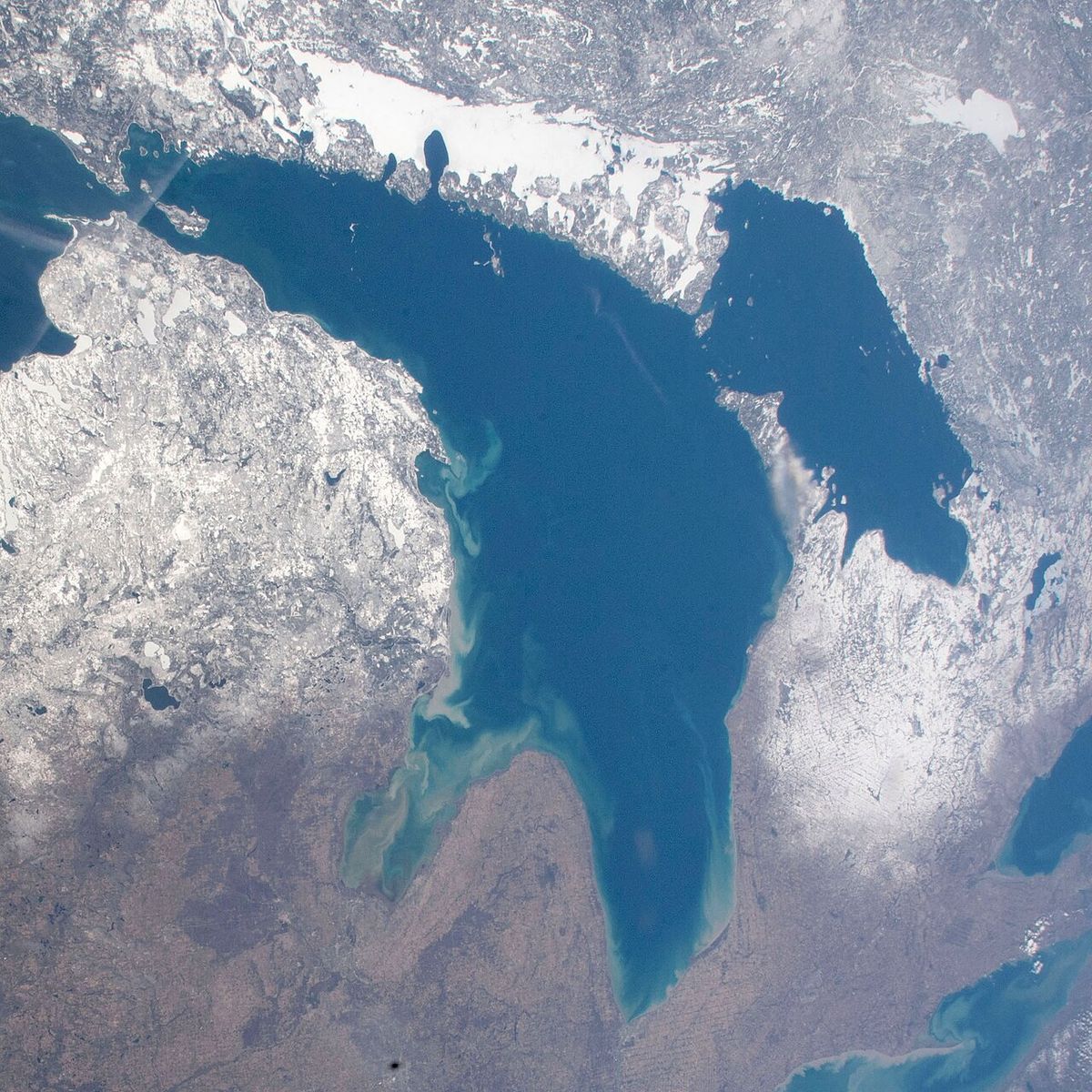
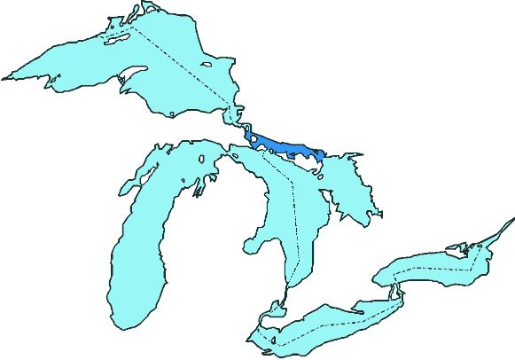
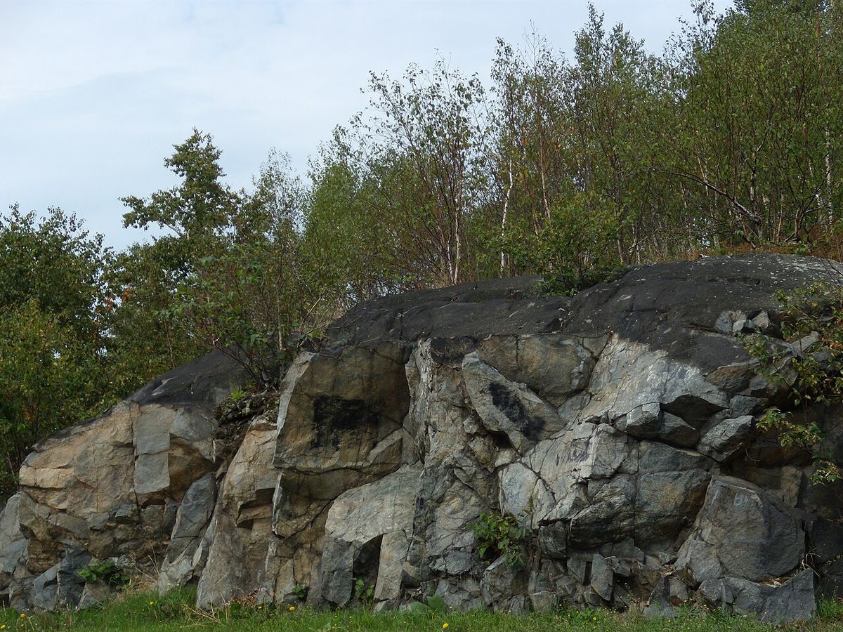
Greater Sudbury encompasses a vast area of the Canadian Shield, characterized by rocky outcrops, hills, and over 330 lakes larger than 10 hectares. The most prominent is Lake Wanapitei, the largest lake in the world situated entirely within a single municipality, a status that belonged to Ramsey Lake prior to the 2001 amalgamation. The city is divided between two main watersheds: the French River watershed flowing east into Georgian Bay and the Spanish River watershed flowing west into the North Channel of Lake Huron. The city's mineral wealth originates from the Sudbury Basin, a nearly two-billion-year-old geological structure now understood to be the remnant of a massive impact crater, likely from a comet, containing profitable amounts of nickel, copper, platinum, and palladium in ores like pentlandite, pyrite, and pyrrhotite. The historical environmental legacy of smelting and logging for fuel, including for the reconstruction of Chicago after the 1871 fire, created a distinctive, barren terrain where vegetation was devastated and bedrock was charred black by pollution and acid rain that penetrated up to three inches into the granite. Local smelting released sulphur into the atmosphere where it combined with water vapour to form sulphuric acid, contributing to acid rain and giving Sudbury a widespread reputation as a wasteland for much of the 20th century.
This damaged terrain led to a major environmental recovery program, known as regreening, beginning in the late 1970s following the construction of the Inco Superstack in 1972, which dispersed sulphuric acid pollution over a wider area and reduced the acidity of local precipitation. Key initiatives included spreading lime and seeds of wild grasses by hand and aircraft, and by 2010 the program had rehabilitated 3,350 hectares of land and planted 9.2 million trees, though approximately 30,000 hectares remained untreated. During the Apollo program, NASA astronauts trained in Sudbury to study impact breccia and shatter cones, rare formations from meteorite impacts, though the common belief that Sudbury was chosen for its resemblance to the Moon's surface is a misconception. Conservation efforts are managed in part by Conservation Sudbury, which operates the Lake Laurentian Conservation Area, and other projects include the Fielding Bird Sanctuary near Lively and a hiking trail near Coniston named for scientist Jane Goodall. Six provincial parks and two provincial conservation reserves are also located partially or entirely within the city boundaries, providing protected natural areas for recreation and conservation.
- Chiniguchi River Provincial Park
- Daisy Lake Uplands Provincial Park
- Fairbank Provincial Park
- Killarney Lakelands and Headwaters Provincial Park
- Wanapitei Provincial Park
- Windy Lake Provincial Park
- MacLennan Esker Forest Conservation Reserve
- Tilton Forest Conservation Reserve
Climate
Greater Sudbury has a humid continental climate with warm, often humid summers and long, cold, snowy winters. Its location north of the Great Lakes makes it susceptible to arctic air masses, and snow cover is typical for up to six months of the year with monthly precipitation relatively even throughout the seasons. While extreme weather is rare, the city was struck by one of Canada's worst tornadoes on August 20, 1970, which killed six people, injured two hundred, and caused over $17 million in damages, equivalent to approximately $138 million in 2025. The highest temperature ever recorded was 41.1 °C on July 13, 1936, and the lowest was -48.3 °C on December 29, 1933, reflecting the region's extremely seasonal temperature range with average January lows around -18 °C and average July highs of 25 °C. The climate classification is Köppen Dfb, characterized by warm and often humid summers with occasional short periods of hot weather, contrasting sharply with the long, cold winters that define much of the year.
Demographics
According to the 2021 census, Greater Sudbury had a population of 166,004 living in 71,476 of its 75,967 total private dwellings, representing a 2.8 percent increase from 2016. With a land area of 3,186.26 square kilometres, it had a population density of 52.1 persons per square kilometre. The census metropolitan area, which includes the city, Wahnapitae First Nation, and Markstay-Warren, had a population of 170,605 living in 73,387 dwellings, with a land area of 4,187.4 square kilometres and a density of 40.7 persons per square kilometre. The median age in the city is 43.2 years, slightly above the provincial average of 41.6 years. Educational attainment data from 2011 showed 17.2 percent of the population held a university degree compared to 23.3 percent nationally, while 18.1 percent had no certificate, diploma, or degree compared to 17.3 percent nationally, indicating the population was historically less educated than the Canadian average.
The ethnic composition of Greater Sudbury is distinct within Canada, with a relatively small visible minority population of 6.6 percent compared to the national average of 26.5 percent. However, the Indigenous population is significant, representing 11 percent of residents, more than double the national average of 5 percent. The largest visible minority groups are Black at 2.5 percent, South Asian at 1.9 percent, and Chinese at 0.6 percent. Religiously, the population remains predominantly Christian, though secularization is growing rapidly. In 2021, 64 percent of residents identified as Christian, down from 81 percent in 2011, with Catholics forming the largest single group at 47 percent, down from 59 percent. Those with no religious affiliation accounted for 33 percent, a substantial increase from 18 percent in 2011. Other religions, including Islam, Judaism, and Hinduism, together constitute about 3 percent of the population, up from 1 percent a decade earlier, reflecting a gradual diversification in religious affiliation.
| Demographic Indicator | Greater Sudbury (2021) | National Average (2021) |
|---|---|---|
| Visible Minority Population | 6.6% | 26.5% |
| Indigenous Population | 11% | 5% |
| Population with French Mother Tongue | 22.6% | Not Applicable |
| Population with No Religious Affiliation | 33% | Not Applicable |
Culture, Language, and Community
Greater Sudbury is an officially bilingual city and a major centre of Franco-Ontarian culture in Northern Ontario, an influence dating to the first European settlement, the Jesuit mission of Sainte-Anne-des-Pins established just before the railway construction in 1883. According to the 2021 census, 37.5 percent of the population can speak French, and 22.6 percent report French as their mother tongue, while English remains the dominant language of daily use for 83.8 percent of the population. The city's cultural institutions, festivals, and media reflect this strong bilingual and bicultural character, serving a large community whose roots are deeply connected to the history of French settlement and mining in the region. The N'Swakamok Native Friendship Centre was founded in 1972 to address Indigenous community concerns raised in a 1969 white paper, continuing the legacy of the area's original Ojibwe inhabitants for whom the region's original name translates to 'where the three roads meet'.
The current city of Greater Sudbury was formed in 2001 through the amalgamation of the former Regional Municipality of Sudbury, which itself was created in 1973. The amalgamation merged the old city of Sudbury with six towns and several unincorporated areas into a single-tier municipality, specifically to preserve the community identities of the outlying towns. In everyday usage, the urban core is still called Sudbury, while the outlying former municipalities maintain strong community identities. The major amalgamated communities, with their 2001 census populations, include the former city of Sudbury (85,354), Valley East (22,374), Rayside-Balfour (15,046), Nickel Centre (12,672), Walden (10,101), Onaping Falls (4,887), and Capreol (3,486). The Wanup area and a large wilderness tract on the northeastern shore of Lake Wanapitei were also annexed. Various studies have confirmed that the provincial government's initial claims of cost savings from amalgamation did not materialize, and administration of the amalgamated city costs significantly more than the prior regional government structure, contradicting the rationale presented for the municipal merger.
Economy and Landmarks
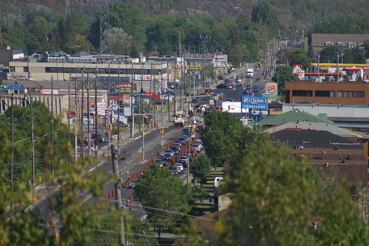
For much of the 20th century, Sudbury's economy was dominated by the global nickel mining industry, with Inco employing more than 25 percent of the population by the 1970s and Falconbridge as another world-leading producer. The city has since successfully diversified, becoming the major service centre for Northeastern Ontario in retail, health care, and education. A key project in this economic transition was the opening of Science North in 1984, a science centre built in a distinctive snowflake-shaped structure connected by a tunnel through the bedrock on the shore of Ramsey Lake where the Creighton fault intersects the lake. Other significant landmarks include the historic Edison Building, the former head office of Falconbridge donated to the city by Xstrata in 2007 to house the municipal archives, and the Copper Cliff smelter which began operations in 1888. The city's economic history is also marked by the contributions of figures like American inventor Thomas Edison, who is credited with the original discovery of the ore body at Falconbridge during a prospecting visit in 1901.
- Science North (inaugurated 1984)
- Copper Cliff Smelter (operational 1888)
- Inco Superstack (constructed 1972)
- Edison Building (donated 2007, houses municipal archives)
- Murray Mine (site of 1883 ore discovery)
- N'Swakamok Native Friendship Centre (founded 1972)
- Frood Mine (major Second World War nickel supplier)
- Sainte-Anne-des-Pins church (historic Franco-Ontarian mission)
The regreening effort was a partnership between the municipality, the province, the mining companies, and academics from Laurentian University. Vale has begun to rehabilitate the slag heaps that surround their smelter in the Copper Cliff area with the planting of grass and trees. They also use biosolids to stabilize and regreen tailings areas. The Sainte-Anne-des-Pins church played a prominent role in the development of Franco-Ontarian culture in the region. Coincidentally, Ste-Anne is the patron saint of miners. Sudbury has since expanded from its resource-based economy to emerge as the major retail, economic, health, and educational centre for Northeastern Ontario.
Questions about Greater Sudbury
Why is Greater Sudbury famous?
Greater Sudbury is historically famous as a world leader in nickel mining. It is the most populous city in Northern Ontario and the largest city in Ontario by area. The city is renowned for its dramatic environmental recovery from industrial pollution, recognized by a United Nations Local Government Honours Award at the 1992 Earth Summit. Greater Sudbury is also home to a large Franco-Ontarian population, which influences its arts and culture.
How did Sudbury get its name?
James Worthington, the superintendent of construction on the Northern Ontario segment of the railway, selected the name Sudbury after Sudbury, Suffolk, in England. This was the hometown of his wife Caroline Hitchcock. The city's official name was changed to Greater Sudbury in 2001 when it was amalgamated. In everyday usage, however, the city is still more commonly referred to as just Sudbury.
What was the regreening of Sudbury?
The regreening was a major environmental reclamation program launched in the late 1970s to rehabilitate land devastated by a century of mining pollution, acid rain, and logging. The program was enabled by the Inco Superstack reducing local acid rain and involved spreading lime to neutralize acidic soil and seeding areas by hand and aircraft. By 2010, it had rehabilitated 3,350 hectares of land, planted 9.2 million trees, and involved Vale rehabilitating slag heaps with biosolids. This community effort earned Sudbury a United Nations Local Government Honours Award in 1992.
What is the population of Greater Sudbury?
Greater Sudbury is the most populous city in Northern Ontario with a population around 166,004 in 2021. This figure is from the 2021 Census of Population conducted by Statistics Canada. The city serves as the major retail, economic, health, and educational centre for Northeastern Ontario. With a land area of 3,186.26 square kilometres, it has a population density of 52.1 people per square kilometre. The population resides in an urban core and many smaller communities scattered around the region.
What is the Sudbury Basin?
The Sudbury Basin is a large geological structure known as the remnants of a nearly two billion-year-old impact crater. It was long thought to be the result of a meteorite collision, though more recent analysis has suggested the crater may have been created by a comet. Rich deposits of nickel sulphide ore were discovered in this formation, containing profitable amounts of nickel, copper, platinum, and palladium. During the Apollo program, NASA astronauts trained in Sudbury to become familiar with impact breccia and shatter cones produced by large meteorite impacts. The exploitation of these mineral resources, enabled by railway construction, dominated the local economy for much of the 20th century.
Is Sudbury a bilingual city?
Yes, Sudbury is a bilingual city with a large francophone population. According to census data, 37.5 percent of Sudburians can speak French and 22.6 percent have French as their mother tongue. French Jesuits established the first European settlement, a mission called Sainte-Anne-des-Pins, just before the construction of the Canadian Pacific Railway in 1883. The Sainte-Anne-des-Pins church played a prominent role in developing Franco-Ontarian culture in the region. This significant Franco-Ontarian population continues to influence the city's arts and culture today.
Sources and further reading
- Greater Sudbury (Wikipedia)
- City of Greater Sudbury (greatersudbury.ca)
- Move to Sudbury (investsudbury.ca)
Checked by the Your Space Hamilton desk. Last updated 2026-10-21.