Cranbrook, British Columbia
Cranbrook is a city in southeastern British Columbia, Canada, and the largest urban centre in the East Kootenay region. Incorporated as a city on November 1, 1905, its growth was secured when Colonel James Baker convinced the Canadian Pacific Railway to establish its Crowsnest Pass line through the community in 1898. As the regional administrative hub, it is home to the headquarters of the Regional District of East Kootenay, the Rocky Mountain Forest District, and the main campus of the College of the Rockies. With a population of 20,499 as of the 2021 census and a census agglomeration population of 27,040, Cranbrook serves as a key transportation, health care, and commercial service centre for the surrounding mountainous area.
History
The area now known as Cranbrook is within the traditional territory of the Ktunaxa peoples. European settlement began with Colonel James Baker, who purchased land and named it Cranbrook after his home in Cranbrook, Kent, England. In 1890, the Kootenay Indian Residential School, also called St. Eugene's, opened in the community and operated until 1975, representing a tragic period in local history. A decisive moment in the community's development occurred in 1898 when Baker successfully persuaded the Canadian Pacific Railway to route its Crowsnest Pass line through Cranbrook instead of the nearby boomtown of Fort Steele. This decision secured Cranbrook's status as the region's primary centre, leading to its incorporation as a city on November 1, 1905, while Fort Steele declined into a preserved heritage town. Throughout the 20th century, Cranbrook's economy became anchored by industries such as mining, forestry services, trades, and health care, supporting its role as the administrative heart of the East Kootenay and the location for regional headquarters of various provincial ministries and agencies.
Geography and climate
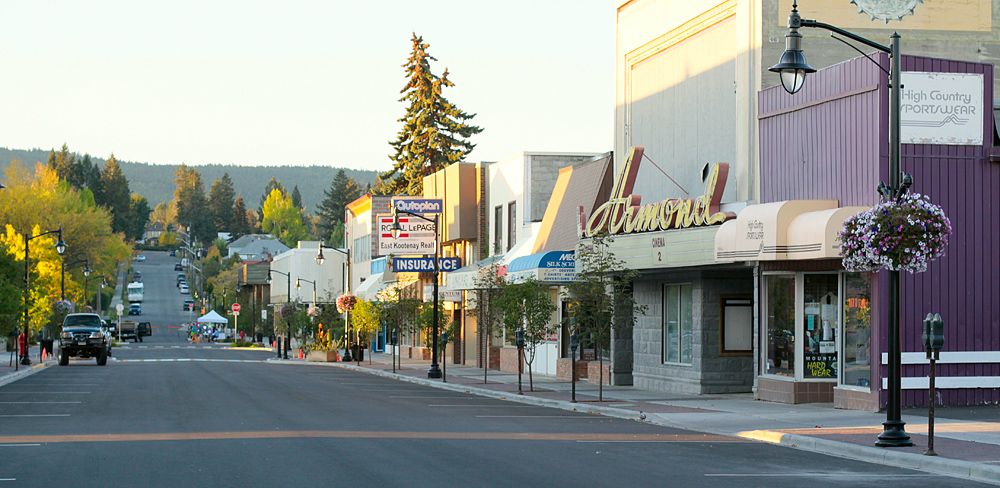
Cranbrook is situated approximately 10 kilometres southwest of the confluence of the Kootenay and St. Mary's Rivers. While the city core is relatively flat, it is surrounded by residential hills and faces the Purcell Mountains to the west and the Rocky Mountains to the north and east. Numerous lakes are found in close proximity, including Jim Smith Lake, Wasa Lake, Lazy Lake, Moyie Lake, Monroe Lake, Norbury Lake, and Elizabeth Lake, offering public recreational beaches, provincial campgrounds, and opportunities for boating, fishing and camping. Cranbrook experiences a humid continental climate characterized by very warm, sunny summer days with cool nights and moderately cold, snowy winters. Environment and Climate Change Canada reports it receives the most sunshine of any city in British Columbia, with about 2,190.5 hours annually, and its climate is extremely similar to Kelowna's in precipitation patterns though Kelowna is significantly warmer. The city is fairly dry year-round, with a good percentage of its precipitation falling as snow, and experiences some of the lightest wind speeds in Canada, few foggy days, and among the highest average barometric pressures of any city in the country. The frost-free period averages 127 days, typically from May 18 to September 23, with mean daily temperatures ranging from -6.5 °C in January to 19.2 °C in July, though temperatures can range from -20 °C in winter to 35 °C in summer. The highest temperature ever recorded was 40.5 °C on August 10, 2018, while the record low was -41.1 °C on January 19, 1950, and the mean annual temperature is 6.1 °C.
Demographics
According to the 2021 Canadian census, Cranbrook had a population of 20,499 living in 8,780 of its 9,058 total private dwellings. This was a change of 2.3% from its 2016 population of 20,047, continuing a pattern of steady growth seen over previous decades. With a land area of 31.97 square kilometres, it had a population density of 641.2 people per square kilometre. The wider census agglomeration, which includes surrounding communities, had a population of 27,040, indicating the city's role as a central service hub for a larger regional population. In terms of religious affiliation, the 2021 census indicated a majority of residents identified as non-religious, reflecting a national trend. The detailed breakdown of religious groups in Cranbrook provides a clear picture of the community's diversity, with Christianity remaining the largest organized faith. The following list details the religious composition as reported in the 2021 census.
- Irreligion: 11,190 persons (56.4%)
- Christianity: 8,060 persons (40.6%)
- Sikhism: 155 persons (0.8%)
- Hinduism: 120 persons (0.6%)
- Buddhism: 85 persons (0.4%)
- Islam: 45 persons (0.2%)
- Indigenous Spirituality: 25 persons (0.1%)
- Judaism: 15 persons (0.1%)
Education
Cranbrook's public school system is administered by School District 5 Southeast Kootenay, which oversees education across the region. The district operates six elementary schools and two middle schools within the city that feed into the city's sole public high school, Mount Baker Secondary School, which is home to approximately 1,000 students and 90 staff members and is the largest high school in the district. Prior to 2004, the middle schools were junior high schools for grades 8-10, but the district adopted the current grade 7-9 model for middle schools due to declining enrollment across the region. There is also a local home-school network operating in the city alongside the traditional public and private institutions. Cranbrook is also the location of the main campus of the College of the Rockies, a post-secondary institution with over 2,500 full and part-time students from more than 21 countries, providing a significant educational resource for the East Kootenay. The following twelve schools are located within Cranbrook, including public, private, and First Nations institutions.
- Aqamnik Elementary School (First Nations school located in St. Mary's Band)
- Gordon Terrace Elementary
- Highlands Elementary School
- Kootenay Christian Academy
- Kootenay Orchards Elementary School
- Laurie Middle School
- Mount Baker Secondary School
- Parkland Middle School
- Pinewood Elementary School
- St. Mary's Catholic Independent School (private school)
- Steeples Elementary School
- T M Roberts Elementary School
Transportation and infrastructure
Cranbrook is a significant transportation hub due to its location at the junction of Highways 3 and 93/95 and its close proximity to the borders of Alberta and the United States. A major Canadian Pacific Railway yard in the city serves as a key gateway for trains arriving from and departing to the United States, a legacy of the 1898 routing decision that shaped the city. The McPhee Bridge, also known as the St. Mary's Bridge, rises high above the St. Mary River near the Cranbrook/Canadian Rockies International Airport and the Shadow Mountain Golf Community, supporting the thousands of people who travel between Kimberley and Cranbrook on Highway 95A. Cranbrook/Canadian Rockies International Airport is located approximately five nautical miles north of the city and recently completed a $12.5 million expansion including lengthening its runway from 6,000 to 8,000 feet to accommodate a limited number of international flights and expanding the terminal for more passengers. The airport is served by Air Canada Jazz with flights to Vancouver and WestJet Encore with flights to Vancouver and Calgary, connecting the city to major western Canadian centres. On February 11, 1978, Pacific Western Airlines Flight 314, a Boeing 737-200, crashed at the airport after nearly impacting a snowplow on the runway, killing 42 of the 49 people on board in a major aviation disaster. Public transit within the city is provided by BC Transit, which runs buses on eight different lines to serve local transportation needs. The city's key infrastructure also includes the East Kootenay Regional Hospital, the largest hospital in the region, which provides critical health care services to a wide area.
Sports, recreation, and culture
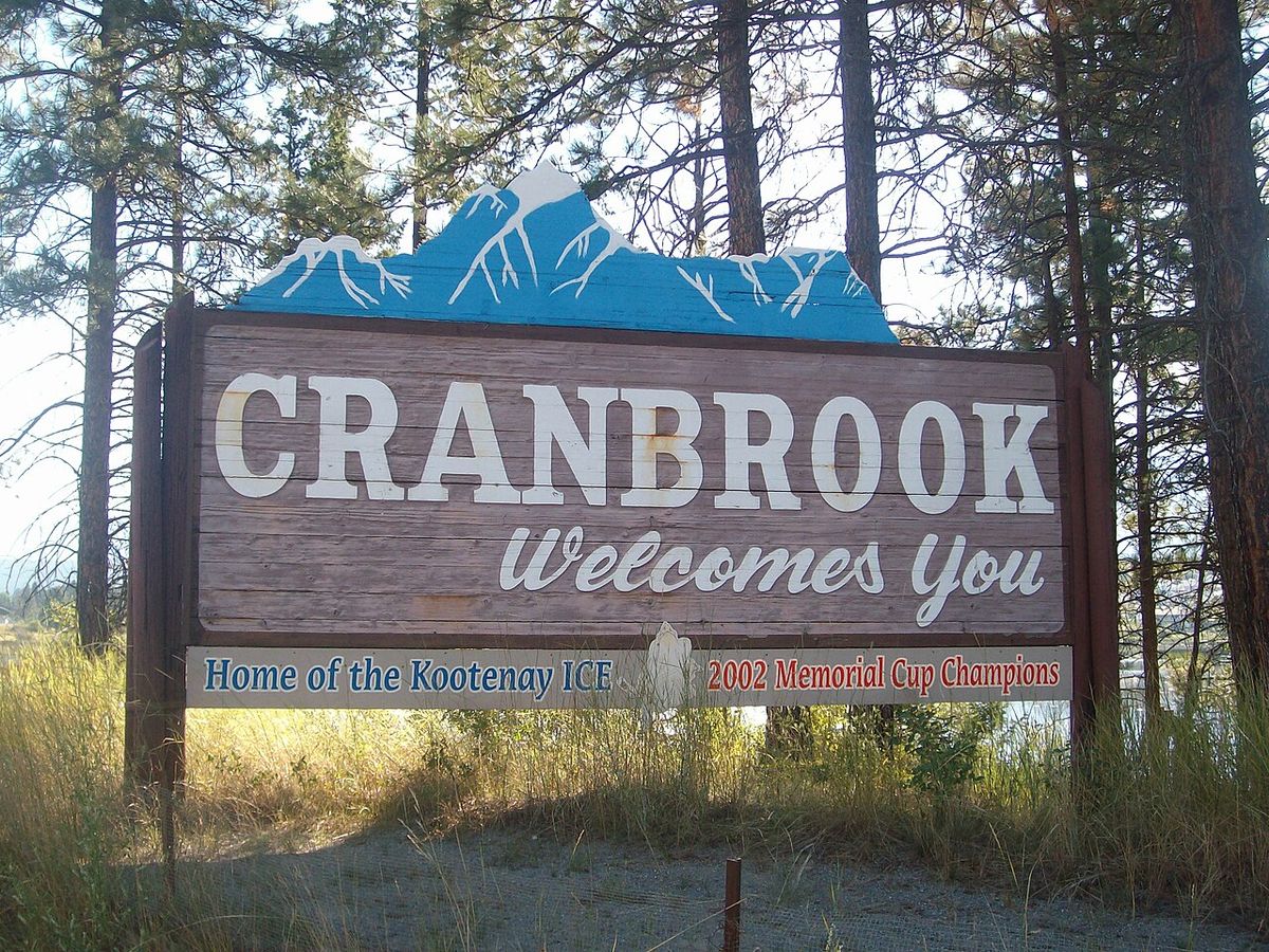
Cranbrook offers a variety of cultural and recreational amenities that leverage its natural setting and history. A prominent cultural institution is the Canadian Museum of Rail Travel, which presents static exhibits of passenger rail cars built in the 1920s for the CPR and in the 1900s for the Spokane International Railway, preserving an important aspect of local heritage. The primary sports and recreation facility is Western Financial Place, a complex featuring a pool and hockey arena that opened in 2000 and was formerly called the RecPlex. It was formerly home to the Western Hockey League's Kootenay Ice until the team relocated to Winnipeg, Manitoba, in 2019, and is now the home arena for the Cranbrook Bucks of the British Columbia Hockey League. A major recreational trail is the 28 kilometre paved Rails to Trails path between Cranbrook and Kimberley, which forms a section of the Trans-Canada Trail and was created on a former CP Rail right-of-way donated by the railway after teardown began in 2009. The community also has access to 2,000 acres of wilderness to explore in the community forest, providing extensive opportunities for hiking and outdoor activities. Local media includes the Cranbrook Daily Townsman daily newspaper, several radio stations including CBC Radio One on 101.3 FM and various commercial stations, and television services including a CTV repeater and Shaw TV community cable channel.
Population and census trends
Cranbrook's population has shown steady growth over recent decades, reflecting its role as a regional service centre for the East Kootenay. The following table shows the population figures from recent Canadian censuses, illustrating this trend alongside the number of private dwellings, which indicates consistent housing growth and development within the city to accommodate new residents. The data reveals a pattern of incremental growth with each five-year census period, confirming Cranbrook's stable expansion. This consistent increase in both population and housing stock demonstrates the city's ongoing development and its function as the primary urban centre for a large geographical area, attracting residents for employment, services, and education.
As of 2021, Cranbrook's census agglomeration population is 27,040. The city is the largest urban centre in the East Kootenay region. Major industries in Cranbrook include mining, forestry services, trades, and health care. The city is also the location of the headquarters of the Regional District of East Kootenay and the regional headquarters of various provincial ministries.
Notable features and sister city
Cranbrook is distinguished by several unique features and institutions that define its community character. It is the location of the regional headquarters for various provincial ministries and agencies, most notably the Rocky Mountain Forest District, consolidating its administrative importance. The city's airport, the Cranbrook/Canadian Rockies International Airport, underwent a significant runway extension to 8,000 feet as part of its expansion to handle more traffic and limited international flights. In sports history, the city was home to the Kootenay Ice major junior hockey team for nearly two decades before their move to Winnipeg in 2019, leaving a legacy now continued by the junior A Cranbrook Bucks. The city maintains an official twinning relationship with Coeur d'Alene, Idaho, in the United States, fostering cultural and economic ties across the international border. These elements collectively contribute to Cranbrook's identity as a community with strong regional connections, a focus on outdoor and cultural amenities, and a history deeply intertwined with transportation and resource industries that built the Canadian West.
Questions about Cranbrook, British Columbia
What is Cranbrook, BC known for?
Cranbrook is known as the largest urban centre in the East Kootenay region. It is known for being the location of the Canadian Museum of Rail Travel. The city is also known for having the most sunshine hours of any British Columbia city. Cranbrook is the location of the headquarters of the Regional District of East Kootenay and the East Kootenay Regional Hospital.
What is the population of Cranbrook?
As of the 2021 Canadian census, the population of Cranbrook was 20,499, living in 8,780 of the city's 9,058 total private dwellings. This represents an increase of 2.3% from the 20,047 residents recorded in the 2016 census. The wider census agglomeration area, which includes surrounding communities, had a population of 27,040 in 2021, showing the city's central role in the region. The city's population density is 641.2 people per square kilometre within its 31.97 square kilometre land area.
What is there to do in Cranbrook?
Visitors and residents can explore outdoor activities at numerous nearby lakes like Jim Smith Lake, Wasa Lake, and Moyie Lake, which offer public beaches, provincial campgrounds, boating, and fishing. The 28 kilometre paved Rails to Trails path to Kimberley is popular for cycling and walking as part of the Trans-Canada Trail, built on a former railway right-of-way. Cultural attractions include the Canadian Museum of Rail Travel with its historic passenger cars, and sports fans can watch the Cranbrook Bucks BCHL hockey team play at Western Financial Place. The surrounding 2,000-acre community forest provides extensive wilderness for hiking and exploration, and the city itself has a public transit system with eight bus lines.
What is the climate like in Cranbrook?
Cranbrook has a humid continental climate with very warm, sunny summer days followed by cool nights and moderately cold, snowy winters. It holds the distinction of being the sunniest city in British Columbia, averaging about 2,190.5 hours of sunshine annually, and its climate is extremely similar to Kelowna's in precipitation patterns though significantly cooler. The city is fairly dry, with light wind speeds year-round, few foggy days, and among the highest average barometric pressures in Canada. The frost-free period averages 127 days from mid-May to late September, with extreme temperatures ranging from a record high of 40.5 °C to a record low of -41.1 °C.
What major industries are in Cranbrook?
Major industries in Cranbrook include mining and forestry services. The city's industries also include trades and health care. The Rocky Mountain Forest District has its headquarters in Cranbrook. The city is also a transportation hub with a major Canadian Pacific Railway yard.
How do I get to Cranbrook?
Cranbrook is accessible by road via Highways 3 and 93/95, which intersect in the city and connect to Alberta and the United States. The Cranbrook/Canadian Rockies International Airport, located just north of the city, offers regular flights to Vancouver and Calgary through Air Canada Jazz and WestJet Encore following a recent runway expansion. The city is a key stop on the Canadian Pacific Railway's network, with a major yard for cross-border freight traffic. Public transit within Cranbrook is provided by BC Transit, which operates a local bus system on eight different lines serving the community, and intercity bus connections are available via the highway network.
Sources and further reading
- Cranbrook, British Columbia (Wikipedia)
- City of Cranbrook, Homepage (cranbrook.ca)
- Cranbrook Newcomers Guide (choosecranbrook.ca)
- Visit Cranbrook (cranbrookbc.com)
- Cranbrook | Canadian Rockies | Kootenay Rockies (travel-british-columbia.com)
Checked by the Your Space Hamilton desk. Last updated 2026-11-01.