Pacific Northwest windstorm
Pacific Northwest windstorms, colloquially known as Big Blows, are powerful extratropical cyclones that form over the North Pacific Ocean and strike the coastal regions of the northwestern United States and British Columbia. These storms are a defining feature of the region's winter weather, characterized by deep low-pressure systems that bring destructive winds, heavy rain, and significant societal impacts. Major events, such as the 1962 Columbus Day storm and the 2006 Hanukkah Eve windstorm, have caused dozens of fatalities, widespread power outages lasting for days, and damage costing hundreds of millions of dollars. For Canadians, these windstorms are a recurrent natural hazard that regularly disrupts life in coastal British Columbia, testing infrastructure and emergency preparedness from Vancouver Island to the Lower Mainland.
Meteorological characteristics and formation
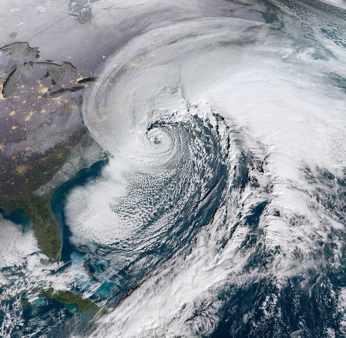
Pacific Northwest windstorms are extratropical cyclones, meaning they derive their energy from the temperature contrast between air masses rather than from tropical warmth. These systems develop as areas of low atmospheric pressure over the North Pacific Ocean, where deep lows are relatively common, especially during the winter months. The storms typically track eastward or northeastward from the Pacific basin towards the coast of western North America. Their formation is driven by the jet stream and the significant temperature gradients present over the cool ocean waters during the fall and winter. The primary hazard from these cyclones is strong, often damaging winds that can blow from any direction, though the southern quadrant of a low-pressure centre is typically the windiest. This distinguishes them from nor'easters on the Atlantic coast, where winds predominantly originate from the northeast. The storms frequently merge with other weather features, such as atmospheric rivers, which channel vast amounts of subtropical moisture into the region, leading to combined wind and flood hazards. For example, in March 2026, two atmospheric rivers were forecast to bring heavy rainfall and significant snowfall to Washington and Oregon, with precipitation totals of 180 to 380 millimetres in mountainous regions and a 75% probability of AR3 conditions in southwestern Washington and northwestern Oregon.
Historical frequency and notable events
According to modern records, the largest Pacific Northwest windstorm events strike the region every 15 to 30 years, with numerous significant storms documented since the late 19th century. The most destructive events are etched into regional history due to their loss of life, economic cost, and prolonged disruption. The 1962 Columbus Day storm, which evolved from the remnants of Typhoon Freda, remains one of the most severe, causing 50 fatalities. The 1993 Inauguration Day windstorm killed six people and left 750,000 homes and businesses without power, causing $130 million in damage in Western Washington and an additional $500,000 in damage to the Evergreen Point Floating Bridge. In 2006, the Hanukkah Eve windstorm resulted in 18 deaths, primarily from carbon monoxide poisoning due to improper indoor generator use, and left over 1.8 million customers without electricity. More recently, the October 2021 and November 2024 Northeast Pacific bomb cyclones tied for the lowest recorded pressure in the region at 942 hPa, matching the intensity of the 1993 storm. British Columbia has experienced its own record-breaking outages, with the December 2018 windstorm affecting over 750,000 BC Hydro customers, surpassing the previous record set by a storm in August 2015 that knocked out power to 710,000 customers in the Lower Mainland.
Key 21st-century windstorm events include the 2006 Hanukkah Eve windstorm, which killed 14 people and caused widespread power outages for 11 days. The 2015 August 29-30 windstorm knocked out power to 710,000 customers in British Columbia's Lower Mainland region. The December 2018 windstorm caused over 750,000 customers in British Columbia to lose power, which was the largest outage in BC Hydro's recorded history. Other significant 21st-century events include the October 2021 Northeast Pacific bomb cyclone and the November 2024 Northeast Pacific bomb cyclone.
- 2007: The Great Coastal Gale of 2007.
- 2015 (August 29-30): Storm knocked out power to 710,000 customers in BC's Lower Mainland, then the largest outage in BC Hydro history.
- 2016 (October): The Ides of October storm, from Typhoon Songda, brought coastal winds near 100 mph and an EF-2 tornado to Manzanita, Oregon.
- 2018 (December 20): Caused BC's largest power outage (over 750,000 customers). One fatality in Duncan from a falling tree and a man rescued by helicopter from White Rock Pier.
- 2021 (October): Northeast Pacific bomb cyclone with a central pressure of 942 hPa.
- 2024 (November): Northeast Pacific bomb cyclone that tied the 2021 and 1993 storms for lowest pressure.
- 2026 (September 23): Forecasted autumn windstorm predicted to bring gusts over 40 mph to northern Oregon and southwestern Washington, with a low pressure centre coming ashore near Astoria or Long Beach.
Other notable historical storms include the Great Gale of 1880 and the January 1921 Great Olympic Blowdown. The February 1979 windstorm led to the catastrophic failure of the Hood Canal Bridge. The November 1990 storm is linked to the Mercer Island bridge sinking in Washington state. The 2013 remnants of Typhoon Pabuk brought heavy rain that made September 2013 the wettest on record for Portland, Oregon. A December 2014 storm brought Portland its strongest recorded wind gust since 1995, which was 59 mph. The Friday the 13th windstorms of November 1981 and the March 1999 windstorm are also part of this extensive historical catalogue.
Impacts and hazards
The impacts of Pacific Northwest windstorms are severe, affecting millions of residents in both the United States and Canada. The most immediate and widespread effect is damage to electrical infrastructure, leading to prolonged power outages that can last for days or, in extreme cases, over a week. Falling trees and branches, often due to the combination of high winds and soil saturated by concurrent heavy rain, are the primary cause of these outages and also pose a direct threat to life and property. Storm-related fatalities have occurred from falling trees, as seen in the 2018 Duncan incident, and from indirect causes like carbon monoxide poisoning in the aftermath of the 2006 storm. The economic toll is regularly in the hundreds of millions of dollars, encompassing damage to homes, businesses, vehicles, and public infrastructure like bridges. For example, the 1993 storm caused $500,000 in damage to Washington's Evergreen Point Floating Bridge. Transportation networks are severely disrupted, with high winds cancelling ferry services, downing trees on roads and railways, and creating hazardous driving conditions. The storms also contribute to coastal erosion, particularly when combined with high seas, and can trigger landslides in steep terrain. Beyond immediate physical damage, the storms strain emergency services, close schools and businesses, and disrupt supply chains. The societal cost includes lost productivity, spoilage of food during extended blackouts, and long-term psychological stress for affected communities.
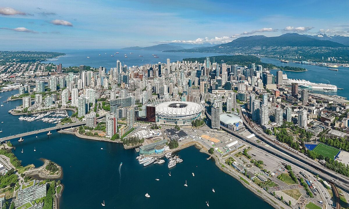
Specific impacts on British Columbia are pronounced due to its heavily forested landscape and population centres along the coast. The August 2015 storm left several municipalities in Metro Vancouver without power for three days, while the December 2018 event caused similar prolonged outages and led to ferry cancellations across the Strait of Georgia. These events highlight the vulnerability of the region's above-ground power distribution system. In the United States, storms like the 1993 Inauguration Day event and the 2006 Hanukkah Eve storm demonstrated that even major metropolitan areas like Seattle and Portland are not immune to crippling disruptions. The 2026 forecast for dual atmospheric rivers in March indicates the persistent threat of compounded hazards, where wind damage is followed or accompanied by river rises and localized flooding from heavy precipitation. The interaction of wind and saturated ground also increases the risk of tree failures, with native Black cottonwoods being particularly noted for causing injury and mayhem when fully leafed, as in a fatal incident in Roy, Washington, in October 2023.
Climate influences and future outlook
The frequency and character of Pacific Northwest windstorms are influenced by large-scale climate patterns, most notably the El Niño-Southern Oscillation (ENSO). El Niño events, marked by warmer-than-average sea surface temperatures in the central and eastern Pacific, typically lead to warmer and drier winter conditions in Washington, Oregon, and Idaho. This can potentially alter storm tracks but does not eliminate the risk of major wind events. As of June 2026, NOAA declared an El Niño was developing, with a 63% chance of a very strong event during November 2026 to January 2027. While El Niño winters may be drier on average, they can still produce powerful storms, and the phenomenon is associated with other risks like marine heatwaves and changes to salmon populations. For instance, the 1983 El Niño affected the distribution and survival of salmon and other fish, and a large marine heatwave in summer 2023 set new records off the Gulf of Alaska and the coasts of Oregon and Washington. Climate change introduces additional complexity, contributing to overall warming, changing precipitation patterns, and potentially intensifying the atmospheric rivers that often accompany these windstorms. The interaction between climate change and El Niño can exacerbate conditions like drought, wildfire risk due to less snowpack, and shoreline erosion from larger waves. Forecasts for the 2026 to 2027 season indicate an active pattern, with predictions in late March 2026 for dual atmospheric rivers to bring heavy rain and snow to the region, demonstrating the persistent threat of compounded wind and precipitation events. The NOAA Climate Prediction Center's outlook suggests weather patterns throughout Alaska, Idaho, Oregon, and Washington will be affected by the developing El Niño in the coming winter, with Alaskans likely to see slightly higher temperatures and more fall storms around the Gulf of Alaska.
Forecasting and preparedness
Forecasting these windstorms has advanced significantly with improved satellite technology, buoy networks, and high-resolution computer models, allowing meteorologists to provide days of advance warning. For instance, models accurately predicted the development of a cyclone off the Oregon coast for September 23, 2026, forecasting wind gusts over 40 mph with possible rogue gusts to 50 mph and localized power outages, particularly in northern Oregon and southwestern Washington. Effective preparedness is critical for mitigating storm impacts. Property owners are advised to maintain trees by having them professionally inspected for weakness, though practices like 'windsail reduction' pruning are debated among arborists as they may stress trees by removing food-producing leaves. During warnings, residents should stay informed through official channels, avoid travel, and be ready for extended power outages. Utilities like BC Hydro have response plans for major outages, but the scale of events like those in 2015 and 2018 tests the limits of infrastructure. Public education campaigns emphasize the danger of carbon monoxide, which was a leading cause of death in the 2006 storm. Communities also work on long-term mitigation, such as improving building codes, burying power lines in critical areas, and managing forests near power corridors to reduce the sail area of large firs and cedars.
Comparative storm intensity and records
The intensity of Pacific Northwest windstorms is commonly measured by central barometric pressure, wind speeds, and the scale of societal disruption. The lowest recorded pressures are benchmarks for extreme events. For example, the October 2021 bomb cyclone underwent rapid bombogenesis with air pressure bottoming out at 942 hPa. The November 2024 bomb cyclone tied the October 2021 storm for the lowest pressure recorded in the Pacific Northwest since the Inauguration Day Storm of 1993. These metrics illustrate the progression of record-setting events in recent decades.
| Storm | Year | Key Metric | Impact Note |
|---|---|---|---|
| Columbus Day Storm | 1962 | 50 fatalities | Evolved from Typhoon Freda |
| Inauguration Day Storm | 1993 | 750,000 without power | Tied 2024 low-pressure record; $130M WA damage |
| Hanukkah Eve Storm | 2006 | 1.8 million without power | 18 fatalities, mostly from CO poisoning |
| Great Coastal Gale | 2007 | Major coastal damage | Significant in Oregon and Washington |
| BC Windstorm | Aug 2015 | 710,000 outages (BC record at time) | Largest in BC Hydro history until 2018. 3-day outages in Metro Vancouver |
| BC Windstorm | Dec 2018 | Over 750,000 outages | Set new BC Hydro outage record. Ferry cancellations, one fatality |
| Bomb Cyclone | Oct 2021 | 942 hPa pressure | Tied for lowest pressure on record. Rapid bombogenesis |
| Bomb Cyclone | Nov 2024 | 942 hPa pressure | Tied 2021 and 1993 storm records |
| Sept 2026 Forecast Storm | 2026 | Gusts >40 mph predicted | Low pressure centre landfall near Astoria/Long Beach. Focused on OR & SW WA |
This historical record shows that while forecasting improves, the region remains vulnerable to cyclones of similar or greater magnitude. The clustering of intense events in the 21st century, including record outages in British Columbia and record-low pressures, highlights the ongoing need for resilient infrastructure and public awareness. The data also shows a trend of storms causing massive, cascading power failures, with British Columbia's outage records being broken twice in three years. The tied pressure records of 1993, 2021, and 2024 indicate that extreme atmospheric conditions continue to recur, and forecast models for 2026 continue to predict storms with impactful wind gusts targeting specific coastal communities.
Related phenomena and regional context
Pacific Northwest windstorms are part of a family of powerful extratropical cyclones that affect various parts of the globe. Their closest analogue is the European windstorm, which develops over the eastern North Atlantic and impacts Western Europe. On the east coast of North America, nor'easters are a similar class of storm, though they are named for their characteristic northeasterly winds, whereas Pacific Northwest storms can have primary winds from any direction. These windstorms often interact with other significant weather patterns prevalent in the region. Atmospheric rivers, long plumes of concentrated moisture, frequently accompany or follow windstorms, as seen in the forecast for March 2026 where integrated vapor transport values over 250 kg m-1s-1 were expected. The Pineapple Express, a specific type of atmospheric river originating near Hawaii, has been a moisture source for storms like the 2013 remnants of Typhoon Pabuk. The region also experiences bomb cyclones, which are extratropical cyclones that undergo rapid intensification, or bombogenesis, with a pressure drop of at least 24 millibars in 24 hours. The October 2021 and November 2024 storms are prime examples. This interplay between different storm types and moisture sources creates complex and often long-duration weather events that challenge forecasters and emergency managers alike. The storms are also linked to broader seasonal shifts, with the first autumn storm of the season often serving as a practice run for more severe events to come in the heart of winter.
Questions about Pacific Northwest windstorm
What is a Pacific Northwest windstorm?
A Pacific Northwest windstorm is a powerful extratropical cyclone that forms over the North Pacific Ocean and moves inland, affecting British Columbia, Washington, and Oregon. Known colloquially as a Big Blow, these storms are most common in the fall and winter months, particularly November and December. They are characterized by deep low pressure, strong winds from varying directions, and often accompany heavy rain or atmospheric rivers. Unlike hurricanes, their energy comes from the clash of air masses, and they are analogous to European windstorms or Atlantic nor'easters.
How often do major windstorms hit the Pacific Northwest?
According to modern records, the largest and most destructive windstorm events strike the Pacific Northwest region every 15 to 30 years. However, significant storms causing widespread damage and power outages occur more frequently, with several notable events recorded in each of the past few decades. The month when most windstorms form is November or December, aligning with the peak of the autumn and winter storm season. The interval between catastrophic events provides a rough guide, but the region can experience damaging storms in any winter year.
What was the worst Pacific Northwest windstorm in history?
The 1962 Columbus Day storm is often cited as one of the worst, with 50 fatalities after it formed from the remnants of Typhoon Freda. In terms of power outages, the 2006 Hanukkah Eve windstorm left over 1.8 million customers without electricity and caused 18 deaths. The 1993 Inauguration Day storm caused $130 million in damage in Western Washington. More recently, the October 2021 and November 2024 bomb cyclones tied for the lowest recorded barometric pressure (942 hPa) in the region, matching the intensity of the 1993 event. The worst storm is measured by different metrics, including lives lost, economic cost, and geographical extent.
How do El Niño and climate change affect these windstorms?
El Niño events, which involve warming of central Pacific waters, typically lead to warmer and drier winter conditions in the Pacific Northwest, which can influence storm tracks and frequency. As of 2026, a strong El Niño was forecast for the 2026 to 2027 winter. Climate change is leading to overall warming and altering precipitation patterns, which may interact with these storms. It can intensify associated atmospheric rivers, potentially increasing rainfall totals. Climate change also contributes to marine heatwaves, which affect ocean ecosystems and can have downstream effects on fisheries and coastal conditions during and after storm seasons.
What should I do to prepare for a Pacific Northwest windstorm?
Secure outdoor items like patio furniture, garbage cans, and decorations that could blow away. Have a battery-powered radio and alternative light sources ready. Crucially, if using a generator for power, ensure it is operated outdoors and far from windows to prevent deadly carbon monoxide poisoning, a leading cause of storm-related deaths. Prune or remove dead or weak tree branches near your home, but consult an arborist for major work. Stay informed by monitoring local weather forecasts and official warnings from agencies like Environment Canada or the National Weather Service.
Why does British Columbia lose power so frequently during these storms?
Widespread power outages in British Columbia, particularly in the Lower Mainland and on Vancouver Island, are common because the electrical grid runs through heavily forested areas with many large trees. High winds, often combined with rain-soaked soil, cause trees and branches to fall onto power lines. The scale of outages can be massive, as seen in August 2015 when 710,000 customers lost power and in December 2018 when over 750,000 were affected, setting records for BC Hydro. The region's dense vegetation and the design of the above-ground distribution system make it highly vulnerable to wind damage.
Sources and further reading
- Pacific Northwest windstorm (Wikipedia)
- El Niño in the Northwest: What Can We Expect? (climatehubs.usda.gov)
- First autumn storm of the season to bring gusty winds ... (emeraldcityweather.com)
- Pacific Windstorm Will Hit The Pacific Northwest Late ... (cliffmass.blogspot.com)
- Atmospheric rivers forecast to bring heavy rain and snow ... (watchers.news)
Checked by the Your Space Hamilton desk. Last updated 2026-10-27.