Hurricane Ernesto (2024)
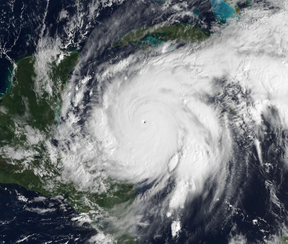
Hurricane Ernesto was a moderately strong Atlantic hurricane in August 2024 that caused significant flooding and damage across the Caribbean and Bermuda before affecting Atlantic Canada. The fifth named storm and third hurricane of the 2024 season, Ernesto developed from a tropical wave east of the Leeward Islands, impacting several island nations before curving northward. It made landfall on Bermuda as a Category 1 hurricane on August 17, becoming the first hurricane to strike the territory since 2020. The storm's large footprint generated dangerous rip currents along the entire U.S. Eastern Seaboard, resulting in three fatalities and contributing to an estimated $520 million in total damages.
Meteorological history
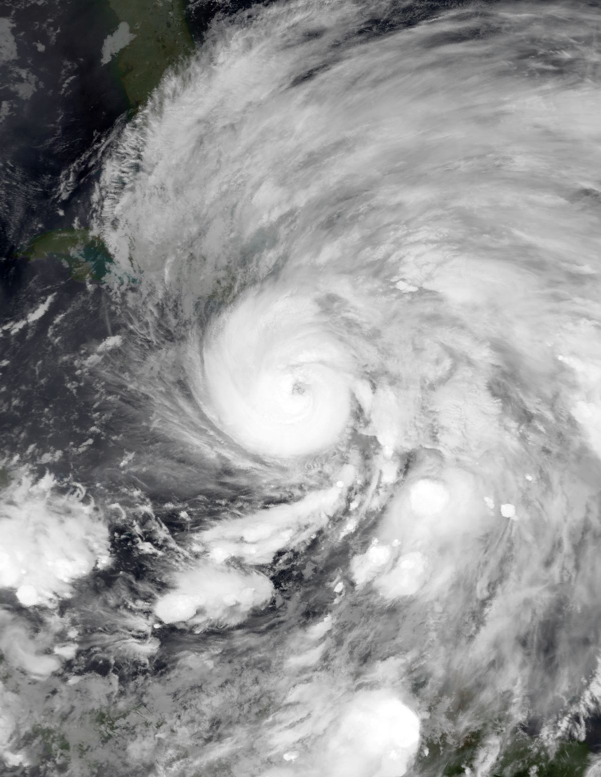
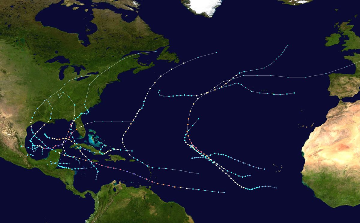
Hurricane Ernesto originated from a tropical wave that moved off the coast of Africa on August 7, 2024. The system organized over the following days, leading to the formation of a broad low-pressure area on August 10. As it moved quickly westward toward the Leeward Islands, it was designated Potential Tropical Cyclone Five. Convective activity increased, and at 12:00 UTC on August 12, the system was upgraded to Tropical Depression Five about 450 miles east of Guadeloupe. Just six hours later, it strengthened into Tropical Storm Ernesto. The storm slowed its forward motion, steered by a large subtropical ridge, and made its first landfall on Guadeloupe around 09:40 UTC on August 13 as a strong tropical storm with winds of 40 mph. Ernesto then turned west-northwestward across the northeastern Caribbean, where favourable conditions of low wind shear and warm sea surfaces allowed for gradual intensification.
After passing north of Puerto Rico as a 70 mph tropical storm by the morning of August 14, Ernesto entered the Atlantic and became a hurricane six hours later. An eyewall formed later that day, though the cyclone initially remained a minimal Category 1 hurricane as it contended with dry air. Despite slow strengthening, its wind field expanded. A weakness in the steering ridge, caused by a trough moving off the eastern United States, prompted Ernesto to begin a recurvature, turning northwest, then north, and finally northeast. The hurricane reached its peak intensity as a Category 2 storm with 100 mph winds by 00:00 UTC on August 16, while located several hundred miles south-southwest of Bermuda. Increasing wind shear from the trough then caused the storm's structure to become asymmetric as it approached Bermuda.
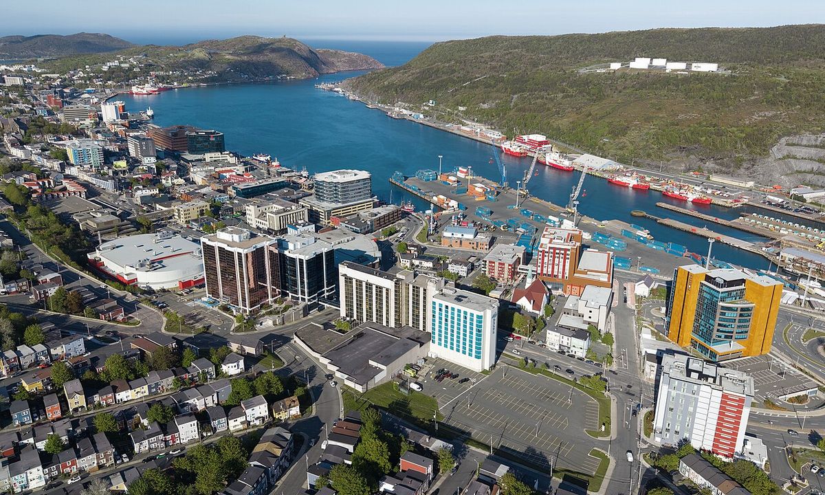
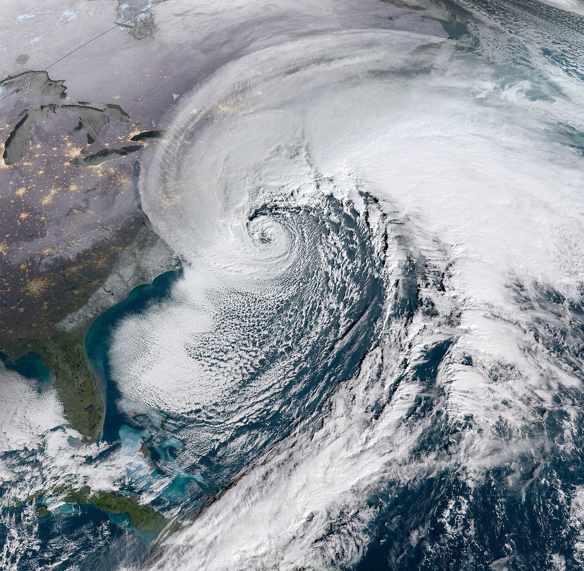
Ernesto made landfall on Bermuda in the early morning of August 17 as a Category 1 hurricane with 85 mph sustained winds. It weakened to a tropical storm as it decelerated but subsequently restrengthened to a hurricane over the warm Gulf Stream by 18:00 UTC on August 18. The system attained a secondary peak of 100 mph winds on August 19 while situated about 520 miles southwest of Cape Race, Newfoundland. Accelerating northeastward, Ernesto began to weaken over cooler waters and transitioned into an extratropical cyclone by 12:00 UTC on August 20, positioned 260 miles east-northeast of St. John's, Newfoundland and Labrador. The remnant open trough continued east-northeast, eventually affecting Great Britain and Ireland by August 22.
Preparations and warnings
Extensive warnings and preparations were undertaken across the Caribbean and Bermuda ahead of Ernesto's arrival. Tropical storm warnings were issued for numerous islands including Anguilla, Antigua and Barbuda, the British and U.S. Virgin Islands, the French West Indies, Montserrat, Puerto Rico, Saint Kitts and Nevis, and Sint Maarten. A hurricane watch was issued for the Virgin Islands, and a hurricane warning was ultimately issued for Bermuda. In the French territories of Saint Martin and Saint Barthélemy, orange alerts were activated, and government offices closed. Sint Maarten closed Princess Juliana International Airport and schools, while Antigua closed VC Bird International Airport. In Puerto Rico, the government mobilized the National Guard, delayed the start of the school year, froze prices on essential goods, and activated municipal emergency plans. Utility company LUMA Energy positioned over 1,000 workers and more than $200 million in supplies to respond to anticipated power outages.
In Bermuda, the hurricane warning prompted the closure of L.F. Wade International Airport and a temporary halt to public transportation. Along the U.S. East Coast, the primary threat was from dangerous surf and rip currents. The National Hurricane Center noted tropical-storm-force winds extended up to 230 miles from Ernesto's centre, affecting a vast stretch of coastline. Rip current warnings and small craft advisories were issued from Florida to New York, leading to beach closures in areas including New York City's Brooklyn and Queens. As the storm's remnants approached Europe, Met Éireann issued yellow warnings for counties Galway and Mayo in Ireland, and the Met Office did the same for parts of Scotland, leading to road closures and sandbag distribution in western Ireland.
Impact in the Caribbean
Ernesto brought strong winds, heavy rain, and flooding to numerous Caribbean islands, causing widespread but generally minor structural damage and significant power outages. In the Leeward Islands, a gust of 77 mph was recorded in Saint Barthélemy and 61 mph in Saint Martin. Sint Maarten reported minor damage and localized flooding. On Sint Eustatius, many trees were downed, roads were damaged and flooded, and part of a historic stone structure was damaged. Saint Kitts and Nevis reported downed power lines and trees, with preliminary damage estimated at EC$2.1 million (US$780,000). Antigua and Barbuda and Montserrat also experienced power outages, with a ship damaged in Little Bay, Montserrat, spilling diesel fuel that was subsequently recovered. In Guadeloupe, several main roads were closed.
The U.S. Virgin Islands were severely affected by hurricane-force wind gusts, which knocked out power to the entire populations of Saint Croix and Saint Thomas. At the peak, over 45,000 customers lost power, at least six cellphone towers were disabled, and many roads were blocked by fallen trees and utility poles. President Joe Biden approved a disaster declaration for the territory. Puerto Rico bore the brunt of the flooding, with sustained winds on Culebra reaching 86 mph. The storm knocked out power to approximately 728,000 households, about half the island's customers, and caused water outages for 235,000 more. Multiple rivers overflowed, damaging roads and infrastructure. Agricultural damage was significant, with the Puerto Rico Department of Agriculture estimating $23.5 million in crop losses, including major damage to bananas, coffee, and vegetables. President Biden also approved a disaster declaration for Puerto Rico.
- Leeward Islands: Widespread power outages, road damage, and minor structural damage.
- U.S. Virgin Islands: Total power loss on Saint Croix and Saint Thomas. Widespread tree and pole damage.
- Puerto Rico: 728,000 power outages; $23.5 million in agricultural damage. Major river flooding.
- Overall Caribbean: At the peak, 750,000 customers were without power across the region. 23 hospitals operated on generators.
Impact on Bermuda and the United States
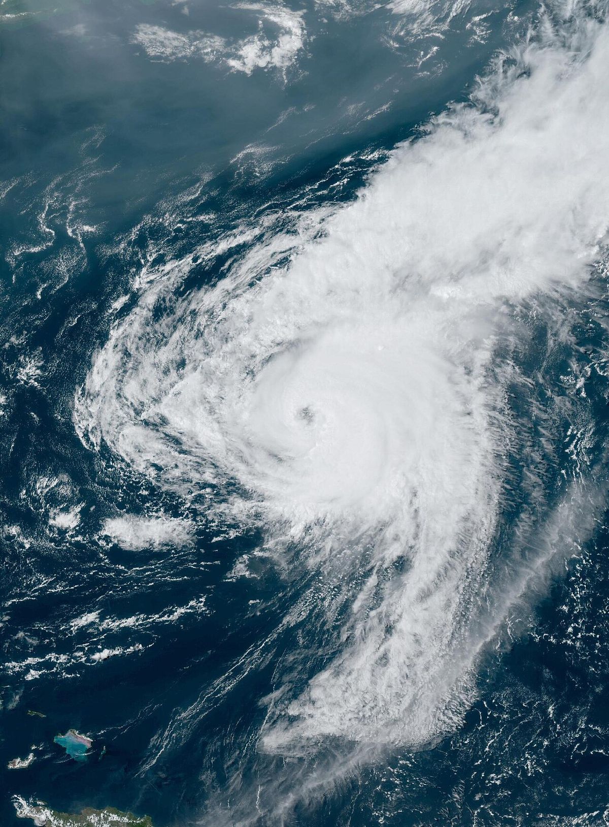
Ernesto made a direct landfall on Bermuda on August 17, the first hurricane to do so since Hurricane Paulette in 2020. The island experienced a storm surge of 2.27 feet and wind gusts up to 110 mph. Rainfall totalled 6.98 inches at the international airport, causing urban flooding. Hurricane-force gusts toppled utility poles and trees, caused light wind damage to businesses, and generated large waves that led to mild coastal flooding. The Bermuda Electric Light Company reported 51 main power lines damaged, resulting in widespread outages. At the peak, 28,817 customers, representing about 75 percent of the island, were without power, with restoration hampered by utility pole fires. Despite the extensive disruptions, no major structural damage was reported on the island.
The storm's large wind field generated dangerous seas along the entire U.S. Eastern Seaboard, even while the centre remained hundreds of miles offshore. The primary impacts were destructive rip currents and coastal erosion. Three fatalities were attributed to these conditions: two in South Carolina and one in North Carolina, where a surfer drowned in Surf City. In Rodanthe, North Carolina, large waves of 6 to 10 feet, combined with high tides, knocked an unoccupied house off its foundation on Hatteras Island. The National Park Service reported minor damage to other homes and closed a section of beach. Rip current rescues were reported from New Jersey to Florida, with eight rescues in Ventnor City, New Jersey, alone. Overall, around ten thousand people were under coastal flood advisories due to Ernesto's influence.
Impact on Canada and Europe
As an extratropical system, the remnants of Hurricane Ernesto brought impacts to Atlantic Canada and Western Europe. On August 19, while still a hurricane, Ernesto was located about 590 miles south of Halifax, Nova Scotia. It accelerated northeastward, making its closest approach to Newfoundland's Avalon Peninsula while undergoing extratropical transition. By 5 a.m. on August 20, the post-tropical cyclone was positioned 150 miles east-northeast of Cape Race, Newfoundland. The Canadian impacts were primarily in the form of high seas and gusty winds associated with the transitioning low-pressure system.
The open trough that was once Hurricane Ernesto continued across the North Atlantic and reached Western Europe by August 22. The United Kingdom's Met Office issued a yellow weather warning for parts of Scotland in anticipation of gusty winds. In Ireland, Met Éireann issued yellow warnings for counties Galway and Mayo. These warnings led to precautionary measures, including the cancellation of the Strathaven Balloon Race in Scotland. In Ireland, Galway County Council closed roads and parking areas vulnerable to flooding, and sandbags were distributed in western parts of the country. In Galway city, streets and quays along waterways were inundated, with flooding exacerbated by a concurrent supermoon.
Climatological context and season
Hurricane Ernesto was the fifth named storm and third hurricane of the 2024 Atlantic hurricane season. Its formation date of August 12 was earlier than the historical average for the season's fifth storm, which typically forms around August 22. The 2024 season followed an exceptionally active 2023 season, which had 20 named storms. Forecasters predicted increased activity for 2024 due to the return of very warm ocean temperatures in the Atlantic and the absence of an El Niño pattern, which typically increases wind shear that disrupts storm development. Ernesto's track and intensity were somewhat similar to Hurricane Earl from the 2022 season.
The storm's impacts highlighted broader climatological trends, particularly the increased flood threat along coastlines due to human-caused climate change and sea level rise. Even distant storms like Ernesto can generate dangerous surf and erosion, as seen with the house collapse in North Carolina's Outer Banks. The storm also demonstrated the persistent danger of rip currents, which rescue tens of thousands of people in the United States annually and had already caused 30 fatalities in 2024 prior to Ernesto. The storm's progression from a tropical cyclone to a potent extratropical system affecting Europe is a common lifecycle for Atlantic hurricanes that recurve into the northern latitudes.
Response and recovery
Recovery efforts across the affected regions were extensive and prolonged. In Puerto Rico and the U.S. Virgin Islands, utility crews worked for days to restore power to hundreds of thousands of customers. The disaster declarations approved by President Joe Biden unlocked federal assistance for emergency work and repairs to public infrastructure in both territories. In Bermuda, the electric utility worked to repair dozens of damaged power lines and poles, a process complicated by fires at some pole sites. While power was restored within several days, the event served as a stress test for the island's infrastructure. Along the U.S. coast, local governments and lifeguard services emphasized beach safety and rip current awareness in the aftermath of the drownings. The National Park Service closed vulnerable beach sections in North Carolina to assess further risks to shoreline structures.
| Region | Key Recovery Actions | Notable Challenges |
|---|---|---|
| Puerto Rico & U.S. Virgin Islands | Federal disaster declarations. Massive power restoration efforts | Widespread flooding damaging roads and agriculture. Prolonged outages |
| Bermuda | Utility pole and line repairs. Debris clearance | Utility pole fires slowing restoration. 75% of customers lost power |
| U.S. East Coast | Beach closures and safety advisories. Property damage assessments | Rip current dangers persisting after storm's passage. Coastal erosion |
| Ireland & UK | Road closures. Sandbag distribution. Event cancellations | Flooding in Galway exacerbated by high tides from a supermoon |
Questions about Hurricane Ernesto (2024)
What was the path of Hurricane Ernesto in 2024?
Hurricane Ernesto developed east of the Leeward Islands on August 12, 2024. It moved west-northwest, impacting Guadeloupe, the Virgin Islands, and passing north of Puerto Rico. The storm then curved northward, reaching Category 2 strength south of Bermuda before making landfall there as a Category 1 hurricane on August 17. It continued northeast, affecting Atlantic Canada as it transitioned to an extratropical cyclone by August 20, with its remnants eventually reaching Western Europe.
Was Hurricane Ernesto a major hurricane?
No, Hurricane Ernesto was not classified as a major hurricane (Category 3 or higher). It reached its peak intensity as a Category 2 hurricane with maximum sustained winds of 100 mph (155 km/h) on August 16 while south of Bermuda. It made landfall on Bermuda as a Category 1 hurricane with 85 mph winds. While it caused significant flooding and damage, it did not attain major hurricane status.
How did Hurricane Ernesto affect Canada?
Hurricane Ernesto approached Atlantic Canada as it was undergoing extratropical transition. On August 19, it was located about 590 miles south of Halifax, Nova Scotia. By August 20, the post-tropical cyclone was 150 miles east-northeast of Cape Race, Newfoundland, having made its closest approach to the Avalon Peninsula. The primary impacts for Canadian waters and coastal areas were high seas and gusty winds associated with the powerful low-pressure system.
How much damage did Hurricane Ernesto cause?
Hurricane Ernesto caused an estimated $520 million in total damages. This figure includes significant impacts across multiple regions. In Puerto Rico, over 728,000 households lost power, 235,000 suffered water outages, and agricultural damage reached $23.5 million. In Bermuda, the hurricane caused widespread power outages affecting 28,817 customers at the peak and led to urban flooding. Along the United States East Coast, the storm's swells caused property damage, including the collapse of a home in North Carolina, and resulted in three rip current related fatalities.
Why were there rip current deaths so far from the storm?
Rip current deaths occurred far from Hurricane Ernesto because it was a large storm with a broad wind field that generated extensive ocean swells. Tropical storm force winds extended up to 230 miles from its centre. These winds created dangerous swells that propagated hundreds of miles, affecting the entire United States Eastern Seaboard. Warnings for dangerous rip currents were issued from Florida to New York. The powerful currents led to three confirmed drownings of swimmers in North Carolina and South Carolina, despite the storm being offshore over the Atlantic.
How does Ernesto compare to other hurricanes that hit Bermuda?
Hurricane Ernesto was the first hurricane to make landfall on Bermuda since Hurricane Paulette in 2020. A key distinction for Ernesto was its exceptional rainfall, which made it the second wettest tropical cyclone on record for the territory with 6.98 inches measured at L.F. Wade International Airport. It made landfall as a Category 1 hurricane with gusts to 110 mph, causing urban flooding, downed trees, and widespread power outages affecting about 75 percent of customers. However, no major structural damage was reported, resulting in impacts generally characterized as minor wind damage.
Sources and further reading
- Hurricane Ernesto (2024) (Wikipedia)
- Ernesto Brings Dangerous Seas to North America's Atlantic ... (nesdis.noaa.gov)
- Tropical Storm Ernesto (science.nasa.gov)
Checked by the Your Space Hamilton desk. Last updated 2026-10-28.