Hurricane Earl (2010)
Hurricane Earl was a long-lived and powerful Cape Verde hurricane that formed during the 2010 Atlantic hurricane season. The storm impacted the Leeward Islands, Puerto Rico, the Bahamas, the East Coast of the United States, and Atlantic Canada, where it made landfall as a Category 1 hurricane in Nova Scotia. For Canadians, Earl was a significant event that caused widespread power outages, coastal flooding, and tragically resulted in one drowning death in Nova Scotia. The hurricane was notable for being the most studied tropical cyclone in history at the time, due to an extensive research campaign launched by NASA and other agencies.
Meteorological History
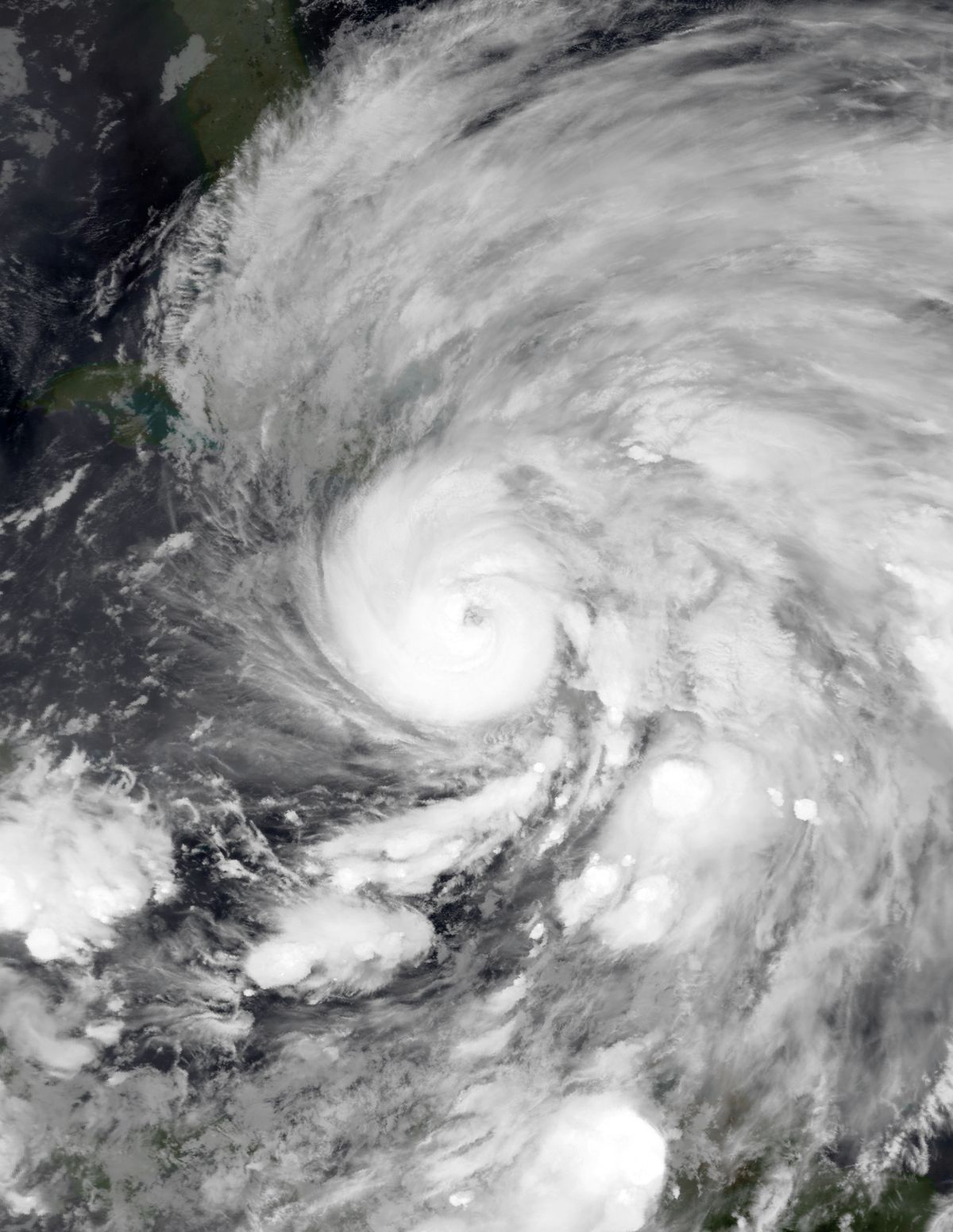
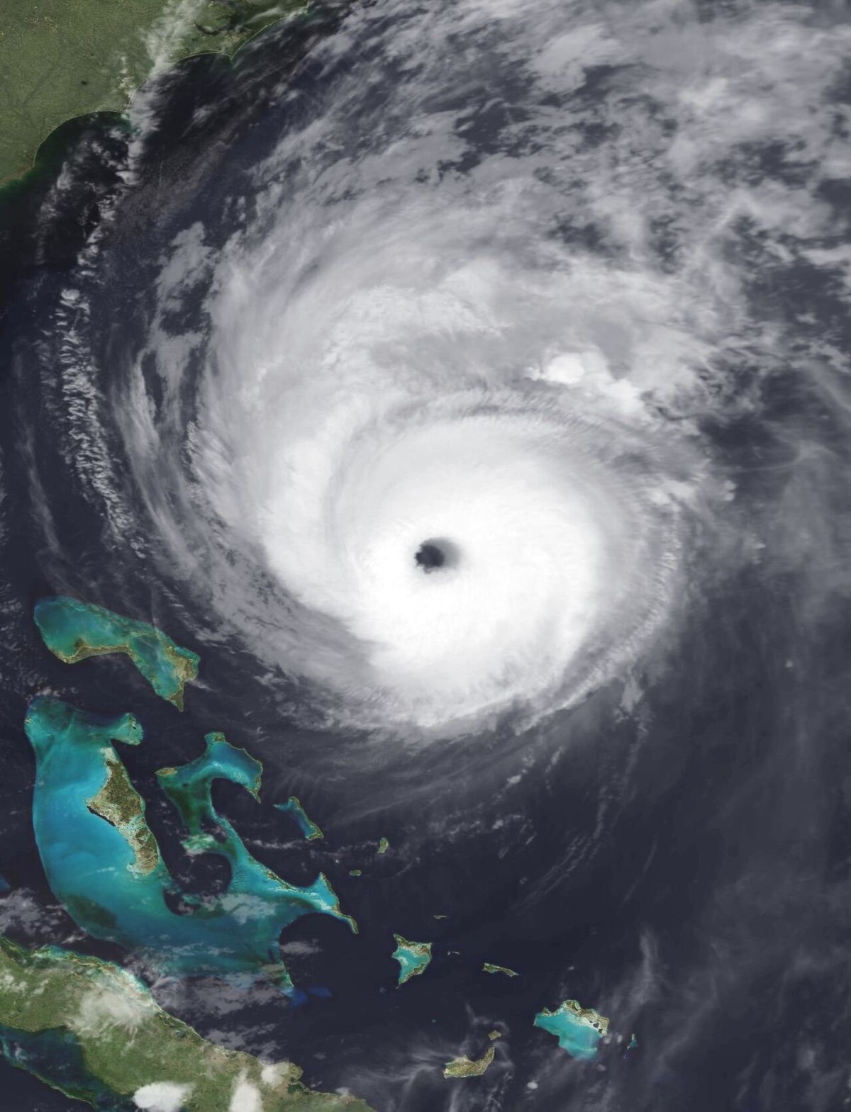
Hurricane Earl originated from a vigorous tropical wave that moved off the west coast of Africa around August 23, 2010. The National Hurricane Center classified the system as Tropical Depression Seven on August 25, and it strengthened into Tropical Storm Earl just six hours later. The storm tracked westward for several days, hampered by dry air which kept its intensity in check. On August 29, as it neared the Lesser Antilles, Earl intensified into a hurricane roughly 365 miles east of the northern Leeward Islands. Rapid intensification followed, and by August 30, Earl became a major hurricane, reaching Category 4 status with winds of 135 mph as it brushed the islands. The storm's peak intensity was achieved on the morning of September 2, with maximum sustained winds of 145 mph and a minimum central pressure of 928 mbar.
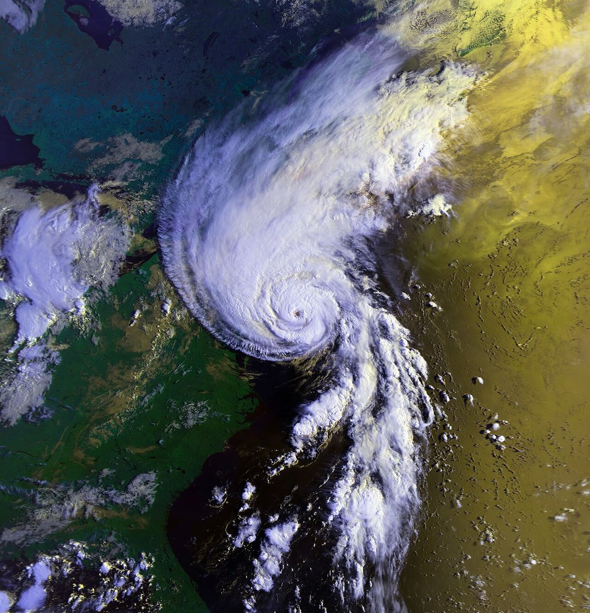
After peaking, Earl began to weaken due to increasing wind shear and cooler ocean temperatures as it turned northward. The storm passed approximately 85 miles east of Cape Hatteras, North Carolina, on September 3 with winds of 105 mph. Continuing to accelerate northeastward, Earl was downgraded to a tropical storm that evening but regained hurricane strength as it approached Atlantic Canada. The hurricane made landfall near Western Head, Queens County, Nova Scotia, at around 1400 UTC on September 4 as a Category 1 hurricane with 75 mph winds. After crossing Prince Edward Island and entering the Gulf of Saint Lawrence, Earl transitioned into a post-tropical cyclone as its wind field became asymmetric. Its remnants were absorbed by a larger mid-latitude low-pressure area about 205 miles north-northeast of St. Anthony, Newfoundland, on the afternoon of September 5.
Preparations in the Caribbean and United States
Widespread preparations were undertaken across the Caribbean, the United States, and Canada as Hurricane Earl advanced. In the Leeward Islands, governments issued tropical storm and hurricane watches and warnings beginning on August 27. France issued a tropical storm watch for Saint Martin and Saint Barthélemy, while Antigua and Barbuda and the Netherlands Antilles issued watches for their islands. These were upgraded to warnings and eventually hurricane warnings from Anguilla to Montserrat by August 28. Emergency shelters were opened on Anguilla, Antigua, Barbuda, Montserrat, St. Kitts, Nevis and the Virgin Islands. The Robert L. Bradshaw International Airport and Vance W. Amory International Airport on St. Kitts and Nevis were shut down, and Leeward Islands Air Transport canceled 42 flights. Although not in the direct path, officials in the Dominican Republic prompted evacuations of coastal towns and canceled flights across the country.
Along the United States East Coast, the National Hurricane Center began issuing watches on August 31, eventually covering areas from Bogue Banks, North Carolina, to the United States-Canada border in Maine. Mandatory evacuations were ordered for Ocracoke Island on August 31 and for Hatteras Island on September 1, affecting an estimated 30,000 residents and visitors. States of emergency were declared in Maryland, North Carolina, Virginia, and Massachusetts. Naval Station Norfolk was put on standby to depart port within 24 hours if necessary. In Massachusetts, Governor Deval Patrick declared a state of emergency, NSTAR deployed crews from Michigan to Cape Cod, and the ferry to Nantucket stopped service. School districts in Rhode Island, including Bristol-Warren and Cumberland, closed schools early on September 3 in anticipation of the storm.
Preparations and Forecast in Canada
In Canada, the Canadian Hurricane Center issued a hurricane watch for areas in Nova Scotia between Medway Harbour and Digby on September 2, along with a tropical storm watch from Ecum Secum to Fort Lawrence. Watches were expanded to include Prince Edward Island and parts of eastern New Brunswick later that day. By September 3, a tropical storm warning was in effect for Prince Edward Island and parts of Nova Scotia. Forecasters had predicted an 80 percent chance of Earl striking Nova Scotia since the end of August, with a 60 percent chance it would be a hurricane at landfall. This long lead time enabled emergency preparations to begin nearly a week in advance, with the Red Cross placing over 900 volunteers on standby. Because anticipated landfall would take place at low neap tide and storm surge was predicted to be minimal, no mandatory evacuation orders were issued, although some marinas required boats to be moved to safer mooring.
The Department of Tourism, Culture and Heritage warned tourists in the area of the likely impacts. Virtually all permanent residents stayed and prepared to be without electricity for a couple of days. While ferries in the area were cancelled, the Confederation Bridge linking New Brunswick and Prince Edward Island was not closed, though it barred high-sided vehicles and motorcycles for six hours at the height of the storm. The last warnings in Canada were discontinued as Earl moved northward, though a new tropical storm warning was issued for parts of Newfoundland between Burgeo and Boat Harbour before all advisories ended following the storm's extratropical transition.
Impact in the Caribbean
The Caribbean islands bore the initial brunt of Hurricane Earl, suffering significant damage and one fatality. In Antigua and Barbuda, the entire island of Antigua lost power as high winds felled numerous trees and signs and damaged homes, destroying at least one house and forcing the evacuation of eight people. An estimated seven inches of rain caused widespread flooding, with waist-deep water reported in Bolans Village leading to the rescue of seven people. One person died in Antigua and Barbuda after being electrocuted while attempting to restore power. Following the storm, Governor General Dame Louise Lake-Tack declared a country-wide holiday for August 30 to aid cleanup efforts. The storm inflicted at least $40.8 million in damage across the region. Other islands in the Leeward Islands chain experienced strong winds, damaging houses and toppling trees, signs, and power lines, resulting in hundreds of thousands of electrical outages. Heavy rainfall led to flooding that inundated streets across the impacted islands.
In the Lesser Antilles, Hurricane Earl brought strong winds that damaged houses and toppled trees, signs, and power lines. This resulted in hundreds of thousands of electrical outages across the islands. Heavy rainfall from the storm led to flooding, which inundated streets and left waist-deep water in some areas. One death occurred in Antigua and Barbuda when a person was electrocuted while attempting to restore power. The region suffered at least $40.8 million in damage from the storm.
- Complete loss of power on the island of Antigua.
- At least one home destroyed on Antigua, forcing eight evacuations.
- Approximately 7 inches (180 mm) of rainfall causing widespread flooding.
- Seven people rescued from waist-deep water in Bolans Village, Antigua.
- One fatality in Antigua and Barbuda from electrocution.
- A national holiday declared on August 30, 2010, for cleanup in Antigua and Barbuda.
- Total regional damage estimated at a minimum of $40.8 million (2010 USD).
Hurricane Earl impacted the Leeward Islands as a major hurricane on August 30, 2010, though its center passed roughly 25 miles east-northeast of St. Martin. The storm's strong winds and heavy rain caused significant damage, including toppled trees and power lines leading to widespread outages. Flooding from the rainfall inundated streets on multiple islands. The event demonstrated the region's vulnerability to such storms, which can cause substantial damage even without a direct landfall.
Impact in the United States
While Hurricane Earl remained offshore, it still affected the United States East Coast with tropical storm-force winds, dangerous seas, and rip currents. The Outer Banks of North Carolina experienced the strongest effects from the storm's closest approach, with damage totalling about $3.8 million. Six fatalities were confirmed in the United States as a result of Earl's indirect impacts. Three deaths occurred in Florida, two in New Jersey, and one in Massachusetts, all attributed to rip currents and rough seas. Coastal areas from North Carolina to Massachusetts experienced high surf and minor coastal flooding. The storm's passage led to school closures in parts of Rhode Island and the suspension of ferry services to Nantucket, Massachusetts. In Suffolk County and Nassau County on Long Island, New York, emergency officials prepared for winds in excess of 40 mph and the Long Island Rail Road suspended service to the Hamptons before the storm arrived.
Along the East Coast of the United States, tropical storm-force winds affected portions of North Carolina and Massachusetts. The storm's center passed roughly 85 miles east of Cape Hatteras, North Carolina on September 3. Little structural damage resulted in the United States, with total damage in the Outer Banks estimated at about $3.8 million. Six fatalities were confirmed in the United States as a result of dangerous rip currents and rough seas generated by the hurricane.
- Damage in the Outer Banks of North Carolina totalled about $3.8 million.
- Six fatalities occurred: three in Florida, two in New Jersey, and one in Massachusetts.
- All U.S. deaths were caused by rip currents and rough seas.
- The storm's closest approach was 85 miles east of Cape Hatteras, North Carolina, on September 3.
- Mandatory evacuations affected an estimated 30,000 people on Ocracoke and Hatteras Islands.
- States of emergency were declared in Maryland, North Carolina, Virginia, and Massachusetts.
- The Long Island Rail Road suspended service to the Hamptons.
Federal Emergency Management Agency administrator Craig Fugate cautioned that Earl's approach warranted a reminder for evacuation plans to be updated for the U.S. east coast. He noted that it would not take much for the storm to come ashore somewhere on the coast. His message was for everyone to pay attention to the storm's progress and official warnings. This statement was made as Hurricane Earl approached the United States coastline in late August and early September 2010.
Impact in Canada
Hurricane Earl's landfall in Nova Scotia on September 4, 2010, marked a significant weather event for Atlantic Canada. The hurricane brought sustained winds of 75 mph, causing extensive damage to trees and power infrastructure. Hundreds of thousands of residents across Nova Scotia and Prince Edward Island lost electrical power, with some outages lasting for days. The storm caused coastal flooding and erosion, particularly along the Atlantic coast of Nova Scotia. Tragically, one person drowned in Nova Scotia as a direct result of the storm. The hurricane's wind field was expansive, with tropical storm-force winds affecting a large swath of the Maritimes and eastern Newfoundland even after the system transitioned to post-tropical.
In Nova Scotia, Canada, Hurricane Earl made landfall as a Category 1 hurricane near Western Head on September 4. The storm caused one drowning death in the province. Hundreds of thousands of people in Nova Scotia lost electrical power for several days due to the hurricane's impacts. After crossing Prince Edward Island, the storm entered the Gulf of Saint Lawrence and transitioned into a post-tropical storm.
- Widespread power outages affected hundreds of thousands of customers in Nova Scotia and Prince Edward Island.
- Significant tree damage was reported, blocking roads and damaging property.
- Coastal flooding occurred, particularly along the Atlantic coast of Nova Scotia.
- One drowning death was reported in Nova Scotia.
- Ferry services across the region were cancelled for the duration of the storm.
- The Confederation Bridge between New Brunswick and Prince Edward Island restricted traffic for six hours.
In Atlantic Canada, Hurricane Earl made landfall in Nova Scotia as a Category 1 hurricane with sustained winds of 75 mph. The storm caused one drowning death in Nova Scotia. Hundreds of thousands of people in the province lost power for days following the hurricane's passage. This event served as a reminder of the region's vulnerability to tropical systems, even those that have weakened from their peak intensity before arrival.
Research and Scientific Significance
Hurricane Earl became a landmark case study for meteorological research. As the storm tracked along the U.S. East Coast, NASA launched the Genesis and Rapid Intensification Processes (GRIP) field campaign. A former military WB-57 aircraft equipped with 15 new instruments was flown into the storm at altitudes up to 60,000 feet. Routine Hurricane Hunter missions were supplemented by a DC-8 aircraft and the first-ever use of an unmanned research drone in a hurricane. According to lead GRIP scientist Tim Miller, the combined missions made Hurricane Earl the most studied tropical cyclone in history up to that point. The data collected led to substantially improved forecast accuracy during the latter part of Earl's lifecycle.
Compared to forecasts for a similar storm, Hurricane Floyd in 1999, warnings for Earl covered roughly 1,500 fewer miles of coastline. This precision is estimated to have saved residents and businesses approximately $1 billion in evacuation costs and losses. Geological research on the island of Anegada in the British Virgin Islands also benefited from deposits left by Earl. A study of beach deposits from historical wash-out events was able to use Earl's deposits for comparison. This helped researchers determine that a tsunami linked to the 1755 Lisbon earthquake, rather than a hurricane, was likely responsible for the older, more significant deposits from between 1650 and 1800. The storm thus contributed to both atmospheric science and geological understanding.
Historical Context, Naming, and Records
Hurricane Earl was the fifth named storm and second major hurricane of the 2010 Atlantic hurricane season. The name 'Earl' has been used for Atlantic storms seven times, recurring on the six-year rotating list first in 1980, then in 1986, 1992, 1998, 2004, 2010, and again in 2016. The 2010 iteration was notable for its intensity and track. It was the first major hurricane to threaten New England since Hurricane Bob in 1991. The 2010 season also provided a stark contrast in activity between ocean basins. While Earl was threatening the U.S. East Coast in August, the Northeast Pacific hurricane season was experiencing one of its least active periods on record, producing the fewest named storms and hurricanes of the modern era. The 2010 Earl was not retired by the World Meteorological Organization, so the name remains on the rotating list.
Hurricane Earl was a long-lived and powerful Cape Verde hurricane that reached peak winds of 145 mph. It was the first major hurricane to threaten New England since Hurricane Bob in 1991. According to lead scientist Tim Miller, the extensive GRIP research campaign made Hurricane Earl the most studied tropical cyclone in history up to that point. The research outcomes allowed for substantially improved forecasts during the latter part of Earl's existence.
- Peak intensity: Category 4 hurricane with 145 mph winds on September 2, 2010.
- Duration: A long-lived storm from August 25 to September 6, 2010.
- Canadian landfall: Category 1 hurricane at Western Head, Nova Scotia, on September 4, 2010.
- Research: Became the most studied tropical cyclone in history at the time.
- U.S. impact: First major hurricane to threaten New England since Hurricane Bob in 1991.
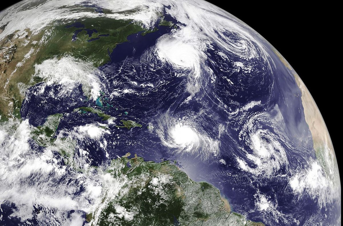
- Satellite imagery: Appeared with Hurricane Danielle in a single NASA Terra satellite overpass on August 29, 2010.
- Forecast savings: Improved warnings saved an estimated $1 billion in evacuation costs compared to Hurricane Floyd.
Hurricane Earl was a significant Cape Verde hurricane that impacted the Leeward Islands, the East Coast of the United States, and Atlantic Canada in 2010. It caused at least $40.8 million in damage in the Caribbean and was responsible for multiple fatalities. The storm was the subject of an unprecedented research campaign, making it the most studied tropical cyclone in history at that time. Its impacts highlighted the vulnerability of both Caribbean islands and Atlantic Canada to tropical cyclones.
Questions about Hurricane Earl (2010)
When did Hurricane Earl hit Canada and where did it make landfall?
Hurricane Earl made landfall in Canada on September 4, 2010. The centre of the storm came ashore near Western Head in Queens County, Nova Scotia, at approximately 1400 UTC. At the time of landfall, Earl was a Category 1 hurricane with maximum sustained winds of 75 mph (121 km/h). After crossing Nova Scotia, the storm moved over Prince Edward Island before entering the Gulf of Saint Lawrence and transitioning into a post-tropical cyclone.
What damage did Hurricane Earl cause in Canada?
In Canada, Hurricane Earl caused extensive power outages, with hundreds of thousands of customers losing electricity in Nova Scotia and Prince Edward Island, some for multiple days. The storm brought down numerous trees and caused coastal flooding and erosion, particularly in Nova Scotia. One drowning death was reported in Nova Scotia as a direct result of the storm. The hurricane also led to the cancellation of ferry services and temporary traffic restrictions on the Confederation Bridge linking New Brunswick and Prince Edward Island.
How strong was Hurricane Earl at its peak?
Hurricane Earl reached its peak intensity on the morning of September 2, 2010. At its strongest, it was a Category 4 major hurricane on the Saffir-Simpson scale, with maximum sustained winds of 145 mph (233 km/h). The storm's minimum central pressure at peak intensity was 928 millibars. This peak occurred while Earl was over the open Atlantic, east of the United States coastline.
How many people died because of Hurricane Earl?
Hurricane Earl was responsible for at least eight fatalities. One death occurred in Antigua and Barbuda due to electrocution while restoring power. Six deaths were reported in the United States, all resulting from rip currents and rough seas generated by the storm (three in Florida, two in New Jersey, and one in Massachusetts). In Canada, one person drowned in Nova Scotia as a direct result of the hurricane.
Why were evacuation orders limited in Nova Scotia?
Mandatory evacuation orders were not issued in Nova Scotia primarily because the anticipated storm surge was predicted to be minimal. Hurricane Earl was forecast to make landfall during a low neap tide, which significantly reduced the surge threat. While emergency officials warned residents and tourists, and some marinas required boats to be moved, the decision was made not to order evacuations. Officials focused preparations on the expectation of widespread power outages and wind damage instead.
Was Hurricane Earl the most studied storm in history?
Yes, according to Tim Miller, the lead scientist in the Genesis and Rapid Intensification Processes (GRIP) program, Hurricane Earl was the most studied tropical cyclone in history. The research campaign involved a former military WB-57 aircraft carrying 15 new instruments, a DC-8, routine Hurricane Hunter missions, and the first use of an unmanned research drone in a hurricane. This extensive data collection allowed for substantially improved forecasts during the latter part of Earl's existence. Compared to a similar storm like Hurricane Floyd in 1999, the improved warnings for Earl covered roughly 1,500 fewer miles of coastline, saving an estimated $1 billion in evacuation losses.
Sources and further reading
- Hurricane Earl (2010) (Wikipedia)
- Hurricane Earl, NASA Science (science.nasa.gov)
- Historical Hurricanes and Tropical Systems, National Weather Service (weather.gov)
- 5 Things to Know About Hurricane Earl | The Weather Channel (weather.com)
Checked by the Your Space Hamilton desk. Last updated 2026-10-29.