Geography and climate of Winnipeg
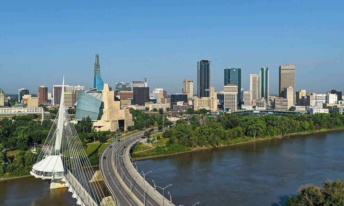
Winnipeg, the capital of Manitoba, is a major Canadian city situated in the geographic centre of North America on the flat plain of the Red River Valley. Its location far from moderating oceans and mountains gives it an extreme humid continental climate, characterized by bitterly cold winters, warm summers, and a high potential for severe flooding. The city's geography and climate have shaped its development, necessitating massive engineering projects like the Red River Floodway and influencing its design and environmental challenges. Understanding Winnipeg's physical setting is key to grasping the city's identity, its historical struggles with natural disasters, and its ongoing adaptation to a changing climate.
Geographic Setting and Topography
Winnipeg lies at the bottom of the ancient glacial Lake Agassiz basin, a low-lying flood plain with an extremely flat topography that defines its landscape and flood risk. The city is positioned on the eastern edge of the Canadian Prairies in Western Canada, earning it the moniker 'Gateway to the West'. It is bordered by tallgrass prairie to the west and south and transitions into aspen parkland to the northeast, not far from the boreal forests of the Canadian Shield. This location places Winnipeg relatively close to large Shield lakes and parks, as well as Lake Winnipeg, the twelfth-largest freshwater lake on Earth.
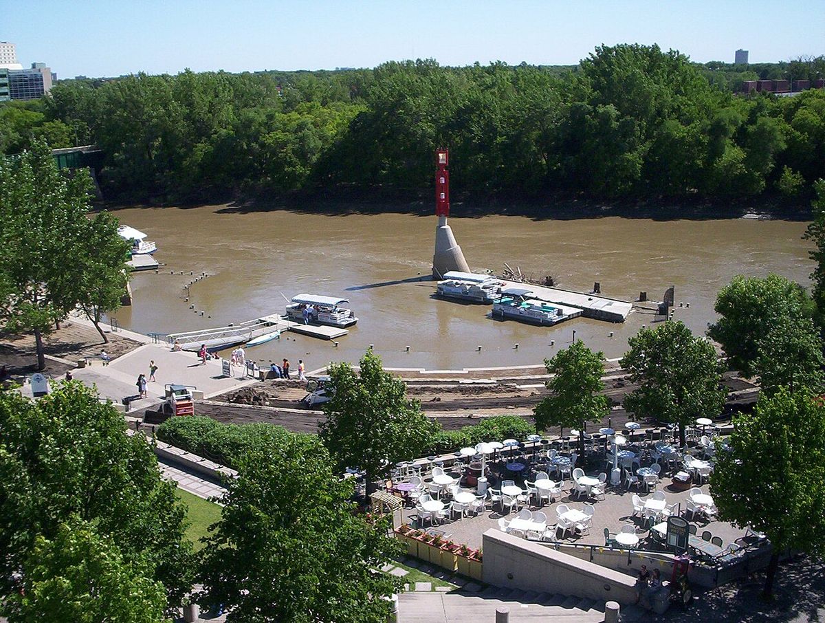
The city's isolation is notable, with the closest metropolitan area of similar or greater size being Minneapolis-Saint Paul, Minnesota, located 733 kilometres to the southeast. According to the Census geographic units of Canada, the city encompasses a total area of 464.01 square kilometres. The dominant geographic features are its three major rivers: the Red River, designated a Canadian heritage river, the Assiniboine River, and the smaller Seine River. The confluence of the Red and Assiniboine at The Forks is a historic and cultural centrepoint. The city's extreme flatness, combined with substantial seasonal snowfall, creates a perennial vulnerability to severe flooding, a challenge that has dictated major infrastructure projects.
Climate Characteristics
Winnipeg experiences a humid continental climate with dramatic seasonal temperature contrasts due to its midcontinental position. Summers are typically warm with average July temperatures of 19.7 degrees Celsius, while winters are bitterly cold with a mean January temperature of -16.4 degrees Celsius. The city is one of Canada's sunniest, averaging 306 days with measurable sunshine per year and ranking second for clearest skies nationally. Precipitation is moderate, averaging 521.1 millimetres annually, with most falling in the warmer months. June is the wettest month and February the driest.
The openness of the prairies leaves the city exposed to numerous weather systems, including blizzards and cold Arctic high-pressure systems known as polar highs. Winnipeg has four distinct seasons with short transitional periods in spring and autumn, which are known for highly variable and rapidly changing conditions. The urban heat island effect is observable, with downtown weather stations like the one at The Forks recording higher temperatures than the Winnipeg James Armstrong Richardson International Airport station. For instance, the average yearly maximum daily minimum temperature is 22.0 degrees Celsius at The Forks compared to 20.4 degrees Celsius at the airport.
Notable Climate Records and ExtremesWinnipeg's climate is marked by significant extremes that highlight its continental nature. The highest temperature ever recorded was 42.2 degrees Celsius on 11 July 1936, while the hottest in the past 50 years was 38.7 degrees Celsius, reached in August 1988 and again in August 1989. The highest humidex reading was 48 on 25 July 2007. Conversely, the city is virtually assured of a white Christmas, with only one 25 December in the last century having no snow on the ground. Among Canada's 100 largest cities, Winnipeg has the tenth-coldest winter. The city averages 27 days with thunderstorms per season and experiences measurable snowfall on 54.7 days per year, with snow lying on the ground for an average of 132 days.
- Record high temperature: 42.2 °C (108.0 °F) on 11 July 1936.
- Record high humidex: 48 on 25 July 2007.
- Highest dew point: 27.4 °C (81.3 °F) recorded on 17 July 2022.
- Warmest month on record: July 2021 with a mean temperature of 22.7 °C (72.9 °F).
- Most humid month on record: July 2024 with an average dew point of 16.9 °C (62.4 °F).
- Snow cover duration: Average of 132 days per year.
Flood Risk and Mitigation Infrastructure
The combination of Winnipeg's extremely flat topography and substantial prairie snowfall creates a persistent and severe flood risk, primarily from the Red River. The greatest recorded flood height occurred in 1826, an event that remains the benchmark for the last two centuries. A catastrophic flood in 1950 led to a provincial state of emergency, the evacuation of 100,000 residents, and the destruction of approximately 10,000 homes. This disaster prompted the Government of Manitoba, under Premier Dufferin Roblin, to initiate the construction of the Red River Floodway, a monumental piece of infrastructure colloquially known as Duff's Ditch.
Construction on the floodway began on 6 October 1962 at a cost of $63 million and involved excavating about 76.5 million cubic metres of earth. Completed in March 1968, the 47-kilometre-long diversion channel has since prevented over $10 billion in flood damages. The system successfully protected the city during high-water events in 1974 and 1979. However, during the record 1997 Red River flood, water threatened the city's less-protected southwest corner, requiring emergency reinforcement of dikes with sandbags. Other key water diversion projects in the region include the Portage Diversion on the Assiniboine River and the Shellmouth Reservoir. These structures collectively form a critical defence system, though the threat of summer flash flooding from intense rainfall, as seen in Parkland communities in 2026, presents a different and growing challenge.
Urban Form and Neighbourhoods
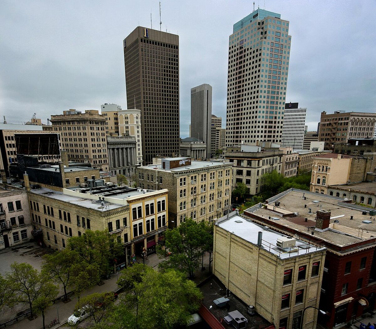
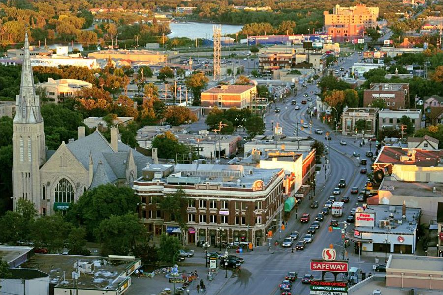
Winnipeg's development is a product of its geographic constraints and historical amalgamation of thirteen separate municipalities. The city uses a grid plan, but multiple different grids exist, leading to a complex and non-uniform street system where cardinal directions are imprecise and address numbering lacks a universal standard. Major thoroughfares like Portage Avenue are notably wide, a legacy of spring soil conditions and historical Red River ox cart use. Downtown Winnipeg, the economic core centred on the intersection of Portage and Main, covers about one square mile and has seen over Can$1.2 billion in revitalization investment since 1999, with more than 72,000 people working there.
The city contains 230 neighbourhoods. The Exchange District, a 30-block National Historic Site of Canada, holds North America's most extensive collection of early 20th-century terracotta and cut stone architecture. Osborne Village is the most densely populated neighbourhood in Winnipeg and the second most in Western Canada. Saint Boniface serves as the centre of the Franco-Manitoban community, featuring landmarks like the St. Boniface Cathedral and the Royal Canadian Mint. The Forks, at the confluence of the Red and Assiniboine rivers, is a major public space and historic site. Residential expansion has been greatest to the south and west, following the course of the major rivers, with the urbanized area spanning about 25 kilometres east-west and 20 kilometres north-south.
- Number of neighbourhoods: 230.
- Tallest building: 201 Portage, 33 storeys, 128 m (420 ft).
- Major commercial areas: Polo Park, Kildonan Crossing, South St. Vital, Garden City.
- Largest park: Assiniboine Park, home to the zoo and Leo Mol Sculpture Garden.
- Major downtown districts: The Exchange District, The Forks, Broadway-Assiniboine, Chinatown.
Natural Environment and Urban Forest
Winnipeg is situated at an ecological crossroads where tall grass prairie meets aspen parkland. The tall grass prairie areas are notable for endangered species like the western prairie fringed orchid and grasses such as big bluestem. The city is home to a diverse array of bird species, including ferruginous hawks, great horned owls, and abundant Canada geese and mallards. The Red River supports fish species like catfish, goldeye, and walleye. A defining natural feature is Winnipeg's urban forest, which includes the largest remaining mature urban elm forest in North America.
The city's approximately 8 million trees include species such as elm, ash, maple, oak, poplar, and spruce. However, the urban forest faces challenges from pests, disease, and development. The city has set a target of achieving 24 per cent urban forest coverage by 2065, but recent coverage has fallen to 17 per cent due to removals and pest control efforts. This green infrastructure is increasingly vital for climate adaptation, providing shade during heat waves and helping manage stormwater. The loss of tree cover exacerbates urban heat island effects and reduces resilience to extreme weather events like the intense heat waves and storms experienced in recent years.
Climate Change and Recent Weather Extremes
Winnipeg's highly variable midcontinental climate is becoming more extreme due to climate change, leading to what climatologists describe as weather whiplash. Recent years have seen a string of severe events, including intense summer rainstorms causing flash flooding and basement damage in 2026, prolonged heat waves, widespread wildfire smoke in 2025, and the destructive October 2019 wet snowstorm. A 2026 assessment gave Winnipeg a climate change severity score of 52 out of 100, indicating a high level of severity. Climatologists link increased variability to a more 'wavy' jet stream, driven by faster Arctic warming, which can lead to stagnant weather patterns and repeated storms.
The city faces the dual challenges of mitigating greenhouse gas emissions and adapting to unavoidable impacts. Transportation accounts for nearly half of Winnipeg's carbon emissions. The city's climate action plan aims for significant reductions, but overall emissions continue to rise. Adaptation priorities include improving stormwater management, expanding the urban forest, creating more cooling centres, and ensuring reliable winter maintenance for active transportation infrastructure. The experience of summer 2026, where communities in the hilly Parkland region faced rapid, devastating floods from repeated storms, highlights the need for preparedness for new types of climate-driven disasters beyond the familiar spring flood pattern.
Seasonal Weather Patterns
Winter in Winnipeg is long and severe, characterized by very cold temperatures, snow, and phenomena like ice fog and the aurora borealis. The city averages 49 days per year where the minimum temperature falls below -20 degrees Celsius. Significant winter thaws are rare. A powerful El Niño event developing in the Pacific in 2026 was forecast to bring milder winter temperatures and fewer extreme cold events to the region for the 2026-27 season.
Summer brings warm, frequently sunny weather with temperatures often in the mid to high twenties Celsius. Humidity is typically moderate, though humidex readings can exceed 40. The growing season lasts from late May to late September. The city averages 14 days per year where the temperature reaches 30 degrees Celsius or higher, and it frequently gets thunderstorms, averaging 27 per season. Winnipeg's trees are usually in full bloom by late May and do not lose their leaves until early October.
Spring and Autumn are short, highly variable transitional seasons. Temperatures can swing wildly, as exemplified by April records ranging from -6.3 to 34.3 degrees Celsius and October records from -6 to 30.5 degrees Celsius. The city often experiences an Indian summer, with summer-like weather returning briefly after the first autumn frosts. April is the windiest month of the year, while July is the least windy, and these seasons feature rapidly changing conditions that can challenge residents and infrastructure.
Comparative Climate Data
The urban heat island effect in downtown Winnipeg moderates temperatures compared to the airport, as shown by data from The Forks weather station. This table illustrates key temperature metrics comparing these two locations, demonstrating the influence of the built environment on local climate. The data confirms that the dense downtown core retains more heat, a factor that must be considered in climate adaptation strategies aimed at protecting vulnerable populations. The Forks station also recorded a record high daily minimum of 25.1 degrees Celsius in July 2007 and the most humid month with an average dew point of 15.6 degrees Celsius in July 2024.
| Metric | Winnipeg Airport (YWG) | The Forks (Downtown) |
|---|---|---|
| Average Yearly Max. Daily Min. Temp. | 20.4 °C (68.7 °F) | 22.0 °C (71.6 °F) |
| Average Yearly Max. Dew Point | 23.7 °C (74.7 °F) | 22.9 °C (73.2 °F) |
| Record High Temp. (June 2022) | 37.4 °C (99.3 °F) | |
| Warmest Month Mean Temp. | 24.0 °C (75.2 °F) in July 2012 |
Climate data for downtown Winnipeg demonstrates the urban heat island effect cities have on moderating temperatures compared to airport weather stations. The average yearly maximum daily minimum temperature is 22.0 °C in The Forks compared to 20.4 °C at the YWG Airport. The average yearly maximum dew point is 22.9 °C in The Forks compared to 23.7 °C at the YWG airport. This shows how urban development can create a distinct microclimate within the city.
Questions about Geography and climate of Winnipeg
Why is Winnipeg so prone to flooding?
Winnipeg is prone to flooding primarily due to its extremely flat topography in the Red River Valley and substantial seasonal snowfall. The city lies on the ancient bed of glacial Lake Agassiz, a vast flood plain. When snow melts in the spring, the water has very little gradient to flow away, causing the Red River to rise slowly but powerfully over a large area. The greatest recorded flood was in 1826. This risk led to the construction of the Red River Floodway, a massive diversion channel completed in 1968 that has since prevented billions of dollars in damage.
What is the coldest month in Winnipeg?
January is the coldest month in Winnipeg, with a mean temperature of -16.4 degrees Celsius. Winters are long and severe, with the city averaging 49 days per year where the minimum temperature falls below -20 degrees Celsius. Winnipeg's winter is the tenth coldest among Canada's 100 largest cities. The city is virtually assured of a white Christmas, and significant winter thaws where temperatures approach 10 degrees Celsius are practically unheard of.
How does climate change affect Winnipeg's weather?
Climate change is increasing the variability and extremity of Winnipeg's already variable midcontinental climate. This leads to 'weather whiplash,' such as the shift from severe drought and wildfire smoke in 2025 to intense summer rainstorms and flash flooding in 2026. Climatologists attribute this to a more 'wavy' jet stream that can get stuck, bringing repeated storms. The city's climate change severity score was 52 out of 100 in 2026. Events like the October 2019 wet snowstorm, prolonged heat waves, and new patterns of summer flooding are consistent with projected climate impacts.
What was built to protect Winnipeg from floods?
The primary structure protecting Winnipeg from Red River flooding is the Red River Floodway, known as Duff's Ditch. This 47-kilometre-long diversion channel was built between 1962 and 1968 at a cost of $63 million. It works by diverting floodwaters around the eastern edge of the city, having prevented over $10 billion in damages since its completion. The broader flood control system also includes the Portage Diversion on the Assiniboine River and the Shellmouth Reservoir. These projects were spurred by the devastating 1950 flood that forced 100,000 people from their homes.
Is Winnipeg a windy city?
Winnipeg has a reputation for being windy, famously at the intersection of Portage Avenue and Main Street. However, statistically, it is only the 12th windiest city in Canada. The average annual wind speed is 16.9 km/h, predominantly from the south, though the city has experienced wind gusts up to 129 km/h. April is the windiest month, while July is the least windy. The city's openness on the prairie makes it exposed to various weather systems, but it is not as windy as some other Canadian cities.
What are the major geographic features around Winnipeg?
Winnipeg's dominant geographic features are its three rivers: the Red River, the Assiniboine River, and the Seine River. The city lies in the flat Red River Valley, on the eastern edge of the Canadian Prairies, near the transition to aspen parkland and the Canadian Shield. It is relatively close to Lake Winnipeg, one of the world's largest freshwater lakes. The surrounding landscape is predominantly agricultural prairie, but the city also contains significant natural areas like Assiniboine Park and the largest remaining mature urban elm forest in North America.
Sources and further reading
- Geography and climate of Winnipeg (Wikipedia)
- Winnipeg, MB - 7 Day Forecast (weather.gc.ca)
- How geography, climate change conspired to create ... (cbc.ca)
- El Niño signals a milder winter for Winnipeg this year (winnipegsun.com)
- Winnipeg's challenge: preparing for weather extremes (winnipegfreepress.com)
Checked by the Your Space Hamilton desk. Last updated 2026-10-29.