Blizzard of 1977
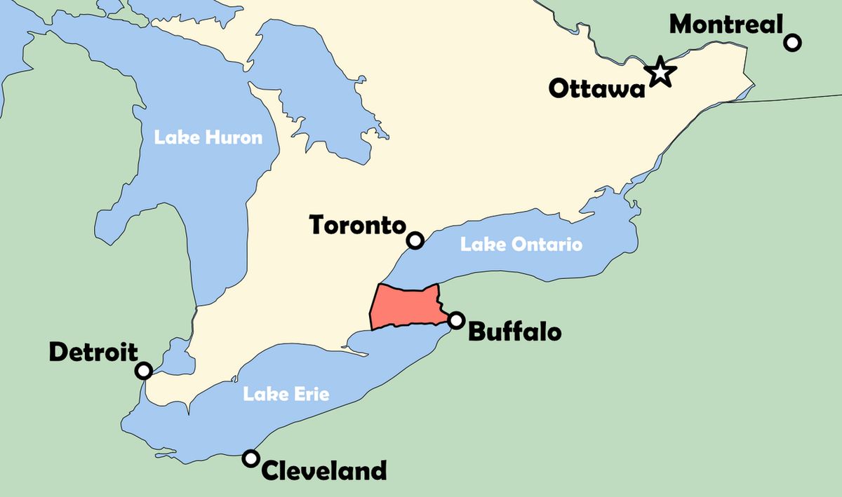
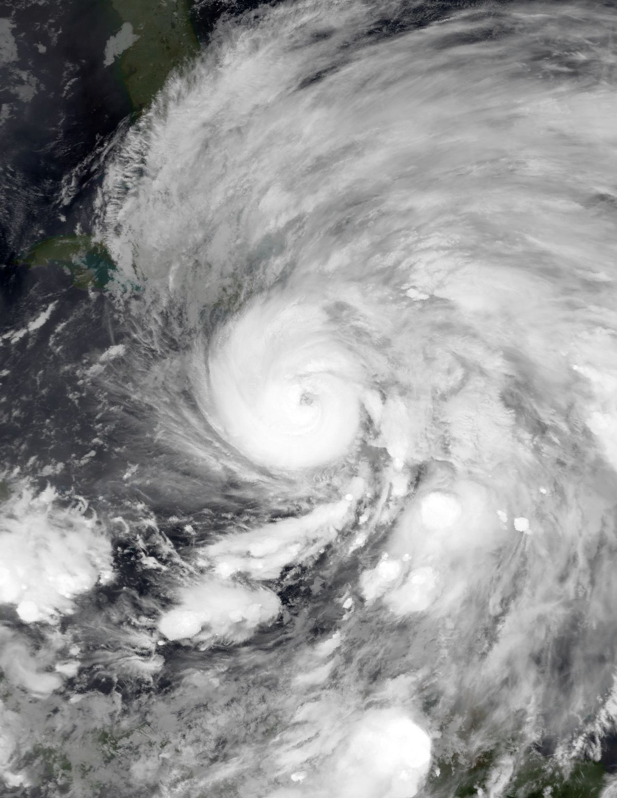
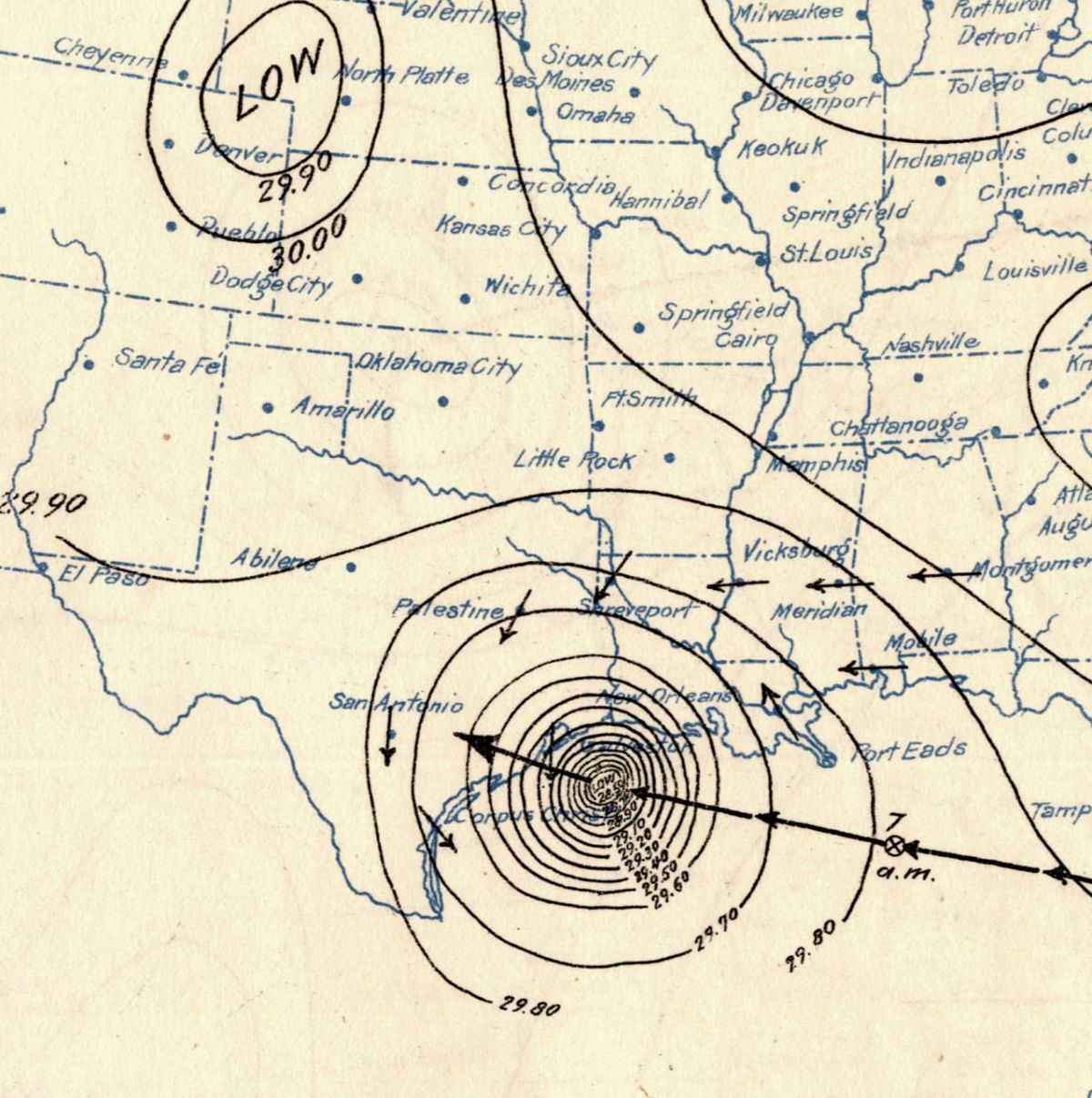
The Blizzard of 1977 was a catastrophic weather event that struck the Great Lakes region from January 28 to February 1, 1977, with its most severe impacts felt in Western New York and Southern Ontario. The storm was characterized not by massive new snowfall, but by hurricane-force winds that scoured vast quantities of existing snow from the frozen surface of Lake Erie and the land, creating monumental drifts that paralyzed entire communities. The event resulted in 23 storm-related deaths in Western New York and five more in northern New York, stranding thousands of people and bringing normal life to a standstill. For Canadians, particularly in the Niagara Peninsula of Southern Ontario, the blizzard remains a defining historical disaster, illustrating the vulnerability of urban and rural areas to extreme winter conditions and the importance of community resilience and emergency preparedness.
The Unusual Winter of 1976 to 1977
The severity of the Blizzard of 1977 cannot be understood without examining the extraordinary and persistent weather patterns that set the stage during the preceding months. A high-amplitude planetary wave pattern established itself from October 1976 through January 1977, featuring a strong ridge over western North America and a deep trough over the east. This pattern was more than three standard deviations from the mean over eastern North America in January. A strong blocking high over the Arctic Ocean displaced the polar vortex south into Canada, creating a powerful northwest flow that funneled record-breaking Arctic air into the central and eastern United States. The Ohio Valley averaged more than 8 °F (4 °C) below normal for the winter, while snow was observed as far south as Miami, Florida, on January 20. In stark contrast, the Pacific Northwest under the ridge experienced unprecedented drought, with Washington, Oregon, and Idaho recording their driest October-to-February period on record.
In Western New York, this pattern manifested as an intensely cold and snowy lead-up to the blizzard. November 1976 in Buffalo was the coldest in nearly 100 years, with an average temperature of 34.1 °F (1.2 °C), about 11 °F (6 °C) below normal. December continued the trend, averaging 22.0 °F (-5.6 °C), also about 11 °F below normal, with a snowfall of 60.7 in (154 cm). The critical pre-condition occurred on December 14, when Lake Erie froze over completely, an unusually early event that halted lake-effect snow but allowed deep, powdery snow to accumulate on its icy surface. January 1977 was Buffalo's coldest on record since 1870, with an average temperature of 13.8 °F (-10.1 °C) and not a single day above freezing. By January 27, the city's snow depth was 59.1 in (150 cm), with 151.3 in (384 cm) having fallen that winter prior to the blizzard.
The Storm's Arrival and Immediate Impact
The blizzard was triggered by an Arctic cold front sweeping southward through the Great Plains and Midwest. In Buffalo, after a morning temperature rise, the storm hit with sudden and terrifying force around 11:10 am on Friday, January 28. Observers in the M&T Bank Building described a gray wall that turned white as it enveloped the city, accompanied by a blast of wind that shook the building. The National Weather Service office in Buffalo issued its first-ever blizzard warning that morning. Visibility at the Greater Buffalo International Airport in Cheektowaga dropped from 0.75 miles to zero almost instantly, where it remained for over 12 hours. Winds increased to 29 mph (47 km/h) with gusts to 49 mph (79 km/h), and later averaged 46 mph (74 km/h) with gusts to 69 mph (111 km/h). The immediate effect was the complete immobilization of the region. Within 30 minutes in areas nearest Lake Erie, roads became impassable. City snowplows were forced back to garages because drivers could not see their own plow blades. Most workers in Buffalo had been released early but few made it home, joining thousands stranded in offices, factories, and vehicles.
Three airplanes on the tarmac at the Greater Buffalo International Airport in Cheektowaga were waiting to take off when the blizzard hit. One airplane idled for five minutes, which resulted in its nose wheel freezing and preventing it from turning around. During the four hours after the blizzard hit, the temperature at the Buffalo airport fell from 26 degrees Fahrenheit to 0 degrees Fahrenheit. Pedestrians were knocked down by the wind in city streets, so pairs of policemen pulled them into buildings. People formed human chains from the Memorial Auditorium to people stranded in cars so the motorists would not get lost trying to find shelter.
The Unique Mechanism of the Blizzard
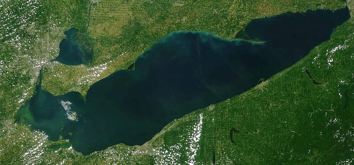
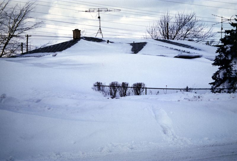
The Blizzard of 1977 was unique because its destructive power came less from new precipitation and more from the redistribution of a massive existing snowpack. Only about 12 inches (30 cm) of new snow fell during the event. The primary source of the blinding, drifting snow was the deep, powdery accumulation on the frozen surface of Lake Erie and the snow already covering the land. The hurricane-force winds, with a sustained northwest direction, acted like a giant shovel, scouring this snow and blowing it into the densely populated Niagara Frontier. Meteorologists realized by early afternoon on January 28 that the radar showed almost no new snowfall, indicating the snow was being blown off the frozen lake. The extreme cold of the preceding month was a key factor, as it prevented the usual thaw-freeze cycles that consolidate snow into a harder, less mobile crust. The snow remained light and powdery, perfect for drifting.
National Weather Service meteorologist Ben Kolker explained that the wind was so strong that it packed the snow. He said it broke the snow crystals up so they really packed in solidly, almost like a form of cement. The drifted snow on roadways was difficult to clear because the strong wind packed the snow into a solid state. In Western New York and Southern Ontario's Niagara Peninsula, snow which was accumulated on frozen Lake Erie and snow on the ground at the start of the blizzard provided ample material for the high winds to blow into huge drifts. The high winds blew snow into drifts of 30 to 40 feet.

Crisis and Response in Western New York
The blizzard created a multi-faceted crisis that overwhelmed normal emergency services. With roads impassable, the Buffalo police force was nearly immobilized by Friday evening. Through radio and television broadcasts, citizens were asked to loan snowmobiles and four-wheel drive vehicles to police, who then used them to answer emergency calls. Looting became a significant problem, with reports of theft from abandoned vehicles, fire trucks, a stranded ambulance, and various stores and factories. Nearly 100 people were arrested for looting. An estimated 13,000 people were stranded in downtown Buffalo alone on Friday night, with thousands more in surrounding areas such as the 1,700 people at Bell Aerosystems in Wheatfield and 2,500 at Harrison Radiator in Lockport. Shelters were spontaneously established in public buildings, with 700 people staying in the Donovan State Office Building, 200 in the Rath Building, and 300 in the Memorial Auditorium.
A major fire broke out on Whitney Place and Virginia Street in Buffalo on Friday evening, illustrating the extreme difficulties of emergency response. Fire trucks rammed through stalled cars to get near the scene, and hoses had to be stretched two to three blocks because apparatus could get no closer. The firefighting was hampered by hoses freezing and bursting, pumpers stalling or having their water coolant freeze, and runoff water from the hoses freezing vehicles in place, requiring jackhammers to free them. The fire destroyed six or seven houses and left 50 people homeless. Virginia Street and Whitney Place were closed for more than two weeks following the fire due to vehicles stuck in the ice.
- Police mobilized citizen-owned snowmobiles and 4x4 vehicles for emergency calls.
- Approximately 13,000 people were stranded in downtown Buffalo overnight.
- Major shelters included the Donovan State Office Building (700 people) and Memorial Auditorium (300 people).
- Looting led to nearly 100 arrests.
- A major fire on Whitney Place required heroic efforts and left 50 homeless.
- The National Guard was activated to assist with transport and clearing.
Impact on Southern Ontario
While the storm is often associated with Buffalo, Southern Ontario, particularly the Niagara Peninsula, endured similarly catastrophic conditions. The same meteorological forces were at play, with fierce northwest winds blowing across the frozen Lake Erie and the snow-covered peninsula. Communities like Fort Erie, Port Colborne, and Welland were buried under enormous drifts, and transportation ground to a halt. Reports from Welland indicated a common vehicular failure mode where snow was blasted into car engine compartments, melted on the hot engine, saturated spark plugs, and then refroze, stalling the vehicles. Other cars overheated when snow packed under the radiator, melted, and refroze, interfering with the cooling fan. The isolation of rural communities and farms was a major concern, as country roads vanished under deep, hardened snow. Snowmobiles, often operated by volunteers, became the only viable link for transporting essential supplies, medicine, and medical personnel.
The blizzard of 1977 hit Western New York and Southern Ontario. The combination of bitter cold, high winds, and blowing snow paralyzed areas affected by the storm. In the hardest struck areas, snowmobiles became the only viable method of transportation. The drifted snow from the blizzard was difficult to clear because the wind packed the snow solidly.
Aftermath and Long-Term Legacy
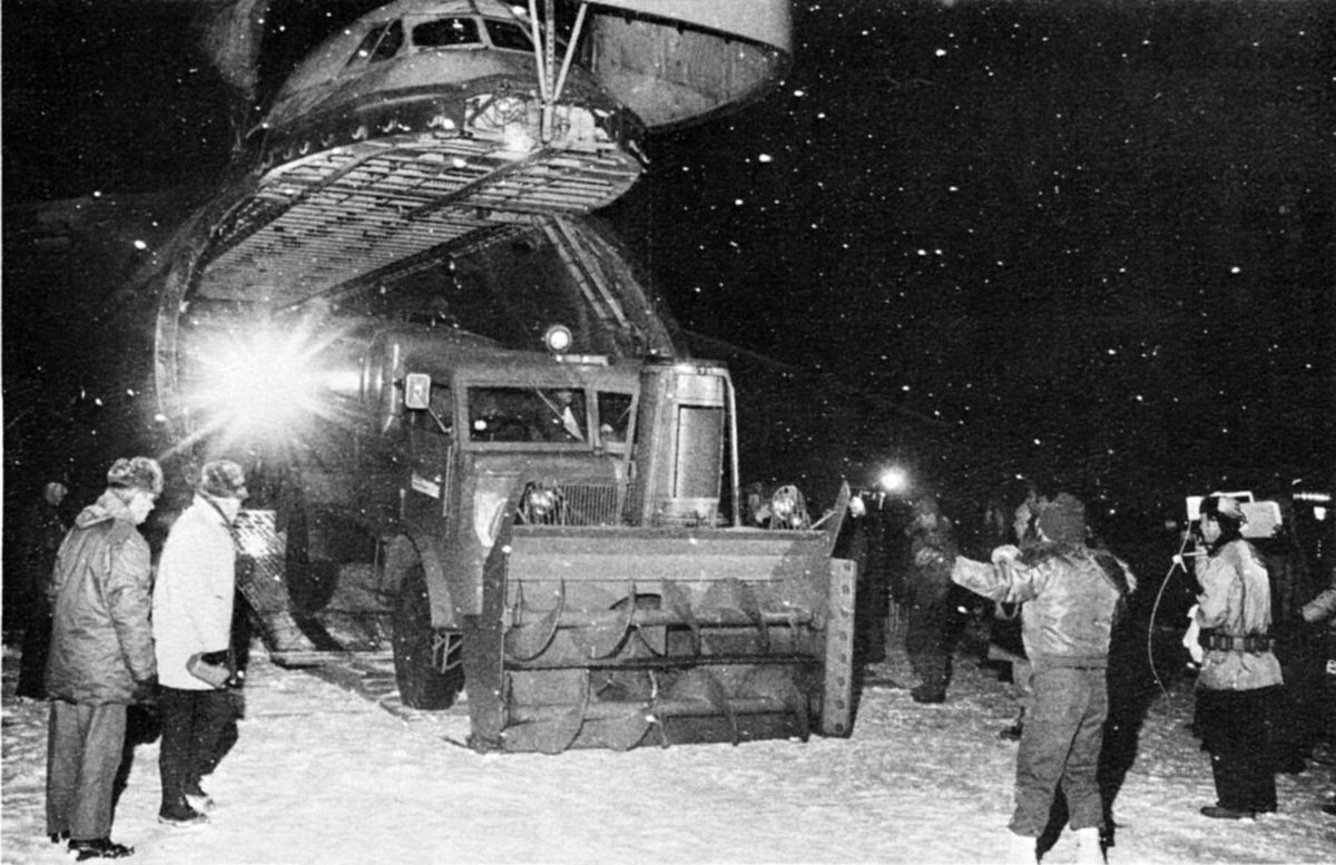
The immediate aftermath of the blizzard was a prolonged recovery operation. Clearing the cement-like drifts required heavy machinery, including front-end loaders and bulldozers, as conventional snowplows were often ineffective. The Greater Buffalo International Airport remained closed for days. Schools and businesses stayed shut, and travel bans were enforced in many areas. The final death toll attributed to the storm reached 23 in Western New York and five in northern New York. The blizzard's legacy is deeply embedded in the collective memory of the Great Lakes region, serving as a benchmark for extreme winter weather. The event prompted significant changes in emergency preparedness and meteorological communication.
The Buffalo National Weather Service office had issued its first-ever blizzard warning for the event, a practice that became standard. Municipalities reviewed and improved snow removal plans, stockpiling equipment and salt. The concept of restricting or banning travel gained prominence as a life-saving tool. For a generation of Canadians and Americans in the region, the Blizzard of 1977 represents a story of survival, community solidarity in the face of disaster, and a stark reminder of nature's power to bring modern infrastructure to a standstill.
Comparative Winter Statistics
Weather conditions during the months leading up to the blizzard contributed to the disastrous storm. November, December and January average temperatures were severely below normal. By January 27, Buffalo's snow depth was 59.1 inches. There was continuous snow cover from November 29 until the day of the blizzard, and 151.3 inches of snow had fallen that winter prior to the blizzard.
| Month | Total Snowfall | Notable Records |
|---|---|---|
| November 1976 | 31.3 in (80 cm) | Coldest in nearly 100 years |
| December 1976 | 60.7 in (154 cm) | Lake Erie frozen by Dec. 14 |
| January 1977 | 59.1 in (150 cm)* | Coldest on record. No day above freezing |
| Pre-Blizzard Snow Depth (Jan. 27) | 59.1 in (150 cm) | Seasonal total to date: 151.3 in (384 cm) |
Prior to January 28, the day the blizzard started, it had snowed almost every day since just after Christmas. January's average temperature was 10 degrees Fahrenheit below normal. It never rose to freezing in Buffalo that month, the first January that had occurred. Lake Erie was covered by a deep, powdery snow at the beginning of the blizzard. January's unusually cold conditions limited the usual thawing and refreezing, so the snow on the frozen lake remained powdery.
Questions about Blizzard of 1977
What made the Blizzard of 1977 so unique and severe?
The blizzard's severity was due to a rare combination of factors, not heavy new snowfall. An existing snowpack of over 150 cm, including deep powdery snow on the frozen surface of Lake Erie, was scoured by sustained hurricane-force winds gusting to 111 km/h. These winds packed the snow into cement-like drifts as high as 12 metres. The extreme cold preceding the storm, with Buffalo experiencing its coldest January on record, kept the snow light and dry, making it ideal for massive drifting that paralyzed the region.
Why did Lake Erie freezing over contribute to the blizzard?
Lake Erie froze over by December 14, 1976. When this occurs, lake effect snow does not occur because the wind cannot pick up moisture from the lake's surface, convert the moisture to snow, and then dump it when the winds reach shore. Lake Erie was covered by a deep, powdery snow at the beginning of the blizzard. The snow which was accumulated on frozen Lake Erie provided ample material for the high winds to blow into huge drifts.
How did people survive stranded in their cars or offices?
Thousands survived by sheltering in place wherever they were caught. An estimated 13,000 people were stranded in downtown Buffalo alone, taking refuge in office buildings like the Donovan State Office Building (700 people) and the Memorial Auditorium (300 people). People formed human chains to guide stranded motorists to shelter. Community cooperation was essential, with citizens loaning snowmobiles and 4x4 vehicles to police and emergency services for rescue missions and transport of medical personnel.
What were the long-term effects of the Blizzard of 1977?
The blizzard led to major changes in emergency preparedness and weather communication. It prompted the first-ever blizzard warning from the Buffalo National Weather Service office. Municipalities overhauled snow removal plans, increased equipment stockpiles, and formalized travel ban protocols. The event remains a defining historical reference point for winter disaster planning in the Great Lakes region, emphasising the need for community resilience and the potential for existing snowpack to become a deadly hazard under extreme wind conditions.
How many people died in the Blizzard of 1977?
There were 23 total storm related deaths in Western New York, with five more in northern New York. The blizzard, which occurred from January 28 to February 1, 1977, was a catastrophic event that paralyzed regions with its combination of bitter cold, high winds, and blowing snow. Daily peak wind gusts in Buffalo ranged from 46 to 69 mph, and the high winds blew existing snowfall into massive drifts of 30 to 40 feet. These extreme conditions, coupled with pre existing deep snow cover and impassable roads, created a deadly situation. The storm's severity was exacerbated by months of severely below normal temperatures that had caused Lake Erie to freeze over by mid December.
Was Southern Ontario affected by the Blizzard of 1977?
Yes, Southern Ontario was affected by the Blizzard of 1977. The storm hit Western New York, Central New York, Northern New York, and Southern Ontario from January 28 to February 1. In Southern Ontario's Niagara Peninsula, snow accumulated on frozen Lake Erie and snow on the ground at the blizzard's start provided ample material for the high winds to blow into huge drifts. The combination of bitter cold, high winds, and blowing snow paralyzed areas affected by the storm. The blizzard's impact was similar to that in Western New York, where deep powdery snow on the frozen lake and land was scoured by winds gusting over 69 mph, creating devastating conditions.
Sources and further reading
- Blizzard of 1977 (Wikipedia)
- Weather Events of our History (greyroots.com)
- Blizzard of '77 (aweathermoment.com)
- Weather History for January 28 (weather.gov)
- Memories of the Historic Buffalo Blizzard of 1977 (moxiegardiner.com)
Checked by the Your Space Hamilton desk. Last updated 2026-10-22.