Michipicoten Island
Michipicoten Island is a large, remote wilderness island in the northeastern part of Lake Superior, Ontario. As the third-largest island in the lake, it is a provincially protected area renowned for its rugged topography, dense forests, and significant ecological narratives, particularly involving woodland caribou and wolf populations. The island, accessible primarily by boat or floatplane, offers a stark and challenging destination for adventurous kayakers and those seeking solitude in a pristine natural environment. Its management as a non-operating provincial park emphasizes preservation, with minimal facilities, making it a bastion of wilderness in the Great Lakes.
Geography and Geology
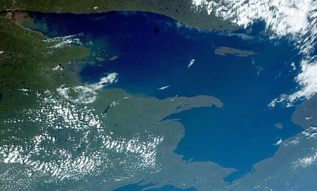
Michipicoten Island is situated approximately 175 kilometres northwest of Sault Ste. Marie and 65 kilometres southwest of Wawa, Ontario, with its closest point to the mainland being about 16 kilometres away. The island measures 27 kilometres in length and up to 10 kilometres in width, forming a significant landmass in eastern Lake Superior. Its topography is defined by a rugged interior featuring east-west aligned ridges, which present gentle southern slopes and steep, cliff-like northern slopes. The island's bedrock is composed of ancient lava flows and intrusive rocks related to the volcanic activity of the Midcontinent Rift System, giving it a distinctive geological character. Over twenty inland lakes dot the forested interior, which is part of the Great Lakes-St. Lawrence Forest region, contributing to the island's complex hydrology and scenic variety. The highest point on the island reaches 298 metres above the level of Lake Superior, providing vantage points over the surrounding water and forest.
Park Establishment and Management
Michipicoten Island and surrounding shoals and waters within 2,500 metres of its shoreline were designated as Michipicoten Island Provincial Park on December 11, 1984, with regulation following in 1985. The park encompasses 36,740 hectares of land and water, established to protect its unique island ecosystem. Management of the park has operated under an Interim Management Statement approved in 1986, as efforts to develop a comprehensive Park Management Plan in the 2000s were not finalized. The park is classified as non-operating, meaning it has no developed visitor facilities such as maintained trails, campgrounds, or canoe routes. Public recreation, including camping, hiking, and wildlife viewing, is permitted but entirely self-directed, and hunting is prohibited within park boundaries. The interim statement provides the policy direction for protection and management until a full plan is prepared, and it was signed by the Regional Director of the Northeastern Region of the Ministry of Natural Resources.
Several inholdings and existing uses were recognized at the time of park creation. Private cottages in Quebec Harbour, existing mining claims and a lease, and a commercial outpost camp on Michi Lake operating under a land use permit were all excluded from park regulation or allowed to continue. An exploratory licence of occupation for mineral exploration was established in 1984 for a five-year term, with provisions for annual extensions up to a maximum of 11 years. The Front Range Lighthouse building, established on the eastern end of the island in 1912, is leased from Transport Canada by the Ministry of Natural Resources for use as a park headquarters. Access to the island is challenging, with the most convenient method being by floatplane, although Quebec Harbour on the south shore provides a natural refuge for boats and is marked on yachting charts. The aircraft and boat docking facility at the lighthouse location had deteriorated and was identified for upgrade in the interim management statement, which also noted that no recreation facilities would be developed at that time.
Human History and Use
The island's name, Michipicoten, is an Anglicization of the Ojibwe word "Mishipikwadina," meaning "big bluffs," a reference to the geography of the nearby mainland river. On some historical maps, it appears as Isle Maurepas, named for the French minister of marine, Jean-Frédéric Phélypeaux, Count of Maurepas. For generations, the island has held cultural significance for Anishinaabe peoples, being traditionally cited as the home of Mishipeshu, a powerful underwater creature in Ojibwe, Odawa, and Potawatomi traditions. Men from the Hudson's Bay Company post at Michipicoten River were dispatched to the harbour for fall fishing operations before permanent structures were built.
The commercial fishing enterprise evolved through several owners, beginning with operations linked to the Hudson's Bay Company post at Michipicoten River. Permanent buildings were erected at Quebec Harbour in 1871 by T. Griffiths and Co., and fishermen began overwintering there to exploit the late fall and early spring seasons. The site may have been operated by the Chicago-based A. Booth Packing Company, which acquired a Crown Land lease on the south side of Quebec Harbour around 1860 but moved to the north side in 1905 due to a title dispute. The Ganley brothers, managers of the Dominion Transportation Line, ran a passenger boat service between Sault Ste. Marie and Quebec Harbour. The Booth Fisheries enterprise declined in the 1920s reportedly due to poor management and sold its eastern Lake Superior interests and two tugs in 1934 to James Purvis and Son, Ltd. of Gore Bay. Under Ivan Purvis, the business expanded by exploiting new fishing grounds like Superior Shoal, employing up to 40 people and families on the island and operating four tug licenses for 220,000 metres of gill net. The operation was sold to Ferroclad Fisheries of Mamainse in 1959. Today, human presence is minimal, limited to a small number of private camp owners, commercial fishers, clients of the fly-in outpost camp, and occasional adventurous kayakers, with the island typically being uninhabited in winter due to remoteness and access difficulty.
Wildlife and Ecological Significance
Michipicoten Island hosts a diverse array of wildlife within its forest and aquatic ecosystems. The island supports one of the highest beaver populations in the region and provides nesting sites for peregrine falcons. Its most prominent and studied ecological story, however, involves the population dynamics of woodland caribou and gray wolves. The island's indigenous caribou herd was extirpated by overhunting in the mid-1800s. A lone male caribou was observed on the island in 1981, and a formal reintroduction program began in 1982 when the Ontario Ministry of Natural Resources translocated seven caribou from the Slate Islands. An additional male was moved to the island in 1989. The herd thrived in the absence of predators, with a population growth rate calculated at λ=1.18, reaching approximately 160 animals by 2001 and an estimated 680 by 2011, demonstrating that lichen, scarce in the island's forest type, was not a critical dietary requirement.
This growth provided a unique opportunity to test ecological hypotheses about caribou decline, specifically A. T. Bergerud's proposed test comparing the range hypothesis against the predation hypothesis. The first part of the test, that caribou would increase without abundant lichen, was confirmed. The situation changed dramatically in the winter of 2014 when wolves crossed to the island via an ice bridge from the mainland. The wolf population increased rapidly, more than tripling by the winter of 2016/2017, with an anticipated count of about 20 wolves by 2017/2018. The resulting predation pressure caused a severe decline in the caribou herd, confirming the second part of Bergerud's test and supporting the predation hypothesis that wolves are a key factor in caribou population dynamics. By March 2019, due to the critically low number of remaining caribou, all surviving caribou and wolves were relocated off the island, with a pack of eight wolves moved to Isle Royale in 2018. The island's ecological significance is highlighted by its status as one of the last verifiable locations for caribou in the federally recognized ON6 Lake Superior caribou range, as surveys along the north shore in 2016 failed to conclusively observe any remaining caribou.
In a significant recent conservation action, the Thunder Bay Field Naturalists Club (TBFNC) purchased two parcels of land totalling 537 acres on Michipicoten Island in February 2019. These properties, which are surrounded by the provincial park, are intended to be kept as remote, undisturbed wilderness to provide suitable habitat for any future caribou reintroductions. The project was supported by funding from Environment and Climate Change Canada's Canada Nature Fund, a $500 million federal investment supporting conservation by non-federal partners. Since the acquisition, the club has conducted volunteer wildlife monitoring using trail cameras placed on the properties. Teams of six volunteers have travelled by boat from Wawa to the island annually, including in 2024, 2025, and 2026, to retrieve images, replace batteries, and compile summary reports on wildlife observations. This data is shared with local First Nations and wildlife managers to inform future conservation decisions, including potential caribou reintroductions to the island.
Visiting the Island
Visiting Michipicoten Island Provincial Park is an expedition suited for experienced and self-sufficient wilderness travellers. There are no public ferry services, maintained docks, roads, or visitor facilities of any kind. The primary means of access is by private or chartered boat or by floatplane, with Quebec Harbour being the most common landing point for vessels. The park's status as non-operating means visitors must bring all necessary supplies, including food, water, shelter, and safety equipment, and must practice strict Leave No Trace principles. All recreation is backcountry in nature, with opportunities for wilderness camping, hiking across rugged terrain, wildlife viewing, kayaking along the shoreline, and fishing in Lake Superior or inland lakes, subject to provincial fishing regulations. Prior to park regulation, recreational use was low and included activities like sportfishing, canoeing, boating, hiking, camping, beachcombing, and wildlife viewing.
The best time to visit is during the summer months when Lake Superior is typically calmer and weather conditions are more favourable for travel and camping. However, even in summer, the lake is known for rapidly changing and severe weather, making careful planning and preparedness essential. Winter visits are extremely challenging due to the island's remoteness, harsh weather, and the formation of dangerous ice conditions, and the island is usually uninhabited during this season. Commercial tourism occurs on a very small scale, limited to one fly-in outpost camp on Michi Lake operated under a land use permit. Those interested in visiting should contact the Ontario Ministry of Natural Resources district office in Wawa for the most current information on conditions and regulations before attempting a trip. The district office is located at P.O. Box 1160, 22 Mission Road, Wawa, with telephone number 705-856-2396.
Key Features and Points of Interest
Michipicoten Island's landscape and history offer several notable features for those who venture there. The terrain is a dramatic mix of forested ridges, inland lakes, and a rugged Superior coastline. Quebec Harbour, a deep natural harbour on the south shore, has been a focal point of human activity for over a century, from commercial fishing to modern-day boating refuge. The Front Range Lighthouse, established in 1912 and staffed until 1988, stands on the eastern end of the island. Its building is now used for park operations. The island's interior lakes, such as Michi Lake, provide secluded freshwater environments. The extensive forest cover includes sugar maple stands and supports a rich understory. The island's natural resource values historically included mineral resources and fur trapping, but no commercial timber values have been identified.
- Quebec Harbour: A historic commercial fishing base and natural deep-water harbour for boat refuge, with private cottages and a deteriorated docking facility.
- Front Range Lighthouse: A historic light station established in 1912, staffed until 1988, with the building now leased from Transport Canada for park headquarters use.
- Interior Lakes: Over twenty inland lakes, including Michi Lake, which hosts a commercial fly-in outpost camp operating under a land use permit.
- Rugged Shoreline and Ridges: Dramatic cliffs, cobble beaches, and east-west ridges with gentle southern and steep northern slopes characteristic of Lake Superior's north shore.
- Forest Ecosystems: Mature mixed forest of the Great Lakes-St. Lawrence region, with significant beaver activity and nesting peregrine falcons.
- Thunder Bay Field Naturalists Club Reserve: A 537-acre privately protected wilderness area purchased in 2019, with ongoing wildlife camera monitoring since acquisition.
- Geological Formations: Bedrock of ancient lava flows and intrusive rocks from the Midcontinent Rift System, defining the island's fundamental structure.
- Historic Fishing Stations: Sites associated with the Booth Fisheries and Purvis fishing operations, representing a century of commercial fishing history.
Michipicoten Island is a rugged and remote island in northeastern Lake Superior, characterized by a heavily forested landscape with inland lakes and ancient lava bedrock. Its compelling ecological history includes the introduction and study of a woodland caribou herd and the later arrival of wolves. The island's isolation and limited facilities make it a destination for adventurous kayakers and those seeking a wilderness experience. Designated as Michipicoten Island Provincial Park in 1985, this status protects its unique geological features, wildlife habitats, and cultural landscapes. The park's management is guided by an interim statement, with ongoing conservation efforts including land acquisition by naturalist groups.
Questions about Michipicoten Island
Where is Michipicoten Island located?
Michipicoten Island is located in the northeastern part of Lake Superior, within Ontario's Thunder Bay District. It is approximately 175 kilometres northwest of Sault Ste. Marie and 65 kilometres southwest of the town of Wawa. The island's closest point to the Ontario mainland is about 16 kilometres away, making it a significant but remote feature in the lake. It is the third largest island in Lake Superior, after Isle Royale and St. Ignace Island.
Can you visit Michipicoten Island Provincial Park?
Yes, the park is open for public use, but it is classified as a non-operating park, meaning it has no visitor facilities, maintained trails, or designated campsites. Access is challenging and typically requires a private or chartered boat or a floatplane. Visitors must be entirely self-sufficient, bringing all necessary gear and supplies, and must be prepared for wilderness conditions and rapidly changing weather on Lake Superior. All recreation is at your own risk, and hunting is prohibited within the park.
What happened to the caribou and wolves on Michipicoten Island?
Caribou were reintroduced to the island in 1982 after being extirpated in the 1800s. The herd grew successfully until wolves crossed an ice bridge from the mainland in 2014. Wolf predation then caused a severe caribou population decline. By March 2019, the remaining caribou and wolves were relocated off the island to prevent local extirpation, with a pack of eight wolves moved to Isle Royale in 2018. Conservation groups now monitor the island for potential future reintroductions. The population dynamics provided a real-world test of ecological theories about caribou decline.
Are there any facilities or services on the island?
There are no public facilities or services for visitors on Michipicoten Island. The park is undeveloped wilderness. The only structures are a few private camps, a historic lighthouse building used for park operations, and the infrastructure of a single commercial fly-in outpost camp on Michi Lake. Visitors must plan to be completely self-reliant for navigation, shelter, food, water, and waste disposal. The nearest park office for information is the Ontario Ministry of Natural Resources district office in Wawa.
What is the significance of the Thunder Bay Field Naturalists Club land purchase?
In February 2019, the Thunder Bay Field Naturalists Club purchased 537 acres of land on Michipicoten Island to protect it as undisturbed wilderness. The property is surrounded by the provincial park and is intended to preserve habitat for future caribou reintroduction. Funded partly by the federal Canada Nature Fund, the club conducts annual wildlife monitoring using trail cameras on the land, sharing data with First Nations and wildlife managers. Volunteer teams have collected monitoring data in 2024, 2025, and 2026 to inform conservation decisions.
What wildlife can be found on Michipicoten Island?
The island supports diverse wildlife, including one of the area's highest beaver populations and nesting peregrine falcons. Its most famous inhabitants were the reintroduced woodland caribou and the wolves that later arrived. Other species common to the Great Lakes-St. Lawrence Forest are present. The inland lakes and surrounding waters of Lake Superior also host various fish species, making it a destination for sportfishing. Arctic plant species are also found on the island, adding to its botanical interest.
Sources and further reading
- Michipicoten Island (Wikipedia)
- Thunder Bay Field Naturalists Club | Michipicoten Island (tbfn.net)
- Michipicoten Island Provincial Park (ontarioparks.ca)
- The best camping in Michipicoten Island Provincial Park, ON (hipcamp.com)
- Michipicoten Island Provincial Park Management Statement (ontario.ca)
Checked by the Your Space Hamilton desk. Last updated 2026-10-25.