Lake Storm Aphid
Lake Storm Aphid, commonly known as the October Storm or October Surprise, was a record-setting early-season lake effect snowstorm that struck the Buffalo, New York, area and parts of southern Ontario from October 12 to 13, 2006. The storm, officially named by the National Weather Service office in Buffalo as part of its insect-themed naming convention for that year, dumped up to 24 inches (61 cm) of wet, heavy snow on areas still in full autumn foliage. Its highly localized but devastating impact caused widespread tree damage, prolonged power outages affecting hundreds of thousands, and led to a federal disaster declaration. The event remains a stark example of the destructive potential of lake effect snow and a significant moment in the weather history of Western New York.
Meteorological Development and Forecast
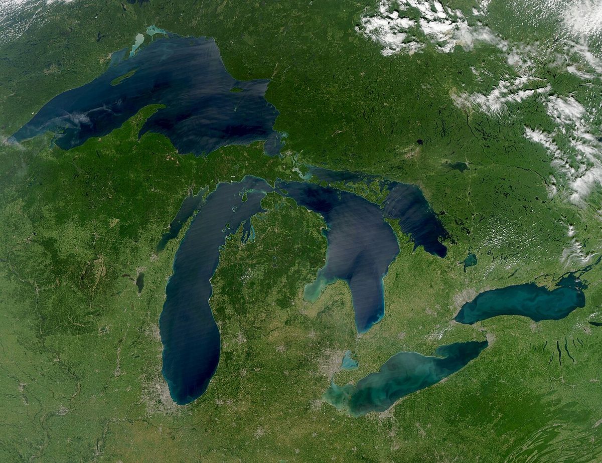
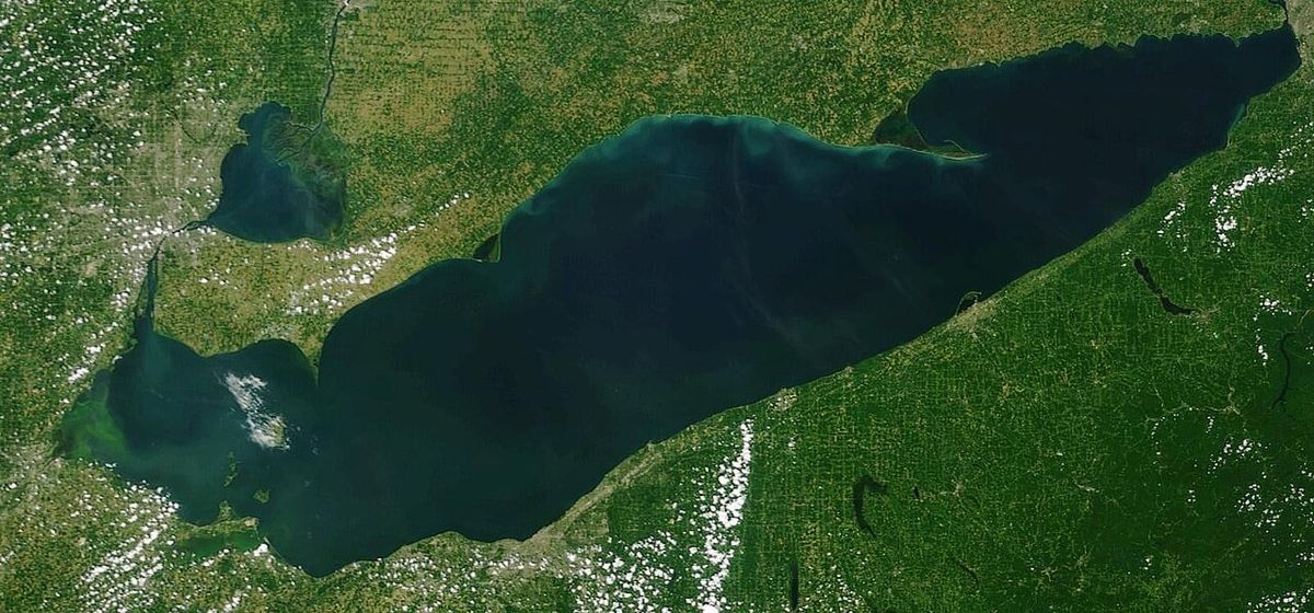
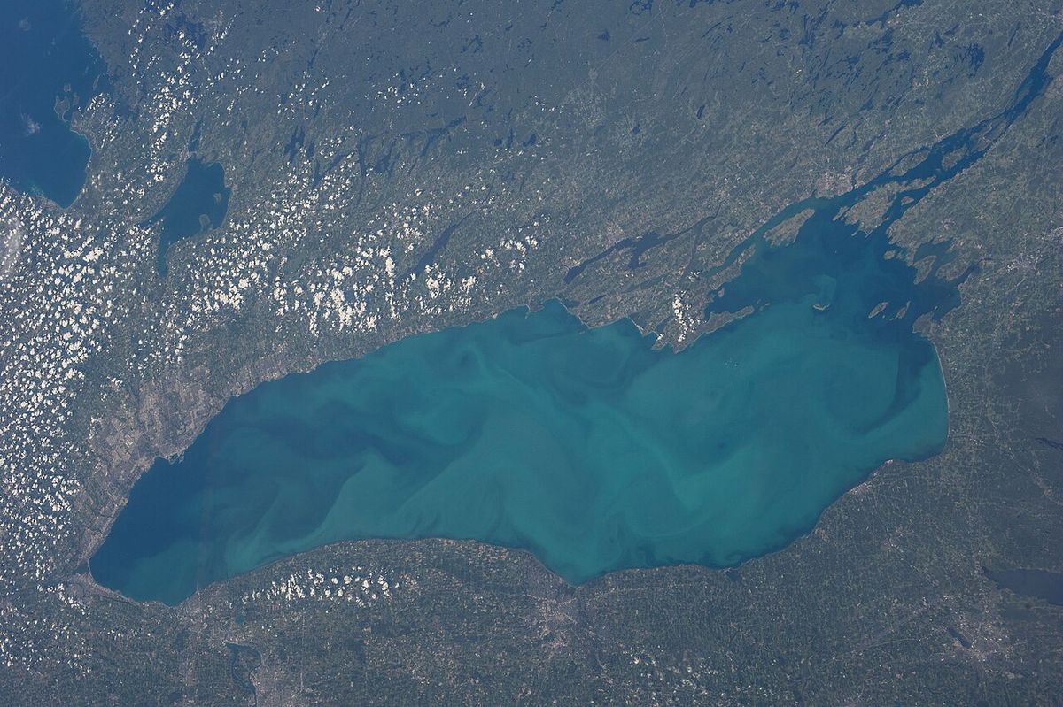
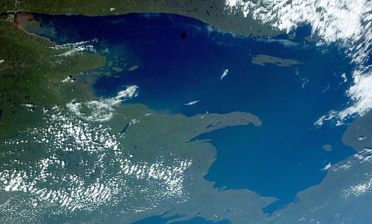
The origins of Lake Storm Aphid can be traced to early October 2006, when long-range weather models first indicated a deep low-pressure system would affect the Great Lakes basin. By October 6, forecasters at the National Weather Service in Buffalo and Environment Canada noted the potential for lake effect precipitation but initially predicted only minimal accumulations, expecting mainly rain. Concerns grew by October 9 as models suggested the possibility of accumulating wet snow, even with surface temperatures above freezing, due to the high snowfall rates typical of lake effect squalls. The storm's development was driven by a classic lake effect setup where a strong cold front, associated with a deepening low-pressure centre near Attawapiskat, Ontario, swept polar continental air across the relatively warm waters of Lake Erie. This front passed Port Colborne, Ontario, at 11:35 PM EST on October 11 and the Buffalo Airport at 12:46 AM on October 12, setting the stage for rapid destabilization. A lake effect squall began forming over Lake Erie by 3:30 AM that morning, with the first lake effect rain reported at Buffalo Airport at 3:54 AM.
Forecasters upgraded their concerns throughout October 12 as conditions evolved. The NWS Buffalo issued a special weather advisory on the afternoon of October 11 mentioning minor accumulations of less than 2 inches, with Environment Canada issuing similar advisories for Canadian areas. By the morning of October 12, the potential for a significant snowfall event became clearer, though predictions still focused on rain mixed with ice pellets and wet snow. That afternoon, the NWS issued a lake effect snow warning for one to six inches of snow and officially dubbed the system 'Lake Storm Aphid' per its annual naming scheme. The critical changeover from rain to snow occurred rapidly at the Buffalo Airport between 1:51 PM and 2:09 PM as temperatures plummeted from 41 °F (5 °C) to near freezing, driven by increased vertical mixing within the intensifying squall. Radar indicated the squall's echo-tops reaching 20,000 feet (6,100 m) by 2:54 PM, accompanied by lightning, signalling the development of thundersnow, a rare and intense manifestation of lake effect storms.
Timeline of the Storm
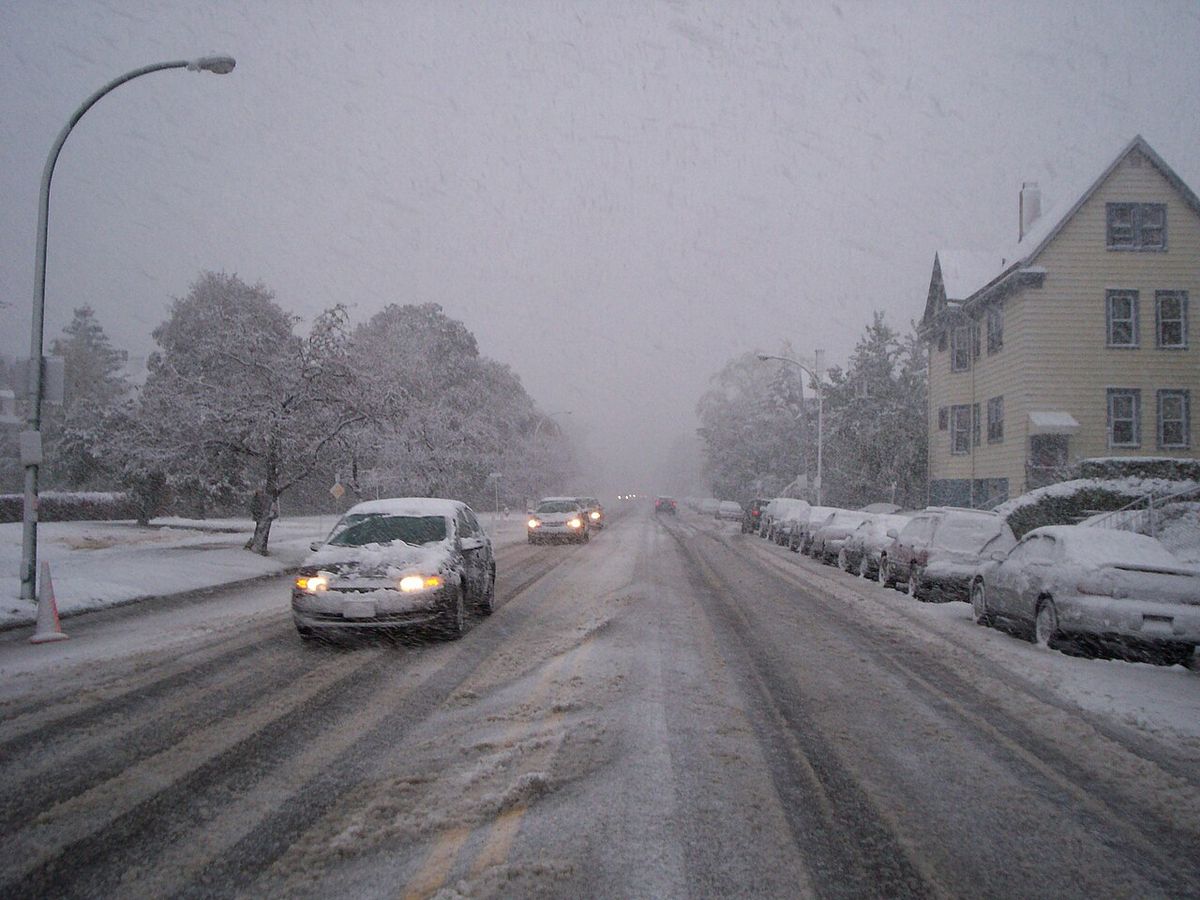
The storm unfolded with remarkable speed, transforming a rainy autumn day into a historic snow emergency within hours. The following chronology details key events from the storm's approach through to its immediate aftermath, highlighting the rapid escalation and the long recovery period. The storm's initial development began days earlier with a frontal zone forming over the northern United States and Canada, which led to the merger of two low pressure systems over northern Michigan on October 11. The main event commenced on October 12 as the cold front passed through, with the first lake effect rain reported in Buffalo just before 4:00 AM and the change to heavy snow occurring in the early afternoon.
- October 10: A frontal zone developed over northern Minnesota and southern Manitoba.
- October 11, 11:35 PM: The leading cold front passed the Port Colborne, Ontario, weather reporting station.
- October 12, 12:46 AM: The cold front passed the Buffalo Airport reporting station.
- October 12, 3:30 AM: The first lake effect squall began to form over Lake Erie.
- October 12, 2:36 PM: NWS Buffalo issued a formal lake effect snow warning for several counties, citing potential tree damage and power outages.
- October 12, 4:54 PM: Snowfall rates increased to over 1 inch (2.5 cm) per hour, allowing the first significant ground accumulations to begin.
- October 12, 7:30 PM: Buffalo-Niagara International Airport grounded all flights due to deteriorating conditions.
- October 12, 9:15 PM: The Ontario Provincial Police closed the Niagara section of the Queen Elizabeth Way (QEW).
- October 12, 10:25 PM: The New York State Thruway closed at Interstate 190, and the Peace Bridge border crossing was shut down.
- October 13, 2:00 AM: Buffalo Airport reported 10.0 inches (25.4 cm) of snow accumulation.
- October 13, 8:00 AM: Buffalo Airport reported 22.0 inches (55.9 cm) of snow accumulation.
- October 13, 10:30 AM: Amherst, New York, reported a storm total of 24 inches (61 cm), setting an all-time record for the event.
The aftermath saw a prolonged recovery period. The remaining snow fully melted by October 15, but the cleanup of debris and restoration of power took much longer. Most schools in the affected areas did not reopen until October 23, with some in the hardest-hit suburbs like Amherst and Hamburg reopening on October 26 and 27, respectively, after repairs to storm-damaged buildings. The federal disaster declaration on October 24 formally recognized the scale of the damage and activated additional resources for the region's recovery efforts.
Impact and Damage
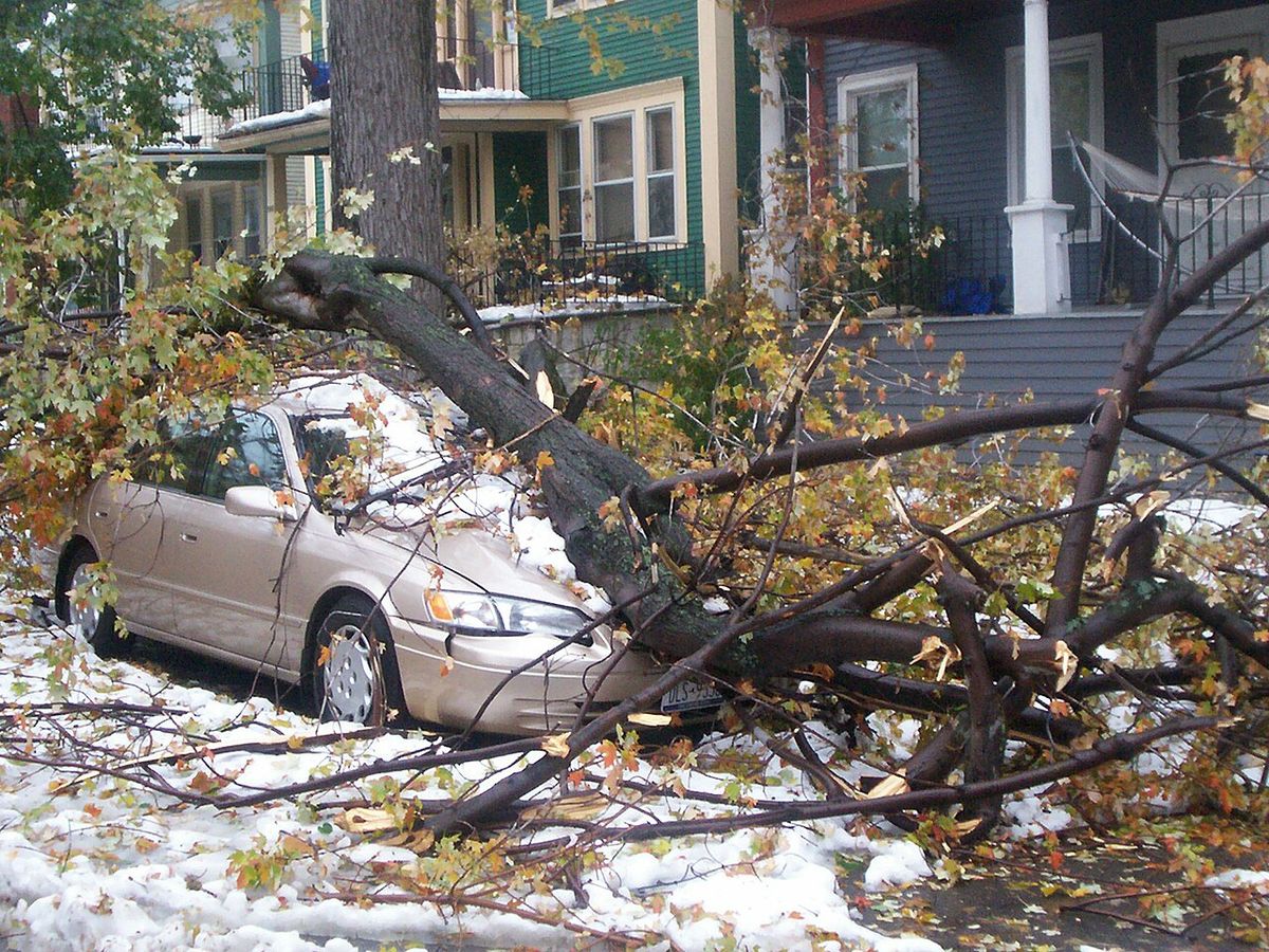
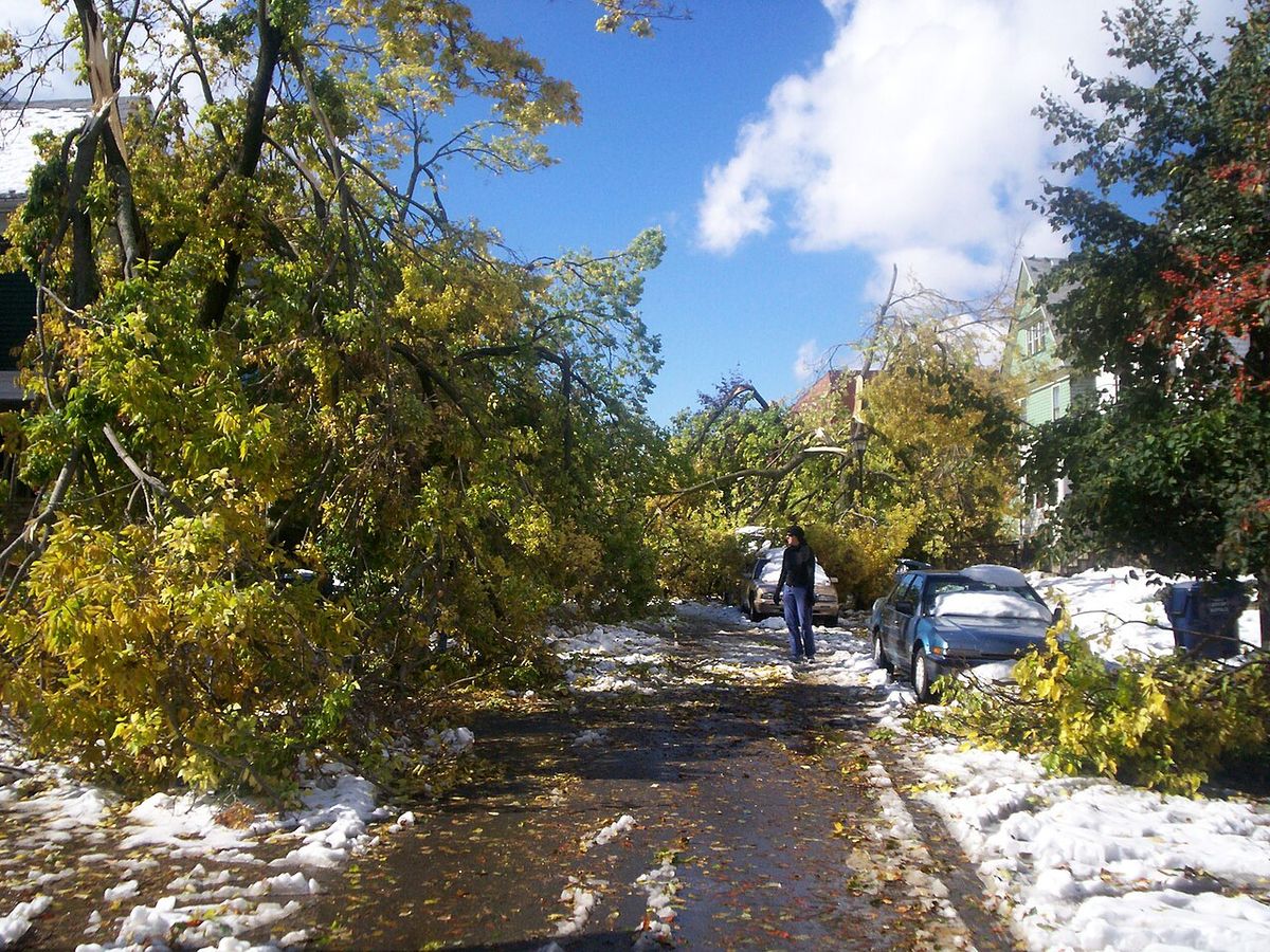
The impact of Lake Storm Aphid was severe and highly localized, with snowfall totals varying dramatically over short distances. While the greater Toronto area received no snow at all, the Buffalo metro region was paralysed. The storm's defining characteristic was the wet, heavy nature of the snow, which had a snow-water equivalent ratio between 6:1 and 12:1, making it exceptionally dense and heavy. This 'cement-like' snow accumulated on trees that had not yet shed their leaves, creating catastrophic weight loads. An estimated 90 percent of trees in the city of Buffalo were damaged, with significant losses in the historic park system designed by Frederick Law Olmsted. The damage represented a major setback to the city's urban reforestation goals, which aimed to increase canopy cover from 12 percent toward the national average of 30 percent.
The weight of snow and falling limbs devastated the region's electrical infrastructure. At the peak of the storm, approximately 400,000 people lost power. Of those, about 100,000 households remained without electricity for a full week, with a few thousand enduring outages for up to ten days. The resulting power crisis led to a frantic search for generators, with hardware stores like Lowe's and Home Depot selling out immediately. The storm was directly responsible for at least 13 fatalities in the days following its onset. Three deaths occurred during the storm itself, two from automobile accidents and one from a falling branch. Ten additional deaths were reported in the aftermath, stemming from causes such as pre-existing health conditions aggravated by the stress of the event and carbon monoxide poisoning from improperly ventilated generators. Injuries numbered in the hundreds and included chainsaw accidents during cleanup and further cases of carbon monoxide exposure.
The economic and logistical toll was immense. Initial conservative damage estimates for cleanup started at US$130 million, with officials estimating between 6 and 8.6 million cubic yards of debris needed removal. The cleanup was severely hampered in the first days by a dangerous interplay of downed power lines and fallen trees, where utility crews could not access lines due to trees and tree removal crews could not work due to live wires. Major transportation routes were shut down, including a 100-mile stretch of the New York State Thruway and the Buffalo-Niagara International Airport, which closed for multiple hours across October 12 and 13. Despite the extreme conditions, a scheduled Buffalo Sabres hockey game against the New York Rangers at HSBC Arena proceeded on the night of October 12, drawing a full attendance of 18,690 spectators. This event became a notable moment of community resilience amid the widespread disruption.
Government and Emergency Response
The response to the unprecedented early-season disaster unfolded through local, state, and federal channels, coordinated through established Emergency Operations Plans. Local fire and police departments were the first responders, dealing with blocked roads, accidents, and a surge in emergency calls. As the storm intensified, highway departments were called in to clear tree limbs, but crews were quickly overwhelmed by the scale of the damage, which prevented snow plows from accessing roads and effectively stranded the region. The widespread power outages, caused by limbs snapping power lines, created a secondary hazard that complicated all recovery efforts. By October 13, New York Governor George Pataki declared a state of emergency for Erie, Niagara, Genesee, and Orleans Counties, dispatching state equipment and personnel to assist. Local municipal leaders also declared states of emergency within their jurisdictions to access additional resources and coordinate local responses.
The federal government became involved swiftly. The Federal Emergency Management Agency initially issued a temporary disaster declaration to provide financial assistance to local governments for response and cleanup. This was followed by a major disaster declaration from President George W. Bush on October 24, 2006, specifically for the four hardest-hit counties in Western New York. This presidential declaration unlocked additional federal resources, though the initial federal aid was directed at public infrastructure and did not immediately cover individual household assistance. The coordinated response, facilitated by common emergency plans across jurisdictions, was credited with enabling effective communication between agencies during the crisis, though the sheer magnitude of the damage meant recovery was measured in weeks and months rather than days. The event tested and demonstrated the multi-level emergency management framework in place for such regional disasters.
Historical Context and Records
Lake Storm Aphid is a significant anomaly in the climatic record of the Great Lakes region. The event produced the two snowiest October days in Buffalo since the National Weather Service began keeping records 137 years prior. The 24-inch accumulation in Amherst set a record for the storm itself, though snowfall was intensely localized, with areas north of Buffalo city proper receiving less than an inch while Depew and Alden were among the hardest hit. The storm was a textbook example of thundersnow, a rare phenomenon where thunder and lightning occur within a snowstorm, which contributed to its incredible snowfall rates and public notoriety. The Toronto Star described it as 'one of the most devastating snow storms in US history,' while the NWS office in Buffalo used terms like 'astounding,' 'unbelievable,' and 'incredible' in its assessments.
The storm's legacy is deeply tied to its timing. Striking in mid-October, it caught communities completely unprepared for winter conditions, with leaf-laden trees acting as perfect catalysts for destruction. The damage to Buffalo's urban forest was particularly poignant, affecting a cherished civic asset and altering the landscape for years to come. The event highlighted the vulnerabilities of infrastructure to early-season winter storms and influenced future preparedness discussions. Two decades later, in 2026, the 20th anniversary of the storm was marked by local media reminiscences, which reinforced its enduring place in the collective memory of Western New York as a defining weather event. The storm serves as a key reference point for meteorologists and emergency planners when considering the potential impacts of similar early-season systems.
Comparative Lake Effect Snow Events
Lake effect snow is a common occurrence downwind of the Great Lakes, but Lake Storm Aphid was exceptional for its early season intensity and specific damage profile. The following table contrasts key metrics of Lake Storm Aphid with another notable lake effect event from a different season, illustrating the variability of these storms. While both events generated similar peak snowfall totals, the context of their occurrence led to vastly different impacts on the communities they affected, particularly regarding damage to trees and infrastructure. Lake effect storms are named and tracked by meteorological offices to help with public communication and historical analysis of these often hyper-local weather events.
The 2025 lake effect snow event produced a similar peak snowfall amount but occurred in late November when trees were largely bare. This timing resulted in far less structural and arboreal damage. Lake Storm Aphid's unique destructiveness came from the combination of record wet snow and vulnerable, leaf covered trees. This specific combination distinguishes it from many other major lake effect storms in the historical archive. The storm remains a benchmark for early season severity. It is also a case study in the compound risks posed by extreme weather timing.
Questions about Lake Storm Aphid
Why was the October 2006 snowstorm called Lake Storm Aphid?
The National Weather Service office in Buffalo named the storm 'Lake Storm Aphid'. This was in accordance with their naming scheme for lake effect snowstorms for that year, which related to insects. The public and locals never used that terminology. They simply referred to it as the October Surprise or the October Storm or Arborgeddon.
How much snow fell during Lake Storm Aphid and where was it worst?
The storm dumped up to 24 inches (61 centimetres) of snow on some areas of the Buffalo metro region. Amherst, New York, reported 24 inches (60.96 centimetres) of snow accumulation. The Buffalo Airport reported 22.0 inches (55.9 centimetres). The storm's effects were highly localized, with other areas seeing very little snow or no snow at all. The greater Toronto area, for example, had no snowstorm at all.
What made this snowstorm so destructive compared to a typical winter storm?
The destruction was magnified by two key factors: the early season timing and the snow's physical properties. The storm hit in mid-October when trees were still in full leaf, providing a broad surface for the wet, heavy snow to cling to. The snow had a high water content, making it exceptionally weighty. This combination caused widespread breaking of limbs and trunks, which in turn downed power lines, leading to massive outages. The damage to the urban forest was compared to that of a hurricane.
How long did the power outages last after the storm?
Power outages were extensive and prolonged. At the peak, approximately 400,000 customers lost electricity. For about 100,000 households, power was not restored for an entire week following the storm. A few thousand residents, primarily in the hardest-hit areas, endured power outages for up to ten days, relying on generators and emergency shelters for heat and light during unseasonably cold temperatures.
Was Lake Storm Aphid declared a federal disaster?
Yes, the storm triggered a federal disaster declaration. On October 24, 2006, President George W. Bush declared a major disaster for Erie, Genesee, Orleans, and Niagara Counties in Western New York. This declaration made federal assistance available for emergency work and the repair of public infrastructure. The state of New York had previously declared a state of emergency for those counties on October 13, mobilizing state resources for the response.
What is thundersnow and did it occur during this storm?
Thundersnow is a rare weather phenomenon where thunder and lightning occur within a snowstorm. It indicates particularly intense convective activity and often leads to very high snowfall rates. During Lake Storm Aphid, thundersnow was observed. The National Weather Service noted lightning detection at 2:54 PM on October 12, coinciding with radar observations of the snow squall reaching heights of 20,000 feet. This contributed to the 'astounding' and 'unbelievable' nature of the event as described by forecasters.
Sources and further reading
- Lake Storm Aphid (Wikipedia)
- Lake Effect Snow Event Archive, Buffalo (weather.gov)
- 20th Anniversary of Lake Storm Aphid (thenew961.com)
Checked by the Your Space Hamilton desk. Last updated 2026-10-24.