Lachine Rapids
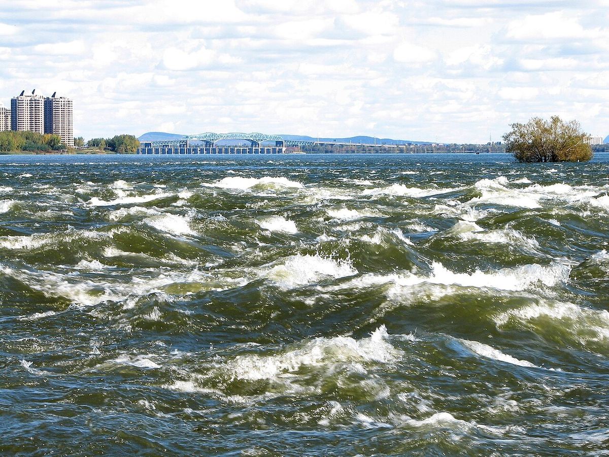
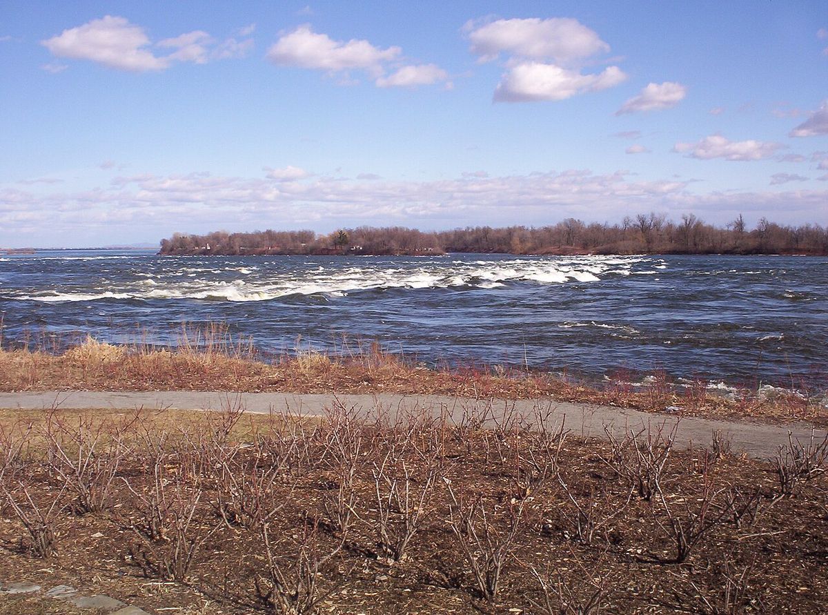
The Lachine Rapids are a significant series of rapids on the Saint Lawrence River, located between the Island of Montreal and the South Shore near the borough of LaSalle. Spanning approximately 4.8 kilometres, these rapids are renowned for their large, permanent standing waves created by the river's unique shelf-like drops. Historically, they formed a major barrier to navigation, shaping Montreal's development as a critical portage point and later as a rail and port hub. Today, the rapids are a celebrated natural landmark, offering world-class whitewater recreation and serving as the dramatic centrepiece of Parc des Rapides, a 30-hectare urban park and bird sanctuary.
Geography and Hydrology
The Lachine Rapids are situated on the Saint Lawrence River, specifically in the segment flowing between the southwestern tip of the Island of Montreal and the southern shore. Despite their name, they are located adjacent to the Montreal borough of LaSalle, not the present-day borough of Lachine. The rapids extend for roughly 4.8 kilometres and are characterized by their distinctive and powerful standing waves. These waves are a permanent feature because the immense volume and consistent current of the river interact with fixed, shelf-like drops in the riverbed. While seasonal changes in water flow from the Great Lakes affect the size and shape of the waves, they do not alter the waves' fundamental positions. This consistent hydrology creates a predictable yet formidable whitewater environment that has challenged mariners for centuries and now attracts adventure seekers. The rapids are a dominant natural force that visibly defines this stretch of the riverfront, offering a dramatic contrast to the calmer waters upstream and downstream.
Historical Significance and Exploration
The rapids have been a defining geographical feature since long before European contact, influencing Indigenous travel and trade routes. The first recorded European sighting was by French explorer Jacques Cartier in 1535, who initially believed the river might be the fabled Northwest Passage. In 1611, Samuel de Champlain named the rapids Sault Saint-Louis after a young crewman named Louis who drowned there. This name was also applied to the adjacent Lac Saint-Louis and remained in common use until the mid-19th century. The name 'Lachine' itself is derived from the French term for China, 'La Chine', a reference to early colonial dreams of a passage to Asia. On June 13, 1611, Champlain and his interpreter Étienne Brûlé became the first Europeans known to successfully travel past the rapids, with Brûlé continuing upriver to live among the Algonquin peoples.
The rapids presented a severe and lasting obstacle to waterborne transportation into the continental interior. For over two centuries, all cargo and vessels had to be unloaded and carried overland via a portage, a laborious process that cemented the location of the settlement that became Montreal. A significant historical incident occurred in July 1674 when explorer Louis Jolliet capsized his canoe in the rapids, losing the official written report of his discovery of the Mississippi River. This accident subsequently raised the standing of his fellow explorer, Father Jacques Marquette.
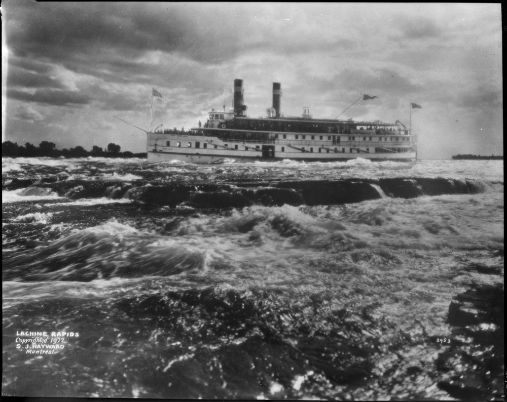
Shipbuilder John McQuaid, a native of County Armagh, Ireland who later settled in Kingston, Ontario, is credited as the first person to design a ship capable of shooting the Lachine Rapids. In the past, these rapids represented a considerable barrier to maritime traffic. Until the construction of the Lachine Canal through Montreal, the rapids had to be portaged. Even with the canal, the difficulty was such that it was usually more convenient to ship goods by rail to Montreal, where they could be loaded at the city's port. For that reason, Montreal remains a major rail hub and one of Canada's largest ports.
Parc des Rapides and Natural Environment
Parc des Rapides is a 30-hectare urban park located along the LaSalle shoreline that provides public access and panoramic views of the Lachine Rapids. Officially situated at 8180 boulevard LaSalle, the park serves a dual purpose as a recreational green space and a vital wildlife refuge. The park's landscape is designed to allow visitors to safely observe the powerful rapids from lookouts equipped with explanatory panels detailing the natural and human history of the site. Beyond the thrilling whitewater, the park is an ecological sanctuary, particularly for birdlife. It shelters over 225 species of migratory birds and hosts one of the largest colonies of great blue herons in Québec. The islands within the rapids themselves provide crucial resting and nesting grounds for these birds.
The park's management emphasizes conservation and respectful coexistence with nature. The use of drones is prohibited across the entire site to minimize disturbance to wildlife. Visitors can register for a full slate of seasonal activities that allow them to engage with the environment responsibly. The combination of dramatic hydrology and rich biodiversity makes Parc des Rapides a unique urban oasis where the raw power of the river coexists with delicate ecosystems. This setting offers a distinct opportunity for environmental education and nature interpretation within the Montreal metropolitan area. The park is also recognized as a National Historic Event site, with a commemorative plaque originally located at 7760 La Salle Boulevard in Lachine.
Recreation and Adventure Sports
The Lachine Rapids are a premier destination for adrenaline-fuelled water sports within easy reach of downtown Montreal. The consistent standing waves provide ideal conditions for several disciplines, drawing enthusiasts from across the country and internationally. Commercial whitewater rafting and jet boat expeditions offer thrilling, guided introductions to the rapids for visitors of all experience levels. For individual paddlers, whitewater kayaking has a strong and growing community here. Notably, the rapids have also become a famous site for river surfing, with a particularly popular standing wave located adjacent to the Habitat 67 complex at coordinates 45°30′00″N 73°32′31″W.
The broader riverfront facilitates a wide range of non-motorized aquatic activities. Paddling along the calmer sections of the Lachine Canal and the nearby lake is a popular pastime, supported by events like Parks Canada's free 'Lock & Paddle' event. Scheduled for Saturday, July 11, 2026, this event invites the public to paddle the canal in non-motorized craft and experience a lockage. Participants can launch from either the Peel Basin dock at 31 Mill Street or the Atwater Market area, with free parking provided at 1151 Mill Street. All paddlers and passengers must wear a personal flotation device, and the event is smoke-free and alcohol-free. Parc des Rapides itself is a key hub for outdoor recreation beyond the water. It is integrated into Montreal's extensive waterfront cycling path network, making it easily accessible by bike. Park amenities and seasonal programming support walking, cycling, picnicking, cross-country skiing, and ice skating, ensuring year-round use.
- Whitewater Rafting & Jet Boating: Guided commercial tours travel through the main rapids.
- River Surfing & Kayaking: Popular on specific standing waves, including near Habitat 67.
- Canal Paddling: Recreational kayaking and canoeing on the adjacent Lachine Canal.
- Cycling: The park is a major stop on the Montreal waterfront bike path.
- Fishing: The rapids and surrounding waters attract anglers.
- Winter Sports: Cross-country skiing and ice skating trails are maintained in the park.
- Birdwatching & Photography: Prime location due to the large heron colony and migratory species.
Lachine Waterfront Park Development 2026
Montreal is advancing a significant transformation of the Lachine waterfront with a major development plan slated for 2026. This project aims to create a new, climate-resilient public park on a long peninsula along the Lachine Canal, situated between Parc René-Lévesque and Promenade Père-Marquette at 1800 chemin des Iroquois. The city has completed the development plan and environmental impact study and is engaging with provincial and federal partners to secure authorizations. The core vision is to balance expanded public access with rigorous ecological restoration, creating wetlands and wildlife habitats to enhance biodiversity and climate resilience. The design emphasizes a pedestrian- and cyclist-friendly corridor that provides sheltered access to the river through two protected bays designed for passive recreation.
Site preparation for the Lachine waterfront park development is scheduled to begin in spring 2026. Initial work will involve the careful dismantling of aging marina infrastructure and docks, along with necessary upgrades to sewer and drinking-water systems to support new park facilities. The phased approach is intended to minimize risk to nearby ecosystems during construction. The park is explicitly not designed for swimming but will facilitate non-motorized water activities with features like a boat-launching ramp. It will be supported by amenities such as a nearby BIXI station, integrating it into the city's active transportation network. The project represents a strategic urban effort to intertwine ecological restoration with year-round community programming, creating a new model for accessible, sustainable waterfronts in Montreal. The city frames this development as a central element for river access and climate adaptation within its broader urban strategy.
Wildlife and Conservation
The ecosystem surrounding the Lachine Rapids is remarkably rich, especially considering its urban location. Parc des Rapides is officially designated as a bird sanctuary, playing a critical role in the migration routes of numerous species. The park's most famous avian residents are the great blue herons, which nest in one of the largest heron colonies found in Québec. Over 225 bird species have been recorded utilizing the park's habitats, which include riverine islands, shoreline vegetation, and sheltered inlets. These areas provide essential food, rest, and nesting sites for migratory birds traveling along the Saint Lawrence River corridor. The conservation mandate of the park ensures these species are protected from excessive human disturbance.
Conservation efforts extend beyond birdlife to encompass the entire riparian environment. The prohibition on drones and the careful design of visitor pathways help minimize the human impact on sensitive areas. The upcoming Lachine waterfront park development further demonstrates this commitment, with its core principles being environmental restoration and climate-adaptive design. Plans include creating new wetlands and planting native vegetation to reinforce the local ecosystem's health and resilience. This integrated approach to conservation ensures that the dramatic natural spectacle of the rapids exists within a functioning and protected ecosystem, preserving its ecological value for future generations alongside its recreational and historical significance. The park's role as a refuge is a key component of its identity, attracting not only recreationists but also dedicated birdwatchers, photographers, and those participating in historical and nature interpretation activities.
Access and Visitor Information
Accessing the Lachine Rapids and Parc des Rapides is straightforward due to its location within the Montreal urban area. The main park entrance is at 8180 boulevard LaSalle in the borough of LaSalle. The site is a key stop along Montreal's extensive waterfront cycling path, making it highly accessible by bicycle. For drivers, parking is available at the park, though specific details on capacity are best confirmed before a visit. Public transit options also serve the LaSalle area, connecting visitors to this natural attraction. The park is open year-round, with different activities available each season, from summer picnicking and water sports to winter cross-country skiing on groomed trails.
For those wishing to experience the water directly, several commercial operators offer whitewater rafting and jet boat tours, with bookings typically required in advance. The free Lock & Paddle event on the Lachine Canal provides a more tranquil paddling opportunity, with specific launch points at Peel Basin and Atwater Market. Visitors should note important regulations for a safe and respectful visit. All participants in on-water activities must wear a Transport Canada-approved personal flotation device. The use of drones is strictly prohibited within Parc des Rapides to protect wildlife. The new Lachine waterfront park development, when open, will provide additional access points and amenities, including a non-motorized boat launch and enhanced cycling connections, further integrating this historic landscape into the city's recreational fabric.
Questions about Lachine Rapids
Where exactly are the Lachine Rapids located?
The Lachine Rapids are on the Saint Lawrence River, between the Island of Montreal and the South Shore. They are located near the borough of LaSalle in Montreal. Despite the name, they are not adjacent to the present-day borough of Lachine, which can be confusing. The primary public access point is through Parc des Rapides at 8180 boulevard LaSalle in LaSalle.
What is the historical significance of the rapids?
The Lachine Rapids were a considerable barrier to maritime traffic. The first European to see the rapids was Jacques Cartier in 1535. In 1611, Samuel de Champlain named the rapids Sault Saint-Louis. The need to move goods around this obstacle led to Montreal becoming a major rail hub and one of Canada's largest ports. The Lachine Rapids are now passed by the South Shore Canal of the Saint Lawrence Seaway.
What is the Lock & Paddle event?
Lock & Paddle is a free annual paddling event organized by Parks Canada on the Lachine Canal. The 2026 event is scheduled for Saturday, July 11. Participants can bring non-motorized watercraft like canoes and kayaks to paddle a section of the canal and experience going through a lock. The event includes music, is family-friendly, and requires all participants to wear personal flotation devices.
Can you go whitewater rafting on the Lachine Rapids?
Yes, whitewater rafting and jet boat expeditions to the Lachine Rapids are available in Montreal. These rapids are a series of large standing waves on the Saint Lawrence River, about 4.8 kilometres in length, located between the Island of Montreal and the South Shore. The waves are formed by permanent shelf-like drops in the riverbed, and their size and shape change with seasonal water flow. Beyond rafting, the rapids are also popular for whitewater kayaking and river surfing on a specific standing wave. The city maintains Des Rapids Park, which provides a place for visitors to appreciate this natural feature.
What is Parc des Rapides known for?
Parc des Rapides is a 30 hectare urban park in LaSalle, Montreal, known for offering front row seats to the crashing white water of the Lachine Rapids. The park is a major refuge for migrating birds, sheltering over 225 species, and hosts one of the largest great blue heron colonies in Québec. Its attractions make it a popular draw for surfers, kayakers, rafters, and anglers who use the rapids. The park also serves as a key stop along Montreal's waterfront cycling path and features historical remnants from centuries of river activity. It offers quiet escapes with picnic areas, winding trails, and seasonal activities like cross country skiing.
What is the new park development planned for Lachine in 2026?
The new development is the Lachine waterfront park development 2026, a plan to transform a long peninsula along the Lachine Canal into a base for river access and climate resilience. The project centers on environmental restoration, creating wetlands and wildlife habitats, while designing a pedestrian and cyclist friendly corridor for year round urban recreation. Site preparation activities, including dismantling aging marina infrastructure and upgrading sewer systems, are planned to begin in spring 2026. The park will not be a swimming venue but will feature a boat launching ramp, encourage non motorized water activities, and balance public access with ecological safeguards. This development aligns with Montreal's broader strategy for a more accessible and climate resilient riverfront.
Sources and further reading
- Lachine Rapids (Wikipedia)
- Parc des Rapides (montreal.ca)
- Parc des Rapides | Park in Lasalle, Montreal | The Main (themain.com)
- Lachine Waterfront Park Development 2026: Montreal Plan (montrealtimes.ca)
Checked by the Your Space Hamilton desk. Last updated 2026-10-29.