Coquihalla Summit
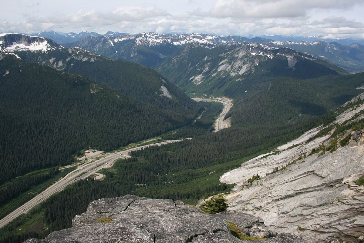
Coquihalla Summit is a major highway pass and the highest point on the Coquihalla Highway between Hope and Merritt in British Columbia. Located approximately 45 kilometres north of Hope, the summit sits at an elevation of 1,244 metres and marks the drainage divide between the Coquihalla and Coldwater rivers. The surrounding Coquihalla Summit Recreation Area, a 5,750-hectare provincial park established in 1987, protects a unique ecological transition zone between the coastal and interior regions. This area is a significant destination for travellers, hikers, and outdoor enthusiasts, offering access to historic routes, rugged alpine scenery, and a network of popular trails.
Geography and Setting
Coquihalla Summit is situated along Highway 5, the Coquihalla Highway, roughly halfway between the towns of Hope and Merritt. The summit itself is the highest point on this segment of the highway, though the Surrey Lake Summit farther north on Highway 5 is higher at 1,444 metres. The ascent to Coquihalla Summit from the south is notably steep, with a particularly sharp grade north of the Great Bear snowshed. The pass forms the hydrological divide, with waters flowing south into the Coquihalla River and north into the Coldwater River. The broader Coquihalla Summit Recreation Area encompasses forested mountain slopes stretching from Portia Peak in the southwest to the Coquihalla Lakes in the northeast, preserving a dramatic setting of granite peaks and subalpine terrain. This area is centred on the highway summit, about 45 kilometres north of Hope, and serves as a convenient rest stop and gateway to outdoor recreation for thousands of travellers annually.
History and Transportation
The Coquihalla Valley has served as a vital transportation corridor from the coast to the Interior for centuries. The name Coquihalla originates from the Halq'emeylem word Kw'ikw'iya:la, meaning 'stingy container,' which referred to a specific fishing rock on the river where, according to Stó:lō oral history, water beings would pull salmon off spears. The first major trail through the area, the Hope-Nicola Trail, was constructed in 1876. Rail transportation arrived in the early 1900s with the Kettle Valley Railway, which operated through the pass until 1961, and remnants of its grade remain visible today and form part of the Trans-Canada Trail network, including the nearby Othello Tunnels. The modern era began with the construction of the Coquihalla Highway, with the segment from Hope to Merritt opening in 1986 after being championed by local MLA Tom Waterland, who convinced the provincial cabinet of the route's necessity. A series of protected areas, including the recreation area, were established along the route that same year. The area's history as a travel route was starkly reminded in February 2014 when a Class 4 avalanche, triggered after nine days of snowfall, closed the highway 33 kilometres north of Hope for three days, requiring clearance by helicopters dropping explosives.
Coquihalla Summit Recreation Area
The Coquihalla Summit Recreation Area is a provincial park centred on the highway summit, established on September 4, 1987. Its primary purpose is to protect the distinctive Coast-Cascade dry belt that marks the transition between the wet coastal climate and the drier southern interior. The 5,750-hectare area provides recreational opportunities for highway travellers and conserves historic features like the old Kettle Valley Railway grade and the original Coquihalla Highway alignment. The recreation area is managed by BC Parks and is subject to seasonal advisories and area restrictions, such as partial wildfire closures that were in effect as of August 2026. The park's location directly off Highway 5 makes it highly accessible, roughly a two-hour drive from Vancouver and about 1.5 hours from Kamloops. The area was established with the dual goals of protecting the transition environment and providing break opportunities for travellers on the new Coquihalla Highway. A proposal exists to expand the recreation area southward to include more of the area surrounding the Coquihalla River.
Ecology and Wildlife
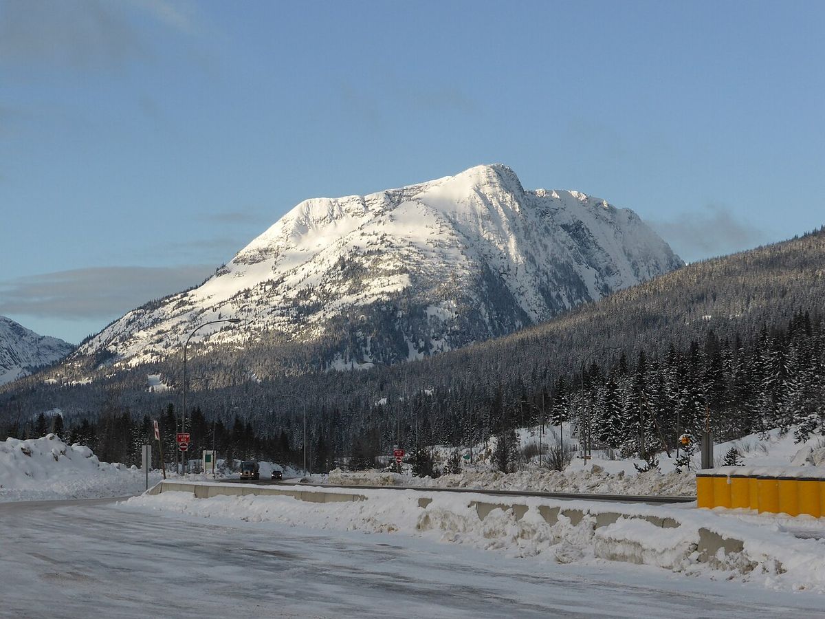
The recreation area's significance lies in its ecological transition zone, which contains four distinct biogeoclimatic zones. This convergence results in a high diversity of plant and animal life, blending coastal and interior species. The setting features impressive granite peaks, subalpine forests, and wildflower meadows during the summer months. This variety supports a wide range of wildlife, and visitors are advised to review wildlife safety guidelines, as backcountry areas are not considered suitable for pets due to potential conflicts with bears and other animals. BC Parks acknowledges the area's deep Indigenous history and connection, noting that the official park information is part of an ongoing process to better reflect Indigenous teachings and traditions related to the land. The protected area helps conserve the habitat for many species within this unique dry-belt alpine environment that exists between two major climatic regions of the province.
Recreation and Trails
The Coquihalla Summit Recreation Area is a premier destination for hiking, with trails suitable for various skill levels. Popular activities include day hiking, scrambling, backcountry camping, fishing, snowshoeing, and backcountry skiing. The area is known for its challenging climbs and panoramic ridge walks. Key trailheads are accessed from highway pullouts like the Zopkios and Britton Creek rest areas, though some require travel on gravel forestry roads. Visitors must be self-sufficient as services are limited, with only occasional food trucks at rest areas during summer weekends, and the nearest full services are in Hope. The following list highlights some of the most notable hiking routes in the area, which are highly rated by the hiking community.
- Falls Lake Trail: An easy 1.5-kilometre trail leading to a scenic alpine lake framed by Nak Peak, suitable for families and winter snowshoeing, with fishing for small rainbow trout.
- Zoa Peak: A steady 7-kilometre forest climb leading to a broad, open alpine ridge popular with hikers and winter recreationists, offering views of Thar and Nak peaks.
- Needle Peak and Flatiron: A classic 11-kilometre scramble route rising to 2,095 metres, offering light technical sections and the option for overnight camping at Pretty Lake.
- Illal Creek: A route featuring wildflower meadows and access to summits like Coquihalla Mountain and Jim Kelly, ideal for backcountry camping over a long weekend.
- Ottomite Mountain Trail: A ridge traverse covering Zupjok, Llama, and Alpaca peaks, with Alpaca being the highest at 2,083 metres and offering panoramic views.
- Zupjok Peak: The first and steepest climb on the Ottomite route, gaining 430 metres over 2 kilometres, with views of Zopkios and Yak peaks.
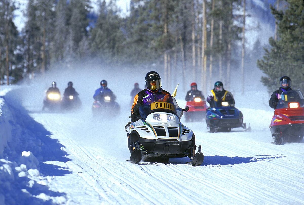
Other permitted activities include horseback riding on existing gravel roads and pipeline rights-of-way, hunting during open seasons with proper licences, and the use of electric-assist bicycles on designated trails as per BC Parks guidelines. Winter camping is allowed, though no facilities are provided and conditions can be extreme. All visitors are urged to practice Leave No Trace principles and be prepared for rapidly changing mountain weather. The area is also used by the Coquihalla Summit Snowmobile Club, and occasional highway delays for club events can occur, such as those scheduled for October 2026.
Visitor Information and Regulations
Access to the Coquihalla Summit Recreation Area is free, with parking available at various trailheads along Highway 5. Cell phone service is unreliable, so downloading maps and GPX tracks in advance is essential. Pets are permitted but must be leashed at all times and are not allowed in beach areas or buildings, and owners must dispose of their waste. For anglers, Falls Lake offers fishing for rainbow trout in its 25.6-hectare surface area with an average depth of 10 metres, but a valid British Columbia freshwater fishing licence is required. Hunters must comply with all provincial regulations and seasons, and the discharge of firearms is permitted for hunting within the park during open seasons. Campfires are not permitted within the recreation area, and visitors must use portable stoves for cooking. Avalanche terrain is present, and those venturing into the backcountry in winter must be equipped with and knowledgeable in using avalanche safety gear. As of 2026, trail closures can occur, such as for the Falls Lake and Zoa Peak trails, so checking current BC Parks advisories before visiting is crucial. Travellers can monitor road conditions via highway cameras, such as the one at the Boston Bar Creek Rest Area on the north side of the summit, which provides updates on air and road temperatures.
Selected Trail Statistics
The Coquihalla Summit Recreation Area offers a surprising diversity of trails for visitors. These trails range from mellow lakeside strolls to adrenaline-pumping scrambles and peaceful alpine meadows perfect for backcountry camping. The area's routes are highly rated by the hiking community. Trail options are available to suit every style of adventurer, from beginners to those looking for a technical day out. For example, the Falls Lake Trail is an easy 1.5-kilometre walk suitable for beginners or kids. In contrast, trails like Yak Peak involve aggressive climbs, light scrambling sections, and some exposure, catering to more experienced hikers.
These trails offer experiences from a gentle lakeside walk to demanding full-day ridge traverses. The area's high elevation and exposure mean weather conditions can deteriorate quickly, so proper preparation with clothing, navigation, and emergency supplies is mandatory for all outings. The trails are mostly on accessible paths but often require sure-footedness and, for the harder routes, alpine experience. The community rating for routes in the area is very high, with an average score of 5.0 stars from numerous reviews.
Access and Nearby Amenities
Driving from Vancouver to the central Zopkios Rest Area access point takes about two hours and covers roughly 190 kilometres. From Kamloops, the drive is approximately 1.5 hours south on Highway 5. Parking varies by trailhead, with some like Yak and Zoa starting directly at highway pullouts, while others require a short drive on logging roads, such as the road to the Falls Lake trailhead which is located about one kilometre west of the highway turn-off. There are no stores, gas stations, or lodging within the recreation area itself. The only amenities are the highway rest areas, which sometimes have food trucks on summer weekends. For supplies, accommodation, and meals, the town of Hope is the primary service centre, with recommendations including the Blue Moose Café for coffee and sandwiches and Home Restaurant for a hearty post-hike meal. The area is a wild and undeveloped region, emphasizing the need for visitors to bring all necessary food, water, and equipment for their trip, and to have a full contingency plan in case of emergencies.
Questions about Coquihalla Summit
Where is Coquihalla Summit located?
Coquihalla Summit is located on the Coquihalla Highway (Highway 5) in British Columbia, approximately 45 kilometres north of Hope and 65 kilometres south of Merritt. It is the highest point on the highway between those two cities, sitting at an elevation of 1,244 metres. The surrounding Coquihalla Summit Recreation Area is centred on the pass and is directly accessible from the highway. The summit is just south of the former toll booth plaza and acts as the divide between the Coquihalla River and Coldwater River watersheds.
What is there to do at Coquihalla Summit Recreation Area?
The recreation area offers a wide range of outdoor activities, primarily focused on hiking and mountain recreation. Visitors can enjoy trails ranging from easy walks to Falls Lake to challenging scrambles up peaks like Yak and Needle. Other popular activities include backcountry camping, fishing at Falls Lake for rainbow trout, snowshoeing, backcountry skiing, wildlife viewing, and exploring historic sites like the old Kettle Valley Railway grade. It is also a common stop for highway travellers to take in the scenic views from rest areas, and activities like horseback riding and hunting are permitted in designated areas with appropriate licences.
Do I need a pass or permit to visit?
No park pass or entry fee is required to visit the Coquihalla Summit Recreation Area. However, specific activities within the park do require licences. A valid British Columbia freshwater fishing licence is needed to fish in Falls Lake. Similarly, hunting during open seasons requires all applicable provincial hunting licences. All visitors must comply with BC Parks regulations, including leash laws for pets and a ban on campfires. Electric-assist bicycles are permitted on signed trails provided they meet BC Parks criteria.
What are the camping options?
Camping in the recreation area is backcountry and primitive, with no developed facilities or services. Winter camping is permitted, but visitors must be prepared for severe conditions and use fuel stoves only. Traditional camping spots exist near Falls Lake, which has two tent pads. For longer trips, backcountry camping is common in areas like the Illal Creek meadows or near Pretty Lake below Needle Peak. All camping is first-come, first-served, and strict Leave No Trace practices must be followed. There are no designated campgrounds with amenities, and the area is not suitable for RVs or car camping.
Is the area safe for winter visits?
Winter visits require significant preparation and caution. The area receives heavy snowfall and contains considerable avalanche terrain. Anyone venturing into the backcountry for skiing, snowshoeing, or hiking must be equipped with avalanche safety gear, including a transceiver, probe, and shovel, and have the training to use it. Coastal winter weather can change rapidly, reducing visibility and travel conditions. Always check the current avalanche forecast and BC Parks advisories before any winter trip, as trail closures can occur. The Coquihalla Highway itself can be hazardous in winter, with closures possible due to weather or avalanche control work.
What is the historical significance of the area?
The Coquihalla Valley has been a major transportation corridor for millennia, with deep Indigenous connections. The name Coquihalla originates from a Halq'emeylem word referring to a specific fishing site. The Hope-Nicola Trail was built in 1876, followed by the Kettle Valley Railway in the early 1900s, which operated until 1961, and its remnants are still visible. The modern Coquihalla Highway opened in 1986 after advocacy by MLA Tom Waterland. The recreation area, established in 1987, protects remnants of these historic routes and the unique ecological transition zone they pass through, conserving a chapter of British Columbia's transportation history.
Sources and further reading
- Coquihalla Summit (Wikipedia)
- Coquihalla Summit Recreation Area (bcparks.ca)
- My Favourite Hikes in the Coquihalla Summit Recreation ... (peakplanningcreative.com)
- Coquihalla Summit Recreation Area (tourismhcc.ca)
- Best hiking trails in Coquihalla Summit Recreation Area (komoot.com)
Checked by the Your Space Hamilton desk. Last updated 2026-10-29.