Archipelago of Saint-Pierre Lake
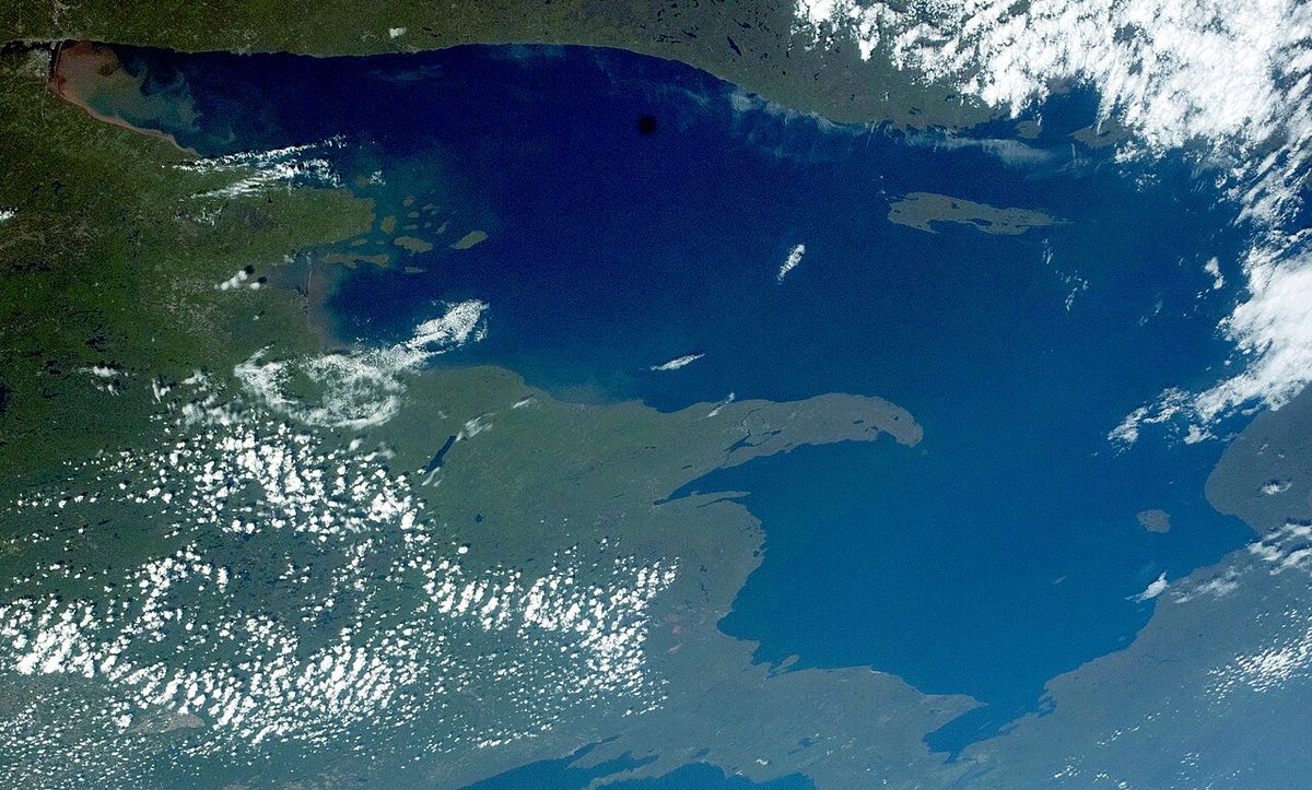
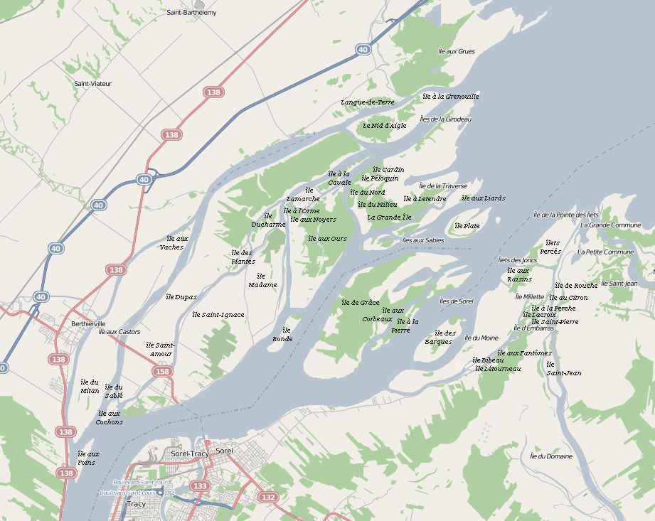
The Archipelago of Lake Saint Pierre is a vast freshwater delta and the largest island group in the St. Lawrence River, located in the western expanse of Lake Saint Pierre in Quebec. Comprising 103 islands, the archipelago is divided into two main groups: the Islands of Berthier to the north and the islands of Sorel to the south. This ecologically rich region is a UNESCO-recognized wetland of international importance, serving as a critical migratory stopover for waterfowl and supporting distinctive ecosystems. The area also sustains human communities, with a mix of agriculture, historical settlements, and recreational activities woven into its floodplain environment.
Geography and Geology
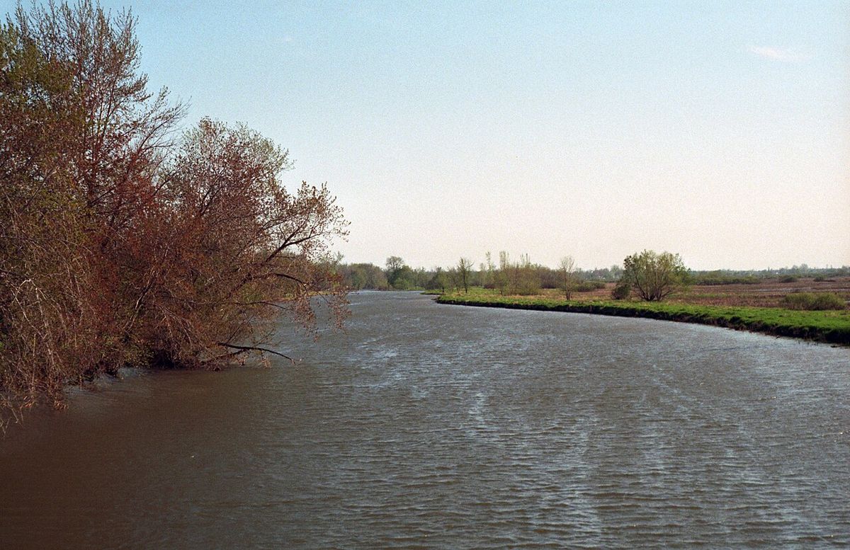
The Archipelago of Lake Saint Pierre is a geological product of the last ice age, formed as a delta following the retreat of the ice cap and subsequently shaped by the alluvium of the St. Lawrence River. Approximately 12,000 years ago, the region was submerged by the Champlain Sea, which deposited layers of clayey marine sediments as it gradually withdrew. The visible parts of the islands today consist of recent alluvial deposits, primarily silt, which reach a maximum height of 7 to 8 metres above the river level. This deposition process continues annually during the spring floods when the river overflows its banks, covering portions of the islands and leaving behind a fresh layer of nutrient-rich silt. Although these floods can cause temporary travel disruptions and damage, they are fundamentally beneficial to the agricultural productivity of the region, replenishing the soil. The flat, low-lying nature of the islands, with an average elevation of just 3 to 5 metres above sea level, makes them inherently susceptible to this annual inundation, which has shaped both the physical and human geography of the area for millennia.
Topography and Hydrology
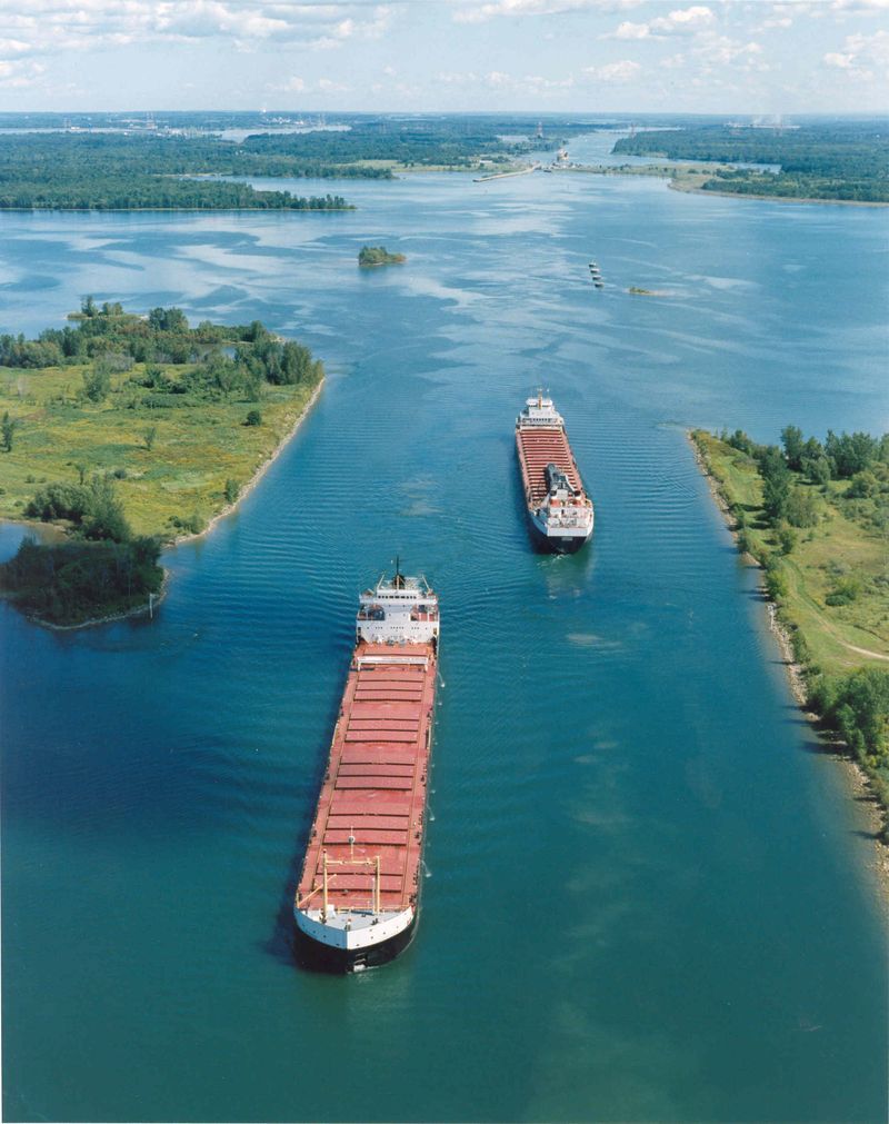
The topography of the archipelago is characterized by an exceptionally flat relief, with most islands sitting only 3 to 5 metres above sea level, making them susceptible to widespread flooding each spring. The St. Lawrence River widens significantly at the entrance to Lake Saint Pierre, forming this expansive delta of hundreds of islands and islets crisscrossed by numerous channels. The hydrography of the area is defined by 14 tributaries that drain a vast basin of 46,075 square kilometres, with a monthly average flow of 777 cubic metres per second. A striking hydrological disproportion exists between the north and south shores. The south shore, with only four rivers, contributes a massive drainage area of 42,250 square kilometres and a flow of 712 cubic metres per second. In contrast, the north shore, with ten rivers, drains a much smaller area of 3,825 square kilometres and contributes a flow of just 65.2 cubic metres per second. This disparity highlights the dominant influence of southern watersheds on the lake's hydrology. The main navigable channel through the lake is the St. Lawrence Seaway, a dredged passage 11.3 metres deep and 245 metres wide that allows heavy commercial vessels to traverse the otherwise shallow lake, which has an average depth of only three metres.
Ecology and Wildlife
The Archipelago of Lake Saint Pierre is ecologically paramount, containing wetland ecosystems recognized under the Ramsar Convention and forming the core of the Lac Saint-Pierre Biosphere Reserve designated by UNESCO in 2000. It is the most important migratory stopover for waterfowl in eastern Canada and hosts North America's largest heronry, a stronghold for the great blue heron. The area's biodiversity is rich, with surveys estimating over 500 plant species, about 50 of which have legal protection in Quebec and Canada. Recorded fauna include 290 bird species, 90 fish species, 61 invertebrate taxa, 40 mammals, 16 amphibians, and 12 reptiles. This concentration of life is supported by the productive floodplain ecosystems, though the area also faces challenges from at least eight identified invasive alien species. The lake and its archipelago provide a crucial refuge within a region where much of the surrounding territory shows significant human use, making the preservation of these wetlands essential for regional biodiversity. Ongoing scientific research, including work from the Université du Québec à Trois-Rivières using vessels like the Lampsilis, continues to document and assess these complex ecosystems to inform conservation strategies.
Human History and Settlement
Human history on the islands dates back to First Nations who inhabited and frequented the archipelago, living off the local fauna, as noted by Jacques Cartier in September 1535 and Samuel de Champlain on 29 June 1603. European settlement began with the foundation of a wooden fort in August 1642 to repel Iroquois attacks on Trois-Rivières, though it was burned by the Iroquois in 1647 and rebuilt in 1665 by the company of Captain Pierre de Saurel. The first permanent settlers were demobilized soldiers from the Carignan-Salières Regiment who arrived in 1672, establishing the tradition of communal grazing on the islands. Agriculture took root on the floodplains, and by 1710 the population of the local manor was 112 people, concentrated on islands like Castors, Dupas, Saint-Ignace, and Isle Madame. In the late 1920s, stone dams were built upstream to raise water levels in the shipping channel south of the archipelago. The area also holds cultural significance as the setting for Germaine Guèvremont's novels The Outlander (1945) and Marie-Didace (1947). Guèvremont lived for nearly 30 years on Îlette Pé near the Chenal du Moyne, and her house later became the Museum of Scripture. Many summer cottages on pilings were erected along the Chenal aux Corbeaux between Crow and Lapierre Islands, a area described in Guèvremont's work.
Islands and Communities
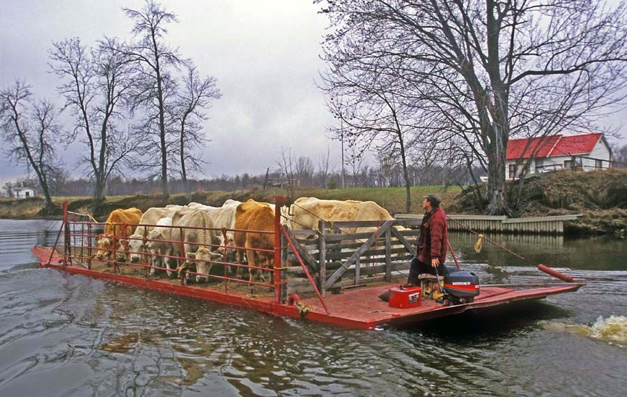
The archipelago's 103 islands host twenty-two coastal villages, with a population of approximately 2600 recorded in 2011. Islands such as Dupas and Saint-Ignace-de-Loyola are partially urbanized, while the majority of others are dedicated to agriculture and grazing. A network of small, often unpaved roads services the riparian environment, with the islands of Saint-Ignace-de-Loyola, Dupas, and Castors connected to the north shore of the St. Lawrence by bridges. The primary connection across the river is a ferry service between Sorel and Saint-Ignace Island, the largest in the archipelago. Most other islands are accessible only by boat. The inhabited islands include notable examples from a partial list of the 103, such as île aux Castors, île Dupas, île Saint-Ignace, île Madame, île aux Corbeaux, île à la Pierre, and the smallest inhabited island, île d'Embarras. The south side of the river is home to Île d'Embarras, noted as the smallest of the inhabited islands. The channels between these islands, such as Chenal Landroche, have required dredging to manage sediments deposited during spring floods and maintain navigation for local and recreational traffic.
- île aux Castors (Beaver Island)
- île Dupas
- île Saint-Ignace
- île Madame
- île aux Corbeaux (Crow Island)
- île à la Pierre (Lapierre Island)
- île d'Embarras (Embarrassment Island) - the smallest inhabited island
- île de Grâce
- île aux Foins
- île du Mitan
- île Saint-Jean
- île aux Cochons
Economic Activities and Management
Key economic sectors in the Archipelago of Lake Saint Pierre region include agriculture, hunting, fishing, tourism, recreation, industry, and services. The area presents a complex management challenge due to the interplay of commercial shipping, extensive agriculture, and significant ecological values within proximity to major urban centres like Sorel-Tracy and Trois-Rivières. Commercial navigation relies entirely on the St. Lawrence Seaway, a dredged channel 11.3 metres deep and 245 metres wide that cuts through the centre of the lake to accommodate heavy vessels. Research and monitoring are active, led by institutions like the Université du Québec à Trois-Rivières, which operates the research vessel Lampsilis. Over 250 scientific papers, theses, and government reports have focused on Lake Saint-Pierre in the past decade, informing management decisions such as the yellow perch fishing moratorium instituted in 2012 due to low stock levels, which was extended for a further five years in 2017. A persistent historical challenge is the presence of unexploded ordnance in the lake sediments south of the seaway, a legacy from its use as a Department of National Defence firing range until 2000, requiring ongoing specialist cleanup efforts to prevent accidents. This hazard makes that section of the lake unsafe for navigation outside the marked channel, directly impacting recreational and commercial use of the waterway.
Climate and Environment
The archipelago experiences a northern continental climate, slightly cooler but sunnier than the Montreal area. The frost-free period is long, which favours cereal crop production across the agricultural islands. Winters are not excessively severe, with manageable rainfall and cold. The environment is dynamically shaped by the annual spring floods, which, while temporarily disruptive, deposit vital alluvium that sustains the fertile soils. The combination of this climate, the fertile floodplains, and the extensive wetlands creates a unique and productive environment that supports both biodiversity and human livelihood. The region's climate and hydrology have directly influenced settlement patterns, with communities historically concentrating on slightly higher ground on islands like Castors and Dupas to mitigate flood impacts while still benefiting from the rich agricultural land.
Recreation and Tourism
The wide expanse of Lake Saint-Pierre and its archipelago is a popular destination for a range of nautical activities, with generally strong winds favouring sailing. The area attracts visitors for its beaches, charming cabins, and opportunities for boating, fishing, and wildlife observation. The M.S. Jacques-Cartier offers cruises on the lake and St. Lawrence River departing from the Port of Trois-Rivières, a city founded in 1634. Landmarks include the Port Saint-François lighthouse, a 14.6-metre octagonal white structure with a red roof built in 1907, which stands on the western side of the wharf. While the lake is a hub for recreation, navigation is restricted in certain areas due to shallow waters and the historical presence of unexploded ordnance, with access between Pierreville and Nicolet limited to the dredged Chenal Landroche. The lake's role shifted from a commercial port to a holiday destination after an immense ice jam in the spring of 1865 caused water to rise six metres and severely damaged the port facilities at Port Saint-François, following earlier competition from railroads established in 1845.
Conservation and Research
The conservation of the Archipelago of Lake Saint Pierre is guided by its status as a UNESCO Biosphere Reserve, aiming to balance ecosystem protection with sustainable human use. A priority is completing a comprehensive assessment of the reserve's ecosystems, with surveys already covering several highly productive areas. Information on ecosystems is currently concentrated on the lakeshore, which supports much of the region's biodiversity and has attracted most research attention. Provincial and federal governments are actively involved in research and monitoring, helping to translate scientific findings into regulations and guidance. Expert committees have been established in recent years to strengthen collaboration among Quebec universities and focus on specific issues concerning Lake Saint-Pierre. This substantial body of work is essential for monitoring ecosystem health and guiding decisions on both conservation and economic development. The management of species like the yellow perch, under a moratorium since 2012, exemplifies how research directly informs resource management to prevent overexploitation and aid stock recovery in this vital aquatic habitat.
Questions about Archipelago of Saint-Pierre Lake
Where is the Archipelago of Lake Saint Pierre located?
The archipelago is situated in the western part of Lake Saint Pierre, which is itself a broad, shallow expansion of the St. Lawrence River in Quebec. It lies between Lavaltrie and Trois-Rivières on the north shore and between Sorel-Tracy and Deschaillons-sur-Saint-Laurent on the south shore. This location places it within the Lac Saint-Pierre Biosphere Reserve, approximately halfway between Montreal and Quebec City. The lake is a fluvial expansion of the St. Lawrence formed as the Champlain Sea retreated at the end of the last ice age.
Why is the Archipelago of Lake Saint Pierre ecologically important?
The archipelago is of immense ecological importance as it contains the largest freshwater wetland in Quebec and is a UNESCO-designated biosphere reserve core area. It serves as the most significant migratory stopover for waterfowl in eastern Canada and hosts North America's largest great blue heron colony. Its diverse ecosystems support over 500 plant species, 290 bird species, 90 fish species, and hundreds of other animals, making it a biodiversity hotspot within the St. Lawrence River system. The wetlands are also recognized under the international Ramsar Convention.
Can you visit the islands, and how do you get there?
Yes, many of the islands can be visited, though access varies. The islands of Saint-Ignace-de-Loyola, Dupas, and Castors are connected to the north shore by a network of bridges. A ferry service operates between Sorel on the south shore and Saint-Ignace Island, the largest island. Most other islands are accessible only by private boat. The area is popular for recreational boating, sailing, and cruising, with tours available from ports like Trois-Rivières. Visitors should be aware of navigation restrictions in areas with shallow water or historical unexploded ordnance.
Do people live on the islands?
Yes, the archipelago is home to a permanent population. As of the 2011 census, approximately 2600 people were living across twenty-two coastal villages on the islands. Islands like Dupas and Saint-Ignace-de-Loyola are partially urbanized, while many other islands have agricultural communities and seasonal residences. The smallest inhabited island is Île d'Embarras (Embarrassment Island). The population has historical roots dating to demobilized soldiers who settled in 1672, establishing traditions of grazing and agriculture.
What are the main environmental challenges facing the archipelago?
Key challenges include managing the balance between intensive agriculture, commercial shipping, and ecological conservation within a biosphere reserve framework. Spring floods, while beneficial for soil fertility, can cause property damage and travel issues. The lake also faces issues related to invasive species and historical pollution, such as unexploded ordnance from past military testing which requires ongoing cleanup. Scientific research guides actions like the yellow perch fishing moratorium to address overfishing, demonstrating the ongoing need for science-based management of this complex ecosystem.
What is the connection between the archipelago and literature?
The archipelago, specifically the Sorel Islands, is the setting for Germaine Guèvremont's novels The Outlander and Marie-Didace. This direct link to Quebec literature is rooted in the author's personal experience, as she lived for nearly 30 years on Îlette Pé near the Chenal du Moyne. Her house later became the Museum of Scripture. The novels' characters are associated with the Sorel Islands, and the physical landscape is featured in the stories. For instance, many summer cottages on pilings were erected along the Chenal aux Corbeaux between the Crows and Lapierre Islands, a corner of the country described in Guèvremont's work. This integration of setting and narrative makes the archipelago a significant cultural landmark in Canadian literature.
Sources and further reading
- Archipelago of Saint-Pierre Lake (Wikipedia)
- Lac Saint-Pierre, Man and the Biosphere Programme (MAB) (unesco.org)
- Navigation on Lake Saint-Pierre (humainaucoeurdulacst-pierre.com)
Checked by the Your Space Hamilton desk. Last updated 2026-10-30.