Tofino
Tofino is a district municipality located on the west coast of Vancouver Island in British Columbia. Situated at the western terminus of Highway 4 on the Esowista Peninsula, it lies within the traditional territory of the Tla-o-qui-aht First Nations in Clayoquot Sound. Originally a resource community sustained by fishing and logging, Tofino gained international prominence in the late 20th century as the epicentre of large-scale environmental protests against old-growth logging. Today, it is a renowned year-round tourism destination, celebrated for its surfing, storm watching, and proximity to Pacific Rim National Park Reserve, with tourism forming the dominant sector of its modern economy.
Geography and Setting
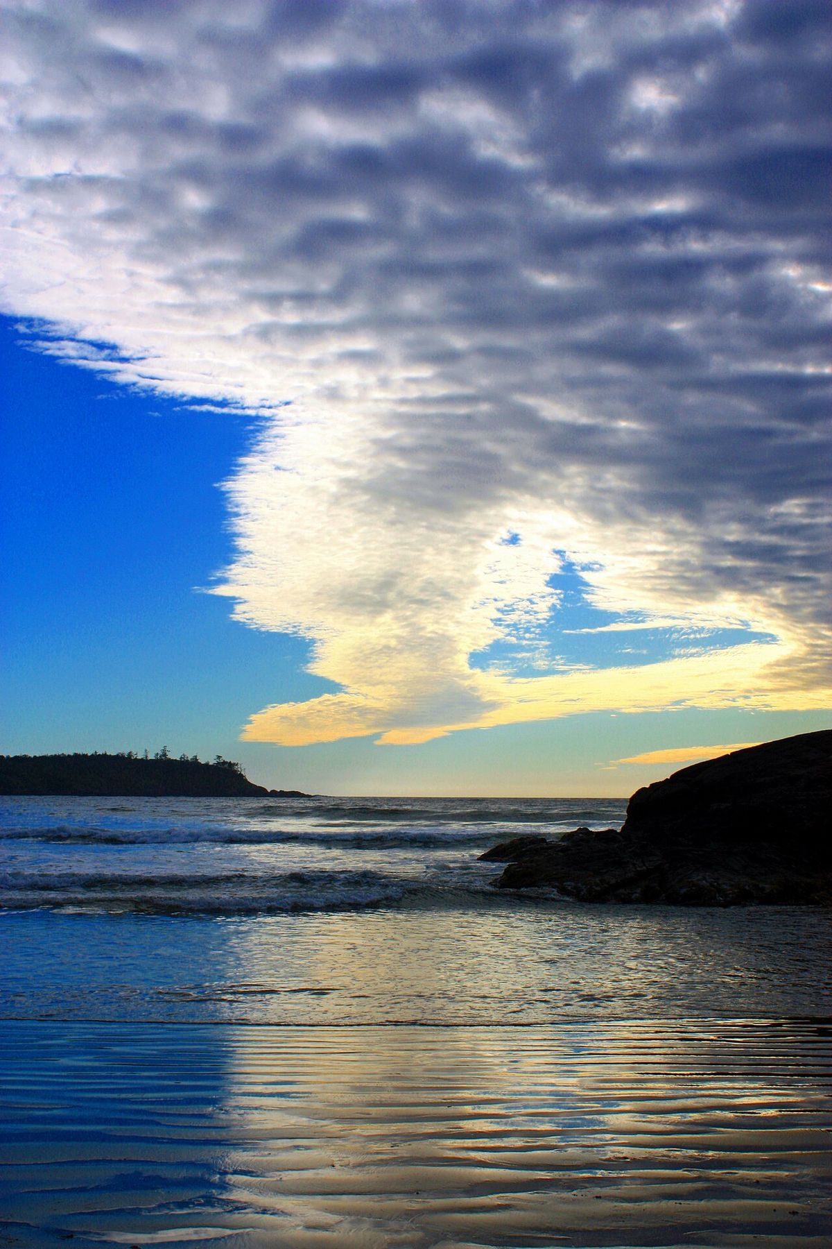
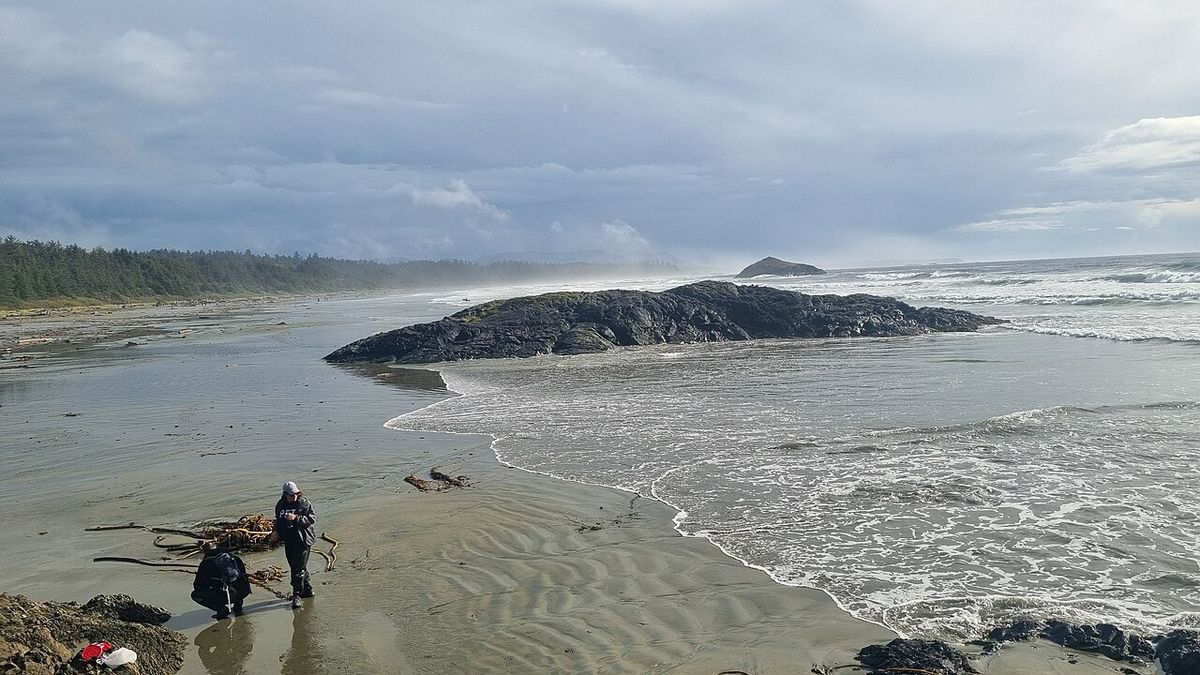
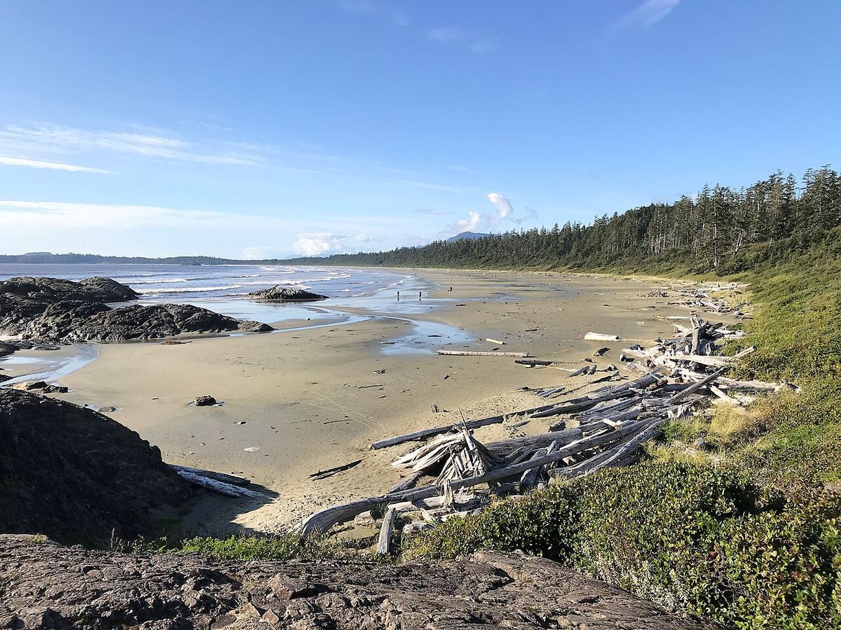
Tofino occupies the tip of the Esowista Peninsula at the southern edge of Clayoquot Sound on Vancouver Island's rugged west coast. The district is surrounded by the waters of the Pacific Ocean, with the principal Tla-o-qui-aht village of Opitsaht located directly across the harbour on Meares Island. Tofino's landscape is defined by temperate rainforests, long sandy beaches, and rocky headlands. The community serves as the gateway to Pacific Rim National Park Reserve, with the park's famed Long Beach located just to the south. To the north, accessible by boat or floatplane, is Maquinna Marine Provincial Park, known for its natural hot springs and located about 45 kilometres north of Tofino. The area's climate is characterized by mild, wet winters and cool, drier summers, heavily influenced by its maritime position, which also makes it a prime location for watching winter storms on the water.
Early History and Indigenous Settlement
The Tla-o-qui-aht First Nations, one of the Nuu-chah-nulth peoples, have inhabited Clayoquot Sound for thousands of years, with archaeological evidence of occupation dating back some 4,200 years. Their principal village, Opitsaht, is believed to have been continuously inhabited for at least 2,000 years. The Tla-o-qui-aht formed through the amalgamation of smaller groups originally based around Kennedy Lake, and their territory came to encompass Tofino Inlet, the Esowista Peninsula, and Meares Island. The name Esowista is derived from a Tla-o-qui-aht war of conquest against the Esowistaht people and translates as "clubbed to death." British trader John Meares reported visiting Chief Wickaninnish at Echachis in Clayoquot Sound in 1788 and seeing some 800 people gathered in a single longhouse, indicating the scale and social organization of Indigenous settlements prior to European contact.
European contact began with Spanish explorer Juan Josef Pérez Hernández in 1774, followed by British captain James Cook's arrival at Nootka Island in 1778, which initiated a trade in sea otter pelts between the Nuu-chah-nulth and visiting European and American vessels. In 1792, Spanish explorers Galiano and Valdés named the nearby Tofino Inlet after Admiral Vicente Tofiño de San Miguel y Wandewalle, under whom Galiano had learned cartography. The first permanent non-Indigenous settlement was established by British colonial agent William Banfield, who set up a trading post on Stubbs Island, also known as Clayoquot, in 1854. Further settlers of English, Scottish, and Norwegian descent arrived on the Esowista Peninsula from the 1890s onward.
Establishment of the Town and Japanese Canadian Community
Surveyor T.S. Gore mapped the Esowista Peninsula in 1895, assigning the lot numbers still used today. Settler John Grice, who had pre-empted land at the tip of the peninsula in 1893, had his property surveyed and subdivided for a future townsite in 1900, initially naming it "Clayoquot" after the older settlement across the harbour. To avoid confusion between the two "Clayoquots," the name "Tofino" gradually came into use. Father Charles Moser, the Roman Catholic missionary at Opitsaht, is recorded as the first to use the name in his diary in 1904. A general store, telegraph office, and one-room school were established in the early 1900s, and the settlement's first church, St. Columba Anglican, was built by volunteers in 1913. A government dock was completed in 1908, along with a lifeboat station that remained a community fixture for decades, and the Tofino Post Office opened in 1909, formally cementing the town's name.
Tofino was incorporated as a municipality in 1932. From 1917 onward, Japanese Canadian fishermen, many originally from Steveston on the Fraser River, began fishing off the west coast of Vancouver Island in growing numbers. A residency requirement imposed by the federal Department of Fisheries in 1923 led around ninety Japanese Canadian fishermen and their families to settle permanently in the Tofino area, including clusters of homes on Stubbs Island, in Storm Bay, and on land near what is now known as the Eik Tree. By the 1930s, the Japanese Canadian community in Tofino numbered close to one hundred people, more than a third of the town's population, and was closely integrated into local social and economic life.
Second World War and Post-War Development
Following Japan's attack on Pearl Harbor in December 1941, the federal government seized all fishing vessels owned by Japanese Canadians on the coast and, in January 1942, declared all persons of Japanese descent to be enemy aliens. On March 15, 1942, ninety-five Japanese Canadian residents of Tofino and Clayoquot were evacuated from the government wharf aboard the coastal steamer Princess Maquinna. During the war, the Royal Canadian Air Force constructed an air base, RCAF Station Tofino, near Long Beach, which operated from 1942 until 1944 and hosted more than 2,000 service personnel. No Japanese Canadians returned to live in Tofino after the war. In January 1947, the village's municipal council passed a resolution intended to exclude "orientals" from owning property or residing in the municipality, although no such bylaw was ever formally enacted. In 2019, Tofino's mayor issued a formal apology on behalf of the community for the town's treatment of Japanese Canadians during the war.
In the early 1950s, as part of the Cold War-era Pinetree Line early-warning network, a radar station operated on what is now known as Radar Hill from 1954 until its closure in 1958. Until 1959, Tofino remained accessible only by air, water, or a rough logging road with locked gates. A gravel road connecting Tofino and Ucluelet to Port Alberni opened to public traffic on August 22, 1959, remained gated to daytime logging use until 1964, and was fully paved by 1972. The new road transformed the local economy, allowing fish and freight to be trucked to outside markets and drawing growing numbers of visitors to Long Beach. It also gave rise to a local surfing culture from the mid-1960s onward.
Counterculture and Creation of Pacific Rim National Park
During the late 1960s and early 1970s, Tofino and nearby Wreck (Florencia) Bay became a centre of Canada's counterculture. Beginning in 1968 and 1969, hippies, artists, Vietnam War draft dodgers, veterans, and other young travellers established a seasonal community of driftwood shelters and tents, drawn by the area's isolation and natural beauty. At its peak, as many as 500 people spent summers there. The influx generated mixed reactions among local residents, with some accepting the newcomers and helping them sell their artwork and crafts, while others viewed their unconventional appearance and lifestyle as harmful to the area's reputation and tourism industry. The area's growing popularity coincided with mounting concerns about overcrowding and environmental degradation along Long Beach, strengthening calls for greater protection of the coastline.
The creation of Pacific Rim National Park Reserve gained momentum during this period, with federal and provincial governments reaching an agreement in 1970 after years of lobbying. That same year, Prime Minister Pierre Trudeau visited Long Beach by helicopter to inspect the proposed park and famously tried surfing in the Pacific Ocean. After successfully standing on his surfboard during his first attempt, Trudeau joked with a long-haired young man who asked when marijuana would be legalized, replying, "You mean you need grass to get high on in this magnificent area?". Pacific Rim National Park was officially opened on May 4, 1971, by Princess Anne. Between 1970 and 1975, homes, resorts, and other structures within the new park's boundaries, including the informal settlement at Wreck Bay, were expropriated and removed.
The establishment of the park did not reduce pressures on Long Beach. Improved access, growing publicity, and the paving of Highway 4 in 1972 led to a dramatic increase in visitor numbers. By Easter 1973, thousands of campers were occupying Long Beach and nearby beaches, while the May long weekend brought an estimated 10,000 visitors, widespread disorder, vehicle burnings, and RCMP intervention, prompting Parks officials to conclude that unrestricted beach use was no longer sustainable. Despite strong local opposition and concerns that tourism would suffer, the park prohibited beach camping and vehicle access in 1975. Rather than reducing tourism, the restrictions shifted development outside the park boundaries, fuelling rapid growth in accommodation and visitor services around Tofino.
The Clayoquot Sound Protests
Tofino became the focus of major environmental protests over old-growth logging in Clayoquot Sound beginning in 1984, when the Tla-o-qui-aht First Nation declared Meares Island a Tribal Park to prevent the forestry company MacMillan Bloedel from logging it. The provincial government had granted MacMillan Bloedel permission in November 1983 to log 90% of Meares Island, and negotiations through the government-established Meares Island Planning Committee, formed in 1980, failed to produce a compromise before the company withdrew from talks. At a Meares Island Easter Festival held in Tofino on April 21, 1984, attended by some 600 people, Tla-o-qui-aht chief councillor Moses Martin declared the island a Tribal Park, and the carving Weeping Cedar Woman, by Godfrey Stephens, became a symbol of the campaign. A standoff at Heelboom Bay on Meares Island on November 21, 1984, in which a flotilla of boats and shoreline protesters blocked a MacMillan Bloedel crew boat from landing loggers, was followed by a court injunction, granted by the BC Court of Appeal in March 1985, that halted logging on the island pending resolution of Indigenous title claims brought by the Tla-o-qui-aht and Ahousaht First Nations. The dispute had lasting economic effects on Tofino, including the relocation of MacMillan Bloedel's local office and a bank branch to Ucluelet and an estimated 20% drop in local house prices.
Further confrontations followed elsewhere in Clayoquot Sound. In 1988, protesters blockaded logging-road construction by Fletcher Challenge at Sulphur Passage, near Shelter Inlet, resulting in the arrest of thirty-five people, including Ahousaht hereditary chief Earl Maquinna George. Several protesters, among them Betty Krawczyk and Judith Robinson, served jail time at Oakalla Prison for defying court injunctions. In April 1991, protesters set fire to the Kennedy River Bridge to block access to a MacMillan Bloedel logging area, an act that idled over 200 loggers and was followed by the sinking of a company barge in Tofino Harbour. International Forest Products (Interfor) began operating in the Sound later that year, adopting smaller cutblocks and helicopter logging in an effort to reduce its environmental impact and avoid the publicity directed at MacMillan Bloedel. Through the early 1990s, environmental organizations including Greenpeace and the Sierra Club ran an international publicity campaign against BC logging practices, coining the term "Brazil of the North" for Clayoquot Sound and prompting European boycotts of forest products from the region.
Protests intensified through the following decade, culminating in the summer of 1993, after Premier Mike Harcourt's government announced the Clayoquot Sound Land Use Decision on April 13, 1993, permitting logging on 62% of the Sound. Thousands of demonstrators gathered at a peace camp, coordinated by Tzeporah Berman, near a former clear-cut close to Kennedy Lake, to blockade logging trucks at the Kennedy River Bridge each morning. By September of that year, 932 people had been arrested, then the largest mass arrest in Canadian history, with 309 people arrested in a single day on August 9, 1993. Supporters of the protest, including the Australian rock band Midnight Oil and American environmental lawyer Robert F. Kennedy Jr, drew additional media attention to the campaign, while the logging-industry-backed group Share BC organized counter-rallies in Ucluelet and later at the provincial legislature in Victoria. Most of those arrested were tried in mass proceedings before the BC Supreme Court, held in the theatre of the Royal BC Museum in Victoria beginning in August 1993, on charges of criminal contempt for violating logging-company injunctions.
- Scientific Panel: A nineteen-member scientific panel, established in October 1993 and chaired by Fred Bunnell, released recommendations in May 1995 calling for variable-retention forestry to replace clear-cutting in the Sound.
- Interim Agreement: In March 1994, the provincial government signed an Interim Measures Agreement giving First Nations a role, including an effective veto, in land-use decisions for Clayoquot Sound pending treaty negotiations.
- Economic Shift: By 1997 logging levels in the Sound had fallen to roughly a tenth of their 1991 volume.
- Joint Venture: The protests contributed to new provincial forest-practices standards and to the 1999 creation of Iisaak Forest Resources, a joint venture between MacMillan Bloedel and Nuu-chah-nulth interests.
- Biosphere Reserve: Clayoquot Sound was designated a UNESCO Biosphere Reserve in May 2000.
Modern Tourism Economy and Infrastructure
Tourism has become the dominant sector of Tofino's economy since the 1990s, supplanting fishing and logging as the town's principal industries. Parks Canada estimated that some 769,308 visitors entered the Tofino area in 1993 alone, and by the mid-1990s an estimated 80% to 90% of local floatplane charter business catered to tourists rather than the resource industries. The municipality received Resort Municipality status from the provincial government in 2008. A wave of higher-end accommodation established the area as a destination for upscale wilderness tourism, beginning with the Middle Beach Lodge, opened on MacKenzie Beach in 1993, and the Wickaninnish Inn, which opened on Chesterman Beach in 1996 after a contested municipal rezoning process.
| Year | Lodge | Location |
|---|---|---|
| 1993 | Middle Beach Lodge | MacKenzie Beach |
| 1996 | Wickaninnish Inn | Chesterman Beach |
| 2000 | Clayoquot Wilderness Lodge | Mouth of the Bedwell River |
| 2002 | Long Beach Lodge | Cox Bay |
Rapid growth in visitor numbers has periodically strained local infrastructure. Voters rejected a proposed $3.8-million upgrade to the town's water system in a June 2004 referendum. In August 2006 a severe drought forced mayor John Fraser to declare a total water-use ban, requiring hotels and restaurants to close over the Labour Day long weekend before an emergency plan to truck in water from Ucluelet allowed businesses to reopen under continued restrictions. Subsequent federal, provincial, and municipal investment added new reservoirs and a treatment plant to the water system, including a 22.5-million-litre capacity reservoir on Meares Island. Tofino has continued to discharge untreated sewage into the ocean.
Local development has periodically provoked opposition in Tofino. In 2002, plans to remove a pair of large old-growth red cedars, including the "Eik Tree," for a condominium development led to the formation of the Tofino Natural Heritage Society. This opposition included a twenty-eight-day tree-sit protest. Following this, the surviving tree was fitted with a metal support girdle anchored into bedrock for its preservation. In a separate proposal that same year to build condominiums near Tonquin Park, residents formed the Tonquin Nature Reserve Committee. This committee successfully purchased the land to prevent its development.
Demographics and Cultural Significance
Tofino's permanent population is approximately 2,516 residents, but its summer population swells to many times its winter size. The town attracts surfers, hikers, nature lovers, bird watchers, campers, whale watchers, fishermen, and a number of chefs and culinary professionals, which has resulted in a burgeoning choice of restaurants and specialty shops. Despite its small population, the town's culinary scene is notable, and in the winter, many people visit Tofino and the West Coast to watch storms on the water. The community's identity is a blend of Indigenous history, settler resilience, countercultural influence, and contemporary environmental stewardship. The legacy of the Clayoquot Sound protests remains a defining part of the town's narrative, emphasizing conservation and sustainable practices. The presence of the Tla-o-qui-aht First Nations, with their enduring cultural traditions and ongoing legal and political advocacy, is a constant in the area's character through ongoing treaty negotiations and co-management of resources. This unique fusion of elements makes Tofino not just a picturesque destination but a community with a distinct and complex relationship to its land and history.
Questions about Tofino
What is Tofino known for?
Tofino is best known as a year-round tourism destination on Vancouver Island's west coast. It is famous for surfing, storm watching in the winter months, and whale watching. The town serves as the gateway to Pacific Rim National Park Reserve and its Long Beach. Tofino also gained international recognition in the 1980s and 1990s as the centre of major environmental protests against old-growth logging in Clayoquot Sound, which is now a UNESCO Biosphere Reserve.
How do you get to Tofino?
Tofino is accessible by road, air, and sea. The primary route is Highway 4, which runs from Port Alberni to the west coast, providing the only road connection to the rest of Vancouver Island. The Tofino-Long Beach Airport offers regional flights. Historically, before the highway opened in 1959, access was only by boat, floatplane, or a gated logging road. Many visitors also arrive via ferry from the BC mainland to Vancouver Island before driving the scenic but winding highway.
What is the history of the Japanese Canadian community in Tofino?
A significant Japanese Canadian community formed in Tofino beginning around 1917, as fishermen and their families settled permanently, especially after a 1923 federal fisheries residency requirement. By the 1930s, nearly one hundred Japanese Canadians lived in the area, comprising over a third of the town's population. During the Second World War, following Japan's attack on Pearl Harbor, the federal government forcibly evacuated all ninety-five Japanese Canadian residents from Tofino on March 15, 1942. None returned to live there after the war, and the town later issued a formal apology in 2019 for its treatment of the community.
What were the Clayoquot Sound protests?
The Clayoquot Sound protests were a series of major environmental demonstrations centred near Tofino from 1984 through the 1990s. They opposed extensive old-growth logging in Clayoquot Sound. Key events included the Tla-o-qui-aht declaration of Meares Island as a Tribal Park in 1984, mass blockades at logging sites, and international campaigns. The conflict led to new forestry standards, greater First Nations involvement in land-use decisions, and the designation of Clayoquot Sound as a UNESCO Biosphere Reserve in 2000.
When did Tofino become a tourist destination?
While Tofino had always attracted some visitors, its modern identity as a major tourist destination began to take shape after Highway 4 opened to the public in 1959, improving access. The creation of Pacific Rim National Park Reserve in 1971 drew more people to the area. The transition accelerated in the 1990s following the logging protests, as tourism supplanted fishing and logging as the dominant industry. The opening of high-end lodges like the Wickaninnish Inn in 1996 helped establish Tofino as a destination for upscale wilderness tourism, a status formalized when it received Resort Municipality designation in 2008.
What is Tofino's connection to Pacific Rim National Park?
Tofino is the primary gateway community to the Long Beach unit of Pacific Rim National Park Reserve. The park, established in 1971, encompasses Long Beach, the Broken Group Islands, and the West Coast Trail. The park's creation was influenced by the area's growing popularity and concerns about environmental degradation. While the park prohibited beach camping and vehicle access in 1975 to manage overcrowding, it continues to be a major draw for visitors to Tofino, who come for hiking, beachcombing, and experiencing the temperate rainforest and dramatic coastline.
Sources and further reading
- Tofino (Wikipedia)
- District of Tofino: Home (tofino.ca)
- Tofino Accommodation & Activities | The Official Tourism ... (tourismtofino.com)
- Tofino, Guide for Newbies (awalkandalark.com)
- What to Do in Tofino, Canada's Coziest Coastal Town (sunset.com)
Checked by the Your Space Hamilton desk. Last updated 2026-11-01.