Scarborough, Ontario
Scarborough is a large administrative district and former city located in the eastern part of Toronto, Ontario. With a 2021 census population of 623,610, it is bordered by Victoria Park Avenue to the west, Steeles Avenue and Markham to the north, the Rouge River and Pickering to the east, and Lake Ontario to the south. Its history spans from Indigenous settlements dating back many centuries and European settlement in the 1790s to rapid post-war suburban growth. Incorporated as a township in 1850, it became part of Metropolitan Toronto in 1953, was reconstituted as a borough in 1967, became a city in 1983, and was amalgamated into the City of Toronto in 1998. Today, Scarborough is characterized by major commercial centres like Scarborough Town Centre, natural landmarks such as the Scarborough Bluffs and Rouge Park, and ongoing urban development that continues to shape its future.
History and Municipal Evolution
The area now known as Scarborough has a long history of human habitation, with archaeological evidence of a nomadic camp dating back to 8000 BCE. In the 17th century, the Seneca village of Ganatsekwyagon was located here, followed by Mississauga settlements before European colonization. British settlement began in earnest in the 1790s after the land was surveyed, with the first land patents issued in 1796 to stonemasons David and Andrew Thomson, whose mills established the Thomson Settlement. The district was incorporated as a township in 1850, with local government initially led by an elected reeve and council. A significant shift occurred in 1953 when Scarborough was included within the new regional government of Metropolitan Toronto, which managed services like major roads and transit while the township retained its local council.
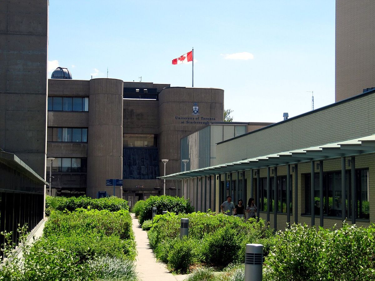
Scarborough's growth accelerated in the post-war era, leading to its incorporation as a borough in 1967, with Albert Campbell becoming its first mayor. The borough's status was changed to a city in 1983, reflecting its expanding population and urban character. Throughout the latter half of the 20th century, much of Scarborough's rural land was converted into suburban housing developments. This period of expansion concluded in 1998 when Scarborough, along with East York, Etobicoke, North York, York, and the old city of Toronto, was amalgamated into the single-tier City of Toronto. The former Scarborough Civic Centre now houses offices of the Toronto municipal government.
Geography and Natural Features
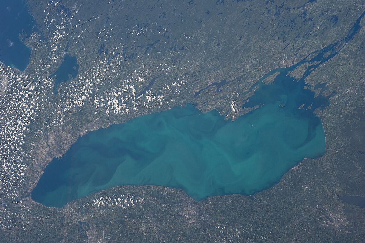
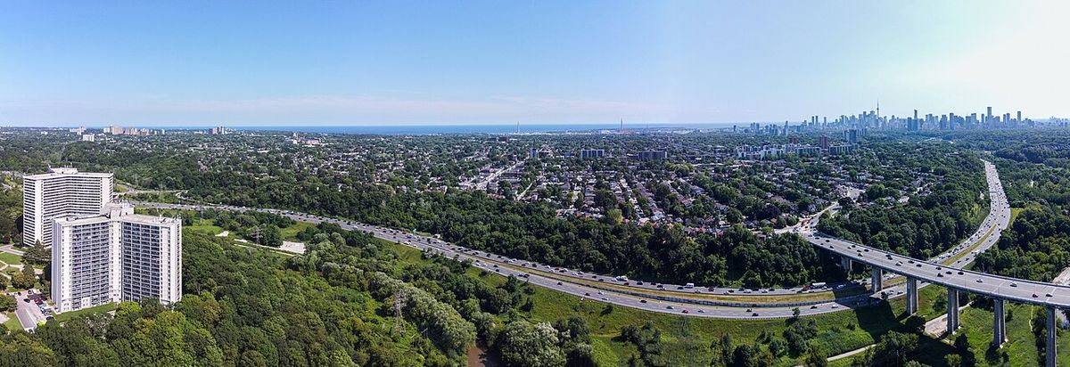
Scarborough occupies a large area in eastern Toronto, bounded by Victoria Park Avenue to the west, Steeles Avenue to the north, the Rouge River and Pickering to the east, and Lake Ontario to the south. The district's topography is defined by two major watersheds. Highland Creek drains approximately 70 percent of Scarborough's area, flowing through the western half of the district, while the Rouge River flows through the eastern portion. Both rivers empty into Lake Ontario, though their deltas are constricted by railway corridors. The Highland Creek watershed is highly urbanized, with about 85 percent of its land devoted to urban uses, though sections of its deep ravines remain as parkland. In contrast, parts of the Rouge River valley are preserved in a natural, wooded state as part of Rouge National Urban Park, providing habitat for wildlife including deer, foxes, and coyotes.
The district's most famous natural landmark is the Scarborough Bluffs, a 14-kilometre long earthen escarpment along the Lake Ontario shore that reaches heights over 60 metres. These bluffs are a remnant of the prehistoric Glacial Lake Iroquois shoreline. Erosion has been a persistent issue, leading to property abandonment and stabilization efforts using limestone breakwaters and infill since the 1980s. The northeast corner of Scarborough retains a rural character with some of Toronto's last remaining farms, contributing to the district's reputation as a greener part of the city. The climate is a humid continental type, with conditions moderated by proximity to Lake Ontario, though areas farther inland experience slightly colder winters and less summer cooling.
Demographics and Cultural Diversity
Scarborough is one of Canada's most multicultural communities, a character shaped by decades of immigration. According to the 2021 census, visible minorities comprised 76.8 percent of the district's population, a figure that has grown from 73.9 percent in 2016. A majority of residents are immigrants or their descendants, with 56.6 percent of the population being foreign-born as of 2016. This diversity is reflected in active commercial strips along arteries like Kingston Road, Eglinton Avenue East, and Lawrence Avenue East, which feature a wide array of Caribbean, Chinese, African, and Indian restaurants and shops. The Agincourt neighbourhood is notably known for its concentration of Chinese businesses, while Scarborough is also home to one of the largest populations of Sri Lankan Tamils outside of Sri Lanka.
The age distribution in Scarborough shows a significant working-age population, with 52 percent of residents between 25 and 64 years old as of the last major survey. Younger residents aged 14 or younger made up 21 percent of the population, while seniors aged 65 and over constituted 12 percent. Like the broader Canadian population, Scarborough is aging, with projections indicating nearly 30 percent of residents will be seniors by 2041. The district has a large number of retirement communities, which alongside family-oriented neighbourhoods contributes to a demographic profile where the two largest groups are projected to be over 55 and under 25. The 2021 census recorded a population of 629,941 living in private dwellings within the census districts of the former city, with a population density of 3,356.1 people per square kilometre.
Economy and Major Developments
Scarborough's economy features a strong manufacturing sector and is home to the corporate headquarters of numerous national and international companies. Compared to the City of Toronto as a whole, Scarborough has a higher concentration of manufacturing jobs and a lower proportion of professional, scientific, and technical services. Major employers and head offices located in the district include Toyota Canada, Bell Media, Teva Canada, Mastermind Toys, Aviva, Telus, and the pizza chains 241 Pizza and Pizza Nova. Amazon opened a new fulfillment centre in north Scarborough in 2020. The Scarborough City Centre area around Scarborough Town Centre has developed into a significant secondary business district for Toronto, featuring high-density office towers, government offices, and the retail hub of the shopping mall.
Urban development continues to be a major force in shaping Scarborough's landscape. In July 2026, Toronto City Council approved a series of major development projects in Scarborough, accounting for 7,316 new residential units. These approvals included mixed-use communities, purpose-built rental housing, and new long-term-care facilities. Notable projects approved at that time include the eight-building complex at 1911 to 1921 Eglinton Avenue East, which will deliver 2,243 condominium units, and the multi-phase Woodside Square redevelopment at McCowan Road and Finch Avenue East, set to add 2,339 condominiums and 216 seniors' residence units. Other significant approvals were for a 510-unit rental building on Victoria Park Avenue, a 661-unit condominium project at Lawrence Avenue East and Markham Road, and a 512-bed Extendicare long-term care home on Guildwood Parkway.
- 1911 to 1921 Eglinton Avenue East: 2,243 condominium units in buildings up to 48 storeys.
- Woodside Square Redevelopment: 2,339 condominiums and 216 seniors' units.
- 507-513 Victoria Park Avenue: 510 market-rate rental units.
- 3585 Lawrence Avenue East: 661 condominium units in 34- and 35-storey towers.
- Extendicare Guildwood LTC: A 9-storey facility with 512 long-term-care beds.
- Toronto Tamil Community Centre: A 2-storey, 4,578m² community facility at 251 Staines Road.
Governance and Community Representation
As a district within the City of Toronto, Scarborough is represented at the municipal level through the Scarborough Community Council and six city wards. The Scarborough Community Council, composed of the councillors representing those wards, considers local planning and administrative matters. Its public meetings, such as those scheduled for September 9 and October 7, 2026, are held in a hybrid format at the Scarborough Civic Centre Council Chambers and via Webex. Local planning applications are also reviewed by the Committee of Adjustment for the Scarborough district, which holds public hearings to consider minor variances and consents. The district is divided into six wards, each represented by a city councillor who also sits on the Scarborough Community Council and the main Toronto City Council.
The six wards covering Scarborough are Ward 20 (Scarborough Southwest), Ward 21 (Scarborough Centre), Ward 22 (Scarborough-Agincourt), Ward 23 (Scarborough North), Ward 24 (Scarborough-Guildwood), and Ward 25 (Scarborough-Rouge Park). Ward-specific issues often reflect local concerns, such as transit infrastructure and community safety. For example, in Ward 23 (Scarborough North), which had 94,025 residents according to the 2021 census, a key concern has been the lack of transit, with the proposed Scarborough East Rapid Transit (SERT) project identified as a top unfunded priority. In April 2026, Council allocated $10 million to advance the SERT project and requested additional funding from other levels of government. Community safety, including concerns about auto theft and break-ins, has also been prominent in local campaigns leading into the 2026 municipal election.
Culture, Media, and Notable Residents
Scarborough has a distinct cultural identity that has influenced Canadian arts and media. The district has been home to a number of notable comedians, actors, and musicians who often reference their upbringing in the area. Comedian and actor Mike Myers, who grew up in Scarborough, satirized local cable access shows in his film Wayne's World. Other famous residents have included comedian John Candy, actor Jim Carrey during his teen years, actor Eric McCormack, and comedian and YouTube personality Lilly Singh. The musical group Barenaked Ladies originated in Scarborough, as did singer Abel Tesfaye, known professionally as the Weeknd. The area has also produced prominent hip hop artists and producers, contributing to its reputation as a cultural incubator.
Local news media in Scarborough has historically been served by community publications. The Scarborough Mirror, founded in 1962, was for many years the primary English-language local newspaper before becoming an online-only publication in 2023. Other past publications included The Enterprise, the Scarborough Mail, and The News. The Chinese-language Ming Pao Daily News has its headquarters in the district. In broadcast media, the studios at 9 Channel Nine Court at McCowan Road and Highway 401 have been a significant production centre since 1961, originally housing CTV Toronto (CFTO) and later becoming the headquarters for The Sports Network (TSN). Cable service was introduced by Trillium Cable in 1970, which was later acquired by Shaw Cable and then Rogers Cable.
Crime and Public Safety
Long-term crime statistics indicate that Scarborough has historically been less prone to violent crime than the rest of Toronto. Between 1997 and 2006, the proportion of violent crime committed in Scarborough averaged 20.4 percent, while the district's average share of the city's population over that period was 23.6 percent. Murder rates in Scarborough showed no consistent divergence from the rest of the city during that decade, with Scarborough's share of Toronto's murders ranging from a low of 8.8 percent to a high of 32.2 percent. In 2008, former Toronto Police Chief Bill Blair stated that 42 Division, which covers north Scarborough, was the safest division in the city. Data from that year indicated the safest part of Toronto was north Scarborough from Victoria Park Avenue to the Pickering border, north of Highway 401.
In 2008, Scarborough's portrayal in media crime reporting became a point of contention for local representatives. City Councillors Norm Kelly and Michael Thompson argued that news outlets were distorting public perception by reporting shootings in other parts of the city by the nearest major intersection, while often attributing incidents in Scarborough broadly to 'Scarborough'. They contended this practice created an erroneous impression of the district as crime-ridden and proposed a media protocol to standardize location reporting to intersections. Toronto's executive committee, including Mayor David Miller, declined the request, stating it was not council's role to dictate how media performs its job. This debate highlighted ongoing concerns about community image and the social impact of crime reporting.
Questions about Scarborough, Ontario
Is Scarborough a city or part of Toronto?
Scarborough is an administrative district and a former city that is now part of Toronto. It was incorporated as a township in 1850, became a borough in 1967, and was declared a city in 1983. In 1998, it was amalgamated with five other municipalities and the old city of Toronto to form the current single-tier City of Toronto. Today, it is governed as part of Toronto but retains a distinct local identity and is represented by its own community council and city wards.
What is Scarborough known for?
Scarborough is renowned for its exceptional cultural diversity, with a majority of residents being immigrants or their descendants. It is known for natural landmarks like the Scarborough Bluffs and Rouge National Urban Park, and for major attractions including the Toronto Zoo. The district is also a significant commercial hub with Scarborough Town Centre and corporate headquarters for companies like Toyota Canada. Culturally, it has been the birthplace or home to many notable Canadian entertainers, including Mike Myers, John Candy, and the Weeknd.
What are the main neighbourhoods or areas in Scarborough?
Scarborough contains many distinct neighbourhoods, often centred around major intersections and historical villages. Key areas include Scarborough City Centre, a major business and retail district around Scarborough Town Centre. Agincourt is known for its active Chinese-Canadian community and businesses. Other notable neighbourhoods are Guildwood, near the scenic bluffs. Woburn in the central area. And the more rural Morningside Heights in the northeast. The district is officially divided into six municipal wards: Scarborough Southwest, Scarborough Centre, Scarborough-Agincourt, Scarborough North, Scarborough-Guildwood, and Scarborough-Rouge Park.
How diverse is Scarborough's population?
Scarborough is one of the most diverse communities in Canada. According to the 2021 census, 76.8 percent of its population identified as a member of a visible minority group. Over half of all residents (56.6 percent as of 2016) are foreign-born. The district is home to large communities of people with Chinese, South Asian (including one of the world's largest Sri Lankan Tamil diasporas), Caribbean, and African heritage. This diversity is visibly reflected in the multitude of ethnic restaurants, shops, and places of worship found along its main commercial streets.
What is the Scarborough Bluffs?
The Scarborough Bluffs are a prominent geological formation and natural landmark along the Lake Ontario shoreline in Scarborough. They are a 14-kilometre long earthen escarpment that reaches heights of over 60 metres in places. The bluffs were formed from sediments deposited by glacial lakes thousands of years ago and were named by Elizabeth Simcoe in 1793 for their resemblance to cliffs in Scarborough, England. Erosion has been a persistent issue, requiring stabilization efforts. The bluffs offer scenic views and are a popular destination for hiking and photography, contributing significantly to the district's green space.
What major development is happening in Scarborough?
In July 2026, Toronto City Council approved ten major development sites in Scarborough. These approvals are part of a wave of urban intensification focused on creating denser, mixed-use communities. The projects span various types, including rental housing and long-term-care facilities, and are concentrated in areas like the Scarborough City Centre and along transit corridors such as the Highway 401 corridor and the northern end of the Scarborough RT. This development continues a historical pattern of growth, converting previously rural or suburban areas into higher-density residential and commercial spaces to meet housing needs in Toronto.
Sources: Wikipedia and current public reporting, checked by the Your Space Hamilton desk. Last updated 2026-10-24.