Mount Meager massif
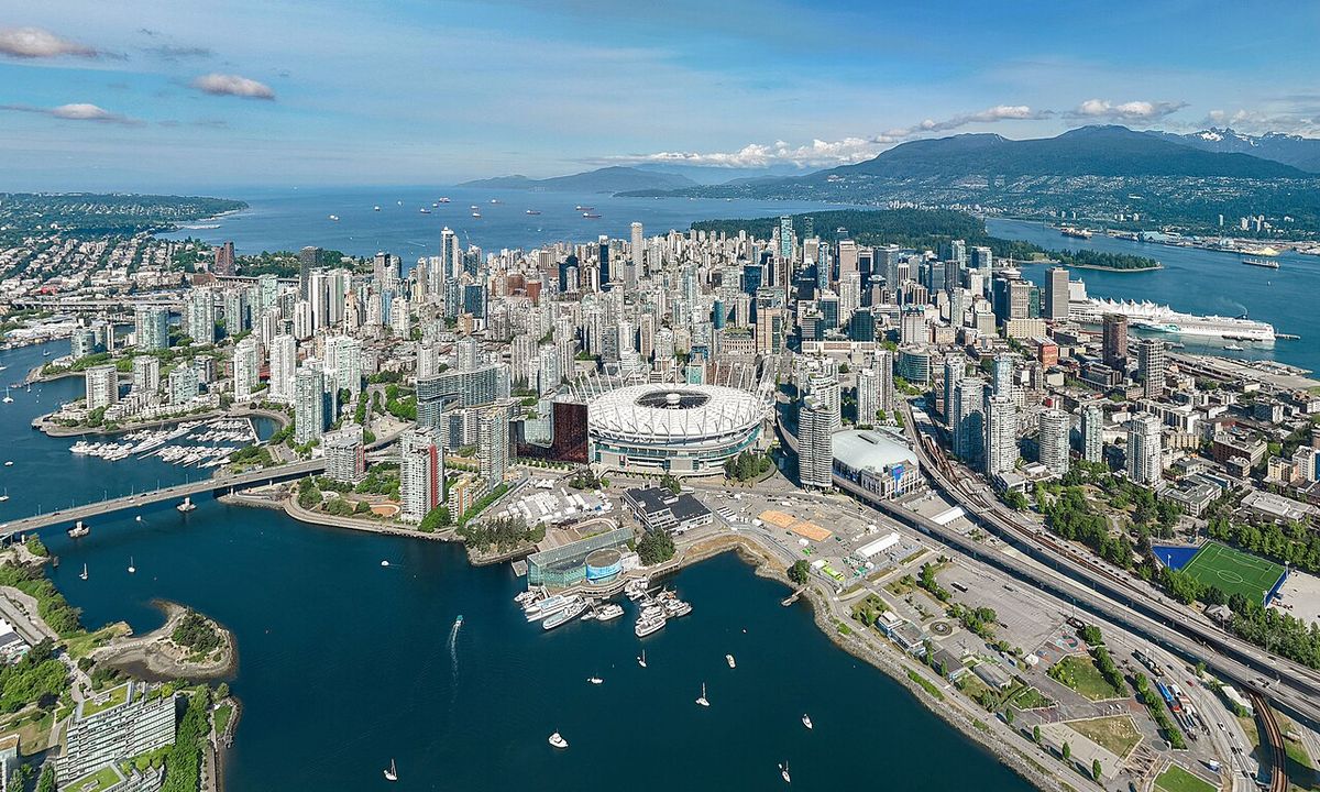
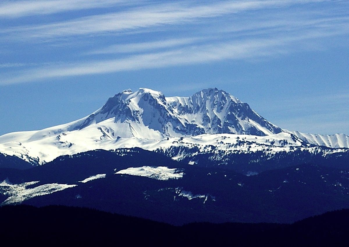
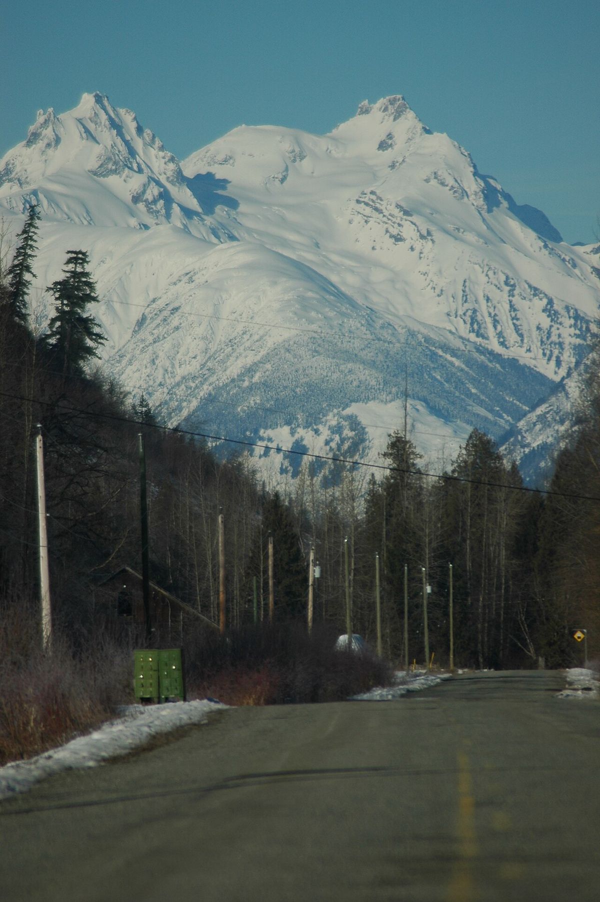
The Mount Meager massif, also known as Q'welq'welústen, is a group of volcanic peaks in the Pacific Ranges of British Columbia's Coast Mountains and the northernmost major volcanic centre of the Cascade Volcanic Arc. Located approximately 150 kilometres north of Vancouver at the head of the Lillooet River, the massif is a complex of at least six major summits, the highest being Plinth Peak at 2,680 metres. It is one of Canada's most significant volcanic hazards, having produced the country's largest volcanic eruption in the last 10,000 years about 2,400 years ago and experiencing frequent large landslides, including a record-breaking event in 2010. The mountain is classified as a 'very high threat' volcano due to its active geology, instability, and proximity to populated areas in the Sea to Sky corridor, prompting the installation of Canada's first continuous real-time volcano monitoring station in spring 2026.
Geography and setting
The Mount Meager massif is situated within the rugged Coast Mountains of southwestern British Columbia, approximately 60 kilometres northwest of the village of Pemberton. The massif lies at the northern terminus of the Pemberton Valley and the headwaters of the Lillooet River, within the Lillooet Land District. The region's geography is heavily influenced by its proximity to the Pacific Ocean, which generates extreme precipitation on the western slopes of the mountains, feeding lush old-growth forests and extensive wetland habitats. These forests are home to diverse wildlife including grizzly bears, black bears, wolves, wolverines, moose, and mountain goats. The massif itself is deeply dissected by glaciers and streams, with its upper slopes perpetually covered in snow and ice, creating a dramatic and unstable landscape.
Six main summits constitute the volcanic complex, each representing eroded volcanic edifices. Plinth Peak is the highest at 2,680 metres, followed closely by Mount Meager at 2,650 metres. Capricorn Mountain rises to 2,570 metres west of Mount Meager, with Mount Job at 2,493 metres just west of Capricorn. Pylon Peak, south of Capricorn and Mount Meager, stands at 2,481 metres, while Devastator Peak is the lowest and southernmost summit at 2,315 metres. The area's natural beauty contrasts with its geological hazards, making it a focal point for both recreation and scientific study. The valleys contain plants of the cottonwood-willow-thimbleberry association and glaucous willowherbs, and the region is also used for activities like heli-skiing.
Geological context and structure
The massif is a key component of the Garibaldi Volcanic Belt (GVB), the northern segment of the Cascade Volcanic Arc that stretches from northern California to British Columbia. Volcanism here is driven by the subduction of the Juan de Fuca Plate beneath the North American Plate at the Cascadia subduction zone, a 1,094-kilometre-long fault capable of generating massive earthquakes like the magnitude 9.0 event in 1700. The plates converge at a rate of 3 to 4 centimetres per year, and the interface between them locks for roughly 500 years before releasing stored energy. Its total volume is estimated at 20 cubic kilometres, and it consists of at least four overlapping stratovolcanoes that have become younger from south to north.
The volcano is composed of a wide range of volcanic rocks, from rhyodacite to basalt, erupted from at least eight distinct volcanic vents. The geomorphology resembles that of Glacier Peak in Washington State. The massif's structure includes lava domes, volcanic plugs, and piles of lava flows, with the highest peaks formed by eroded plugs of rhyodacite. Deep glacial erosion has exposed numerous feeder dikes and volcanic structures. A notable feature was Perkin's Pillar, a vertical tower of brecciated lava that was an erosional remnant until its collapse in June 2005. The complex geology provides a unique opportunity to study the relationships between subsurface magma chambers and surface lava expressions. The rock types include rhyolites, dacites, andesites and basaltic andesites typical of subduction zone volcanism.
Eruptive history and volcanic hazards
Four primary eruptive periods have been identified, with large northwest-southeast trending structures possibly controlling magma ascent. The fourth and most recent period began 150,000 years ago and continued until less than 3,000 years ago. It formed the Plinth, Job, Capricorn, and Mosaic assemblages through eruptions of rhyodacite lava flows, domes, and breccias. The climactic event of this period was the explosive eruption about 2,400 years ago from the Bridge River Vent on the northeastern flank of Plinth Peak at an elevation of 1,524 metres. This was a Volcanic Explosivity Index (VEI) 4 event, ejecting about 0.8 cubic kilometres of material, creating a plume 15 kilometres high, and depositing the Bridge River Ash. The texture of the ash changed from coarse blocks of pumice 10 centimetres in diameter near the vent to pellets of 0.7 millimetres farther east. The eruption produced pyroclastic flows, lahars, and lava flows, and created a 110-metre-high dam across the Lillooet River which failed catastrophically within months.
Key hazards associated with the massif include landslides and potential volcanic eruptions. The Mount Meager massif has been the source of several large landslides in the past. It produced the largest volcanic eruption in Canada in the last 10,000 years. Although the massif has not erupted for more than 2,000 years, it could produce a major eruption. Any volcanic hazard ranging from landslides to eruptions could pose a significant risk to humans and wildlife.
- Explosive volcanic eruptions capable of producing pyroclastic flows, ashfall, and lahars.
- Catastrophic landslides and debris flows from the mountain's unstable slopes, like the 53 million cubic metre event in 2010.
- The formation and sudden failure of temporary volcanic dams, leading to catastrophic flooding.
- Emissions of toxic gases, such as hydrogen sulfide and carbon dioxide, from fumaroles on the mountain.
- Ground deformation and slope movement detected by satellite at rates of centimetres per month.
- The potential for a landslide up to ten times larger than the 2010 event if slopes near active fumaroles collapse.
The 2010 landslide from the Capricorn peak is the largest documented landslide in Canadian history and temporarily dammed Meager Creek. Climate change is accelerating glacial retreat, which destabilizes slopes. The upper slopes of the massif are covered with snow and ice. Streams and glaciers have played a significant role in dissecting the massif.
Recent activity and monitoring
Although the last confirmed eruption occurred 2,400 years ago, Mount Meager exhibits clear signs of being an active volcanic system. The mountain is unstable and experiences frequent landslides. In recent years, satellite radar imagery has detected surface movement on its slopes at a rate of centimetres per month. The emergence of fumaroles through the shrinking Job Glacier is a direct signal of volcanic unrest beneath the ice. One such expedition in 2016 by Christian Stenner involved crossing a seven-metre-wide chasm to reach a fumarole tunnel emitting toxic steam.
For decades, monitoring of Canadian volcanoes has been inadequate. Mount Meager currently has only two cameras and a basic citizen-science seismometer that does not provide real-time data. This is set to change dramatically with the planned installation of a 'gold standard' continuous monitoring station in spring 2026. Funded by a grant obtained by the Squamish-Lillooet Regional District and partners, this station will be Canada's first to provide a real-time data stream from a suite of instruments. The new monitoring station will include the following key instruments:
- A seismometer to detect earthquakes and volcanic tremor.
- GPS sensors to measure ground deformation.
- Infrasound sensors to listen for explosions.
- Cameras for visual surveillance.
Volcanologist Glyn Williams-Jones of Simon Fraser University, a lead proponent of the project, stated that this station is a critical first step to 'take the pulse' of the volcano. The US Geological Survey recommends at least 12 real-time seismometers on a 'very high threat' volcano like Mount Meager. Williams-Jones aims to build out a network of six seismometers on the volcano in the coming years, with hopes for two or three more stations within a year or two of the first installation. The data will feed into an early warning system to protect the nearby communities of Pemberton, Whistler, and the broader Sea to Sky corridor, which is home to over 33,000 permanent residents.
Human history, naming and land use
The mountain holds the name Q'welq'welústen in Ucwalmícwts, the language of the Líl̓wat First Nation, which translates to 'cooked face place' or 'really hot face', a reference to its volcanic nature. The official name Meager Mountain was adopted on May 6, 1924, after Meager Creek, which was itself named for J. B. Meager, who held timber licences there. The name was changed to Mount Meager in 1966 to avoid duplication of the local name 'Cathedral'. The individual peaks were named largely through the work of Canadian mountaineer Neal M. Carter of the British Columbia Mountaineering Club. The official naming dates for the major summits are as follows:
- Plinth Peak: September 6, 1951.
- Mount Job and Pylon Peak: January 17, 1957.
- Devastator Peak: August 3, 1977.
- Capricorn Mountain: June 22, 1967 (renamed from Mount Capricorn).
The area has seen limited industrial activity. A large pumice deposit on the massif, over 2,000 metres long and 1,000 metres wide, has been intermittently mined since at least the 1970s. The deposit was first held by J. MacIsaac, then investigated by W. H. Willes in the mid-1970s, and later staked by L. B. Bustin in 1988 before being bought by D. R. Carefoot in 1990. About 7,500 cubic metres of pumice was mined in 1998 by the Great Pacific Pumice Incorporation after evaluations for its use as construction material and an oil absorbent. More significantly, the Mount Meager area has long been identified as one of British Columbia's five areas most capable of commercial geothermal development. At least 16 geothermal sites exist in the province, with Meager Creek and nearby Pebble Creek offering the potential for commercial power stations generating 100 to 200 megawatts each. The combination of volcanic heat and groundwater creates an ideal resource, though development has been slow to materialize.
Scientific importance and future outlook
A 2022 study published in the Canadian Journal of Earth Sciences surveyed 28 Canadian volcanoes and classified only two in the 'very high threat' category, both in the Sea to Sky corridor: Mount Garibaldi and Mount Meager. The report concluded that while Mount Meager is one of the best-studied volcanoes in Canada, its monitoring remains inadequate. The mountain serves as a crucial natural laboratory for understanding volcanic processes in a glacial environment, a scenario becoming more common with climate change. Researchers like Williams-Jones and University of British Columbia volcanologist Kelly Russell study its past eruptions and landslides to model potential future hazards. Russell's modelling of the 2,400-year-old dam failure showed it was carved through 2.5 kilometres of rock in about eight hours, a rate of erosion rarely considered in modern timescales.
The future of Mount Meager is one of uncertainty mitigated by growing scientific attention. The installation of the 2026 monitoring station represents a foundational shift in Canada's approach to volcanic risk. Scientists acknowledge that another large eruption or a landslide an order of magnitude larger than the 2010 event is possible, though the timing is unpredictable. The ongoing retreat of its glaciers due to climate change is exposing more unstable rock and potentially increasing hydrothermal pressure, which could trigger new activity. Continuous monitoring is essential to provide the data needed for early warnings and informed emergency planning for the communities living in the shadow of this sleeping giant. Williams-Jones describes the massif as a 'great, sleeping giant' where pressure can build up unseen, making it more dangerous without proper observation.
The Bridge River Vent and eruption details
The Bridge River Vent is a relatively young volcanic crater that formed during the major eruption about 2,400 years ago. Situated on the northeastern flank of Plinth Peak at 1,524 metres elevation, the crater is roughly bowl-shaped and breached on its northern side. The eruption ranged from explosive to effusive and involved lava dome extrusion, pyroclastic flows, lahars and lava flows. The eastward migration of the eruption column spread material across Western Canada to deposit the Bridge River Ash. In the Bridge River and Lillooet River area the ash occurs as a coarse-textured deposit with blocks of pumice up to 10 centimetres in diameter, but the texture rapidly becomes finer eastward. At Big Bar on the Fraser River pellets are up to 3 millimetres in diameter while in the Messiter area they have a maximum diameter of 0.7 millimetres.
The vent has oversteepened walls covered with ice and debris from volcanic activity and slope collapses. Because it is located on the northern slope of the massif, it represents a satellite vent. The eruption that formed the Bridge River Vent was probably fed through a conduit from the magma chamber below the massif. A stress field controlled by regional tectonics has been commonly invoked to explain the dynamics of lateral flow of magma from a reservoir to produce such eruptions. This event demonstrates the volcano's capacity for highly explosive activity that can impact areas far beyond its immediate vicinity, with ash reaching Alberta 530 kilometres to the east.
Comparative threat and regional volcanism
The Garibaldi Volcanic Belt (GVB) has a long history of eruptions and poses a threat to the surrounding region. The latest explosive eruption in the entire belt occurred at the Bridge River Vent on Mount Meager. The GVB extends north from Watts Point volcano to at least the Meager massif, but the nature of volcanoes farther north like the Silverthrone and Franklin Glacier complexes is debated. Some scientists regard Silverthrone Caldera as the northernmost volcano of the GVB, while others note the geology of the Meager massif more closely matches the belt. It is also unclear whether the Milbanke Sound Cones are part of the Garibaldi Belt. If Silverthrone and Franklin Glacier are true Cascade Arc volcanoes, then Mount Meager is not the northernmost volcano of the arc. These northern complexes contain the same rhyolites, dacites, andesites and basaltic andesites produced by subduction zone volcanism.
Unlike most subduction zones, the Cascadia margin has no deep oceanic trench along the continental margin because the mouth of the Columbia River deposits silt and prehistoric floods from Glacial Lake Missoula deposited large amounts of sediment, burying the depression. The outer margin is slowly being compressed, and when stored energy is released by slippage across the fault, it can create enormous earthquakes. However, earthquakes along the zone are uncommon, and there is evidence of a decline in volcanic activity over the last few million years, possibly due to a slower rate of plate convergence now compared to seven million years ago. Within this context, Mount Meager remains a focal point of hazard assessment because of its proven large-scale eruptive potential and its location relative to human settlement.
Questions about Mount Meager massif
When did Mount Meager last erupt?
The last confirmed eruption of the Mount Meager massif occurred approximately 2,400 years ago, around 410 BCE. This was a significant explosive eruption rated at Level 4 on the Volcanic Explosivity Index. It originated from the Bridge River Vent on the flank of Plinth Peak, sending ash as far as Alberta and creating a massive volcanic dam across the Lillooet River. While there has been no eruption since, the volcano is considered active and exhibits signs of unrest such as fumaroles and frequent landslides.
Is Mount Meager a threat to Vancouver?
Mount Meager is located 150 km north of Vancouver. Any volcanic hazard ranging from landslides to eruptions could pose a significant risk to humans and wildlife. If a major eruption were to happen, relief efforts would be quickly organized. Teams such as the Interagency Volcanic Event Notification Plan are prepared to notify people threatened by volcanic eruptions in Canada.
What was the 2010 Mount Meager landslide?
On August 6, 2010, a massive chunk of the Capricorn peak collapsed, generating a debris flow with an estimated volume of 53 million cubic metres. This event is recognized as the largest landslide ever documented in Canadian history. The debris flow swept down Meager Creek and into the Lillooet River, temporarily damming the creek and prompting evacuation orders for the area. It highlighted the extreme instability of the massif's slopes, a hazard separate from but related to its volcanic nature.
What is being done to monitor Mount Meager for eruptions?
Historically, monitoring has been minimal. A major advancement is scheduled for spring 2026 with the installation of Canada's first continuous, real-time volcano monitoring station on Mount Meager. This 'gold standard' station, funded by regional partners, will stream data from a seismometer, GPS, cameras, and infrasound sensors. This network is designed to detect early signs of unrest, such as earthquake swarms or ground deformation, and will form the backbone of a future volcanic early warning system for the region.
Could climate change cause Mount Meager to erupt?
Scientists like volcanologist Glyn Williams-Jones state that climate change is increasing the risk of both landslides and potential volcanic activity at Mount Meager. The rapid melting of glaciers removes weight and support from the mountain's slopes, which can destabilize them and potentially trigger landslides. The reduction of ice cover can decrease confining pressure on the volcanic system, potentially allowing magma to rise more easily or triggering hydrothermal explosions. While not a direct cause of magma generation, glacial retreat can influence the timing and style of volcanic events.
Why are there holes and toxic gas on the Mount Meager glacier?
The holes and toxic gas on the Mount Meager glacier are evidence of ongoing volcanic activity. The Mount Meager massif is part of the Garibaldi Volcanic Belt, which includes subglacial volcanoes. Volcanism here is caused by the subduction of the Juan de Fuca Plate under the North American Plate at the Cascadia subduction zone. This geologic activity can produce heat and gases that escape through the ice. Evidence such as hot springs and earthquakes documents more recent volcanic activity at the massif. The melting of glaciers due to climate change is also increasing the exposure of these volcanic features and may heighten associated risks.
Sources and further reading
- Mount Meager massif (Wikipedia)
- Canada's first volcano monitoring station set to be installed ... (squamishchief.com)
- Sleeping giant: Inside the Mount Meager volcano (canadiangeographic.ca)
- Over the volcano (newsinteractives.cbc.ca)
Checked by the Your Space Hamilton desk. Last updated 2026-10-28.