Hurricane Lee (2023)
Hurricane Lee was a long-lived and powerful tropical cyclone that formed in early September 2023 and ultimately impacted Atlantic Canada and the northeastern United States. After undergoing a period of explosive intensification to reach Category 5 strength, the hurricane weakened and transitioned into a large post-tropical storm as it moved northward. The storm caused significant impacts in Canada, including widespread power outages for hundreds of thousands, downed trees, coastal flooding, and extensive damage in Nova Scotia and New Brunswick, with total Canadian damages estimated at $30 million. The storm was responsible for several fatalities in the United States and Puerto Rico due to rip currents and wind damage.
Meteorological history
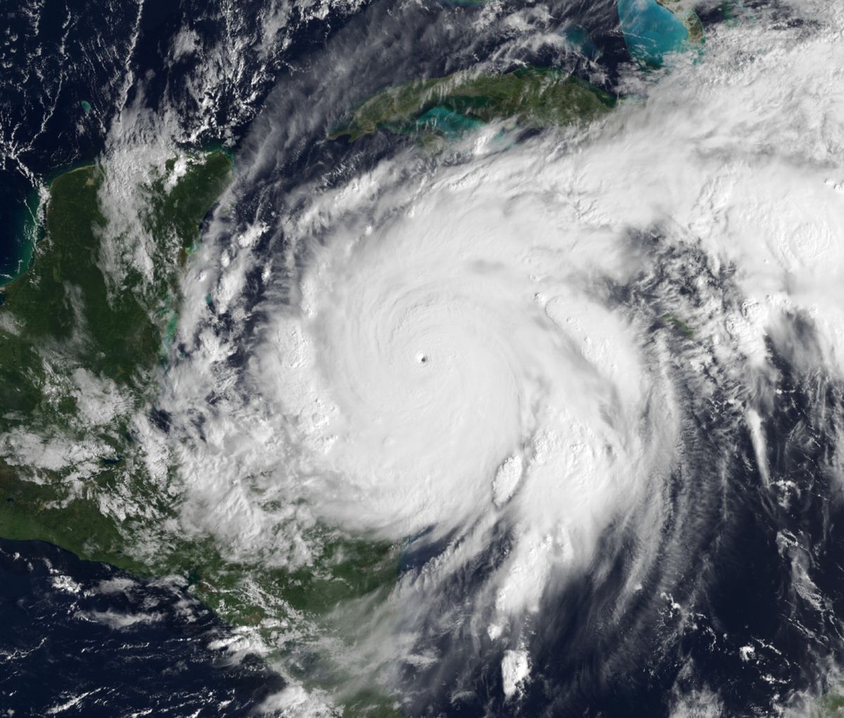
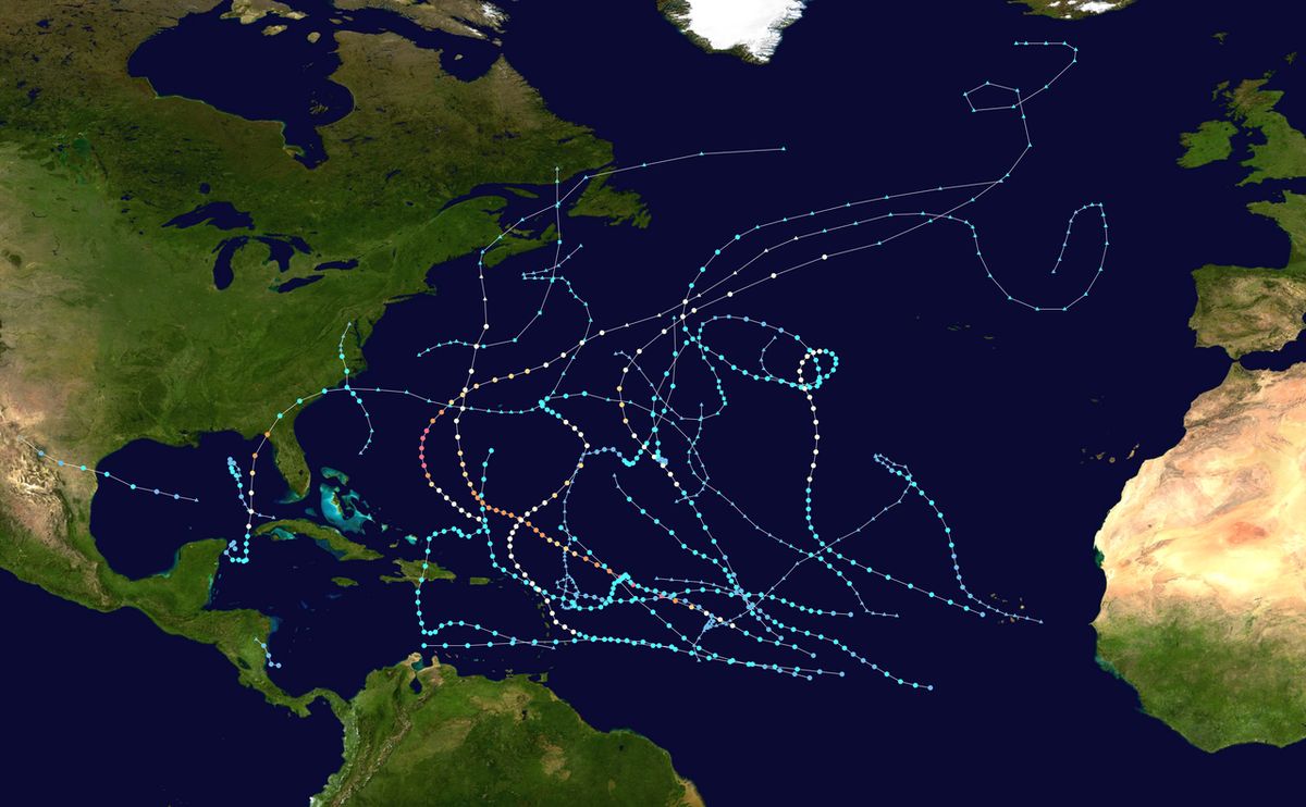
Hurricane Lee originated from a tropical wave that moved off the west coast of Africa on September 1, 2023, producing disorganized convection. The system gradually organized, with a broad surface low forming by September 4 and acquiring a well-defined centre by the next day. Consequently, Tropical Depression Thirteen developed at 12:00 UTC on September 5, located roughly midway between Africa and the Lesser Antilles. It strengthened into Tropical Storm Lee just six hours later and became a hurricane by 21:00 UTC on September 6, steered west-northwestward by a mid-level ridge. Lee underwent a period of explosive intensification on September 7, reaching Category 2 strength at 15:00 UTC and Category 4 strength by 21:00 UTC as its eye cleared.
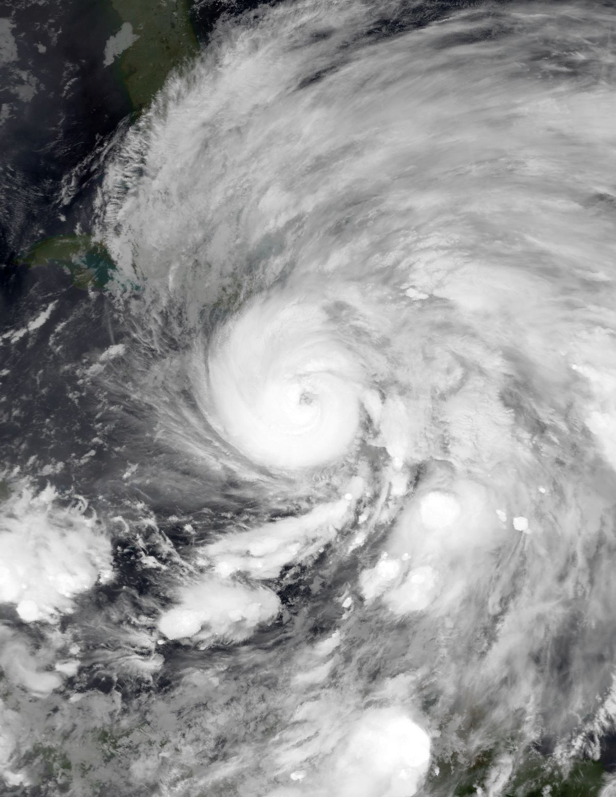
A hurricane hunters mission a few hours later found Lee had reached Category 5 strength with a clear 17-mile-wide eye surrounded by convective cloud tops with temperatures as low as -105 °F. By 06:00 UTC on September 8, Lee's maximum sustained winds peaked at 165 mph (270 km/h), an increase of 80 mph in 24 hours, making it the sixth-fastest intensifying Atlantic hurricane on record. During this peak, its minimum central pressure fell to 926 mbar. Increasing southwesterly wind shear quickly caused Lee's eye to become cloud-filled, weakening it back to a high-end Category 4 and then below Category 3 status by late September 9 as it underwent an eyewall replacement cycle. Wind shear abated on September 10, allowing Lee to reintensify to Category 3 major hurricane strength, but further eyewall replacement cycles caused fluctuations in its size and intensity for several days as it tracked west-northwestward to northwestward.
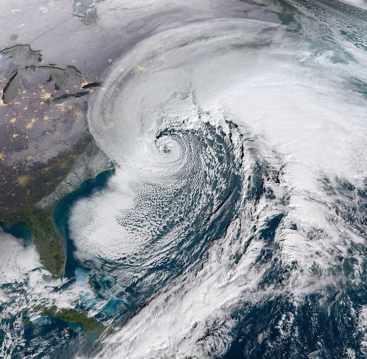
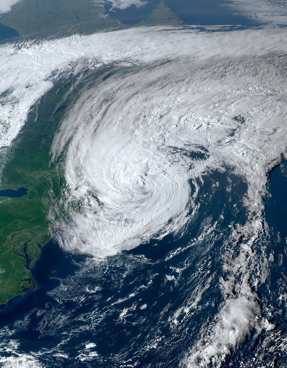
After tracking for much of its trans-Atlantic journey, Lee turned northward on September 13, moving around the western side of a subtropical ridge and weakening to Category 2 strength. It became a Category 1 hurricane on September 14 while passing approximately 185 miles west of Bermuda later in the day. As the hurricane pushed northward, dry air and wind shear displaced convection to its northern side, causing it to commence extratropical transition. This transition was completed by 06:00 UTC on September 16. The post-tropical cyclone then made landfalls in Nova Scotia, New Brunswick, Prince Edward Island, and Newfoundland before moving into the far northern Atlantic and merging with another extratropical low late on September 18.
Preparations in Canada
As Hurricane Lee approached, Environment Canada issued a series of watches for Atlantic Canada based on the forecast track and intensity. Hurricane watches were issued for parts of Charlotte County, particularly its coast and Grand Manan Island in New Brunswick, as well as for Nova Scotia's Digby, Yarmouth, Shelburne, and Queens counties. Further tropical storm watches were issued for southeastern New Brunswick and several other parts of Nova Scotia. On September 15, Prime Minister Justin Trudeau announced he had convened the federal Incident Response Group to discuss potential impacts and warned Canadians to take precautions and listen to local officials. Provincial utilities and emergency organizations mobilized resources in anticipation of significant disruptions from wind and rain.
Key preparations across the Maritimes included the following specific measures. NB Power vice-president Nicole Poirier announced crews were put into position to respond to potential power outages, and New Brunswick Emergency Measures Organization director Kyle Leavitt warned of hazardous driving conditions and urged residents to stay home. Nova Scotia Power senior director Matt Drover announced that utility crews were being mobilized throughout the province. Bay Ferries cancelled all sailings of the MV Fundy Rose between September 16 and 17. Northumberland Ferries Limited cancelled ferry crossings between Nova Scotia and Prince Edward Island. Maritime Electric stationed utility crews throughout Prince Edward Island to respond to outages. Cruise ship schedules at the Port of Saint John were cancelled.
- New Brunswick: NB Power positioned crews. EMO warned residents to stay home. Flights cancelled at Greater Moncton and Fredericton airports.
- Nova Scotia: Nova Scotia Power mobilized crews. Bay Ferries cancelled MV Fundy Rose sailings September 16-17.
- Prince Edward Island: Maritime Electric stationed crews. Northumberland Ferries cancelled crossings. Flights cancelled at Charlottetown Airport.
- National: Prime Minister Trudeau convened Incident Response Group on September 15.
Widespread travel disruptions were anticipated and realized. Many flights were cancelled or delayed to and from Greater Moncton Roméo LeBlanc International Airport and Fredericton International Airport on September 16 and 17 due to hazardous conditions. Most flights to and from Halifax Stanfield International Airport were cancelled, as were flights at Charlottetown Airport. These cancellations aimed to protect passengers and crew from the hazardous wind conditions forecasted and later experienced across the region.
Impact in Canada
The post-tropical remnants of Hurricane Lee brought strong winds, with hurricane-force gusts, to Nova Scotia and New Brunswick on September 16 and 17. The primary impacts were widespread power outages and damage from downed trees and power lines, with total damages in Canada estimated at $30 million. In New Brunswick, power outages associated with the cyclone rose to 37,000 customers on the afternoon of September 16. Trees were felled throughout the province, sometimes taking utility poles and wires with them, and low-lying areas in Saint John and Fredericton suffered from flooding. In Nova Scotia, nearly 200,000 customers lost electricity, representing the most significant outage event. A utility pole caught fire in Stoney Island, and coastal roads in the Eastern Shore region were inundated or destroyed by storm surge, with several roads being destroyed.
The majority of damage in Nova Scotia was caused by trees being knocked over by wind gusts. Rissers Beach Provincial Park suffered significant storm surge, with extensive damage to the boardwalk and several trees knocked over throughout the park. The highest wind gust caused by the cyclone in Canada, 73 mph (117 km/h), was recorded at Halifax Stanfield International Airport. Strong winds with hurricane-force gusts caused widespread, but minimal structural damage in both provinces as Lee passed through. The following table summarizes the key impact statistics reported in Canadian provinces.
| Province | Notable Damage |
|---|---|
| Nova Scotia | Coastal road destruction, boardwalk damage at Rissers Beach, widespread tree damage, utility pole fire in Stoney Island |
| New Brunswick | Flooding in Saint John and Fredericton, downed trees and wires province-wide |
| Prince Edward Island | Preparations made, ferry cancellations |
| Newfoundland and Labrador | Landfall of post-tropical system |
Impact in the United States and Bermuda
While the core of Hurricane Lee remained offshore, its large wind field generated dangerous surf and rip currents along the entire United States Atlantic coast, leading to multiple fatalities and an estimated $50 million in damage. A 21-year-old man was killed on September 14 when the boat he was in capsized and sank after being hit by a tall wave in New Jersey's Manasquan Inlet. His body washed ashore on Point Pleasant Beach on September 24. On September 15, a 15-year-old boy drowned due to rough surf off Fernandina Beach, Florida. Earlier, a 66-year-old man had drowned in rip currents at Poza del Obispo in Puerto Rico when a 66-year-old man drowned. In Maine, a 50-year-old man was killed in Searsport on September 16 when a tree fell onto the car he was in.
In New England, Maine experienced the most significant effects with approximately 94,000 customers losing power on the afternoon of September 16. Heavy rainfall peaked at 6.50 inches in Steuben, and wind damage was widespread, including a downed tree that forced the closure of part of SR 11 in Aroostook County. Maine House Republican leader Billy Bob Faulkingham and another lobsterman were rescued after their boat overturned off Winter Harbor while they clung to the hull. A man was injured while driving on SR 11 in Moro Plantation after a downed tree went through his windshield. In Bar Harbor, a whale watching vessel broke free and crashed ashore, forcing authorities to offload 1,800 U.S. gallons of diesel fuel to prevent it from spilling into the ocean. The storm's impacts were also felt elsewhere in the region.
- Massachusetts: Damage totaled $11,700. Trees felled due to saturated ground. A police cruiser in Cohasset crushed by a falling tree while the officer was outside. Numerous flights cancelled at Logan International Airport.
- New Hampshire: Wind gusts reached 96 mph on Mount Washington, where a wind advisory had been in effect.
- New York: Eastern Long Island experienced beach erosion and gusty winds from the storm.
- Florida: A 15-year-old boy drowned in rough surf at Fernandina Beach on September 15.
- New Jersey: A 21-year-old man killed in a boating accident at Manasquan Inlet on September 14. Two other people were rescued.
- Puerto Rico: A 66-year-old man drowned in rip currents at Poza del Obispo.
Preparations in the United States and Bermuda
As Lee approached the northeastern seaboard, the National Hurricane Center and state governments enacted a wide range of watches, warnings, and emergency measures. A hurricane watch and a tropical storm watch were issued for the New England coastline from Rhode Island to Maine, including Block Island, Martha's Vineyard and Nantucket, on September 13. A storm surge watch was also issued for Cape Cod Bay and Nantucket but was later cancelled when the storm veered further east. A wind advisory was put into effect for New Hampshire's White Mountains, where winds were expected to be stronger due to elevation. These alerts prompted significant action from state and local authorities across multiple jurisdictions.
State-level preparations were extensive and varied. New York State Governor Kathy Hochul deployed fifty National Guard members to Long Island, and the New York City Emergency Management Department advised coastal communities to review emergency plans. The town of Southampton declared a state of emergency, shutting down coastal roads, and East Hampton prohibited swimming at all beaches on September 15. In Massachusetts, Governor Maura Healey announced a state of emergency and activated 50 Massachusetts National Guard members capable of operating high-water vehicles. Boston Mayor Michelle Wu announced the opening of an emergency operations centre on September 14, and preparations to place sand bags and flood walls were made with the Boston Police and Fire Departments on standby.
Maine Governor Janet Mills declared a state of emergency and requested President Joe Biden to issue an emergency disaster declaration for the state, which he did later that evening. Utility workers from as far as Tennessee were brought into Maine to help quickly restore power in case of outages, and the Maine Harbor Master's Association advised boat owners to secure their boats. The National Park Service also shut down certain areas of Acadia National Park. In Rhode Island, the Department of Transportation cleaned storm drains and cut down at-risk trees to mitigate flood and wind risk, and the Independent Man statue atop the State House was being taken down for unrelated repairs. Preparations were also made in other jurisdictions ahead of the storm.
- Bermuda: Tropical storm watches issued September 12, upgraded to warnings September 13. House of Assembly meeting moved from September 15 to September 22.
- Leeward Islands & British Virgin Islands: Tropical cyclone alert in effect September 7-8. 5-day high surf warning issued September 8.
- Puerto Rico & U.S. Virgin Islands: U.S. federal government deployed food, water, and rapid response teams on September 7.
- Massachusetts Ferries: All Hy-Line Cruises service canceled. Steamship Authority waived change and cancellation fees for ferries between September 15 and 17.
Records and classification
Hurricane Lee was notable for its rapid intensification phase, which placed it among the most quickly strengthening storms in Atlantic history. The increase of its maximum sustained winds by 80 mph within a 24-hour period ranked it as the sixth-fastest intensifying Atlantic hurricane on record at the time. This record considers storms that underwent similar explosive strengthening, placing Lee behind Hurricane Wilma in 2005, Hurricane Felix in 2007, Hurricane Erin in 2025, Hurricane Milton in 2024, and Hurricane Matthew in 2016. The storm's lifecycle also demonstrated classic meteorological patterns, including multiple eyewall replacement cycles and a complete transition from a tropical to an extratropical system before its Canadian landfalls, which is common for storms recurring into the higher latitudes.
The storm's impacts in Canada were significant enough for it to be listed among notable hurricanes affecting the region. Its track brought post-tropical conditions to four provinces, causing the most substantial power outage event in Nova Scotia in recent memory related to a tropical system. The estimated $30 million in Canadian damages reflects the widespread nature of the wind and flood damage, particularly along the Atlantic coastline where storm surge proved destructive. The storm's behaviour and impacts provide a case study in the hazards posed by transitioning tropical systems to populated areas of Atlantic Canada, where hurricane-force wind gusts and coastal flooding can occur even after the core has lost its tropical characteristics.
Questions about Hurricane Lee (2023)
What damage did Hurricane Lee cause in Nova Scotia?
In Nova Scotia, Hurricane Lee caused nearly 200,000 customers to lose electricity. Strong winds with hurricane-force gusts led to widespread downed trees and power lines. Storm surge inundated coastal roads and destroyed several roads in the Eastern Shore region. The boardwalk at Rissers Beach Provincial Park suffered extensive damage from storm surge. The highest wind gust recorded in Canada from the storm was 73 mph (117 km/h) at Halifax Stanfield International Airport, and a utility pole caught fire in Stoney Island.
How many people died because of Hurricane Lee?
Hurricane Lee was responsible for five fatalities. Three storm-related deaths occurred in the mainland United States. These included a 21-year-old man killed in Manasquan Inlet, New Jersey, a 15-year-old boy who drowned off Fernandina Beach, Florida, and a 50-year-old man who died in Searsport, Maine, when a tree fell onto his car. One fatality occurred in Puerto Rico when a 66-year-old man drowned in rip currents at Poza del Obispo.
What preparations were made in New Brunswick for Hurricane Lee?
In New Brunswick, Environment Canada issued hurricane watches for parts of Charlotte County and Grand Manan Island. The provincial Emergency Measures Organization director warned of hazardous driving conditions and urged residents to stay home. NB Power positioned crews for outage response, and many flights were cancelled at Greater Moncton and Fredericton international airports. Cruise ship visits to the Port of Saint John were also cancelled.
When did Hurricane Lee hit Canada?
The post-tropical remnants of Hurricane Lee made landfall in Atlantic Canada on September 16, 2023. After transitioning into an extratropical cyclone that same day, the system impacted multiple provinces. It made landfalls in Nova Scotia, New Brunswick, Prince Edward Island, and Newfoundland and Labrador as it moved through the region. The cyclone then moved out into the far northern Atlantic on September 18, where it merged with another extratropical low. This period brought hurricane-force wind gusts, flooding rains, and significant power outages to the affected Canadian provinces.
Why was Hurricane Lee considered a rapid intensification storm?
Hurricane Lee was considered a rapid intensification storm because its maximum sustained winds increased by 80 mph (130 km/h) within a 24-hour period on September 7, 2023. This explosive intensification brought it to Category 5 strength, with winds reaching 165 mph (270 km/h). This rate of strengthening ranks it as the sixth-fastest intensifying Atlantic hurricane on record. It is surpassed only by Hurricane Wilma in 2005, Hurricane Felix in 2007, Hurricane Erin in 2025, Hurricane Milton in 2024, and Hurricane Matthew in 2016. The storm achieved this intensity amid highly favorable conditions before wind shear caused it to weaken shortly afterward.
What was the total estimated cost of damage from Hurricane Lee?
The total damage from Hurricane Lee is estimated at $80 million. This figure combines the estimated $50 million in damage in the United States with approximately $30 million in damage in Canada. In the United States, the majority of damage occurred in Maine, featuring downed trees, power lines, and flash flooding. In Canada, the $30 million in damage occurred primarily in the provinces of Nova Scotia and New Brunswick. This damage resulted from hurricane-force wind gusts, flooding in low-lying areas, storm surge that destroyed some roadways, and widespread power outages that affected hundreds of thousands of customers.
Sources and further reading
- Hurricane Lee (2023) (Wikipedia)
- Healey declares state of emergency as Hurricane Lee ... (wbur.org)
- History of Hurricane Lee (foxweather.com)
- Hurricane Lee Traverses the Warm Atlantic (science.nasa.gov)
Checked by the Your Space Hamilton desk. Last updated 2026-10-23.