Hurricane Helene (1958)
Hurricane Helene was the most intense tropical cyclone of the 1958 Atlantic hurricane season, reaching peak Category 4 strength with winds of 150 mph. The hurricane made an exceptionally close approach to the North Carolina coast, coming within 10 miles of Cape Fear on September 27 before recurving out to sea. While it spared the United States a direct landfall, Helene caused extensive wind and flood damage along the Eastern Seaboard and later brought severe conditions to Atlantic Canada as an extratropical storm. The storm resulted in one indirect death and total damages of $11.4 million, making it the costliest storm of the season. Its impacts in Canada, particularly on Cape Breton Island and Newfoundland, highlighted the threat that Atlantic hurricanes can pose to Canadian communities.
Meteorological history
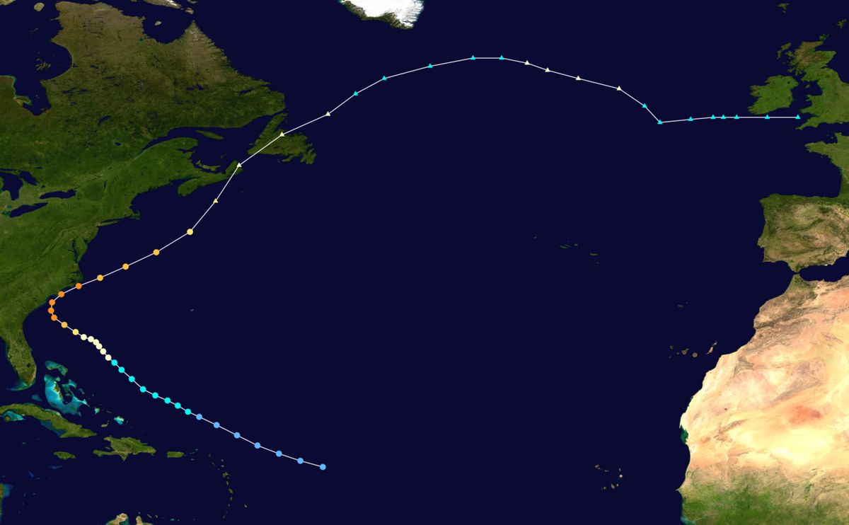
The origins of Hurricane Helene trace back to a tropical wave that formed near Cape Verde on September 16, 1958. The system moved westward and was classified as a tropical depression east of the Leeward Antilles at 0600 UTC on September 21, with initial winds of 30 mph. It strengthened into a tropical storm and was named Helene at 1600 UTC on September 23 as it moved west-northwestward under the influence of trade winds. The storm's development was aided by a large upper-level anticyclone that created favourable conditions, and it attained hurricane intensity by 1200 UTC on September 24 while located 425 miles east of Fort Pierce, Florida. Helene's track was shaped by steering currents around the Azores High and an anticyclone off the Mid-Atlantic states, which directed it slowly toward the Carolinas. This slow motion over warm waters allowed for rapid intensification beginning on September 26. A reconnaissance flight that day reported a pressure drop of 40 mbar from the previous day, down to 948 mbar. The hurricane quickly escalated to Category 4 status, reaching its peak intensity on September 27 with maximum sustained winds of 150 mph and a minimum central pressure of 930 mbar. At its peak, Helene came within 10 miles of the North Carolina coast near Cape Fear before a trough in the atmosphere caused it to recurve sharply to the northeast away from land. The hurricane then accelerated over the cooler waters of the North Atlantic, steadily weakening, and was no longer a major hurricane by 1200 UTC on September 28. By 1800 UTC on September 29, Helene had transitioned into an extratropical cyclone as it passed over Newfoundland, though it still maintained hurricane-force winds with a gale field extending 500 miles from its centre. The remnants continued eastward across the Atlantic, becoming a dominant synoptic feature before finally dissipating just west of Great Britain at 0600 UTC on October 4.
Preparations and warnings
As Helene developed and intensified, the United States Weather Bureau issued a progressive series of warnings and advisories for coastal communities. Initial cautions for ships in the storm's path began upon its formation, and on September 23 advisories were specified for small craft in the northern Bahamas to remain in protected places. By September 24, special bulletins were issued for press, radio, and television stations along the U.S. East Coast, with small craft warnings extending from the Carolinas southward to Daytona Beach, Florida. The first hurricane watch was issued at 1000 UTC on September 26 for the entire Georgia coast to Charleston, South Carolina, accompanied by a gale warning from Daytona Beach to Wilmington, North Carolina. As Helene rapidly intensified and its projected path shifted, warnings were escalated and expanded. At 1600 UTC on September 27, areas from Savannah, Georgia to Cape Fear, North Carolina were placed under a hurricane emergency, prompting urgent calls for precautionary measures and immediate evacuation. Hurricane warnings were extended at 0400 UTC that day to include areas between Cape Fear and Cape Hatteras, North Carolina. The Weather Bureau's forecasts initially projected a South Carolina landfall, but these were adjusted northward until the storm's recurve away from the coast led to the discontinuation of all warnings south of Wilmington by 2200 UTC on September 27. All onshore hurricane warnings were downgraded to gale warnings or discontinued by 1000 UTC on September 28, though offshore gale warnings remained for oceanic regions from the Virginia Capes to Cape Cod, Massachusetts. The Weather Bureau also cautioned interests in Newfoundland, forecasting hurricane-force winds for the island despite not issuing formal warnings there. In anticipation of the storm, emergency preparations were extensive and detailed.
The Southeastern American Red Cross sent ten field staff to locations in Georgia and South Carolina and held 27 hurricane preparation conferences to plan procedures. Other civil defence organizations mobilized preparation staff and equipment. The Weather Bureau sent a mobile weather station to Charleston, South Carolina to monitor conditions and alert populations with short-range radio. Beaches on North Carolina's coast, including Wrightsville Beach and Carolina Beach, were completely evacuated during the night of September 27. In Wilmington, 100 members of the United States National Guard were dispatched to monitor waterfront property, while 60 others were kept on standby. In South Carolina, Governor George Bell Timmerman Jr. issued an order to minimize casualties and prevent looting, which led highway patrol to turn back civilian vehicles attempting to enter Myrtle Beach from 15 miles outside the city. Approximately 100 members of the National Guard and local police patrolled the Myrtle Beach area. Despite repeated mandatory evacuation orders, a few people remained in Myrtle Beach. Civil Defense authorities forcibly evacuated some stragglers but permitted others to stay.
Impact on the United States
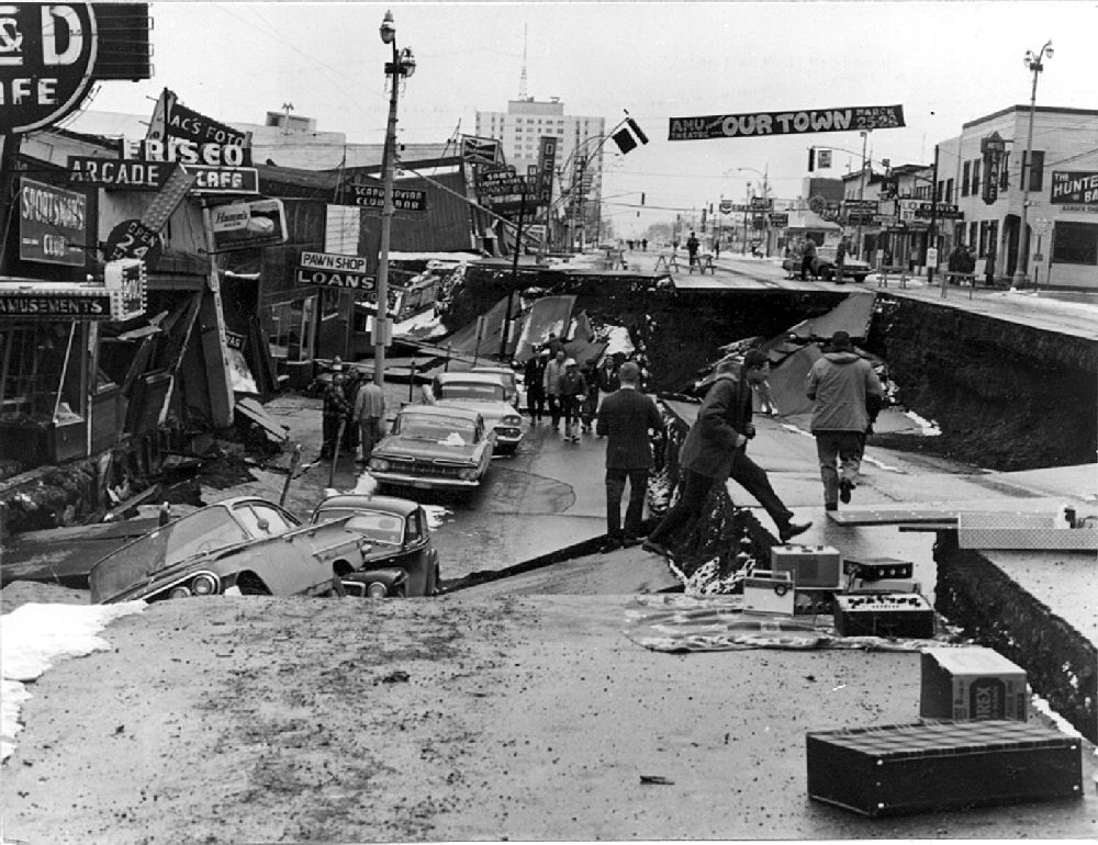
Despite remaining offshore, Hurricane Helene's close parallel to the coastline caused significant damage from South Carolina to Virginia, with rainfall extending as far north as Maine. Total damages in the United States reached $11.2 million, and the storm was responsible for one indirect fatality. The most severe impacts were concentrated in North Carolina, where the hurricane made its closest approach. Storm surge was mitigated by the storm's offshore track and its arrival at low tide, with peak surge heights around 6 feet at Marine Corps Air Station Cherry Point. In Wilmington, the cumulative sea level was roughly 9 feet above normal, and ocean swells arrived at the coast 2.5 to 3 times per minute, indicative of a strong hurricane. However, sand dunes at Fort Fisher were mostly destroyed by waves, and on Cedar Island winds pushed waves inland, inundating homes. Elsewhere, minor beach erosion occurred. Wind damage was extensive and severe. A weather station in Wilmington recorded a sustained wind of 88 mph and a record-breaking gust of 135 mph, surpassing the record set by Hurricane Hazel in 1954. At Cape Fear, winds were estimated at 125 mph with gusts to 160 mph. This powerful wind caused widespread destruction across coastal communities.
- In Wrightsville Beach, 12 houses were flattened, with damage estimated by police at $300,000 and extensive damage to the water system.
- A 300-foot pier and a pavilion were destroyed in Ocean Isle Beach.
- Numerous homes and businesses in Topsail Beach, Kure Beach, Yaupon Beach, and Shallotte were unroofed or destroyed, with two homes on Topsail Island demolished.
- Extensive property damage was reported in Atlantic Beach and Morehead City, where a roof was blown from a yacht shed.
- In Southport, damage was described as worse than Hurricane Hazel, with metal debris in streets, half its pier swept away, and numerous live oak trees uprooted.
The winds caused massive power and communications outages, knocking out 7,000 telephones in Wilmington alone and causing $150,000 in damage to Southern Bell Telephone Company offices. Power was cut as a precaution in Wilmington, and long-distance services failed in Morehead City and on Ocracoke Island. The United States Army provided Southport with a temporary electrical generator for water pumps and light. In Cape Hatteras, damages reached an estimated $1 million. Crop damage, particularly to corn, was observed up to 40 miles inland. Rainfall in North Carolina peaked at 8.29 inches at Wilmington International Airport, with 4.85 inches in Hatteras and at least 3 inches common elsewhere along the coast. The single indirect death occurred when a car skidded off a flooded highway. Total damage in North Carolina amounted to $11 million. In South Carolina, impacts were less severe but still notable. Charleston experienced sustained winds of 63 mph, resulting in downed trees and street signs, minor shingle damage, and sporadic power outages. Damage became progressively worse from Georgetown to Little River, with automobile accidents, torn roofs, and damaged piers. On Harbor Island, 50 percent of structures suffered roof damage, causing an estimated $125,000 in losses. Beach erosion occurred along the coast, and three fishing piers were damaged in Windy Hill and Cherry Grove Beach. Damage in Myrtle Beach was minor and limited to roofs and windows. Further inland in Columbia, no rainfall was reported and damage was minimal, though light crop damage was reported in Marion County. Statewide damage in South Carolina was estimated at $200,000.
Impact on Canada
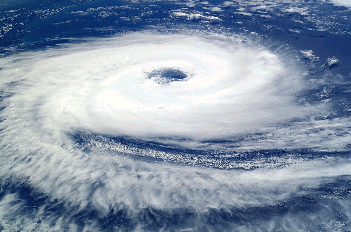
After recurving away from the United States, Helene transitioned into an extratropical cyclone and swept across Atlantic Canada on September 29, bringing strong winds and heavy rain. The storm was particularly severe on Cape Breton Island in Nova Scotia, where it was considered the worst in at least 21 years. Powerful winds caused widespread power outages that severed most communications between the island and the mainland. In Sydney, Nova Scotia, property damage was estimated at C$100,000. The storm then moved over Newfoundland, where it made landfall with hurricane-force winds. A peak gust of 82 mph was recorded at Naval Station Argentia. The high winds again caused significant power failures and loss of communications across the region. Total damage in Newfoundland was also reported to be at least C$100,000. The combined Canadian damages from Helene amounted to at least C$200,000, contributing to the storm's overall status as the season's costliest cyclone. The extratropical remnants of Helene continued to be a dominant weather feature as they traversed the Atlantic Ocean toward Great Britain, where they dissipated on October 4.
Records and meteorological significance
Hurricane Helene set several notable records during its lifespan, primarily related to its intensity and measured winds. The wind gust of 135 mph recorded at the Weather Bureau office in Wilmington, North Carolina, established a new record for the fastest wind gust ever measured at that location, breaking the previous record of 98 mph set by Hurricane Hazel just four years earlier. This measurement highlighted the exceptional strength of Helene's wind field even without a direct landfall. Meteorologically, Helene was the most intense tropical cyclone of the 1958 Atlantic hurricane season in terms of both maximum sustained winds and minimum central pressure. Its rapid intensification phase as it approached the Carolinas demonstrated how favourable atmospheric conditions, including weak steering currents and the presence of an upper-level anticyclone, can fuel a storm's explosive development. The hurricane's track, which brought a major Category 4 storm within 10 miles of the U.S. coast without making landfall, served as a stark reminder of the significant damage that can be inflicted by a close-passing hurricane. Helene's transformation into a powerful extratropical system that affected Canada illustrated the lifecycle of Atlantic hurricanes and their potential to impact regions far from their tropical origins. The storm's large wind field, with gale-force winds extending 220 miles from the centre while a hurricane and 500 miles during extratropical transition, contributed to its widespread effects across both the United States and Canada.
Response and aftermath
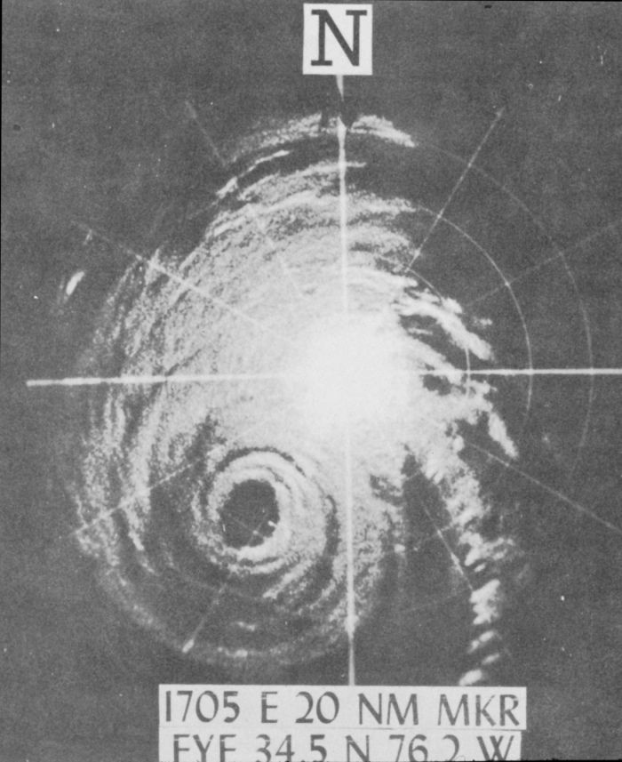
The response to Hurricane Helene involved coordinated efforts between weather forecasters, civil defence agencies, and the military to protect life and property. The United States Weather Bureau's network of weather forecast offices, including the one in Charleston that issued local statements, played a critical role in disseminating timely warnings that allowed for evacuations. The deployment of a mobile weather station to Charleston exemplified efforts to maintain situational awareness when fixed infrastructure was threatened. The use of long-range WSR-57 weather radar allowed forecasters to track the storm's eye as it approached the coast, providing valuable real-time data. In the aftermath, damage assessment and recovery began immediately. The provision of a temporary military generator to Southport, North Carolina, was a direct response to the crippling power outages that affected water pumps and emergency services. The total financial toll of $11.4 million placed Helene as the costliest storm of the 1958 season, a designation that reflected both its intensity and its populous track. The storm's impacts led to no major changes in hurricane policy but reinforced the importance of heeding evacuation orders even for storms forecast to remain offshore. The experience in Canada, where the storm was noted as the worst in decades for Cape Breton, likely informed local preparedness for future extratropical transitions of hurricanes. The single traffic-related fatality in North Carolina highlighted the continuing danger of flooded roadways after the worst winds have passed.
Comparison of impacts by region
Hurricane Helene caused extensive damage across the United States East Coast despite not making landfall in North Carolina. In the United States, damages reached 11.2 million dollars and there was one indirect death. The hurricane's close proximity to land caused strong winds that resulted in widespread power outages and cut telecommunications along the coast. After impacting the United States, Helene produced strong winds and heavy rain across much of Atlantic Canada, where damage in Sydney, Nova Scotia totaled 100,000 Canadian dollars. Total damages associated with Helene in the United States and Canada amounted to 11.4 million dollars, making it the costliest storm of the 1958 Atlantic hurricane season.
| Region | Peak Wind Gust | Notable Damage | Estimated Cost |
|---|---|---|---|
| Wilmington, NC | 135 mph | Widespread property damage, 7,000 phones out, water system damage | ~$2 million |
| Wrightsville Beach, NC | Not measured locally | 12 houses flattened | $300,000 |
| Cape Hatteras, NC | Not measured locally | Structural damage | $1 million |
| North Carolina (statewide) | 160 mph (est. at Cape Fear) | Crop damage, beach erosion, widespread structural damage | $11 million |
| Harbor Island, SC | Not measured locally | Roof damage to 50% of structures | $125,000 |
| South Carolina (statewide | 63 mph (Charleston) | Pier damage, beach erosion, minor roof damage | $200,000 |
| Sydney, Nova Scotia | Not measured locally | Property damage, communications cut | C$100,000 |
| Newfoundland | 82 mph (Argentia) | Power outages, communications loss | C$100,000+ |
This distribution of impacts highlights how the hurricane's offshore track concentrated the most severe wind damage in coastal North Carolina, while the extratropical phase caused considerable disruption in Canadian maritime provinces. The one indirect fatality in North Carolina occurred due to flooding, a reminder of the dangers that accompany such storms even without a direct landfall. The storm's total cost of $11.4 million solidified its position as the season's most significant economic event. The damage in Canada, while smaller in dollar value, represented a severe event for local communities, with the storm on Cape Breton Island being the worst in a generation.
Questions about Hurricane Helene (1958)
How strong was Hurricane Helene at its peak?
Hurricane Helene reached its peak intensity on September 27, 1958, as a Category 4 hurricane on the Saffir-Simpson scale. Its maximum sustained winds were 150 mph (240 km/h), and its minimum central barometric pressure was recorded at 930 mbar. This made it the most intense tropical cyclone of the entire 1958 Atlantic hurricane season in terms of both wind speed and pressure. A reconnaissance flight had noted a precipitous pressure drop of 40 mbar in the 24 hours leading to its peak.
Did Hurricane Helene make landfall in the United States?
No, Hurricane Helene did not make landfall in the United States. However, it came extraordinarily close, passing within 10 miles (16 km) of Cape Fear, North Carolina, on September 27, 1958. Its centre remained just offshore, but its large wind field and close proximity were enough to cause extensive damage along the North Carolina coast and parts of South Carolina. The storm's eye was visible on coastal WSR-57 weather radar as it neared the coast.
What damage did Hurricane Helene cause in Canada?
As an extratropical cyclone, Helene impacted Atlantic Canada on September 29, 1958. It caused severe conditions on Cape Breton Island, Nova Scotia, which was considered the worst storm there in over two decades, causing C$100,000 in damage in Sydney and cutting most communications to the mainland. In Newfoundland, wind gusts peaked at 82 mph at Naval Station Argentia, causing widespread power outages and at least C$100,000 in damage. Total Canadian damages were at least C$200,000.
What record was set by Hurricane Helene?
A weather station in Wilmington, North Carolina, recorded a wind gust of 135 mph during Hurricane Helene. This set a new record for the fastest wind gust ever measured at that location, breaking the previous record of 98 mph that had been set during Hurricane Hazel in 1954. The sustained wind at the same station was 88 mph. The estimated gusts at Cape Fear were even higher, reaching 160 mph.
Were there any fatalities from Hurricane Helene?
Hurricane Helene was responsible for one indirect fatality. The death occurred in North Carolina when a car skidded off a flooded highway. There were no reports of direct fatalities from the storm's winds or surge in either the United States or Canada. The extensive evacuations and warnings along the U.S. coast likely helped prevent a higher death toll.
Why was damage from storm surge relatively limited?
Damage from storm surge was mitigated by two key factors. First, Helene's strongest surge was in the eastern half of the storm, which remained over the open ocean. Second, and crucially, the hurricane's closest approach to the North Carolina coast coincided with low tide. While surge heights still reached up to 6 feet in places like Cherry Point and the cumulative sea level was 9 feet above normal in Wilmington, the low tide conditions prevented more catastrophic coastal flooding and widespread inundation.
Sources and further reading
- Hurricane Helene (1958) (Wikipedia)
- Hurricane Helene: September 27, 1958 (weather.gov)
- In 1958, another Hurricane Helene rocked the Carolinas (npr.org)
Checked by the Your Space Hamilton desk. Last updated 2026-10-23.