Hurricane Arthur
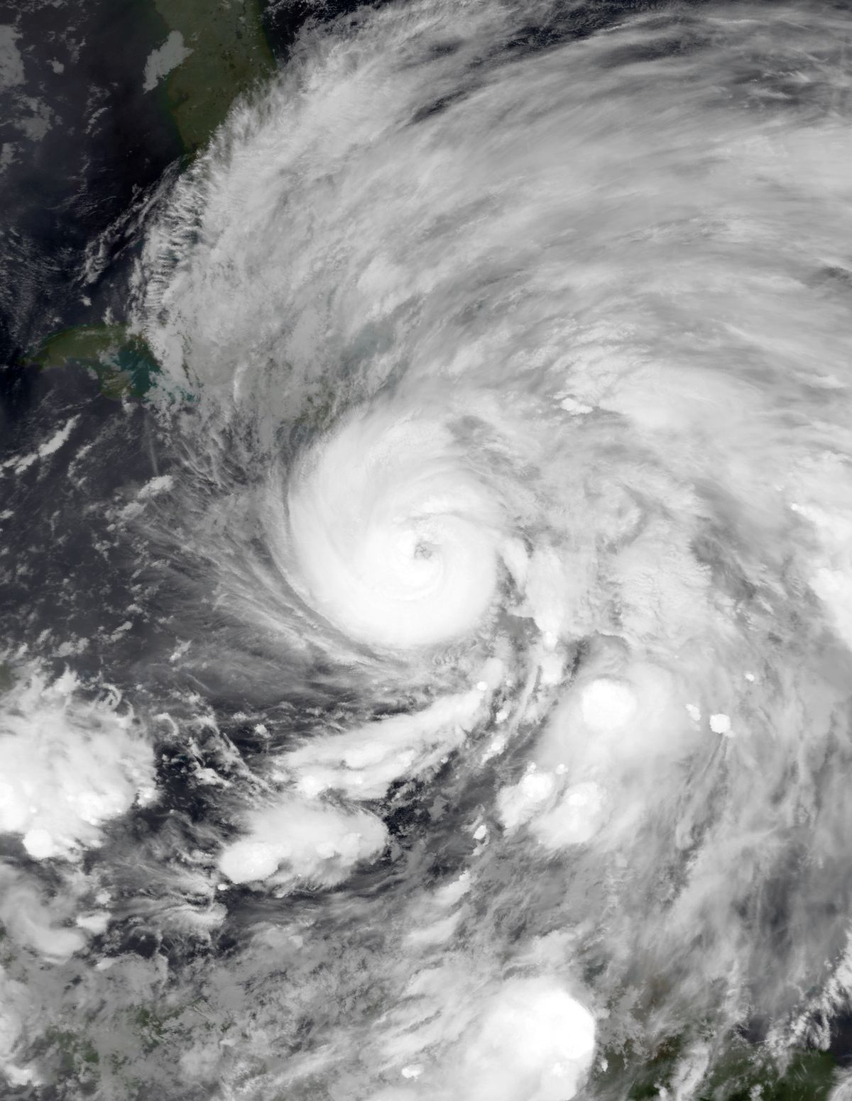
Hurricane Arthur was a Category 2 hurricane that struck the United States and Atlantic Canada in early July 2014. As the first named storm of the 2014 Atlantic hurricane season, it holds the record for the earliest hurricane landfall in the U.S. state of North Carolina. The storm caused significant disruption to Fourth of July celebrations along the eastern seaboard and inflicted widespread damage in the Canadian Maritimes, particularly through prolonged power outages. Its impacts in Canada led to substantial criticism of utility companies and a major review of emergency response protocols.
Meteorological history
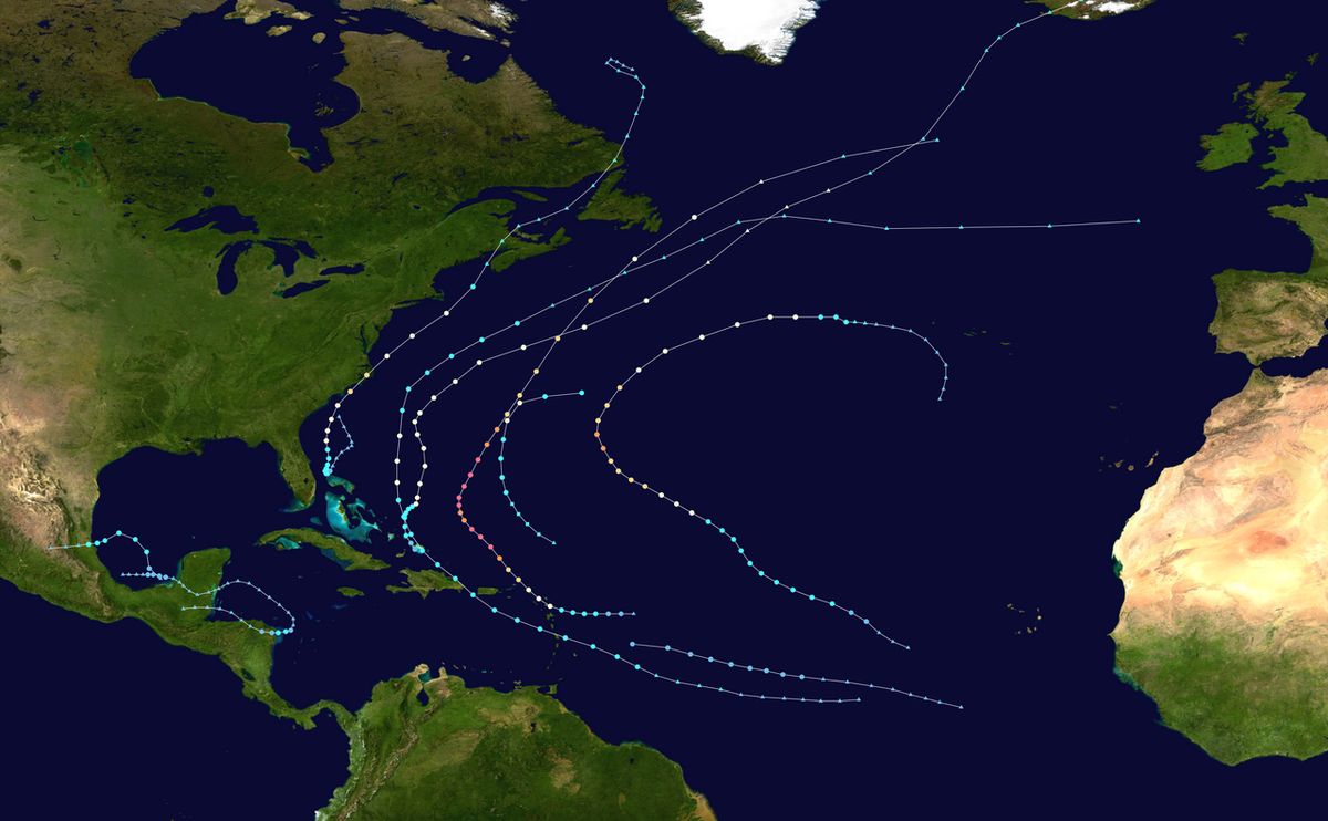
The origins of Hurricane Arthur can be traced to a non-tropical area of low pressure that developed over the northern Gulf of Mexico on June 25, 2014. This system moved northeast across the Southeastern United States, becoming intertwined with a frontal boundary before emerging into the western Atlantic Ocean on June 28. A low-pressure centre formed off the coast of South Carolina and gradually organized under generally favourable conditions. A United States Air Force reconnaissance mission on June 30 confirmed a well-organized circulation, but the system was not classified until convection consolidated sufficiently. The National Hurricane Center designated the system as Tropical Depression One at 00:00 UTC on July 1, while it was located about 70 miles east-southeast of Fort Pierce, Florida. The depression drifted westward before turning north as forecast, and based on wind measurements from Grand Bahama, it was upgraded to Tropical Storm Arthur around 15:00 UTC on July 1.
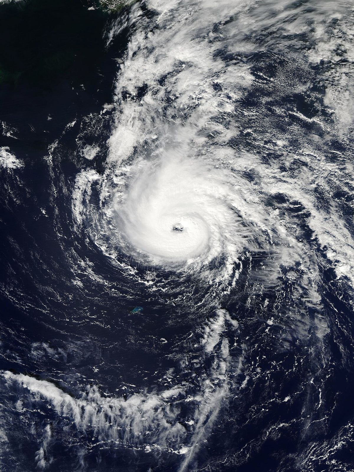
Moderate wind shear and dry air initially hindered organization, causing a displacement between the storm's mid-level and low-level centres. As shear decreased on July 2, convection consolidated around a developing eye, and the storm's winds increased to 70 mph. Arthur attained hurricane status early on July 3, positioned about 190 miles south-southwest of Cape Fear, North Carolina. The hurricane then curved toward the north-northeast ahead of a deep-layer trough over the Eastern United States. Arthur continued to intensify as it approached the North Carolina coast, developing a well-defined eye 25 to 30 miles wide. The storm reached its peak intensity with maximum sustained winds of 100 mph at 00:00 UTC on July 4, making it a Category 2 hurricane.
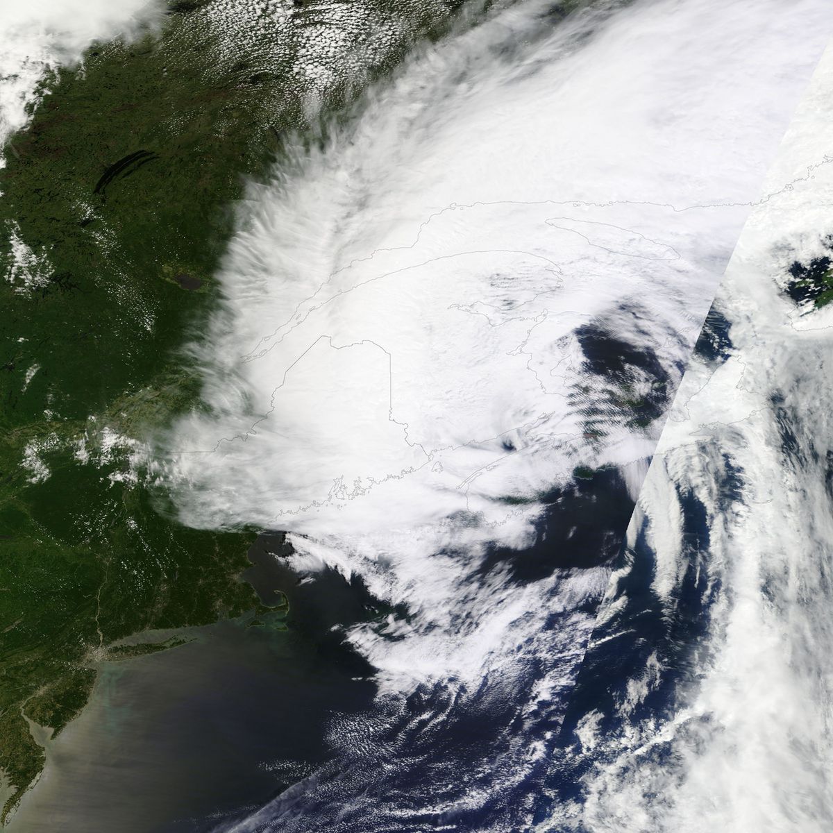
It made landfall at 03:15 UTC over Shackleford Banks, between Cape Lookout and Beaufort, setting a new record for the earliest hurricane landfall in North Carolina. The cyclone deepened slightly over Pamlico Sound, reaching its minimum central pressure of 973 mbar. After brushing the Dare County coastline and passing north of Oregon Inlet, Arthur emerged back over the Atlantic Ocean on July 4. Weakening began as the hurricane moved over cooler waters and encountered increasing wind shear. Arthur started transitioning into an extratropical cyclone on July 5 as it accelerated northeastward, passing within 75 miles of Chatham, Massachusetts. The National Hurricane Center issued its final advisory at 12:00 UTC when Arthur completed its extratropical transition over the Bay of Fundy.
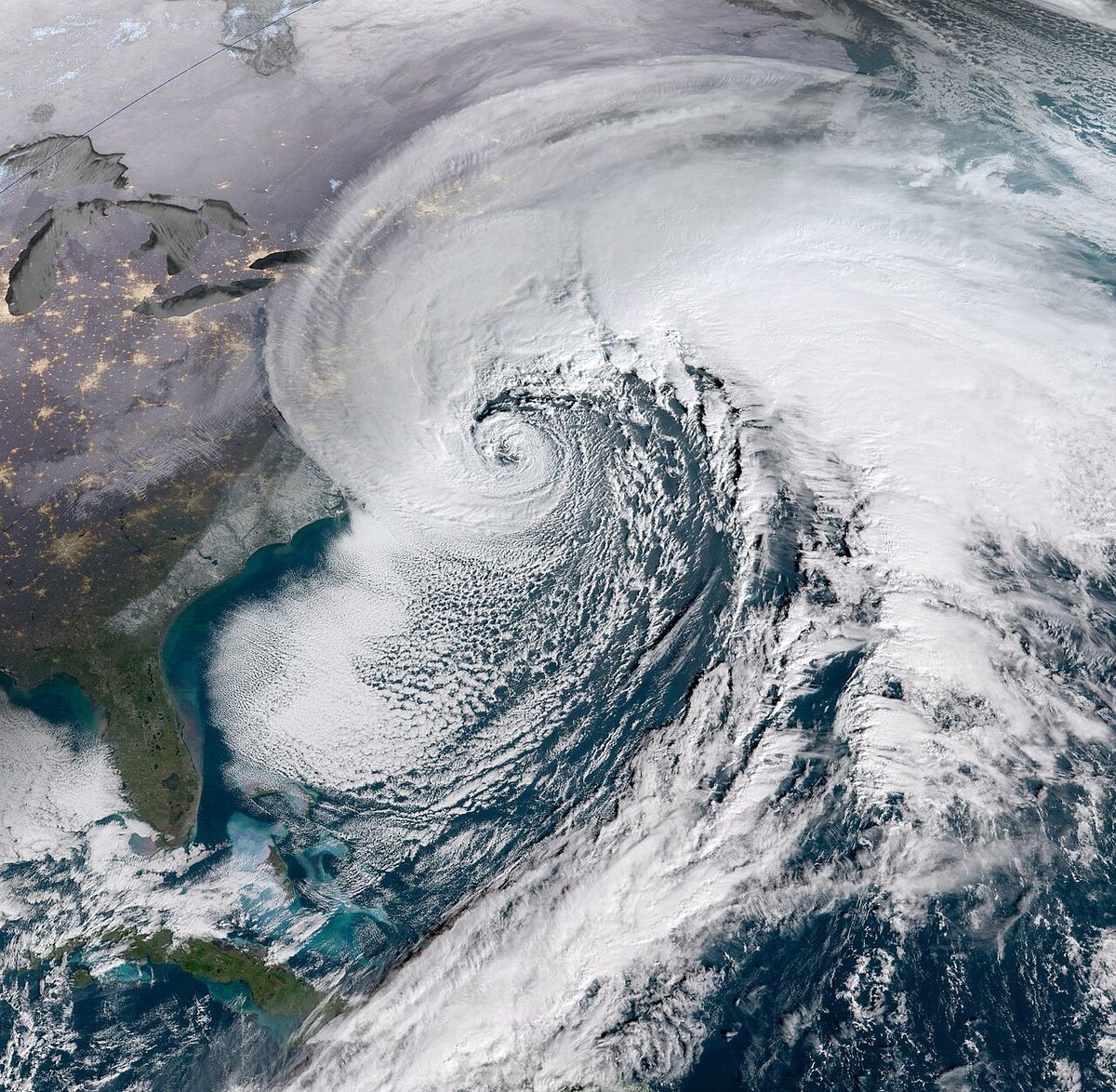
The remnants of Arthur re-intensified as a sting jet developed, producing hurricane-force gusts. The post-tropical system made another landfall near Fundy National Park, New Brunswick, by 18:00 UTC on July 5. It then moved through Labrador and over the Labrador Sea before finally dissipating on July 9. Meteorologists noted the improved accuracy of forecast models, specifically the National Oceanic and Atmospheric Administration's Geophysical Fluid Dynamics Laboratory and Hurricane Weather Research and Forecasting models, in predicting Arthur's track and intensity. The storm's extratropical transition and the development of a sting jet, which produced damaging winds in Canada, were also subjects of meteorological analysis.
Preparations and warnings
An extensive series of tropical cyclone warnings and watches were issued along the East Coast of the United States and Atlantic Canada in anticipation of Arthur. Initial watches were posted in Florida on July 1, followed by warnings and watches that expanded northward through the Carolinas and into Virginia. By July 2, a hurricane warning was in effect from Surf City to Duck, North Carolina, including the Albemarle and Pamlico sounds. Tropical storm warnings were later issued for parts of coastal Massachusetts, including Cape Cod and Nantucket. In Canada, Environment Canada issued tropical storm watches and warnings for areas of Nova Scotia, New Brunswick, and Prince Edward Island. In North Carolina, Governor Pat McCrory declared a state of emergency for 25 counties ahead of the storm, and mandatory evacuations were ordered for Hatteras Island and Richland Township in Beaufort County.
Voluntary evacuations were advised for Ocracoke Island, Aurora, Pamlico Beach, and Belhaven. Approximately 4,300 people evacuated Ocracoke Island via ferry. State officials deployed 105 National Guard members and 400 state highway patrol officers to assist with evacuations and preparations. The deteriorating Bonner Bridge on North Carolina Highway 12 was closed as a precaution, and heavy equipment was positioned to clear potential sand and debris. The hurricane's timing led to widespread cancellations and rescheduling of Independence Day events. In Ocean City, Maryland, fireworks were postponed to July 5, and Boston's Fourth of July Boston Pops concert and fireworks display were moved to July 3. Fireworks shows were also postponed throughout Rhode Island.
The National Park Service closed the Wright Brothers National Memorial and Cape Lookout National Seashore. Several airlines waived change fees for travelers in affected areas, and Seymour Johnson Air Force Base relocated more than 54 aircraft to Ohio to avoid potential wind damage. In Atlantic Canada, utilities and governments prepared for the storm's arrival. Nova Scotia Power marshalled resources to respond to expected power outages, and numerous weekend events were cancelled, including the Stan Rogers Folk Festival. Province-managed parks, beaches, and campgrounds in Nova Scotia were closed. Environment Canada issued high wind warnings for the Maritimes, the Canadian Red Cross readied volunteers, and the Point Lepreau Nuclear Generating Station in New Brunswick took precautionary measures with Canadian Nuclear Safety Commission staff deployed to the site.
Impact in the United States
Total damage in the United States from Hurricane Arthur was estimated at over US$10 million. The storm's effects were felt from Florida to New England, with the most significant impacts concentrated in North Carolina. In Florida and Georgia, outer bands of Arthur triggered scattered severe thunderstorms. One storm near Elkton, Florida, on July 3 produced straight-line winds estimated at 70 to 80 mph, causing two barns to collapse, with minor damage totaling about $23,000. Coastal South Carolina experienced wind gusts up to 42 mph and scattered power outages. The highest rainfall total in the United States, 8.73 inches, was recorded just outside Myrtle Beach, South Carolina. In North Carolina, Arthur made landfall as a Category 2 hurricane, with a peak wind gust of 101 mph recorded at Cape Lookout and a gust of 91 mph at a Coast Guard station in Cape Hatteras.
The storm spawned at least two tornadoes, including an EF1 tornado in Duplin County that damaged two structures and many trees, and another EF1 tornado in Martin County that knocked a tree onto a house. The highest rainfall in the state was 4.20 inches at Kinston. Storm surge peaked at 4.5 feet at Oregon Inlet, causing coastal flooding. Arthur caused approximately 44,000 power outages in North Carolina, along with widespread flooding along the northern coast, but no deaths or serious injuries were reported. As Arthur moved northeast, it brought impacts to New England, causing flash flooding, additional power outages, and widespread road closures in the region while ferry services were suspended. Damage in New England was included in the overall U.S. damage estimate.
Key recorded impacts in the United States included numerous tropical cyclone warnings and watches being issued along the East Coast. A state of emergency was declared for 26 North Carolina counties, and both mandatory and voluntary evacuations were imposed along the state's coast. Damage was limited to strewn debris and inundated roads, and though 44,000 power outages were reported and widespread flooding occurred along northern sections of the coast, no deaths or serious injuries were reported. In New England, Arthur brought flash flooding and caused additional power outages, resulting in widespread road closures and suspension of ferry service.
- Peak wind gust: 101 mph at Cape Lookout, NC.
- Maximum rainfall: 8.73 inches near Myrtle Beach, SC.
- Peak storm surge: 4.5 ft at Oregon Inlet, NC.
- Power outages: Approximately 44,000 customers in NC.
- Tornadoes: Two EF1 tornadoes confirmed in NC.
- Overall damage estimate: US$10 million.
Impact in Canada
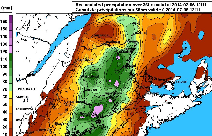
The remnants of Hurricane Arthur struck Atlantic Canada and Quebec on July 5, 2014, producing hurricane-force wind gusts and widespread damage. The storm left more than 300,000 customers without electricity across the region, with Nova Scotia and New Brunswick hardest hit. Damage to Nova Scotia's power grid was considered the worst since Hurricane Juan in 2003. Restoration efforts were prolonged, with thousands of customers still without power 10 days after the storm passed. The cost to restore and repair the electrical grid in Nova Scotia alone was C$8.4 million. The storm's high winds toppled countless trees and power lines, blocking roads and damaging property.
In New Brunswick, the utility NB Power suffered a record-breaking C$23 million in damage from the storm. The severe impacts prompted widespread complaints from customers and politicians regarding the response of the utility companies. A communication breakdown between Nova Scotia Power and the public exacerbated problems during the outage. Nova Scotia Premier Stephen McNeil publicly condemned the company's response as "inexcusable," leading to calls for formal reviews of both Nova Scotia Power and New Brunswick Power. Beyond the power grid, the storm caused significant disruption to transportation and commerce, with fallen trees damaging homes and vehicles, and the storm's timing on a holiday weekend compounded recovery challenges. The financial toll on utilities and the protracted recovery highlighted vulnerabilities in the region's infrastructure to post-tropical systems.
Records and meteorological significance
Hurricane Arthur set several meteorological records during its lifecycle. Its landfall in North Carolina at 03:15 UTC on July 4, 2014, made it the earliest hurricane on record to strike the state, surpassing the previous record of July 11 set by an unnamed hurricane in 1901. Arthur was also the first hurricane to make landfall in the United States since Hurricane Isaac in 2012, and it was the first hurricane to reach Category 2 strength in the Atlantic basin since Hurricane Sandy in the 2012 season. The storm's formation and intensification were notable for occurring in early July, a period that often sees less favourable conditions for hurricane development in that region.
Aftermath and response
The aftermath of Hurricane Arthur in Canada was dominated by the critical failure of the power grid and the subsequent public and political fallout. The scale of the outages and the slow pace of restoration led Nova Scotia Premier Stephen McNeil to demand a review of Nova Scotia Power's performance. Similarly, New Brunswick Power faced scrutiny for its handling of the storm, which caused C$23 million in damage to its infrastructure. These reviews focused on preparedness, response times, communication with the public, and infrastructure resilience. In the United States, cleanup operations in North Carolina involved clearing debris from roads and repairing damaged infrastructure. The lack of fatalities was attributed to effective evacuations and public heeding of warnings.
Due to the hurricane's timing, many Independence Day activities in the U.S. were cancelled or rescheduled. Losses in the country amounted to US$10 million. In Atlantic Canada and Quebec, hurricane-force gusts associated with Arthur's remnants produced widespread damage, leaving more than 300,000 without electricity. Efforts to restore and repair damage to the electrical grid in Canada cost C$8.4 million (US$7.9 million), and New Brunswick Power suffered a record-breaking C$23 million (US$21.6 million) in damage.
Later storm of the same name
The name Arthur was reused in subsequent Atlantic hurricane seasons, as is standard practice by the World Meteorological Organization. Notably, Tropical Storm Arthur formed in June 2026, becoming the first named storm of that season. This system developed in the Gulf of Mexico and brought intense rainfall and the threat of flash flooding to the U.S. Gulf Coast, particularly in Texas and Louisiana. The 2026 Arthur reached maximum sustained winds of 45 mph and produced a storm surge of up to 3 feet along the Texas coastline before being downgraded to a post-tropical cyclone. It was characterized by exceptional rainfall, with some areas forecast to receive up to 20 inches, leading to life-threatening flash flooding. The 2026 storm differed significantly from its 2014 predecessor in strength, track, and primary hazard.
Hurricane Arthur in 2014 was the earliest known hurricane to make landfall in North Carolina and the first hurricane to make landfall in the United States since Hurricane Isaac in 2012. It attained peak winds of 100 mph as a Category 2 hurricane and made landfall at Shackleford Banks, North Carolina. The 2026 Arthur was a tropical storm with maximum winds of 45 mph that primarily threatened the Gulf Coast. The 2014 storm caused power outages and flooding along the East Coast and in Canada, while the 2026 storm was noted for its potential to produce extreme rainfall.
| Attribute | Hurricane Arthur (2014) | Tropical Storm Arthur (2026) |
|---|---|---|
| Peak Classification | Category 2 Hurricane | Tropical Storm |
| Maximum Winds | 100 mph (160 km/h) | 45 mph (75 km/h) |
| Primary Impact Region | North Carolina, Atlantic Canada | Texas, Louisiana, Gulf Coast |
| Key Hazard | Wind, Storm Surge, Power Outages | Torrential Rainfall, Flash Flooding |
Questions about Hurricane Arthur
When did Hurricane Arthur make landfall in North Carolina?
Hurricane Arthur made landfall in North Carolina at 03:15 UTC on July 4, 2014. It came ashore over Shackleford Banks, located between Cape Lookout and Beaufort. This landfall set a record for the earliest hurricane to strike the state, beating the previous record of July 11. The storm was a Category 2 hurricane with peak winds of 100 mph at the time of landfall.
What was the impact of Hurricane Arthur in Canada?
The remnants of Hurricane Arthur caused severe damage in Atlantic Canada and Quebec on July 5, 2014. Hurricane-force wind gusts toppled trees and power lines, leaving more than 300,000 customers without electricity. Nova Scotia experienced its worst power grid damage since Hurricane Juan in 2003. The storm prompted major criticism of utility companies, with Nova Scotia Premier Stephen McNeil calling Nova Scotia Power's response "inexcusable. Restoration costs for the electrical grid in Nova Scotia alone reached C$8.4 million.
How much damage did Hurricane Arthur cause in the United States?
Total damage in the United States was estimated at over US$10 million. The most significant impacts were in North Carolina, where the storm caused widespread flooding, power outages for 44,000 customers, and spawned two EF1 tornadoes. Damage also occurred in Florida, Georgia, and South Carolina from associated thunderstorms. Despite the disruption to Fourth of July celebrations and coastal flooding, no deaths or serious injuries were reported in the U.S.
Why was Hurricane Arthur's impact in Canada so severe on the power grid?
The severity of power outages in Canada was due to hurricane-force wind gusts associated with Arthur's remnants, which brought down a vast number of trees and power lines across a wide area. The damage to Nova Scotia's grid was described as the worst since 2003. A breakdown in communication between Nova Scotia Power and the public worsened the crisis during restoration. The utility's response was heavily criticized, leading to a formal review of its performance and preparedness.
What records did Hurricane Arthur set?
Hurricane Arthur set the record for the earliest hurricane landfall in North Carolina, occurring on July 4. It was also the first hurricane to make landfall in the United States since Hurricane Isaac in 2012. Arthur was the first hurricane to reach Category 2 strength in the Atlantic basin since Hurricane Sandy in the 2012 season. Its formation marked the first named storm of the 2014 Atlantic hurricane season.
Was there another storm named Arthur after 2014?
Yes, the name Arthur was reused for a tropical storm in June 2026. This system was the first named storm of the 2026 Atlantic hurricane season and primarily affected the U.S. Gulf Coast with torrential rainfall and flash flooding threats. Unlike the 2014 hurricane, the 2026 Arthur remained a tropical storm with maximum winds of 45 mph and was notable for its potential to produce extreme rainfall totals of up to 20 inches in some areas. The storm formed on June 17, 2026, and dissipated the following day. All tropical storm watches and warnings for this system were eventually discontinued.
Sources and further reading
- Hurricane Arthur (Wikipedia)
- Tropical Storm Arthur (science.nasa.gov)
- Post-Tropical Cyclone Arthur fuels torrential rainfall, strong ... (foxweather.com)
- Tropical Storm Arthur Forecast to Deliver Boatloads of Rainfall ... (weather.substack.com)
Checked by the Your Space Hamilton desk. Last updated 2026-10-28.