Ottawa River
The Ottawa River, known in French as Rivière des Outaouais and in Algonquin as Kichi-Sìbì or Kitchissippi, is a major waterway defining the border between the Canadian provinces of Ontario and Quebec. Rising from Lac des Outaouais in central Quebec, it flows 1,271 kilometres west and southeast to its confluence with the St. Lawrence River at Montreal, draining a vast basin of 146,300 square kilometres. For millennia, it has been a vital artery for Indigenous peoples, a historic fur trade and timber route, and a major source of regional hydroelectric power generation. Today, the river remains a crucial ecological corridor and a hub for recreation, supporting diverse wetlands, forests, and communities along its course.
Geography and Hydrology
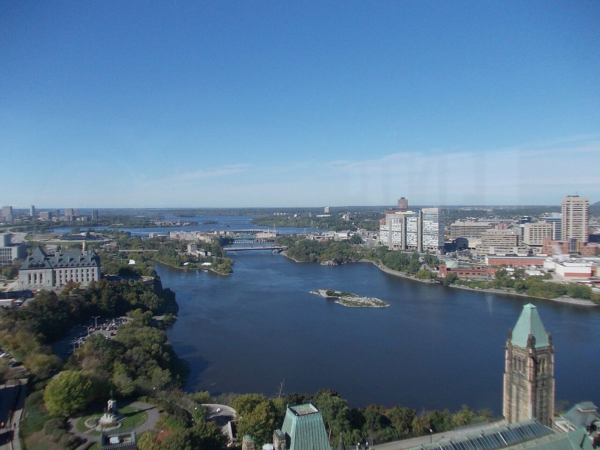
The Ottawa River originates at Lac des Outaouais, north of Quebec's Laurentian Mountains, and initially flows westward into Lake Timiskaming. From this point, the river's course southeastward serves as the interprovincial border between Ontario and Quebec for the majority of its length. It passes through the capital region of Ottawa and Gatineau, where it absorbs major tributaries like the Rideau and Gatineau rivers, before culminating in the Lake of Two Mountains and finally the St. Lawrence River at Montreal. Hydrological monitoring at the Carillon Dam, near the river's mouth, records an average annual flow of 1,939 cubic metres per second, though this can vary dramatically with seasonal and climatic conditions. The river's flow has reached recorded extremes from a low of 467 cubic metres per second in 2010 to a staggering high of 9,094 cubic metres per second during spring flooding in 2017.
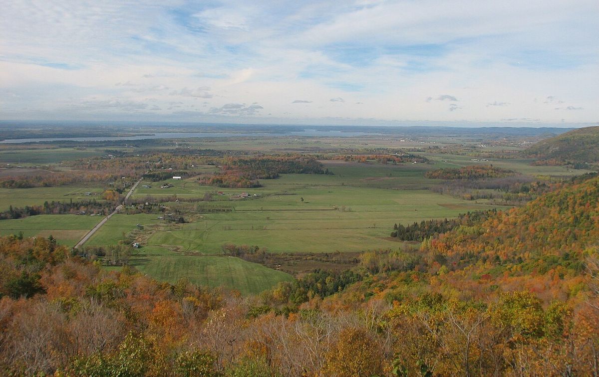
The river's course traverses diverse geological landscapes, flowing primarily over the ancient bedrock of the Canadian Shield in its upper reaches. In its lower sections, the river valley cuts through limestone plains and extensive deposits left by retreating glaciers. This geological history is directly responsible for the varied ecosystems found along its banks. The river flows through large expanses of both deciduous and coniferous forest that recolonized the valley after the last ice age. Coniferous forests and blueberry bogs typically thrive on old sand plains or wet clay substrates, while richer soils support deciduous stands of birch, maple, beech, oak, and ash. Centuries of human activity, from logging to settlement, have disturbed nearly all these forests, making remaining tracts of older growth particularly valuable for conservation. The river also supports extensive and biologically significant wetland complexes, which depend on seasonal water-level fluctuations to maintain their ecological character.
- Westmeath sand dune/wetland complex, notable for rare dune plants.
- Mississippi Snye, an important aquatic habitat.
- Breckenridge Nature Reserve, protecting shoreline ecosystems.
- Shirleys Bay, featuring a large silver maple swamp and alvar shoreline.
- Ottawa Beach/Andrew Haydon Park, a recreational and wetland area.
- Petrie Island, known for its marshes and beaches.
- The Duck Islands and Greens Creek, significant wetland habitats.
These wetlands exhibit five principal vegetation types. One type is swamp, which is mostly silver maple. There are four herbaceous vegetation types named for the dominant plant species in them: Scirpus, Eleocharis, Sparganium and Typha. Inland, and mostly south of the river, older river channels which date back to the end of the ice age have sometimes filled with a different wetland type, which is peat bog. Notable examples of these peat bogs include Mer Bleue and Alfred Bog. The distribution of forests and wetlands is very much a product of past glacial events, including deposits of sand and clay from the Champlain Sea period.
Geological History
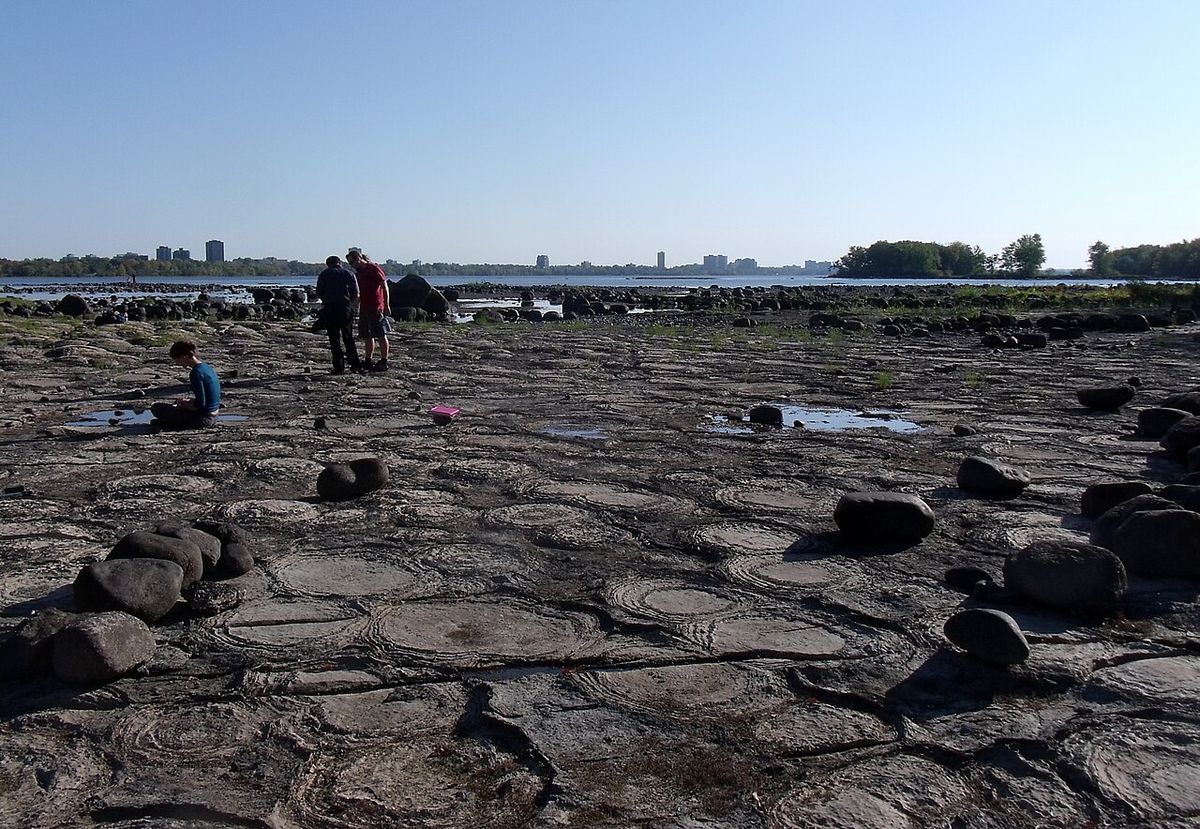
The Ottawa River flows within the Ottawa-Bonnechere Graben, a Mesozoic rift valley that formed approximately 175 million years ago. This underlying geological structure has shaped the broad valley the river occupies today. The most recent and significant geological chapter began with the retreat of the continental ice sheet at the end of the last ice age. The immense weight of the glacier had depressed the land that now forms the Ottawa River valley, along with the St. Lawrence valley and Lake Champlain, to below sea level. As the ice melted, this depression filled with seawater, creating an ancient arm of the Atlantic Ocean known as the Champlain Sea.
The retreat of the Champlain Sea left behind deep deposits of sand and clay that influenced the modern landscape. The sand formed vast plains, which often support pine forests, and localized dune systems like those at Westmeath and Constance Bay. The clay deposits, particularly a sensitive material known as Leda clay, created areas of poor drainage that led to the formation of large swamps and bogs. These clay deposits can become unstable when saturated, leading to landslides such as the 1993 collapse of the former town site of Lemieux, Ontario, into the South Nation River. As the land gradually rebounded from the weight of the ice in a process called isostatic uplift, the coastline retreated eastward, and the freshwater drainage system of the Ottawa River took its current form. For a time following the sea's retreat, the Ottawa River valley acted as a drainage outlet for the Upper Great Lakes basin via Lake Nipissing and the Mattawa River. However, ongoing land uplift around 4,000 years ago eventually blocked this eastward flow, causing Lake Nipissing to drain westward through the French River instead, which later became part of the historic canoe route westward.
Human History and Cultural Significance
The Ottawa River has been central to human life in the region for thousands of years. It is the traditional territory of the Algonquin First Nation, who call the river Kichisìpi, meaning 'Great River' in Anicinàbemowin. The Algonquin people, who refer to themselves as Omàmiwinini or 'down-river people', lived throughout the watershed at the time of European contact and maintain a deep cultural connection to the waterway. Early European explorers sometimes considered the Ottawa River more significant than the upper St. Lawrence, applying the name 'River Canada' to the Ottawa and the St. Lawrence below Montreal.
In 1615, French explorer Samuel de Champlain and his interpreter Étienne Brûlé, guided by Algonquin people, became the first Europeans to travel up the Ottawa River. They followed the water route west along the Mattawa and French Rivers to reach the Great Lakes, establishing a corridor that would define Canadian exploration and trade for centuries. For the next two hundred years, the Ottawa River was the primary route for French fur traders, voyageurs, and coureurs des bois travelling to the interior. This journey was perilous, with dangerous rapids along sections like that near Deux Rivières claiming many lives, as marked by crosses reported by explorer Daniel Harmon in 1800. Key trading posts along the route included Lachine, Fort Coulonge, Lac des Allumettes, Mattawa House, and Fort Témiscamingue.
- 1615: Samuel de Champlain and Étienne Brûlé travel the river with Algonquin guides.
- Early 1800s: The river becomes a central artery for the timber trade, with vast rafts of white pine logs floated downstream.
- 1832: The Carillon Canal is completed, providing a strategic military supply route alongside the Rideau Canal.
- 1950: The dam at Rapides-des-Joachims is built, creating Holden Lake and submerging historic rapids.
The 19th century saw the river's importance shift to the timber industry, as vast stands of virgin white pine were accessed via the Ottawa and its tributaries. This boom led to the establishment of small farming communities along the shores to supply lumber camps. The river's strategic military value was recognized following the War of 1812, leading to the construction of the Carillon Canal in 1832. Along with the Rideau Canal, it was built to provide a secure supply route to Kingston and Lake Ontario, bypassing the vulnerable St. Lawrence River. While its role as a primary economic corridor declined with the advent of railroads and highways in the 20th century, the Ottawa River's cultural and recreational significance endures.
Hydroelectric Development and Economic Use
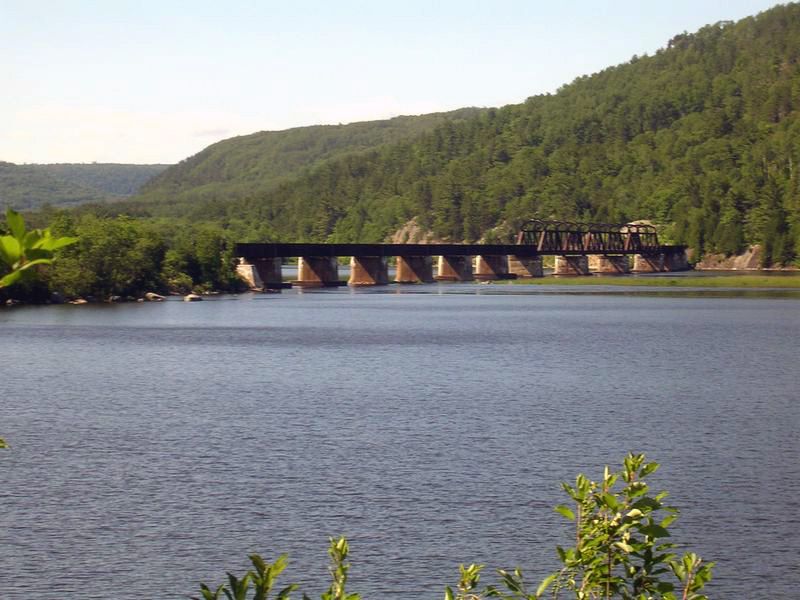
A series of dams and generating stations were constructed along its length, altering the river's hydrology and ecology. The first major development in the modern era was the dam at Rapides-des-Joachims, built in 1950, which created Holden Lake and submerged the historic rapids and portages at Deux Rivières. These installations have provided clean energy but have also had environmental impacts, including the disruption of shoreline and wetland ecosystems and the near-extermination of once-abundant American eels in the river. Beyond power generation, the river historically supported a pulp and paper mill at Témiscaming and was the lifeblood of the timber industry through log driving, a practice that has since ceased. Today, the river's economic importance is supplemented by recreation, with some 20,000 pleasure boaters using the Carillon Canal annually.
The hydroelectric installations are operated by provincial utilities and are critical components of the regional energy grid. The management of water levels and flows for power generation, flood control, and other uses is coordinated by bodies like the Ottawa River Regulation Planning Board. While the river is no longer a primary transport route for commerce, it remains an active corridor for recreational boating, canoeing, and kayaking, contributing to the tourism economies of many riverside communities. The Carillon Generating Station is a joint operation, with Ontario Power Generation operating four generators with a capacity of 96 megawatts and Hydro-Québec operating four generators with a capacity of 89 megawatts.
| Installation (Downstream Order) | Operator / Note |
|---|---|
| Upper Ottawa River Dams | Various |
| Rapides-des-Joachims (Holden Lake) | Built 1950 |
| Lower Ottawa River Dams | Various |
| Carillon Generating Station | Joint operation: OPG (96 MW) and Hydro-Québec (89 MW) |
Ecology and Protected Areas
The Ottawa River ecosystem is a complex mosaic of aquatic, wetland, and forest habitats shaped by its geological past and hydrological regime. The river supports five principal wetland vegetation types, including silver maple swamps and herbaceous zones dominated by species like bulrush (Scirpus), spike-rush (Eleocharis), bur-reed (Sparganium), and cattail (Typha). These wetlands are biologically rich and depend on the natural seasonal fluctuation of water levels, with high water maintaining swamp ecosystems and low water exposing sand and clay flats that allow rare plants to germinate. The adjacent forests, though largely disturbed by historical logging and fires, still provide habitat for numerous species, with remnant old-growth areas being of high conservation priority. The river's ecological health is monitored and advocated for by organizations such as the Ottawa Riverkeeper.
A network of protected areas along the river's course in both provinces helps conserve its natural heritage. In Quebec, three national parks lie directly on the Ottawa River: Oka National Park, Plaisance National Park, and Opémican National Park. The river also flows through the large La Vérendrye Wildlife Reserve, and several controlled harvesting zones (ZECs) border its shores. Ontario has established seven provincial parks along the river's banks, offering protection to various landscapes and providing recreational opportunities. These parks include Voyageur, Fitzroy, Ottawa River Provincial Park, Westmeath, Petawawa Terrace, Driftwood, and Alexander Lake Forest Provincial Park. This patchwork of conservation lands helps preserve critical shoreline habitats, islands, and interior forests associated with the river corridor.
- Oka National Park (QC)
- Plaisance National Park (QC)
- Opémican National Park (QC)
- La Vérendrye Wildlife Reserve (QC)
- Voyageur Provincial Park (ON)
- Fitzroy Provincial Park (ON)
- Westmeath Provincial Park (ON)
- Petawawa Terrace Provincial Park (ON)
Ottawa River Provincial Park
Ottawa River Provincial Park, located in the Township of Whitewater Region, Ontario, offers a specific example of riverside conservation focused on a pristine and dynamic section of the waterway. This non-operating park protects a series of undeveloped islands and a small portion of the Ontario shoreline along a segment of the river renowned for its whitewater. The park's waters are used extensively by commercial rafting companies and recreational kayakers and canoeists. As a non-operating park, it provides no visitor services or facilities, but it is open for backcountry camping, whitewater paddling, swimming, hunting, and fishing, offering a rustic wilderness experience. The park encompasses several named islands, including Big, Butternut, Cedar, Hazelton, and Lorne Islands, along with numerous smaller, unnamed islets.
The geology of these islands varies from marble bedrock to low-lying alluvial deposits of sand and silt. This varied substrate supports a diverse plant community, including sixteen regionally significant plant species such as little bluestem, cordgrass, and Indiangrass. The park also provides habitat for the nationally significant lake cress. The protection of these islands and the adjacent shoreline helps maintain the ecological integrity of a historically important and recreationally valuable stretch of the Ottawa River, preserving its natural character amid broader human use and development. The park's status as a non-operating area means it is managed for conservation and low-impact recreation, relying on visitors to practice leave-no-trace principles.
Questions about Ottawa River
How long is the Ottawa River and where does it start and end?
The Ottawa River is 1,271 kilometres long. It rises at Lac des Outaouais, north of the Laurentian Mountains of central Quebec. The river flows west to Lake Timiskaming and then southeast to Ottawa and Gatineau. It finally drains into the Lake of Two Mountains and the St. Lawrence River at Montreal.
What is the historical significance of the Ottawa River?
The Ottawa River was a vital corridor for centuries. It was the traditional territory and travel route for the Algonquin First Nation. In 1615, it became the route used by Samuel de Champlain and Étienne Brûlé to reach the Great Lakes, opening the interior for the fur trade. Throughout the 19th century, it was the central artery for the timber industry, with vast log rafts floated downstream. It also gained military significance with the completion of the Carillon Canal in 1832.
Are there hydroelectric dams on the Ottawa River?
Yes, several hydroelectric dams have been constructed on the Ottawa River. In 1950, the dam at Rapides-des-Joachims was built, forming Holden Lake behind it. Hydroelectric installations are operated by entities such as Ontario Power Generation and Hydro-Québec. These dams have had negative effects upon shoreline and wetland ecosystems and are thought to be responsible for the near extermination of American eels in the river.
What are some key natural areas or parks along the Ottawa River?
Numerous parks protect sections of the river. In Quebec, key areas include Oka National Park, Plaisance National Park, and Opémican National Park. In Ontario, there are seven provincial parks along its banks, such as Voyageur, Fitzroy, and Ottawa River Provincial Park. The latter protects a pristine whitewater section and islands used for backcountry recreation. Significant wetlands like the Westmeath sand dunes, Shirleys Bay, and Petrie Island are also important natural areas.
What was the Champlain Sea and how did it shape the Ottawa River valley?
The Champlain Sea was an arm of the ocean that filled the Ottawa River valley after the last ice age when the valley was depressed below sea level by the glacier's weight. Fossil remains of marine life dating from this period have been found in marine clay. Sand deposits from this era produced vast plains and areas of sand dunes, while clay deposits resulted in areas of poor drainage, large swamps, and peat bogs. Hence, the distribution of forests and wetlands is a product of these glacial events.
What does the name 'Ottawa' mean and what is its Indigenous name?
The name 'Ottawa' comes from the Algonquin word meaning 'to trade', as the river was the major trade route of Eastern Canada at the time. Its Indigenous Algonquin name is Kichi-Sìbì or Kitchissippi, which translates to 'Great River'. The Algonquin people, whose traditional territory encompasses the entire Ottawa Valley, define themselves in relation to this river, calling themselves the Omàmiwinini or 'down-river people'. Although the river was later named for the Ottawa peoples who controlled it around 1685, only one band, the Kinouncherpirini, ever actually inhabited the valley. Early European explorers sometimes called it the River Canada, considering it more significant than the Upper St. Lawrence, before names like Grand River were used and eventually the present name was settled upon.
Sources and further reading
- Ottawa River (Wikipedia)
- Ottawa River South Shore Riverfront Park Plan (ncc-ccn.gc.ca)
- Ottawa River Provincial Park (ontarioparks.ca)
- Ottawa River Pathway Lookout (engage.ottawa.ca)
Checked by the Your Space Hamilton desk. Last updated 2026-10-22.