Lake of the Woods
Lake of the Woods is a vast freshwater lake straddling the borders of Ontario, Manitoba, and Minnesota, renowned for its complex geography and rich natural and cultural history. Its convoluted shoreline, comprising over 14,552 islands and 65,000 miles of coast, creates a unique international boundary that includes the detached Northwest Angle of the United States. The lake is a vital ecological habitat and a major driver of regional tourism, celebrated globally as a premier destination for walleye fishing. Its management is a coordinated international effort, governed by treaties and control boards established between Canada and the United States.
Geography and Formation
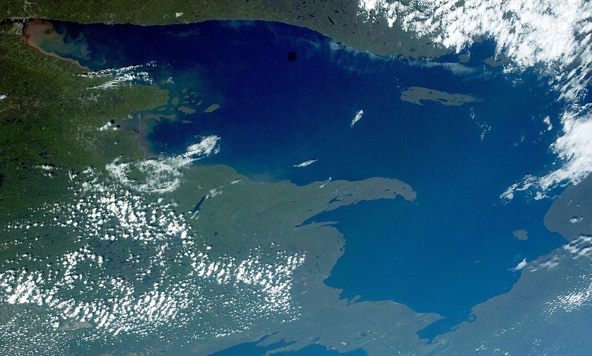
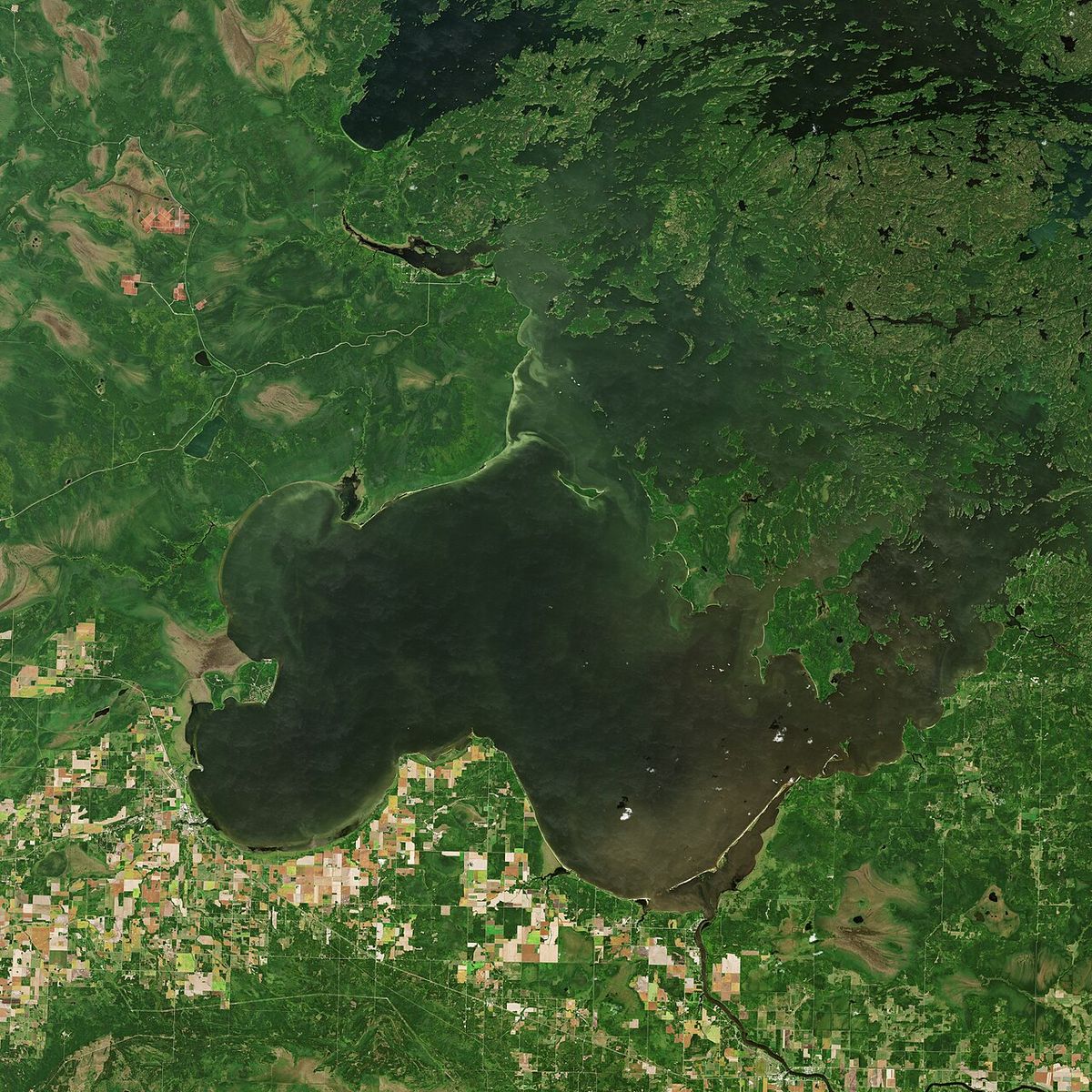
Lake of the Woods occupies a glacially carved basin in the heart of North America, spanning jurisdictions in northwestern Ontario, southern Manitoba, and northern Minnesota. The lake exceeds 70 miles in length and width, presenting a sprawling, island-dotted surface that ranks as the sixth largest freshwater lake located at least partially in the United States and the 35th largest in the world by area. Its primary source is the Rainy River, which flows from the east, supplemented by inflows from Shoal Lake, Kakagi Lake, and numerous smaller rivers. The lake's ultimate drainage is northward, emptying into the Winnipeg River and subsequently into Lake Winnipeg, with its waters eventually reaching Hudson Bay via the Nelson River. The lake's most famous geographical peculiarity is that it separates the Northwest Angle and Angle Township of Minnesota from the rest of the United States, making that area accessible only by crossing the lake or traveling through Canadian territory.
The lake's immense 65,000 miles of shoreline is a product of its incredibly complex shape, fragmented by more than 14,552 islands ranging from tiny islets to substantial landmasses. This labyrinthine geography played a historically problematic role in treaty negotiations intended to define the international border between the United States and British North America. The largest single land feature within the lake is the Aulneau Peninsula, a mass approximately twenty miles long and ten miles wide that is nearly severed from the Ontario mainland. This peninsula itself contains over eighty inland lakes, the largest being Arrow Lake, which contains thirteen islands within it.
History and Naming
The lake has been known by various names through history, reflecting its significance to Indigenous peoples and European explorers. The earliest recorded name from European exploration comes from Pierre Gaultier de Varennes, sieur de La Vérendrye, who referred to it in 1731 as Lake Minitic or Lac des Bois. The name Minitic is believed to derive from an Anishinaabe term meaning 'Islands in a River,' an apt description of the lake's northern reaches. The name Lac des Bois, which translates to Lake of the Woods, is thought by some historians to be a potential mistranslation of an Indigenous name describing the wooded shores or sand hills of the region. The lake remains an important site for several Anishinaabe First Nations, who have longstanding connections to its waters and islands.
One of the contemporary Anishinaabe names for the lake is Babiikwaawangaa-zaagaʼigan, meaning 'Lake with Uneven Sand,' a reference to the sand dunes found along its shores. The Aulneau Peninsula was named in honour of Jesuit missionary Father Jean-Pierre Aulneau, who was killed on the lake on 8 June 1736, and the Catholic church in Warroad, Minnesota, is named Father Aulneau Memorial Church in his honour. The lake's islands also hold darker historical moments, such as Massacre Island, which is traditionally considered the site where twenty French men and a group of Cree traders were beheaded in the mid-18th century by Sioux, an event that ignited decades of war. In the late 19th century, the northern part of the lake saw mining activity, including the Sultana Mine on an island, though operations ceased after an accident and stories about it being haunted by miners persist.
International Governance and Water Management
The management of Lake of the Woods water levels is a formalized binational process, a necessity born from early 20th century concerns over flooding and navigation issues caused by dams built at its outlet near Kenora. In 1912, the federal governments of Canada and the United States referred the matter to the International Joint Commission (IJC). Following the IJC's 1917 recommendations, the Lake of the Woods Control Board (LWCB) was established by Canadian Order-in-Council in 1919, with statutory acts passed by Canada and Ontario in 1921 and 1922, respectively. The 1922 Canada-Ontario-Manitoba Tripartite Agreement was also signed, though Manitoba did not appoint a board member until 1958 after it gained control over its natural resources and passed its own Lake of the Woods Control Board Act. The LWCB's composition includes one member appointed by Canada, two by Ontario, and one by Manitoba, and it is responsible for the day-to-day regulation of lake levels.
The framework for international cooperation was solidified by the 1925 Canada/USA Convention and Protocol regarding Lake of the Woods. This treaty established the allowable operating range for lake levels and created a second body, the International Lake of the Woods Control Board (ILWCB), comprising one American and one Canadian member appointed by their respective federal governments. The ILWCB must approve the decisions of the Canadian LWCB whenever water levels rise above or fall below certain prescribed limits. If the international board members cannot agree, the dispute is referred to the IJC for a final, binding decision. This system ensures shared responsibility for a water body critical to ecosystems, property owners, and the City of Winnipeg, which sources its drinking water from adjacent Shoal Lake via the Greater Winnipeg Water District Aqueduct.
Ecology and Wildlife
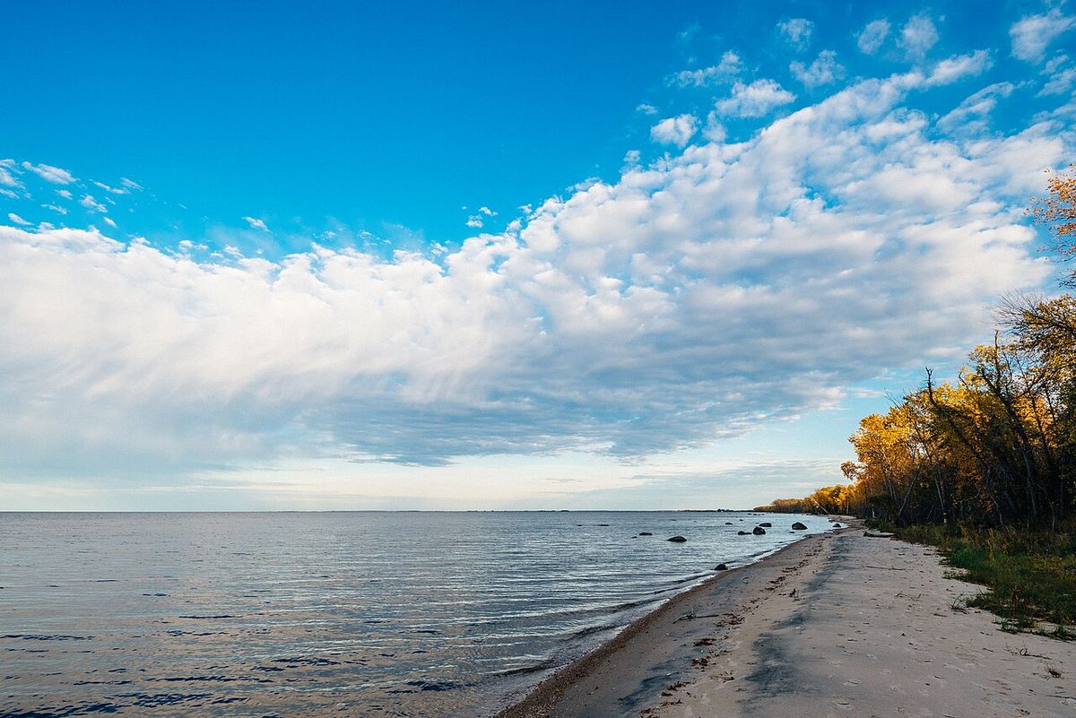
Lake of the Woods supports a diverse and significant array of wildlife, benefiting from its vast, often remote archipelago of islands and extensive wetlands. The islands provide crucial nesting habitats for several bird species of conservation interest. Notably, the piping plover, a threatened shorebird, nests on the lake's sandy beaches. The area also hosts one of the largest breeding colonies of American white pelicans in the region, with thousands of birds utilizing the islands during the summer. As recently as the early 20th century, the lake's islands and surrounding boreal forest provided calving habitat for boreal woodland caribou, though this population has since declined or disappeared from the immediate area.
The lake's forested shores and islands are home to a large population of bald eagles, with several hundred nesting pairs documented in this area. The aquatic ecosystem is equally rich, supporting a wide variety of fish species that form the basis of a world-renowned fishery. The lake's complex structure, with its deep basins, shallow reefs, and weedy bays, creates ideal habitats for walleye, northern pike, muskellunge, smallmouth and largemouth bass, lake trout, lake sturgeon, perch, sauger, crappie, and panfish. This biodiversity makes the lake a vital component of the broader Lake Winnipeg watershed and a key area for ecological study and conservation efforts focused on species like the lake sturgeon and nesting colonial waterbirds.
Recreation and Tourism
Tourism is a major economic driver for communities around Lake of the Woods, with the lake offering a vast playground for outdoor enthusiasts. The region's nickname, the 'Walleye capital of the world,' highlights its premier status for sport fishing, which attracts anglers year-round. Ice fishing is a particularly popular winter activity, with villages of ice huts appearing on the frozen lake. Beyond fishing, the lake is a destination for boating, sailing, kayaking, and houseboating, with numerous marinas and resorts providing rentals, guides, and nautical charts. The remote nature of many islands also offers exceptional opportunities for backcountry camping and wilderness exploration, where campers can locate a site by boat and find abundant wildlife even on small islands.
Several protected parks and reserves enhance the recreational landscape, providing formal access and facilities. These include Lake of the Woods Provincial Park and Sable Islands Provincial Nature Reserve in Ontario, and Zippel Bay State Park in Minnesota, which offers campsites, toilet facilities, a marina with access to the Zippel River, and a beach. The Royal Lake of the Woods Yacht Club, based on the lake, adds a historic and social dimension to its nautical culture. For visitors without their own equipment, a network of outfitters and resorts provides everything from guided fishing trips and houseboat rentals to full-service accommodations and dining, making the lake's wonders accessible to all.
- Major Fish Species: Walleye, northern pike, muskellunge, smallmouth bass, largemouth bass, lake trout, lake sturgeon, perch, sauger, crappie, panfish.
- Provincial/State Parks: Lake of the Woods Provincial Park (ON), Assabaska Heritage Park, Sable Islands Provincial Nature Reserve (ON), Zippel Bay State Park (MN).
- Notable Islands for Recreation: Big Island, Copeland Island (Camp Stephens), Magnuson's Island (Fort St. Charles), Massacre Island, Penasse Island (site of former American Point post office).
- Key Activities: Sport fishing, ice fishing, boating, sailing, kayaking, camping, wildlife viewing, houseboating.
- Services Available: Marinas, resorts, equipment outfitters, houseboat rentals, nautical charts, camping and fishing advice.
Surrounding Communities
The shores and islands of Lake of the Woods are home to a mix of municipalities, First Nations communities, and remote settlements, each with deep ties to the lake. In Ontario, the city of Kenora acts as the primary urban hub and historic commercial centre on the lake's northern shore. Other Ontario communities include Sioux Narrows-Nestor Falls, Rainy River, Minaki, and French Portage Narrows. Numerous First Nations are located on the Ontario shores, including the Anishnaabeg of Naongashiing First Nation, Naotkamegwanning First Nation, Obashkaandagaang Bay First Nation, Niisaachewan Anishinaabe Nation, Ojibways of Onigaming First Nation, Northwest Angle 33 First Nation, Northwest Angle 37 First Nation, and the Anishinabe of Wauzhushk Onigum First Nation. The Manitoba side features smaller communities like Middlebro and the Buffalo Point First Nation. The lake's significance as a border feature is most evident in Minnesota, where towns like Warroad, Baudette, Hackett, and Wheeler's Point are economically and culturally linked to the water, despite the geographic isolation of the Northwest Angle and Angle Township.
The lake's islands also host seasonal camps, historic sites, and private cottages. Copeland Island, for instance, is the long-time site of Camp Stephens, a summer camp operated by the Winnipeg YM-YWCA. Magnuson's Island is the location of the restored Fort St. Charles, a National Historic Site of Canada marking an important 18th-century French fur trade post. The distribution of communities reflects the lake's role as a source of sustenance, transportation, and economic livelihood for generations, from Indigenous fisheries and fur trade routes to modern tourism and recreation. This network of settlements relies on the lake for both physical connection and economic survival.
Notable Islands and Landmarks
The thousands of islands within Lake of the Woods each have their own character and history, contributing to the lake's legendary reputation for exploration. The Aulneau Peninsula, though connected by a narrow isthmus at its southeast corner, functions as a massive island-like landmass containing its own interior lake system. A canal was once cut at Turtle Portage to make it a true island, but it has since been filled back in, leaving a manual portage for small- to medium-sized boats. Chapel Island, located about 15 kilometres from Kenora, served as a historic rest stop for Indigenous canoeists traveling for trade and a site where white settlers attempted missionary conversion, offering refuge in bad weather, though the chapel has since burnt down. Massacre Island is marked by a large wooden cross, commemorating the 18th-century conflict that occurred there. Penasse Island was once the site of American Point, the northernmost post office in the contiguous United States.
- Copeland Island: Also known as Camp Stephens, a Winnipeg YM-YWCA summer camp.
- Massacre Island: Traditional site of a mid-18th century conflict where French men and Cree traders were killed. Marked by a large wooden cross.
- Penasse Island: Location of the former American Point post office, the most northern post office in the contiguous United States.
- Sultana Mine: Site of a late-1800s island mine in the northern area of the lake, closed after an accident.
- Brush Island and Garden Island: Located in Minnesota waters.
- Flag Island and Little Oak Island: Also part of the Minnesota island group.
The islands of Lake of the Woods contain historic sites like Fort St. Charles and tragic sites such as Massacre Island. These landmarks illustrate the lake's history of cultural contact, industry, and daily life. They are physical reminders of the lake's central role in regional exploration, trade, and settlement. The islands also provide critical nesting habitats for the piping plover and large numbers of American white pelicans. As recently as the early 20th century, these islands provided calving habitat for boreal woodland caribou.
Hydrological and Political Significance
Lake of the Woods holds a unique position in the hydrology and politics of North America. As a key reservoir in the Winnipeg River drainage basin, its regulated outflow directly influences water levels downstream in Lake Winnipeg and the Nelson River system flowing to Hudson Bay. The lake's management is therefore of interest not only to local shoreline residents but also to hydroelectric operators and the government of Manitoba. The 1925 treaty and the ongoing work of the control boards represent a long-standing and successful example of transboundary water cooperation between Canada and the United States. The International Lake of the Woods Control Board, while activated by the treaty, is distinct from the International Joint Commission, as its members are appointed directly by the federal governments rather than by the IJC.
The lake's geography has had lasting political consequences, most visibly in the creation of the Northwest Angle exclave. This situation has led to practical complexities for residents regarding customs, transportation, and emergency services, requiring special agreements between the US and Canadian governments. The lake's status as a border water body means that activities such as fishing and boating are subject to the laws and regulations of multiple jurisdictions. The presence of First Nations communities with inherent and treaty rights adds another layer of governance and stewardship to the lake, emphasizing its role as a shared space with multiple, sometimes overlapping, authorities and responsibilities. This multi-jurisdictional reality defines the modern experience of the lake, from resource management to recreational use.
Questions about Lake of the Woods
Where is Lake of the Woods located?
Lake of the Woods is a transboundary lake located in central North America. It spans parts of the Canadian provinces of Ontario and Manitoba and the US state of Minnesota. The city of Kenora, Ontario, is a major community on its northern shore. The lake's complex shape creates the unique geographic anomaly of the Northwest Angle, a part of Minnesota that is physically separated from the rest of the United States by the lake and can only be reached by boat or through Canada.
Why is Lake of the Woods famous for fishing?
Lake of the Woods is nicknamed the Walleye capital of the world. The lake is home to walleye, northern pike, muskellunge, smallmouth bass, largemouth bass, and lake trout. It is the host of year round fishing. Ice fishing is a popular recreation activity on the lake.
What is the Northwest Angle and how is it connected to Lake of the Woods?
The Northwest Angle is a small section of Minnesota that is the northernmost point of the contiguous United States. It is located on the northern shore of Lake of the Woods and is completely detached from the rest of Minnesota by the lake's waters. This unusual geography is a result of historical treaty definitions using the 'northwesternmost point' of the lake as a landmark. Residents and visitors can only reach the Northwest Angle by boat across the lake or by driving through the Canadian province of Manitoba, passing through customs.
How is the water level of Lake of the Woods managed?
Water levels on Lake of the Woods are managed through a cooperative binational system established by treaty. The 1925 Canada/USA Convention and Protocol set the operating range. Day-to-day regulation is handled by the Canadian Lake of the Woods Control Board, with members from Canada, Ontario, and Manitoba. An International Lake of the Woods Control Board, with one US and one Canadian member appointed by their federal governments, must approve decisions when levels rise above or fall below certain limits. If they disagree, the dispute goes to the International Joint Commission for a final ruling.
What are some notable islands on Lake of the Woods?
Magnuson's Island, site of the restored Fort St. Charles. Massacre Island, marked by a cross commemorating an 18th-century conflict. And Copeland Island, home to the historic Camp Stephens YMCA camp. Penasse Island was once the site of the northernmost post office in the contiguous United States, called American Point. Chapel Island was a historic rest stop and missionary site.
What Indigenous communities are connected to Lake of the Woods?
Many Anishinaabe (Ojibwe) First Nations have traditional territories and contemporary communities on the shores of Lake of the Woods. In Ontario, these include Naotkamegwanning First Nation, Anishinabe of Wauzhushk Onigum First Nation, Big Grassy First Nation, Northwest Angle 33 First Nation, Ojibways of Onigaming First Nation, and the Anishnaabeg of Naongashiing First Nation, among others. In Manitoba, the Buffalo Point First Nation is located on the lake. The lake is known in Ojibwe as Pikwedina Sagainan and also by the name Babiikwaawangaa-zaagaʼigan, meaning 'Lake with Uneven Sand.'
Sources and further reading
- Lake of the Woods (Wikipedia)
- Lake of the Woods Provincial Park (ontarioparks.ca)
- Visit Kenora and experience everything Lake of the Woods ... (visitkenora.ca)
- Beach Front Park (lakeofthewoods.ca)
Checked by the Your Space Hamilton desk. Last updated 2026-10-20.