Horseshoe Falls
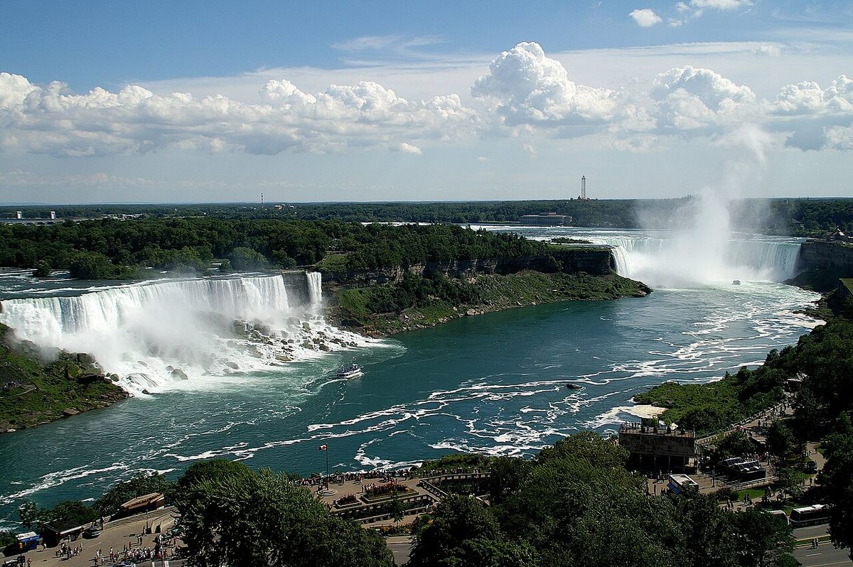
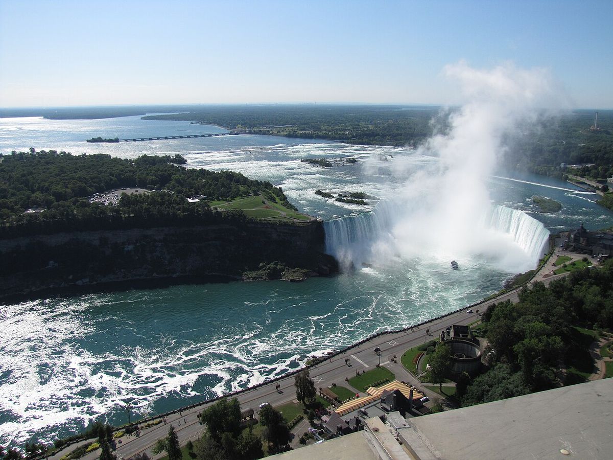
Horseshoe Falls, often called the Canadian Falls, is the largest and most voluminous of the three waterfalls that constitute Niagara Falls on the Niagara River. It forms a natural border between the Canadian province of Ontario and the US state of New York, with the majority of its crest located on the Canadian side. The falls are a defining natural landmark of Canada, attracting millions of visitors annually and serving as a major source of hydroelectric power. Its distinctive horseshoe shape, created by the relentless force of water erosion, is a widely recognized symbol of Canadian natural heritage and cross-border cooperation.
Geography and Hydrology
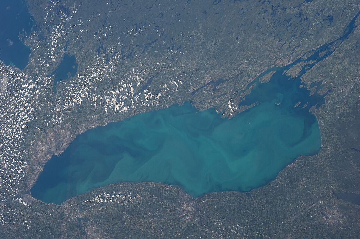
The Horseshoe Falls is situated on the Niagara River, which drains Lake Erie into Lake Ontario, marking part of the international boundary. The Niagara River's flow is heavily managed for hydroelectric generation, with significant water diversion occurring, especially at night and during winter months. Despite these diversions, Horseshoe Falls carries the vast majority of the river's remaining flow, estimated at around 90 percent, while the American Falls and Bridal Veil Falls on the US side carry the remaining 10 percent. The immense volume of water plunging over the crest creates a powerful mist plume and a constant roar that can be heard from considerable distances.
The bedrock beneath the falls consists of hard dolomite limestone overlying softer shale and sandstone. The relentless force of the water erodes the softer layers, causing periodic rockfalls and the gradual upstream retreat of the crest. This erosive process is what originally formed the pronounced horseshoe shape and continues to shape the falls' geography. The Canadian viewpoint is primarily from Table Rock, while the US perspective is from Terrapin Point on Goat Island, though the view from the American side is more limited. The powerful flow and deep plunge pool at the base make the area immediately below the falls treacherous for navigation.
International Boundary and Terrapin Point
The location of Horseshoe Falls in relation to the Canada-United States border has been a subject of geographical and engineering change. The international boundary line was established by the Treaty of Ghent in 1819. Historically, the northeastern end of the falls extended into New York State, flowing around a group of rocks known as the Terrapin Rocks. In 1955, the area between Terrapin Rocks and Goat Island was filled in to create a viewing area known as Terrapin Point. Further engineering work was undertaken in the early 1980s by the United States Army Corps of Engineers.
They constructed diversion dams and retaining walls designed to redirect water flow away from Terrapin Point to mitigate erosion. This series of projects effectively eliminated approximately 400 feet (120 metres) of the Horseshoe Falls crest that was once on the US side. Consequently, the official national maps for both countries now indicate that only a very small portion of the falls remains within United States territory. The ongoing natural erosion of the crest means the falls will continue to migrate upstream, which may necessitate future discussions regarding the precise location of the international boundary in this area.
Tourism and Viewing Areas
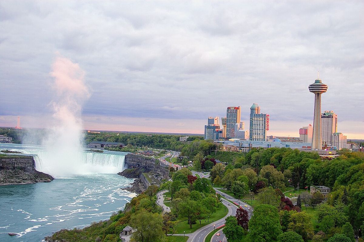
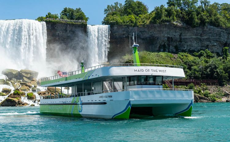
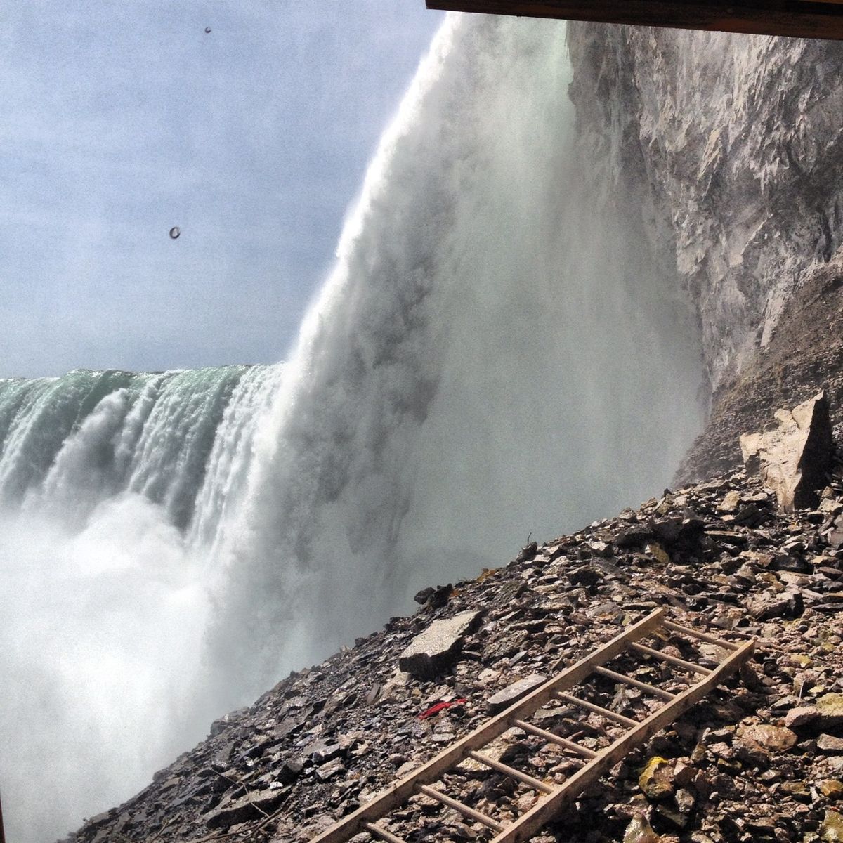
Horseshoe Falls is the centrepiece of Niagara Falls tourism, with numerous attractions and viewing platforms operated by the Niagara Parks Commission on the Ontario side. Table Rock, located mere metres from the crest, offers a powerful and immersive viewing experience where visitors can feel the spray and thunder of the falling water. The Journey Behind the Falls attraction allows guests to descend via elevator to tunnels that lead to observation portals located directly behind the curtain of water. The Hornblower Niagara Cruises (formerly Maid of the Mist) boat tours depart from the Canadian shore and travel into the mist-filled basin at the foot of the falls. On the American side, viewing is primarily from Terrapin Point on Goat Island, which provides a panoramic but more distant view of the Canadian Falls.
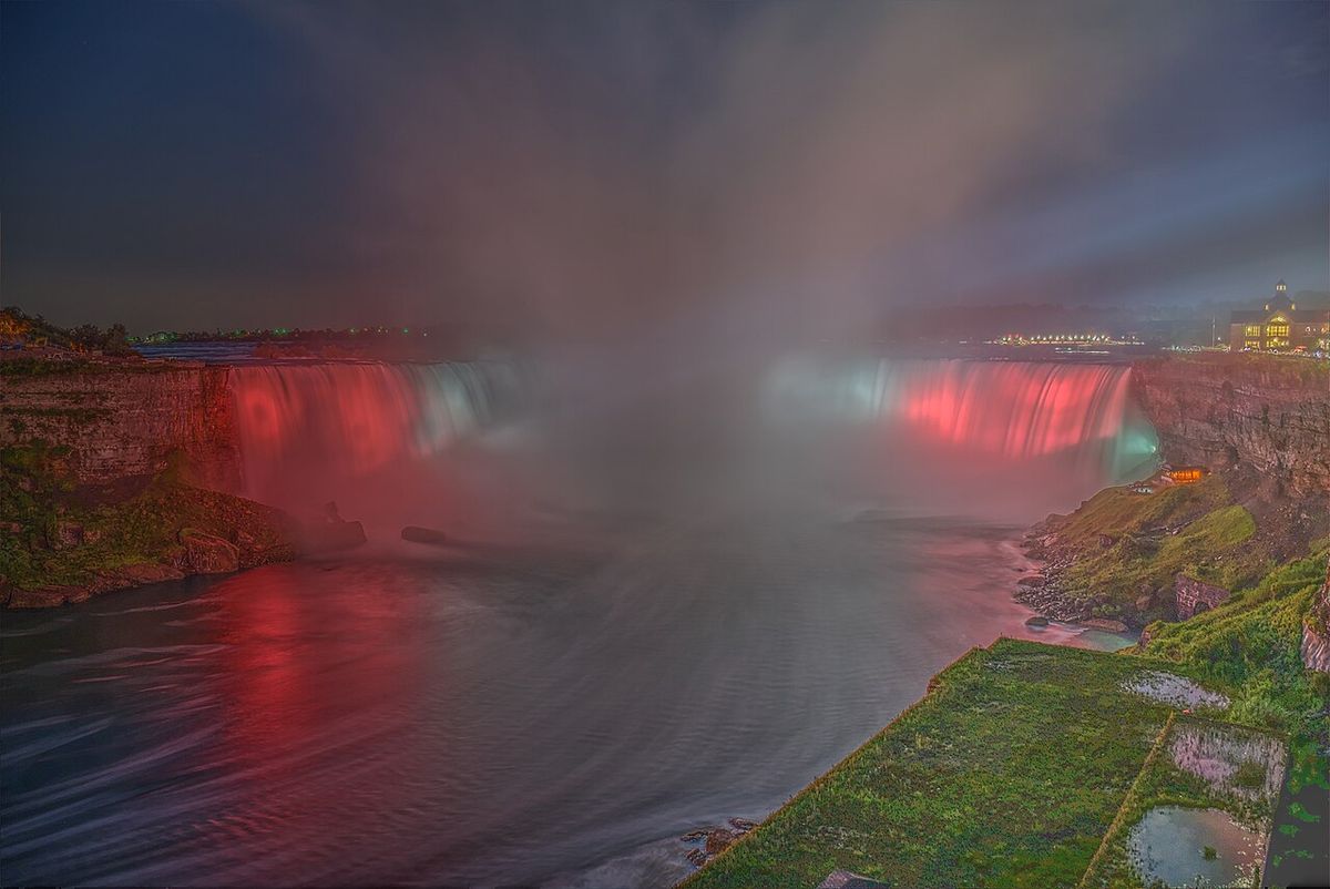
The Cave of the Winds tour on the US side gives access to walkways near the base of the adjacent Bridal Veil Falls. It does not approach Horseshoe Falls closely. The developed Canadian shoreline features hotels and observation towers. It also offers illuminated night views. This contrasts with the more park-like setting of the US side. Key tourist landmarks and activities are found on the Canadian side.
- Table Rock Welcome Centre and viewing plaza
- Journey Behind the Falls tunnel experience
- Hornblower Niagara Cruises boat tours
- Niagara Parks Botanical Gardens and Butterfly Conservatory
- Illumination of the falls with coloured lights each evening
- Fireworks displays over the falls during summer seasons
Annual visitor numbers to Niagara Falls, Ontario, consistently reach into the tens of millions. This makes it one of Canada's top tourist destinations. The tourism infrastructure is designed to accommodate this high volume. It also aims to preserve sightlines to the natural wonder. The area is undoubtedly highly commercialized.
Hydroelectric Power Generation
Water diversion for power plants significantly reduces the flow over the falls, particularly outside of peak daylight tourist hours. Up to half of the Niagara River's water can be diverted, with the proportion increasing to about 75 percent at night and in the winter months when tourist numbers are lower. This managed flow is governed by a treaty between Canada and the United States designed to balance power generation with preserving the falls' aesthetic appeal. On the Canadian side, the Sir Adam Beck Hydroelectric Generating Stations, located upstream from the falls, are major facilities.
The diverted water is channeled through canals and tunnels to these plants before being returned to the Niagara River downstream. This system provides a substantial portion of Ontario's electrical power. The management of water flow is a continuous process, with international oversight to ensure an equitable share of the resource and to maintain the visual appeal of Horseshoe Falls for visitors. The following table outlines the approximate flow distribution under normal daytime conditions.
| Destination | Approximate Percentage of Niagara River Flow |
|---|---|
| Over Horseshoe Falls | 90% |
| Over American & Bridal Veil Falls | 10% |
The ability to generate clean hydroelectric power from the falls is a significant economic benefit for the region. It is also a significant environmental benefit. This power generation permanently alters the natural flow regime. The natural flow regime would otherwise exist without this diversion.
Geology and Erosion
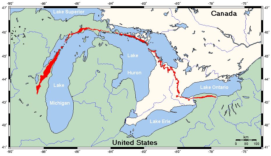
The formation and ongoing evolution of Horseshoe Falls are dictated by the unique geology of the Niagara Escarpment. The caprock is composed of hard, erosion-resistant Lockport dolomite, which underlies softer layers of Rochester shale and Clinton/Medina sandstones. The plunging water gradually wears away the softer shales and sandstones, undermining the hard caprock until sections collapse. This process causes the waterfall to retreat upstream, a phenomenon that has been occurring for thousands of years since the falls formed at the escarpment after the last glacial period. The rate of retreat has been slowed considerably by human intervention, including water diversion for power and engineering works to stabilize the banks.
Today, the rate is significantly less. The distinctive horseshoe shape is a direct result of this erosive process, as the centre of the crest, where the water flow and force are greatest, erodes more quickly than the sides. Major rockfalls have occurred throughout recorded history, dramatically altering the profile of the falls. Continued monitoring and engineering are required to manage this natural process, especially where it intersects with tourism infrastructure and the international border.
Environmental and Cultural Significance
Beyond its economic roles in tourism and power, Horseshoe Falls holds significant environmental and cultural meaning. The mist zone created by the falls supports unique microclimates and vegetative communities on the surrounding cliffs. The Niagara River corridor is a major migratory pathway for birds, and the area is recognized for its biodiversity. Culturally, the falls have been a sacred site for Indigenous peoples, including the Neutral, Haudenosaunee, and Ojibwe nations, long before European contact. The name Niagara is derived from an Indigenous word, often translated as referring to the thunder of waters.
In the modern era, the falls have become a global symbol of natural power and beauty, featured in countless films, artworks, and literary references. It is also a traditional destination for honeymoons. The shared stewardship of the falls by Canada and the United States, through bodies like the International Niagara Board of Control, represents an example of cross-border environmental cooperation. Preservation efforts focus on maintaining water quality in the river, protecting the scenic integrity of the falls, and managing the impacts of millions of visitors on the local ecosystem. Key management bodies and treaties related to the falls include:
- The Niagara Parks Commission (Ontario, Canada)
- The International Niagara Board of Control
- The Treaty of Ghent (1819), establishing the boundary
- The Niagara River Water Diversion Treaty
- The Niagara Falls Illumination Board
Questions about Horseshoe Falls
Why is it called Horseshoe Falls?
It is called Horseshoe Falls due to its pronounced curved crest, which resembles a horseshoe. This shape is a natural result of the erosive process, where the centre of the waterfall, subjected to the strongest water flow, erodes more rapidly than the sides. Over centuries, this differential erosion has carved the falls into its distinctive arcing form. The name distinguishes it from the other two Niagara Falls, the American Falls and the smaller Bridal Veil Falls.
Can you walk to the bottom of Horseshoe Falls?
No, you cannot walk to the bottom of Horseshoe Falls. The official national maps for both Canada and the United States indicate that a portion of the Horseshoe Falls is located within the United States. The area has been altered by engineering works. The Falls are located between Terrapin Point in New York and Table Rock in Ontario.
How much water goes over Horseshoe Falls?
The volume of water flowing over Horseshoe Falls varies due to hydroelectric diversions. Under the international water management agreement, approximately 90 percent of the Niagara River's remaining flow (after diversion) goes over Horseshoe Falls. Up to half of the river's total water can be diverted for power generation, with diversions increasing to about 75 percent at night and in winter. This management ensures the falls remain visually impressive during peak tourist hours while maximizing renewable energy production.
What is the best place to view Horseshoe Falls?
The best and most recognized views of Horseshoe Falls are from the Canadian side in Ontario. Key viewpoints include Table Rock, which is situated right at the crest of the falls, and the Skylon Tower or Niagara SkyWheel for high panoramas. The American side at Terrapin Point on Goat Island offers a broader, more panoramic view but from a greater distance. For an immersive experience, the Journey Behind the Falls tunnels and the Hornblower boat tour are highly recommended.
How is Horseshoe Falls lit up at night?
Horseshoe Falls is illuminated nightly by a sophisticated system of high-powered, coloured LED lights located on the Canadian side. The lights are operated by the Niagara Falls Illumination Board, a bi-national entity. The colours and patterns can be changed for special events, holidays, or to support charitable causes. The illumination presents the falls' grandeur after dark and is a major tourist attraction in itself, often accompanied by seasonal fireworks displays over the water.
Is Horseshoe Falls in Canada or the USA?
The majority of Horseshoe Falls is located in Canada, specifically in the province of Ontario, while a smaller portion is in the United States, in New York State. It is situated between Table Rock in Ontario and Terrapin Point on Goat Island in New York. The international border was set by the 1819 boundary line based on the Treaty of Ghent. Official national maps for both countries now indicate only a minor segment of the falls is within the United States, and ongoing erosion may further alter this territorial boundary in the future.
Sources and further reading
- Horseshoe Falls (Wikipedia)
- The Canadian & Horseshoe Falls | Clifton Hill, Niagara ... (cliftonhill.com)
- Canadian Falls, Horseshoe Falls, Facts ... (infoniagara.com)
Checked by the Your Space Hamilton desk. Last updated 2026-10-20.