Arctic Archipelago
The Arctic Archipelago, also known as the Canadian Arctic Archipelago, is a vast group of islands situated north of the Canadian continental mainland. Covering approximately 1.4 million square kilometres, it comprises much of Northern Canada, predominantly within the territories of Nunavut and the Northwest Territories. This region is important to Canada due to its immense size, its role in the history of Indigenous peoples and Arctic exploration, and its strategic and environmental importance in the context of climate change and sovereignty. The archipelago's 36,563 islands form the world's largest high-Arctic land area after Greenland and are central to the geography and identity of Canada's North.
History and Human Settlement
The human history of the Arctic Archipelago stretches back millennia, beginning with the arrival of the Paleo-Eskimos from the Canadian mainland around 2500 BCE. These first inhabitants were later replaced by the Thule people, the ancestors of the modern Inuit, who migrated into the region between 1000 and 1500 CE. European exploration began in the 1570s with the voyages of Martin Frobisher, which later formed the basis for British claims over the islands. Canadian sovereignty over the archipelago was established in 1880 when Britain transferred the islands to Canada, and for much of the late 19th and 20th centuries, the islands were administered as part of the District of Franklin. The district was dissolved upon the creation of Nunavut in 1999, which transferred administration of most of the archipelago to the new territory. Today, Canada asserts sovereignty over the waterways of the Northwest Passage as internal waters, a position contested by other maritime nations and central to ongoing discussions about environmental protection and national security in the region.
Geography and Climate
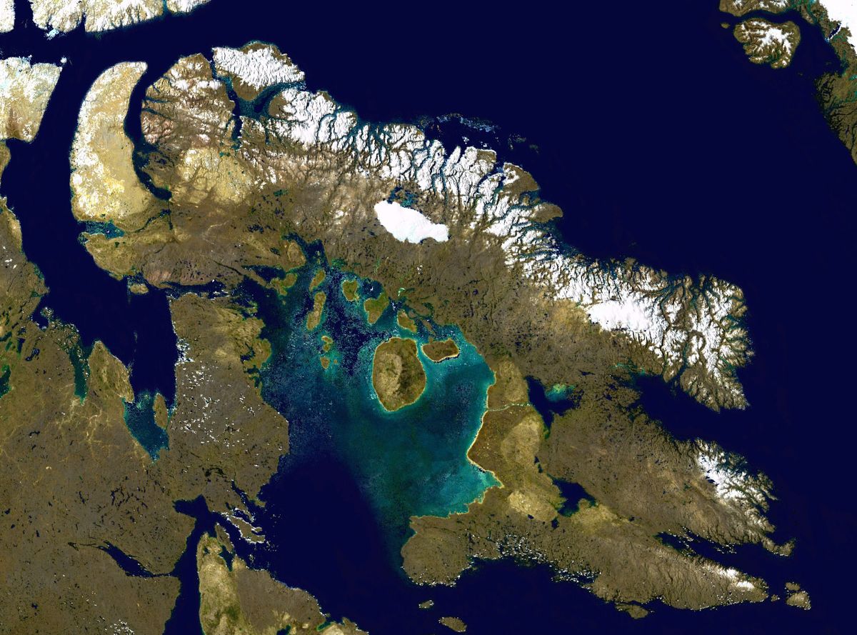
The Arctic Archipelago spans a massive area, extending roughly 2,400 kilometres from east to west and 1,900 kilometres from the mainland to its northernmost point at Cape Columbia on Ellesmere Island. It is bounded by the Beaufort Sea to the west, the Arctic Ocean to the northwest, Greenland, Baffin Bay and Davis Strait to the east, and Hudson Bay and the mainland to the south. The islands are separated by a complex network of channels collectively known as the Northwest Passage, and the terrain is predominantly Arctic tundra, with mountainous regions on the larger islands. The climate is harshly Arctic, characterized by long, extremely cold winters and short, cool summers, and this environment is experiencing measurable effects from climate change. Scientific computer estimates determine that melting ice in the region could contribute 3.5 centimetres to global sea-level rise by the year 2100, which shows the global importance of changes occurring in this remote area.
Major Islands and Population
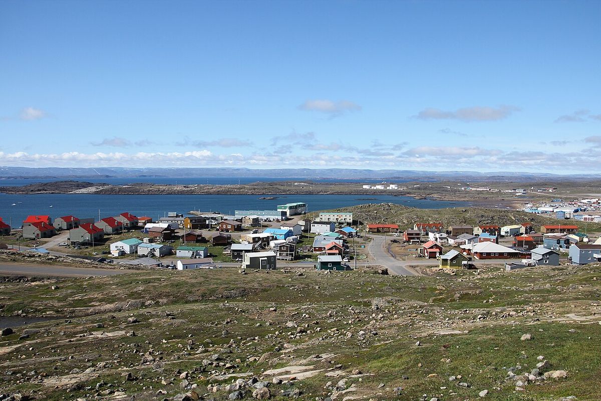
Of the archipelago's 36,563 islands, 94 are classified as major islands, each with an area greater than 130 square kilometres, and the islands vary dramatically in size, with 20 exceeding 5,000 square kilometres in area. Human settlement is extremely sparse and scattered, concentrated almost exclusively in coastal Inuit communities, and only 11 of the thousands of islands are populated. The population distribution is highly uneven, with the majority of residents living on the southern islands, and the total population of all islands in the Canadian Arctic was 23,073 in 2021. Baffin Island is the largest island in the archipelago and in all of Canada, with a population of 13,309, which accounts for 56.51 per cent of the archipelago's total inhabitants and over a third of the population of Nunavut.
- Baffin Island is the largest island in the archipelago and in all of Canada, with a population of 13,309 as of 2021.
- Victoria Island is the second largest, spanning the border between Nunavut and the Northwest Territories.
- Ellesmere Island is the third largest and northernmost major island, part of the Queen Elizabeth Islands cluster.
- Banks Island is located in the Inuvik Region of the Northwest Territories.
- Devon Island is one of the largest uninhabited islands on Earth.
- Axel Heiberg Island is a major uninhabited island in the Queen Elizabeth group.
- Melville Island is shared between Nunavut and the Northwest Territories.
- Southampton Island is located at the entrance to Hudson Bay.
As of 2026, there are 20 islands in the Canadian Arctic Archipelago with an area over 5,000 square kilometres. There are a further 19 islands in the region with areas greater than 1,000 square kilometres but under 5,000 square kilometres. These islands, both inhabited and uninhabited, form the core landmasses of the region. They contribute to the vast and complex geography of Northern Canada.
Political and Strategic Significance
The Arctic Archipelago holds considerable political and strategic importance for Canada, with sovereignty over the islands and the surrounding waters being a longstanding priority. Canada's claim that the waterways of the Northwest Passage constitute Canadian Internal Waters is a point of international debate, as most maritime countries view these as international waters, and this disagreement has implications for environmental regulation, security, and resource management. A notable territorial dispute involved Hans Island, a small, barren island in the Nares Strait between Ellesmere Island and Greenland, and after decades of diplomatic discussion, Canada and Denmark reached an agreement to divide the island, settling the dispute. The creation of Nunavut in 1999 transferred the administration of most of the archipelago to the new territory, empowering the Inuit majority in the region and embedding principles of Indigenous self-government into its governance, which significantly changed the administration of the Canadian North.
Largest Islands by Area
The largest islands in the Canadian Arctic Archipelago are those with an area greater than 5,000 square kilometres. There are 20 such islands as of 2026. These large islands dominate the geography of the region. A further 19 islands have areas between 1,000 and 5,000 square kilometres. The northernmost cluster of islands, which includes Ellesmere Island, is known as the Queen Elizabeth Islands.
The northernmost cluster of islands is known as the Queen Elizabeth Islands. This group was formerly called the Parry Islands. It includes Ellesmere Island. The Queen Elizabeth Islands represent some of the most remote landscapes in the archipelago. Human settlement in this area is extremely thin and scattered.
Environmental Context and Change
The Arctic Archipelago is a bellwether for global climate change, with its vast ice caps, glaciers, and sea ice being highly sensitive to warming temperatures. The observed and projected melting of ice in this region has direct global consequences, notably contributing to sea-level rise, and scientific computer models estimate that melting from the Canadian Arctic Archipelago alone could raise global sea levels by 3.5 centimetres by the end of this century. The changing climate also affects local ecosystems, including tundra vegetation and wildlife such as polar bears, seals, and caribou, which are vital to Inuit culture and subsistence. The so-called Last Ice Area, a region north of the archipelago where thick, multi-year sea ice is projected to persist the longest, is of particular scientific and conservation interest, and environmental changes are intertwined with issues of sovereignty and governance. Shifting ice conditions potentially alter maritime access and resource exploitation pressures in the region, making the archipelago a focal point for both scientific study and international policy discussions about the future of the Arctic.
Questions about Arctic Archipelago
Where is the Arctic Archipelago located?
The Arctic Archipelago is located to the north of the Canadian continental mainland. It is situated in the northern extremity of North America and is surrounded by the Arctic Ocean. The archipelago is bounded on the west by the Beaufort Sea, on the east by Greenland, Baffin Bay and Davis Strait, and on the south by Hudson Bay and the Canadian mainland. It extends some 2,400 kilometres longitudinally and covers about 1,424,500 square kilometres. This group of islands comprises much of Northern Canada, predominantly within the territories of Nunavut and the Northwest Territories.
How many islands are in the Canadian Arctic Archipelago?
The Canadian Arctic Archipelago consists of 36,563 islands. Of these, 94 are classified as major islands, being larger than 130 square kilometres. There are 20 islands that exceed 5,000 square kilometres in size, and a further 19 islands greater than 1,000 square kilometres but under 5,000 square kilometres. The islands cover a total area of about 1,400,000 square kilometres. After Greenland, this archipelago is the world's largest high Arctic land area.
What is the population of the Arctic Archipelago?
As of 2021, the total population of all islands in the Canadian Arctic was 23,073 people. Human settlement is extremely thin and scattered, being mainly coastal Inuit settlements on the southern islands. Of the more than 36,000 islands, only 11 are populated. Baffin Island has the largest population of 13,309 people, which accounts for 56.51 percent of the population of the Arctic Archipelago.
Who were the first people to live in the Arctic Archipelago?
The first humans to live in the Arctic Archipelago were the Paleo Eskimos, who arrived from the Canadian mainland around 2500 BCE. They were later replaced by the Thule people, who migrated into the region between 1000 and 1500 CE. The Thule people are the ancestors of today's Inuit. These historical migrations established the human presence in the archipelago long before European exploration and claims began in the 1570s.
What is the Northwest Passage and why is it important?
The Northwest Passage is a series of waterways that separate the various islands of the archipelago from each other and from the continental mainland. Canada claims all these waterways as Canadian Internal Waters. However, most other maritime countries view them as international waters. This disagreement over the passages' status has raised Canadian concerns about environmental enforcement, national security, and general sovereignty. The issue remains significant for international law and Arctic governance.
What was the dispute over Hans Island?
Hans Island is a small island located in the Nares Strait, east of Ellesmere Island. For decades, there was a dispute over its ownership between Canada and Denmark. This dispute was part of broader considerations of sovereignty in the region. The disagreement was resolved when the two countries agreed to share ownership of the island, establishing a border across it.
Sources and further reading
- Arctic Archipelago (Wikipedia)
- The Seven Wonders Of The Arctic Archipelago (uphere.ca)
- Canadian Arctic Archipelago: Travel Guide (quarkexpeditions.com)
- Arctic Archipelago (thecanadianencyclopedia.ca)
Checked by the Your Space Hamilton desk. Last updated 2026-10-22.