Downtown Vancouver
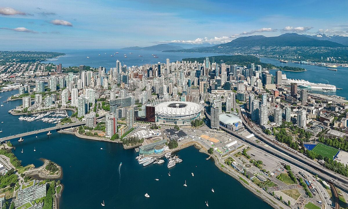
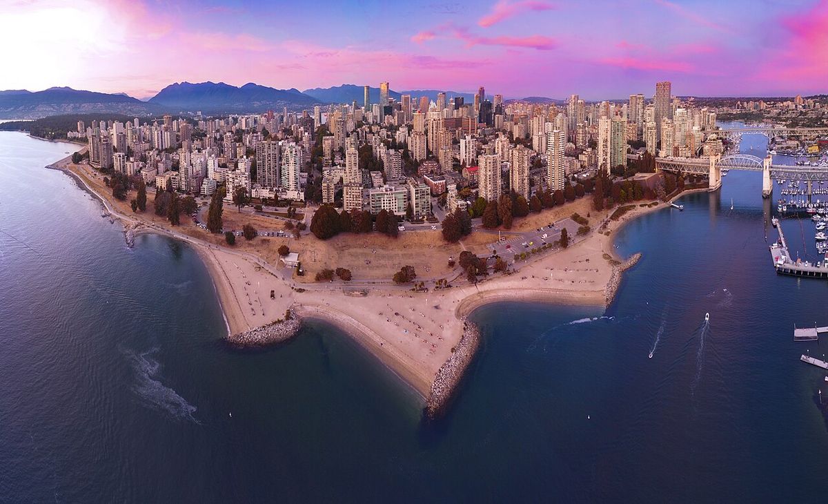
Downtown Vancouver is the primary city centre and central business district of Vancouver, British Columbia, Canada. Located on the northwestern shore of the Burrard Peninsula, it is bordered by Burrard Inlet to the north and False Creek to the south, forming a densely populated urban core. The area is a major economic, cultural, and transportation hub for the Lower Mainland region and the province. It is distinguished by its high concentration of residential and office towers, making it one of the densest urban areas in the country.
Geography and Boundaries
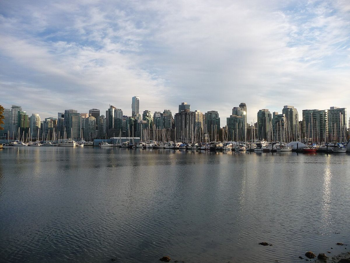
Downtown Vancouver occupies a geographically constrained area on the Burrard Peninsula, largely defined by significant water bodies. Officially, the City of Vancouver delineates Downtown as bounded by Burrard Inlet to the north, the separate neighbourhood of the West End to the west, the communities across False Creek such as Fairview and Mount Pleasant to the south, and the Downtown Eastside and Strathcona to the east and southeast. This official definition excludes the West End and Stanley Park, which are situated on the adjacent Downtown Peninsula. Many unofficial descriptions and popular understandings, however, incorporate the West End and Stanley Park into a broader conception of Downtown. The area's topography, with water on three sides, has historically shaped its development and continues to influence transportation and urban planning. The downtown core itself contains several distinct districts, including the central financial district, the Granville Mall and Entertainment District, and Downtown South, alongside notable heritage and residential neighbourhoods.
Notable Sub-neighbourhoods
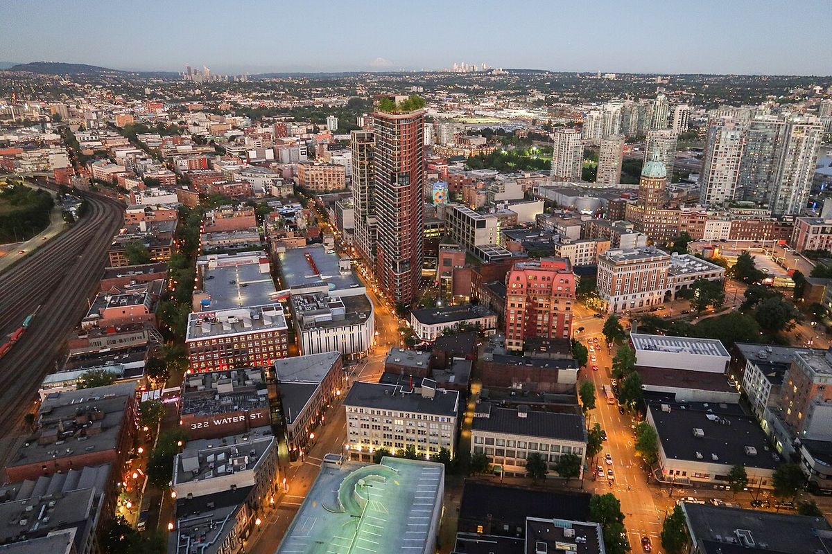
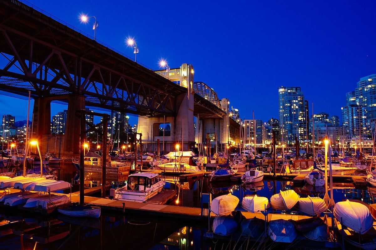
Downtown Vancouver is composed of several distinct sub-neighbourhoods, each with its own unique character and history. These areas range from historic districts to newly revitalized waterfront communities, contributing to the downtown core's diverse urban fabric. Yaletown is a heritage area located along False Creek and the seawall, originally a warehouse district for the Canadian Pacific Railway that has been redeveloped into a high-density residential and commercial neighbourhood known for its loft conversions, condominiums, and upper-middle-class demographic. Coal Harbour, situated along the northern waterfront, is Vancouver's former port area transformed into a residential precinct featuring luxury high-rise condominiums for high-income residents, with marinas and parks along the seawall. Gastown is the original townsite of Vancouver and a National Historic Site, retaining its historic architecture and cobblestone streets, famous for the Gastown steam clock and mixing tourist-oriented retail with residential lofts and apartments housing lower- and middle-income residents.
Chinatown is where many Chinese immigrants established their homes and businesses when they first moved to Vancouver. Residential areas are home to low-income residents in apartments. There are some warehouses still located in the area. Crosstown is a roughly four-block area at the western edge of Chinatown, east of Yaletown and south of Gastown, connecting these three neighbourhoods. It is a compact, high-density neighborhood including high-end heritage buildings like the historic Sun Tower and a row of heritage high-rise boutique loft conversions along Beatty Street. The area also includes nine mixed-use residential condominium towers. As one of the fastest-growing area of Downtown with an influx of new investments and businesses, the neighbourhood offers parks, traditional restaurants, coffee or tea shops, outdoor markets, and many more retail shops. Japantown was an old neighbourhood located east of Gastown that once had a notable concentration of Japanese immigrants. It ceased to be a distinctly ethnic Japanese area during World War II when Japanese Canadians were interned and had their properties permanently confiscated by the King government. Although some Japanese returned after the war, the community never revived to the original state. As the Japantown ceased to exist, the area is now often marketed as Railtown by real estate developers due to the proximity of the West Coast Express railways.
Architecture and Skyline
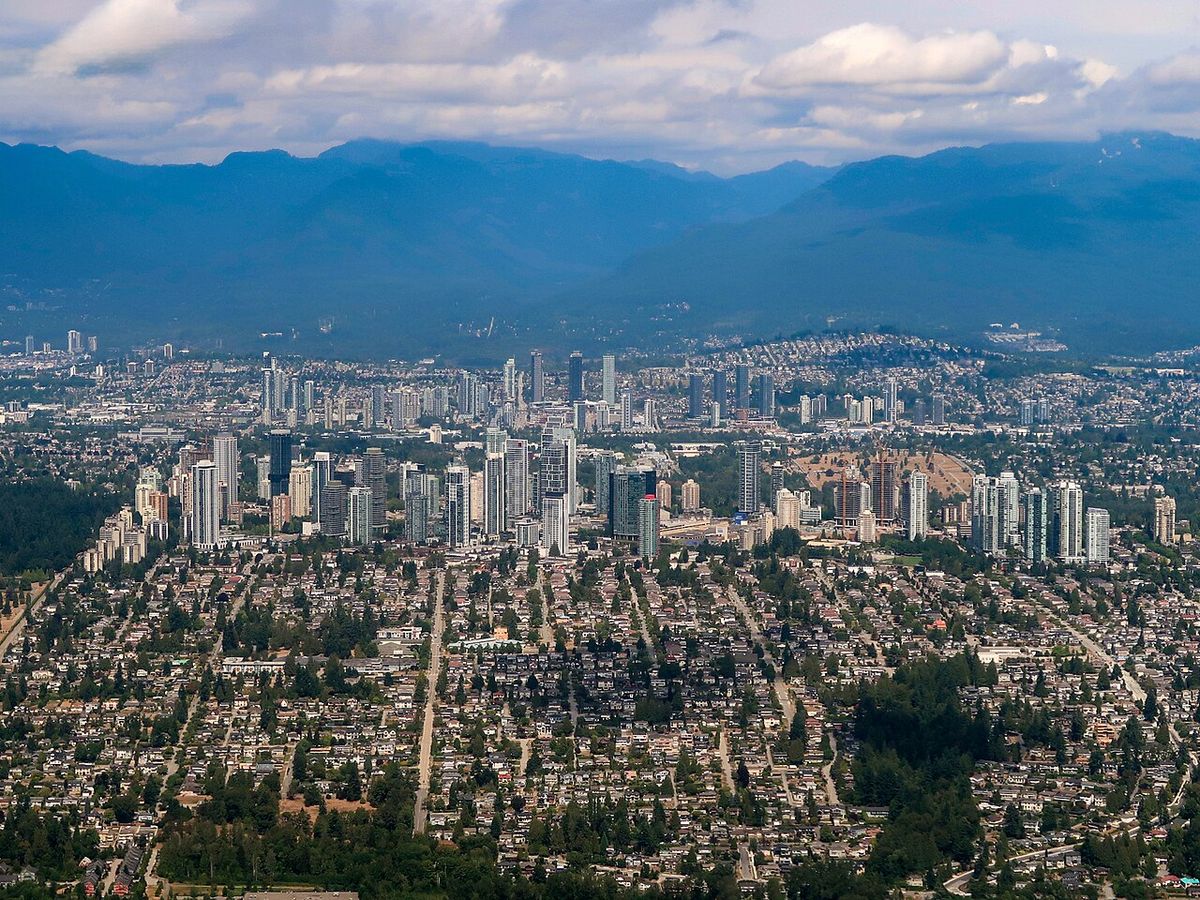
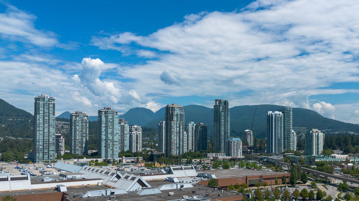
Downtown Vancouver's skyline is dominated by modern high-rise towers, primarily used for residential and office purposes, reflecting the area's extreme density. The downtown core contains almost all of Vancouver's tallest buildings, with the sole exception being Marine Gateway North located near Marine Drive station in South Vancouver. This concentration of skyscrapers is a direct result of geographic constraints and a long-standing policy of promoting high-density urban living. The area also preserves a significant number of the city's remaining historic buildings, particularly within the Gastown and Chinatown historic districts. The juxtaposition of old and new architecture provides a visual narrative of the city's growth from a resource-based port to a major global metropolis.
Sports and Entertainment Facilities
Downtown Vancouver serves as the primary venue for major professional sports and large-scale entertainment events in the region. Two major sporting facilities anchor the eastern edge of the downtown core near False Creek. Rogers Arena, originally known as GM Place, is the home venue for the National Hockey League's Vancouver Canucks. Immediately adjacent is BC Place Stadium, a domed multipurpose stadium that serves as the home for the Canadian Football League's BC Lions and Major League Soccer's Vancouver Whitecaps FC. BC Place also hosts major concerts, trade shows, and other large public events. The Stadium-Chinatown SkyTrain station provides direct rapid transit access to this sports and entertainment district. The presence of these facilities contributes significantly to the area's activity, drawing thousands of spectators downtown for games and events throughout the year and supporting a wide array of restaurants and bars in the surrounding neighbourhoods.
Transportation and Access
Downtown Vancouver's transportation network is complex, designed to move a high volume of people into and out of a peninsula with limited land access. The presence of Burrard Inlet and False Creek restricts road entry primarily to four major bridges. The Lions Gate Bridge connects downtown to the North Shore municipalities and the Trans-Canada Highway. South of False Creek, the Burrard Street Bridge, Cambie Street Bridge, and Granville Street Bridge provide crucial links to the rest of Vancouver. Public transit is centred on Waterfront Station, the principal hub for the region. This historic station is the terminus for two SkyTrain rapid transit lines. The Expo Line travels east from Waterfront through the Dunsmuir Tunnel, while the Canada Line tunnels south under Granville and Davie Streets to Richmond and Vancouver International Airport. Six SkyTrain stations are located within downtown.
Waterfront Station is also the terminus for the SeaBus passenger ferry, which crosses Burrard Inlet to the North Shore in 10 to 12 minutes, and for the West Coast Express commuter rail service to eastern suburbs like Coquitlam, Port Coquitlam, and Mission. Most north-south bus routes in Vancouver, as well as suburban routes from the North Shore and Burnaby, terminate or run through downtown. Two private water taxi services, False Creek Ferries and the Aquabus, operate within False Creek, connecting downtown neighbourhoods with Granville Island and other points along the inlet. Float plane and helicopter terminals are located near Waterfront Station, providing air connections to coastal communities and Vancouver Island.
- Most north-south bus routes in Vancouver, as well as suburban routes from the North Shore and Burnaby, terminate or run through downtown.
- Two private water taxi services, False Creek Ferries and the Aquabus, operate within False Creek, connecting downtown neighbourhoods with Granville Island and other points along the inlet.
- Float plane and helicopter terminals are located near Waterfront Station, providing air connections to coastal communities and Vancouver Island.
Demographic and Economic Profile
Downtown Vancouver is characterized by an exceptionally high population density for a Canadian city centre, driven by a large residential population living in high-rise apartments and condominiums. This residential density is unusual for a North American downtown and is a defining feature of Vancouver's urban model. The population is socio-economically diverse, ranging from high-income professionals in Coal Harbour and Yaletown to lower-income residents in parts of Gastown and Chinatown. Economically, downtown functions as the primary financial and business services hub for British Columbia, housing the headquarters of many major corporations, banks, and legal firms within its central business district. The area also supports a significant tourism and hospitality sector, anchored by hotels, the Canada Place cruise ship terminal, and historic districts like Gastown. Retail is concentrated along Robson Street, the Pacific Centre mall, and the Granville Mall entertainment district.
Cultural and Community Landmarks
Beyond its commercial and residential functions, Downtown Vancouver contains numerous cultural institutions and community landmarks. The historic districts of Gastown and Chinatown are themselves living landmarks, offering architectural heritage and cultural depth. The Gastown steam clock is a famous tourist attraction, while Chinatown's Millennium Gate and the Dr. Sun Yat-Sen Classical Chinese Garden are significant cultural sites. The Vancouver Art Gallery, located in the former provincial courthouse building in the city's core, is a major visual arts institution. The central library branch of the Vancouver Public Library, with its distinctive Colosseum-inspired design, is another architectural and community landmark. The seawall paths that ring Stanley Park and False Creek provide extensive recreational space, connecting downtown neighbourhoods to natural amenities. These elements collectively contribute to the area's identity as not just an economic engine but also a cultural and recreational destination for residents and visitors alike.
Questions about Downtown Vancouver
Which professional sports teams play in Downtown Vancouver?
Downtown Vancouver is home to three major professional sports teams. The NHL's Vancouver Canucks play at Rogers Arena. The CFL's BC Lions and MLS's Vancouver Whitecaps FC both use the neighbouring BC Place Stadium. Both venues are located in the downtown core near False Creek and are served by the Stadium-Chinatown SkyTrain station.
What is the main public transportation hub for Downtown Vancouver?
The historic Waterfront station is the principal transit hub for the downtown core. It is the terminus for the SeaBus passenger ferry to the North Shore and the West Coast Express commuter rail to the eastern suburbs. Waterfront station is also served by two SkyTrain lines, the Expo Line and the Canada Line. Terminals are also available near Waterfront station for float planes and helicopters.
What is the difference between Gastown and Yaletown?
Gastown is another heritage area of the city with tourist shops found near the notable Gastown steam clock. The area is mixed with lower and middle class residents living in apartments, condominiums and lofts. Yaletown is a heritage area of Downtown, located along False Creek and the seawall. Formerly home to Vancouver's warehouses, the area has been revitalized with commercial and residential developments and is now home to an upper middle class with a mix of condominiums and apartments.
What happened to Vancouver's Japantown?
Vancouver's Japantown, located east of Gastown, was a distinct ethnic neighbourhood until the Second World War. During the war, the Canadian government interned Japanese Canadians and confiscated their properties, permanently dispersing the community. Although some Japanese Canadians returned after the war, the neighbourhood never fully recovered its former character. The area is now often referred to as Railtown by real estate developers.
What are the official boundaries of Downtown Vancouver?
Downtown Vancouver is officially bounded by Burrard Inlet to the north, the West End to the west, Granville Island, Fairview and Mount Pleasant across False Creek to the south, and the Downtown Eastside and Strathcona to the east and southeast. It is situated on the northwestern shore of the Burrard Peninsula. Unofficially, many sources include the West End and Stanley Park as part of the Downtown Peninsula, but the City of Vancouver defines them as separate neighbourhoods. This geographically constrained area is one of the densest in Canada due to its many residential towers. Notable sub neighbourhoods within these official boundaries include Yaletown, Coal Harbour, Gastown, and Chinatown.
How do you get to Downtown Vancouver from the North Shore?
The primary routes from the North Shore to Downtown Vancouver are the Lions Gate Bridge and the SeaBus ferry. The Lions Gate Bridge connects the North Shore municipalities to the Trans Canada Highway and downtown. For transit users, the SeaBus is a passenger only ferry that departs from Waterfront station, the principal transit hub for downtown, and reaches the North Shore in 10 to 12 minutes. Waterfront station also serves as the terminus for the West Coast Express commuter rail and is a hub for SkyTrain lines. Access to downtown is limited by water on three sides, with only four major bridges providing entry, including the Lions Gate Bridge from the north.
Sources and further reading
- Downtown Vancouver (Wikipedia)
- Vancouver Neighbourhood Information Map (faithwilson.com)
- Vancouver neighbourhoods: where to live in ... (moving2canada.com)
- Downtown Vancouver Neighbourhoods: Where to Explore (thebradford.ca)
- Where To Stay In Vancouver, Neighborhood Guide (foreverlostintravel.com)
Checked by the Your Space Hamilton desk. Last updated 2026-10-21.