Prince Rupert, British Columbia
Prince Rupert is a port city located on Kaien Island in British Columbia, approximately 770 kilometres northwest of Vancouver. Incorporated in 1910, it serves as the land, air, and water transportation hub for the province's North Coast and is situated on the ancestral territory of the Ts'msyen people. The city is known for having Canada's deepest ice-free natural harbour and is a critical trans-Pacific shipping gateway, connecting North America to key Asian markets. With a population of approximately 12,300 as of 2021, Prince Rupert's economy is anchored by its port operations, commercial fishing, and a growing tourism sector focused on the adjacent Great Bear Rainforest.
History and Founding
The Prince Rupert Harbour area has been home to Coast Tsimshian (Ts'msyen) peoples for at least 5,000 years, serving as a significant centre of trade and commerce. European settlement began in earnest when the Grand Trunk Pacific Railway (GTP) selected the location for its western terminus, replacing Port Simpson. The GTP purchased a large First Nations reserve and received a land grant from the provincial government to establish the townsite. A post office was established on November 23, 1906, and extensive surveying and clearing commenced that year. The provincial government financed early infrastructure, including plank sidewalks, roads, and water mains, though the damp muskeg terrain of Kaien Island proved expensive to develop. Prince Rupert was officially incorporated as a municipality on March 10, 1910, named after Prince Rupert of the Rhine following a nationwide competition held by the railway.
An initial real estate boom saw the town quickly develop businesses, banks, and hotels, but this growth collapsed by 1912, exacerbated by World War I. The GTP's ambitious plans, including a large hotel and passenger ship pier, were never realized, and the company's bankruptcy left a town that would take decades to grow. The Prince Rupert railway station, a listed historic place, replaced a temporary building in 1922. The promise of a highway connection to the mainland spurred further development, culminating in the opening of the road to Terrace on September 4, 1944, for wartime defence purposes. This highway was paved in 1951 and extensively rerouted and repaved in 1970, solidifying the city's land connection.
20th and 21st Century Development
After World War II, fishing and forestry became the dominant industries, with Prince Rupert considered the halibut capital of the world from 1912 until the early 1980s. The city saw significant civic development from the 1960s into the 1980s, including a civic centre, swimming pool, public library, and the Lester Centre of the Arts. The 1990s brought a severe downturn with the closure of the pulp mill, a fish plant fire, and a softwood lumber dispute, leading to population decline from a peak near 18,000. A critical turning point came in 2005 with the announcement of a new container port, new ownership for the pulp mill, a new cruise ship dock, and a resurgence in bulk shipping. Recent years have focused on preparing for major economic growth, including an expected $1.35-billion investment in a bulk terminal on Ridley Island projected to create up to 1,900 jobs.
The city has also faced significant social challenges. In the summer of 1958, a major riot erupted over racial discrimination and police brutality towards Indigenous people, involving as many as 1,000 residents and leading to the reading of the Riot Act. The city continues to work on community development and workforce attraction, with the provincial government providing $240,000 in 2026 for a targeted marketing campaign to attract skilled workers needed to support anticipated growth. Key recent developments include the official groundbreaking for a new Save-On-Foods store on George Hills Way and ongoing generational investments in civic infrastructure as outlined in the 2026 proposed budget.
Geography and Climate
Prince Rupert is situated on Kaien Island, just north of the mouth of the Skeena River and linked to the mainland by a short bridge. It is the western terminus of Trans-Canada Highway 16 (the Yellowhead Highway), approximately 144 kilometres west of Terrace and 715 kilometres west of Prince George. The city's harbour is sheltered by Digby Island and includes Tuck Inlet, Morse Basin, and Porpoise Harbour. Prince Rupert is renowned for its oceanic climate and is located within a temperate rainforest. It is known as 'The City of Rainbows' and holds the distinction of being Canada's wettest city, with annual precipitation ranging from 2,620 millimetres at the airport to 3,060 millimetres in town.
Prince Rupert receives measurable precipitation on an average of 240 days per year. The city averages only 1242 hours of sunshine annually, which is regarded as the least amount of sunshine for any municipality in Canada. Summers are mild and comparatively less rainy, with an August daily mean temperature of 13.8 °C (56.8 °F). Winters are chilly and damp but mild by Canadian standards, with a January daily mean of 2.4 °C (36.3 °F). Snow amounts are moderate for Canadian standards, averaging 0.92 m (36 in) and occurring mostly from December to March. The highest temperature ever recorded was 32.2 °C (90.0 °F) on 6 June 1958, and the lowest temperature ever recorded was -24.4 °C (-11.9 °F) on 4 January 1965.
Demographics and Community
According to the 2021 Canadian census, Prince Rupert had a population of 12,300 living in 5,072 of its 5,747 total private dwellings, representing a slight increase of 0.7% from 2016. The population density was 186.4 people per square kilometre. Population estimates for 2026 suggest a figure of approximately 12,919. Historically, Prince Rupert has had one of the highest percentages of First Nations population among Canadian municipalities with over 5,000 people. Religious affiliation data from 2021 shows a majority of residents (56.0%) reporting no religious affiliation, followed by Christianity (35.6%), Sikhism (3.4%), Buddhism (1.6%), Hinduism (1.4%), Islam (0.8%), Indigenous Spirituality (0.2%), and Judaism (0.1%).
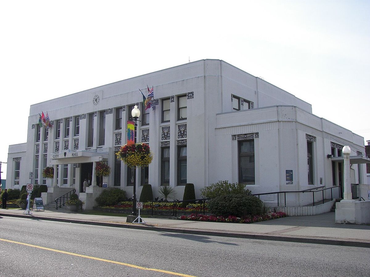
The city is part of the federal electoral district of Skeena, Bulkley Valley, represented by Conservative MP Ellis Ross as of 2026. Provincially, it is within the North Coast-Haida Gwaii riding, represented by New Democratic Party MLA Tamara Davidson. Local governance is led by Mayor Herb Pond and the Prince Rupert City Council. The city maintains an active planning department, which in April 2026 organized a professional development event for planners focusing on downtown vitality. Education is provided through BC School District 52, which also serves Port Edward, with post-secondary options available at a Coast Mountain College campus that also serves as a campus for the University of Northern British Columbia.
Economy and Industry
Prince Rupert's economy is fundamentally tied to its strategic location and deep-water port. Key sectors include commercial fishing, port operations, and tourism. While historically centred on fish canning, the fishing industry has largely transitioned to fresh and frozen processing. The port is a major economic driver, serving as the closest North American port to key Asian destinations and functioning as a vital trans-Pacific hub for container and bulk cargo. The Prince Rupert Port Authority (PRPA) administers the port facilities, which are all serviced by CN Rail. In November 2022, Global Ports Holding signed a ten-year terminal operating agreement with the PRPA to manage cruise ship infrastructure capable of handling vessels up to 335 metres. Major port facilities include the Fairview Terminal container port, Prince Rupert Grain, Trigon Pacific Terminals (formerly Ridley Terminals), and various docks and wharves.
The city is preparing for significant future investment, notably a $1.35-billion bulk terminal project on Ridley Island. Tourism capitalizes on access to the Great Bear Rainforest, offering wildlife viewing, fishing, and cultural experiences. The city supports a diverse retail and dining scene and has recently seen commercial development such as the new Save-On-Foods store. The provincial government's 2026 funding of a workforce attraction initiative aims to help local employers fill jobs in trades, health care, education, and service industries to support this growth. This initiative is part of the province's Look West strategy to strengthen the workforce and develop a more independent economy in British Columbia.
Transportation and Port
Prince Rupert's transportation network integrates road, rail, sea, and air connections, leveraging its unique geography. The city maintains over 60 kilometres of roads, including three major bridges: the Hays Creek (Sixth Avenue) Bridge, the Morse Creek (Second Avenue) Bridge, and the Cow Bay Trestle Bridge. It is the western terminus of Highway 16, providing a vital road link to the rest of British Columbia. The port possesses the deepest ice-free natural harbour in North America and the third deepest in the world. Its location at 54° North makes it the northwesternmost port in North America connected to the continental railway network, offering reduced transit times to Asian markets compared to other west coast ports. The harbour's depth and shelter, free of major obstructions, were confirmed by federal hydrographic surveys between 1906 and 1908.
Passenger ferry services are a key component of regional travel. BC Ferries operates services from Prince Rupert to Haida Gwaii and to Port Hardy on Vancouver Island. The Alaska Marine Highway provides ferry connections to Ketchikan, Juneau, Sitka, and other Alaskan ports. The Prince Rupert Ferry Terminal is co-located with the Via Rail station, which offers the thrice-weekly Jasper, Prince Rupert train, connecting to Prince George, Jasper, and the broader national passenger rail network. The Canadian Coast Guard maintains CCG Base Seal Cove in the harbour for search and rescue and aids to navigation, and also bases helicopters there for servicing remote locations. Prior to its final run in 2021, the CN Aquatrain barge carried rail cargo between Prince Rupert and Whittier, Alaska.
- Roads: Western terminus of Trans-Canada Highway 16. Over 60 km of city-maintained roads.
- Rail: Served by CN Rail for freight and Via Rail's Jasper, Prince Rupert service for passengers.
- Ferries: BC Ferries to Haida Gwaii and Port Hardy. Alaska Marine Highway to Alaska.
- Air: Prince Rupert Airport located on Digby Island, accessible by ferry.
- Port Authority: Prince Rupert Port Authority (PRPA) operates multiple terminals.
- Coast Guard: CCG Base Seal Cove provides search, rescue, and navigation services.
Culture and Notable Residents
Prince Rupert's cultural life is shaped by its Indigenous heritage, maritime identity, and remote coastal setting. The Lester Centre of the Arts serves as a key performing arts venue. The city's history is deeply connected to the Ts'msyen people, whose presence in the area spans millennia. This rich cultural backdrop, combined with access to the Great Bear Rainforest, fosters a strong connection to the natural environment and outdoor recreation, including fishing, wildlife viewing, and exploring historic sites. The community is known for its resilience, shaped by the region's characteristic weather and economic cycles. The city encourages sustainable travel principles of respect for the land, local people, and culture.
The city has been home to many notable individuals across various fields. In politics, Iona Campagnolo served as a federal Minister of Amateur Sports, President of the Liberal Party of Canada, and Lieutenant-Governor of British Columbia. Dan Miller served as Premier of British Columbia from August 1999 to February 2000. In sports, Rod Brind'Amour is a former captain of the NHL's Carolina Hurricanes, and Lisa Walters is an LPGA golf champion. The arts are represented by figures such as artist Sid Dickens, video artist Paul Wong, and Haida artist Don Yeomans. Business leaders include John S. MacDonald, a founding principal of MacDonald, Dettwiler and Associates, and industrialist Sohen Singh Gill, who established Prince Rupert Sawmills in 1958 and employed much of the town's workforce in the 1960s. Other residents include former Prince Edward Island Premier Frederick Peters, who served as City Solicitor from 1911 to 1919, and co-owners of the Seattle Pilots baseball team, Dewey and Max Soriano.
- Rod Brind'Amour: Former NHL captain (Carolina Hurricanes).
- Iona Campagnolo: Politician, former Lieutenant-Governor of BC (2001 to 2007).
- Dan Miller: Politician, Premier of British Columbia (1999 to 2000).
- Duff Pattullo: Former mayor of Prince Rupert and Premier of BC (1933 to 1941).
- Lisa Walters: LPGA golf champion.
- Takao Tanabe: Renowned painter (CM, OBC).
- Gloria Macarenko: CBC Vancouver journalist, born and raised in Prince Rupert.
Questions about Prince Rupert, British Columbia
What is Prince Rupert known for?
Prince Rupert is known as a port city and the land, air, and water transportation hub of British Columbia's North Coast. It is known as 'The City of Rainbows' and is Canada's wettest city. The port possesses the deepest ice-free natural harbour in North America. Historically, it was considered the halibut capital of the world from 1912 until the early 1980s. Key sectors of its economy include commercial fishing, port operations, and tourism.
What is the weather like in Prince Rupert?
Prince Rupert has an oceanic climate and is located in a temperate rainforest. It is Canada's wettest city, with annual averages of precipitation ranging from 2,620 mm (103 in) at the airport to 3,060 mm (120 in) in town. On average, 240 days per year receive at least some measurable precipitation, and there are only 1242 hours of sunshine per year on average. Summers are mild and comparatively less rainy. Winters are chilly and damp but warmer than most locations at a similar latitude.
What are the main industries in Prince Rupert?
The main industries are port operations and shipping, commercial fishing and seafood processing, and tourism. The port is a central part of the economy, handling containerized and bulk cargo like grain and coal. The fishing industry, though transformed from its historic canning roots, remains significant. Tourism leverages the city's access to wilderness areas like the Great Bear Rainforest for fishing, wildlife viewing, and cultural experiences. Forestry has historically been important but has seen significant downturn.
Who are the current political representatives for Prince Rupert?
Prince Rupert is part of the Skeena, Bulkley Valley federal riding. Ellis Ross is the member of Parliament (MP) for the riding, and is a member of the Conservative Party. Prince Rupert is the largest population centre in the North Coast-Haida Gwaii provincial riding. Tamara Davidson is the member of the Legislative Assembly (MLA). She is a member of the New Democratic Party of British Columbia.
How do you get to Prince Rupert?
Prince Rupert is accessible by road, rail, sea and air. It is located at the secondary western terminus of Trans-Canada Highway 16, the Yellowhead Highway, approximately 144 km west of Terrace. By sea, BC Ferries provide service to Haida Gwaii and Port Hardy on Vancouver Island, while Alaska Marine Highway ferries connect to ports like Ketchikan, Juneau and Sitka along Alaska's Inside Passage. Via Rail offers a thrice weekly Jasper to Prince Rupert train service, connecting to the continental passenger rail network. The city is situated on Kaien Island and is linked to the mainland by a short bridge. Prince Rupert Airport is located on nearby Digby Island, providing air access to the region.
What is the population of Prince Rupert?
According to the 2021 Census of Population, Prince Rupert had a population of 12,300 people. This represents a slight change of 0.7 percent from its 2016 population of 12,220. With a land area of 66 square kilometres, this results in a population density of 186.4 people per square kilometre. The population has fluctuated over time, reaching a peak of about 18,000 in the early 1990s before declining due to industrial downturns. As of the 2001 census, among Canadian municipalities with 5,000 or more people, Prince Rupert had the highest percentage of First Nations population. A 2026 population estimate suggests the number may now be around 12,919.
Sources and further reading
- Prince Rupert, British Columbia (Wikipedia)
- City of Prince Rupert (princerupert.ca)
- Helping Prince Rupert attract workers for growth, BC Gov News (news.gov.bc.ca)
- Discover British Columbia's North Coast | Visit Prince Rupert (visitprincerupert.com)
- City of Prince Rupert, Events (pibc.bc.ca)
Checked by the Your Space Hamilton desk. Last updated 2026-10-27.