1700 Cascadia earthquake
The 1700 Cascadia earthquake was a massive megathrust earthquake that struck the Pacific Northwest coast of North America on the evening of January 26, 1700. With an estimated moment magnitude of 8.7 to 9.2, the quake ruptured the Cascadia subduction zone along approximately 1,000 kilometres from mid-Vancouver Island to northern California. It generated a trans-Pacific tsunami that caused damage in Japan and left a clear geological and cultural imprint on the Indigenous peoples of the region. For Canadians, particularly those in coastal British Columbia, this prehistoric event defines the catastrophic seismic hazard posed by the Cascadia subduction zone, informing modern emergency preparedness and community relocation efforts.
The Earthquake and Tsunami
The 1700 Cascadia earthquake was a full-margin rupture of the Cascadia subduction zone, where the oceanic Juan de Fuca plate is forced beneath the North American plate. The rupture extended from the central west coast of Vancouver Island southward to northern California, a distance of roughly 1,000 kilometres. Geological evidence indicates the plates slipped an average of 20 metres along the fault, releasing energy equivalent to a moment magnitude between 8.7 and 9.2. The sudden uplift of the seafloor generated a massive tsunami that radiated across the Pacific Ocean. The waves struck the coast of North America within minutes, inundating coastal forests and Indigenous settlements. The tsunami then travelled across the ocean, taking approximately 9 to 10 hours to reach the coast of Japan.
The precise timing of the earthquake, at about 9:00 PM Pacific Time on January 26, 1700, was deduced centuries later from Japanese historical records. These records document an 'orphan tsunami' that arrived without a felt local earthquake. The waves struck communities in modern-day Iwate Prefecture, including Tsugaruishi, Kuwagasaki (now part of Miyako), and Ōtsuchi. Maximum wave heights in Japan were estimated between 2 and 5 metres based on damage reports. At Kuwagasaki, flooding destroyed 13 houses and a subsequent fire burned 20 more, damaging about 10 percent of the town's buildings. The tsunami also disrupted shipping, with one vessel carrying 28 metric tons of rice being driven ashore, killing two sailors. In the Tanabe area, waves flooded wheat fields, rice paddies, and a storehouse, and entered the moat of Tanabe Castle.
Contemporary Japanese observers were often confused by the event, as no earthquake was felt beforehand. Some writers referred to the waves merely as a high tide or high waves, while an observer at Kuwagasaki specifically called it a tsunami. The village headman of Miho noted the waves behaved like a tsunami but was puzzled by the absence of seismic shaking. These detailed accounts, recorded on the 8th and 9th days of the 12th month of Genroku 12 in the Japanese calendar, provided the exact dates of January 27 and 28, 1700, which researchers used to backtrack the tsunami's origin time and location to the Cascadia coast.

Scientific Evidence and Discovery
The connection between the Japanese tsunami and a North American earthquake was established through interdisciplinary research in the late 20th century. Dendrochronology, the study of tree rings, provided crucial evidence. 'Ghost forests' of red cedar trees along the coasts of Washington and Oregon, killed when the land suddenly subsided and saltwater inundated their roots, show their last growth rings formed in 1699. This indicates they died in the winter of 1699 to 1700, coinciding with the tsunami. These stands include trees on the Copalis River in Washington and submerged stumps exposed at low tide. Sediment cores from coastal lakes and ocean floors reveal sand layers deposited by tsunami waves, further corroborating the event's timing and extent. Archaeological investigations have uncovered evidence of several coastal Indigenous villages in the Pacific Northwest being abandoned around 1700, consistent with tsunami destruction.
Core samples from the ocean floor and debris from earthquake-induced landslides also support the timing of the event. Earlier conjectures linking the earthquake to the Bridge of the Gods landslide on the Columbia River or the Tseax Cone eruption in British Columbia have been disproven by modern dating techniques. Radiocarbon dating and dendrochronology place the Bonneville Slide around 1450, showing it was a separate event. Scientific research into the event is ongoing, such as a 2021 study published in the Journal of Geophysical Research: Solid Earth by Diego Melgar, which investigated whether the January 26, 1700 earthquake was part of a larger rupture sequence. This type of analysis helps refine models of how stress is distributed and released along the complex subduction zone, which is critical for improving forecasts of future seismic behaviour.
Indigenous Oral Traditions and Accounts
While written records were absent in Cascadia, numerous Indigenous nations from British Columbia to northern California preserve detailed oral histories describing a great earthquake and tsunami. These stories, passed down for generations, provide a human-scale account of the disaster that aligns with scientific findings. Not all earthquake stories in the region refer to the 1700 event, but virtually all native peoples in the area have at least one traditional story of an event of unmatched destructive power. Many contain temporal clues, such as estimates in generations since the event, that point to a date range in the late 1600s or early 1700s. Specific stories from various nations offer vivid details that often match the reconstructed conditions of the 1700 quake.
The Huu-ay-aht legend recounts a large earthquake and ocean wave devastating their settlements at Pachena Bay on a winter evening shortly after residents had gone to sleep, consistent with the 9:00 PM timing. Every community on the bay was wiped out except for Masit, located on a mountainside 75 feet above sea level. The only other survivor was a young woman named Anacla aq sop, who was staying at Kiix-in on Barkley Sound, an area less impacted by the tsunami. These narratives often describe the complete destruction of coastal villages, with survival depending on immediate flight to high ground or fortunate location. Ethnographic research has also focused on a common regional pattern of art and mythology depicting a great battle between a thunderbird and a whale, which some interpret as symbolic of the earthquake and tsunami. Cultural signifiers such as earthquake-inspired ritual masks and dances also exist among some groups, indicating the event's deep integration into cultural practices and worldviews.
- Huu-ay-aht (Pachena Bay, BC): A winter evening quake and wave destroyed coastal villages. Only Masit on a mountainside and one woman at Kiix-in survived.
- Kwakwakaʼwakw (N. Vancouver Island, BC): A nighttime earthquake caused virtually all houses in their community to collapse.
- Cowichan (Vancouver Island inner coast, BC): Stories speak of a nighttime earthquake causing a landslide that buried an entire village.
- Makah (Washington, USA): Survivors were only those who immediately fled inland after the shaking stopped, before the tsunami hit.
- Quileute (Washington, USA): A flood was so powerful it swept villagers in their canoes inland all the way to Hood Canal.
- Southern Oregon Tribes (USA): Oral history describes a large tidal wave that uprooted trees and swept away villages, with people tying canoes to treetops.
Geological Context and Recurrence Interval
The 1700 event is part of a long-term cycle of immense stress buildup and release. The geological record, studied through sediment cores and tsunami deposits, reveals that great earthquakes of magnitude 8 or higher occur here approximately every 500 years on average. The intervals between these full-margin ruptures have varied from about 300 to 900 years, with an average recurrence interval of 570 to 590 years. This long recurrence interval compared to other subduction zones, like Japan's which may have major quakes every 100 to 200 years, may indicate unusually large stress buildup and subsequently unusually large earthquake slip in Cascadia.
Recent scientific investigations continue to refine our understanding of the zone's complexity. In 2023, Washington scientists reported on a high-pressure and high-temperature seafloor seep off the coast of Oregon, likely located on the plate boundary. Named 'Pythia's Oasis', it is the first such seep found on the Cascadia Subduction Zone and may play a role in the regulation of fluid overpressures within the fault, which can influence earthquake potential. The confirmation of the 1700 event's magnitude and the understanding of recurrence intervals directly feed into modern hazard forecasts. In 2010, geologists predicted a 37 percent chance of a magnitude 8.2 or larger event occurring in the next 50 years. The same forecast estimated a 10 to 15 percent chance of a full-margin magnitude 9.0+ rupture within that 50-year timeframe. These probabilities are based on the geological record showing the region is within the window for another great earthquake, given the last one was over 300 years ago.
Modern Hazard Assessment and Urban Risk
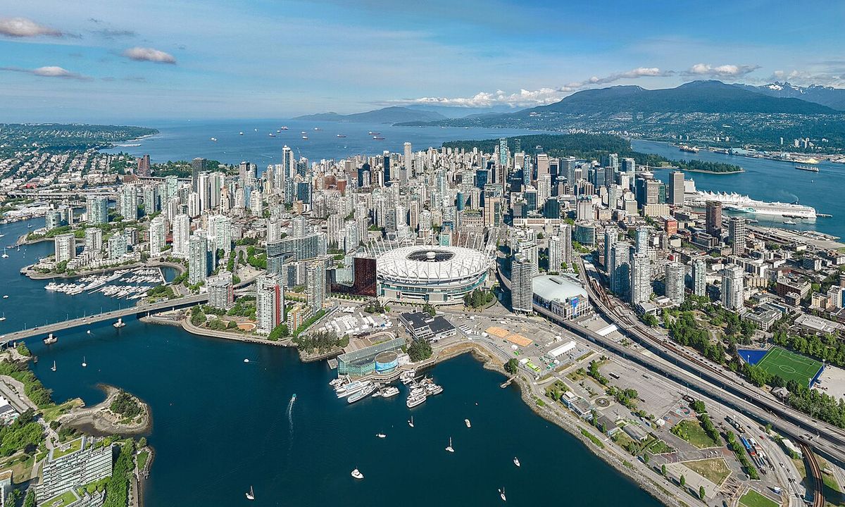
The legacy of the 1700 earthquake directly informs contemporary risk assessment for the Pacific Northwest, including British Columbia. A tsunami generated by a similar magnitude 9 quake could reach heights of 24 to 30 metres along some parts of the coast. While major cities like Vancouver, Victoria, Seattle, Portland, and Tacoma might be sheltered from the full brunt of a tsunami, they face severe shaking damage. These cities contain many vulnerable structures, especially older bridges and unreinforced brick buildings. Consequently, most of the damage in these urban centres would probably be from the earthquake itself rather than inundation. Experts have raised specific concerns about structural preparedness, with one asserting that buildings in Seattle are inadequate to withstand an event even the size of the magnitude 7.9 1906 San Francisco earthquake, let alone a more powerful Cascadia rupture.
Kenneth Murphy, who directs FEMA's Region X, the division responsible for Oregon, Washington, Idaho, and Alaska, stated that the operating assumption is that everything west of Interstate 5 will be toast. A 2004 study revealed the potential for relative mean sea level rise, caused by subsidence of coastal land, along the Cascadia subduction zone. The study postulated that cities on the west coast of Vancouver Island, such as Tofino and Ucluelet, are at risk for a 1-to-2-metre subsidence relative to mean sea level. This subsidence would occur during a major seismic event. The geological record shows great earthquakes occur in the zone about every 500 years on average.
| City/Region | Primary Seismic Risk | Noted Vulnerability |
|---|---|---|
| Vancouver, BC & Victoria, BC | Strong ground shaking | Sheltered from worst tsunami. Older infrastructure at risk. |
| Seattle, WA & Portland, OR | Strong ground shaking | Inadequate building resilience for M7.9+ events. Vulnerable bridges. |
| Tofino & Ucluelet, BC | Tsunami and co-seismic subsidence | Risk of 1-2 metre land subsidence raising relative sea level. |
| Coastal communities west of I-5 | Tsunami inundation | FEMA assumes catastrophic damage ('toast') from combined quake/tsunami. |
Community Preparedness and Relocation Initiatives
In response to the defined hazard, significant preparedness measures are underway across the region. Tsunami evacuation routes, signage, and public education campaigns are now common in coastal towns from British Columbia to California. The scientific confirmation of their oral histories has spurred several Indigenous nations to lead proactive community relocation and fortification projects. These initiatives address both the immediate tsunami threat and the longer-term risk of coastal subsidence and more frequent river flooding exacerbated by climate change. The Huu-ay-aht First Nations rebuilt their administration building on a high point in their territory as an interim evacuation point. Coastal residents are immediately evacuated to this building whenever a tsunami warning is issued.
The Quileute people secured a land grant from the US government in 2012 to move their settlement inland, both for tsunami protection and because of more frequent flooding on the Quillayute River. The Shoalwater Bay Indian Tribe sought and received a FEMA Pre-Disaster Mitigation (PDM) grant to build the first vertical evacuation tower on their coast, a structure completed near the Tokeland Marina in 2022. These projects represent tangible steps toward increasing community resilience based on the lessons of the past. Government and scientific agencies have also produced extensive resources for public and professional education, such as the Cascadia Region Earthquake Workgroup's 2005 magnitude 9.0 earthquake scenario and the Pacific Tsunami Warning Center's animation of the 1700 tsunami forecast model.
Ongoing Research and Future Implications
Research into the 1700 Cascadia earthquake and the behaviour of the subduction zone remains active and critical for updating hazard models. Studies continue to analyze sediment layers, tree rings, and archaeological sites to refine the timeline and characteristics of not only the 1700 event but earlier prehistoric quakes. This paleoseismic work aims to better understand the variability in recurrence intervals and rupture patterns, which is key for probabilistic forecasting. The 2021 study questioning whether the 1700 quake was part of a rupture sequence is an example of this ongoing refinement. The discovery of features like 'Pythia's Oasis' indicates that the subduction zone is more complex and volatile than previously believed.
Monitoring such seafloor seeps could provide new insights into the fluid pressures and frictional conditions on the fault, which are major factors controlling when and how it slips. Geologists have determined the Pacific Northwest is not prepared for such an earthquake, and this research directly informs the scale of mitigation required. The potential for 30-metre tsunamis and permanent coastal subsidence requires long-term planning that integrates land-use policy, engineering, and community-led adaptation. The event's history, spanning from Japanese archives to Indigenous oral traditions to modern geology, provides a unique and comprehensive case study in paleoseismology. It demonstrates how multidisciplinary research can reconstruct a catastrophic event that occurred before written local records, and how that knowledge can directly drive life-saving preparedness for Canada and the entire Pacific Northwest.
Questions about 1700 Cascadia earthquake
When did the 1700 Cascadia earthquake happen?
The earthquake occurred at approximately 9:00 PM Pacific Time on January 26, 1700. This date and time were determined centuries later by correlating geological evidence from North America with historical records of a tsunami that struck Japan on January 27 and 28, 1700. The tsunami's travel time across the Pacific Ocean helped researchers pinpoint the origin time. Japanese records exist from the modern Iwate Prefecture, in communities like Tsugaruishi, Miyako, and Ōtsuchi.
How big was the 1700 Cascadia earthquake?
The earthquake is estimated to have had a moment magnitude between 8.7 and 9.2, classifying it as a megathrust event. The fault rupture extended approximately 1,000 kilometres from mid-Vancouver Island to northern California. The average slip along the fault was about 20 metres. This makes it one of the largest known earthquakes in global history, comparable in scale to the 2004 Indian Ocean and 2011 Tōhoku earthquakes.
What evidence proves the 1700 Cascadia earthquake happened?
Multiple lines of evidence confirm the event. Japanese historical documents describe an 'orphan tsunami' in 1700 with no local cause, damaging towns like Kuwagasaki and Ōtsuchi. In North America, dendrochronology shows coastal 'ghost forests' of trees killed by saltwater immersion had their last growth rings in 1699. Geological sediment cores reveal sand layers from tsunami inundation. Archaeological sites indicate coastal village abandonment around 1700. Indigenous oral traditions from numerous nations also describe a catastrophic earthquake and tsunami.
Could a similar earthquake happen again in the Pacific Northwest?
Yes, scientists agree that the Cascadia subduction zone will produce another great earthquake. The fault experiences these massive ruptures roughly every 500 years on average, with intervals ranging from 300 to 900 years. A 2010 forecast estimated a 37 percent chance of a magnitude 8.2 or larger quake in the next 50 years. There is also a 10 to 15 percent chance of a full-margin magnitude 9.0+ event in that timeframe. The region is considered overdue for a significant seismic event.
How are Indigenous communities preparing for the next Cascadia quake?
Informed by their oral histories of the 1700 event, several Indigenous nations are actively relocating or fortifying their communities. The Quileute Tribe secured a US federal land grant in 2012 to move their village inland from the tsunami zone. The Shoalwater Bay Indian Tribe built the Washington coast's first vertical evacuation tower, completed in 2022 with a FEMA grant. The Huu-ay-aht First Nations use a high-elevation administration building as an interim evacuation point during tsunami warnings.
What would be the impact of a similar earthquake today?
A repeat of the 1700 earthquake would be catastrophic. A tsunami reaching up to 30 metres high would devastate coastal communities. Major cities like Vancouver and Seattle would experience severe ground shaking, likely causing widespread damage to older buildings, bridges, and infrastructure. FEMA has warned that areas west of Interstate 5 could be devastated. While tsunami evacuation plans and building code improvements are in progress, experts assert the region remains underprepared for an event of this magnitude.
Sources and further reading
- 1700 Cascadia earthquake (Wikipedia)
- 1700 Cascadia Subduction Zone Earthquake (pnsn.org)
- The Great Quake and the Great Drowning (hakaimagazine.com)
Checked by the Your Space Hamilton desk. Last updated 2026-10-19.