Mount Robson
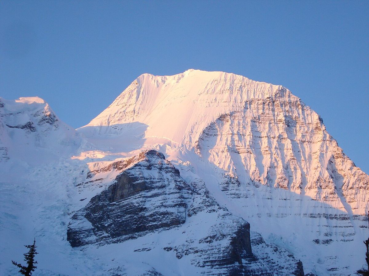
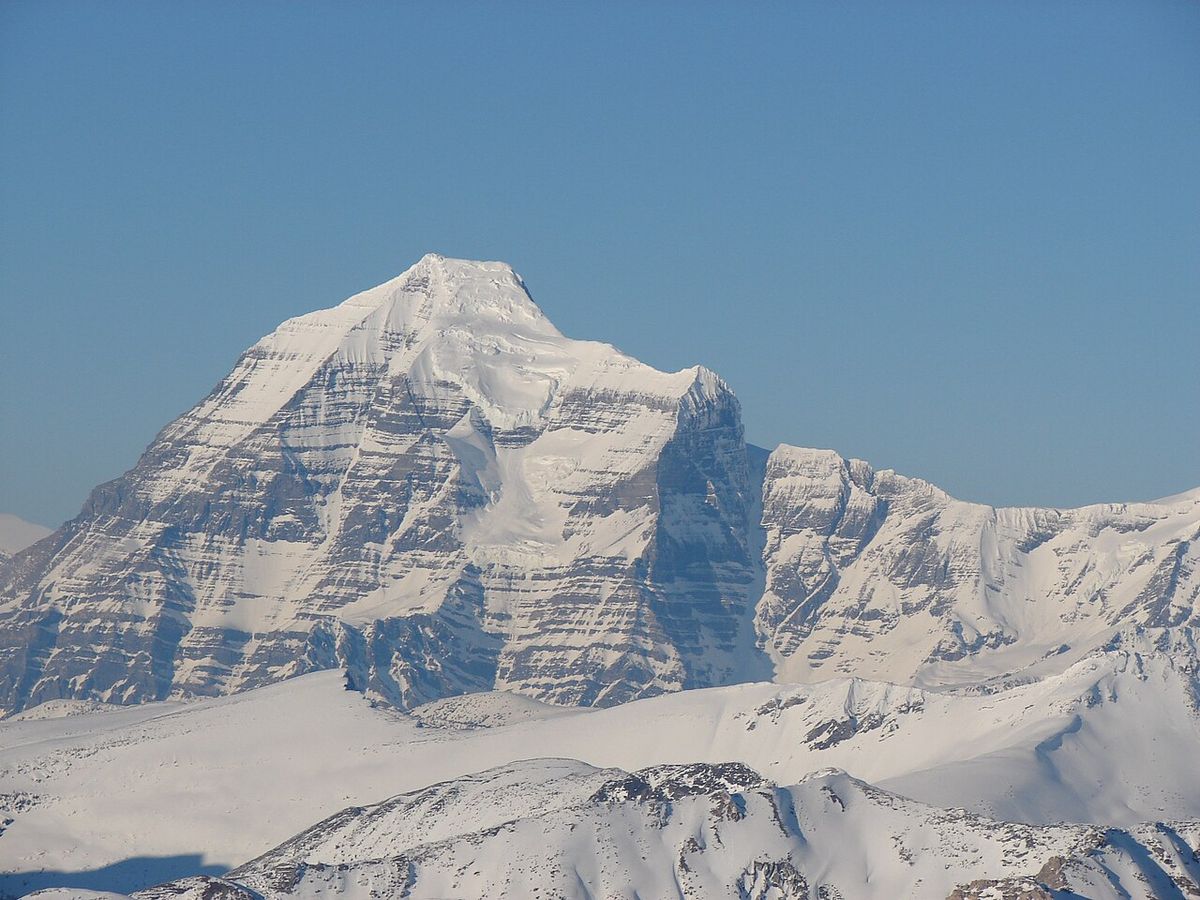
Mount Robson is the highest peak in the Canadian Rockies and the most prominent mountain in North America's Rocky Mountain range. Located entirely within Mount Robson Provincial Park in British Columbia, it forms a central part of the Rainbow Range. The mountain's dramatic south face is a famous landmark clearly visible from the Yellowhead Highway. Its formidable height and challenging terrain have made it a premier destination for mountaineers and a symbol of the Canadian wilderness.
Geography and Topography
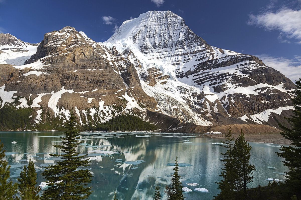
Mount Robson exhibits extraordinary vertical relief over the surrounding landscape. From Kinney Lake on its southwest side, the mountain rises 2,975 metres to the summit. The heavily glaciated north face features 800 metres of ice extending from the summit down to the Berg Glacier. This glacier calves directly into Berg Lake, a body of water approximately two kilometres long situated at an elevation of 1,646 metres. Backcountry campgrounds are located at each end of Berg Lake, and a log shelter named Hargreaves Shelter honours the local outfitting family. The Robson Glacier, which once fed into both Berg Lake and Adolphus Lake across the Continental Divide, has receded more than two kilometres since the early 1900s and is now the sole source of the Robson River. The summit of Mount Robson experiences a tundra climate (ET).
History and Naming
Mount Robson was first surveyed in 1893 by James McEvoy, who confirmed it as the highest peak in the Canadian Rockies. The mountain's name is likely derived from Colin Robertson, an early 19th-century fur trader for the North West Company and Hudson's Bay Company, though confusion later arose with John Robson, a premier of British Columbia. The Texqa’kallt, a Secwepemc people and the area's earliest known inhabitants, call the mountain Yexyexéscen, meaning striped rock, which was recorded in 1891 as Yuh-hai-has-kun, The Mountain of the Spiral Road. An unofficial name for the peak is Cloud Cap Mountain. Prior to the completion of the Grand Trunk Pacific railway, early explorers faced a difficult pack train journey from Edmonton or Laggan via Jasper to reach the mountain.
Early Exploration and First Ascent
Early attempts to climb Mount Robson were few due to its remote location. The most famous early effort was by George Kinney, a founding member of the Alpine Club of Canada, who claimed a summit success with outfitter Donald 'Curly' Phillips in August 1909 after eleven previous attempts. This claim was met with major controversy within the Alpine Club over the implausibility of his reported route, and it is now generally believed he reached the high summit ridge but not the final ice dome. Kinney Lake, below the south face, is named in his honour. The first documented and undisputed ascent was achieved in 1913 by a large party of the Alpine Club of Canada, led by the guide Conrad Kain. This expedition utilized the new railway for access and conquered what was then considered the hardest ice face on the continent. Key figures and events in the early history of Mount Robson include:
- 1893: First survey by James McEvoy.
- August 1909: George Kinney's disputed summit claim with Donald Phillips.
- 1913: First confirmed ascent led by guide Conrad Kain.
- 1924: First ascent of the South Face (Normal Route) by Conrad Kain.
Climbing Routes and Challenges
Mount Robson presents a severe challenge to climbers despite being under 4,000 metres in elevation. There is no easy route to the summit, and the mountain has a notably high failure rate, with only about ten percent of attempts being successful. Unpredictable and often severe weather frequently rebuffs summit bids, and some years see no successful ascents at all. The most formidable challenge is the 1,500-metre Emperor Face on the northwest side, a objective for elite alpinists. More popular and historically significant routes include the Kain route, which follows the Robson Glacier and was the line of the first ascent, and the southeast face. The main climbing routes on Mount Robson, with their difficulty ratings, include:
- South Face (Normal Route) IV
- Kain Face IV
- Wishbone Arete IV 5.6
- Emperor Ridge V 5.6
- Emperor Face, Stump/Logan VI 5.9 A2
- Emperor Face, Cheesmond/Dick VI 5.9 A2
- Emperor Face, Infinite Patience VI WI5 M5 5.9
- North Face IV
- Fuhrer Ridge IV 5.4
Mount Robson Provincial Park
The mountain is the centrepiece and namesake of Mount Robson Provincial Park, the second oldest provincial park in British Columbia. The park protects a vast wilderness area encompassing the headwaters of the Fraser River and significant portions of the Rainbow Range. The Yellowhead Highway (Highway 16) runs through the park, providing spectacular views of Mount Robson's south face and access to popular trailheads. The park is a major destination for hiking, with the 19-kilometre trail to Berg Lake being one of its most famous backcountry routes. This trail passes Kinney Lake and leads to the stunning turquoise waters of Berg Lake, directly beneath the mountain's north face. The park's ecosystems range from interior rainforest valleys to alpine tundra and support diverse wildlife including grizzly bears, mountain goats, and caribou.
Geology and Glaciation
Mount Robson is composed primarily of sedimentary rock, including limestone and shale, that was uplifted during the formation of the Rocky Mountains. The mountain is part of the Rainbow Range, a subrange of the Canadian Rockies characterized by its steep, rugged topography. Glacial activity has carved deep cirques and U-shaped valleys across the region. The Berg and Robson glaciers are the most significant ice bodies on the mountain, though both have receded substantially over the past century. The Robson Glacier's retreat has altered local hydrology, disconnecting it from the Arctic Ocean watershed. The persistent ice and snowfields on the upper slopes feed the numerous rivers and lakes in the surrounding valleys and contribute to the mountain's stark appearance. Notable geographic features directly associated with Mount Robson include:
- Kinney Lake, below the south face.
- Berg Lake, at the base of the north face.
- Robson Glacier, source of the Robson River.
- Berg Glacier, which calves into Berg Lake.
- Adolphus Lake, formerly fed by the Robson Glacier.
- Robson River and Smoky River, key drainage systems.
Questions about Mount Robson
Who first climbed Mount Robson?
The first documented and undisputed ascent of Mount Robson was completed in 1913 by a party from the Alpine Club of Canada, led by the Austrian-born guide Conrad Kain. This expedition utilized the newly built Grand Trunk Pacific railway for access. Prior to this, George Kinney claimed a summit in 1909, but this is widely disputed. The 1913 climb followed the Robson Glacier and northeast face, a route now known as the Kain route.
Can you see Mount Robson from the highway?
Yes, the dramatic south face of Mount Robson is clearly visible from the Yellowhead Highway (Highway 16) as it passes through Mount Robson Provincial Park. This view is one of the most famous and photographed roadside vistas in the Canadian Rockies. The highway provides several designated viewpoints where travellers can safely stop to view and photograph the mountain. The visibility of such a massive peak from a major roadway makes it a highly accessible natural landmark.
What is the hike to Berg Lake like?
The hike to Berg Lake is a 19-kilometre (one-way) backcountry trail that is considered one of the premier hikes in the Canadian Rockies. The trailhead is accessed from the Mount Robson Provincial Park visitor centre off the Yellowhead Highway. The route passes Kinney Lake before climbing to the stunning, turquoise-coloured Berg Lake, which sits at an elevation of 1,646 metres directly beneath the north face of Mount Robson. The trail features backcountry campgrounds, the Hargreaves Shelter, and views of the Berg Glacier calving into the lake.
Why is Mount Robson difficult to climb?
Mount Robson is notoriously difficult to climb due to its complex topography, severe and unpredictable weather, and extensive glaciation. There is no easy route to the summit, and even the most popular routes involve significant technical ice and rock climbing. The success rate for summit attempts is very low, estimated at only about ten percent. The Emperor Face on the northwest side is one of the great challenges in North American mountaineering. Poor weather conditions often prevent any successful ascents in entire climbing seasons.
How tall is Mount Robson?
Mount Robson is the highest point in the Canadian Rockies. It has great vertical relief, rising 2,975 metres from Kinney Lake on its southwest side. The mountain's north face features 800 metres of ice extending from the summit to the Berg Glacier. This immense scale and prominence make it the most prominent mountain in North America's Rocky Mountain range. Its challenging height and terrain contribute to a high failure rate for climbers, with only about 10 percent of summit attempts being successful.
Where is Mount Robson located?
Mount Robson is located entirely within Mount Robson Provincial Park of British Columbia. It is part of the Rainbow Range in the Canadian Rockies. The mountain's south face is clearly visible from the Yellowhead Highway, also known as Highway 16. The Berg Lake Trail, a 19 kilometre hike, provides access to views of the heavily glaciated north face from Berg Lake. The area's early access was greatly improved by the completion of the Grand Trunk Pacific railway.
Sources and further reading
- Mount Robson (Wikipedia)
- Mount Robson Park (bcparks.ca)
- Mount Robson (gocampingbc.com)
- Mount Robson Provincial Park (andreaference.com)
- Robson Meadows Campground | Camping & RVing BC (campingrvbc.com)
Checked by the Your Space Hamilton desk. Last updated 2026-10-21.